Cilan

Settlement in Caernarfonshire

Wales

Cilan

Porth Ceiriad
Porth Ceiriad Credit: Anthony Parkes

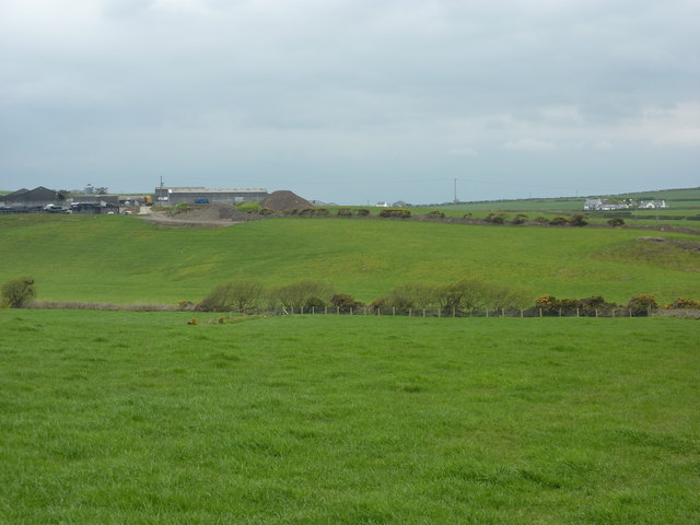
Cilan is a small rural village located in the county of Caernarfonshire, Wales. Situated on the Llŷn Peninsula, it is nestled between the picturesque coastline of Cardigan Bay and the rolling hills of Snowdonia National Park. The village is approximately 3 miles southwest of the town of Abersoch, a popular tourist destination known for its sandy beaches and water sports activities.

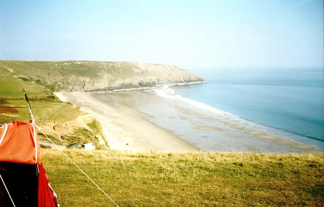
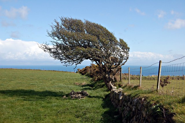
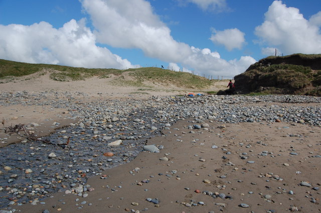
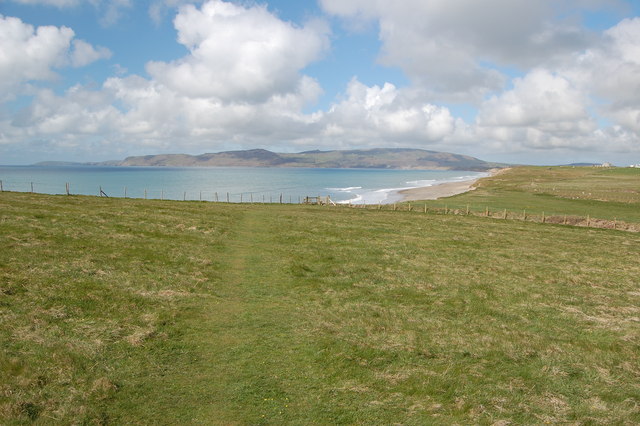
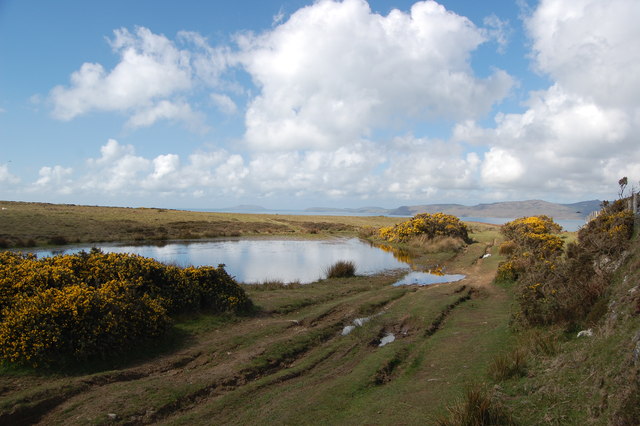
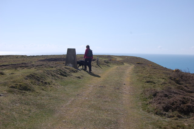
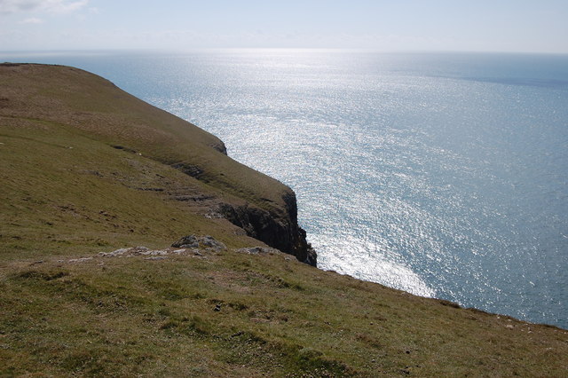
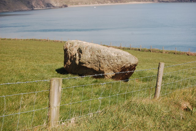
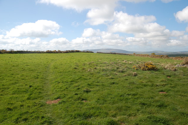
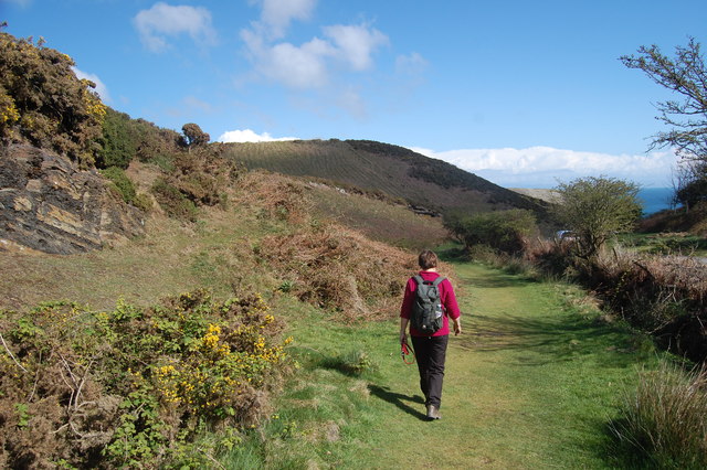
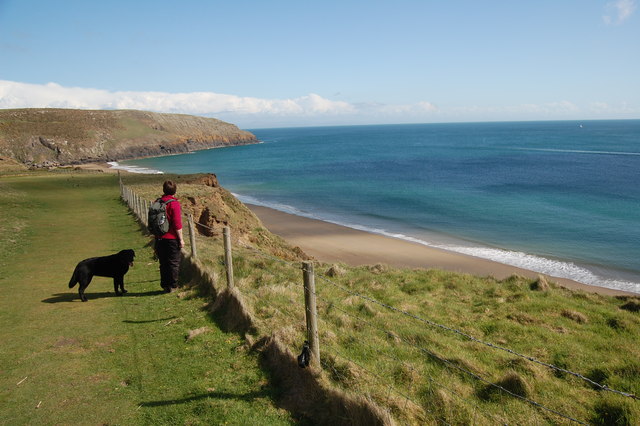
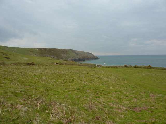
Cilan is known for its stunning natural beauty, with its rugged cliffs, sandy coves, and panoramic views of the sea. The area is a haven for outdoor enthusiasts, offering opportunities for coastal walks, birdwatching, and fishing. The nearby hills also provide great hiking and mountain biking trails for those seeking a more adventurous experience.

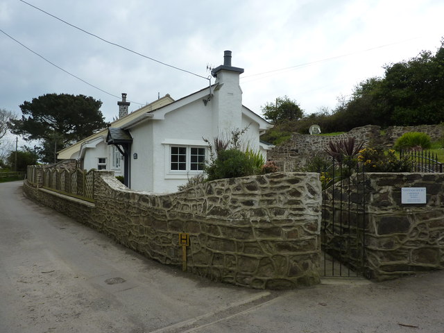
The village itself is small and peaceful, with a tight-knit community that values its Welsh heritage. Traditional Welsh culture can be seen in the local language, music, and arts. The village hosts various events throughout the year, including traditional music festivals and agricultural shows, showcasing the area's rich cultural heritage.

Cilan offers limited amenities, with a small number of shops and services available within a short drive. However, for more extensive facilities, residents and visitors can easily access nearby towns such as Abersoch and Pwllheli.

Overall, Cilan provides a tranquil escape for those looking to enjoy the natural beauty of the Welsh countryside while still being within reach of larger towns and amenities.

If you have any feedback on the listing, please let us know in the comments section below.
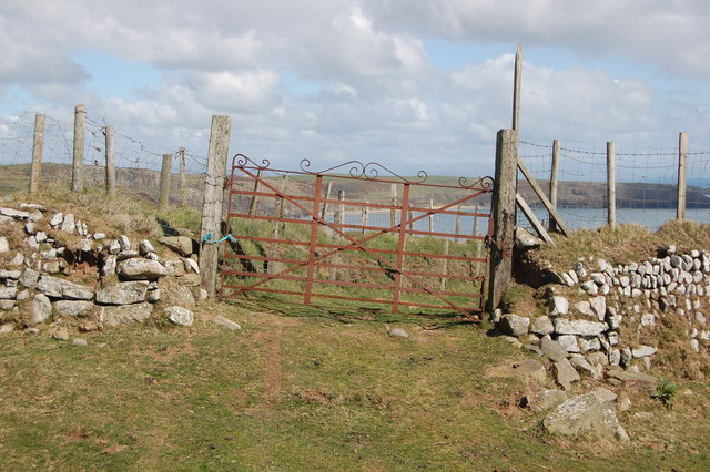
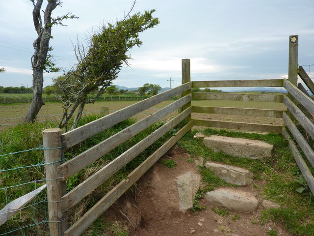
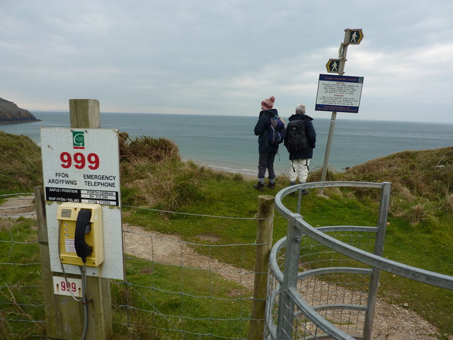
Cilan Images

Images are sourced within 2km of 52.793412/-4.5208243 or Grid Reference SH3024. Thanks to Geograph Open Source API. All images are credited.

Porth Ceiriad
Porth Ceiriad
Tree on a wall A wind-blown tree growing on an old wall above Porth Ceiriad.
Tree on a wall
A wind-blown tree growing on an old wall above Porth Ceiriad.
Stream crossing the beach at Hell's Mouth Looking back across the beach to where the stream emerges from the dunes.
Stream crossing the beach at Hell's Mouth
Looking back across the beach to where the stream emerges from the dunes.
Footpath from Hell's Mouth
Pond by the coastal path, Pen Y Groes Here the path turns west to give views across Hell's Mouth and beyond.
Pond by the coastal path, Pen Y Groes
Here the path turns west to give views across Hell's Mouth and beyond.
The trig point & Llyn Coastal Path at Mynydd Cilan
Trwyn y Fulfran On the headland near the coast path.
Trwyn y Fulfran
On the headland near the coast path.
Wall and gate By the coast path (which doesn't go through the gate). Ancient wall - newer gate.
Wall and gate
By the coast path (which doesn't go through the gate). Ancient wall - newer gate.
Burial chamber  The cyst covering the burial (Bronze age? Neolithic?).
Burial chamber
The cyst covering the burial (Bronze age? Neolithic?).
Lleyn Coast Path On a slight detour inland heading for Nant-y-big
Lleyn Coast Path
On a slight detour inland heading for Nant-y-big
Path to Porth Ceiriad  On the Llyn coastal path.
Path to Porth Ceiriad
On the Llyn coastal path.
Porth Ceiriad On the coast path above Porth Ceiriad beach.
Porth Ceiriad
On the coast path above Porth Ceiriad beach.
Cim, farmhouse south of Machroes
Stile over Welsh wall A wall of stone with earth and vegetation.
Stile over Welsh wall
A wall of stone with earth and vegetation.
Porth Ceiriad, Lleyn Peninsula
Emergency phone and footpath signs Porth Ceiriad, Lleyn Peninsula.
Emergency phone and footpath signs
Porth Ceiriad, Lleyn Peninsula.
Nant-y-big, white painted cottage I have been told by a visitor to the Geograph site that the 'white painted cottage' is now called 'Ceiriad Cottage' but was formerly known as 'Argraig', which means 'On the rock' in Welsh. It is situated on the road which leads to 'Nant-y-Big'.
Nant-y-big, white painted cottage
I have been told by a visitor to the Geograph site that the 'white painted cottage' is now called 'Ceiriad Cottage' but was formerly known as 'Argraig', which means 'On the rock' in Welsh. It is situated on the road which leads to 'Nant-y-Big'.
The path that doesn't get to Ty Newydd Farm A footpath starting from SH302258 should enable walkers to reach the farm; however a brand new barbed wire fence has been put up blocking the path at SH301261.
The path that doesn't get to Ty Newydd Farm
A footpath starting from SH302258 should enable walkers to reach the farm; however a brand new barbed wire fence has been put up blocking the path at SH301261.
Show me another place!

Cilan is located at Grid Ref: SH3024 (Lat: 52.793412, Lng: -4.5208243)

Unitary Authority: Gwynedd

Police Authority: North Wales

What 3 Words

///nerves.nests.collides. Near Pwllheli, Gwynedd

Nearby Locations

Cilan Pared-mawr Muriau

Related Wikis

Porth Ceiriad

Porth Ceiriad is a south-east facing beach and bay in the parish of Llanengan, near to Abersoch, in the county of Gwynedd, North Wales. It has several...

Cilan Head

Cilan Head is a headland on the tip of the Llŷn Peninsula of Gwynedd in northwestern Wales, near Abersoch.Cilan Head is the southernmost point of the peninsula...

RAF Hell's Mouth

Royal Air Force Hell's Mouth, or more simply RAF Hell's Mouth, is a former Royal Air Force air gunnery and bombing range. It was initially redeveloped...

Llanengan

Llanengan is a small village and community 1.2 mi (1.9 km) around Abersoch in Gwynedd in north-west Wales. It had a population of 2,024 at the 2001 census...

Penrhyn Du Mines

The Penrhyn Du Mines are a collection of mines situated near Llanengan on the Llŷn Peninsula. It encompasses the Penrhyn, Assheton, Western and Tan-y-Bwlch...

Porth Neigwl

Porth Neigwl, also known in English as "Hell's Mouth", is a broad bay, about 3 miles (5 km) wide, on the south coast of the Llŷn Peninsula in North Wales...

St Tudwal's Lighthouse

St Tudwal's Lighthouse on Saint Tudwal's Island West is active, but unstaffed. The site of the lighthouse, which marks the north end of Cardigan Bay, was...

Abersoch

Abersoch is a village in the community of Llanengan in Gwynedd, Wales. It is a popular coastal seaside resort, with around 2,600 residents, on the east...

Nearby Amenities

Located within 500m of 52.793412,-4.5208243
Source: PGS
Lat/Long: 52.789674/-4.517204
Source: PGS
Lat/Long: 52.790954/-4.517248
Source: PGS
Lat/Long: 52.7913376/-4.5170769
Source: PGS
Lat/Long: 52.791602/-4.516636
Source: PGS
Lat/Long: 52.791741/-4.515795
Source: PGS
Lat/Long: 52.792512/-4.515612
Source: PGS
Lat/Long: 52.792643/-4.515404
Source: PGS
Lat/Long: 52.792774/-4.515198
Source: PGS
Lat/Long: 52.7930219/-4.5146581
Source: PGS
Lat/Long: 52.7932295/-4.5137568
Place Of Worship
Lat/Long: 52.795713/-4.519512
Barrier: kissing_gate
Lat/Long: 52.7911949/-4.5200653
Barrier: kissing_gate
Lat/Long: 52.7913523/-4.5192097
Barrier: kissing_gate
Lat/Long: 52.7920035/-4.5182589
Barrier: kissing_gate
Lat/Long: 52.7937824/-4.5165756
Barrier: kissing_gate
Lat/Long: 52.7938995/-4.5148981
Barrier: kissing_gate
Lat/Long: 52.7911836/-4.5201484
Barrier: kissing_gate
Lat/Long: 52.7895612/-4.5196168
Direction: 105
Generator Method: photovoltaic
Generator Output Electricity: yes
Generator Solar Modules: 26
Generator Source: solar
Generator Type: solar_photovoltaic_panel
Location: roof
Power: generator
Lat/Long: 52.7955072/-4.518977
Direction: 185
Generator Method: photovoltaic
Generator Output Electricity: yes
Generator Solar Modules: 16
Generator Source: solar
Generator Type: solar_photovoltaic_panel
Location: roof
Power: generator
Lat/Long: 52.7959511/-4.5262572
The data included in this document is from www.openstreetmap.org. The data is made available under ODbL.

Have you been to Cilan?

Leave your review of Cilan below (or comments, questions and feedback).