Tanysgafell

Settlement in Caernarfonshire

Wales

Tanysgafell

Electrical cabinet on Bangor Road, Bethesda
Electrical cabinet on Bangor Road, Bethesda Credit: Meirion

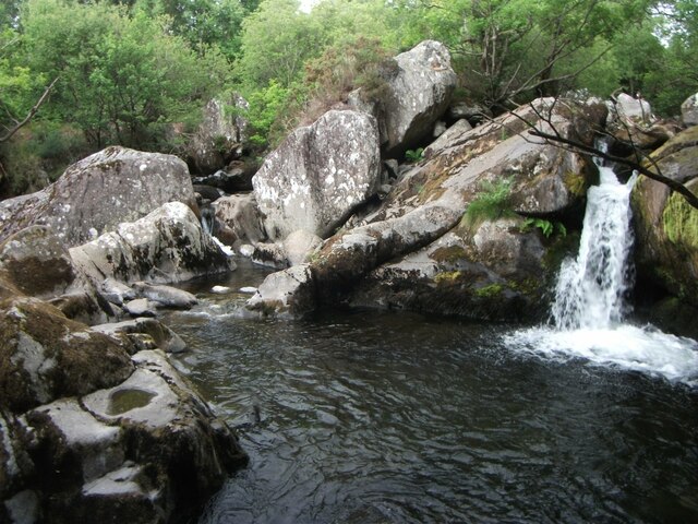
Tanysgafell is a small village located in the county of Caernarfonshire in northwestern Wales. Nestled amidst the picturesque Snowdonia National Park, it is a place of natural beauty and tranquility. The village is situated near the banks of the River Seiont, offering stunning views of the rolling hills and lush green valleys that surround it.

With a population of around 300, Tanysgafell is a close-knit community where residents enjoy a peaceful and rural lifestyle. The village is primarily residential, with a scattering of traditional stone houses and cottages, giving it a charming and timeless character.

Although small in size, Tanysgafell benefits from its proximity to the town of Caernarfon, which lies just a few miles to the south. This larger settlement provides access to a range of amenities, including shops, schools, and healthcare facilities.

For outdoor enthusiasts, Tanysgafell offers an abundance of opportunities to explore the stunning natural surroundings. The Snowdonia National Park, with its majestic mountains, sparkling lakes, and winding trails, is a paradise for hikers, climbers, and nature lovers. Additionally, the nearby coast provides access to beautiful beaches and opportunities for water sports such as surfing and sailing.

Overall, Tanysgafell is a quaint and picturesque village that offers residents and visitors a peaceful retreat in the heart of the breathtaking Welsh countryside.

If you have any feedback on the listing, please let us know in the comments section below.

Tanysgafell Images

Images are sourced within 2km of 53.180118/-4.0757023 or Grid Reference SH6166. Thanks to Geograph Open Source API. All images are credited.

Electrical cabinet on Bangor Road, Bethesda
Hydrant sign on Ffordd Gerlan, Bethesda
Electrical cabinet on Ffordd Gerlan, Bethesda
Electrical cabinet on Carneddi Road, Bethesda
Hydrant marker on Gerlan Road, Bethesda
Elizabeth II post box on Braichmelyn, Bethesda LL57 21
Elizabeth II post box on Braichmelyn, Bethesda
LL57 21
Hydrant sign on Cefnfaes Road, Bethesda
Hydrant marker on Braichmelyn, Bethesda
Sluice valve marker at the junction of Station Road and Bangor Road, Bethesda
Damaged sluice valve marker on Bangor Road, Bethesda
Sluice valve marker on Bangor Road, Bethesda
Waterfall on Afon Caseg, Bethesda
Wooden fingerpost, Sling
Flooded Penrhyn Slate Quarry Penrhyn Quarry is home to Zip World which has the world's fastest and Europe's longest zip line. Velocity 2 has four parallel lines that span 1.5 kilometres over Penrhyn Quarry lake, it is possible to reach speeds of over 100 mph.
Flooded Penrhyn Slate Quarry
Penrhyn Quarry is home to Zip World which has the world's fastest and Europe's longest zip line. Velocity 2 has four parallel lines that span 1.5 kilometres over Penrhyn Quarry lake, it is possible to reach speeds of over 100 mph.
Benchmark on Llwyn Bleddyn Road, Rachub For more details see: <span class="nowrap"><a title="https://www.bench-marks.org.uk/bm29697" rel="nofollow ugc noopener" href="https://www.bench-marks.org.uk/bm29697">Link</a><img style="margin-left:2px;" alt="External link" title="External link - shift click to open in new window" src="https://s1.geograph.org.uk/img/external.png" width="10" height="10"/></span>
Benchmark on Llwyn Bleddyn Road, Rachub
For more details see: LinkExternal link
Benchmark on boulder, Mynydd Llandegai For more details see: <span class="nowrap"><a title="https://www.bench-marks.org.uk/bm114242" rel="nofollow ugc noopener" href="https://www.bench-marks.org.uk/bm114242">Link</a><img style="margin-left:2px;" alt="External link" title="External link - shift click to open in new window" src="https://s1.geograph.org.uk/img/external.png" width="10" height="10"/></span>
Benchmark on boulder, Mynydd Llandegai
For more details see: LinkExternal link
Dŵr Cymru / Welsh Water sign on Britannia Street, Rachub
Sign at Tan y Bwlch substation on Tan y Garth, Rachub
Show me another place!

Tanysgafell is located at Grid Ref: SH6166 (Lat: 53.180118, Lng: -4.0757023)

Unitary Authority: Gwynedd

Police Authority: North Wales

What 3 Words

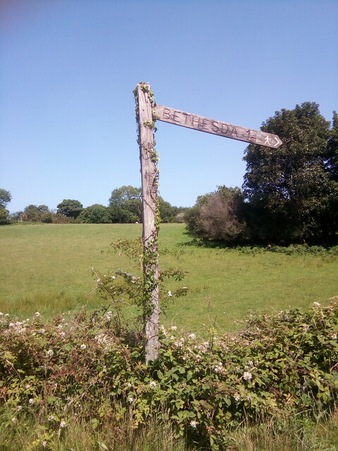
///completed.carry.kicks. Near Bethesda, Gwynedd

Related Wikis

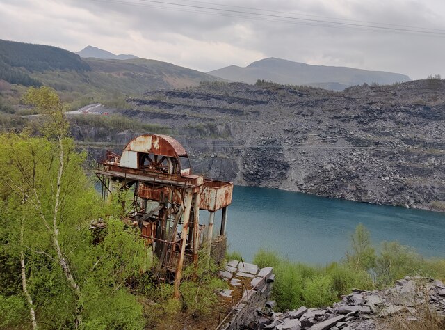
Felin Fawr Slate Works

Felin Fawr Works is a former slate works to Penrhyn Quarry Railway in Bethesda, Wales. It dates back to 1803; This is when the first mill was supposedly...

Bethesda railway station

Bethesda railway station was a station in Bethesda, Gwynedd, Wales. == History == The station was opened by the London and North Western Railway on 1 July...

Ogwen (electoral ward)

Ogwen is the name of an electoral ward covering part of the village and community of Bethesda in Gwynedd, Wales. It elects councillors to the community...

Ysgol Dyffryn Ogwen

Ysgol Dyffryn Ogwen ("Ogwen Valley School") is a bilingual secondary school for pupils aged 11 to 19 years. It is situated in Bethesda in the Ogwen valley...

Nearby Amenities

Located within 500m of 53.180118,-4.0757023
Barrier: kissing_gate
Lat/Long: 53.1820454/-4.0812134
Barrier: kissing_gate
Lat/Long: 53.1825194/-4.0819297
Barrier: kissing_gate
Lat/Long: 53.1810587/-4.0828335
Barrier: kissing_gate
Lat/Long: 53.1796872/-4.0765778
Bethesda
Historic Railway: station
Railway: site
Wikidata: Q28971081
Wikipedia: en:Bethesda railway station
Lat/Long: 53.1806287/-4.068607
Post Box
Post Box Type: lamp
Ref: LL59 19
Lat/Long: 53.1770288/-4.0736257
Telephone
Booth: K6
Covered: booth
Lat/Long: 53.1770219/-4.0736607
Man Made: mast
Mast: telecommunication
Lat/Long: 53.1779967/-4.0741136
Barrier: kissing_gate
Bicycle: yes
Foot: yes
Lat/Long: 53.1787967/-4.0735103
Barrier: kissing_gate
Lat/Long: 53.1805195/-4.0734911
Barrier: kissing_gate
Lat/Long: 53.1803595/-4.0771361
Power: pole
Lat/Long: 53.1802439/-4.0682837
Power: pole
Lat/Long: 53.1796523/-4.0683534
Power: pole
Lat/Long: 53.1789386/-4.0684876
Power: pole
Lat/Long: 53.1769029/-4.0781318
Power: pole
Lat/Long: 53.177353/-4.0785798
Power: pole
Lat/Long: 53.1764599/-4.078873
Power: pole
Lat/Long: 53.1764116/-4.0776177
Power: pole
Lat/Long: 53.1785593/-4.0815766
Power: pole
Lat/Long: 53.178233/-4.0806164
Power: pole
Lat/Long: 53.1757294/-4.0769275
Power: pole
Lat/Long: 53.1777459/-4.0792538
Power: pole
Lat/Long: 53.1788722/-4.0824717
Pont Sarnau
Place: locality
Lat/Long: 53.1800326/-4.0714084
Pont Galedffrwd
Place: locality
Lat/Long: 53.1770254/-4.0723018
Barrier: bollard
Bicycle: yes
Foot: yes
Lat/Long: 53.1802207/-4.0686106
Bench
Lat/Long: 53.1818639/-4.0731224
Bench
Lat/Long: 53.1819636/-4.0731304
Lon Las Ogwen
Board Type: history
Information: board
Tourism: information
Lat/Long: 53.180232/-4.0686169
Power: pole
Lat/Long: 53.176521/-4.0798734
Power: pole
Lat/Long: 53.176275/-4.0780898
Direction: 170
Man Made: adit
Note: Outfall of the George drainage adit.
Lat/Long: 53.1807712/-4.0730475
Ford: yes
Lat/Long: 53.1806747/-4.0819735
Ford: yes
Lat/Long: 53.1802501/-4.0808515
Ford: yes
Lat/Long: 53.1798934/-4.0773818
Direction: SW
Generator Method: photovoltaic
Generator Output Electricity: yes
Generator Solar Modules: 8
Generator Source: solar
Generator Type: solar_photovoltaic_panel
Location: roof
Power: generator
Lat/Long: 53.1820345/-4.0689534
Direction: SW
Generator Method: photovoltaic
Generator Output Electricity: yes
Generator Solar Modules: 8
Generator Source: solar
Generator Type: solar_photovoltaic_panel
Location: roof
Power: generator
Lat/Long: 53.1820687/-4.0690097
Direction: SW
Generator Method: photovoltaic
Generator Output Electricity: yes
Generator Solar Modules: 8
Generator Source: solar
Generator Type: solar_photovoltaic_panel
Location: roof
Power: generator
Lat/Long: 53.1821253/-4.0690814
Direction: 215
Generator Method: photovoltaic
Generator Output Electricity: yes
Generator Solar Modules: 16
Generator Source: solar
Generator Type: solar_photovoltaic_panel
Location: roof
Power: generator
Lat/Long: 53.1772548/-4.0768678
Direction: 255
Generator Method: photovoltaic
Generator Output Electricity: yes
Generator Solar Modules: 14
Generator Source: solar
Generator Type: solar_photovoltaic_panel
Location: roof
Power: generator
Lat/Long: 53.1786301/-4.0760404
Tanysgafell
Place: hamlet
Lat/Long: 53.1806647/-4.0752724
Barrier: kissing_gate
Lat/Long: 53.1838349/-4.0722024
Barrier: kissing_gate
Lat/Long: 53.183753/-4.0723808
Information: board
Tourism: information
Lat/Long: 53.1799726/-4.0715478
The data included in this document is from www.openstreetmap.org. The data is made available under ODbL.

Have you been to Tanysgafell?

Leave your review of Tanysgafell below (or comments, questions and feedback).