Brandelhow Point

Coastal Feature, Headland, Point in Cumberland Allerdale

England

Brandelhow Point

Barrow Beck
Barrow Beck Credit: David Brown

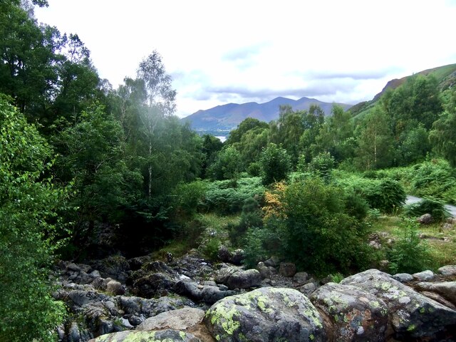
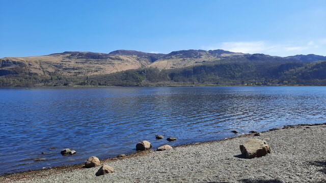
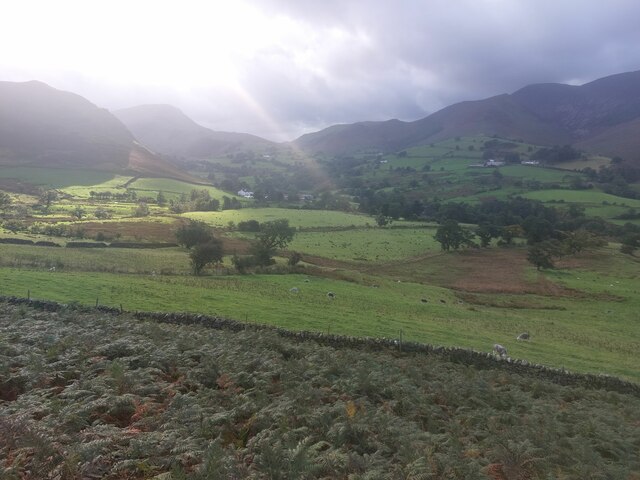
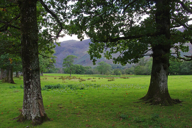
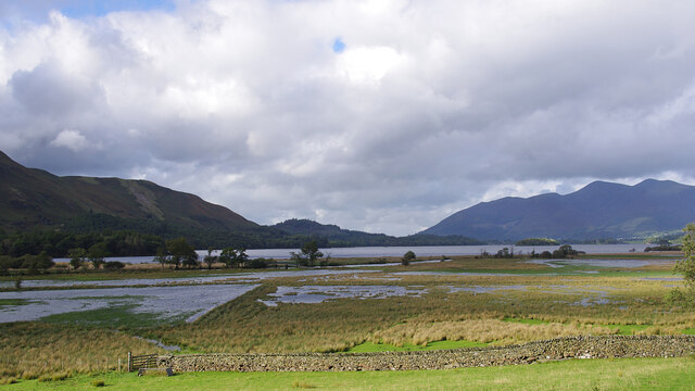
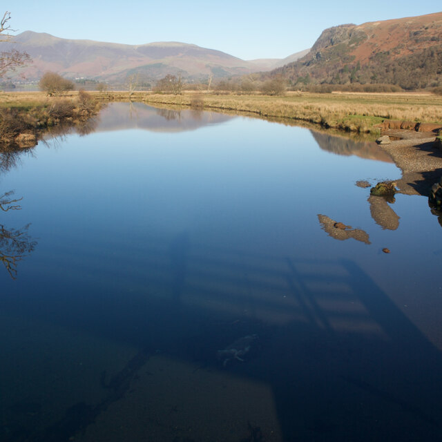
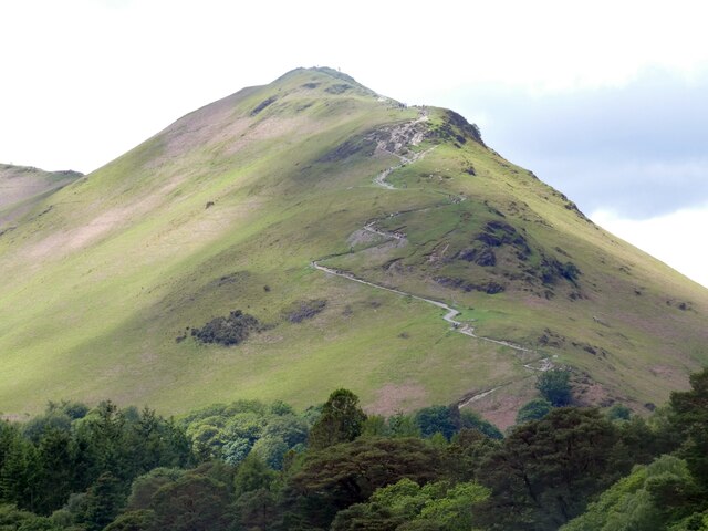
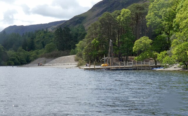
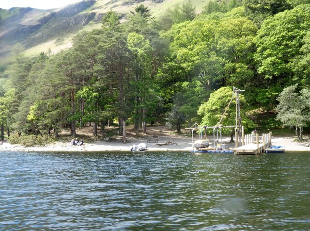
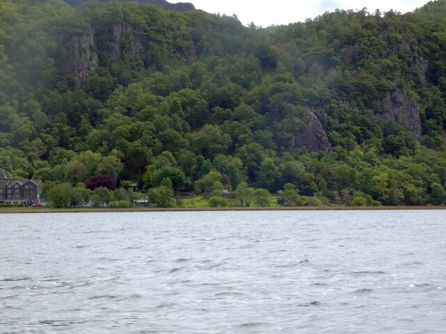
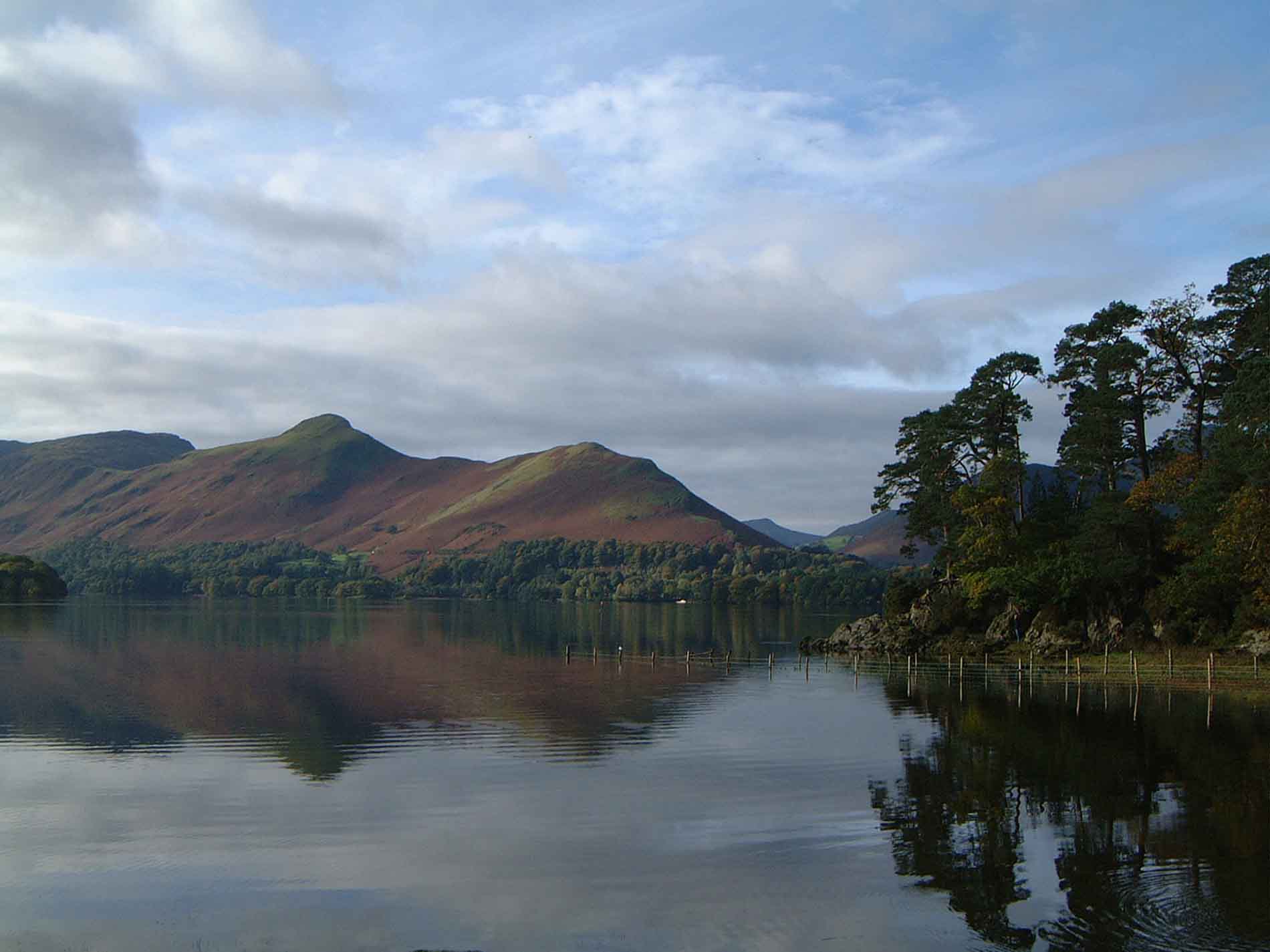
Brandelhow Point is a prominent coastal feature located in Cumberland, England. Situated on the western edge of Derwentwater, it is a headland that extends into the lake, forming a distinct point. Offering stunning views and natural beauty, it is a popular destination for both locals and tourists.

The point is characterized by its rocky cliffs and lush vegetation, creating a picturesque landscape. The rugged terrain adds to its charm, providing a dramatic backdrop against the tranquil waters of Derwentwater. Visitors can enjoy a leisurely walk along the coastline, taking in the panoramic views of the surrounding area. The point also serves as an excellent vantage point for observing wildlife, with various bird species often seen nesting in the cliffs.

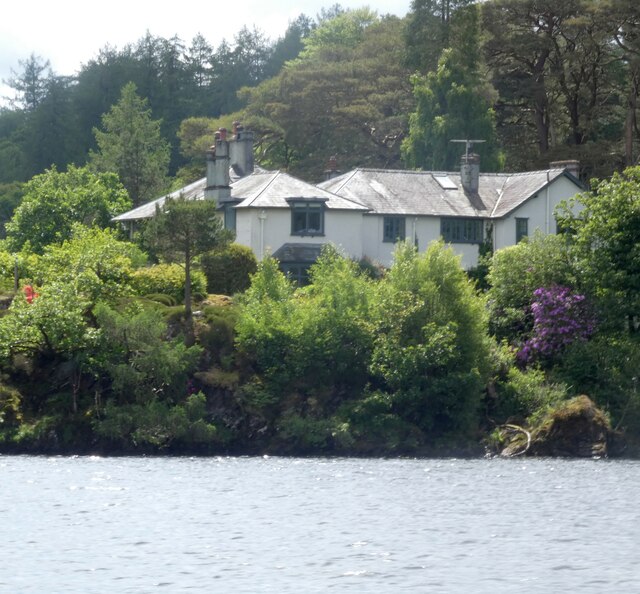
Brandelhow Point is steeped in history and culture. It is believed to have derived its name from the nearby Brandelhow Park, a historic estate dating back to the 12th century. The area is also known for its connection to the famous writer and illustrator, Beatrix Potter, who had a holiday home in the vicinity. Her love for the region's natural beauty and wildlife greatly influenced her works, and Brandelhow Point was a source of inspiration for some of her illustrations.

Overall, Brandelhow Point is a captivating coastal feature that offers a unique blend of natural beauty, history, and cultural significance. Its breathtaking views, diverse wildlife, and rich heritage make it a must-visit destination for nature enthusiasts and history lovers alike.

If you have any feedback on the listing, please let us know in the comments section below.

Brandelhow Point Images

Images are sourced within 2km of 54.565569/-3.1564931 or Grid Reference NY2519. Thanks to Geograph Open Source API. All images are credited.

Barrow Beck
Barrow Beck
Derwent Water seen from Brandlehow Landing Stage Bleaberry Fell and Castlerigg Fell can be seen on the other side of the lake.
Derwent Water seen from Brandlehow Landing Stage
Bleaberry Fell and Castlerigg Fell can be seen on the other side of the lake.
Footbridge over the River Derwent Across the flat river flood plain can be seen Shepherds Crag.
Footbridge over the River Derwent
Across the flat river flood plain can be seen Shepherds Crag.
Yewthwaite Gill The course of Yewthwaite Gill, the sides of the channel showing sides of extensive erosion.
Yewthwaite Gill
The course of Yewthwaite Gill, the sides of the channel showing sides of extensive erosion.
The pastures of Yewthwaite Looking across the grassy pastures of Yewthwaite. After a day of heavy rain the sun is beginning to break through the clouds above the valley.
The pastures of Yewthwaite
Looking across the grassy pastures of Yewthwaite. After a day of heavy rain the sun is beginning to break through the clouds above the valley.
Roadside trees, Borrowdale The number of trees increases as you move away from the head of Derwent Water or the River Derwent.
Roadside trees, Borrowdale
The number of trees increases as you move away from the head of Derwent Water or the River Derwent.
River Derwent flood plain The flat ground at the head of Derwent Water frequently floods. Skiddaw is in the far distance.
River Derwent flood plain
The flat ground at the head of Derwent Water frequently floods. Skiddaw is in the far distance.
Ashness Bridge On the minor road from Barrow Bay to Watendlath, the Grade II listed Ashness Bridge over Barrow Beck is a popular tourist attraction.
Barrow Beck flows into Derwentwater and thence into the River Derwent.
Ashness Bridge
On the minor road from Barrow Bay to Watendlath, the Grade II listed Ashness Bridge over Barrow Beck is a popular tourist attraction. Barrow Beck flows into Derwentwater and thence into the River Derwent.
River Derwent From the Chinese Bridge — looks nice enough to swim in, but take a closer look into the water in the shadow of the bridge: a dead sheep.
River Derwent
From the Chinese Bridge — looks nice enough to swim in, but take a closer look into the water in the shadow of the bridge: a dead sheep.
Footpath through Lodore Hotel On my map this is supposed to be a Permissive path to avoid using the road. On the latest O.S. mapping it's classed as a Public Footpath.

Either way its use is not welcoming and the 'bridge' over the beck just beyond the gate is very precarious.
Footpath through Lodore Hotel
On my map this is supposed to be a Permissive path to avoid using the road. On the latest O.S. mapping it's classed as a Public Footpath. Either way its use is not welcoming and the 'bridge' over the beck just beyond the gate is very precarious.
Ashness Bridge
Ashness Bridge
Gate on Brown Knotts
Path to Catbells The zig-zag path up to Catbells as viewed from Derwentwater.
Path to Catbells
The zig-zag path up to Catbells as viewed from Derwentwater.
High Brandelhow The jetty here is currently undergoing repair.
High Brandelhow
The jetty here is currently undergoing repair.
High Brandelhow The landing stage is presently undergoing repair.
High Brandelhow
The landing stage is presently undergoing repair.
Brandelhow Point Housing at Brandelhow Point.
Brandelhow Point
Housing at Brandelhow Point.
Housing at Brandelhow Point
Southern end of Derwentwater On the left is the Lodore Falls Hotel.  The B5289 to Borrowdale hugs the ground beneath Shepherds Crag <a href="https://www.geograph.org.uk/photo/1513276">NY2618 : Shepherds Crag</a>.
Southern end of Derwentwater
On the left is the Lodore Falls Hotel. The B5289 to Borrowdale hugs the ground beneath Shepherds Crag NY2618 : Shepherds Crag.
Show me another place!

Brandelhow Point is located at Grid Ref: NY2519 (Lat: 54.565569, Lng: -3.1564931)

Administrative County: Cumbria

District: Allerdale

Police Authority: Cumbria

What 3 Words

///care.hypocrite.flushes. Near Keswick, Cumbria

Related Wikis

Cat Bells

Cat Bells is a fell in the English Lake District in the county of Cumbria. It has a height of 451 metres (1,480 ft) and is one of the most popular fells...

Cataract of Lodore

"The Cataract of Lodore" is a poem written in 1820 by the English poet Robert Southey which describes the Lodore Falls on the Watendlath. == Publication... ==

Lodore Falls

Lodore Falls is a waterfall in Cumbria, England, close to Derwentwater and downstream from Watendlath. The falls are located on the beck that flows from...

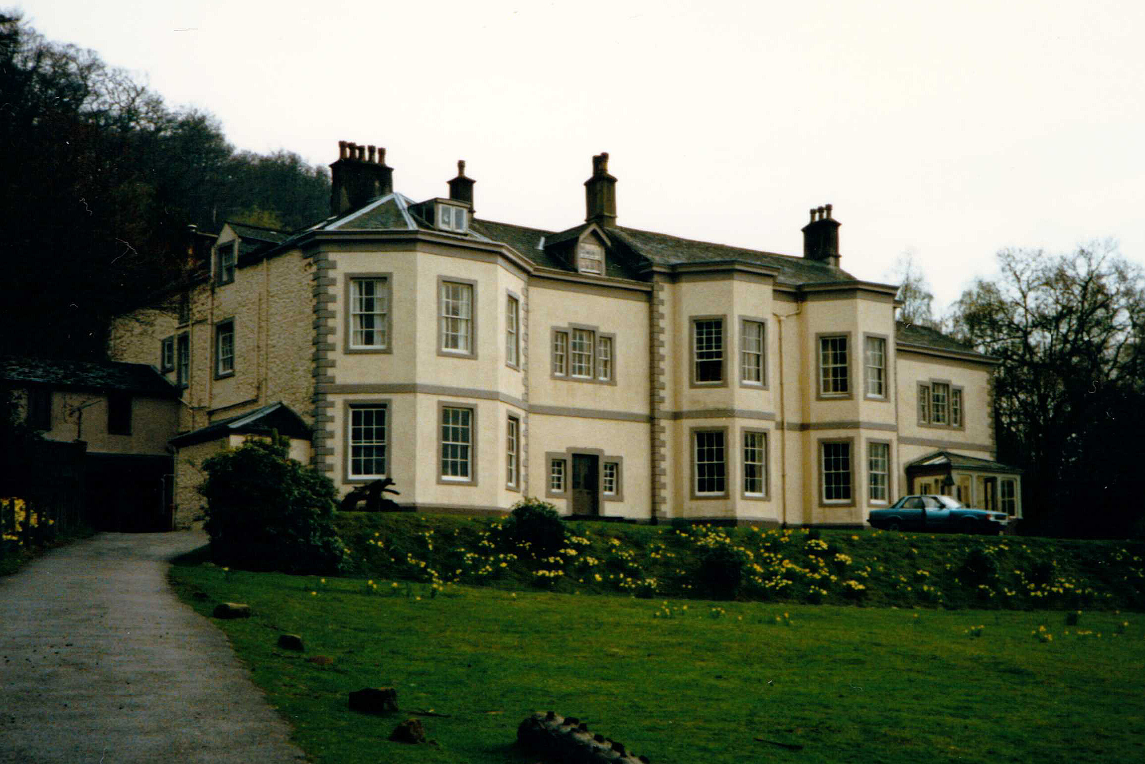
Barrow House, Cumbria

Barrow House is a late 18th-century mansion situated on the eastern shore of Derwentwater in Borrowdale within the Lake District National Park, in the...
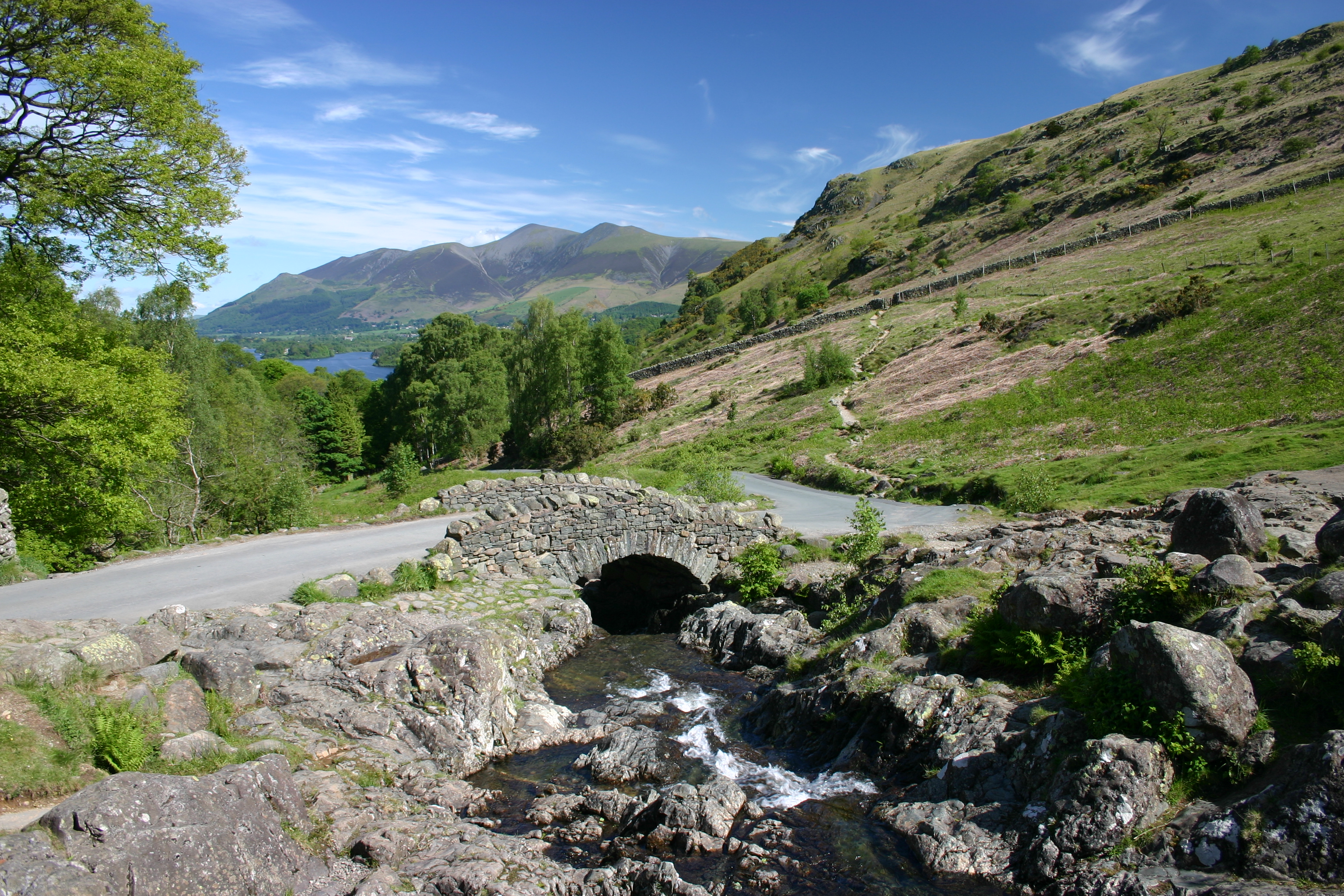
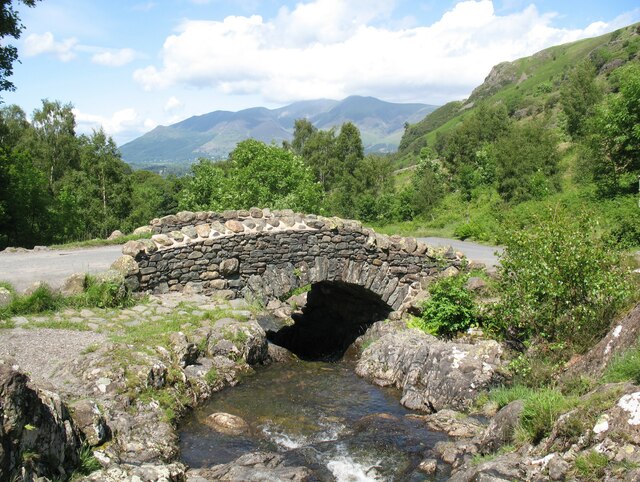
Ashness Bridge

Ashness Bridge is a traditional stone-built bridge on the single-track road from the Borrowdale road (B5289) to Watendlath, in the English Lake District...

Little Town, Cumbria

Little Town is a hamlet in the civil parish of Above Derwent, in the Allerdale district of Cumbria, England. It is in the Workington constituency of the...

Rigg Beck

Rigg Beck is a minor river of Cumbria in England. Rigg Beck is also the name of a famous dwelling – the Purple House – placed where the Beck crosses the...

Newlands Valley

The Newlands Valley is in the Lake District National Park in Cumbria, England. It is regarded as one of the most picturesque and quiet valleys in the national...

Nearby Amenities

Located within 500m of 54.565569,-3.1564931
Ferry Terminal
High Brandelhow
Ferry: yes
Public Transport: station
Lat/Long: 54.5675759/-3.1584714
Abbot's Bay
Natural: bay
Lat/Long: 54.5645159/-3.1554912
Brandelhow Bay
Natural: bay
Lat/Long: 54.5664349/-3.1570093
Myrtle Bay
Natural: bay
Lat/Long: 54.5628451/-3.1532239
Barrier: kissing_gate
Lat/Long: 54.5651699/-3.1600991
Hiking: yes
Information: guidepost
Source: GPS Survey
Tourism: information
Lat/Long: 54.5638139/-3.1590609
Bench
Backrest: no
Check Date: 2023-06-07
Material: stone
Source: GPS Survey
Lat/Long: 54.5648076/-3.159549
Bench
Backrest: no
Source: GPS Survey
Lat/Long: 54.5691725/-3.1582669
Brandlehow Point
Place: locality
Lat/Long: 54.5654935/-3.1566031
Brandlehow Lead Mine
Abandoned: yes
Man Made: mine
Mineral: lead
Lat/Long: 54.5663965/-3.1606257
Bench
Lat/Long: 54.5648491/-3.1623522
Tourism: viewpoint
Lat/Long: 54.5648661/-3.1622829
Bench
Backrest: no
Lat/Long: 54.5650022/-3.1635568
Covered: no
Leisure: picnic_table
Material: wood
Lat/Long: 54.5677854/-3.1589177
Covered: no
Leisure: picnic_table
Lat/Long: 54.5674055/-3.1588791
The data included in this document is from www.openstreetmap.org. The data is made available under ODbL.

Have you been to Brandelhow Point?

Leave your review of Brandelhow Point below (or comments, questions and feedback).