Veron Point

Coastal Feature, Headland, Point in Orkney

Scotland

Veron Point

Short-eared owl on the prowl Meadow grasses hide a feast
Short-eared owl on the prowl Credit: Alan Reid

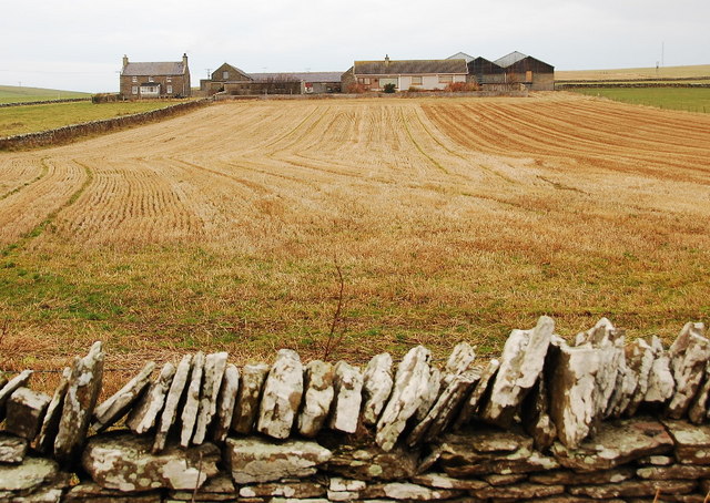
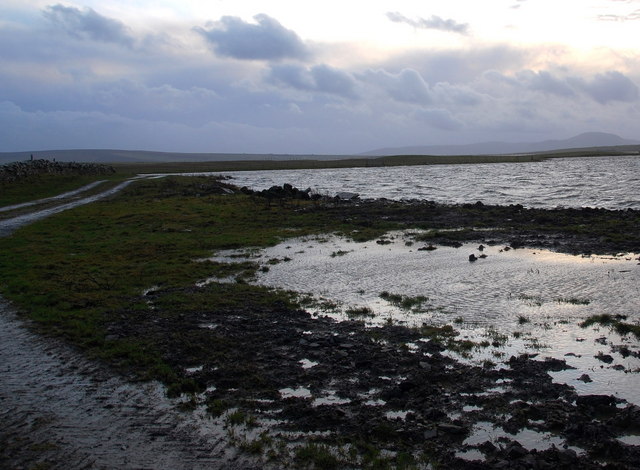
Veron Point is a prominent coastal feature located on the island of Orkney, off the northeastern coast of Scotland. It is a headland that juts out into the North Sea, offering stunning panoramic views of the surrounding coastline and the vast ocean beyond.

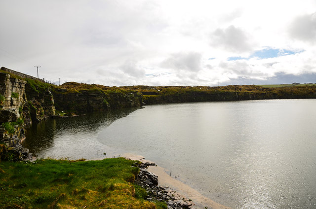
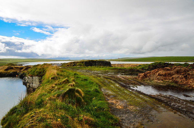
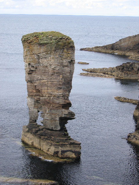
The point is known for its rugged and dramatic landscape, with tall cliffs that plunge into the sea below. These cliffs are composed of layers of sedimentary rock, showcasing the geological history of the region. The area is also rich in birdlife, with various seabird colonies nesting in the cliffs, including fulmars, guillemots, and kittiwakes.

Veron Point is a popular destination for outdoor enthusiasts and nature lovers. It provides opportunities for hiking, birdwatching, and photography. The coastal path that runs along the headland offers breathtaking vistas and allows visitors to explore the diverse flora and fauna that thrive in this coastal environment.

The point is easily accessible by both car and foot, with a small parking area available nearby. From there, visitors can follow a well-marked trail that leads to the edge of the headland. It is important to note that care should be taken when exploring Veron Point, as the cliffs can be steep and dangerous.

In conclusion, Veron Point is a stunning coastal feature in Orkney, offering picturesque views, diverse wildlife, and outdoor recreational opportunities. It is a must-visit destination for anyone seeking to experience the natural beauty of this remote and captivating region.

If you have any feedback on the listing, please let us know in the comments section below.
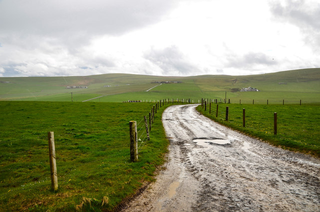
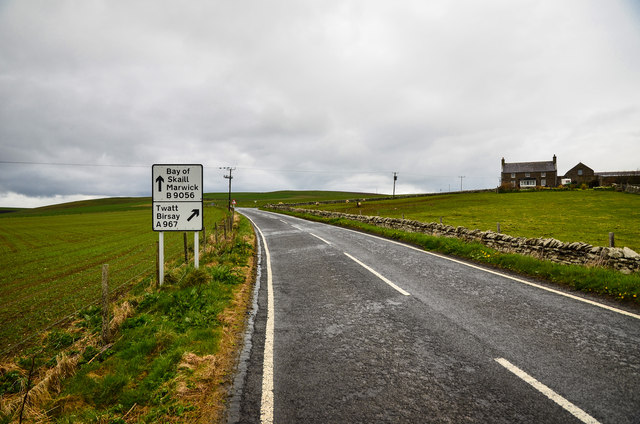
Veron Point Images

Images are sourced within 2km of 59.015377/-3.2954 or Grid Reference HY2514. Thanks to Geograph Open Source API. All images are credited.

Short-eared owl on the prowl Meadow grasses hide a feast
Short-eared owl on the prowl
Meadow grasses hide a feast
Voy: postbox № KW16 10 A small postbox emptied at 11 o'clock each weekday and Saturday morning. The western end of the Loch of Stenness is in the distance.
Voy: postbox № KW16 10
A small postbox emptied at 11 o'clock each weekday and Saturday morning. The western end of the Loch of Stenness is in the distance.
Lee Track to Upper Lee and Lee Farm.
Lee
Track to Upper Lee and Lee Farm.
Knowes of Cott Looking to the blind summit with the school on the left.
Knowes of Cott
Looking to the blind summit with the school on the left.
Redland Hill Passing by the hill to the left and dropping down to the A967 with the Loch of Stenness on the horizon.
Redland Hill
Passing by the hill to the left and dropping down to the A967 with the Loch of Stenness on the horizon.
Newhouse Dropping down to the A967 past Redland Hill to the left.
Newhouse
Dropping down to the A967 past Redland Hill to the left.
Right Twatt Junction of the A967 to Twatt and Birsay which is to the right, and the B9056 ahead to the Bay of Skaill and Marwick which also leads to Scara Brae. There are of course Two Twatts in the north, the other being in Shetland.
Right Twatt
Junction of the A967 to Twatt and Birsay which is to the right, and the B9056 ahead to the Bay of Skaill and Marwick which also leads to Scara Brae. There are of course Two Twatts in the north, the other being in Shetland.
Vinbreck By the A967 with a view towards the Loch of Stenness.
Vinbreck
By the A967 with a view towards the Loch of Stenness.
A967 to Twatt Taken by Vinbreck looking north east.
A967 to Twatt
Taken by Vinbreck looking north east.
Anvil Cottage View along the A967 by the cottage as the heavens open and spots of rain attack my lens which a vengeance.
Anvil Cottage
View along the A967 by the cottage as the heavens open and spots of rain attack my lens which a vengeance.
Disused Quarry by the Loch of Clumly By the A967 now infilled with water.
Disused Quarry by the Loch of Clumly
By the A967 now infilled with water.
Disused Quarry By the A967 with a view across to the Loch of Clumly on the horizon.
Disused Quarry
By the A967 with a view across to the Loch of Clumly on the horizon.
Quarry and Loch Disused quarry to the left and the Loch of Clumly right both next to the A967.
Quarry and Loch
Disused quarry to the left and the Loch of Clumly right both next to the A967.
Red Water Pump At the side of the Loch of Clumly, didn't test it to see if it still worked.
Red Water Pump
At the side of the Loch of Clumly, didn't test it to see if it still worked.
Loch Clumly By the A967 looking north west.
Loch Clumly
By the A967 looking north west.
Redland Farm Looking down the farm drive with the Loch of Stenness on the horizon.
Redland Farm
Looking down the farm drive with the Loch of Stenness on the horizon.
Newall and Redlandhill Local farms off the A967 by the next bend in the road.
Newall and Redlandhill
Local farms off the A967 by the next bend in the road.
Redland View from the track by the farm along the A967 looking north west.
Redland
View from the track by the farm along the A967 looking north west.
Show me another place!

Veron Point is located at Grid Ref: HY2514 (Lat: 59.015377, Lng: -3.2954)

Unitary Authority: Orkney Islands

Police Authority: Highlands and Islands

What 3 Words

///nylon.lock.backtrack. Near Sandwick, Orkney Islands

Nearby Locations

Veron Point

Related Wikis

Voy

Voy is a settlement in the Orkney Islands of the north of Scotland. Voy is within the parish of Sandwick. The settlement is 3 miles (5 kilometres) north...

Loch of Stenness

The Loch of Stenness is a large brackish loch on Mainland, Orkney, Scotland and is named for the parish of Stenness. It is 2 miles (3.2 kilometres) northeast...

Yesnaby

Yesnaby is an area in Sandwick, on the west coast of Orkney Mainland, Scotland, south of Skara Brae. It is renowned for its spectacular Old Red Sandstone...

Loch of Skaill

The Loch of Skaill is a small somewhat triangular, freshwater loch in the parish of Sandwick, Orkney on Mainland Orkney, Scotland. It lies 0.5 mi (0.80...

Broch of Borwick

The Broch of Borwick is an Iron Age broch located on Mainland, Orkney, Scotland (grid reference HY22411678). It is a scheduled monument. == Location... ==

Loch of Harray

The Loch of Harray is the largest loch of Mainland Orkney, Scotland and is named for the parish of Harray. It lies immediately north of the Loch of Stenness...

Ring of Brodgar

The Ring of Brodgar (or Brogar, or Ring o' Brodgar) is a Neolithic henge and stone circle about 6 miles north-east of Stromness on Mainland, the largest...

Unstan Chambered Cairn

Unstan (or Onstan, or Onston) is a Neolithic chambered cairn located about 2 mi (3 km) north-east of Stromness on Mainland, Orkney, Scotland. The tomb...

Nearby Amenities

Located within 500m of 59.015377,-3.2954
Post Box
Collection Times: Mo-Sa 11:00
Operator: Royal Mail
Post Box Type: lamp
Ref: KW16 10
Royal Cypher: scottish_crown
Lat/Long: 59.0153036/-3.3036605
Site of the Mill of Voy - watermill, C19 corn and barley
Addr City: Voy, Orkney
Place: locality
Lat/Long: 59.0149576/-3.3017419
Burnt mounds (prehistoric)
Historic: archaeological_site
Lat/Long: 59.0152688/-3.3017415
Power: pole
Lat/Long: 59.0186165/-3.2925295
Power: pole
Lat/Long: 59.0193518/-3.2917424
The data included in this document is from www.openstreetmap.org. The data is made available under ODbL.

Have you been to Veron Point?

Leave your review of Veron Point below (or comments, questions and feedback).