Turkey Broad

Lake, Pool, Pond, Freshwater Marsh in Norfolk North Norfolk

England

Turkey Broad

Barton Broad - Gayes Staithe 1980
Barton Broad - Gayes Staithe 1980 Credit: Roy Hughes

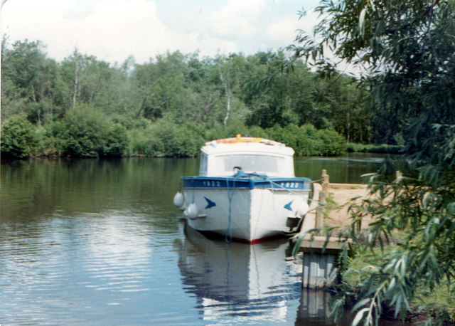
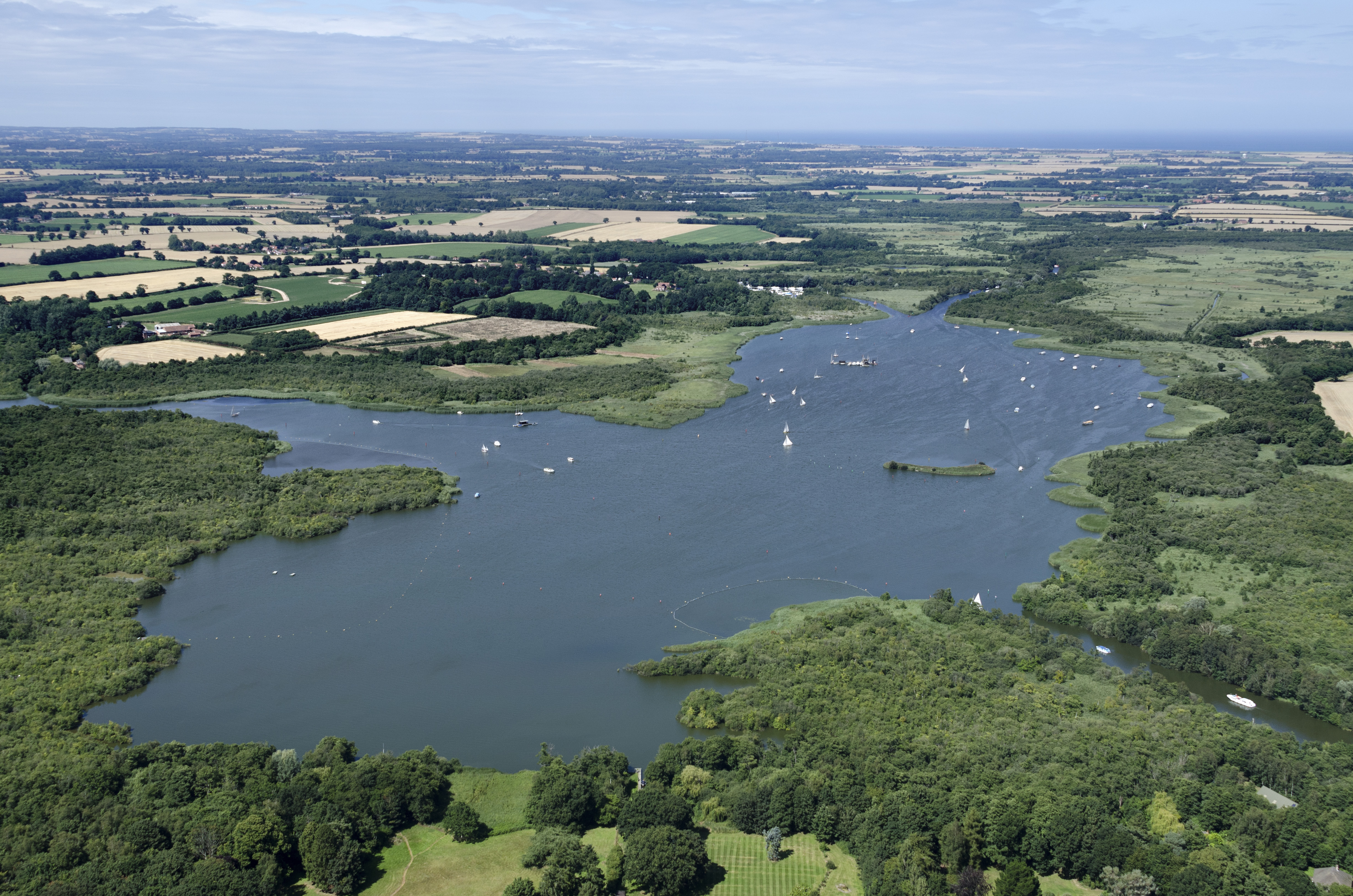
Turkey Broad is a picturesque freshwater marsh located in Norfolk, England. Situated within the Norfolk Broads National Park, it covers an area of approximately 20 hectares and is surrounded by dense woodland and reed beds. The broad is a haven for wildlife, serving as a home to a diverse range of species and providing a vital habitat for many rare and protected plants and animals.

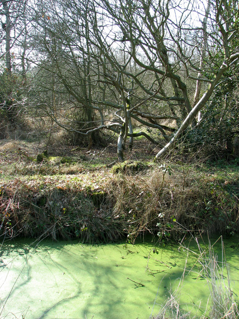
The broad itself is a shallow lake, with an average depth of around 2 meters. Its water is primarily sourced from rainfall and runoff from the surrounding area. The water in Turkey Broad is known for its exceptional clarity, allowing visitors to see the rich underwater vegetation and the myriad of fish species that inhabit the water.

The broad is also home to a variety of bird species, making it a popular spot for birdwatchers. Visitors can observe elegant swans, graceful herons, and numerous species of ducks and geese that frequent the area throughout the year. The reed beds surrounding the broad provide nesting sites for many of these birds, ensuring a constant presence of avian activity.

Access to Turkey Broad is provided by a network of footpaths and trails that wind through the surrounding woodlands and marshes. These paths offer stunning views of the broad and its surrounding landscape, providing an opportunity for visitors to immerse themselves in the tranquility and natural beauty of the area.

Overall, Turkey Broad is a cherished natural gem in Norfolk, offering a peaceful retreat for both nature enthusiasts and those seeking a moment of respite amidst the stunning Norfolk Broads.

If you have any feedback on the listing, please let us know in the comments section below.

Turkey Broad Images

Images are sourced within 2km of 52.732928/1.4953461 or Grid Reference TG3620. Thanks to Geograph Open Source API. All images are credited.

Barton Broad - Gayes Staithe 1980
White Park cattle in pasture south of Catfield
Church Wood, Catfield
Drainage ditch surrounding Church Wood, Catfield
The Old Saddlery At the road-junction in the village of Neatishead.
The Old Saddlery
At the road-junction in the village of Neatishead.
The White Horse Inn, Neatishead
The Street, Neatishead The White Horse Inn <a href="https://www.geograph.org.uk/photo/3329186">TG3421 : The White Horse Inn, Neatishead</a> is on the left, with the Old Saddlery <a href="https://www.geograph.org.uk/photo/3329184">TG3420 : The Old Saddlery</a> to the right.
The Street, Neatishead
The White Horse Inn TG3421 : The White Horse Inn, Neatishead is on the left, with the Old Saddlery TG3420 : The Old Saddlery to the right.
Cox's Boatyard, Barton Turf
Car park for Barton Broad There is a boardwalk through the marshy area at the southern edge of Barton Broad, reached by a footpath across fields from the car park.
Car park for Barton Broad
There is a boardwalk through the marshy area at the southern edge of Barton Broad, reached by a footpath across fields from the car park.
Little house in the wood Derelict cottage near Barton Broad car park.
Little house in the wood
Derelict cottage near Barton Broad car park.
Farmland by Catfield Hall
The Lodge partially hidden by trees from Lodge Road
Footpath to Toad Hole Cottage from How Hill, Ludham
To the River Ant from How Hill, Ludham
Marsh pasture by Irstead
Track to Browns Hill, Irstead
Drainage ditch beside the track to Browns Hill, Irstead
Track from Browns Hill to Irstead Road, Irstead The track is the access road to Browns Hill and Browns Hill Cottage and also serves as a public footpath.
Track from Browns Hill to Irstead Road, Irstead
The track is the access road to Browns Hill and Browns Hill Cottage and also serves as a public footpath.
Show me another place!

Turkey Broad is located at Grid Ref: TG3620 (Lat: 52.732928, Lng: 1.4953461)

Administrative County: Norfolk

District: North Norfolk

Police Authority: Norfolk

What 3 Words

///eager.gained.thrashing. Near Horning, Norfolk

Related Wikis

Irstead

Irstead is a village and former civil parish, now in the parish of Barton Turf, in the North Norfolk district, in the county of Norfolk, England. The village...

Barton Broad

Barton Broad is a large lake that forms part of the River Ant which gives its name to a 164-hectare (410-acre) nature reserve north-east of Norwich in...

Ant Broads & Marshes National Nature Reserve

Ant Broads & Marshes NNR is a national nature reserve in Norfolk, England established by English Nature. It is named after the River Ant. It is part of...

Ant Broads and Marshes

Ant Broads and Marshes is a 745.3-hectare (1,842-acre) biological Site of Special Scientific Interest north-east of Norwich in Norfolk. Most of it is a...

Nearby Amenities

Located within 500m of 52.732928,1.4953461
Barton Broad Boardwalk
Note: Should be on waters edge, not sure whether water or path is out of place
Tourism: viewpoint
Lat/Long: 52.7332583/1.4929224
Parking
Barton Broad Boardwalk
Access: no
Access Bicycle: yes
Access Disabled: yes
Capacity: 6
Parking: surface
Lat/Long: 52.7312698/1.4926439
Irstead
Is In Country: United Kingdom
Is In County: Norfolk
Is In Nation: England
Place: village
Postal Code: NR12
Wikidata: Q962629
Lat/Long: 52.7306796/1.5011871
Post Box
Operator: Royal Mail
Post Box Type: wall
Lat/Long: 52.7290425/1.49612
Barrier: block
Lat/Long: 52.7323152/1.4904028
Power: pole
Lat/Long: 52.7310944/1.489833
Power: pole
Lat/Long: 52.7305471/1.4918098
Power: pole
Lat/Long: 52.7299932/1.4937812
Power: pole
Lat/Long: 52.7294101/1.4957982
Power: pole
Transformer: distribution
Lat/Long: 52.7293703/1.4958143
Give Way
Lat/Long: 52.7288869/1.4963201
Power: pole
Lat/Long: 52.7286726/1.4949372
Moores Head Marsh
Place: locality
Lat/Long: 52.7354731/1.5000522
Bicycle Parking
Bicycle Parking: stands
Capacity: 8
Lat/Long: 52.731226/1.4925165
The data included in this document is from www.openstreetmap.org. The data is made available under ODbL.

Have you been to Turkey Broad?

Leave your review of Turkey Broad below (or comments, questions and feedback).