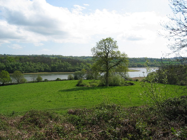
Weir Wood Reservoir

Lake, Pool, Pond, Freshwater Marsh in Sussex Wealden

England

Weir Wood Reservoir

Buildings as part of Standen National Trust
Buildings as part of Standen National Trust Credit: Barry Hunter

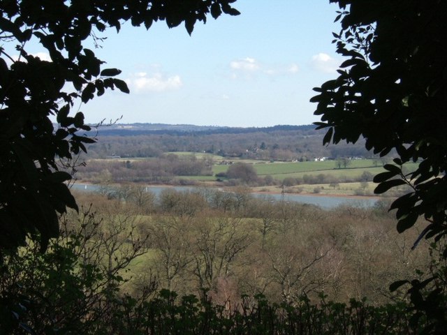
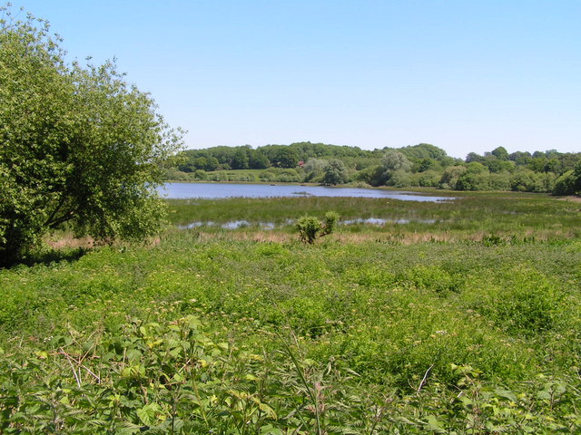
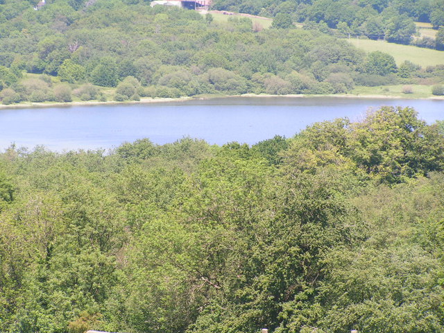
Weir Wood Reservoir is a picturesque freshwater body located in Sussex, England. Covering an area of approximately 280 acres, it is considered one of the largest bodies of water in the region. Originally created in 1952 by damming the River Medway, the reservoir serves as an important water source for the surrounding area, as well as a popular recreational spot for both locals and tourists.

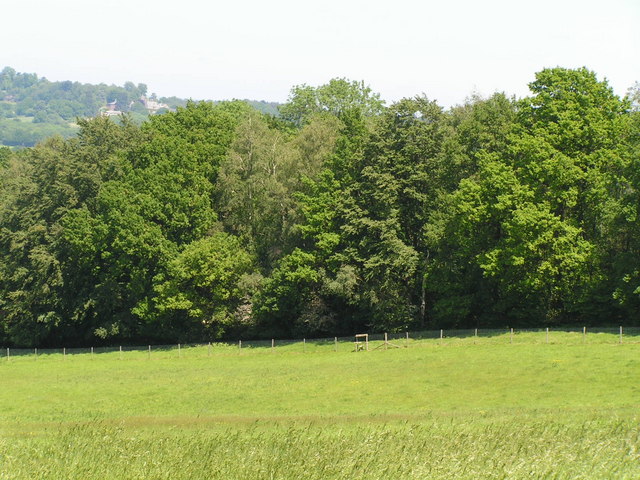
The reservoir is surrounded by lush woodlands, creating a tranquil and scenic environment. It is home to a diverse range of flora and fauna, making it a haven for nature enthusiasts and birdwatchers. The reservoir is particularly known for its variety of waterfowl, including great crested grebes, tufted ducks, and common pochards.

With its calm and peaceful waters, Weir Wood Reservoir is a popular destination for various water activities. Sailing and windsurfing are particularly popular, with the reservoir hosting regular competitions and sailing events. Fishing is also a common pastime, with the reservoir offering a variety of fish species, including pike, roach, and perch.

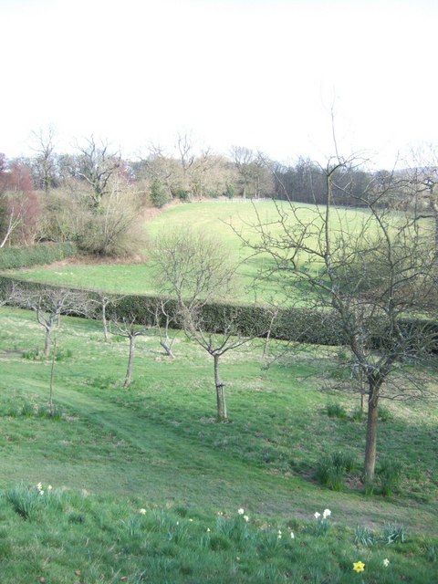
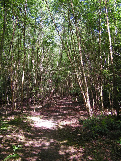
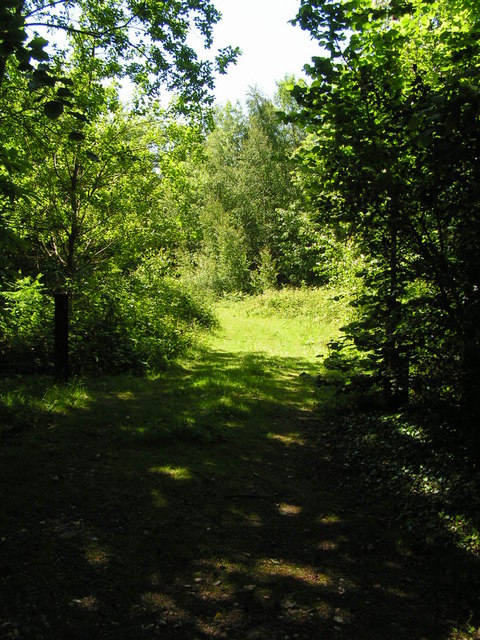
The reservoir is bordered by a nature reserve, which provides opportunities for pleasant walks and hikes. The reserve features several walking trails that offer breathtaking views of the reservoir and its surroundings. Additionally, there are designated picnic areas and a café where visitors can relax and enjoy the serenity of the location.

Overall, Weir Wood Reservoir is a beautiful and diverse freshwater body that offers a peaceful escape from the hustle and bustle of daily life. Its tranquil waters, abundant wildlife, and recreational activities make it a popular destination for both nature lovers and outdoor enthusiasts alike.

If you have any feedback on the listing, please let us know in the comments section below.

Weir Wood Reservoir Images

Images are sourced within 2km of 51.095751/-0.007979918 or Grid Reference TQ3934. Thanks to Geograph Open Source API. All images are credited.

Buildings as part of Standen National Trust
Rugby Fields Marked on the map as playing fields at the central southern edge of the grid square.
Rugby Fields
Marked on the map as playing fields at the central southern edge of the grid square.
Weir Wood Reservoir Looking south from the top edge of the gridsquare. Weir Wood Reservoir was  created in 1954.
Weir Wood Reservoir
Looking south from the top edge of the gridsquare. Weir Wood Reservoir was created in 1954.
Stone Farm rocks The sandstone rocks along the side of this hill are used for climbing practice.
Stone Farm rocks
The sandstone rocks along the side of this hill are used for climbing practice.
Footpath This direction takes you to Mill Place and the Bluebell railway line
Footpath
This direction takes you to Mill Place and the Bluebell railway line
Weir Wood Reservoir As seen from Standen
Weir Wood Reservoir
As seen from Standen
Gardens at Standen From the East side of the house
Gardens at Standen
From the East side of the house
Standen Standen (now an NT property) was built in the 1890s and is decorated with William Morris wallpapers and fabrics.
Standen
Standen (now an NT property) was built in the 1890s and is decorated with William Morris wallpapers and fabrics.
Saint Hill Manor 18th century manor house, once owned by L Ron Hubbard
Saint Hill Manor
18th century manor house, once owned by L Ron Hubbard
Weir Wood Reservoir Nature reserve Birdlife especially Herons are common in this area
Weir Wood Reservoir Nature reserve
Birdlife especially Herons are common in this area
Stone Farm Rocks An outcrop of Tunbridge Wells Sandstone, used for rock climbing.
Stone Farm Rocks
An outcrop of Tunbridge Wells Sandstone, used for rock climbing.
Stone Farm Rocks Stone Farm Rocks are a series of Tunbridge Wells sandstone crags and a Site of Special Scientific Interest (under the name Stone Hill Rocks) in the county of West Sussex. The site consists of 8 metres  high sandstone crags. The crags reveal sedimentary structures which are used to examine the deposition of minerals in relation to water depths, direction and strength.
The site is owned by the British Mountaineering Council who run it for the benefit of climbers. There are 74 identified climbs on the rocks. Bolt belays have been installed at the top of many of the climbs to reduce erosion of the site.
Stone Farm Rocks
Stone Farm Rocks are a series of Tunbridge Wells sandstone crags and a Site of Special Scientific Interest (under the name Stone Hill Rocks) in the county of West Sussex. The site consists of 8 metres high sandstone crags. The crags reveal sedimentary structures which are used to examine the deposition of minerals in relation to water depths, direction and strength. The site is owned by the British Mountaineering Council who run it for the benefit of climbers. There are 74 identified climbs on the rocks. Bolt belays have been installed at the top of many of the climbs to reduce erosion of the site.
Weir Wood Reservoir Weir Wood reservoir was created by damming the upper valley of the River Medway. A multi-purpose reservoir used as a water supply and recreation.
Weir Wood Reservoir
Weir Wood reservoir was created by damming the upper valley of the River Medway. A multi-purpose reservoir used as a water supply and recreation.
Woodland along the shores of Weir Wood Reservoir
Footpath through the Woods behind Legsheath Farm Part of the northern section of Ashdown Forest
Footpath through the Woods behind Legsheath Farm
Part of the northern section of Ashdown Forest
Footpath into the Woods Part of Ashdown Forest
Footpath into the Woods
Part of Ashdown Forest
Field & Wood
Field & Wood
Show me another place!

Weir Wood Reservoir is located at Grid Ref: TQ3934 (Lat: 51.095751, Lng: -0.007979918)

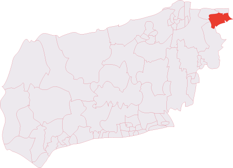
Administrative County: East Sussex

District: Wealden

Police Authority: Sussex

What 3 Words

///offer.cape.filed. Near Forest Row, East Sussex

Related Wikis

Weir Wood Reservoir

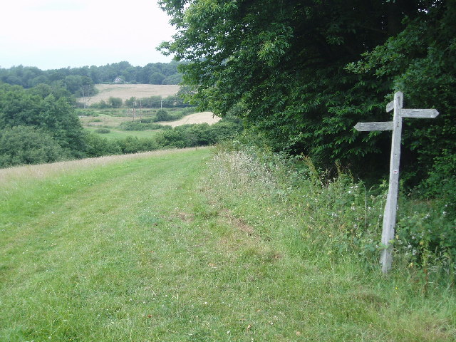
Weir Wood Reservoir is a 153.5-hectare (379-acre) biological Site of Special Scientific Interest west of Forest Row in East Sussex. It is in High Weald...
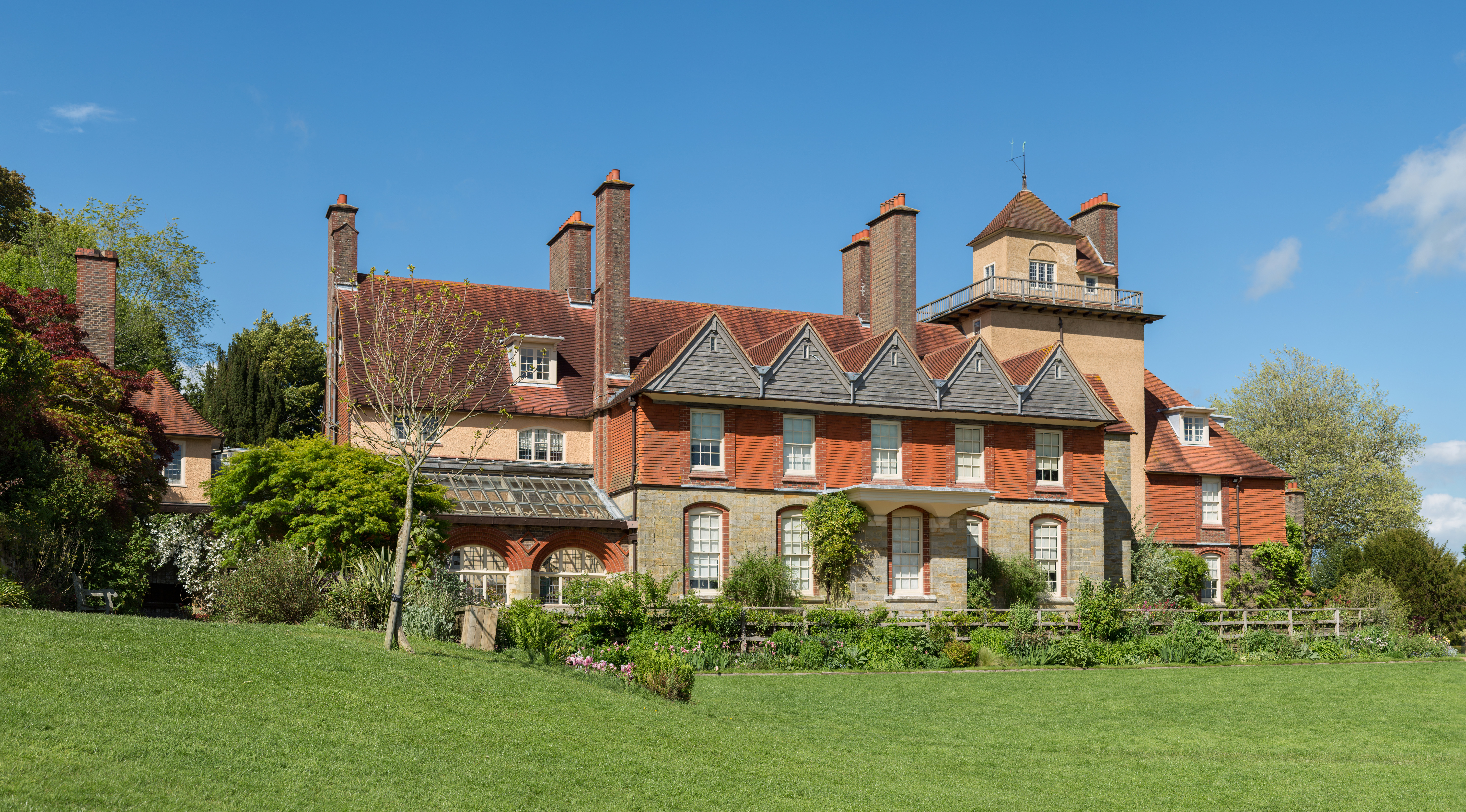
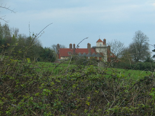
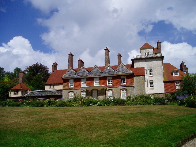
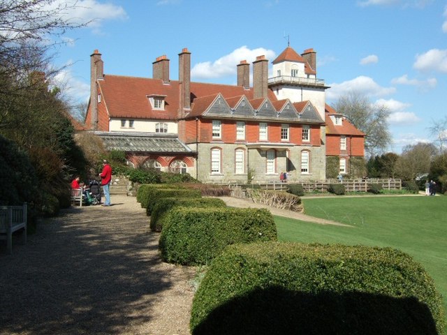
Standen

Standen is an Arts and Crafts house located to the south of East Grinstead, West Sussex, England. The house and its surrounding gardens belong to the National...

Saint Hill Green

Saint Hill Green is a small village near East Grinstead, West Sussex, England. It is notable for two country houses in the vicinity: Standen, designed...
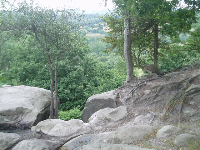
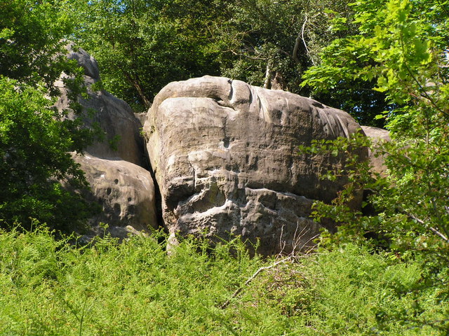
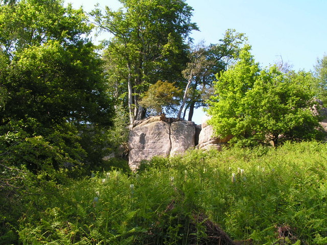
Stone Farm Rocks

Stone Farm Rocks or Stone Hill Rocks is a 0.6-hectare (1.5-acre) geological Site of Special Scientific Interest south of East Grinstead in West Sussex...
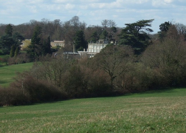
Saint Hill Manor

Saint Hill Manor is a Grade II listed country manor house at Saint Hill Green, near East Grinstead in West Sussex, England. It was constructed in 1792...

East Grinstead South & Ashurst Wood (electoral division)

East Grinstead South & Ashurst Wood is an electoral division of West Sussex in the United Kingdom, and returns one member to sit on West Sussex County...

Three Bridges–Tunbridge Wells line

The Three Bridges–Tunbridge Wells line is a mostly disused railway line running from Three Bridges (on the Brighton Main Line) in West Sussex to Tunbridge...

Lingfield Cernes

Lingfield Cernes is a 10.3-hectare (25-acre) biological Site of Special Scientific Interest east of Lingfield in Surrey. == Site details == This site has...

Related Videos

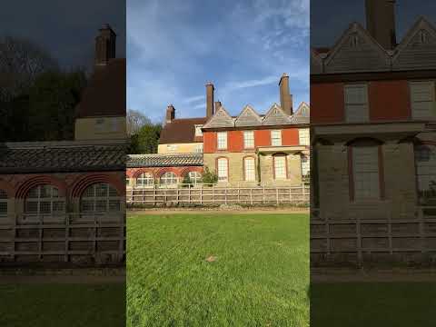
Weir Reservoir Walk.

A nice 5.5 mile walk around Weir Reservoir just south of East Grinstead.

[UK] 🇬🇧 Discover Secret Stones on a 13-Mile Hike at Stone Farm Rocks

Welcome to our channel! In this exciting adventure, join us as we embark on a 13-mile hike through the breathtaking Stone Farm ...

My Buddi - Lightweight, compact with added CleanFibres that helps keep skin free from infections.

Get more information at mybuddi.co - We specialise in extra lightweight hiking, camping and travel gear. Our lightweight and ...

Nearby Amenities

Located within 500m of 51.095751,-0.007979918
Source: landsat photo
Lat/Long: 51.0964233/-0.0143202
Source: landsat photo
Lat/Long: 51.0965823/-0.0138194
Source: landsat photo
Lat/Long: 51.0965979/-0.0134612
Source: landsat photo
Lat/Long: 51.0959557/-0.0120348
Source: landsat photo
Lat/Long: 51.097256/-0.0080043
Source: landsat photo
Lat/Long: 51.0983877/-0.0065298
Source: landsat photo
Lat/Long: 51.0980045/-0.0068815
Source: landsat photo
Lat/Long: 51.098593/-0.0055131
Source: landsat photo
Lat/Long: 51.0984861/-0.0041941
Source: landsat photo
Lat/Long: 51.0938302/-0.0025864
Source: landsat photo
Lat/Long: 51.0938851/-0.0039977
Source: landsat photo
Lat/Long: 51.0938428/-0.0051955
Source: landsat photo
Lat/Long: 51.0940853/-0.0058947
Source: landsat photo
Lat/Long: 51.0940971/-0.0063121
Source: landsat photo
Lat/Long: 51.0931615/-0.0071186
Source: landsat photo
Lat/Long: 51.0924387/-0.0078678
Source: landsat photo
Lat/Long: 51.0931263/-0.0084529
Source: landsat photo
Lat/Long: 51.0930313/-0.0100701
Source: landsat photo
Lat/Long: 51.0928699/-0.0122798
Source: landsat photo
Lat/Long: 51.0929918/-0.0132309
Millenium Picnic Site
Tourism: picnic_site
Lat/Long: 51.0991447/-0.0040942
Power: tower
Lat/Long: 51.0987562/-0.0101174
Barrier: stile
Lat/Long: 51.0973886/-0.0141402
Bench
Backrest: yes
Check Date: 2021-04-17
Lat/Long: 51.0964175/-0.011889
Barrier: stile
Lat/Long: 51.0965077/-0.0113886
Barrier: stile
Lat/Long: 51.0973718/-0.0132137
Barrier: stile
Lat/Long: 51.0975543/-0.0109631
Barrier: stile
Lat/Long: 51.0966033/-0.0108579
Power: pole
Lat/Long: 51.0986745/-0.0118918
Power: pole
Lat/Long: 51.0997137/-0.007442
Power: pole
Lat/Long: 51.0997932/-0.007462
Power: pole
Lat/Long: 51.09876/-0.0119295
Power: tower
Lat/Long: 51.098187/-0.0126132
The data included in this document is from www.openstreetmap.org. The data is made available under ODbL.

Have you been to Weir Wood Reservoir?

Leave your review of Weir Wood Reservoir below (or comments, questions and feedback).