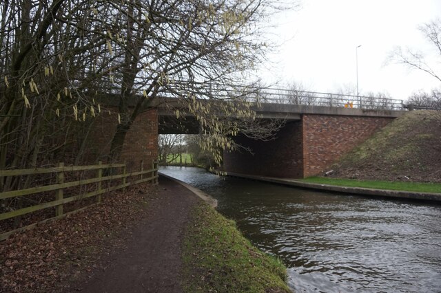
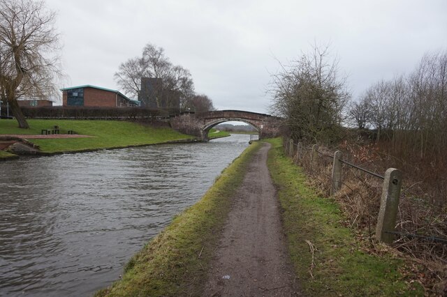
Sandymoor Pool

Lake, Pool, Pond, Freshwater Marsh in Cheshire

England

Sandymoor Pool

Bridgewater canal towards Moorefield Bridge
Bridgewater canal towards Moorefield Bridge Credit: Ian S

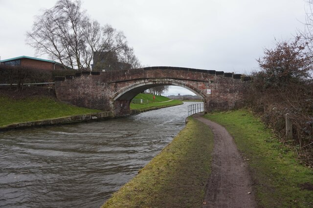
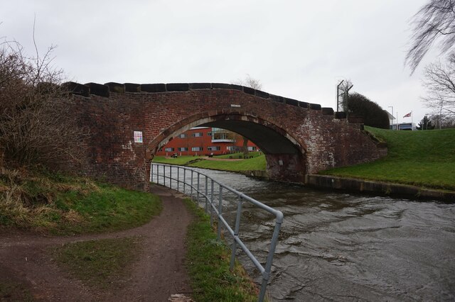
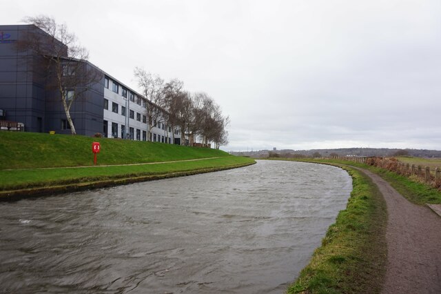
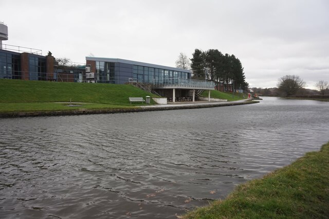
Sandymoor Pool is a picturesque freshwater body located in Cheshire, England. Nestled within the tranquil village of Sandymoor, the pool offers a serene natural environment for both locals and visitors to enjoy.

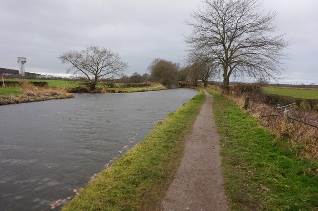
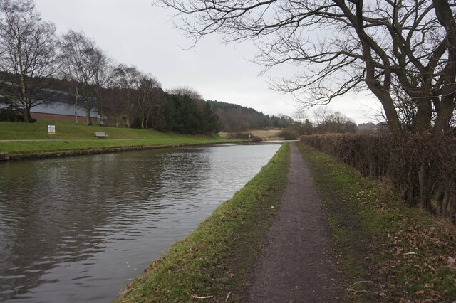
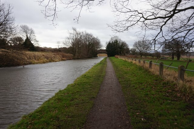
With an area spanning approximately 2 acres, Sandymoor Pool is relatively small but boasts abundant natural beauty. Surrounded by lush greenery, the pool serves as a haven for various species of flora and fauna. The crystal-clear water reflects the vibrant colors of the surrounding landscape, creating a visually captivating scene.

The pool is home to a diverse range of aquatic life, including fish, insects, and amphibians. It serves as an important breeding ground for many species, further enhancing its ecological significance. The presence of these creatures adds to the overall tranquility and serenity of the area, making it an ideal spot for nature enthusiasts and photographers.

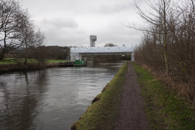
The pool's shoreline comprises a mixture of sandy beaches and reed beds, which provide shelter and nesting sites for numerous bird species. This makes Sandymoor Pool a popular destination for birdwatchers, who can spot a variety of waterfowl and wading birds throughout the year.

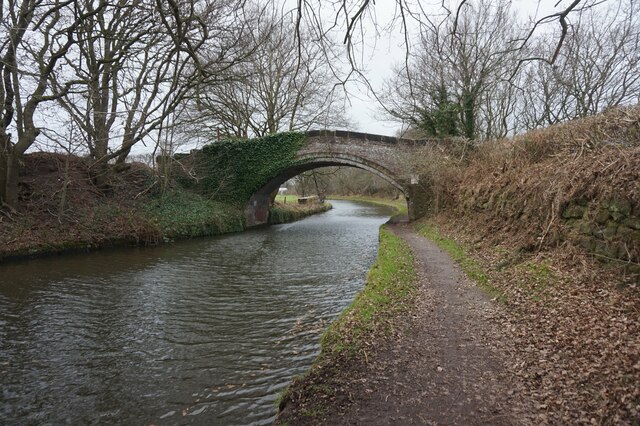
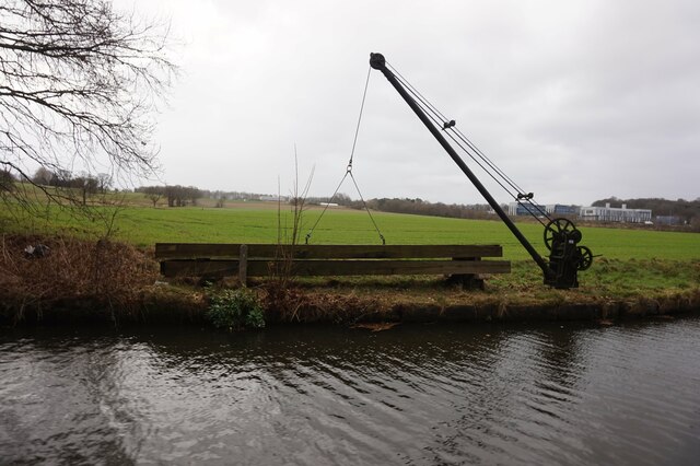
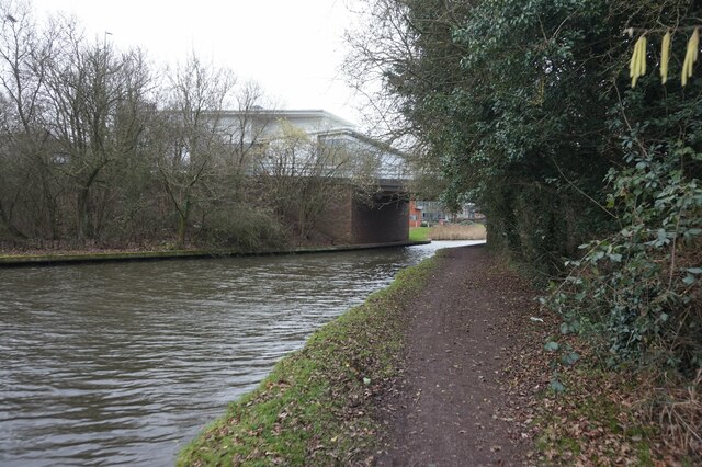
Additionally, the pool is surrounded by footpaths and nature trails, allowing visitors to explore the area and take in the breathtaking scenery at their leisure. The peaceful atmosphere makes it an ideal spot for picnics, leisurely walks, or simply unwinding with the soothing sounds of nature.

In summary, Sandymoor Pool is a small yet enchanting freshwater body located in Cheshire, offering a tranquil escape from the hustle and bustle of everyday life. Its diverse wildlife, scenic surroundings, and peaceful ambiance make it a cherished natural gem within the region.

If you have any feedback on the listing, please let us know in the comments section below.

Sandymoor Pool Images

Images are sourced within 2km of 53.344673/-2.6638911 or Grid Reference SJ5583. Thanks to Geograph Open Source API. All images are credited.

Bridgewater canal towards Moorefield Bridge
Daresbury Sci-Tech park
Bridgewater canal at Moorefield Bridge
Crane at Moorfield Bridge, Bridgewater canal
Bridgewater canal towards Daresbury Expressway Bridge
Working boat James, Bridgewater canal
Bridgewater canal at Daresbury Expressway Bridge
Daresbury Innovation Centre, Daresbury Sci-Tech Park
Bridgewater canal towards Daresbury Expressway Bridge
Daresbury Laboratory, Daresbury Sci-Tech Park
Bridgewater canal towards Keckwick Bridge
Daresbury Tower at Daresbury Sci-Tech Park
Bridgewater canal at Keckwick Bridge
Bridgewater canal towards Keckwick Bridge
Bridgewater canal towards Keckwick Hill Bridge
Show me another place!

Sandymoor Pool is located at Grid Ref: SJ5583 (Lat: 53.344673, Lng: -2.6638911)

Unitary Authority: Halton

Police Authority: Cheshire

What 3 Words

///rungs.cove.skinny. Near Daresbury, Cheshire

Related Wikis

Sandymoor

Sandymoor is a civil parish in Runcorn, Halton, Cheshire, England, with a population of approximately 3,700. The majority of housing in Sandymoor was built...

Red Lodge, Norton

Red Lodge, is in Manor Farm Road, Norton, Runcorn, Cheshire, England. Built originally as a lodge at the entrance to the estate of Norton Priory, it was...

Sandymoor Ormiston Academy

Sandymoor Ormiston Academy is a coeducational secondary school and sixth form located in the Parish of Sandymoor, Runcorn, Cheshire, England. The school...

Norton Priory

Norton Priory is a historic site in Norton, Runcorn, Cheshire, England, comprising the remains of an abbey complex dating from the 12th to 16th centuries...

Keckwick

Keckwick is an area in the Borough of Halton in Cheshire. Although there is no village as such, numerous toponyms attest to a particular identity in the...

Fountains Wood

Fountains Wood is a woodland in Cheshire, England, near Runcorn. It covers a total area of 1.08 hectares (2.67 acres). It is owned and managed by the Woodland...

Norton, Runcorn

Norton is an area in the eastern part of the town of Runcorn, Cheshire, England. It was originally a separate village 3 miles (5 km) to the east of Runcorn...
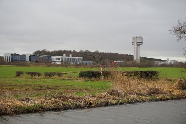
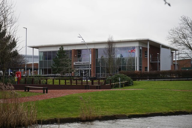
HPCx

HPCx was a supercomputer (actually a cluster of IBM eServer p5 575 high-performance servers) located at the Daresbury Laboratory in Cheshire, England...

Nearby Amenities

Located within 500m of 53.344673,-2.6638911
Motorway Junction
Lat/Long: 53.3471354/-2.6638348
Motorway Junction
Lat/Long: 53.3451557/-2.6712354
Power: tower
Lat/Long: 53.3429155/-2.6660606
Power: tower
Lat/Long: 53.3458953/-2.6675327
Motorway Junction
Lat/Long: 53.3481503/-2.6605995
Traffic Calming: cushion
Lat/Long: 53.344525/-2.6598989
Barrier: bollard
Bicycle: yes
Cyclestreets Id: 90124
Foot: yes
Horse: yes
Motor Vehicle: no
Url: https://www.cyclestreets.net/location/90124/
Lat/Long: 53.3477223/-2.6653093
Turning Circle
Lat/Long: 53.343444/-2.6676903
Sandymoor
Place: suburb
Source: npemap.org.uk, landsat
Lat/Long: 53.3449629/-2.6610588
Barrier: bollard
Bicycle: yes
Foot: yes
Motor Vehicle: no
Lat/Long: 53.3422005/-2.6695388
Crossing
Crossing: unmarked
Crossing Island: no
Kerb: flush
Tactile Paving: no
Lat/Long: 53.3423364/-2.6680312
Barrier: kissing_gate
Bicycle: yes
Foot: yes
Horse: no
Motor Vehicle: no
Lat/Long: 53.3408903/-2.6631446
Barrier: cycle_barrier
Bicycle: yes
Cyclestreets Id: 90119
Foot: yes
Motor Vehicle: no
Url: https://www.cyclestreets.net/location/90119/
Lat/Long: 53.3442639/-2.6687358
Crossing
Crossing: unmarked
Crossing Island: no
Tactile Paving: no
Lat/Long: 53.3441492/-2.6703638
Barrier: bollard
Bicycle: yes
Cyclestreets Id: 90121
Foot: yes
Horse: yes
Motor Vehicle: no
Url: https://www.cyclestreets.net/location/90121/
Lat/Long: 53.3447535/-2.6678927
Crossing
Crossing: unmarked
Crossing Island: yes
Kerb: lowered
Tactile Paving: no
Lat/Long: 53.3445642/-2.6679618
Crossing
Crossing: unmarked
Crossing Island: yes
Kerb: lowered
Tactile Paving: no
Lat/Long: 53.3445058/-2.6680118
Barrier: bollard
Bicycle: yes
Cyclestreets Id: 90120
Foot: yes
Horse: yes
Motor Vehicle: no
Url: https://www.cyclestreets.net/location/90120/
Lat/Long: 53.3442823/-2.6688444
Barrier: kissing_gate
Bicycle: yes
Cyclestreets Id: 90123
Foot: yes
Horse: no
Motor Vehicle: no
Url: https://www.cyclestreets.net/location/90123/
Lat/Long: 53.3458495/-2.665607
Crossing
Crossing: unmarked
Crossing Island: no
Tactile Paving: yes
Lat/Long: 53.3431877/-2.6620928
Crossing
Crossing: unmarked
Crossing Island: no
Tactile Paving: yes
Lat/Long: 53.3434683/-2.6611092
Crossing
Crossing: unmarked
Crossing Island: no
Crossing Markings: no
Tactile Paving: yes
Lat/Long: 53.3463208/-2.660643
Barrier: kissing_gate
Lat/Long: 53.3456661/-2.6654526
Barrier: kissing_gate
Lat/Long: 53.3434101/-2.6609417
Barrier: kissing_gate
Bicycle: yes
Foot: yes
Horse: no
Motor Vehicle: no
Lat/Long: 53.3411497/-2.6633631
Barrier: bollard
Bicycle: yes
Cyclestreets Id: 90101
Foot: yes
Motor Vehicle: no
Url: https://www.cyclestreets.net/location/90101/
Lat/Long: 53.3412827/-2.6600024
Barrier: cycle_barrier
Bicycle: yes
Cyclestreets Id: 90100
Foot: yes
Horse: no
Motor Vehicle: no
Url: https://www.cyclestreets.net/location/90100/
Lat/Long: 53.3424521/-2.6589355
Barrier: kissing_gate
Lat/Long: 53.3424704/-2.6593511
Bench
Lat/Long: 53.3436004/-2.6657299
Barrier: kissing_gate
Lat/Long: 53.3450402/-2.6653085
Traffic Calming: cushion
Lat/Long: 53.3436782/-2.6604729
Barrier: bollard
Motor Vehicle: no
Proposed: yes
Lat/Long: 53.3440263/-2.65709
Barrier: cycle_barrier
Lat/Long: 53.3447729/-2.6566255
Barrier: cycle_barrier
Bicycle: yes
Cyclestreets Id: 90099
Foot: yes
Horse: no
Motor Vehicle: no
Url: https://www.cyclestreets.net/location/90099/
Lat/Long: 53.3437228/-2.6594878
Barrier: cycle_barrier
Bicycle: yes
Cyclestreets Id: 90116
Foot: yes
Horse: no
Motor Vehicle: no
Url: https://www.cyclestreets.net/location/90116/
Lat/Long: 53.3422594/-2.6680091
Barrier: cycle_barrier
Bicycle: yes
Cyclestreets Id: 90117
Foot: yes
Horse: no
Motor Vehicle: no
Url: https://www.cyclestreets.net/location/90117/
Lat/Long: 53.3423842/-2.6680556
Barrier: bollard
Bicycle: yes
Cyclestreets Id: 90122
Foot: yes
Horse: yes
Motor Vehicle: no
Url: https://www.cyclestreets.net/location/90122/
Lat/Long: 53.3458768/-2.6656882
Red campion close
Addr City: Runcorn
Addr Housenumber: 1
Addr Postcode: WA7 1US
Tourism: apartment
Lat/Long: 53.3481596/-2.6643515
Generator Method: photovoltaic
Generator Output Electricity: yes
Generator Source: solar
Generator Type: solar_photovoltaic_panel
Location: roof
Power: generator
Lat/Long: 53.3403567/-2.6640194
Generator Method: photovoltaic
Generator Output Electricity: yes
Generator Source: solar
Generator Type: solar_photovoltaic_panel
Location: roof
Power: generator
Lat/Long: 53.3404088/-2.6638638
Generator Method: photovoltaic
Generator Output Electricity: yes
Generator Source: solar
Generator Type: solar_photovoltaic_panel
Location: roof
Power: generator
Lat/Long: 53.340468/-2.6634856
Generator Method: photovoltaic
Generator Output Electricity: yes
Generator Source: solar
Generator Type: solar_photovoltaic_panel
Location: roof
Power: generator
Lat/Long: 53.3413744/-2.6629331
Generator Method: photovoltaic
Generator Output Electricity: yes
Generator Source: solar
Generator Type: solar_photovoltaic_panel
Location: roof
Power: generator
Lat/Long: 53.341567/-2.6621687
Generator Method: photovoltaic
Generator Output Electricity: yes
Generator Source: solar
Generator Type: solar_photovoltaic_panel
Location: roof
Power: generator
Lat/Long: 53.3420202/-2.6626917
Generator Method: photovoltaic
Generator Output Electricity: yes
Generator Source: solar
Generator Type: solar_photovoltaic_panel
Location: roof
Power: generator
Lat/Long: 53.3424606/-2.664934
Generator Method: photovoltaic
Generator Output Electricity: yes
Generator Source: solar
Generator Type: solar_photovoltaic_panel
Location: roof
Power: generator
Lat/Long: 53.3424894/-2.6651593
Generator Method: photovoltaic
Generator Output Electricity: yes
Generator Source: solar
Generator Type: solar_photovoltaic_panel
Location: roof
Power: generator
Lat/Long: 53.3423405/-2.6613962
Generator Method: photovoltaic
Generator Output Electricity: yes
Generator Source: solar
Generator Type: solar_photovoltaic_panel
Location: roof
Power: generator
Lat/Long: 53.3412083/-2.6607391
Generator Method: photovoltaic
Generator Output Electricity: yes
Generator Source: solar
Generator Type: solar_photovoltaic_panel
Location: roof
Power: generator
Lat/Long: 53.3412531/-2.6608919
Generator Method: photovoltaic
Generator Output Electricity: yes
Generator Source: solar
Generator Type: solar_photovoltaic_panel
Location: roof
Power: generator
Lat/Long: 53.3412883/-2.661018
Generator Method: photovoltaic
Generator Output Electricity: yes
Generator Source: solar
Generator Type: solar_photovoltaic_panel
Location: roof
Power: generator
Lat/Long: 53.3407773/-2.6606172
Generator Method: photovoltaic
Generator Output Electricity: yes
Generator Source: solar
Generator Type: solar_photovoltaic_panel
Location: roof
Power: generator
Lat/Long: 53.3414595/-2.6587129
Generator Method: photovoltaic
Generator Output Electricity: yes
Generator Source: solar
Generator Type: solar_photovoltaic_panel
Location: roof
Power: generator
Lat/Long: 53.34157/-2.658686
Generator Method: photovoltaic
Generator Output Electricity: yes
Generator Source: solar
Generator Type: solar_photovoltaic_panel
Location: roof
Power: generator
Lat/Long: 53.3411921/-2.6592305
Generator Method: photovoltaic
Generator Output Electricity: yes
Generator Source: solar
Generator Type: solar_photovoltaic_panel
Location: roof
Power: generator
Lat/Long: 53.3413683/-2.6592144
Generator Method: photovoltaic
Generator Output Electricity: yes
Generator Source: solar
Generator Type: solar_photovoltaic_panel
Location: roof
Power: generator
Lat/Long: 53.3418999/-2.6589435
Generator Method: photovoltaic
Generator Output Electricity: yes
Generator Source: solar
Generator Type: solar_photovoltaic_panel
Location: roof
Power: generator
Lat/Long: 53.3417782/-2.659016
Generator Method: photovoltaic
Generator Output Electricity: yes
Generator Source: solar
Generator Type: solar_photovoltaic_panel
Location: roof
Power: generator
Lat/Long: 53.3416917/-2.6590455
Generator Method: photovoltaic
Generator Output Electricity: yes
Generator Source: solar
Generator Type: solar_photovoltaic_panel
Location: roof
Power: generator
Lat/Long: 53.3415813/-2.6590991
Generator Method: photovoltaic
Generator Output Electricity: yes
Generator Source: solar
Generator Type: solar_photovoltaic_panel
Location: roof
Power: generator
Lat/Long: 53.3424236/-2.658214
Generator Method: photovoltaic
Generator Output Electricity: yes
Generator Source: solar
Generator Type: solar_photovoltaic_panel
Location: roof
Power: generator
Lat/Long: 53.3423659/-2.6583266
Generator Method: photovoltaic
Generator Output Electricity: yes
Generator Source: solar
Generator Type: solar_photovoltaic_panel
Location: roof
Power: generator
Lat/Long: 53.3420408/-2.6587799
Generator Method: photovoltaic
Generator Output Electricity: yes
Generator Source: solar
Generator Type: solar_photovoltaic_panel
Location: roof
Power: generator
Lat/Long: 53.3421193/-2.658568
Generator Method: photovoltaic
Generator Output Electricity: yes
Generator Source: solar
Generator Type: solar_photovoltaic_panel
Location: roof
Power: generator
Lat/Long: 53.3422138/-2.6584661
Generator Method: photovoltaic
Generator Output Electricity: yes
Generator Source: solar
Generator Type: solar_photovoltaic_panel
Location: roof
Power: generator
Lat/Long: 53.3438504/-2.6567227
Generator Method: photovoltaic
Generator Output Electricity: yes
Generator Source: solar
Generator Type: solar_photovoltaic_panel
Location: roof
Power: generator
Lat/Long: 53.3442507/-2.6613495
Generator Method: photovoltaic
Generator Output Electricity: yes
Generator Source: solar
Generator Type: solar_photovoltaic_panel
Location: roof
Power: generator
Lat/Long: 53.3457991/-2.6600808
Bus Stop
Pitts Heath
Bus: yes
Naptan AtcoCode: 068000000804
Naptan NaptanCode: halagjtw
Public Transport: platform
Shelter: yes
Lat/Long: 53.3434634/-2.6609764
Bus Stop
Pitts Heath
Bus: yes
Public Transport: platform
Shelter: yes
Lat/Long: 53.3435427/-2.6610259
Traffic Calming: cushion
Lat/Long: 53.344001/-2.6599975
Traffic Calming: cushion
Lat/Long: 53.3434309/-2.6612465
Crossing
Crossing: unmarked
Crossing Island: no
Tactile Paving: yes
Lat/Long: 53.3437379/-2.6603344
Crossing
Crossing: unmarked
Crossing Island: no
Tactile Paving: yes
Lat/Long: 53.3430059/-2.6629496
Crossing
Crossing: unmarked
Crossing Island: no
Crossing Markings: no
Tactile Paving: yes
Lat/Long: 53.3439226/-2.6593899
Crossing
Crossing: unmarked
Crossing Island: no
Tactile Paving: yes
Lat/Long: 53.344349/-2.6598677
Traffic Calming: cushion
Lat/Long: 53.3449753/-2.6601219
Bus Stop
Dorchester
Bus: yes
Public Transport: platform
Shelter: yes
Lat/Long: 53.3455935/-2.6603774
Bus Stop
Dorchester
Bus: yes
Public Transport: platform
Shelter: yes
Lat/Long: 53.3464334/-2.6606676
Bus Stop
Steventon
Bus: yes
Public Transport: platform
Lat/Long: 53.3469732/-2.6589493
Bus Stop
Steventon
Bus: yes
Public Transport: platform
Shelter: no
Lat/Long: 53.346895/-2.6589652
Bus Stop
Bus: yes
Public Transport: platform
Shelter: no
Lat/Long: 53.3436913/-2.669789
Crossing
Crossing: unmarked
Crossing Island: no
Tactile Paving: no
Lat/Long: 53.3439806/-2.6697836
Crossing
Crossing: unmarked
Crossing Island: no
Tactile Paving: no
Lat/Long: 53.3439301/-2.6699041
Crossing
Crossing: unmarked
Crossing Island: no
Tactile Paving: yes
Lat/Long: 53.3429297/-2.6654795
Crossing
Crossing: unmarked
Crossing Island: no
Tactile Paving: yes
Lat/Long: 53.3432377/-2.6654763
Crossing
Crossing: unmarked
Crossing Island: no
Tactile Paving: no
Lat/Long: 53.3423233/-2.6681523
Fixme: How does this link to the cycleways, if it does? If/when it's correct, add horse=* tags to cycleway as appropriate
Lat/Long: 53.3441404/-2.66879
Turning Circle
Lat/Long: 53.3440121/-2.6678733
Turning Circle
Lat/Long: 53.3439344/-2.6679435
Turning Circle
Lat/Long: 53.3430448/-2.6675609
Turning Circle
Lat/Long: 53.3429404/-2.6675469
Veterinary
Sandymoor Vets
Lat/Long: 53.344362/-2.6587581
Co-op Food
Brand: Co-op Food
Brand Wikidata: Q3277439
Shop: supermarket
Lat/Long: 53.3442921/-2.6594186
Chatwins
Shop: bakery
Lat/Long: 53.3443546/-2.6591735
Atm
Lat/Long: 53.3442365/-2.6593136
Sandymoor Village Green
Leisure: park
Lat/Long: 53.343104/-2.6581594
Post Box
Operator: Royal Mail
Operator Wikidata: Q638098
Post Box Design: type_b
Post Box Type: pillar
Ref: WA7 73
Lat/Long: 53.3460443/-2.6607122
Post Box
Operator: Royal Mail
Operator Wikidata: Q638098
Post Box Design: type_b
Post Box Type: pillar
Ref: WA7 89
Royal Cypher: yes
Lat/Long: 53.341956/-2.6637584
Bench
Backrest: yes
Material: metal
Lat/Long: 53.3422393/-2.6636375
Crossing
Crossing: unmarked
Crossing Island: no
Crossing Markings: no
Tactile Paving: yes
Lat/Long: 53.3429049/-2.6650806
Bus Stop
Bus: yes
Departures Board: timetable
Public Transport: platform
Shelter: yes
Lat/Long: 53.3428321/-2.6650416
Bus Stop
Bus: yes
Departures Board: timetable
Public Transport: platform
Shelter: yes
Lat/Long: 53.3428743/-2.6648688
Restaurant
Otterburns
Lat/Long: 53.3443567/-2.6589548
The data included in this document is from www.openstreetmap.org. The data is made available under ODbL.

Have you been to Sandymoor Pool?

Leave your review of Sandymoor Pool below (or comments, questions and feedback).