Aswardby
Settlement in Lincolnshire East Lindsey
England
Aswardby

Aswardby is a small village located in the East Lindsey district of Lincolnshire, England. Situated approximately 5 miles south of the market town of Spilsby, it is nestled amidst the picturesque Lincolnshire Wolds, an Area of Outstanding Natural Beauty.
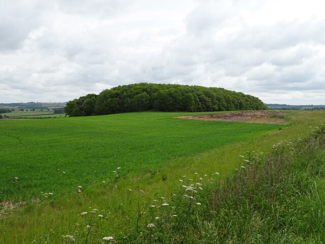
With a population of around 100 residents, Aswardby is known for its tranquility and rural charm. The village is predominantly agricultural, with many of its inhabitants working in farming or related industries. The surrounding landscape is characterized by rolling hills, open fields, and patchwork farmland, offering stunning views and endless opportunities for outdoor activities such as walking, cycling, and horse riding.
The village itself is compact, consisting of a cluster of traditional stone houses and cottages, some of which date back several centuries. There is a small parish church, St. Helen's, which is a Grade II listed building and a focal point for the community. The church holds regular services and occasional events.
Although lacking in amenities, Aswardby benefits from its close proximity to Spilsby, where residents can access a wider range of services including schools, shops, and healthcare facilities. The village is well-connected by road, with the A16 passing nearby, providing easy access to neighboring towns and cities.
Aswardby offers a peaceful and idyllic lifestyle, appealing to those seeking a close-knit community and a rural retreat surrounded by the stunning beauty of the Lincolnshire Wolds.
If you have any feedback on the listing, please let us know in the comments section below.
Aswardby Images
Images are sourced within 2km of 53.212655/0.060677 or Grid Reference TF3770. Thanks to Geograph Open Source API. All images are credited.


Aswardby is located at Grid Ref: TF3770 (Lat: 53.212655, Lng: 0.060677)
Division: Parts of Lindsey
Administrative County: Lincolnshire
District: East Lindsey
Police Authority: Lincolnshire
What 3 Words
///humans.torch.cleanest. Near Spilsby, Lincolnshire
Nearby Locations
Related Wikis

Aswardby
Aswardby (pronounced "as-ard-bee") is a village situated 4 miles (6 km) north-west from Spilsby, in the East Lindsey district of Lincolnshire, England...

Sausthorpe
Sausthorpe is a small village and civil parish in the East Lindsey district of Lincolnshire, England, 8 miles (13 km) east of Horncastle and 3 miles (4...

Langton by Spilsby
Langton by Spilsby, sometimes called Langton by Partney, is a village and civil parish in the East Lindsey district of Lincolnshire, England. It is situated...

Harrington, Lincolnshire
Harrington is a hamlet and civil parish in the East Lindsey district of Lincolnshire, England. It is situated 6 miles (10 km) south-west from Alford, and...
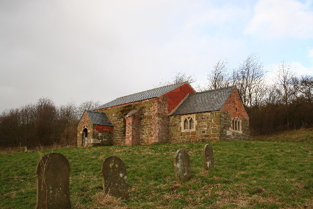
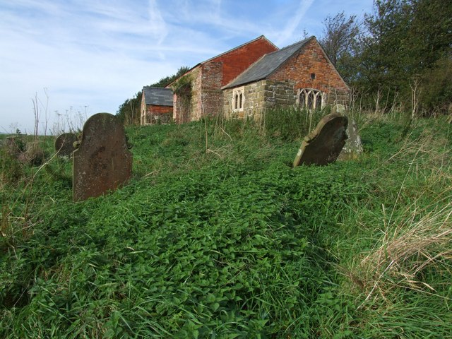
St John the Baptist's Church, Sutterby
St John the Baptist's Church is a redundant Anglican church in the village of Sutterby, Lincolnshire, England. It is recorded in the National Heritage...
Sutterby
Sutterby is a hamlet in the civil parish of Langton by Spilsby, in the East Lindsey district of Lincolnshire, England. It is situated 9 miles (14 km) south...

Thornbury Hill
Thornbury Hill is a hill in Hagworthingham, Lincolnshire, England.

Dalby, Lincolnshire
Dalby is a village and civil parish in the East Lindsey district of Lincolnshire, England. It is situated approximately 3 miles (5 km) north from the town...
Nearby Amenities
Located within 500m of 53.212655,0.060677Have you been to Aswardby?
Leave your review of Aswardby below (or comments, questions and feedback).