Aswardby

Civil Parish in Lincolnshire East Lindsey

England

Aswardby

Across Cinder Hill and the A158 towards Raithby and Mavis Enderby: aerial 2016
Across Cinder Hill and the A158 towards Raithby and Mavis Enderby: aerial 2016 Credit: Chris

Aswardby is a civil parish located in the county of Lincolnshire, England. Situated approximately 9 miles east of the market town of Horncastle, Aswardby covers an area of around 2 square miles.

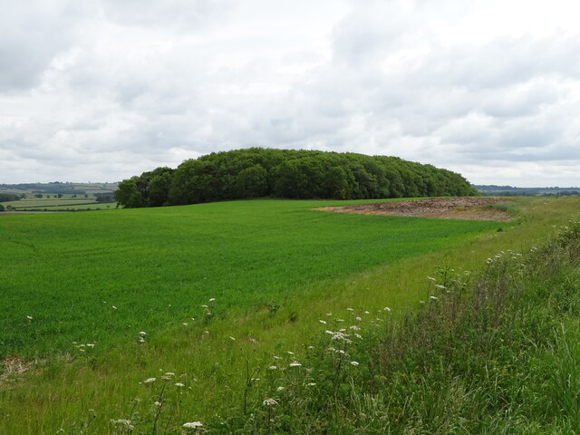
The parish is predominantly rural, characterized by its picturesque countryside and agricultural landscapes. It is surrounded by the charming Lincolnshire Wolds, an Area of Outstanding Natural Beauty, which adds to the area's appeal.

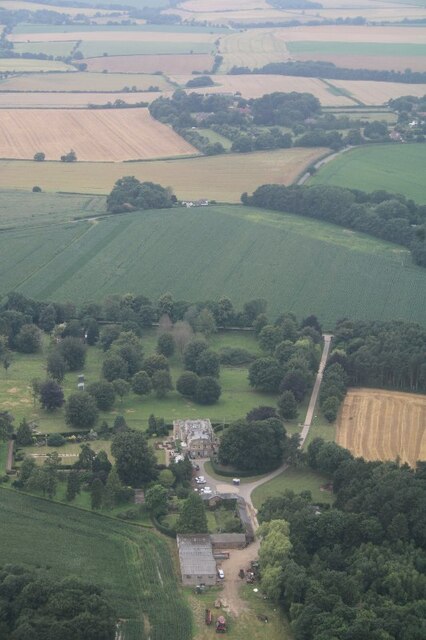
Aswardby is a small community with a population of just over 100 residents. The parish consists of a cluster of houses and farms, with a scattering of historic buildings that contribute to its charm. The local economy is primarily based on agriculture, with many residents involved in farming and related industries.

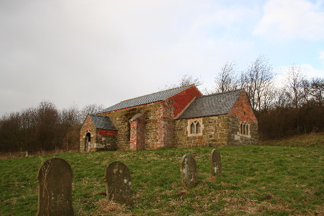
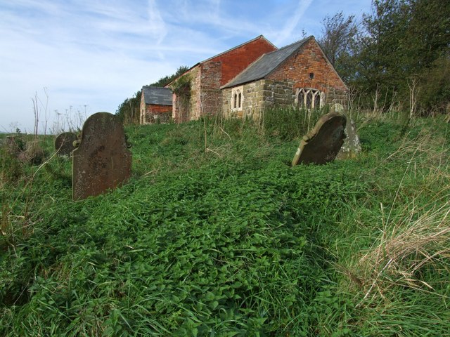
The centerpiece of Aswardby is its parish church, St. Helen's Church, which dates back to the 13th century. This historic building is known for its beautiful architecture and stained glass windows, attracting visitors from both near and far.

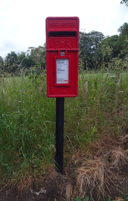
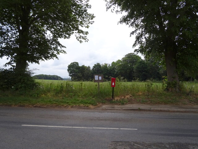
The parish offers a peaceful and tranquil environment, ideal for those seeking a quiet retreat or a countryside getaway. It is well-connected to the surrounding areas by road, making it easily accessible for both residents and visitors.

Overall, Aswardby is a delightful rural parish, known for its natural beauty, historic charm, and close-knit community. It offers a serene escape from the bustling city life, providing a glimpse into the idyllic English countryside.

If you have any feedback on the listing, please let us know in the comments section below.

Aswardby Images

Images are sourced within 2km of 53.214235/0.061337 or Grid Reference TF3770. Thanks to Geograph Open Source API. All images are credited.

Across Cinder Hill and the A158 towards Raithby and Mavis Enderby: aerial 2016
Sausthorpe: aerial 2016
Cinder Hill, near Hagworthingham: aerial 2020
Entering Sausthorpe On Partney Road (A158).
Entering Sausthorpe
On Partney Road (A158).
The Old Hall, Sausthorpe
The Church of St Andrew, Sausthorpe  View from the A158.
The Church of St Andrew, Sausthorpe
View from the A158.
The Church of St Andrew, Sausthorpe
Crossroads on Partney Road (A158), Sausthorpe
Maize crop towards woodland, near Sausthorpe Off the A158.
Maize crop towards woodland, near Sausthorpe
Off the A158.
Partney Road (A158) Towards Hagworthingham.
Partney Road (A158)
Towards Hagworthingham.
Cereal crop off Partney Road (A158)
Partney Road (A158), Sausthorpe
Woodland, Sausthorpe Bridge Beside the road from Sausthorpe towards Raithby by Spilsby.
Woodland, Sausthorpe Bridge
Beside the road from Sausthorpe towards Raithby by Spilsby.
New Plantation Woodland, Cinder Hill.
New Plantation
Woodland, Cinder Hill.
Elizabeth II postbox, Sausthorpe Postbox No. PE23 97.
Elizabeth II postbox, Sausthorpe
Postbox No. PE23 97.
Elizabeth II postbox, Sausthorpe Postbox No. PE23 97.
Elizabeth II postbox, Sausthorpe
Postbox No. PE23 97.
Sausthorpe Hall: aerial 2021
Direction Sign – Signpost in Sausthorpe village Located on the southeast side of the Y junction in Sausthorpe parish. 3 arms and no finial. 

Milestone Society National ID: LI_TF3869
Direction Sign – Signpost in Sausthorpe village
Located on the southeast side of the Y junction in Sausthorpe parish. 3 arms and no finial. Milestone Society National ID: LI_TF3869
Show me another place!

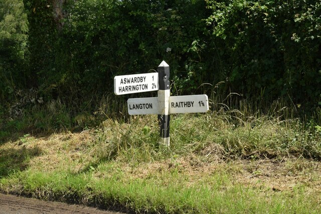
Aswardby is located at Grid Ref: TF3770 (Lat: 53.214235, Lng: 0.061337)

Administrative County: Lincolnshire

District: East Lindsey

Police Authority: Lincolnshire

What 3 Words

///slicing.makeovers.prospered. Near Spilsby, Lincolnshire

Related Wikis

Aswardby

Aswardby (pronounced "as-ard-bee") is a village situated 4 miles (6 km) north-west from Spilsby, in the East Lindsey district of Lincolnshire, England...

Sausthorpe

Sausthorpe is a small village and civil parish in the East Lindsey district of Lincolnshire, England, 8 miles (13 km) east of Horncastle and 3 miles (4...

Langton by Spilsby

Langton by Spilsby, sometimes called Langton by Partney, is a village and civil parish in the East Lindsey district of Lincolnshire, England. It is situated...

Harrington, Lincolnshire

Harrington is a hamlet and civil parish in the East Lindsey district of Lincolnshire, England. It is situated 6 miles (10 km) south-west from Alford, and...

St John the Baptist's Church, Sutterby

St John the Baptist's Church is a redundant Anglican church in the village of Sutterby, Lincolnshire, England. It is recorded in the National Heritage...

Sutterby

Sutterby is a hamlet in the civil parish of Langton by Spilsby, in the East Lindsey district of Lincolnshire, England. It is situated 9 miles (14 km) south...

Thornbury Hill

Thornbury Hill is a hill in Hagworthingham, Lincolnshire, England.

Dalby, Lincolnshire

Dalby is a village and civil parish in the East Lindsey district of Lincolnshire, England. It is situated approximately 3 miles (5 km) north from the town...

Nearby Amenities

Located within 500m of 53.214235,0.061337
Aswardby
Is In: Lincolnshire, England, UK
Place: hamlet
Source: Bing
Lat/Long: 53.2114818/0.0603661
Bus Stop
Fox Warren Lodge
Naptan AtcoCode: 270000009090
Naptan Bearing: SE
Naptan BusStopType: CUS
Naptan CommonName: Fox Warren Lodge
Naptan Indicator: adj
Naptan Landmark: Fox Warren Lodge
Naptan NaptanCode: lingwtdw
Naptan Street: Aswardby
Naptan Verified: no
Source: naptan_import
Lat/Long: 53.2156353/0.0563092
Bus Stop
Fox Warren Lodge
Naptan AtcoCode: 270002700344
Naptan Bearing: NW
Naptan BusStopType: CUS
Naptan CommonName: Fox Warren Lodge
Naptan Indicator: opp
Naptan Landmark: Fox Warren Lodge
Naptan Street: Aswardby
Naptan Verified: no
Source: naptan_import
Lat/Long: 53.2155832/0.0562019
Bus Stop
Methodist Church
Naptan AtcoCode: 270002701658
Naptan Bearing: SE
Naptan BusStopType: CUS
Naptan CommonName: Methodist Church
Naptan Indicator: opp
Naptan Landmark: Methodist Church
Naptan Street: Langton Road
Naptan Verified: no
Source: naptan_import
Lat/Long: 53.2121898/0.0631834
Bus Stop
Methodist Church
Naptan AtcoCode: 270002701659
Naptan Bearing: NW
Naptan BusStopType: CUS
Naptan CommonName: Methodist Church
Naptan Indicator: adj
Naptan Landmark: Methodist Church
Naptan Street: Langton Road
Naptan Verified: no
Source: naptan_import
Lat/Long: 53.2120738/0.0631329
Park Farm
Place: farm
Source: Bing
Lat/Long: 53.2113669/0.0564485
Power: pole
Lat/Long: 53.2161391/0.0573888
Aswardby House
Place: isolated_dwelling
Source: Bing
Lat/Long: 53.2132414/0.0601757
The data included in this document is from www.openstreetmap.org. The data is made available under ODbL.

Have you been to Aswardby?

Leave your review of Aswardby below (or comments, questions and feedback).