Alder Shaw

Wood, Forest in Sussex Rother

England

Alder Shaw

Eden Court, Ticehurst Former primary school building (to right of picture), now converted to apartments with additional new houses surrounding it. Grade II listed.

New primary school at <a href="https://www.geograph.org.uk/gridref/TQ695304">TQ695304</a>
Eden Court, Ticehurst Credit: Oast House Archive

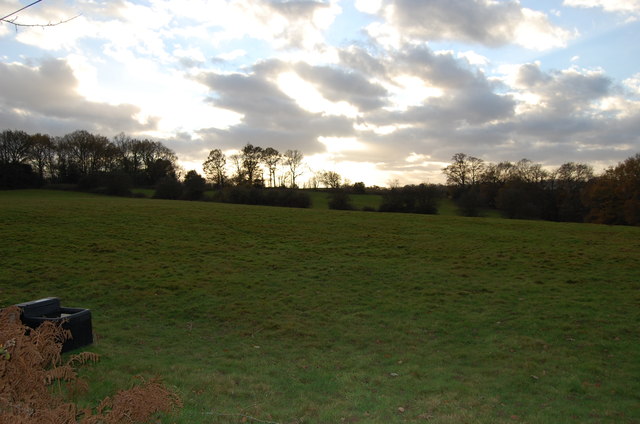
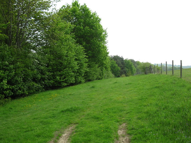
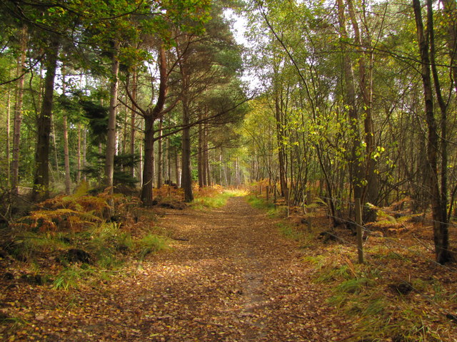
Alder Shaw is a small woodland area located in the county of Sussex, England. Situated in the heart of the countryside, it is known for its dense population of alder trees, which gives the area its name. The woodland covers an approximate area of 100 acres and is a notable feature of the local landscape.

The alder trees in Alder Shaw are predominantly of the common alder (Alnus glutinosa) species, known for their ability to grow in wet or waterlogged conditions. As a result, the woodland is often damp and provides a suitable habitat for various species of wildlife, including birds, mammals, and insects.

The forest floor is covered in a thick layer of moss and ferns, creating a lush and green environment. The canopy of the alder trees provides shelter and shade, making it an ideal habitat for woodland creatures. The area is also home to a variety of plant species, including bluebells, primroses, and wood sorrel, which add to the natural beauty of the woodland.

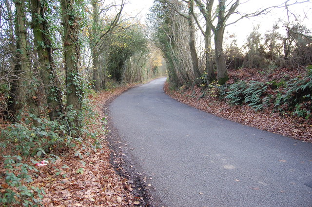
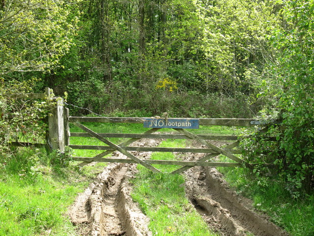
Alder Shaw is a popular destination for nature enthusiasts and walkers who enjoy exploring the peaceful surroundings. There are several walking trails that wind through the woodland, offering visitors the opportunity to immerse themselves in nature and observe the diverse wildlife. The tranquil atmosphere and picturesque scenery make Alder Shaw a perfect retreat for those seeking a break from the hustle and bustle of everyday life.

Overall, Alder Shaw in Sussex is a charming woodland area that showcases the beauty of nature and provides a sanctuary for numerous plant and animal species.

If you have any feedback on the listing, please let us know in the comments section below.

Alder Shaw Images

Images are sourced within 2km of 51.060976/0.40800235 or Grid Reference TQ6831. Thanks to Geograph Open Source API. All images are credited.

Eden Court, Ticehurst Former primary school building (to right of picture), now converted to apartments with additional new houses surrounding it. Grade II listed.

New primary school at <a href="https://www.geograph.org.uk/gridref/TQ695304">TQ695304</a>
Eden Court, Ticehurst
Former primary school building (to right of picture), now converted to apartments with additional new houses surrounding it. Grade II listed. New primary school at TQ695304
Combwell Lodge
Combwell Lodge
Horses, Combwell Priory Farm
Ketleys Oast, Rosemary lane Single round kiln oast house.
Ketleys Oast, Rosemary lane
Single round kiln oast house.
Wintery Fields near Ketley Farm
Rosemary Lane
Rosemary Lane
Ketley's Oast, Rosemary Lane, Ticehurst Single round kiln oast house.
Ketley's Oast, Rosemary Lane, Ticehurst
Single round kiln oast house.
Road to Flimwell at Berner's Hill
Sussex Border Path A grassy part of the long distance route.
Sussex Border Path
A grassy part of the long distance route.
NO footpath An indication that the Sussex Border Path does not go this way because it crosses the reservoir causeway.
NO footpath
An indication that the Sussex Border Path does not go this way because it crosses the reservoir causeway.
A21 near T&J Motel Towards Hastings.
A21 near T&J Motel
Towards Hastings.
End of the dual carriageway, A21
Motel by the A21
Motel by the A21
View from the A21
View from the A21
End of dual carriageway, A21 The A21 is a 63 mile major trunk road running  from Lewisham in Greater London to Hastings, East Sussex. The road is broken up by the M25 motorway between junction 4 and 5.
Wikipedia <span class="nowrap"><a title="http://en.wikipedia.org/wiki/A21_road_(England)" rel="nofollow ugc noopener" href="http://en.wikipedia.org/wiki/A21_road_(England)">Link</a><img style="margin-left:2px;" alt="External link" title="External link - shift click to open in new window" src="https://s1.geograph.org.uk/img/external.png" width="10" height="10"/></span>
End of dual carriageway, A21
The A21 is a 63 mile major trunk road running from Lewisham in Greater London to Hastings, East Sussex. The road is broken up by the M25 motorway between junction 4 and 5. Wikipedia LinkExternal link
A21 The A21 is a 63 mile major trunk road running  from Lewisham in Greater London to Hastings, East Sussex. The road is broken up by the M25 motorway between junction 4 and 5.
Wikipedia <span class="nowrap"><a title="http://en.wikipedia.org/wiki/A21_road_(England)" rel="nofollow ugc noopener" href="http://en.wikipedia.org/wiki/A21_road_(England)">Link</a><img style="margin-left:2px;" alt="External link" title="External link - shift click to open in new window" src="https://s1.geograph.org.uk/img/external.png" width="10" height="10"/></span>
A21
The A21 is a 63 mile major trunk road running from Lewisham in Greater London to Hastings, East Sussex. The road is broken up by the M25 motorway between junction 4 and 5. Wikipedia LinkExternal link
Ketley Wood
Ketley Wood
Church Street, Ticehurst
Show me another place!

Alder Shaw is located at Grid Ref: TQ6831 (Lat: 51.060976, Lng: 0.40800235)

Administrative County: East Sussex

District: Rother

Police Authority: Sussex

What 3 Words

///tributes.juggles.infinite. Near Ticehurst, East Sussex

Related Wikis

Ticehurst

Ticehurst is both a village and a large civil parish in the Rother district of East Sussex, England. The parish lies in the upper reaches of both the Bewl...

Bewl Water

Bewl Water is a reservoir in the valley of the River Bewl, straddling the boundary between Kent and East Sussex in England. It is about 2 miles (3.2 km...

Ticehurst House Hospital

Ticehurst House Hospital was a mental health facility. It opened in 1792 and was owned and run by five generations of members of the Newington family until...

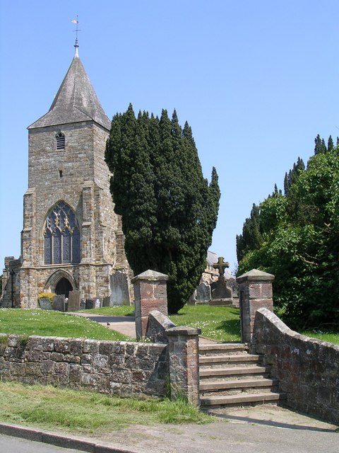
St Mary's Church, Ticehurst

St Mary's Church is a 14th-century parish church dedicated to St Mary the Virgin in Ticehurst, East Sussex, England. Part of the Diocese of Chichester...

Combwell Priory

Combwell Priory was a priory near Bedgebury Cross about 10 miles southeast of Tunbridge Wells in Kent, England. == History == This is a Grade II listed...

Bewl Bridge Rowing Club

Bewl Bridge Rowing Club is a rowing club on the Bewl Water, based at Bewlbridge Lane, Lamberhurst, Wadhurst, Tunbridge Wells. Rowers aged 12 and upwards...
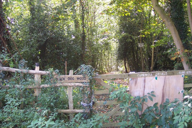
Combwell Wood

Combwell Wood is a 110.6-hectare (273-acre) biological Site of Special Scientific Interest south-east of Tunbridge Wells in Kent. The wood is part of the...

Flimwell

Flimwell is a village in the civil parish of Ticehurst, in the Rother district of East Sussex, England. It is located close to the border with Kent at...

Related Videos

A Hiking Adventure: Bewl Water

Join me as I hike the 20.9km Bewl Water Circular near Ticehurst, East Sussex. It is generally considered a moderately challenging ...

Hike around Bewl Water

A walk around Bewl Water with Chris. Around 21 km (12.5 miles) of great views and weather, as well as Chris sprinkling some ...

Ths Most Beautiful Landscaped Garden? A Day at Scotney Castle Kent UK National Trust

Scotney Castle is one of my favourite National Trust sites and its garden is absolutely stunning. Scotney Castle is in Kent, UK and ...

Hams travel of Flimwell DW70HAM

Rail Replacement between Tunbridge Wells and Hastings Recorded between Tunbridge Wells and Lamberhurst Bypass.

Nearby Amenities

Located within 500m of 51.060976,0.40800235
Dunster's Mill House
Place: isolated_dwelling
Source Name: OS_OpenData_StreetView
Wikidata: Q17555933
Lat/Long: 51.0623992/0.4098411
Norwoods Farm
Place: isolated_dwelling
Source Name: OS_OpenData_StreetView
Lat/Long: 51.0600088/0.4103508
Overys Cottages
Place: isolated_dwelling
Source Name: OS_OpenData_StreetView
Lat/Long: 51.0611888/0.4116382
Overy's Farm
Place: isolated_dwelling
Source Name: OS_OpenData_StreetView
Lat/Long: 51.0621194/0.4127487
Grebe Corner, Bewl Water
Tourism: viewpoint
Lat/Long: 51.0619028/0.4015477
Bench
Lat/Long: 51.0648542/0.4076524
Bench
Lat/Long: 51.0648694/0.4076457
Bench
Lat/Long: 51.0648818/0.407651
Power: pole
Lat/Long: 51.0571495/0.4044771
Power: pole
Lat/Long: 51.0594237/0.4033989
Power: pole
Lat/Long: 51.0590191/0.4050243
Power: pole
Lat/Long: 51.0583161/0.4077655
Power: pole
Lat/Long: 51.0580312/0.4085541
Power: pole
Lat/Long: 51.0573164/0.4082832
Power: pole
Lat/Long: 51.0573114/0.4051638
Power: pole
Lat/Long: 51.0569034/0.4061106
The data included in this document is from www.openstreetmap.org. The data is made available under ODbL.

Have you been to Alder Shaw?

Leave your review of Alder Shaw below (or comments, questions and feedback).