Duckpit Wood

Wood, Forest in Surrey Tandridge

England

Duckpit Wood

A22 Godstone Bypass This road was built to relieve the traffic through the picturesque village of Godstone
A22 Godstone Bypass Credit: Nigel Freeman

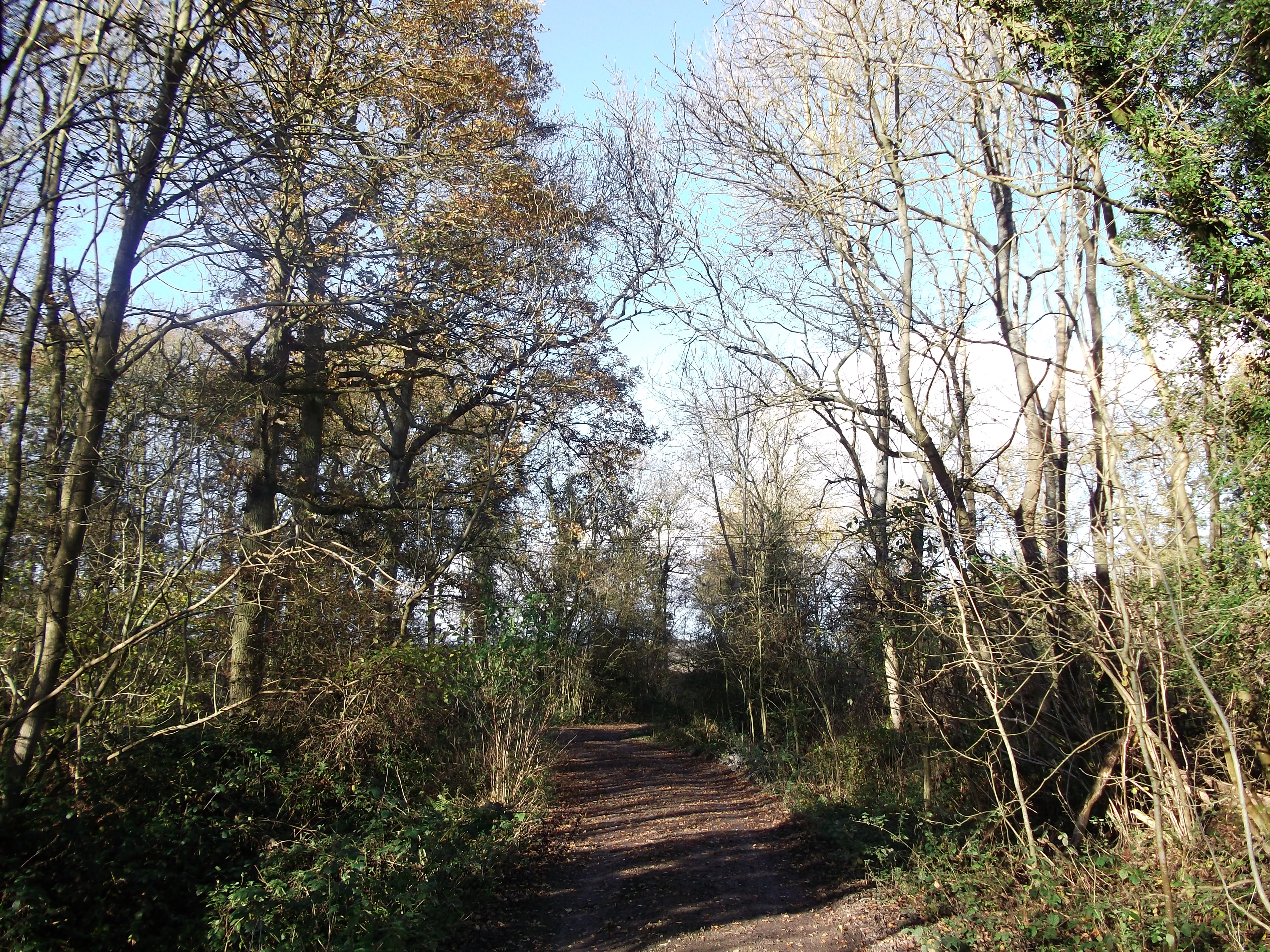
Duckpit Wood is a picturesque woodland located in the county of Surrey, England. Covering an area of approximately 50 acres, it is situated near the village of Ockley, just a few miles south of the Surrey Hills Area of Outstanding Natural Beauty.

The wood is named after the small pond or "duckpit" that can be found within its boundaries. This pond serves as a watering hole for various bird species and other wildlife, attracting visitors who enjoy observing the diverse range of fauna in the area.

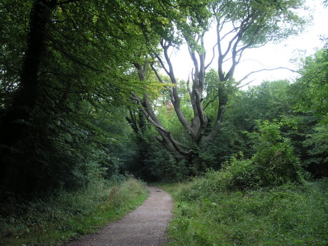
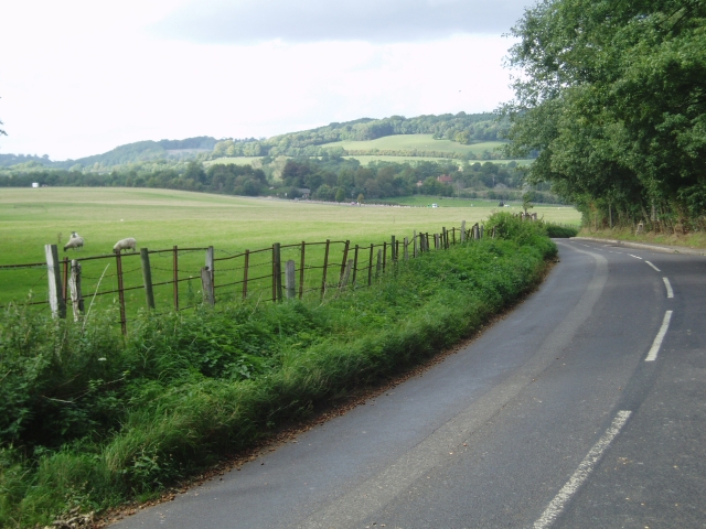
Duckpit Wood is predominantly composed of mixed deciduous trees, including oak, ash, beech, and birch. These trees create a dense canopy that provides shade and shelter for a rich variety of plant and animal life. Bluebells carpet the forest floor in the spring, creating a stunning display of vibrant purple hues.

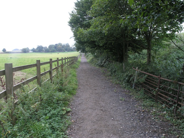
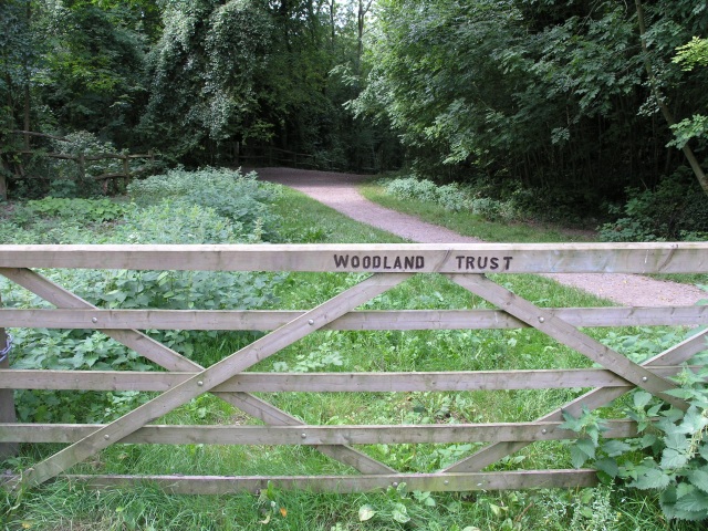
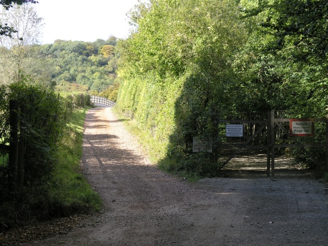
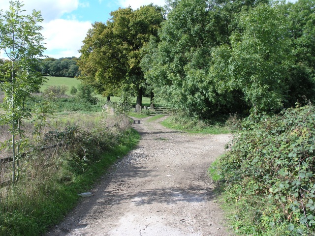
The wood is crisscrossed by a network of footpaths and walking trails, making it a popular destination for hikers, nature enthusiasts, and families seeking outdoor adventures. The paths wind through the ancient woodland, leading visitors past towering trees, babbling brooks, and tranquil glades.

The tranquility of Duckpit Wood is further enhanced by the absence of vehicular traffic, as there is no parking available on site. This adds to the sense of seclusion and peacefulness, allowing visitors to immerse themselves in the natural beauty of the surroundings.

Overall, Duckpit Wood offers a serene and enchanting escape from the hustle and bustle of everyday life, inviting visitors to explore its hidden treasures and experience the wonders of a quintessential Surrey woodland.

If you have any feedback on the listing, please let us know in the comments section below.

Duckpit Wood Images

Images are sourced within 2km of 51.25555/-0.036178217 or Grid Reference TQ3752. Thanks to Geograph Open Source API. All images are credited.

A22 Godstone Bypass This road was built to relieve the traffic through the picturesque village of Godstone
A22 Godstone Bypass
This road was built to relieve the traffic through the picturesque village of Godstone
St. Nicholas Church, Godstone Built on the location of a Norman church, the current building dates back to the early 13th century.  The tower was added later in that century, but was faced with stone as late as 1872. Further modifications have since been made and the church has six bells.
St. Nicholas Church, Godstone
Built on the location of a Norman church, the current building dates back to the early 13th century. The tower was added later in that century, but was faced with stone as late as 1872. Further modifications have since been made and the church has six bells.
Farmland near Godstone This line of trees is clearly visible on the map and was taken from Jackass Lane.
Farmland near Godstone
This line of trees is clearly visible on the map and was taken from Jackass Lane.
St Peter's, Tandridge The yew tree to the left of the parish church in this picture is believed to be over 5000 years old and has been featured on 2nd class postage stamps to commemorate the Millennium. Although it has norman elements, the external building is mostly Victorian.
St Peter's, Tandridge
The yew tree to the left of the parish church in this picture is believed to be over 5000 years old and has been featured on 2nd class postage stamps to commemorate the Millennium. Although it has norman elements, the external building is mostly Victorian.
Tandrige main street The main street that passes through the village of Tandridge.
Tandrige main street
The main street that passes through the village of Tandridge.
Public Bridleway, near the A25 A public bridleway that links two local roads.
Public Bridleway, near the A25
A public bridleway that links two local roads.
The Mount, near Oxted The Mount is a tumulus, an ancient burial mound near Oxted.
The Mount, near Oxted
The Mount is a tumulus, an ancient burial mound near Oxted.
Railway Bridge, near Oxted A railway bridge where the road passes under the railway on the approach to Oxted
Railway Bridge, near Oxted
A railway bridge where the road passes under the railway on the approach to Oxted
North Downs Golf Course This seat commands a good view of several of the greens on the North Downs Golf Course
North Downs Golf Course
This seat commands a good view of several of the greens on the North Downs Golf Course
Woodland Footpath, part of the Woldingham Country Walk This footpath is managed by the Woodlands Trust and is about 5.5 miles of walk ending up in Woldingham station.
Woodland Footpath, part of the Woldingham Country Walk
This footpath is managed by the Woodlands Trust and is about 5.5 miles of walk ending up in Woldingham station.
Marlesdon Park footpath A public footpath that runs through Marlesdon Park.  Marlesdon Park was a barren stretch of land until Sir Robert Claydon, the Lord Mayer of London (1679-80) built his home and estate there, planting many trees.
Marlesdon Park footpath
A public footpath that runs through Marlesdon Park. Marlesdon Park was a barren stretch of land until Sir Robert Claydon, the Lord Mayer of London (1679-80) built his home and estate there, planting many trees.
Field, next to M25 This field next to the M25 has numerous curious looking pipes sticking vertically out of it.  On occasion, surveyors have been seen taking measurements around the pipes.  The pipes were inserted a few years ago as countermeasures when a serious landslip caused the field to subside substantially, partially obscuring the M25.
Field, next to M25
This field next to the M25 has numerous curious looking pipes sticking vertically out of it. On occasion, surveyors have been seen taking measurements around the pipes. The pipes were inserted a few years ago as countermeasures when a serious landslip caused the field to subside substantially, partially obscuring the M25.
Towards Oxted At the junction of Chalk Pit Road with Barrow Green Road, you can see over a field towards Oxted.
Towards Oxted
At the junction of Chalk Pit Road with Barrow Green Road, you can see over a field towards Oxted.
Tandridge Lane towards the North Downs Looking over the fields of Little Court Farm
Tandridge Lane towards the North Downs
Looking over the fields of Little Court Farm
Country bridleway with M25 bridge in the distance This bridleway runs through the land of Barrow Green Court.  The residents definitely don't want unwanted visitors judging by the multiple signs and security features.  In the distance, the bridlepath can be seen crossing the M25.
Country bridleway with M25 bridge in the distance
This bridleway runs through the land of Barrow Green Court. The residents definitely don't want unwanted visitors judging by the multiple signs and security features. In the distance, the bridlepath can be seen crossing the M25.
Parting of the ways After crossing the M25, this bridleway parts into two.  A nice rural looking scene.  In reality accompanied by the roar of traffic from the M25.
Parting of the ways
After crossing the M25, this bridleway parts into two. A nice rural looking scene. In reality accompanied by the roar of traffic from the M25.
St. Mary the Virgin, Oxted and Cemetery St. Mary's, Oxted was built in stages, with the earliest section being built over 900 years ago.  It has quite a large cemetery, pictured here.
St. Mary the Virgin, Oxted and Cemetery
St. Mary's, Oxted was built in stages, with the earliest section being built over 900 years ago. It has quite a large cemetery, pictured here.
St Nicolas Church, Godstone In the diocese of Southwark.
St Nicolas Church, Godstone
In the diocese of Southwark.
Show me another place!

Duckpit Wood is located at Grid Ref: TQ3752 (Lat: 51.25555, Lng: -0.036178217)

Administrative County: Surrey

District: Tandridge

Police Authority: Surrey

What 3 Words

///grows.librarian.crush. Near Oxted, Surrey

Related Wikis

Barrow Green Court

Barrow Green Court is a Grade I listed house near Oxted, Surrey, England.The house was built in the early-17th century, with mid-18th century alterations...

Tandridge Hundred

Tandridge Hundred was a hundred in Surrey, England. It comprised areas in the Tandridge District, the easternmost part of the county, bordering Kent, West...

Titsey Woods

Titsey Woods is a 45.3-hectare (112-acre) biological Site of Special Scientific Interest north-west of Oxted in Surrey.This site is composed of wet semi...

Woldingham and Oxted Downs

Woldingham and Oxted Downs is a 128.4-hectare (317-acre) biological Site of Special Scientific Interest east of Caterham in Surrey.This sloping site on...

A25 road

The A25 road is an east–west main road in the South-East of England. Its carries traffic east from Guildford, Surrey, eastward through Surrey and into...
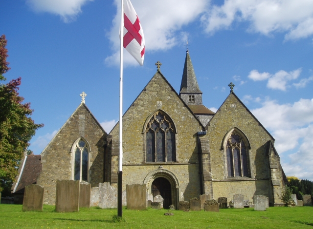
Tandridge

Tandridge is a village and civil parish in the Tandridge District, in the county of Surrey, England. Its nucleus is on a rise of the Greensand Ridge between...
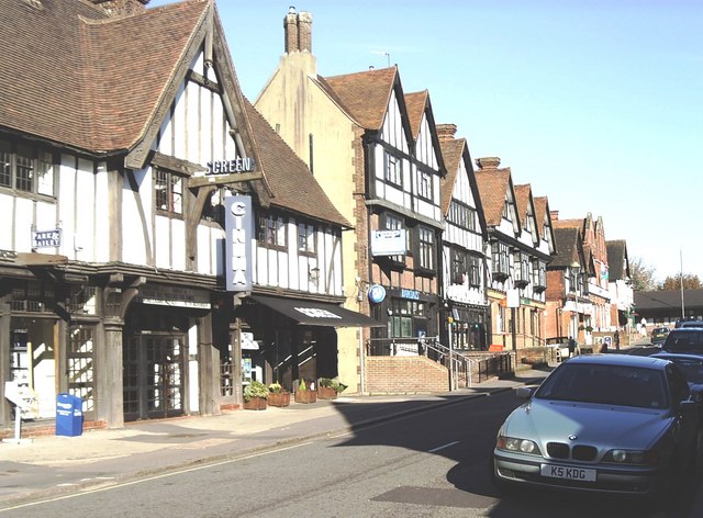
Oxted

Oxted is a town and civil parish in the Tandridge district of Surrey, England, at the foot of the North Downs. It is 9 miles (14 km) south south-east of...

Bay Pond

Bay Pond is a 7-hectare (17-acre) nature reserve in Godstone in Surrey. It is managed by the Surrey Wildlife Trust. It is part of Godstone Ponds Site...

Nearby Amenities

Located within 500m of 51.25555,-0.036178217
Man Made: survey_point
Source: npe
Lat/Long: 51.2548526/-0.0330726
PALMERSWOOD5
Disused: yes
Man Made: petroleum_well
Ref GB Decc: LR/25-8
Source: DECC
Lat/Long: 51.2567273/-0.030781
PALMERSWOOD8
Disused: yes
Man Made: petroleum_well
Ref GB Decc: LR/25-A6
Source: DECC
Lat/Long: 51.2567615/-0.0306649
PALMERSWOOD9
Disused: yes
Man Made: petroleum_well
Ref GB Decc: LR/25-A7
Source: DECC
Lat/Long: 51.2567445/-0.030723
Camera Type: fixed
Height: 6
Man Made: surveillance
Surveillance: public
Surveillance Type: camera
Surveillance Zone: traffic
Lat/Long: 51.2591724/-0.0386581
Camera Mount: pole
Camera Type: panning
Height: 10
Man Made: surveillance
Surveillance: public
Surveillance Type: camera
Surveillance Zone: traffic
Lat/Long: 51.2590958/-0.038654
The data included in this document is from www.openstreetmap.org. The data is made available under ODbL.

Have you been to Duckpit Wood?

Leave your review of Duckpit Wood below (or comments, questions and feedback).