Beacon Plantation

Wood, Forest in Lincolnshire East Lindsey

England

Beacon Plantation

Direction Sign – Signpost on the crossroads in Swaby Located on the southeast side of the crossroads of Church Lane, Pado Lane and Pinfold Lane in Swaby parish. 4 arms and no finial.

Milestone Society National ID: LI_TF3877
Direction Sign – Signpost on the crossroads in Swaby Credit: A Riley

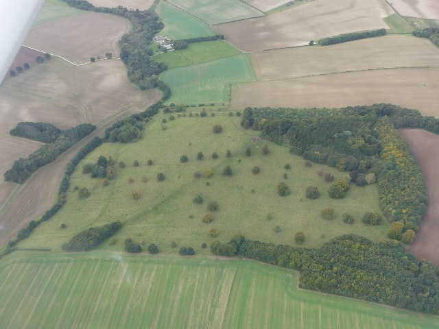
Beacon Plantation is a picturesque woodland area located in the county of Lincolnshire, England. Covering an extensive area, it is known for its dense forests and natural beauty. The plantation is situated near the village of Wood, creating a serene and tranquil environment for visitors.

The Wood is characterized by a diverse range of flora and fauna, making it an ideal destination for nature enthusiasts and wildlife lovers. The woodland is predominantly made up of tall, mature trees such as oak, beech, and pine, which provide a dense canopy, creating a shaded and cool atmosphere even during warmer months.

Beacon Plantation offers various walking trails and pathways for visitors to explore its enchanting surroundings. These trails meander through the woodland, allowing visitors to immerse themselves in the peaceful ambiance and appreciate the natural beauty of the area. Along the trails, one can often spot a wide range of wildlife, including deer, rabbits, and various bird species.

The plantation also boasts a rich history, with remnants of ancient settlements and archaeological sites scattered throughout the area. These historical sites add an element of intrigue and fascination to the woodland, attracting history enthusiasts and curious explorers.

Overall, Beacon Plantation in Lincolnshire is a haven for those seeking solace in nature. Its beautiful woodland, diverse wildlife, and historical significance make it a captivating destination for all who step foot in its serene surroundings.

If you have any feedback on the listing, please let us know in the comments section below.

Beacon Plantation Images

Images are sourced within 2km of 53.278118/0.055284542 or Grid Reference TF3777. Thanks to Geograph Open Source API. All images are credited.

Direction Sign – Signpost on the crossroads in Swaby Located on the southeast side of the crossroads of Church Lane, Pado Lane and Pinfold Lane in Swaby parish. 4 arms and no finial.

Milestone Society National ID: LI_TF3877
Direction Sign – Signpost on the crossroads in Swaby
Located on the southeast side of the crossroads of Church Lane, Pado Lane and Pinfold Lane in Swaby parish. 4 arms and no finial. Milestone Society National ID: LI_TF3877
Direction Sign – Signpost on the crossroads in South Ormsby Located on the northeast side of the crossroads of Bluestone Heath Road and South Road in South Ormsby cum Ketsby parish. 3 arms and no finial. 

Milestone Society National ID: LI_TF3675
Direction Sign – Signpost on the crossroads in South Ormsby
Located on the northeast side of the crossroads of Bluestone Heath Road and South Road in South Ormsby cum Ketsby parish. 3 arms and no finial. Milestone Society National ID: LI_TF3675
Soilmarks on field S of Burwell: aerial 2021 (1)
Soilmarks on field S of Burwell: aerial 2021 (2)
Deserted village of Walmsgate: aerial 2021 (1) See <span class="nowrap"><a title="https://www.heritagegateway.org.uk/Gateway/Results_Single.aspx?uid=MLI43614&resourceID=1006" rel="nofollow ugc noopener" href="https://www.heritagegateway.org.uk/Gateway/Results_Single.aspx?uid=MLI43614&resourceID=1006">Link</a><img style="margin-left:2px;" alt="External link" title="External link - shift click to open in new window" src="https://s1.geograph.org.uk/img/external.png" width="10" height="10"/></span>.

Also contains a ruined church: <span class="nowrap"><a title="https://www.heritagegateway.org.uk/Gateway/Results_Single.aspx?uid=MLI93273&resourceID=1006" rel="nofollow ugc noopener" href="https://www.heritagegateway.org.uk/Gateway/Results_Single.aspx?uid=MLI93273&resourceID=1006">Link</a><img style="margin-left:2px;" alt="External link" title="External link - shift click to open in new window" src="https://s1.geograph.org.uk/img/external.png" width="10" height="10"/></span>
Deserted village of Walmsgate: aerial 2021 (1)
See LinkExternal link. Also contains a ruined church: LinkExternal link
Deserted village of Walmsgate: aerial 2021 (2) See <span class="nowrap"><a title="https://www.heritagegateway.org.uk/Gateway/Results_Single.aspx?uid=MLI43614&resourceID=1006" rel="nofollow ugc noopener" href="https://www.heritagegateway.org.uk/Gateway/Results_Single.aspx?uid=MLI43614&resourceID=1006">Link</a><img style="margin-left:2px;" alt="External link" title="External link - shift click to open in new window" src="https://s1.geograph.org.uk/img/external.png" width="10" height="10"/></span>.

Also contains a ruined church: <span class="nowrap"><a title="https://www.heritagegateway.org.uk/Gateway/Results_Single.aspx?uid=MLI93273&resourceID=1006" rel="nofollow ugc noopener" href="https://www.heritagegateway.org.uk/Gateway/Results_Single.aspx?uid=MLI93273&resourceID=1006">Link</a><img style="margin-left:2px;" alt="External link" title="External link - shift click to open in new window" src="https://s1.geograph.org.uk/img/external.png" width="10" height="10"/></span>
Deserted village of Walmsgate: aerial 2021 (2)
See LinkExternal link. Also contains a ruined church: LinkExternal link
Swaby: aerial 2022
Swaby: aerial 2022
Footpath to Swaby
Footpath to Swaby
Footbridge over a drain near Valley Farm The footbridge isn't on a public footpath. The public footpath turns to the right just beyond the bridge.
Footbridge over a drain near Valley Farm
The footbridge isn't on a public footpath. The public footpath turns to the right just beyond the bridge.
South Ormsby: aerial 2023 (2)
Valley west of Walmsgate: aerial 2023 (1)
Valley west of Walmsgate: aerial 2023 (2)
Walmsgate to Burwell: aerial 2023
Park Farm, Burwell: aerial 2023 See <span class="nowrap"><a title="https://www.heritagegateway.org.uk/Gateway/Results_Single.aspx?uid=MLI118481&resourceID=1006" rel="nofollow ugc noopener" href="https://www.heritagegateway.org.uk/Gateway/Results_Single.aspx?uid=MLI118481&resourceID=1006">Link</a><img style="margin-left:2px;" alt="External link" title="External link - shift click to open in new window" src="https://s1.geograph.org.uk/img/external.png" width="10" height="10"/></span>
Park Farm, Burwell: aerial 2023
See LinkExternal link
Lynchets north of Swaby: aerial 2023 (1) Lynchets are off the "tip" of the pond, with the weeds (black dots) on them.
Lynchets north of Swaby: aerial 2023 (1)
Lynchets are off the "tip" of the pond, with the weeds (black dots) on them.
Lynchets north of Swaby: aerial 2023 (2) Lynchets are off the "tip" of the pond, with the weeds (black dots) on them.
Lynchets north of Swaby: aerial 2023 (2)
Lynchets are off the "tip" of the pond, with the weeds (black dots) on them.
Lynchets north of Swaby: aerial 2023 (3) Lynchets are off the "tip" of the pond, with the weeds (black dots) on them.
Lynchets north of Swaby: aerial 2023 (3)
Lynchets are off the "tip" of the pond, with the weeds (black dots) on them.
Lynchets north of Swaby: aerial 2023 (4) Lynchets are off the "tip" of the pond, with the weeds (black dots) on them.
Lynchets north of Swaby: aerial 2023 (4)
Lynchets are off the "tip" of the pond, with the weeds (black dots) on them.
Show me another place!

Beacon Plantation is located at Grid Ref: TF3777 (Lat: 53.278118, Lng: 0.055284542)

Administrative County: Lincolnshire

District: East Lindsey

Police Authority: Lincolnshire

What 3 Words

///cardinal.pushed.lightens. Near Burwell, Lincolnshire

Related Wikis

Walmsgate

Walmsgate is a hamlet in the civil parish of Burwell, in the East Lindsey district of Lincolnshire, England. It is situated on the A16 road, 6 miles (10...

Ketsby

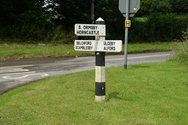
Ketsby is a hamlet in the civil parish of South Ormsby in the East Lindsey district of Lincolnshire, England. It is situated 5 miles (8.0 km) west from...

Swaby

Swaby is a civil parish and village in the East Lindsey district of Lincolnshire, England, about 8 miles (13 km) north from Spilsby, and 6 miles (9.7 km...

South Ormsby

South Ormsby, sometimes called South Ormesby, is a village in the East Lindsey district of Lincolnshire, England. It is situated 1 mile (1.6 km) west from...

Burwell Priory

Burwell Priory was a priory in the village of Burwell, Lincolnshire, England. The priory was built around 1110 for Benedictine monks, by Ansgot of Burwell...

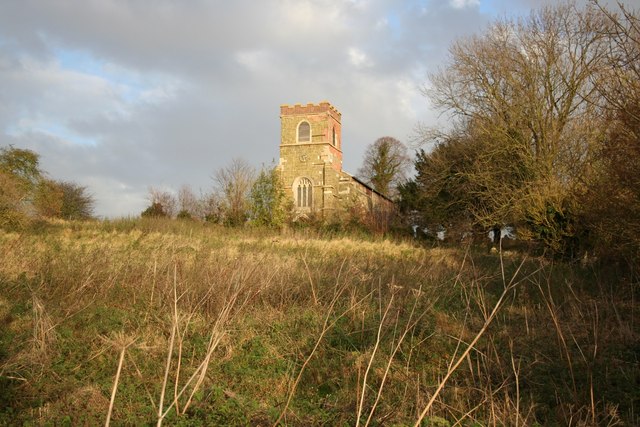
St Michael's Church, Burwell

St Michael's Church is a redundant Anglican church in the village of Burwell, Lincolnshire, England. It is recorded in the National Heritage List for...

Burwell, Lincolnshire

Burwell is a small village and Civil parish in the East Lindsey district of Lincolnshire, England. It is situated on the A16 road, and north from Spilsby...

Calceby

Calceby is a small village and former civil parish, now in the parish of South Thoresby, in the East Lindsey district of Lincolnshire, England. It is situated...

Related Videos

Tour of The Curve

Take a tour of the contemporary smart home property, The Curve, which features light and airy interiors for multi-use entertaining, ...

Gingerbread Soap in September Made ready for Christmas by Soap and So at www.thestuffilove.com

Our favourite soap is gingerbread not just the ginger fragrance but the cinnamon, the hint of a warm fire, melted marshmallows, ...

Nearby Amenities

Located within 500m of 53.278118,0.055284542
Ele: 80
Source: Bing
Lat/Long: 53.2790374/0.0603544
The Lodge
Place: isolated_dwelling
Source: Bing
Lat/Long: 53.2806995/0.0504188
Historic: archaeological_site
Source: Bing
Lat/Long: 53.2776795/0.0562865
Power: pole
Lat/Long: 53.2770543/0.0625884
Power: pole
Lat/Long: 53.277504/0.0617042
Power: pole
Lat/Long: 53.2780315/0.0606127
Power: pole
Lat/Long: 53.2785674/0.0595415
Power: pole
Lat/Long: 53.2791071/0.0584317
Power: pole
Lat/Long: 53.2797585/0.0571328
Power: pole
Lat/Long: 53.2802309/0.0562269
Power: pole
Lat/Long: 53.2808084/0.0552208
Power: pole
Lat/Long: 53.2815232/0.053993
Power: pole
Lat/Long: 53.2820768/0.0529643
The data included in this document is from www.openstreetmap.org. The data is made available under ODbL.

Have you been to Beacon Plantation?

Leave your review of Beacon Plantation below (or comments, questions and feedback).