Sloe Garden Wood

Wood, Forest in Sussex Mid Sussex

England

Sloe Garden Wood

Priest House at West Hoathly Early 15th century dwelling which originally belonged to the clergy but in Elizabethan times was modernised into a substantial Yeomen’s dwelling. It is now a museum containing a fascinating array of domestic country furniture, kitchen equipment, needlework and household items. Outside there is a formal herb garden containing over 150 culinary, medicinal and folklore herbs. <span class="nowrap"><a title="www.sussexpast.co.uk" rel="nofollow ugc noopener" href="http://www.sussexpast.co.uk">Link</a><img style="margin-left:2px;" alt="External link" title="External link - shift click to open in new window" src="https://s1.geograph.org.uk/img/external.png" width="10" height="10"/></span>
Priest House at West Hoathly Credit: Nigel Freeman

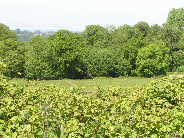
Sloe Garden Wood is a picturesque woodland located in Sussex, England. Covering an area of approximately 50 acres, it is renowned for its natural beauty and rich biodiversity. The wood is primarily composed of sloe trees, which give it its distinctive name. These trees, also known as blackthorns, are native to the region and are most famous for their black-purple fruits, which are used to make sloe gin.

The wood features a diverse range of flora and fauna, making it a haven for nature enthusiasts. The forest floor is carpeted with a variety of wildflowers, including bluebells, wood anemones, and primroses, creating a vibrant and colorful scene in spring. In addition, the wood is home to a plethora of wildlife, including deer, foxes, badgers, and a variety of bird species, making it an ideal spot for birdwatching and wildlife photography.

Visitors to Sloe Garden Wood can enjoy a network of well-maintained walking trails that wind their way through the woodland. These trails provide stunning views of the surrounding countryside, with glimpses of the South Downs National Park in the distance. The wood is also a popular spot for picnics, offering ample space for families and friends to relax and enjoy the peaceful ambiance.

Sloe Garden Wood is a true gem of Sussex, offering a tranquil escape from the hustle and bustle of everyday life. Whether you are a nature lover, a keen photographer, or simply seeking a peaceful retreat, this woodland is a must-visit destination.

If you have any feedback on the listing, please let us know in the comments section below.

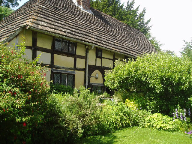
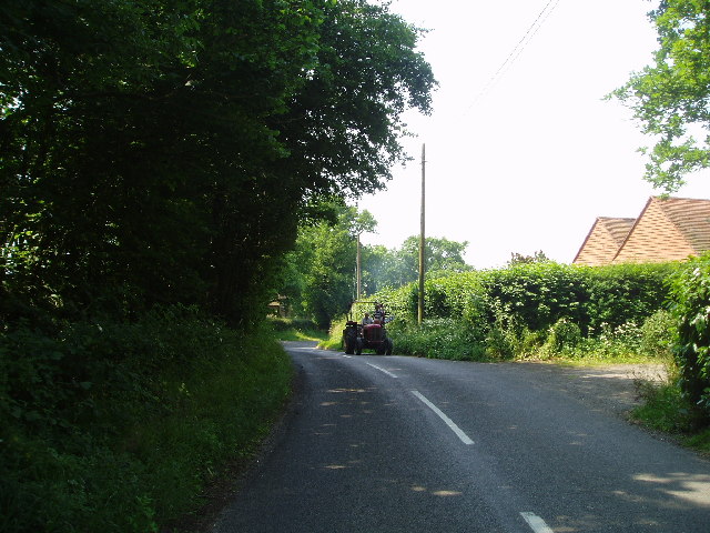
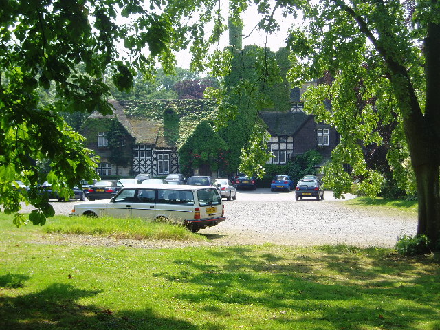
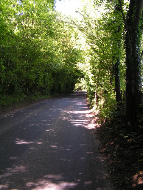
Sloe Garden Wood Images

Images are sourced within 2km of 51.071833/-0.043865738 or Grid Reference TQ3732. Thanks to Geograph Open Source API. All images are credited.

Priest House at West Hoathly Early 15th century dwelling which originally belonged to the clergy but in Elizabethan times was modernised into a substantial Yeomen’s dwelling. It is now a museum containing a fascinating array of domestic country furniture, kitchen equipment, needlework and household items. Outside there is a formal herb garden containing over 150 culinary, medicinal and folklore herbs. <span class="nowrap"><a title="www.sussexpast.co.uk" rel="nofollow ugc noopener" href="http://www.sussexpast.co.uk">Link</a><img style="margin-left:2px;" alt="External link" title="External link - shift click to open in new window" src="https://s1.geograph.org.uk/img/external.png" width="10" height="10"/></span>
Priest House at West Hoathly
Early 15th century dwelling which originally belonged to the clergy but in Elizabethan times was modernised into a substantial Yeomen’s dwelling. It is now a museum containing a fascinating array of domestic country furniture, kitchen equipment, needlework and household items. Outside there is a formal herb garden containing over 150 culinary, medicinal and folklore herbs. LinkExternal link
St Margarets at West Hoathly Of 12th century origins, it stands on high ground with magnificent and peaceful graveyard. Next door is the Cat public house serving food and drink.
St Margarets at West Hoathly
Of 12th century origins, it stands on high ground with magnificent and peaceful graveyard. Next door is the Cat public house serving food and drink.
Hammingden Lane The lane runs down from high ground at West Hoathly to Highbrook on a ridge. On both sides you have valleys and some distant inspriring views.
Hammingden Lane
The lane runs down from high ground at West Hoathly to Highbrook on a ridge. On both sides you have valleys and some distant inspriring views.
Views to the South Downs from the Weald Hook Lane leads down from West Hoathly to Ardingly. It's a narrow road and passes farmyards and woodland. From a bend in the road, you can enjoy the distant scenery.
Views to the South Downs from the Weald
Hook Lane leads down from West Hoathly to Ardingly. It's a narrow road and passes farmyards and woodland. From a bend in the road, you can enjoy the distant scenery.
Priest House at West Hoathly Notice the roof made from Horsham Stone or perhaps more correctly called Slate - a natural product from the area and used widely for roofing from medieval times.
Priest House at West Hoathly
Notice the roof made from Horsham Stone or perhaps more correctly called Slate - a natural product from the area and used widely for roofing from medieval times.
The Selsfield Road near West Hoathly This road is twisty and narrow and, in the summer especially, is very shaded where the trees overhang.
The Selsfield Road near West Hoathly
This road is twisty and narrow and, in the summer especially, is very shaded where the trees overhang.
Sharpthorne Garage The petrol prices at Sharpthorne garage tend to be the most expensive in the area because it's the only garage in the area! It has a shop and cash point so is always busy.
Sharpthorne Garage
The petrol prices at Sharpthorne garage tend to be the most expensive in the area because it's the only garage in the area! It has a shop and cash point so is always busy.
Horsted Lane This road wanders down the hill with high hedges on either side which unfortunately blocks the beautiful countryside views.
Horsted Lane
This road wanders down the hill with high hedges on either side which unfortunately blocks the beautiful countryside views.
The Ravenswood A country 'venue' for weddings, dinners and Jazz !
The Ravenswood
A country 'venue' for weddings, dinners and Jazz !
Sharpthorne village residential area
Grazing field near West Hoathly The lane on the left leads from West Hoathly village to Philpots Manor School, Philpots Quarry and Philpots Farm (all behind camera)
Grazing field near West Hoathly
The lane on the left leads from West Hoathly village to Philpots Manor School, Philpots Quarry and Philpots Farm (all behind camera)
Entrance to Philpots Quarry The actual quarry is over the ridge and has some trees obscuring the view from the lane.
Entrance to Philpots Quarry
The actual quarry is over the ridge and has some trees obscuring the view from the lane.
Road along the county border The left handside of the road is in West Sussex, the right handside is in East Sussex. The border follows the middle of the road for about 1 kilometre around here.
Road along the county border
The left handside of the road is in West Sussex, the right handside is in East Sussex. The border follows the middle of the road for about 1 kilometre around here.
Woodland
Woodland
Tyes Cross Road junction on the northern edge of Ashdown Forest
Tyes Cross
Road junction on the northern edge of Ashdown Forest
Traffic calming measures, entering Sharpthorne.
Sharpthorne Garage - closed!! Obviously the fuel was too expensive. See the first geograph for this square.
Sharpthorne Garage - closed!!
Obviously the fuel was too expensive. See the first geograph for this square.
The Intrepid Fox, outside West Hoathly West Hoathly is a small village and parish in West Sussex. The village has a church and two pubs (The Vinol Cross Inn and The Cat Inn).
Wikipedia: <span class="nowrap"><a title="http://en.wikipedia.org/wiki/West_Hoathly" rel="nofollow ugc noopener" href="http://en.wikipedia.org/wiki/West_Hoathly">Link</a><img style="margin-left:2px;" alt="External link" title="External link - shift click to open in new window" src="https://s1.geograph.org.uk/img/external.png" width="10" height="10"/></span> 
Website: <span class="nowrap"><a title="http://www.westhoathly.gov.uk/" rel="nofollow ugc noopener" href="http://www.westhoathly.gov.uk/">Link</a><img style="margin-left:2px;" alt="External link" title="External link - shift click to open in new window" src="https://s1.geograph.org.uk/img/external.png" width="10" height="10"/></span>
The Intrepid Fox, outside West Hoathly
West Hoathly is a small village and parish in West Sussex. The village has a church and two pubs (The Vinol Cross Inn and The Cat Inn). Wikipedia: LinkExternal link Website: LinkExternal link
Show me another place!

Sloe Garden Wood is located at Grid Ref: TQ3732 (Lat: 51.071833, Lng: -0.043865738)

Administrative County: West Sussex

District: Mid Sussex

Police Authority: Sussex

What 3 Words

///stage.much.porridge. Near Ardingly, West Sussex

Related Wikis

Sharpthorne

Sharpthorne is a village in the Mid Sussex District of West Sussex, South-East England. It lies on the West Hoathly to Forest Row road 3.8 miles (6.2...

West Hoathly SSSI

West Hoathly SSSI is a 0.7-hectare (1.7-acre) geological Site of Special Scientific Interest in Sharpthorne in West Sussex. It is a Geological Conservation...

West Hoathly railway station

West Hoathly is a closed railway station on what is now the Bluebell Railway. The station was closed in 1958, but was used by contractors demolishing the...

The Priest House, West Hoathly

The Priest House is a Grade II* listed fifteenth century timber framed hall house in the centre of West Hoathly, in West Sussex, England. It is close to...

St Margaret's Church, West Hoathly

St Margaret's Church (dedicated in full to St Margaret of Antioch) is an Anglican church in the village of West Hoathly in Mid Sussex, one of seven local...

West Hoathly

West Hoathly is a village and civil parish in the Mid Sussex District of West Sussex, England, located 3.5 miles (5.6 km) south west of East Grinstead...

Philpot's and Hook Quarries

Philpot's and Hook Quarries is a 2.6-hectare (6.4-acre) geological Site of Special Scientific Interest south-west of Sharpthorne in West Sussex. It is...

All Saints Church, Highbrook

All Saints Church is an Anglican church in the hamlet of Highbrook in Mid Sussex, one of seven local government districts in the English county of West...

Nearby Amenities

Located within 500m of 51.071833,-0.043865738
Sharpthorne
Is In: West Hoathly
Place: village
Wikidata: Q7490446
Lat/Long: 51.0746516/-0.0434354
Turning Circle
Lat/Long: 51.0755045/-0.0447948
Barrier: kissing_gate
Material: metal
Lat/Long: 51.0719221/-0.0426012
Barrier: stile
Foot: yes
Material: wood
Stile: stepover
Lat/Long: 51.0687697/-0.040958
Defibrillator
Emergency: defibrillator
Lat/Long: 51.0748963/-0.0414179
Bus Stop
Station Road
Bus: yes
Naptan AtcoCode: 4400EG0152
Naptan Bearing: W
Naptan CommonName: Station Road
Naptan Indicator: adj
Naptan Landmark: Station Road
Naptan NaptanCode: wsxapadg
Naptan ShortCommonName: Sharpthorne
Naptan Street: The Hollow
Naptan Verified: no
Public Transport: platform
Source: naptan_import
Lat/Long: 51.0747041/-0.0410141
Bus Stop
Station Road
Bus: yes
Naptan AtcoCode: 4400EG0153
Naptan Bearing: E
Naptan CommonName: Station Road
Naptan Indicator: opp
Naptan Landmark: Station Road
Naptan NaptanCode: wsxapadj
Naptan ShortCommonName: Sharpthorne
Naptan Street: The Hollow
Naptan Verified: no
Public Transport: platform
Source: naptan_import
Lat/Long: 51.0747881/-0.0408634
Post Box
Collection Times: Mo-Fr 16:45; Sa 11:00
Operator: Royal Mail
Post Box Type: pillar
Ref: RH19 55
Royal Cypher: EIIR
Royal Cypher Wikidata: Q33102113
Lat/Long: 51.0748482/-0.0432244
Community Centre
Sharpthorne Hall
Lat/Long: 51.0752281/-0.041585
Generator Method: photovoltaic
Generator Output Electricity: yes
Generator Source: solar
Generator Type: solar_photovoltaic_panel
Location: roof
Power: generator
Lat/Long: 51.0751642/-0.0469713
Railway: ventilation_shaft
Lat/Long: 51.075788/-0.0443663
Generator Method: photovoltaic
Generator Output Electricity: yes
Generator Source: solar
Generator Type: solar_photovoltaic_panel
Location: roof
Power: generator
Lat/Long: 51.075737/-0.0447547
The data included in this document is from www.openstreetmap.org. The data is made available under ODbL.

Have you been to Sloe Garden Wood?

Leave your review of Sloe Garden Wood below (or comments, questions and feedback).