Nicols Field

Wood, Forest in Surrey Mole Valley

England

Nicols Field

Boxhill and Westhumble Station
Boxhill and Westhumble Station Credit: Alex McGregor

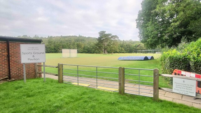
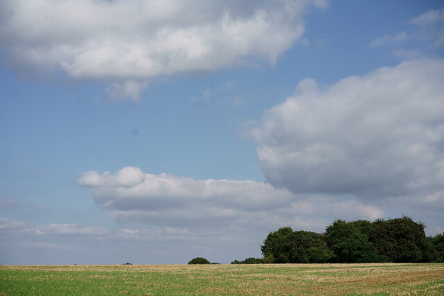
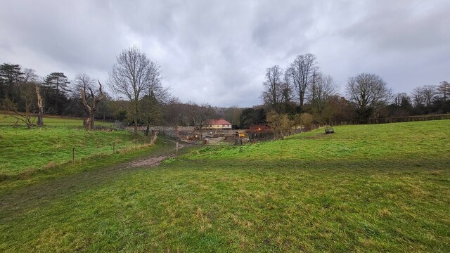
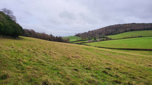
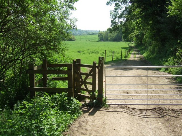
Nicols Field is a picturesque woodland located in Surrey, England. Situated in the southeastern part of the county, it is renowned for its natural beauty and tranquil surroundings. Spanning over an area of approximately 50 acres, Nicols Field offers visitors an opportunity to immerse themselves in the wonders of nature.

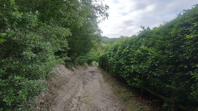
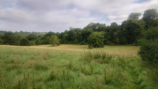
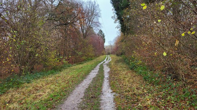
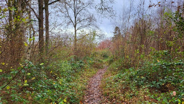
The woodland is characterized by a dense canopy of trees, predominantly consisting of oak, beech, and birch. These towering giants create a cool and shaded environment, perfect for leisurely walks and picnics. The forest floor is adorned with a rich carpet of ferns, bluebells, and other wildflowers, providing a vibrant and colorful backdrop.

Nicols Field is home to a diverse range of wildlife, making it a haven for nature enthusiasts and bird watchers. Visitors can spot various species of birds, including woodpeckers, owls, and songbirds, flitting among the branches. Squirrels, rabbits, and even the occasional deer can also be spotted, adding to the charm of the woodland.

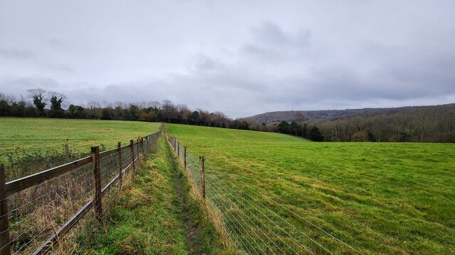
The woodland is crisscrossed by a network of well-maintained trails, allowing visitors to explore the area at their own pace. These trails lead to hidden gems such as a tranquil pond and a small stream, providing a serene setting for quiet contemplation.

Nicols Field is a popular destination for families, hikers, and nature lovers alike. Its proximity to nearby towns and villages makes it easily accessible, while its untouched natural beauty offers an escape from the hustle and bustle of everyday life. Whether one is seeking a peaceful stroll through the woods or an opportunity to connect with nature, Nicols Field is a must-visit destination in Surrey.

If you have any feedback on the listing, please let us know in the comments section below.

Nicols Field Images

Images are sourced within 2km of 51.259653/-0.33573804 or Grid Reference TQ1652. Thanks to Geograph Open Source API. All images are credited.

Boxhill and Westhumble Station
Westhumble Street Short side residential road off the main road with the same name.
Westhumble Street
Short side residential road off the main road with the same name.
Westhumble - Pilgrims Way Private road housing estate.
Westhumble - Pilgrims Way
Private road housing estate.
Mickleham - Old London Road
Box Hill School playing field Grounds next to Swanworth Farm
Box Hill School playing field
Grounds next to Swanworth Farm
Bridleway through Juniperhill Wood Part of Mickleham Downs near Headley Lane.
Bridleway through Juniperhill Wood
Part of Mickleham Downs near Headley Lane.
Field north of Fredley Manor Footpath on the right going to the Old London Road.
Field north of Fredley Manor
Footpath on the right going to the Old London Road.
View From Denbies Vineyard The vineyard buildings, in the middle distance, are surrounded by vines. In the distance are the wooded slopes of Box Hill.
View From Denbies Vineyard
The vineyard buildings, in the middle distance, are surrounded by vines. In the distance are the wooded slopes of Box Hill.
View From Bookham Wood Looking in the direction of Norbury Park.
View From Bookham Wood
Looking in the direction of Norbury Park.
Woodland track on Denshire Hill
Footpath on Denshire Hill Winter has arrived in the woods.
Footpath on Denshire Hill
Winter has arrived in the woods.
Bagden Farm Major works in progress at Bagden Farm.
Bagden Farm
Major works in progress at Bagden Farm.
Public footpath near Phoenice Cottages Popular footpath through the stunning Surrey Hills.
Public footpath near Phoenice Cottages
Popular footpath through the stunning Surrey Hills.
Footpath towards Old Dene Cottages Entering grassland from Chapelhill Woods.
Footpath towards Old Dene Cottages
Entering grassland from Chapelhill Woods.
Keepers Cottage Property on the northern edge of Ranmore Common. Ranmore Common Road is a rural lane with passing places.
Keepers Cottage
Property on the northern edge of Ranmore Common. Ranmore Common Road is a rural lane with passing places.
Mercure Box Hill Burford Bridge Hotel
Underbridge across Dorking and Leatherhead Railway Footpath Mickleham 18 leads off Mickleham footpath 4 immediately passing under the former Horsham, Dorking and Leatherhead Railway towards the A24 and Mickleham village.  The bridge is surprisingly capacious and perhaps once provided occupation access to the meadows along the east side of the river Mole.
Underbridge across Dorking and Leatherhead Railway
Footpath Mickleham 18 leads off Mickleham footpath 4 immediately passing under the former Horsham, Dorking and Leatherhead Railway towards the A24 and Mickleham village. The bridge is surprisingly capacious and perhaps once provided occupation access to the meadows along the east side of the river Mole.
Westhumble Chapel Scheduled Monument, cared for by the National Trust since 1937. The chapel was founded at the end of the twelfth century and desecrated three centuries later.
Westhumble Chapel
Scheduled Monument, cared for by the National Trust since 1937. The chapel was founded at the end of the twelfth century and desecrated three centuries later.
Show me another place!

Nicols Field is located at Grid Ref: TQ1652 (Lat: 51.259653, Lng: -0.33573804)

Administrative County: Surrey

District: Mole Valley

Police Authority: Surrey

What 3 Words

///shakes.rotate.parks. Near Dorking, Surrey

Related Wikis

Mole Gap Trail

The Mole Gap Trail is a 10-kilometre (6.2 mi) official walking route alongside the River Mole, linking the Surrey towns of Dorking and Leatherhead. The...
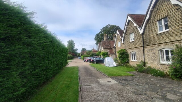
Westhumble

Westhumble is a village in south east England, approximately 2 km (1.2 mi) north of Dorking, Surrey. The village is not part of a civil parish, however...

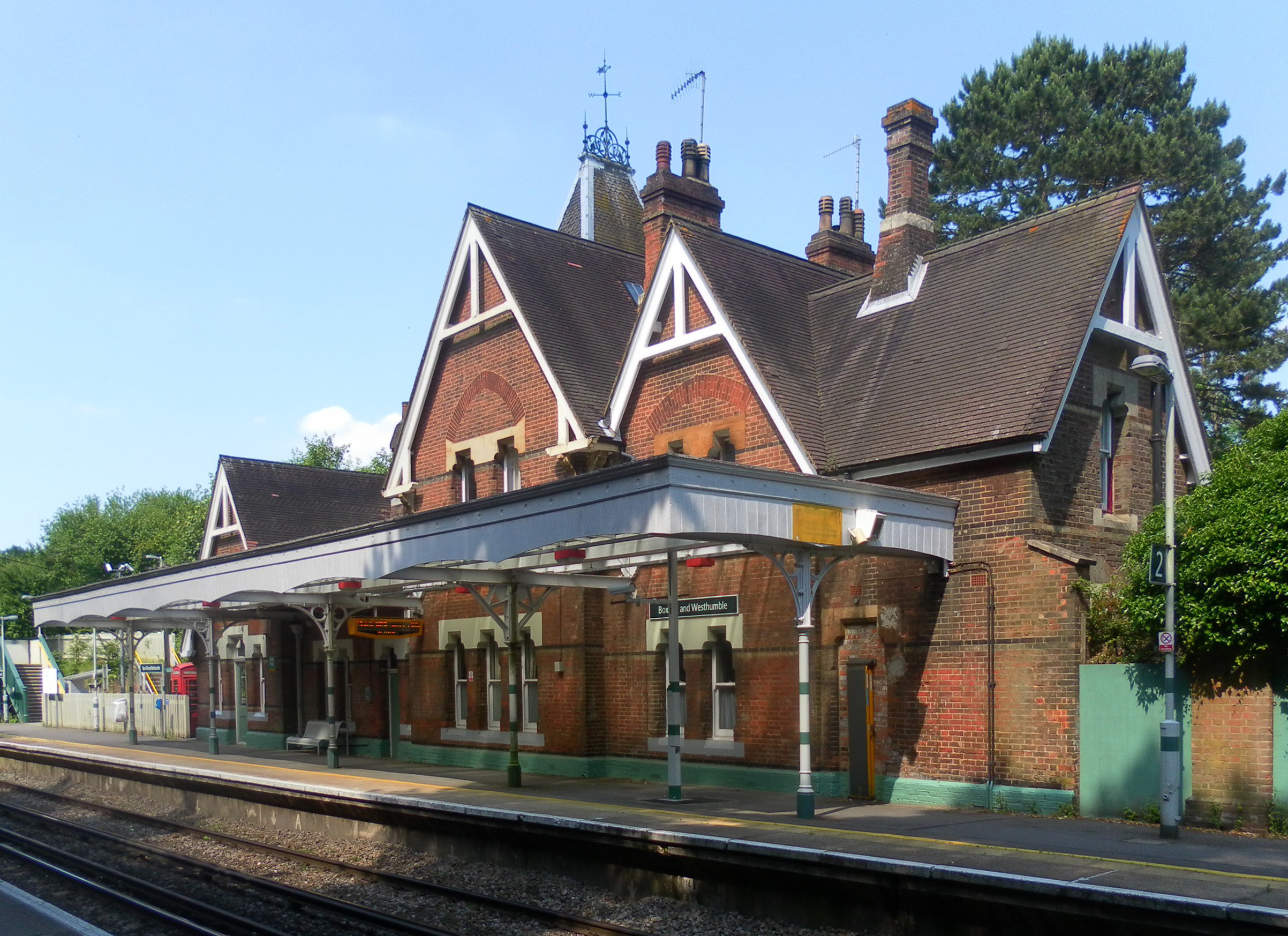
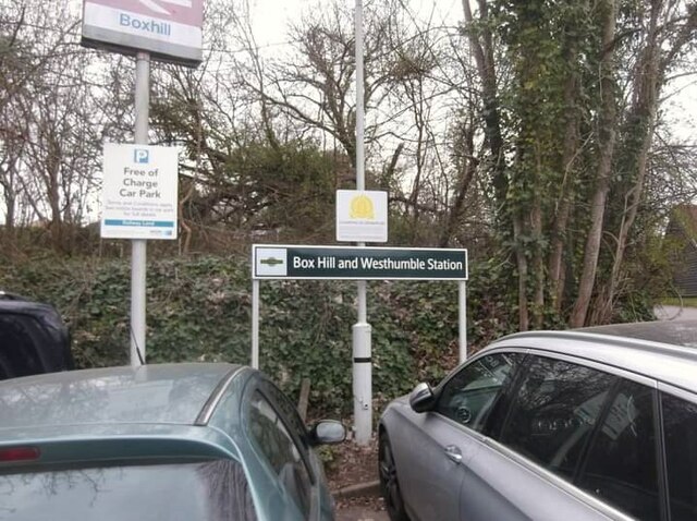
Box Hill & Westhumble railway station

Box Hill & Westhumble is a railway station in the village of Westhumble in Surrey, England, approximately 2 miles (3.2 km) north of Dorking town centre...

Mole Valley (UK Parliament constituency)

Mole Valley is a constituency in Surrey represented in the House of Commons of the UK Parliament since 1997 by Sir Paul Beresford, a Conservative.Further...

Nearby Amenities

Located within 500m of 51.259653,-0.33573804
Barrier: kissing_gate
Foot: yes
Lat/Long: 51.2636934/-0.3360083
Barrier: kissing_gate
Material: metal
Wheelchair: limited
Lat/Long: 51.2585189/-0.3352005
Bench
Backrest: yes
Mapillary: 288256709509576
Survey Date: 2018-02-11
Lat/Long: 51.2562965/-0.3310249
Barrier: stile
Stile: stepover
Lat/Long: 51.2593609/-0.3414674
Beechy Wood
Place: locality
Lat/Long: 51.2612276/-0.3414679
Barrier: kissing_gate
Lat/Long: 51.26183/-0.3319935
Ford: yes
Lat/Long: 51.2585138/-0.3312868
Foxbury Shaw
Natural: wood
Lat/Long: 51.2581636/-0.3354684
Nicols Field
Natural: wood
Lat/Long: 51.2595928/-0.3356617
Barrier: kissing_gate
Bicycle: no
Foot: yes
Horse: no
Material: metal
Motor Vehicle: no
Wheelchair: limited
Lat/Long: 51.2592043/-0.3335311
Barrier: cycle_barrier
Lat/Long: 51.2608393/-0.3416078
The data included in this document is from www.openstreetmap.org. The data is made available under ODbL.

Have you been to Nicols Field?

Leave your review of Nicols Field below (or comments, questions and feedback).