Windsor Common

Wood, Forest in Sussex Horsham

England

Windsor Common

Coppicing, Brickyard Copse Taken from North Lane bridleway.
Coppicing, Brickyard Copse Credit: Simon Carey

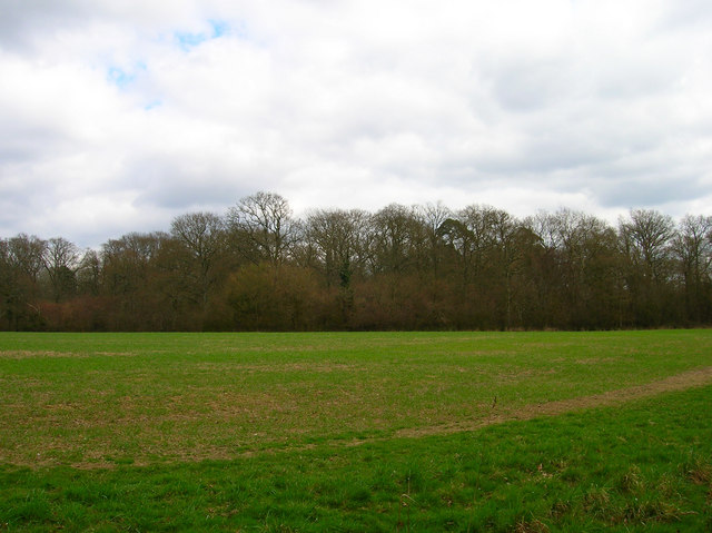
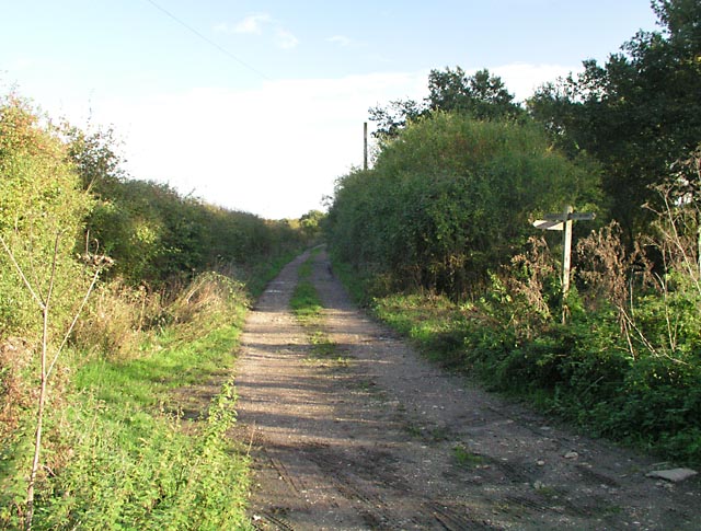
Windsor Common, located in Sussex, England, is a picturesque wooded area known for its dense forest and natural beauty. Covering an expansive area, the common is a popular destination for nature enthusiasts and visitors seeking tranquility away from the bustling city life.

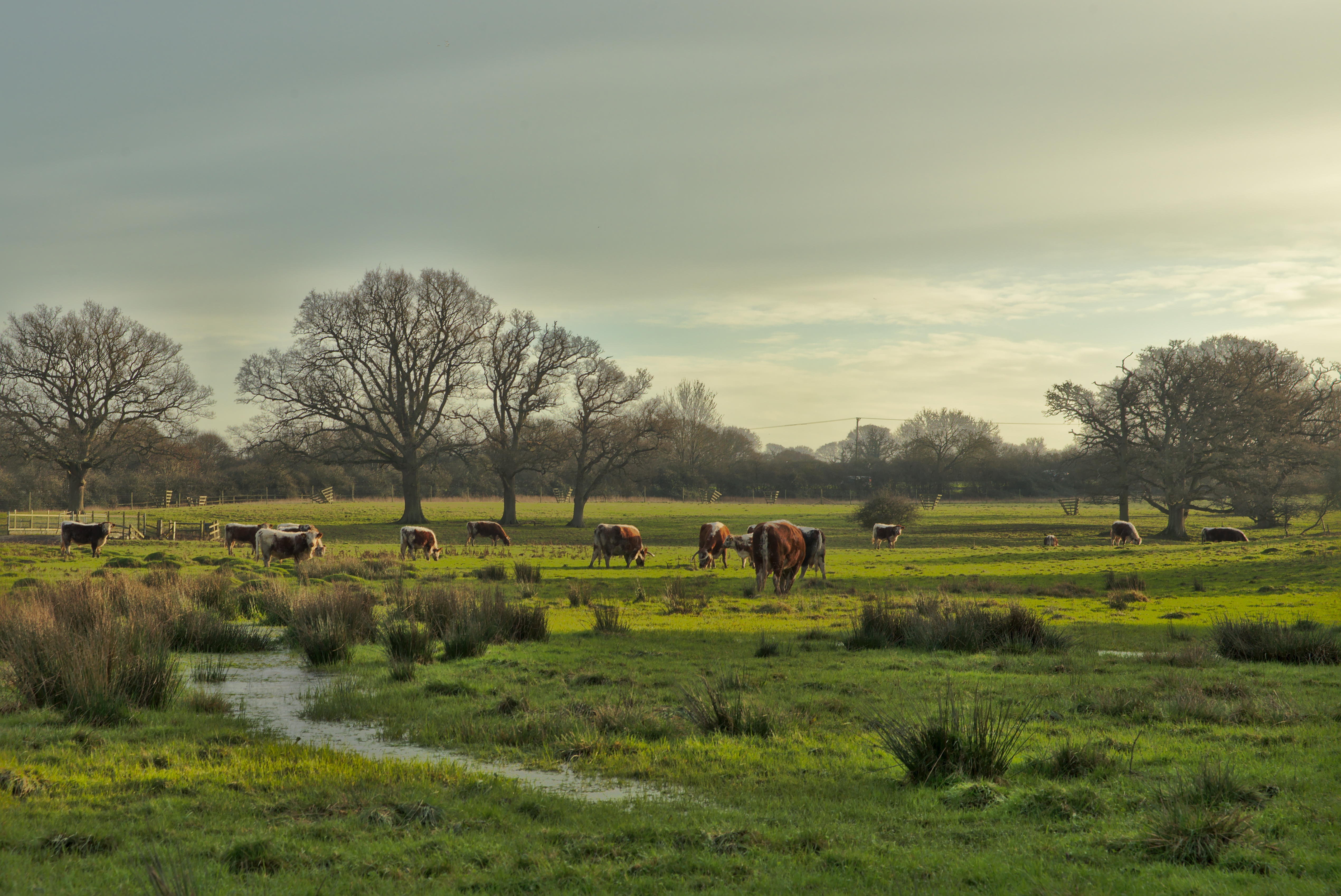
The common features a diverse range of flora and fauna, with towering trees, lush foliage, and vibrant wildflowers creating a vibrant and enchanting atmosphere. The forest is predominantly composed of oak, beech, and ash trees, providing a rich habitat for various species of birds, mammals, and insects.

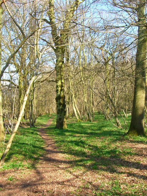
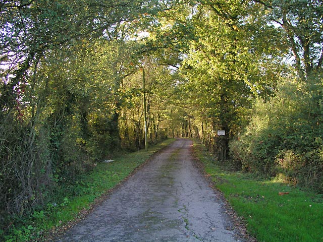
Traversing the common, visitors can find several well-maintained walking trails and paths, allowing them to explore the area at their own pace. These paths wind through the forest, offering breathtaking views of the natural surroundings and opportunities for birdwatching and wildlife spotting.

In addition to its natural beauty, Windsor Common holds historical significance. The area has been used for centuries as a hunting ground and was once part of the royal estate. Remnants of this history can still be seen with the presence of old hunting lodges and other historical structures scattered throughout the common.

Windsor Common is easily accessible, with ample parking facilities and nearby public transportation options. The management of the common ensures that it remains a protected and well-preserved natural habitat, allowing visitors to enjoy its beauty for generations to come. Whether it's a leisurely walk, a picnic, or simply immersing oneself in the peaceful ambiance, Windsor Common offers a truly rejuvenating experience in the heart of Sussex.

If you have any feedback on the listing, please let us know in the comments section below.

Windsor Common Images

Images are sourced within 2km of 50.948723/-0.35659028 or Grid Reference TQ1517. Thanks to Geograph Open Source API. All images are credited.

Coppicing, Brickyard Copse Taken from North Lane bridleway.
Coppicing, Brickyard Copse
Taken from North Lane bridleway.
Basing Wood A lone oak stands guard over an army of firs. Taken from North Lane bridleway just north of Coombelands.
Basing Wood
A lone oak stands guard over an army of firs. Taken from North Lane bridleway just north of Coombelands.
Capite Wood Taken from the footpath that links Woodman's Farm with Buckells Farm. The dense cover of the firs gives it a spooky feel.
Capite Wood
Taken from the footpath that links Woodman's Farm with Buckells Farm. The dense cover of the firs gives it a spooky feel.
Footbridge, Capite Wood Carrying the footpath that links Woodman's Farm to Buckells Farm
Footbridge, Capite Wood
Carrying the footpath that links Woodman's Farm to Buckells Farm
Field near Dalesdown School Chanctonbury Ring can be seen between the two trees to the right just above the less than bucolic flytipping area. Taken from the point where the footpath crosses the farm road.
Field near Dalesdown School
Chanctonbury Ring can be seen between the two trees to the right just above the less than bucolic flytipping area. Taken from the point where the footpath crosses the farm road.
Pot Common Potcommon Furzefield to the left, Soil Wood to the right. Taken from the bridleway.
Pot Common
Potcommon Furzefield to the left, Soil Wood to the right. Taken from the bridleway.
Smiley Face, Honeybridge Lane Painted sign next to the entrance of Dalesdown Educational Establishment.
Smiley Face, Honeybridge Lane
Painted sign next to the entrance of Dalesdown Educational Establishment.
Flat Dossers Known a few of them in my time! Taken from the bridleway.
Flat Dossers
Known a few of them in my time! Taken from the bridleway.
Entrance to Whitefoots Wheelie bin standing guard. This is the point where the bridleway turns shapely west.
Entrance to Whitefoots
Wheelie bin standing guard. This is the point where the bridleway turns shapely west.
Jasmine Cottage, Rookcross Lane Situated at the junction of the lane with the entrance to Rooklands Farm.
Jasmine Cottage, Rookcross Lane
Situated at the junction of the lane with the entrance to Rooklands Farm.
Worthing Road, Dial Post Hard to believe that the A24 used to thunder through this village until the 1980s. Now all is quiet and serene. Dial Post is a hamlet within the parish of West Grinstead and grew in size from the eighteenth century onwards. The in is The Crown.
Worthing Road, Dial Post
Hard to believe that the A24 used to thunder through this village until the 1980s. Now all is quiet and serene. Dial Post is a hamlet within the parish of West Grinstead and grew in size from the eighteenth century onwards. The in is The Crown.
Grinders Wood Taken from the footpath that links Thistleworth Farm with Buckells Farm.
Grinders Wood
Taken from the footpath that links Thistleworth Farm with Buckells Farm.
Outbuildings, Honeybridge Farm Known as Starkers Farm on the 1940s map. Taken from the footpath that links Daylands Farm with Kings Barn Farm.
Outbuildings, Honeybridge Farm
Known as Starkers Farm on the 1940s map. Taken from the footpath that links Daylands Farm with Kings Barn Farm.
Field, Jessops Farm Taken from the footpath that goes through the farm.
Field, Jessops Farm
Taken from the footpath that goes through the farm.
Dying Deer, near Jessops Farm On the footpath that heads south from the farm. Both back legs seemed to be gone. Not much I could do I'm afraid.
Dying Deer, near Jessops Farm
On the footpath that heads south from the farm. Both back legs seemed to be gone. Not much I could do I'm afraid.
Entrance to Perrylands Seen from the A24.
Entrance to Perrylands
Seen from the A24.
Junction of Bridleway 1886/1 and Footpath 1886/2 On Benton's Lane near Wickwood Cottage.
Junction of Bridleway 1886/1 and Footpath 1886/2
On Benton's Lane near Wickwood Cottage.
Farmland near Claylands Farm Taken from the top of the small hillock to the west of Ford Farm with the South Downs in the distance.
Farmland near Claylands Farm
Taken from the top of the small hillock to the west of Ford Farm with the South Downs in the distance.
Show me another place!

Windsor Common is located at Grid Ref: TQ1517 (Lat: 50.948723, Lng: -0.35659028)

Administrative County: West Sussex

District: Horsham

Police Authority: Sussex

What 3 Words

///range.muted.weaned. Near Ashington, West Sussex

Related Wikis

Dial Post

Dial Post is a village in the Horsham District of West Sussex, England. The civil parish, where the lowest level political meetings are held, is West Grinstead...

St James's Church, Ashurst

St James's Church is a Church of England parish church in Ashurst, West Sussex. The church is a grade I listed building and it dates from the early 12th...

Ashington, West Sussex

Ashington is a village and civil parish in the Horsham District of West Sussex, England. It lies on the A24 road 3 miles (4.8 km) north-east of Storrington...

Ashurst, West Sussex

Ashurst is a village and civil parish in the Horsham District of West Sussex, England, about 2 miles (3.2 km) west of Henfield, and 11 miles (18 km) south...

Fountain Inn, Ashurst

The Fountain Inn is a 16th-century public house in the village of Ashurst, in the Horsham district of West Sussex, England. After a period as a farmhouse...

Bines Green

Bines Green is a hamlet in the Horsham District of West Sussex, England. It lies 1.9 miles (3.1 km) north west of Henfield on the B2135 road between Ashurst...

Knepp Castle

The medieval Knepp Castle (sometimes referred to as 'Old Knepp Castle', to distinguish it from the nearby 19th-century mansion) is to the west of the village...

Knepp Wildland

Knepp Wildland is the first major lowland rewilding project in England. It comprises 1,400 hectares (3,500 acres; 5.4 square miles) of former arable and...

Nearby Amenities

Located within 500m of 50.948723,-0.35659028
Power: pole
Lat/Long: 50.9507271/-0.3537254
Power: pole
Lat/Long: 50.9529613/-0.357851
Power: pole
Lat/Long: 50.9519445/-0.3559617
Power: pole
Lat/Long: 50.9490094/-0.3499894
Power: pole
Lat/Long: 50.9494809/-0.3511048
Post Box
Collection Times: Mo-Fr 16:30; Sa 08:15
Operator: Royal Mail
Post Box Mounting: pier
Post Box Type: lamp
Ref: RH12 64
Royal Cypher: EIIR
Royal Cypher Wikidata: Q33102113
Lat/Long: 50.9472377/-0.352504
Location Transition: yes
Power: pole
Lat/Long: 50.9478832/-0.3547892
Power: pole
Lat/Long: 50.9481873/-0.3556502
Power: pole
Lat/Long: 50.9486098/-0.356825
Power: pole
Lat/Long: 50.9490221/-0.3579891
Power: pole
Lat/Long: 50.9495206/-0.3593409
Power: pole
Lat/Long: 50.9499194/-0.3604755
Power: pole
Lat/Long: 50.95033/-0.3616315
Power: pole
Lat/Long: 50.9503216/-0.3618139
Power: pole
Lat/Long: 50.9498687/-0.3605345
Power: pole
Lat/Long: 50.9494446/-0.3593785
Power: pole
Lat/Long: 50.9489596/-0.3580441
Power: pole
Lat/Long: 50.9485481/-0.3568867
Power: pole
Lat/Long: 50.948135/-0.3557011
Location Transition: yes
Power: pole
Lat/Long: 50.9478054/-0.3548214
Power: pole
Lat/Long: 50.9502731/-0.3528919
Power: pole
Lat/Long: 50.9499291/-0.3521054
Power: pole
Lat/Long: 50.9513093/-0.3547997
Power: pole
Lat/Long: 50.9525335/-0.3570553
Power: pole
Lat/Long: 50.9508449/-0.3514286
Power: pole
Lat/Long: 50.9503184/-0.3518272
Power: pole
Lat/Long: 50.9514279/-0.3510362
Ele: 51
Man Made: survey_point
Survey Point Structure: pillar
Lat/Long: 50.9498635/-0.3592473
Buckells Farm
Place: farm
Lat/Long: 50.9467461/-0.3520848
Barrier: stile
Lat/Long: 50.9489719/-0.3526026
Content: water
Man Made: storage_tank
Lat/Long: 50.9499476/-0.3500673
The data included in this document is from www.openstreetmap.org. The data is made available under ODbL.

Have you been to Windsor Common?

Leave your review of Windsor Common below (or comments, questions and feedback).