Brickkiln Wood

Wood, Forest in Sussex Horsham

England

Brickkiln Wood

Coppicing, Brickyard Copse Taken from North Lane bridleway.
Coppicing, Brickyard Copse Credit: Simon Carey

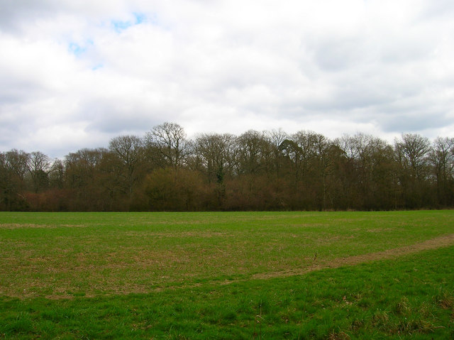
Brickkiln Wood is a beautiful woodland located in the county of Sussex, England. This enchanting forest covers an area of approximately 100 acres and is known for its diverse ecosystem and abundant wildlife.

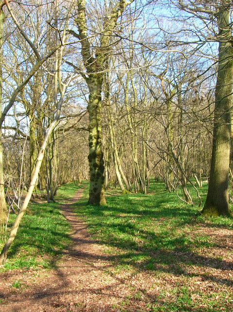
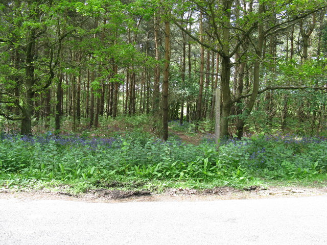
The wood is primarily made up of deciduous trees, including oak, beech, and birch, which create a picturesque canopy during the summer months. The forest floor is covered in a thick carpet of ferns, mosses, and wildflowers, providing a habitat for a wide range of plant species.

Brickkiln Wood is a haven for wildlife enthusiasts, as it is home to numerous animal species. Among the mammals that can be spotted here are deer, foxes, badgers, and squirrels. The woodland also attracts a variety of bird species, including owls, woodpeckers, and thrushes, making it a popular destination for birdwatchers.

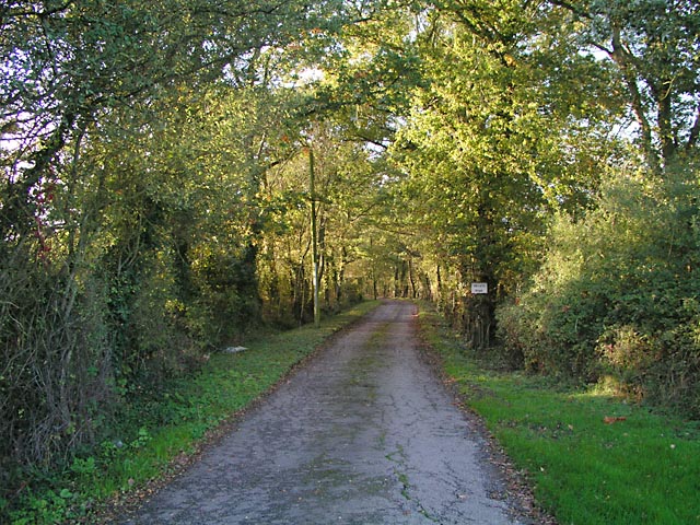
The wood features a network of well-maintained trails, allowing visitors to explore its natural beauty at their own pace. These pathways wind through the forest, offering stunning views of the surrounding countryside and providing opportunities for peaceful walks and picnics.

In addition to its natural beauty, Brickkiln Wood also has historical significance. The name "Brickkiln" comes from the brickmaking industry that once thrived in the area. It is said that the wood was used as a source of fuel for the brick kilns, which were active in the 18th and 19th centuries.

Overall, Brickkiln Wood is a hidden gem in Sussex, offering a tranquil escape from the hustle and bustle of everyday life. Whether it's exploring the woodland trails, observing the diverse wildlife, or simply enjoying the serenity of nature, this forest is a must-visit for nature lovers and history enthusiasts alike.

If you have any feedback on the listing, please let us know in the comments section below.

Brickkiln Wood Images

Images are sourced within 2km of 50.945055/-0.35862712 or Grid Reference TQ1517. Thanks to Geograph Open Source API. All images are credited.

Coppicing, Brickyard Copse Taken from North Lane bridleway.
Coppicing, Brickyard Copse
Taken from North Lane bridleway.
Basing Wood A lone oak stands guard over an army of firs. Taken from North Lane bridleway just north of Coombelands.
Basing Wood
A lone oak stands guard over an army of firs. Taken from North Lane bridleway just north of Coombelands.
Capite Wood Taken from the footpath that links Woodman's Farm with Buckells Farm. The dense cover of the firs gives it a spooky feel.
Capite Wood
Taken from the footpath that links Woodman's Farm with Buckells Farm. The dense cover of the firs gives it a spooky feel.
Footbridge, Capite Wood Carrying the footpath that links Woodman's Farm to Buckells Farm
Footbridge, Capite Wood
Carrying the footpath that links Woodman's Farm to Buckells Farm
Field near Dalesdown School Chanctonbury Ring can be seen between the two trees to the right just above the less than bucolic flytipping area. Taken from the point where the footpath crosses the farm road.
Field near Dalesdown School
Chanctonbury Ring can be seen between the two trees to the right just above the less than bucolic flytipping area. Taken from the point where the footpath crosses the farm road.
Pot Common Potcommon Furzefield to the left, Soil Wood to the right. Taken from the bridleway.
Pot Common
Potcommon Furzefield to the left, Soil Wood to the right. Taken from the bridleway.
Smiley Face, Honeybridge Lane Painted sign next to the entrance of Dalesdown Educational Establishment.
Smiley Face, Honeybridge Lane
Painted sign next to the entrance of Dalesdown Educational Establishment.
Flat Dossers Known a few of them in my time! Taken from the bridleway.
Flat Dossers
Known a few of them in my time! Taken from the bridleway.
Entrance to Whitefoots Wheelie bin standing guard. This is the point where the bridleway turns shapely west.
Entrance to Whitefoots
Wheelie bin standing guard. This is the point where the bridleway turns shapely west.
Worthing Road, Dial Post Hard to believe that the A24 used to thunder through this village until the 1980s. Now all is quiet and serene. Dial Post is a hamlet within the parish of West Grinstead and grew in size from the eighteenth century onwards. The in is The Crown.
Worthing Road, Dial Post
Hard to believe that the A24 used to thunder through this village until the 1980s. Now all is quiet and serene. Dial Post is a hamlet within the parish of West Grinstead and grew in size from the eighteenth century onwards. The in is The Crown.
Grinders Wood Taken from the footpath that links Thistleworth Farm with Buckells Farm.
Grinders Wood
Taken from the footpath that links Thistleworth Farm with Buckells Farm.
Outbuildings, Honeybridge Farm Known as Starkers Farm on the 1940s map. Taken from the footpath that links Daylands Farm with Kings Barn Farm.
Outbuildings, Honeybridge Farm
Known as Starkers Farm on the 1940s map. Taken from the footpath that links Daylands Farm with Kings Barn Farm.
Field, Jessops Farm Taken from the footpath that goes through the farm.
Field, Jessops Farm
Taken from the footpath that goes through the farm.
Footpath, Jack O'Lantern Wood This is one of the better ones too!
Footpath, Jack O'Lantern Wood
This is one of the better ones too!
The route to Hawking Sopers Common Copse is to the right and those rainclouds were heading my way.
The route to Hawking Sopers
Common Copse is to the right and those rainclouds were heading my way.
Dying Deer, near Jessops Farm On the footpath that heads south from the farm. Both back legs seemed to be gone. Not much I could do I'm afraid.
Dying Deer, near Jessops Farm
On the footpath that heads south from the farm. Both back legs seemed to be gone. Not much I could do I'm afraid.
Entrance to Perrylands Seen from the A24.
Entrance to Perrylands
Seen from the A24.
Footpath from country road next to Grinders Wood This path then leads onto Gallops on Windsor Common
Footpath from country road next to Grinders Wood
This path then leads onto Gallops on Windsor Common
Show me another place!

Brickkiln Wood is located at Grid Ref: TQ1517 (Lat: 50.945055, Lng: -0.35862712)

Administrative County: West Sussex

District: Horsham

Police Authority: Sussex

What 3 Words

///compacts.waxer.combining. Near Ashington, West Sussex

Related Wikis

Dial Post

Dial Post is a village in the Horsham District of West Sussex, England. The civil parish, where the lowest level political meetings are held, is West Grinstead...

St James's Church, Ashurst

St James's Church is a Church of England parish church in Ashurst, West Sussex. The church is a grade I listed building and it dates from the early 12th...

Ashington, West Sussex

Ashington is a village and civil parish in the Horsham District of West Sussex, England. It lies on the A24 road 3 miles (4.8 km) north-east of Storrington...

Ashurst, West Sussex

Ashurst is a village and civil parish in the Horsham District of West Sussex, England, about 2 miles (3.2 km) west of Henfield, and 11 miles (18 km) south...

Fountain Inn, Ashurst

The Fountain Inn is a 16th-century public house in the village of Ashurst, in the Horsham district of West Sussex, England. After a period as a farmhouse...

Bines Green

Bines Green is a hamlet in the Horsham District of West Sussex, England. It lies 1.9 miles (3.1 km) north west of Henfield on the B2135 road between Ashurst...

Brightling Park

Brightling Park (previously known as Rose Hill) is a country estate which lies in the parishes of Brightling and Dallington in the Rother district of East...

Wiston, West Sussex

Wiston is a scattered village and civil parish in the Horsham District of West Sussex, England. It lies on the A283 road 2.8 miles (4.5 km) northwest of...

Nearby Amenities

Located within 500m of 50.945055,-0.35862712
Post Box
Collection Times: Mo-Fr 16:30; Sa 08:15
Operator: Royal Mail
Post Box Mounting: pier
Post Box Type: lamp
Ref: RH12 64
Royal Cypher: EIIR
Royal Cypher Wikidata: Q33102113
Lat/Long: 50.9472377/-0.352504
Location Transition: yes
Power: pole
Lat/Long: 50.9478832/-0.3547892
Power: pole
Lat/Long: 50.9481873/-0.3556502
Power: pole
Lat/Long: 50.9486098/-0.356825
Power: pole
Lat/Long: 50.9490221/-0.3579891
Power: pole
Lat/Long: 50.9495206/-0.3593409
Power: pole
Lat/Long: 50.9494446/-0.3593785
Power: pole
Lat/Long: 50.9489596/-0.3580441
Power: pole
Lat/Long: 50.9485481/-0.3568867
Power: pole
Lat/Long: 50.948135/-0.3557011
Location Transition: yes
Power: pole
Lat/Long: 50.9478054/-0.3548214
Buckells Farm
Place: farm
Lat/Long: 50.9467461/-0.3520848
The data included in this document is from www.openstreetmap.org. The data is made available under ODbL.

Have you been to Brickkiln Wood?

Leave your review of Brickkiln Wood below (or comments, questions and feedback).