Backreed Wood

Wood, Forest in Sussex Horsham

England

Backreed Wood

Coppicing, Brickyard Copse Taken from North Lane bridleway.
Coppicing, Brickyard Copse Credit: Simon Carey

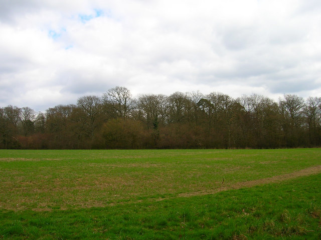
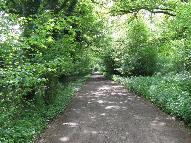
Backreed Wood is a picturesque forest located in the county of Sussex, England. Covering an area of approximately 100 hectares, this woodland is renowned for its natural beauty and rich biodiversity. It is situated in a rural setting, surrounded by rolling hills and tranquil countryside.

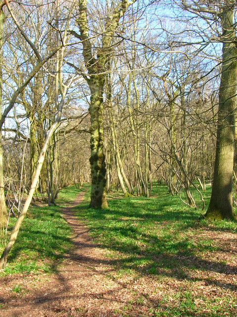
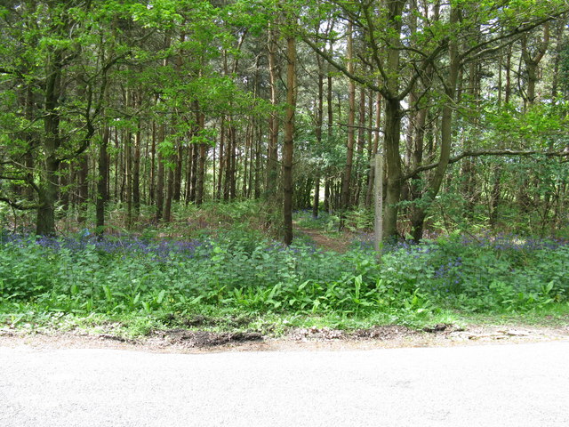
The wood is predominantly composed of broadleaf trees, including oak, beech, and ash, which create a dense canopy overhead, providing shade and shelter for the diverse range of flora and fauna that call this woodland home. The forest floor is carpeted with a variety of wildflowers, ferns, and mosses, adding to the enchanting atmosphere of the wood.

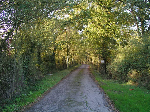
Visitors to Backreed Wood can enjoy a network of well-maintained footpaths and trails, which allow for leisurely walks and hikes throughout the forest. These paths wind their way through the trees, offering glimpses of wildlife such as deer, foxes, and a multitude of bird species. The wood is also home to several small streams and ponds, adding to the overall tranquility and natural charm of the area.

Nature enthusiasts will appreciate the abundance of wildlife that can be observed in Backreed Wood, including rare species of butterflies and beetles. The forest also provides a habitat for a diverse range of birdlife, making it an appealing destination for birdwatchers.

Overall, Backreed Wood is a captivating natural haven, offering visitors a chance to immerse themselves in the beauty of the Sussex countryside and connect with nature.

If you have any feedback on the listing, please let us know in the comments section below.

Backreed Wood Images

Images are sourced within 2km of 50.943339/-0.35998292 or Grid Reference TQ1517. Thanks to Geograph Open Source API. All images are credited.

Coppicing, Brickyard Copse Taken from North Lane bridleway.
Coppicing, Brickyard Copse
Taken from North Lane bridleway.
Basing Wood A lone oak stands guard over an army of firs. Taken from North Lane bridleway just north of Coombelands.
Basing Wood
A lone oak stands guard over an army of firs. Taken from North Lane bridleway just north of Coombelands.
Capite Wood Taken from the footpath that links Woodman's Farm with Buckells Farm. The dense cover of the firs gives it a spooky feel.
Capite Wood
Taken from the footpath that links Woodman's Farm with Buckells Farm. The dense cover of the firs gives it a spooky feel.
Footbridge, Capite Wood Carrying the footpath that links Woodman's Farm to Buckells Farm
Footbridge, Capite Wood
Carrying the footpath that links Woodman's Farm to Buckells Farm
Field near Dalesdown School Chanctonbury Ring can be seen between the two trees to the right just above the less than bucolic flytipping area. Taken from the point where the footpath crosses the farm road.
Field near Dalesdown School
Chanctonbury Ring can be seen between the two trees to the right just above the less than bucolic flytipping area. Taken from the point where the footpath crosses the farm road.
Pot Common Potcommon Furzefield to the left, Soil Wood to the right. Taken from the bridleway.
Pot Common
Potcommon Furzefield to the left, Soil Wood to the right. Taken from the bridleway.
Smiley Face, Honeybridge Lane Painted sign next to the entrance of Dalesdown Educational Establishment.
Smiley Face, Honeybridge Lane
Painted sign next to the entrance of Dalesdown Educational Establishment.
Flat Dossers Known a few of them in my time! Taken from the bridleway.
Flat Dossers
Known a few of them in my time! Taken from the bridleway.
Entrance to Whitefoots Wheelie bin standing guard. This is the point where the bridleway turns shapely west.
Entrance to Whitefoots
Wheelie bin standing guard. This is the point where the bridleway turns shapely west.
Grinders Wood Taken from the footpath that links Thistleworth Farm with Buckells Farm.
Grinders Wood
Taken from the footpath that links Thistleworth Farm with Buckells Farm.
Outbuildings, Honeybridge Farm Known as Starkers Farm on the 1940s map. Taken from the footpath that links Daylands Farm with Kings Barn Farm.
Outbuildings, Honeybridge Farm
Known as Starkers Farm on the 1940s map. Taken from the footpath that links Daylands Farm with Kings Barn Farm.
Field, Jessops Farm Taken from the footpath that goes through the farm.
Field, Jessops Farm
Taken from the footpath that goes through the farm.
Footpath, Jack O'Lantern Wood This is one of the better ones too!
Footpath, Jack O'Lantern Wood
This is one of the better ones too!
The route to Hawking Sopers Common Copse is to the right and those rainclouds were heading my way.
The route to Hawking Sopers
Common Copse is to the right and those rainclouds were heading my way.
Dying Deer, near Jessops Farm On the footpath that heads south from the farm. Both back legs seemed to be gone. Not much I could do I'm afraid.
Dying Deer, near Jessops Farm
On the footpath that heads south from the farm. Both back legs seemed to be gone. Not much I could do I'm afraid.
Entrance to Perrylands Seen from the A24.
Entrance to Perrylands
Seen from the A24.
Footpath from country road next to Grinders Wood This path then leads onto Gallops on Windsor Common
Footpath from country road next to Grinders Wood
This path then leads onto Gallops on Windsor Common
Footpath and farm track to Daylands Farm through Capite Wood
Show me another place!

Backreed Wood is located at Grid Ref: TQ1517 (Lat: 50.943339, Lng: -0.35998292)

Administrative County: West Sussex

District: Horsham

Police Authority: Sussex

What 3 Words

///students.towels.report. Near Ashington, West Sussex

Related Wikis

Dial Post

Dial Post is a village in the Horsham District of West Sussex, England. The civil parish, where the lowest level political meetings are held, is West Grinstead...

Ashington, West Sussex

Ashington is a village and civil parish in the Horsham District of West Sussex, England. It lies on the A24 road 3 miles (4.8 km) north-east of Storrington...

St James's Church, Ashurst

St James's Church is a Church of England parish church in Ashurst, West Sussex. The church is a grade I listed building and it dates from the early 12th...

Ashurst, West Sussex

Ashurst is a village and civil parish in the Horsham District of West Sussex, England, about 2 miles (3.2 km) west of Henfield, and 11 miles (18 km) south...

Fountain Inn, Ashurst

The Fountain Inn is a 16th-century public house in the village of Ashurst, in the Horsham district of West Sussex, England. After a period as a farmhouse...

Wiston, West Sussex

Wiston is a scattered village and civil parish in the Horsham District of West Sussex, England. It lies on the A283 road 2.8 miles (4.5 km) northwest of...

Bines Green

Bines Green is a hamlet in the Horsham District of West Sussex, England. It lies 1.9 miles (3.1 km) north west of Henfield on the B2135 road between Ashurst...

Brightling Park

Brightling Park (previously known as Rose Hill) is a country estate which lies in the parishes of Brightling and Dallington in the Rother district of East...

Nearby Amenities

Located within 500m of 50.943339,-0.35998292
The data included in this document is from www.openstreetmap.org. The data is made available under ODbL.

Have you been to Backreed Wood?

Leave your review of Backreed Wood below (or comments, questions and feedback).