Lion's Wood

Wood, Forest in Sussex Horsham

England

Lion's Wood

Oast Cottage Viewed from the Billingshurst Road the cottage is a Grade II listed building. See <span class="nowrap"><a title="https://historicengland.org.uk/listing/the-list/list-entry/1182086" rel="nofollow ugc noopener" href="https://historicengland.org.uk/listing/the-list/list-entry/1182086">Link</a><img style="margin-left:2px;" alt="External link" title="External link - shift click to open in new window" src="https://s1.geograph.org.uk/img/external.png" width="10" height="10"/></span>
Oast Cottage Credit: Chris Thomas-Atkin

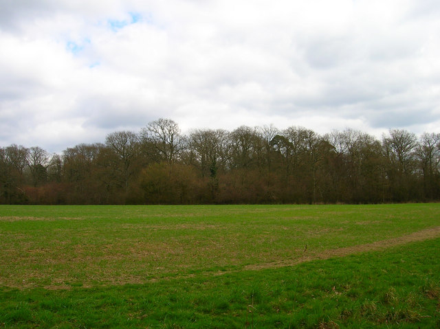
Lion's Wood is a picturesque woodland located in Sussex, England. Situated in the heart of the county, this forested area covers approximately 100 acres of land. The wood is known for its diverse ecosystem and rich biodiversity, making it a popular destination for nature enthusiasts and hikers alike.

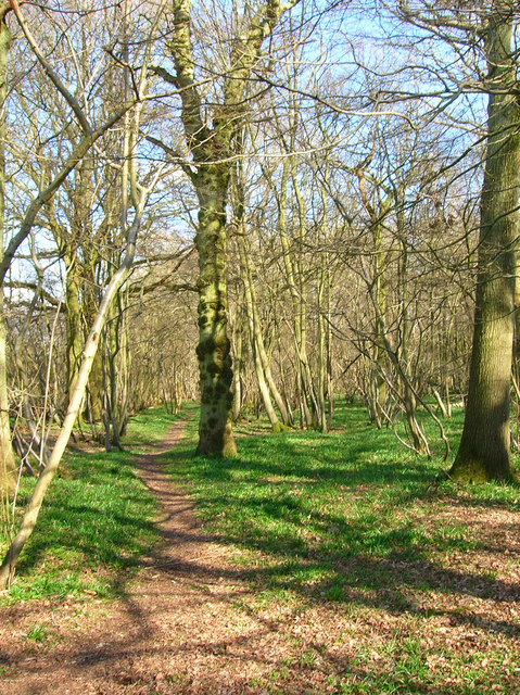
The wood is predominantly made up of broadleaf trees, such as oak, beech, and birch, which provide a stunning display of vibrant colors during the autumn months. The dense canopy created by these towering trees creates a shaded and cool environment, ideal for a leisurely stroll or a peaceful picnic.

Lion's Wood is also home to a variety of wildlife, including deer, foxes, and numerous bird species. Birdwatchers can often spot woodpeckers, owls, and various songbirds within the wood's boundaries. In addition, the forest floor is carpeted with a diverse range of wildflowers and ferns, adding to the natural beauty of the area.

The wood is crisscrossed with well-maintained walking trails, allowing visitors to explore its many hidden gems. These trails cater to all fitness levels, offering both gentle paths for a relaxed walk and more challenging routes for the adventurous. Along the way, hikers can discover serene ponds, babbling brooks, and even a small waterfall, adding to the enchanting atmosphere of the wood.

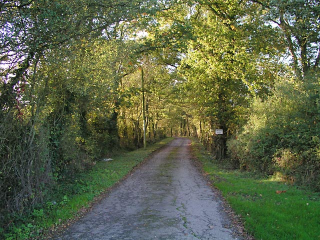
Lion's Wood is easily accessible, with ample parking and facilities available for visitors. Whether you are an avid nature lover, a keen photographer, or simply seeking a peaceful retreat, Lion's Wood in Sussex promises a memorable and rejuvenating experience.

If you have any feedback on the listing, please let us know in the comments section below.

Lion's Wood Images

Images are sourced within 2km of 50.940987/-0.36091971 or Grid Reference TQ1517. Thanks to Geograph Open Source API. All images are credited.

Oast Cottage Viewed from the Billingshurst Road the cottage is a Grade II listed building. See <span class="nowrap"><a title="https://historicengland.org.uk/listing/the-list/list-entry/1182086" rel="nofollow ugc noopener" href="https://historicengland.org.uk/listing/the-list/list-entry/1182086">Link</a><img style="margin-left:2px;" alt="External link" title="External link - shift click to open in new window" src="https://s1.geograph.org.uk/img/external.png" width="10" height="10"/></span>
Oast Cottage
Viewed from the Billingshurst Road the cottage is a Grade II listed building. See LinkExternal link
Footpath to Kensett's Corner Taken from North Lane bridleway.
Footpath to Kensett's Corner
Taken from North Lane bridleway.
Coppicing, Brickyard Copse Taken from North Lane bridleway.
Coppicing, Brickyard Copse
Taken from North Lane bridleway.
Basing Wood A lone oak stands guard over an army of firs. Taken from North Lane bridleway just north of Coombelands.
Basing Wood
A lone oak stands guard over an army of firs. Taken from North Lane bridleway just north of Coombelands.
Capite Wood Taken from the footpath that links Woodman's Farm with Buckells Farm. The dense cover of the firs gives it a spooky feel.
Capite Wood
Taken from the footpath that links Woodman's Farm with Buckells Farm. The dense cover of the firs gives it a spooky feel.
Footbridge, Capite Wood Carrying the footpath that links Woodman's Farm to Buckells Farm
Footbridge, Capite Wood
Carrying the footpath that links Woodman's Farm to Buckells Farm
Field near Dalesdown School Chanctonbury Ring can be seen between the two trees to the right just above the less than bucolic flytipping area. Taken from the point where the footpath crosses the farm road.
Field near Dalesdown School
Chanctonbury Ring can be seen between the two trees to the right just above the less than bucolic flytipping area. Taken from the point where the footpath crosses the farm road.
Pot Common Potcommon Furzefield to the left, Soil Wood to the right. Taken from the bridleway.
Pot Common
Potcommon Furzefield to the left, Soil Wood to the right. Taken from the bridleway.
Smiley Face, Honeybridge Lane Painted sign next to the entrance of Dalesdown Educational Establishment.
Smiley Face, Honeybridge Lane
Painted sign next to the entrance of Dalesdown Educational Establishment.
Flat Dossers Known a few of them in my time! Taken from the bridleway.
Flat Dossers
Known a few of them in my time! Taken from the bridleway.
Entrance to Whitefoots Wheelie bin standing guard. This is the point where the bridleway turns shapely west.
Entrance to Whitefoots
Wheelie bin standing guard. This is the point where the bridleway turns shapely west.
Grinders Wood Taken from the footpath that links Thistleworth Farm with Buckells Farm.
Grinders Wood
Taken from the footpath that links Thistleworth Farm with Buckells Farm.
Outbuildings, Honeybridge Farm Known as Starkers Farm on the 1940s map. Taken from the footpath that links Daylands Farm with Kings Barn Farm.
Outbuildings, Honeybridge Farm
Known as Starkers Farm on the 1940s map. Taken from the footpath that links Daylands Farm with Kings Barn Farm.
Field, Jessops Farm Taken from the footpath that goes through the farm.
Field, Jessops Farm
Taken from the footpath that goes through the farm.
Footpath, Jack O'Lantern Wood This is one of the better ones too!
Footpath, Jack O'Lantern Wood
This is one of the better ones too!
The route to Hawking Sopers Common Copse is to the right and those rainclouds were heading my way.
The route to Hawking Sopers
Common Copse is to the right and those rainclouds were heading my way.
Dying Deer, near Jessops Farm On the footpath that heads south from the farm. Both back legs seemed to be gone. Not much I could do I'm afraid.
Dying Deer, near Jessops Farm
On the footpath that heads south from the farm. Both back legs seemed to be gone. Not much I could do I'm afraid.
Entrance to Perrylands Seen from the A24.
Entrance to Perrylands
Seen from the A24.
Show me another place!

Lion's Wood is located at Grid Ref: TQ1517 (Lat: 50.940987, Lng: -0.36091971)

Administrative County: West Sussex

District: Horsham

Police Authority: Sussex

What 3 Words

///mysteries.every.town. Near Ashington, West Sussex

Related Wikis

Ashington, West Sussex

Ashington is a village and civil parish in the Horsham District of West Sussex, England. It lies on the A24 road 3 miles (4.8 km) north-east of Storrington...

St James's Church, Ashurst

St James's Church is a Church of England parish church in Ashurst, West Sussex. The church is a grade I listed building and it dates from the early 12th...

Dial Post

Dial Post is a village in the Horsham District of West Sussex, England. The civil parish, where the lowest level political meetings are held, is West Grinstead...

Ashurst, West Sussex

Ashurst is a village and civil parish in the Horsham District of West Sussex, England, about 2 miles (3.2 km) west of Henfield, and 11 miles (18 km) south...

Fountain Inn, Ashurst

The Fountain Inn is a 16th-century public house in the village of Ashurst, in the Horsham district of West Sussex, England. After a period as a farmhouse...

Wiston, West Sussex

Wiston is a scattered village and civil parish in the Horsham District of West Sussex, England. It lies on the A283 road 2.8 miles (4.5 km) northwest of...

Buncton

Buncton () is a small village in the Horsham District of West Sussex, England, part of the civil parish of Wiston 0.5 miles (0.80 km) north. It lies to...

All Saints Church, Buncton

All Saints Church is an Anglican church in the hamlet of Buncton in the district of Horsham, one of seven local government districts in the English county...

Nearby Amenities

Located within 500m of 50.940987,-0.36091971
The data included in this document is from www.openstreetmap.org. The data is made available under ODbL.

Have you been to Lion's Wood?

Leave your review of Lion's Wood below (or comments, questions and feedback).