Wellingtonia Clump

Wood, Forest in Sussex Horsham

England

Wellingtonia Clump

New bridleway off Bell Lane The footpath leading south-east off Bell Lane to the old Dorking Road (now sequestered by the A24 dual carriageway) has recently been upgraded to bridleway, no. 3647_1.
New bridleway off Bell Lane Credit: Hugh Craddock

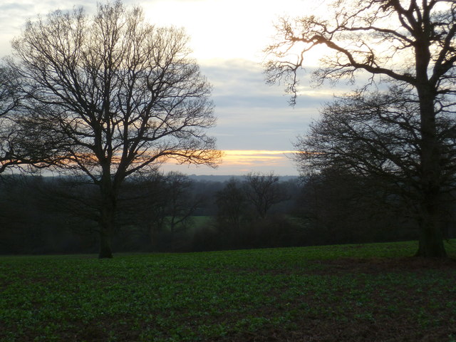
Wellingtonia Clump is a picturesque woodland area located in Sussex, England. It is known for its stunning collection of Wellingtonia trees, also known as giant sequoias. These magnificent coniferous trees, native to North America, form a distinct and impressive feature of the landscape.

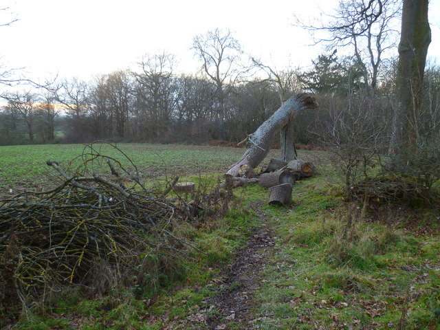
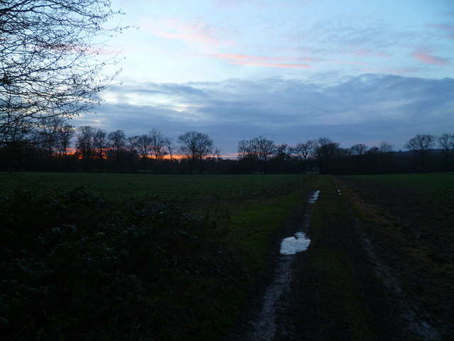
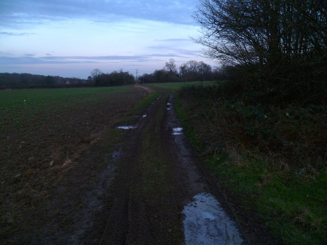
The clump is situated within a larger forest area, offering a serene and peaceful environment for visitors to explore. The trees in Wellingtonia Clump are some of the oldest and tallest in the region, reaching heights of over 200 feet. Their reddish-brown bark and dense foliage create a striking contrast against the surrounding greenery.

The woodland provides a habitat for a diverse range of wildlife, including various bird species, small mammals, and insects. It is a popular spot for birdwatchers and nature enthusiasts, who can observe native and migratory birds in their natural habitat.

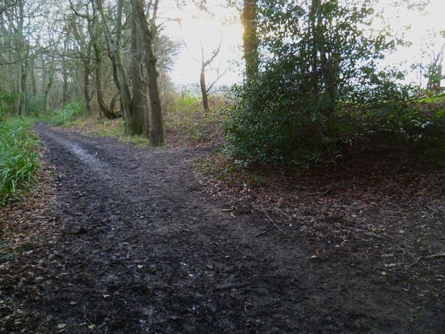
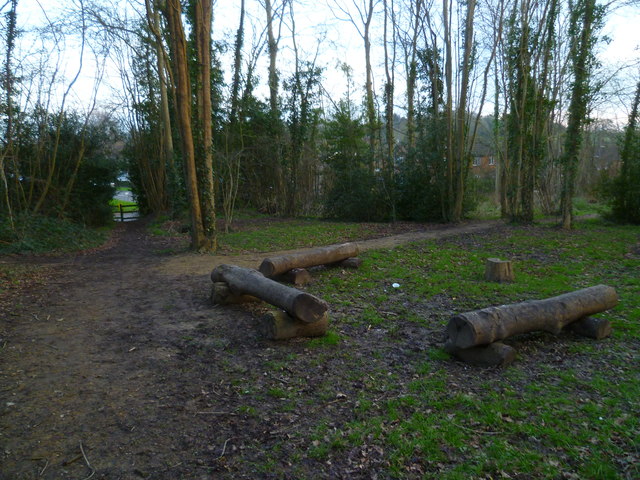
Wellingtonia Clump offers a network of well-maintained walking trails, allowing visitors to wander through the woods and enjoy the beauty of nature. The paths wind through a mixture of dense forest and open spaces, offering glimpses of sunlight filtering through the canopy above.

The clump is easily accessible by car, with a designated parking area nearby. There are also picnic areas and benches scattered throughout the woodland, providing visitors with opportunities to relax and immerse themselves in the tranquility of the surroundings.

Overall, Wellingtonia Clump is a captivating woodland retreat that showcases the grandeur of the giant sequoias and offers a peaceful escape from the hustle and bustle of everyday life.

If you have any feedback on the listing, please let us know in the comments section below.

Wellingtonia Clump Images

Images are sourced within 2km of 51.07956/-0.35452873 or Grid Reference TQ1532. Thanks to Geograph Open Source API. All images are credited.

New bridleway off Bell Lane The footpath leading south-east off Bell Lane to the old Dorking Road (now sequestered by the A24 dual carriageway) has recently been upgraded to bridleway, no. 3647_1.
New bridleway off Bell Lane
The footpath leading south-east off Bell Lane to the old Dorking Road (now sequestered by the A24 dual carriageway) has recently been upgraded to bridleway, no. 3647_1.
Streets of Horsham Junction of Curzon Avenue and Vale Drive.
Streets of Horsham
Junction of Curzon Avenue and Vale Drive.
Old Milestone by A24, Andrews Farm The Milestone is located by the road.  Parish of Warnham (Horsham District). Cast iron post, Horsham post design, erected by the Horsham & Dorking turnpike trust in the 19th Century. An earlier photograph can be found here: <a title="https://www.geograph.org.uk/photo/1596429" href="https://www.geograph.org.uk/photo/1596429">Link</a> 

Inscription reads:-  
24 MILES / TO / BRIGHTON / 2½ / TO / HORSHAM : : 34 MILES / TO / LONDON / 11 / MILES TO / DORKING : : WARNHAM  

Milestone Society National ID: SX_LA34
Old Milestone by A24, Andrews Farm
The Milestone is located by the road.  Parish of Warnham (Horsham District). Cast iron post, Horsham post design, erected by the Horsham & Dorking turnpike trust in the 19th Century. An earlier photograph can be found here: Link  Inscription reads:- 24 MILES / TO / BRIGHTON / 2½ / TO / HORSHAM : : 34 MILES / TO / LONDON / 11 / MILES TO / DORKING : : WARNHAM Milestone Society National ID: SX_LA34
Old Milestone by A24, Andrews Farm The Milestone is located by the road.  Parish of Warnham (Horsham District). Cast iron post, Horsham post design, erected by the Horsham & Dorking turnpike trust in the 19th Century. An earlier photograph can be found here: <a title="https://www.geograph.org.uk/photo/7429171" href="https://www.geograph.org.uk/photo/7429171">Link</a> 

Inscription reads:-  
24 MILES / TO / BRIGHTON / 2½ / TO / HORSHAM : : 34 MILES / TO / LONDON / 11 / MILES TO / DORKING : : WARNHAM  

Milestone Society National ID: SX_LA34
Old Milestone by A24, Andrews Farm
The Milestone is located by the road.  Parish of Warnham (Horsham District). Cast iron post, Horsham post design, erected by the Horsham & Dorking turnpike trust in the 19th Century. An earlier photograph can be found here: Link  Inscription reads:- 24 MILES / TO / BRIGHTON / 2½ / TO / HORSHAM : : 34 MILES / TO / LONDON / 11 / MILES TO / DORKING : : WARNHAM Milestone Society National ID: SX_LA34
School Hill, Warnham School Hill in the village of Warnham, in West Sussex
School Hill, Warnham
School Hill in the village of Warnham, in West Sussex
Timber-framed outbuilding at Bailing Hill Farm - with antler trophies Bailing Hill (on the Warnham Park estate) is currently run as a deer farm - hence the antler trophies.  Apart from the smallish trophies fixed to the first-floor frame, notice the huge pair of antlers on the ground at the far end of the building.   <span class="nowrap"><a title="http://www.warnhampark.com/" rel="nofollow ugc noopener" href="http://www.warnhampark.com/">Link</a><img style="margin-left:2px;" alt="External link" title="External link - shift click to open in new window" src="https://s1.geograph.org.uk/img/external.png" width="10" height="10"/></span>
Timber-framed outbuilding at Bailing Hill Farm - with antler trophies
Bailing Hill (on the Warnham Park estate) is currently run as a deer farm - hence the antler trophies. Apart from the smallish trophies fixed to the first-floor frame, notice the huge pair of antlers on the ground at the far end of the building. LinkExternal link
Former school, by Warnham village green A Victorian school building, overlooking the village green from the east.
Former school, by Warnham village green
A Victorian school building, overlooking the village green from the east.
Mid-18th century tombstone, Warnham churchyard The name is JOHN AGATE (if I've read it correctly) and the date July 1748.  The jawless skull is pretty typical of the rather heartless imagery to be found on 18th century tombstones.
Mid-18th century tombstone, Warnham churchyard
The name is JOHN AGATE (if I've read it correctly) and the date July 1748. The jawless skull is pretty typical of the rather heartless imagery to be found on 18th century tombstones.
Field view to unnamed woodland east of New Barn
Countryside view to the sinking sun
Bridleway goes southwards towards Warnham Manor from footpath crossing See also <a title="https://www.geograph.org.uk/photo/1853304" href="https://www.geograph.org.uk/photo/1853304">Link</a>.
Bridleway goes southwards towards Warnham Manor from footpath crossing
See also Link.
Log seating by crosstracks at Warnham
Houses on Tilletts Lane The camera is near the junction with Gregsons.
Houses on Tilletts Lane
The camera is near the junction with Gregsons.
Warnham Manor seen from footpath See also <a title="https://www.geograph.org.uk/photo/2071947" href="https://www.geograph.org.uk/photo/2071947">Link</a>.
Warnham Manor seen from footpath
See also Link.
Muddy and icy path at sunset
Muddy and icy path going towards Warnham Manor
Junction of Billingshurst and Old Guildford Roads
Shelley Primary School
Show me another place!

Wellingtonia Clump is located at Grid Ref: TQ1532 (Lat: 51.07956, Lng: -0.35452873)

Administrative County: West Sussex

District: Horsham

Police Authority: Sussex

What 3 Words

///hands.linen.chat. Near Warnham, West Sussex

Related Wikis

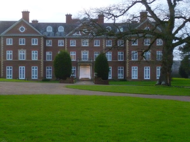
Field Place, Warnham

Field Place is a Grade I listed house in Warnham, West Sussex, England. It is the birthplace of the poet Percy Bysshe Shelley, born there in 1792. The...
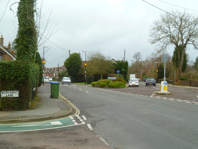
Broadbridge Heath

Broadbridge Heath is a village and civil parish in the Horsham district of West Sussex, England. It is about two miles (3 km) west from the historic centre...

E. Tredcroft's Ground

E. Tredcroft's Ground was a cricket ground at the Warnham Court estate, located at Horsham, Sussex. The first recorded match on the ground was in 1851...

Warnham

Warnham is a village and civil parish in the Horsham district of West Sussex, England. The village is centred 2 miles (3.2 km) north-northwest of Horsham...

Related Videos

Take an Epic 4K Drone Journey on a Beginners Hiking Adventure in the UK!

Distance: 16.5 km (10.3 miles) Grading: Easy Rating: 3 out of 10 Ascents: 314 m Hiking time: About 5.5 to 6.5 hours of actual ...

Walks around Britain | Country Walking Routes | Country walk near me | Walks near London @ Chesworth

Walks around Britain | Country Walking Routes | Country walk near me | Walks near London @ Chesworth - Shu will show you ...

Walks in Sussex : Beedinglee to Horsham

A nice stroll in the British cuntryside from Beedinglee to Horsham in West Sussex.

Nearby Amenities

Located within 500m of 51.07956,-0.35452873
Barrier: kissing_gate
Foot: yes
Lat/Long: 51.0787576/-0.3487133
Barrier: kissing_gate
Foot: yes
Lat/Long: 51.0830291/-0.3541858
Broomlands Farm
Place: farm
Lat/Long: 51.0782992/-0.3556749
Bailing Hill Farm
Place: farm
Lat/Long: 51.0832195/-0.355074
Goose Green
Place: hamlet
Lat/Long: 51.0825051/-0.3550955
Lyons Clumps
Natural: wood
Lat/Long: 51.079849/-0.35207
Wellingtonia Clump
Natural: wood
Lat/Long: 51.0795187/-0.354484
Bus Stop
Bailing Hill
Addr Village: Warnham
Bearing: SW
Naptan AtcoCode: 4400HO0306
Naptan NaptanCode: wsxgmjad
Public Transport: platform
Lat/Long: 51.0820369/-0.3549513
Bus Stop
Bailing Hill
Addr Street: Bailing Hill
Addr Village: Warnham
Bearing: NE
Naptan AtcoCode: 4400HO0302
Naptan NaptanCode: wsxdtmgd
Public Transport: platform
Lat/Long: 51.0812649/-0.3555429
Bus Stop
Byfleets Lane
Addr District: Broadbridge Heath
Addr Street: Broadbridge Heath Road
Bearing: SW
Naptan AtcoCode: 4400HO1583B
Naptan NaptanCode: wsxwadwj
Public Transport: platform
Lat/Long: 51.0776766/-0.3575532
Byfleets Lane
Bus: yes
Public Transport: stop_position
Lat/Long: 51.0770063/-0.3583295
Bus Stop
Byfleets Lane
Addr District: Broadbridge Heath
Addr Street: Broadbridge Heath Road
Bearing: NE
Naptan AtcoCode: 4400HO1583A
Naptan NaptanCode: wsxwadwg
Public Transport: platform
Lat/Long: 51.0770278/-0.3583874
The data included in this document is from www.openstreetmap.org. The data is made available under ODbL.

Have you been to Wellingtonia Clump?

Leave your review of Wellingtonia Clump below (or comments, questions and feedback).