Guessgate Wood

Wood, Forest in Sussex Horsham

England

Guessgate Wood

View from Chanctonbury Ring (3)
View from Chanctonbury Ring (3) Credit: Peter Shimmon

Guessgate Wood, located in Sussex, England, is a captivating forest renowned for its natural beauty and historical significance. Spanning an area of approximately 500 acres, this woodland is nestled in the heart of the Sussex countryside, offering visitors a peaceful and serene environment.

The wood is predominantly composed of deciduous trees, including oak, beech, and ash, which provide a lush green canopy during the summer months and a mesmerizing display of vibrant colors during autumn. The forest floor is adorned with an array of wildflowers and ferns, creating a picturesque scene that attracts nature enthusiasts and photographers alike.

Aside from its natural wonders, Guessgate Wood holds historical importance as it was once part of the ancient medieval hunting grounds. Remnants of this history can be observed through the presence of old hunting lodges and deer stands scattered throughout the forest.

The wood provides a habitat for a diverse range of wildlife, including deer, foxes, badgers, and various bird species. Birdwatchers can enjoy spotting woodpeckers, owls, and a variety of songbirds.

Guessgate Wood offers several well-maintained walking trails that allow visitors to explore its enchanting surroundings. These trails meander through the forest, offering glimpses of tranquil ponds, babbling brooks, and ancient trees. The wood also boasts a picnic area, making it an ideal spot for families and nature enthusiasts to enjoy a day out in the countryside.

In summary, Guessgate Wood in Sussex is a captivating woodland that combines natural beauty with historical significance. Its diverse flora and fauna, along with its well-preserved trails, make it a popular destination for those seeking tranquility and a connection with nature.

If you have any feedback on the listing, please let us know in the comments section below.

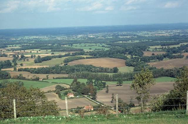
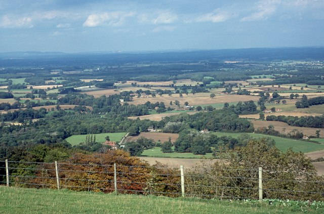
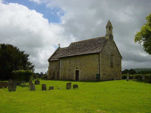
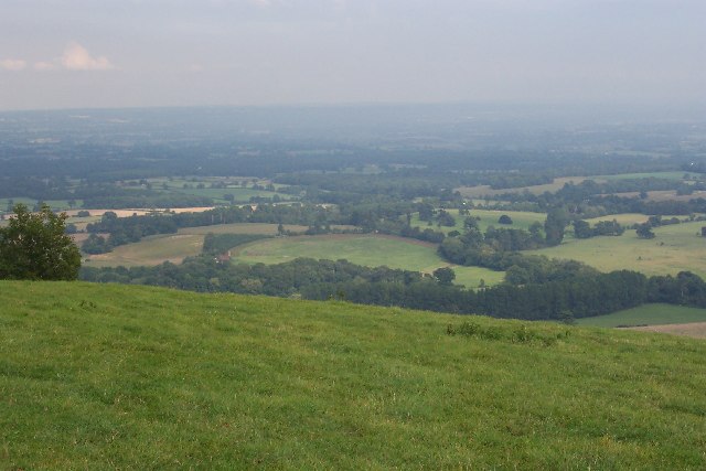
Guessgate Wood Images

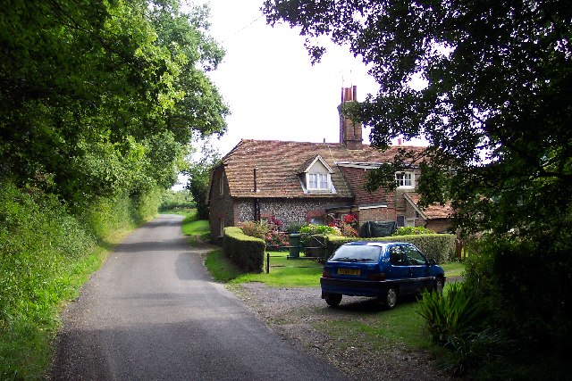
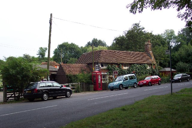
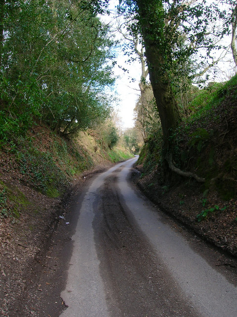
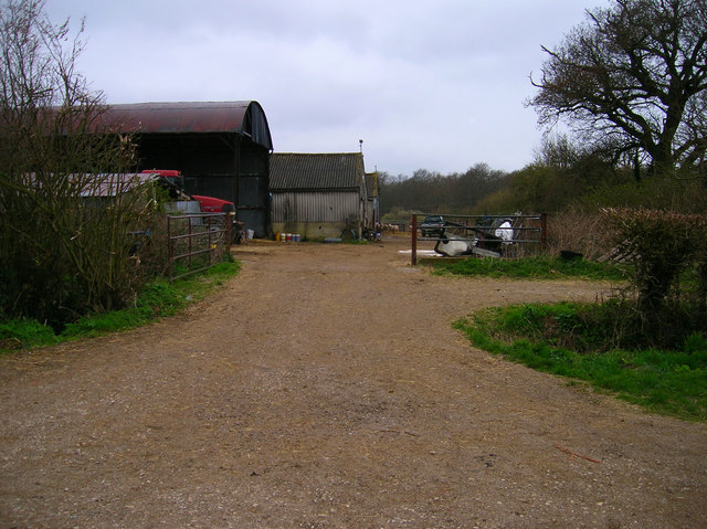
Images are sourced within 2km of 50.918899/-0.36020203 or Grid Reference TQ1514. Thanks to Geograph Open Source API. All images are credited.

View from Chanctonbury Ring (3)
View from Chanctonbury Ring (4)
All Saints Church, Buncton 12th Century Church in the tiny Parish of Wiston with Buncton.
All Saints Church, Buncton
12th Century Church in the tiny Parish of Wiston with Buncton.
Bushovel Farm, Wiston Formerly called Bush Hovel Farm, it is seen slightly left of centre in this picture taken from Chanctonbury Ring. What is interesting is the circular shape of the field to the right of the farmhouse and buildings (with an extension on the right). This betrays it as having been an early clearing in the vast, heavily wooded Sussex Weald from which the farm was created. There are several farms along the foot of the downs here. At first sight it appears not to be the best situation for a farm, the southern sun being blocked by the bulk of the downs for much of the year (although not at Bushovel), but it is along this line that the chalk of the downs gives way to the gault clay of the Weald and it is here that numerous springs rise, providing a plentiful supply of water.
Bushovel Farm, Wiston
Formerly called Bush Hovel Farm, it is seen slightly left of centre in this picture taken from Chanctonbury Ring. What is interesting is the circular shape of the field to the right of the farmhouse and buildings (with an extension on the right). This betrays it as having been an early clearing in the vast, heavily wooded Sussex Weald from which the farm was created. There are several farms along the foot of the downs here. At first sight it appears not to be the best situation for a farm, the southern sun being blocked by the bulk of the downs for much of the year (although not at Bushovel), but it is along this line that the chalk of the downs gives way to the gault clay of the Weald and it is here that numerous springs rise, providing a plentiful supply of water.
Fastings Cottage, Chanctonbury Ring Road
Wiston Tearooms Wiston tearooms is at the southern end of the village. In the garden is a substantial collection of animals including various species of chickens, duck and geese, as well as two pigs, Henry - the infamous "Ashington pig" who was found wandering in the nearby village of Ashington - and George, goats, and a pony.
Wiston Tearooms
Wiston tearooms is at the southern end of the village. In the garden is a substantial collection of animals including various species of chickens, duck and geese, as well as two pigs, Henry - the infamous "Ashington pig" who was found wandering in the nearby village of Ashington - and George, goats, and a pony.
Fields of Hole Street Farm A view across this entirely agricultural square: the fields of Hole Street Farm, looking towards Upper Chancton, with the trees of Birth Copse in the middle distance. The hedge line in the foreground is probably ancient; it marks the parish boundary.
Fields of Hole Street Farm
A view across this entirely agricultural square: the fields of Hole Street Farm, looking towards Upper Chancton, with the trees of Birth Copse in the middle distance. The hedge line in the foreground is probably ancient; it marks the parish boundary.
Holloway, Chanctonbury Ring Road An old droving lane that linked Downland farms with their Wealden pastures.
Holloway, Chanctonbury Ring Road
An old droving lane that linked Downland farms with their Wealden pastures.
Footpath to Kensett's Corner Taken from North Lane bridleway.
Footpath to Kensett's Corner
Taken from North Lane bridleway.
Coppicing, Brickyard Copse Taken from North Lane bridleway.
Coppicing, Brickyard Copse
Taken from North Lane bridleway.
Field, Jessops Farm Taken from the footpath that goes through the farm.
Field, Jessops Farm
Taken from the footpath that goes through the farm.
Footpath, Jack O'Lantern Wood This is one of the better ones too!
Footpath, Jack O'Lantern Wood
This is one of the better ones too!
The route to Hawking Sopers Common Copse is to the right and those rainclouds were heading my way.
The route to Hawking Sopers
Common Copse is to the right and those rainclouds were heading my way.
Dying Deer, near Jessops Farm On the footpath that heads south from the farm. Both back legs seemed to be gone. Not much I could do I'm afraid.
Dying Deer, near Jessops Farm
On the footpath that heads south from the farm. Both back legs seemed to be gone. Not much I could do I'm afraid.
Small Hill near Furzfield Cottage Taken from Spithandle Lane path. The peak should have had Upper Barn on it but this did not appear to be either there or visible.
Small Hill near Furzfield Cottage
Taken from Spithandle Lane path. The peak should have had Upper Barn on it but this did not appear to be either there or visible.
Colour amid the gloom, Spithandle Copse Amongst the churned up mudbath that was Spithandle Lane was the odd bloom of spring flowers and shoots which make a lovely contrast to the murky browns elsewhere
Colour amid the gloom, Spithandle Copse
Amongst the churned up mudbath that was Spithandle Lane was the odd bloom of spring flowers and shoots which make a lovely contrast to the murky browns elsewhere
Spithandle Lane Spithandle Copse to the right, Spithandle Rough to the left. The road at the bottom left heads to College Wood Farm. The lane itself links Wiston to Horsebridge Common.
Spithandle Lane
Spithandle Copse to the right, Spithandle Rough to the left. The road at the bottom left heads to College Wood Farm. The lane itself links Wiston to Horsebridge Common.
Outbuildings, Guessgate Farm Taken from the footpath that links Spithandle Lane to the A283.
Outbuildings, Guessgate Farm
Taken from the footpath that links Spithandle Lane to the A283.
Show me another place!

Guessgate Wood is located at Grid Ref: TQ1514 (Lat: 50.918899, Lng: -0.36020203)

Administrative County: West Sussex

District: Horsham

Police Authority: Sussex

What 3 Words

///shampoo.assembles.privately. Near Ashington, West Sussex

Related Wikis

South Downs National Park

The South Downs National Park is England's newest national park, designated on 31 March 2010. The park, covering an area of 1,627 square kilometres (628...

Wiston, West Sussex

Wiston is a scattered village and civil parish in the Horsham District of West Sussex, England. It lies on the A283 road 2.8 miles (4.5 km) northwest of...

Buncton

Buncton () is a small village in the Horsham District of West Sussex, England, part of the civil parish of Wiston 0.5 miles (0.80 km) north. It lies to...

All Saints Church, Buncton

All Saints Church is an Anglican church in the hamlet of Buncton in the district of Horsham, one of seven local government districts in the English county...

Nearby Amenities

Located within 500m of 50.918899,-0.36020203
Power: pole
Lat/Long: 50.9231452/-0.3616416
Power: pole
Lat/Long: 50.9228479/-0.359979
Power: pole
Lat/Long: 50.9225055/-0.3581889
Power: pole
Lat/Long: 50.922102/-0.3561922
Power: pole
Lat/Long: 50.9218448/-0.3549019
Power: pole
Lat/Long: 50.9230697/-0.3616033
Power: pole
Lat/Long: 50.9227514/-0.3600172
Power: pole
Lat/Long: 50.9224106/-0.3581991
Power: pole
Lat/Long: 50.9220377/-0.3562585
Power: pole
Lat/Long: 50.9217918/-0.3549733
Power: pole
Lat/Long: 50.9198774/-0.3535644
Power: pole
Lat/Long: 50.9194682/-0.3544074
Power: pole
Lat/Long: 50.9190464/-0.3553052
Power: pole
Lat/Long: 50.9184754/-0.3564917
Power: pole
Lat/Long: 50.9178953/-0.3577154
Power: pole
Lat/Long: 50.9173176/-0.3589302
Power: pole
Lat/Long: 50.9163972/-0.361376
Power: pole
Lat/Long: 50.9155249/-0.361162
Power: pole
Lat/Long: 50.914651/-0.3609552
The data included in this document is from www.openstreetmap.org. The data is made available under ODbL.

Have you been to Guessgate Wood?

Leave your review of Guessgate Wood below (or comments, questions and feedback).