Oakesfield Plantation
Wood, Forest in Sussex Horsham
England
Oakesfield Plantation
Oakesfield Plantation, located in Sussex, is a picturesque and expansive woodland area covering approximately 500 acres. Situated in the heart of the county, this plantation boasts a rich history and offers a diverse range of natural features and recreational opportunities.
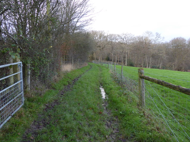
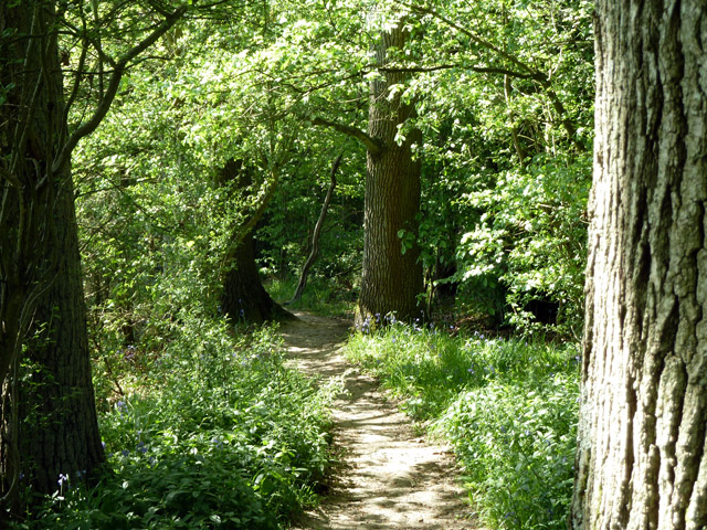
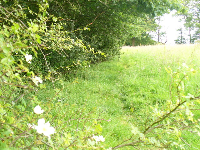
The woodland of Oakesfield Plantation is predominantly composed of native tree species, including oak, beech, and ash, creating a lush and vibrant forest ecosystem. The plantation is meticulously managed to preserve the health and vitality of the woodland, ensuring a harmonious balance between human activity and the natural environment.
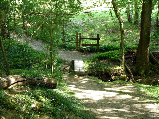
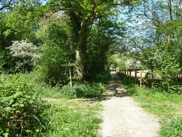
The plantation is intersected by several well-maintained walking trails, which provide visitors with the opportunity to immerse themselves in the tranquil beauty of the woodland. These paths wind through the plantation, offering glimpses of breathtaking vistas, serene clearings, and enchanting wildlife habitats.
Oakesfield Plantation also boasts a variety of recreational facilities, including picnic areas and designated camping sites, allowing visitors to fully enjoy the natural surroundings. The plantation is a popular destination for nature enthusiasts, hikers, and families looking to spend quality time in a serene environment.
Furthermore, Oakesfield Plantation has a rich historical significance. It was originally established in the 18th century as a working plantation, primarily used for timber production. Over the years, it has evolved into a cherished recreational space while retaining its historical charm and cultural heritage.
In conclusion, Oakesfield Plantation in Sussex stands as a testament to the splendor of nature, offering visitors an opportunity to explore a vast and diverse woodland, engage in outdoor activities, and experience the historical legacy of the area.
If you have any feedback on the listing, please let us know in the comments section below.
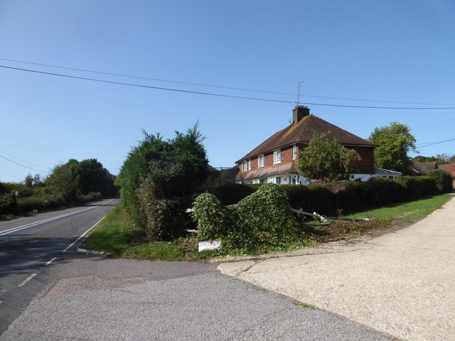
Oakesfield Plantation Images
Images are sourced within 2km of 51.093126/-0.41214061 or Grid Reference TQ1133. Thanks to Geograph Open Source API. All images are credited.


Oakesfield Plantation is located at Grid Ref: TQ1133 (Lat: 51.093126, Lng: -0.41214061)
Administrative County: West Sussex
District: Horsham
Police Authority: Sussex
What 3 Words
///videos.pampered.prowling. Near Slinfold, West Sussex
Related Wikis

High Weald AONB
The High Weald Area of Outstanding Natural Beauty is in south-east England. Covering an area of 1,450 square kilometres (560 sq mi), it takes up parts...

Holy Trinity Church, Rudgwick
Holy Trinity Church is the Anglican parish church of Rudgwick, a village in the Horsham district of West Sussex, England. The oldest part of the church...

Rudgwick
Rudgwick is a village and civil parish in the Horsham District of West Sussex, England. The village is 6 miles (10 km) west from Horsham on the north...

Slinfold Stream and Quarry
Slinfold Stream and Quarry is a 2.3-hectare (5.7-acre) geological Site of Special Scientific Interest west of Horsham in West Sussex. It is a Geological...

Slinfold
Slinfold is a village and civil parish in the Horsham District of West Sussex, England. == Geography == The village is almost 4 miles (6.4 km) west of...
Rudgwick railway station
Rudgwick railway station was on the Cranleigh Line. It served the village of Rudgwick in West Sussex until June, 1965. == History == Rudgwick station opened...

Slinfold railway station
Slinfold railway station was on the Cranleigh Line and served the village of Slinfold in West Sussex. == History == The line had a single track and opened...

Stane Street (Chichester)
Stane Street is the modern name of the 91 km-long (57 mi) Roman road in southern England that linked Londinium (London) to Noviomagus Reginorum (Chichester...
Related Videos

Whales/llandudno town/visiting places in llandudno/how we can spend a day/full day enjoyment/coffee
farinalifestyle #llandudno #greatorme #greatormegoats #northwalescoastlast #welshcoast #llandudnosunset #northwales ...

Wels Catfish Fishing From Furnace Lakes Fishery Roman Lake Peg 6
Hello everyone During my one week fishing trip to furnace lakes Roman lake peg 6 - http://www.furnace-lakes.co.uk Releasing a ...

Battling a Wels Catfish From Furnace Lakes Fishery Roman Lake Peg 6
Hello everyone Fighting a catfish from furnace lakes fishery During my one week fishing trip to furnace lakes Roman lake peg 6 ...
Nearby Amenities
Located within 500m of 51.093126,-0.41214061Have you been to Oakesfield Plantation?
Leave your review of Oakesfield Plantation below (or comments, questions and feedback).