Roman Woods

Wood, Forest in Sussex Horsham

England

Roman Woods

Downs Link, near Slinfold A view of the Downs Link path as it approaches Slinfold in West Sussex.  The path follows a dismantled railway line.  It also forms part of route 223 of the National Cycle Network.

Here, a public footpath crosses the Downs Link path.
Downs Link, near Slinfold Credit: Malc McDonald

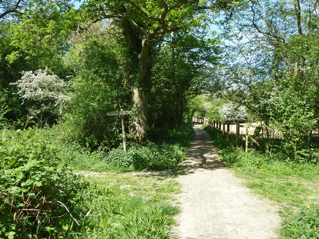
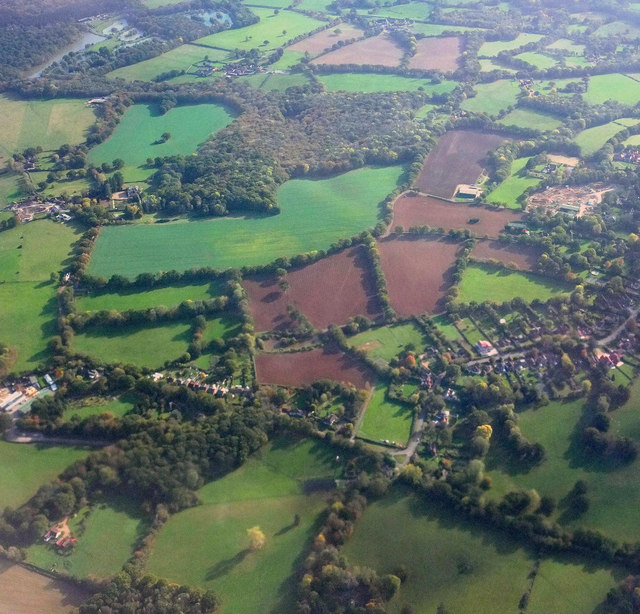
Roman Woods, located in Sussex, England, is a picturesque woodland area known for its rich history and natural beauty. Covering an expansive area, the woods are nestled between the villages of Buxted and Crowborough. The name "Roman Woods" is derived from the belief that the woods were initially inhabited by the Romans during their occupation of Britain.

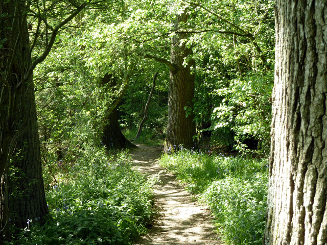
The woodland boasts a diverse range of tree species, including oak, beech, and birch, creating a stunning and vibrant landscape throughout the year. The dense foliage provides a habitat for numerous wildlife species, such as deer, foxes, and various bird species, making it a popular destination for nature enthusiasts and birdwatchers.

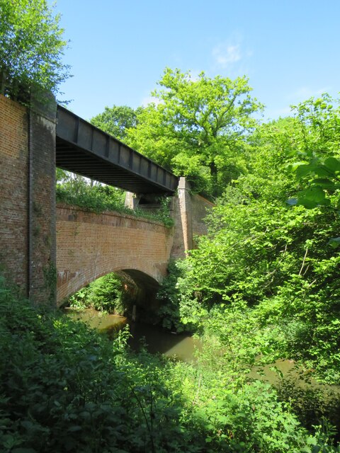
One of the notable features of Roman Woods is the presence of ancient earthworks and remnants of Roman settlements. The woods are home to several archaeological sites, including Roman encampments and a preserved section of the Roman road that once connected London to the south coast. These historical artifacts offer a glimpse into the past and highlight the area's significance during the Roman era.

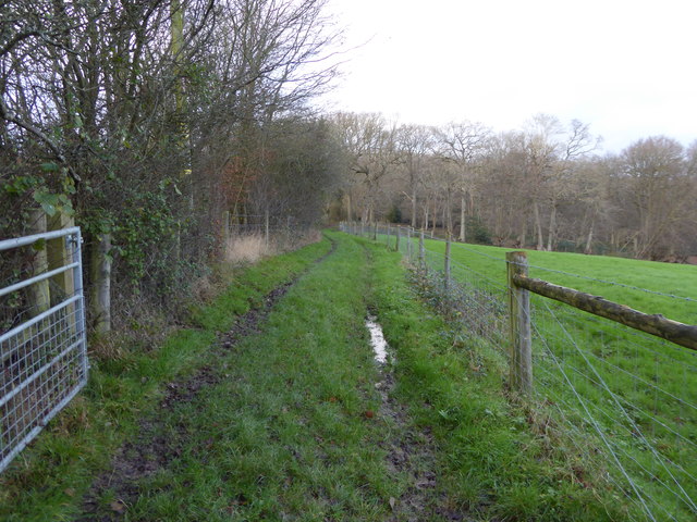
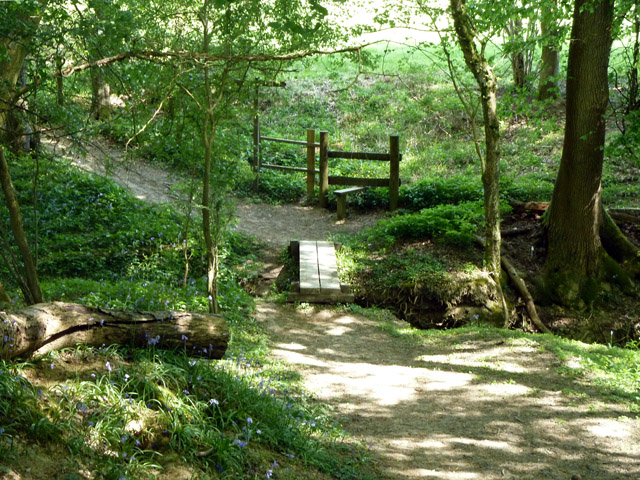
Today, Roman Woods is a designated Site of Special Scientific Interest (SSSI) due to its ecological importance and historical value. The woods offer various walking trails and paths, allowing visitors to explore the serene environment and appreciate the natural wonders that abound. Whether it's for a leisurely stroll, a picnic amidst the tranquil surroundings, or a chance to delve into history, Roman Woods provides an enchanting escape into nature.

If you have any feedback on the listing, please let us know in the comments section below.

Roman Woods Images

Images are sourced within 2km of 51.091226/-0.41457617 or Grid Reference TQ1133. Thanks to Geograph Open Source API. All images are credited.

Downs Link, near Slinfold A view of the Downs Link path as it approaches Slinfold in West Sussex.  The path follows a dismantled railway line.  It also forms part of route 223 of the National Cycle Network.

Here, a public footpath crosses the Downs Link path.
Downs Link, near Slinfold
A view of the Downs Link path as it approaches Slinfold in West Sussex. The path follows a dismantled railway line. It also forms part of route 223 of the National Cycle Network. Here, a public footpath crosses the Downs Link path.
Double bridge near Rudgwick, West Sussex The double bridge which crosses the River Arun near Rudgwick is unique in Britain, in having both a brick arch and an iron girder.

The brick arch was built to carry a railway line across the river.  However, on the far side of the river, the railway would then climb a steep gradient into Rudgwick station.  Inspectors from the government's Board of Trade refused permission for the railway to open, as they felt the gradient up to Rudgwick station was too steep.  The railway compamny therefore had to rebuild this section of the route with higher embankments, so that the gradient into Rudgwick was less steep.  As the railway had been raised to a higher level at this location, the iron girder bridge was installed to carry it across the river.  The brick arch has never been used for its intended purpose.

The railway opened in 1865 but closed a century later.  The railway route now forms part of the Downs Link long distance path, which itself forms part of route 223 of the National Cycle Network.
Double bridge near Rudgwick, West Sussex
The double bridge which crosses the River Arun near Rudgwick is unique in Britain, in having both a brick arch and an iron girder. The brick arch was built to carry a railway line across the river. However, on the far side of the river, the railway would then climb a steep gradient into Rudgwick station. Inspectors from the government's Board of Trade refused permission for the railway to open, as they felt the gradient up to Rudgwick station was too steep. The railway compamny therefore had to rebuild this section of the route with higher embankments, so that the gradient into Rudgwick was less steep. As the railway had been raised to a higher level at this location, the iron girder bridge was installed to carry it across the river. The brick arch has never been used for its intended purpose. The railway opened in 1865 but closed a century later. The railway route now forms part of the Downs Link long distance path, which itself forms part of route 223 of the National Cycle Network.
Gateway and buildings at Pensfold Farm
Dwellings at Pensfold Farm See also <a title="https://www.geograph.org.uk/photo/1984971" href="https://www.geograph.org.uk/photo/1984971">Link</a> from 2010.
Dwellings at Pensfold Farm
See also Link from 2010.
Enclosed path to woodland west of Hyes
Footpath 1396, Rudgwick Heading away from the village.
Footpath 1396, Rudgwick
Heading away from the village.
Footpath 1396, Rudgwick Heading away from the village.
Footpath 1396, Rudgwick
Heading away from the village.
Gravatt's Hanger Quite a lot of bluebells.
Gravatt's Hanger
Quite a lot of bluebells.
Footbridge in Gravatt's Hanger Footpath 1396 crosses.
Footbridge in Gravatt's Hanger
Footpath 1396 crosses.
Gill in Gravatt's Hanger Viewed from footpath 1396, which crosses the gill.
Gill in Gravatt's Hanger
Viewed from footpath 1396, which crosses the gill.
Footpath 1396, Rudgwick Heading towards the village.
Footpath 1396, Rudgwick
Heading towards the village.
Path junction near Godley's Cottage Ways to Rudgwick left, Rowhook right, and Cox Green straight on.
Path junction near Godley's Cottage
Ways to Rudgwick left, Rowhook right, and Cox Green straight on.
Bridleway towards Cox Green West Sussex path 1395.
Bridleway towards Cox Green
West Sussex path 1395.
Bluebells in Godley's Copse
Farm track near Rudgwick This parallels a bridleway to the right of the hedge.
Farm track near Rudgwick
This parallels a bridleway to the right of the hedge.
Bridleway towards Cox Green
Footpath across rape field Used by the Sussex Border Path, according to the map, although there is a shorter bridleway over this section that runs exactly along the border - perhaps thought too muddy in winter?
Footpath across rape field
Used by the Sussex Border Path, according to the map, although there is a shorter bridleway over this section that runs exactly along the border - perhaps thought too muddy in winter?
Cox Green from the air Hermongers and Godley's Copse, also seen in <a href="https://www.geograph.org.uk/photo/5151720">TQ1034 : Hermongers from the air</a>, are towards the upper left. Cox Green is in the lower part of the image. The small wood at lower left is simply called Tolt.
Cox Green from the air
Hermongers and Godley's Copse, also seen in TQ1034 : Hermongers from the air, are towards the upper left. Cox Green is in the lower part of the image. The small wood at lower left is simply called Tolt.
Show me another place!

Roman Woods is located at Grid Ref: TQ1133 (Lat: 51.091226, Lng: -0.41457617)

Administrative County: West Sussex

District: Horsham

Police Authority: Sussex

What 3 Words

///loudly.octagonal.unscathed. Near Slinfold, West Sussex

Related Wikis

Holy Trinity Church, Rudgwick

Holy Trinity Church is the Anglican parish church of Rudgwick, a village in the Horsham district of West Sussex, England. The oldest part of the church...

Rudgwick

Rudgwick is a village and civil parish in the Horsham District of West Sussex, England. The village is 6 miles (10 km) west from Horsham on the north...

High Weald AONB

The High Weald Area of Outstanding Natural Beauty is in south-east England. Covering an area of 1,450 square kilometres (560 sq mi), it takes up parts...

Slinfold Stream and Quarry

Slinfold Stream and Quarry is a 2.3-hectare (5.7-acre) geological Site of Special Scientific Interest west of Horsham in West Sussex. It is a Geological...

Slinfold

Slinfold is a village and civil parish in the Horsham District of West Sussex, England. == Geography == The village is almost 4 miles (6.4 km) west of...

Rudgwick railway station

Rudgwick railway station was on the Cranleigh Line. It served the village of Rudgwick in West Sussex until June, 1965. == History == Rudgwick station opened...

Slinfold railway station

Slinfold railway station was on the Cranleigh Line and served the village of Slinfold in West Sussex. == History == The line had a single track and opened...

Stane Street (Chichester)

Stane Street is the modern name of the 91 km-long (57 mi) Roman road in southern England that linked Londinium (London) to Noviomagus Reginorum (Chichester...

Nearby Amenities

Located within 500m of 51.091226,-0.41457617
Lodge Farm
Place: isolated_dwelling
Lat/Long: 51.0909367/-0.4081535
Bench
Lat/Long: 51.0932957/-0.4092174
The data included in this document is from www.openstreetmap.org. The data is made available under ODbL.

Have you been to Roman Woods?

Leave your review of Roman Woods below (or comments, questions and feedback).