Piney Copse

Wood, Forest in Surrey Guildford

England

Piney Copse

Paths cross near Shere Two paths cross on a hillside near Shere, in Surrey.  The path which bears left forms part of route 22 of the National Cycle Network.
Paths cross near Shere Credit: Malc McDonald

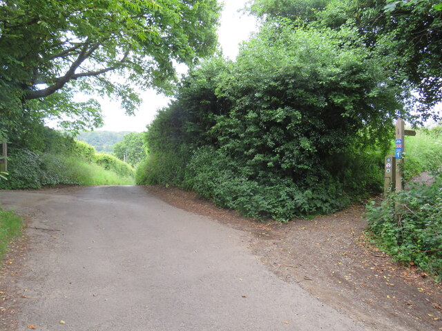
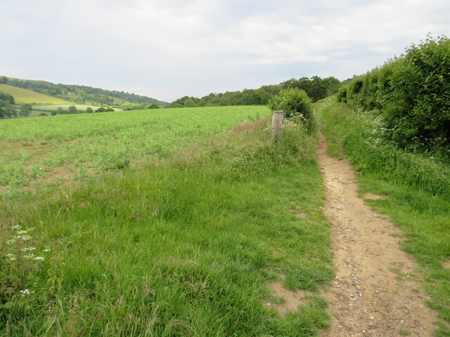
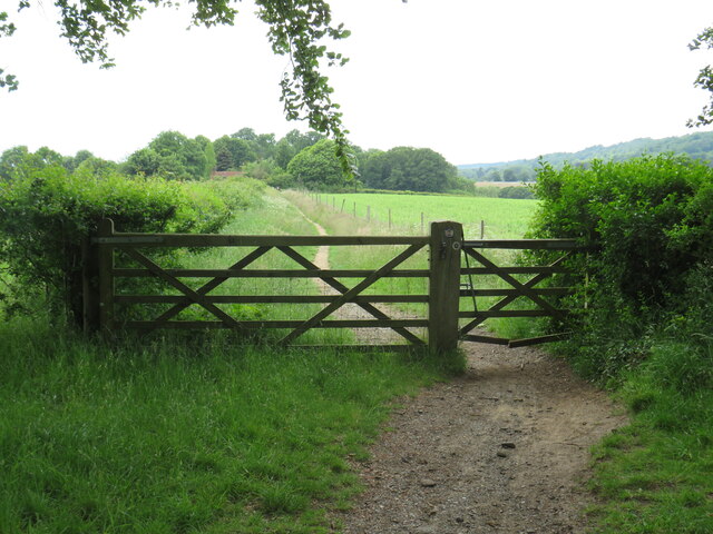
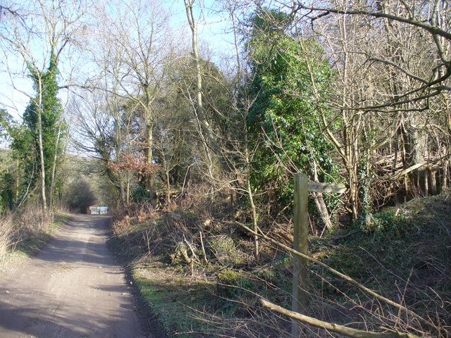
Piney Copse is a picturesque woodland located in Surrey, England. Situated in the southeastern part of the county, it covers an area of approximately 50 acres and is known for its dense population of pine trees, hence the name. The copse is nestled amidst the rolling hills and valleys of the Surrey countryside, providing a serene and tranquil setting for visitors.

The woodland boasts a diverse range of flora and fauna, with a variety of tree species including Scots pine, oak, and birch. The tall, majestic pine trees dominate the landscape, creating a dense canopy that filters sunlight and casts dappled shadows on the forest floor. This unique ecosystem supports a wide array of wildlife, including birds such as woodpeckers, owls, and various songbirds.

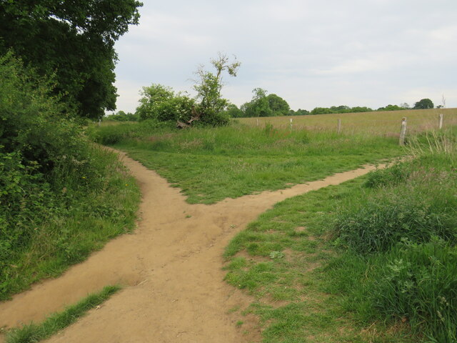
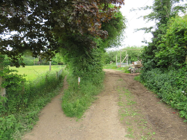
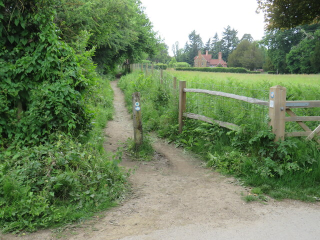
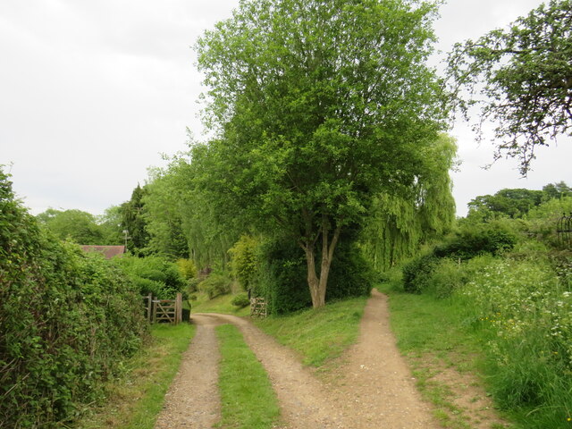
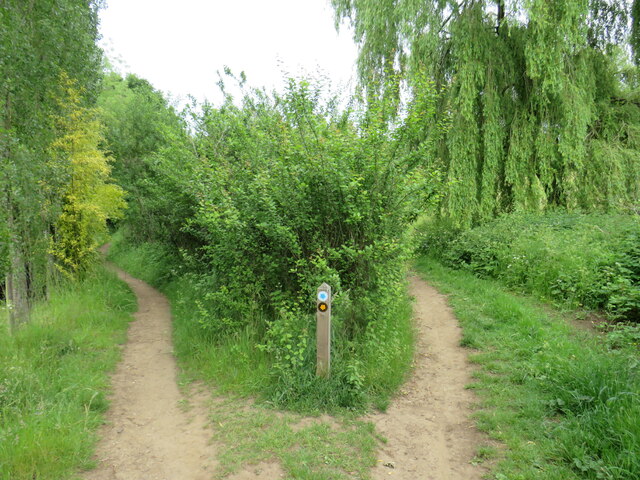
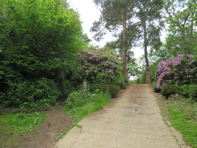
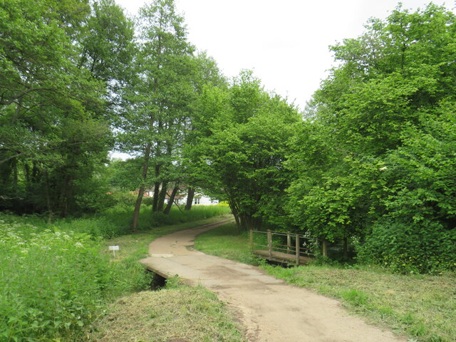
Piney Copse offers a network of well-maintained walking trails, allowing visitors to explore the woodland and immerse themselves in its natural beauty. These pathways meander through the forest, leading to charming clearings and secluded spots, perfect for picnics or simply enjoying the serenity of the surroundings. The copse is a popular destination for nature lovers, hikers, and families seeking a peaceful retreat from the hustle and bustle of daily life.

Managed by the local authorities, Piney Copse provides a valuable habitat for wildlife conservation and is carefully preserved to maintain its ecological balance. It also serves as an important recreational area for the local community, offering a place to unwind, reconnect with nature, and enjoy the beauty of Surrey's woodlands.

If you have any feedback on the listing, please let us know in the comments section below.

Piney Copse Images

Images are sourced within 2km of 51.219287/-0.43499683 or Grid Reference TQ0947. Thanks to Geograph Open Source API. All images are credited.

Paths cross near Shere Two paths cross on a hillside near Shere, in Surrey.  The path which bears left forms part of route 22 of the National Cycle Network.
Paths cross near Shere
Two paths cross on a hillside near Shere, in Surrey. The path which bears left forms part of route 22 of the National Cycle Network.
National Cycle Network route 22 at Gomshall A bridleway used by National Cycle Network route 22 as it enters the village of Gomshall in Surrey.  The small blue sign on the post to the left of the image indicates the cycle route.
National Cycle Network route 22 at Gomshall
A bridleway used by National Cycle Network route 22 as it enters the village of Gomshall in Surrey. The small blue sign on the post to the left of the image indicates the cycle route.
Road junction in Gomshall A junction of minor roads in the Surrey village of Gomshall.  The junction is on route 22 of the National Cycle Network, indicated by the small blue sign attached to the signpost.
Road junction in Gomshall
A junction of minor roads in the Surrey village of Gomshall. The junction is on route 22 of the National Cycle Network, indicated by the small blue sign attached to the signpost.
Railway bridge at Gomshall An arch bridge carries the North Downs Line over a narrow lane in Gomshall.  The sign indicates the maximum height for vehicles passing beneath the bridge is 10 feet 3 inches.

Route 22 of the National Cycle Network passes through the arch.
Railway bridge at Gomshall
An arch bridge carries the North Downs Line over a narrow lane in Gomshall. The sign indicates the maximum height for vehicles passing beneath the bridge is 10 feet 3 inches. Route 22 of the National Cycle Network passes through the arch.
Railway bridge at Gomshall An arch bridge carries the North Downs Line over a narrow lane in Gomshall.

Route 22 of the National Cycle Network passes through the arch.
Railway bridge at Gomshall
An arch bridge carries the North Downs Line over a narrow lane in Gomshall. Route 22 of the National Cycle Network passes through the arch.
Towerhill Farm, Gomshall The track passing through the farm is a public right of way as a bridleway.  It forms part of route 22 of the National Cycle Network.
Towerhill Farm, Gomshall
The track passing through the farm is a public right of way as a bridleway. It forms part of route 22 of the National Cycle Network.
Bridleway and farm track at Gomshall The path to the left is a public bridleway which is on route 22 of the National Cycle Network.  To the right is a farm track.
Bridleway and farm track at Gomshall
The path to the left is a public bridleway which is on route 22 of the National Cycle Network. To the right is a farm track.
Public bridleway, Gomshall A public bridleway at Gomshall in Surrey.  The bridleway is on route 22 of the National Cycle Network.
Public bridleway, Gomshall
A public bridleway at Gomshall in Surrey. The bridleway is on route 22 of the National Cycle Network.
Private driveway and public bridleway, Gomshall A private driveway leading to a house on the left, and a public bridleway to the right.  The bridleway is on route 22 of the National Cycle Network.
Private driveway and public bridleway, Gomshall
A private driveway leading to a house on the left, and a public bridleway to the right. The bridleway is on route 22 of the National Cycle Network.
Paths fork near Gomshall A fork in the path near Gomshall.  The path to the right is a public footpath, while the path to the left is a public bridleway which can be used by horse riders and cyclists as well as walkers.

The bridleway is on route 22 of the National Cycle Network.
Paths fork near Gomshall
A fork in the path near Gomshall. The path to the right is a public footpath, while the path to the left is a public bridleway which can be used by horse riders and cyclists as well as walkers. The bridleway is on route 22 of the National Cycle Network.
Driveway and bridle path near Abinger Hammer A private driveway leading to a house near the village of Abinger Hammer in Surrey.  This image was taken in early June, as the rhododendrons were in bloom.

To the left of the driveway is a public bridleway.  This path forms part of route 22 of the National Cycle Network.
Driveway and bridle path near Abinger Hammer
A private driveway leading to a house near the village of Abinger Hammer in Surrey. This image was taken in early June, as the rhododendrons were in bloom. To the left of the driveway is a public bridleway. This path forms part of route 22 of the National Cycle Network.
Bridge over Tilling Bourne near Abinger Hammer A bridge carries a driveway across Tilling Bourne near the village of Abinger Hammer in Surrey.  The driveway is a public right of way as a bridleway, and forms part of route 22 of the National Cycle Network.
Bridge over Tilling Bourne near Abinger Hammer
A bridge carries a driveway across Tilling Bourne near the village of Abinger Hammer in Surrey. The driveway is a public right of way as a bridleway, and forms part of route 22 of the National Cycle Network.
Rad Lane, Abinger Hammer Rad Lane is a driveway leading to a few houses in the Surrey village of Abinger Hammer.  The lane is a public right of way as a bridleway, and is on route 22 of the National Cycle Network.
Rad Lane, Abinger Hammer
Rad Lane is a driveway leading to a few houses in the Surrey village of Abinger Hammer. The lane is a public right of way as a bridleway, and is on route 22 of the National Cycle Network.
Abinger Hammer The A25 road passing through the Surrey village of Abinger Hammer.

The blue signs towards the right of the image indicate the route taken by route 22 of the National Cycle Network.
Abinger Hammer
The A25 road passing through the Surrey village of Abinger Hammer. The blue signs towards the right of the image indicate the route taken by route 22 of the National Cycle Network.
Hackhurst Lane, Abinger Hammer Hackhurst Lane is a minor road climbing a hillside out of the village of Abinger Hammer.  It is on the route of National Cycle Network route 22 which then turns along the public bridleway to the right.  The blue and red sign attached to the wooden signpost indicates the cycle route.
Hackhurst Lane, Abinger Hammer
Hackhurst Lane is a minor road climbing a hillside out of the village of Abinger Hammer. It is on the route of National Cycle Network route 22 which then turns along the public bridleway to the right. The blue and red sign attached to the wooden signpost indicates the cycle route.
Public bridleway near Abinger Hammer This public bridleway in the North Downs forms part of route 22 of the National Cycle Network.
Public bridleway near Abinger Hammer
This public bridleway in the North Downs forms part of route 22 of the National Cycle Network.
Gate on National Cycle Network route 22 near Abinger Hammer A gate on a public bridleway in the North Downs.  The bridleway forms part of the route of National Cycle Network route 22.
Gate on National Cycle Network route 22 near Abinger Hammer
A gate on a public bridleway in the North Downs. The bridleway forms part of the route of National Cycle Network route 22.
Shere - Gomshall Lane Shere Museum occupies the red brick building while the Village Hall occupies the neighbouring white building.
Shere - Gomshall Lane
Shere Museum occupies the red brick building while the Village Hall occupies the neighbouring white building.
Show me another place!

Piney Copse is located at Grid Ref: TQ0947 (Lat: 51.219287, Lng: -0.43499683)

Administrative County: Surrey

District: Guildford

Police Authority: Surrey

What 3 Words

///snake.oddly.hunt. Near Peaslake, Surrey

Related Wikis

Piney Copse

Piney Copse is 1.7 hectares (4.2 acres) of woodland located approximately 450 metres (1,480 ft) east of Gomshall railway station and north of the Surrey...
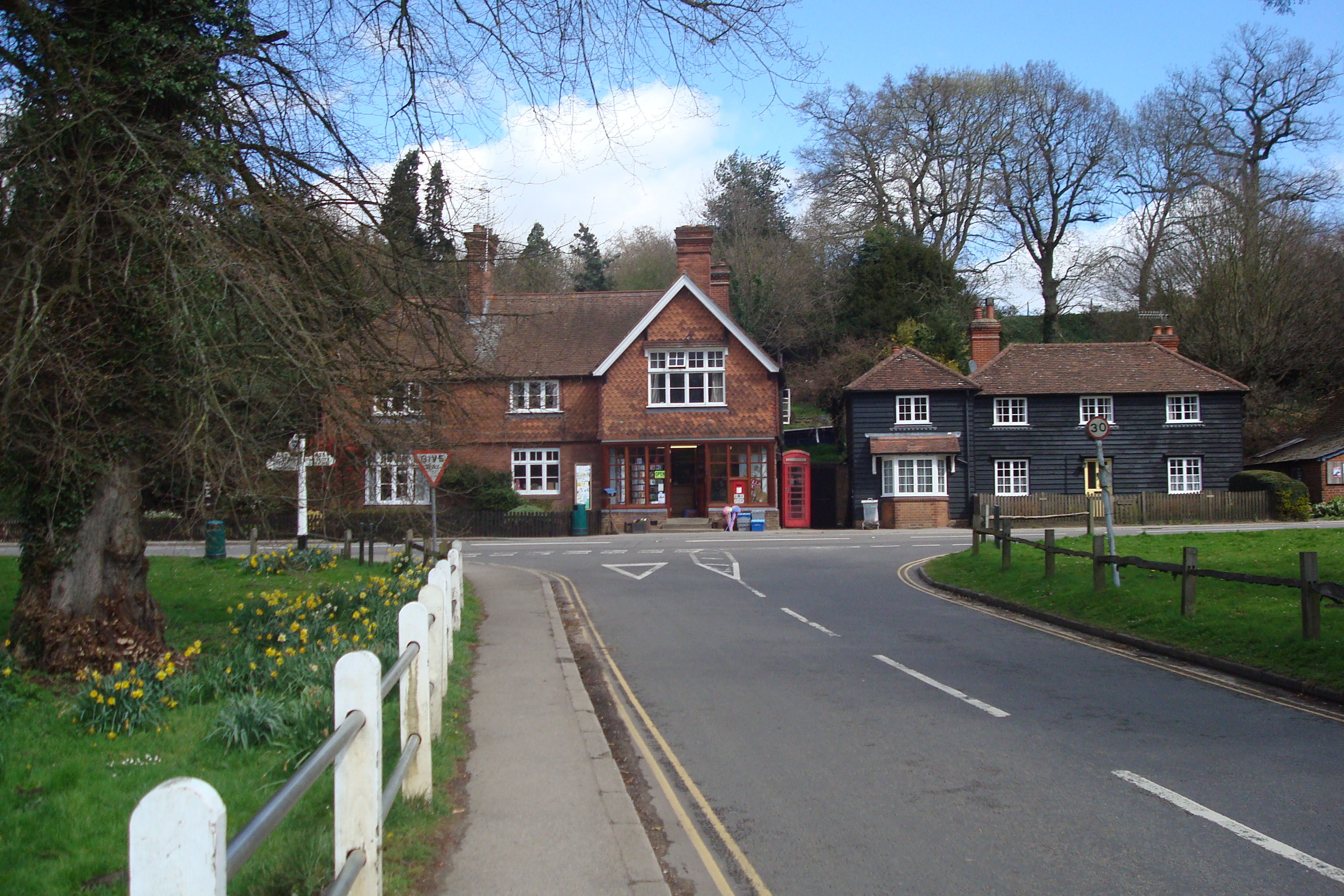
Abinger Hammer

Abinger Hammer is a village in the Vale of Holmesdale, located on the A25 in Surrey, England. The village is located within the Surrey Hills AONB, approximately...

Gomshall railway station

Gomshall railway station serves the village of Gomshall in Surrey, England. The station, and all trains serving it, are operated by Great Western Railway...

Gomshall

Gomshall is a village in the borough of Guildford in Surrey, England.It is on the A25, roughly halfway between Guildford and Dorking, and in Shere civil...
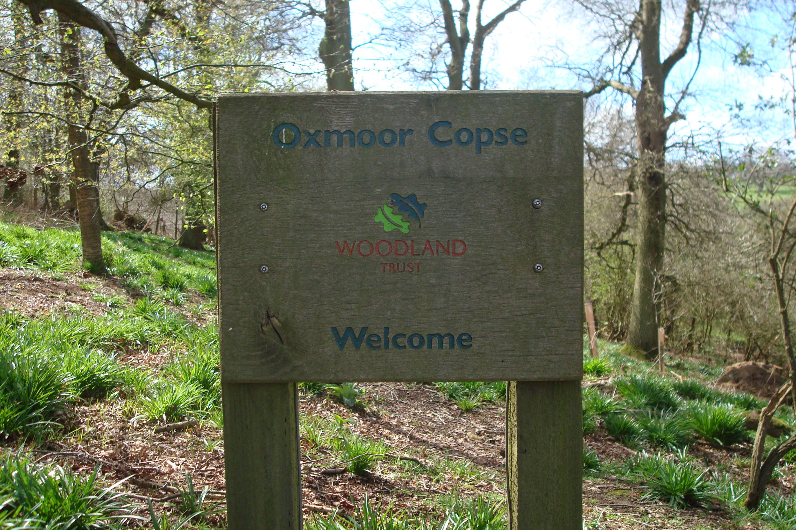
Oxmoor Copse

Oxmoor Copse is just south of the village of Abinger Hammer and to the west of the village of Abinger Common, in Surrey. It is 1.23 hectares (3.0 acres...
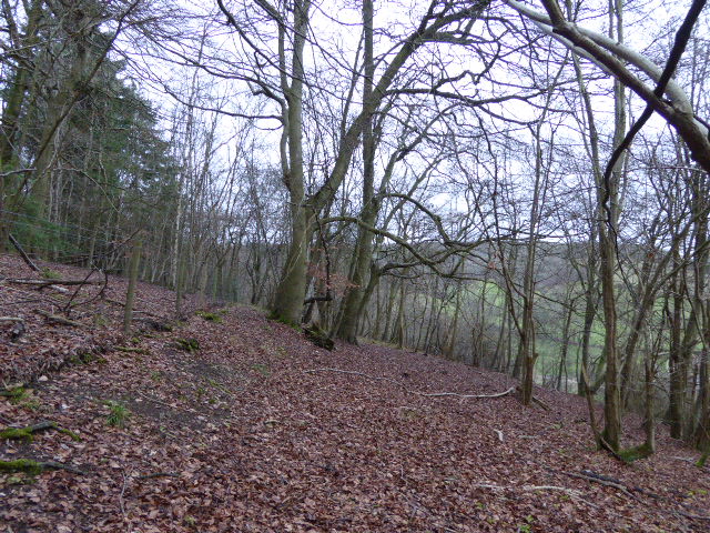
Colekitchen Down

Colekitchen Down is a 3-hectare (7.4-acre) nature reserve north of Gomshall in Surrey. It is managed by the Surrey Wildlife Trust.This sloping area of...

Netley Heath

Netley Heath is an area of woods and heathland in the parish of Shere close to Gomshall in Surrey, England. It is part of a larger geological stratum across...

Upper Common Pits

Upper Common Pits is a 3-hectare (7.4-acre) geological Site of Special Scientific Interest in the north of Gomshall in Surrey. It is a Geological Conservation...

Nearby Amenities

Located within 500m of 51.219287,-0.43499683
Shop: convenience
Lat/Long: 51.2157592/-0.4315115
Hackhurst Farm
Landuse: farm
Note Retag: CS #48756035
Source: npe
Lat/Long: 51.2210949/-0.4301398
The Abinger Arms
Disused Amenity: pub
Lat/Long: 51.216427/-0.4334975
Restaurant
Created By: Potlatch 0.10f
Lat/Long: 51.2175089/-0.4375889
Maxheight: 4.2
Source Bridge: P142-0483
Lat/Long: 51.221129/-0.4351586
Maxheight: 4.2
Source Bridge: P142-0483
Lat/Long: 51.2209728/-0.435184
Tillingbourne Trout Farm and Smokery
Addr City: Abinger Hammer
Addr Country: GB
Addr Postcode: RH5 6SA
Addr Street: Dorking Road
Fhrs Authority: Guildford
Fhrs Id: 649519
Fhrs Local Authority Id: 3275
Sport: fishing
Lat/Long: 51.2168468/-0.4376422
Abinger Hammer Clock
Tourism: attraction
Wheelchair: yes
Wheelchair Description: Above roadway. View from footway.
Lat/Long: 51.2161851/-0.4330119
Bus Stop
Clockhouse
Naptan AtcoCode: 40004408095A
Naptan Bearing: E
Naptan CommonName: Clockhouse
Naptan Indicator: E-bound
Naptan Landmark: Clockhouse
Naptan NaptanCode: surdadpd
Naptan Street: Guildford Road
Naptan Verified: yes
Public Transport: platform
Source: naptan_import
Lat/Long: 51.2158999/-0.4320098
Bus Stop
Clockhouse
Naptan AtcoCode: 40004408095B
Naptan Bearing: W
Naptan CommonName: Clockhouse
Naptan Indicator: W-bound
Naptan Landmark: Clockhouse
Naptan NaptanCode: surdadpg
Naptan Street: Guildford Road
Naptan Verified: yes
Public Transport: platform
Source: naptan_import
Lat/Long: 51.2159496/-0.4325118
Hunters Moon Farm
Place: farm
Source: os_street_view
Lat/Long: 51.2179075/-0.4361155
Old Hatch Farm
Place: farm
Source: os_street_view
Lat/Long: 51.2175607/-0.4355803
Fire Hydrant
Emergency: fire_hydrant
Fire Hydrant Diameter: 100
Fire Hydrant Position: Corner of field 15m east of highway
Fire Hydrant Type: underground
Lat/Long: 51.2191844/-0.4311747
Communication Mobile Phone: yes
Man Made: mast
Tower Type: communication
Lat/Long: 51.2193827/-0.4421643
Man Made: mast
Tower Type: communication
Lat/Long: 51.2196383/-0.4412273
Recycling
Lat/Long: 51.2196705/-0.4415185
Abinger Hammer
Place: village
Wikidata: Q2225649
Lat/Long: 51.2169492/-0.4331841
Cafe
Abinger Hammer Tea Rooms
Lat/Long: 51.2158035/-0.4316164
Bench
Backrest: no
Lat/Long: 51.2190088/-0.4283195
Bicycle Parking
Bicycle Parking: stands
Capacity: 8
Covered: yes
Lat/Long: 51.2193473/-0.4421143
Gomshall
Public Transport: stop_position
Train: yes
Lat/Long: 51.2195352/-0.4413326
Railway: crossing
Lat/Long: 51.2219168/-0.4301746
Railway: crossing
Lat/Long: 51.2218862/-0.4301785
The data included in this document is from www.openstreetmap.org. The data is made available under ODbL.

Have you been to Piney Copse?

Leave your review of Piney Copse below (or comments, questions and feedback).