Edenhall

Settlement in Cumberland Eden

England

Edenhall

Langwathby Village Green -
Langwathby Village Green Credit: David Medcalf

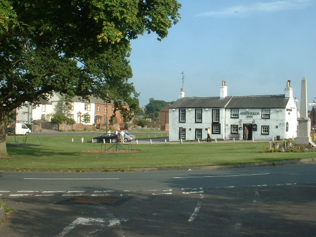
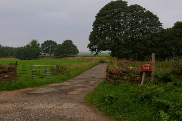
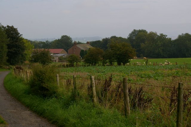
Edenhall is a small village located in the county of Cumberland, in the northwestern region of England. Situated near the River Eden, the village is known for its picturesque setting and historical significance.

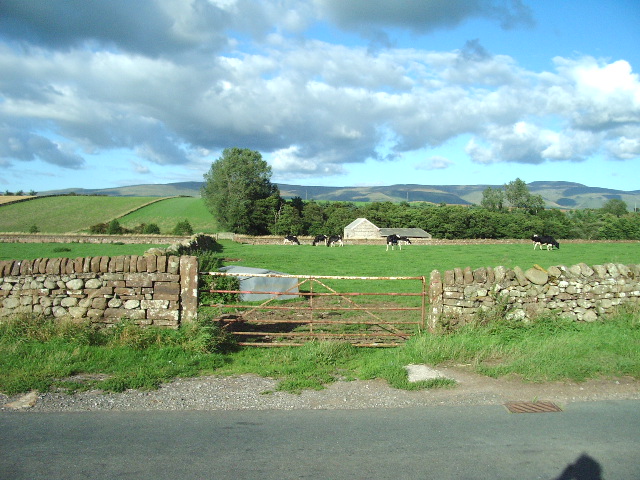
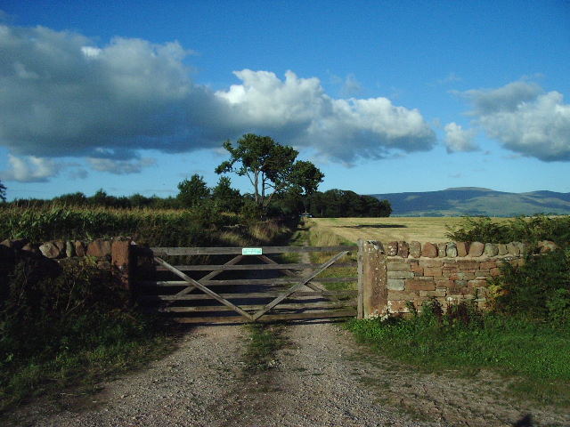
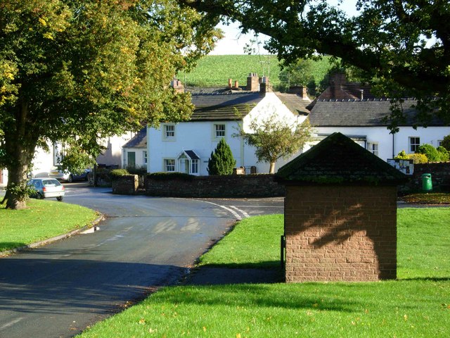
The village of Edenhall is home to a population of around 200 residents. It is characterized by its charming old houses made of local red sandstone, which add to the village's traditional and rustic atmosphere. The surrounding countryside is dominated by rolling green hills and lush farmland, providing a tranquil and idyllic backdrop.

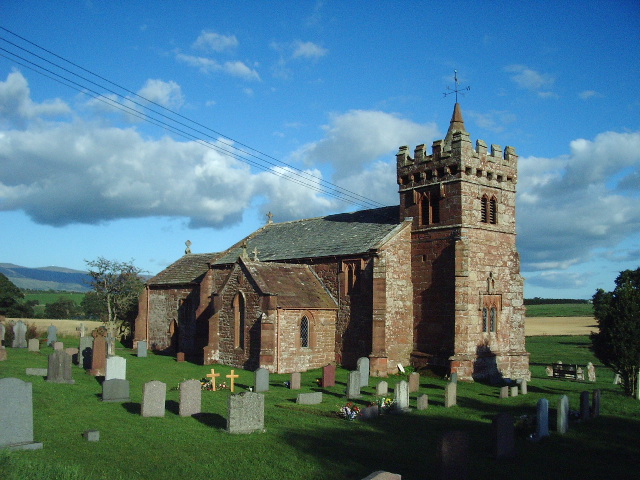
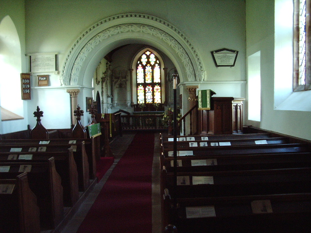
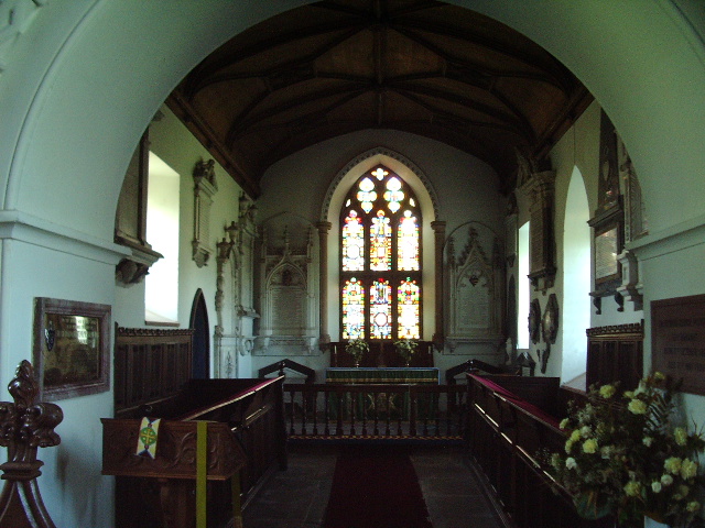
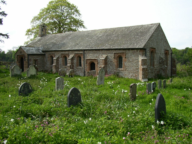
One of the notable landmarks in Edenhall is Edenhall Church, a medieval church that dates back to the 12th century. This beautiful church features stunning stained glass windows and a peaceful churchyard, making it a popular spot for history enthusiasts and visitors seeking a moment of tranquility.

Edenhall is also renowned for its connection to the legend of the Luck of Edenhall. According to folklore, a glass beaker known as the "Luck" was brought to the village by Crusaders in the 14th century. It is said that as long as the glass remains unbroken, the luck will bring good fortune to its owners. Today, the beaker is housed in the Victoria and Albert Museum in London, but the legend remains an important part of Edenhall's heritage.

Overall, Edenhall offers visitors a chance to experience the charm of a traditional English village, with its historical buildings, scenic surroundings, and intriguing folklore.

If you have any feedback on the listing, please let us know in the comments section below.

Edenhall Images

Images are sourced within 2km of 54.684316/-2.678578 or Grid Reference NY5632. Thanks to Geograph Open Source API. All images are credited.

Langwathby Village Green -
Langwathby Village Green
-
Barbary Plains Brick Factory
Sandstone Quarry above Barbary Plains
Langwathby Station with steam train Langwathby station has an excellent cafe called The Brief Encounter and is well worth a visit.
Langwathby Station with steam train
Langwathby station has an excellent cafe called The Brief Encounter and is well worth a visit.
Barn at the Luham
Barn at the Luham
St Cuthbert's Church, Edenhall
Interior of St Cuthbert's Church, Edenhall
Gate According to the sign on the gate you could have an electrifying experience.
Gate
According to the sign on the gate you could have an electrifying experience.
Gate Cross Fell is the high point on the horizon
Gate
Cross Fell is the high point on the horizon
Track Short track off the southside of the Langwathby to Culgaith road
Track
Short track off the southside of the Langwathby to Culgaith road
The Road to Highbarn Cottage
Looking West along A686
Track to Edenhall Grange
Edenhall Grange
Edenhall Grange
Langwathby This attractive Eden Valley village is built round a large green.
Langwathby
This attractive Eden Valley village is built round a large green.
Langwathby Post Office & Stores The village post office and general store is, sadly, a dying breed. This one appears to be thriving, however.
Langwathby Post Office & Stores
The village post office and general store is, sadly, a dying breed. This one appears to be thriving, however.
Show me another place!

Edenhall is located at Grid Ref: NY5632 (Lat: 54.684316, Lng: -2.678578)

Administrative County: Cumbria

District: Eden

Police Authority: Cumbria

What 3 Words

///narrate.worldwide.complains. Near Penrith, Cumbria

Related Wikis

Edenhall

Edenhall is a clustered village and former civil parish, now in the south-west of the parish of Langwathby, 800m to the north in the Westmorland and Furness...

St Cuthbert's Church, Edenhall

St Cuthbert's Church is located near the village of Edenhall, Cumbria, England. It is an active Anglican parish church in the deanery of Penrith, the...

Langwathby

Langwathby is a village and civil parish in northern Cumbria, and in the historic English county of Cumberland, about 5 miles (8 km) north east of Penrith...

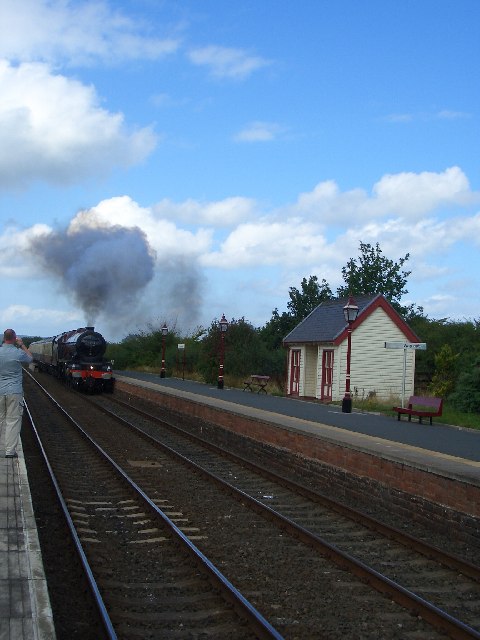
Langwathby railway station

Langwathby is a railway station on the Settle and Carlisle Line, which runs between Carlisle and Leeds via Settle. The station, situated 19 miles 59 chains...

Penrith and The Border (UK Parliament constituency)

Penrith and The Border is a constituency in Cumbria represented in the House of Commons of the UK Parliament since 2019 by Neil Hudson, a Conservative...

Ninekirks

Ninekirks is the local name for St Ninian's church, Brougham, Cumbria. Dedicated to Saint Ninian, it was formerly the Anglican parish church for Brougham...

RAF Hornby Hall

RAF Hornby Hall was a Royal Air Force satellite landing ground located near Brougham, 4 miles (6.4 km) east of Penrith, Cumbria and 8.8 miles (14.2 km...

Little Salkeld railway station

Little Salkeld was a railway station which served the village of Little Salkeld in Hunsonby parish and Great Salkeld, Cumbria, England. The Settle-Carlisle...

Nearby Amenities

Located within 500m of 54.684316,-2.678578
Edenhall
Place: village
Source: NPE
Lat/Long: 54.6849188/-2.6742789
War Memorial (N bound)
Local Ref: AT
Naptan AtcoCode: 090074373951
Naptan Bearing: NE
Naptan BusStopType: CUS
Naptan CommonName: War Memorial (N bound)
Naptan Indicator: at
Naptan Landmark: War Memorial
Naptan NaptanCode: cumdmwjd
Naptan Street: No Name
Naptan Verified: no
Source: naptan_import
Lat/Long: 54.6848915/-2.6758654
Historic: wayside_cross
Lat/Long: 54.6835015/-2.671837
Bus Stop
War Memorial (W bound)
Covered: yes
Local Ref: AT
Naptan AtcoCode: 090074372126
Naptan Bearing: W
Naptan CommonName: War Memorial (W bound)
Naptan Indicator: at
Naptan Landmark: Phonebox
Naptan NaptanCode: cumdapaj
Naptan Street: No name
Naptan Verified: no
Shelter: yes
Source: naptan_import
Lat/Long: 54.6849039/-2.6756255
Historic: memorial
Memorial: war_memorial
Lat/Long: 54.6850629/-2.6757629
Bench
Lat/Long: 54.6851385/-2.6757256
Waste Basket
Lat/Long: 54.6852222/-2.6757209
Public Bookcase
Booth: K6
Disused Amenity: telephone
Man Made: telephone_box
Public Bookcase Type: phone_box
Lat/Long: 54.68493/-2.6755715
Post Box
Post Box Type: wall
Ref: CA11 183
Royal Cypher: GR
Royal Cypher Wikidata: Q33102273
Lat/Long: 54.685051/-2.6755023
Power: pole
Lat/Long: 54.68737/-2.6745021
Power: pole
Lat/Long: 54.6869207/-2.6752199
Power: pole
Lat/Long: 54.6865954/-2.6757105
Power: pole
Lat/Long: 54.6861031/-2.6764601
Power: pole
Lat/Long: 54.6866727/-2.6736016
Power: pole
Lat/Long: 54.6861301/-2.6728668
Power: pole
Lat/Long: 54.6845501/-2.6857036
Power: pole
Lat/Long: 54.6837055/-2.6846587
Power: pole
Lat/Long: 54.6828694/-2.6837519
Power: pole
Lat/Long: 54.682382/-2.685264
Power: pole
Lat/Long: 54.6833225/-2.6823481
Power: pole
Lat/Long: 54.6835631/-2.6815836
Power: pole
Lat/Long: 54.6839007/-2.6806576
Power: pole
Lat/Long: 54.6842432/-2.6797997
Power: pole
Lat/Long: 54.6847208/-2.6786953
Power: pole
Lat/Long: 54.6853223/-2.6777248
The data included in this document is from www.openstreetmap.org. The data is made available under ODbL.

Have you been to Edenhall?

Leave your review of Edenhall below (or comments, questions and feedback).