Edenham

Settlement in Lincolnshire South Kesteven

England

Edenham

Woodland Statue in Bourne Woods Bourne Woods is a mixed area of coniferous plantation and semi-natural broadleaf woodland with public access.  It contains various artworks such as the one depicted here, artist unknown. This particular statue was removed sometime around 2007.
Woodland Statue in Bourne Woods Credit: Tony Atkin

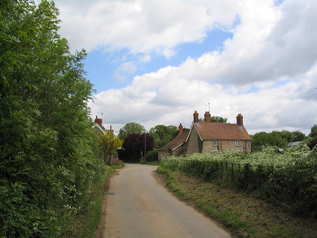
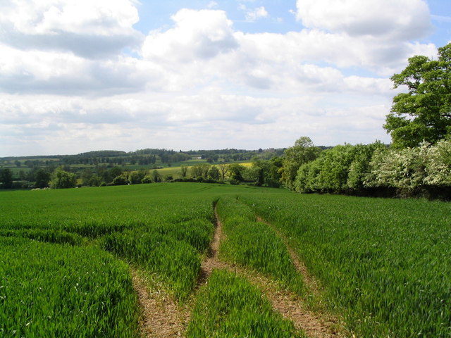
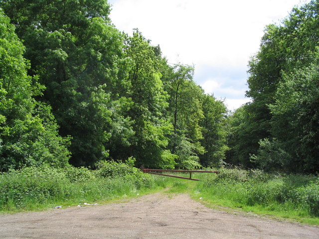
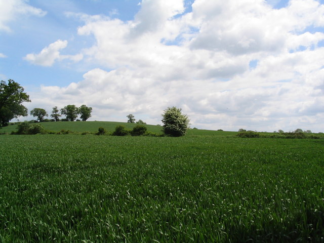
Edenham is a picturesque village located in the South Kesteven district of Lincolnshire, England. Situated about 12 miles south of Grantham, it is set amidst the rolling countryside and offers a tranquil escape from the hustle and bustle of urban life.

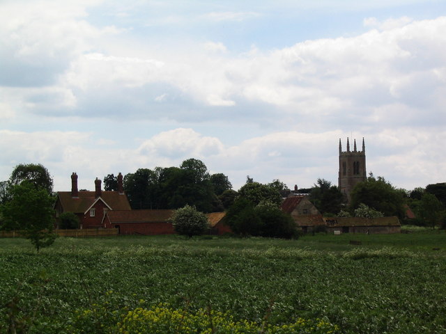
The village is known for its rich history, dating back to the medieval period. It is home to the stunning Edenham Parish Church, dedicated to St. Michael and All Angels, which is a Grade I listed building. This beautiful church features a 13th-century tower and an impressive nave with intricate stained glass windows.

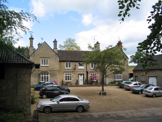
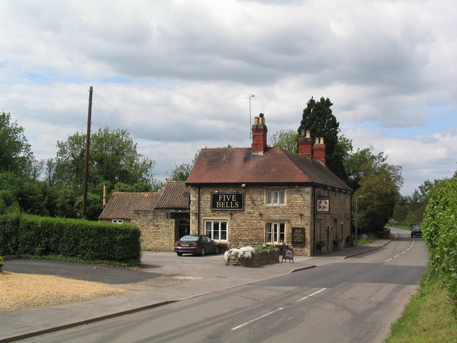
In addition to its historical charm, Edenham boasts a close-knit community and a range of amenities for its residents. The village has a primary school, a village hall, a post office, and a pub, providing essential services and a sense of community spirit.

Nature enthusiasts will find plenty to explore in Edenham, with the nearby Grimsthorpe Castle offering extensive parklands, gardens, and lakes. The castle itself is a magnificent Tudor mansion and is open to the public, allowing visitors to delve into its grand history.

Edenham is also well-positioned for outdoor activities, with numerous walking and cycling trails in the surrounding countryside. The nearby River Glen provides opportunities for fishing and boating, further adding to the village's appeal for nature lovers.

Overall, Edenham is a charming and idyllic village that combines history, natural beauty, and a strong sense of community, making it a delightful place to live or visit in Lincolnshire.

If you have any feedback on the listing, please let us know in the comments section below.
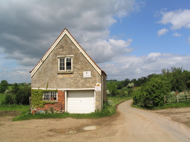
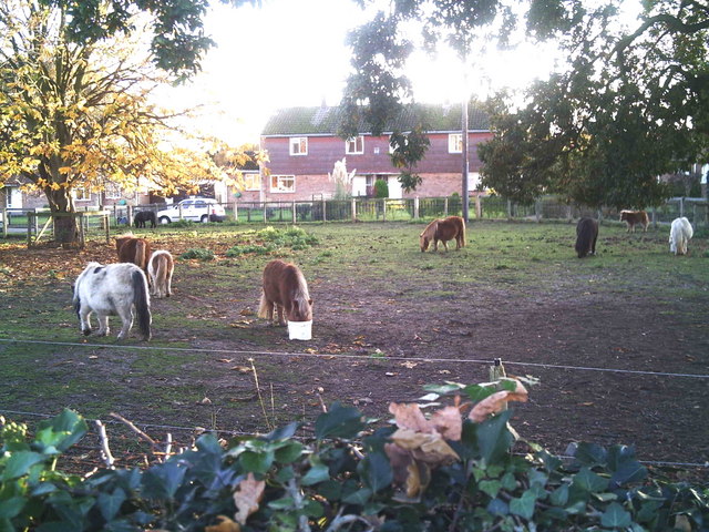
Edenham Images

Images are sourced within 2km of 52.785359/-0.425763 or Grid Reference TF0622. Thanks to Geograph Open Source API. All images are credited.

Woodland Statue in Bourne Woods Bourne Woods is a mixed area of coniferous plantation and semi-natural broadleaf woodland with public access.  It contains various artworks such as the one depicted here, artist unknown. This particular statue was removed sometime around 2007.
Woodland Statue in Bourne Woods
Bourne Woods is a mixed area of coniferous plantation and semi-natural broadleaf woodland with public access. It contains various artworks such as the one depicted here, artist unknown. This particular statue was removed sometime around 2007.
A Woodland Lake, Bourne Wood This is one of two lakes created in the early 1970's.  The glassy appearance is due to melting ice on the surface of the lake.
A Woodland Lake, Bourne Wood
This is one of two lakes created in the early 1970's. The glassy appearance is due to melting ice on the surface of the lake.
In the Woods Midday on Christmas Day 2005.  The weather was overcast and cold but not freezing.  This is Fox Wood, near Bourne.
In the Woods
Midday on Christmas Day 2005. The weather was overcast and cold but not freezing. This is Fox Wood, near Bourne.
Artwork in Bourne Wood Artist unknown.
Artwork in Bourne Wood
Artist unknown.
Wooden Mushrooms in Bourne Wood Artist unknown.
Wooden Mushrooms in Bourne Wood
Artist unknown.
St. Michael, Edenham
The Black Horse, Grimsthorpe Now open for business again
The Black Horse, Grimsthorpe
Now open for business again
Entering Elsthorpe from Grimsthorpe A hamlet of half a dozen houses
Entering Elsthorpe from Grimsthorpe
A hamlet of half a dozen houses
Part of Brook Farm, Elsthorpe
View west from Gunboro Wood Looking towards the valley of the East Glen river (with Grimsthorpe Castle on horizon)
View west from Gunboro Wood
Looking towards the valley of the East Glen river (with Grimsthorpe Castle on horizon)
Entrance to Gunboro Wood One of many woods on the elevated ground bounding the west side of the Fens
Entrance to Gunboro Wood
One of many woods on the elevated ground bounding the west side of the Fens
Barley fields north of Edenham
Edenham from the north
The Five Bells at Edenham
The sewage works at Edenham Which discharges into my dear friend, the East Glen River.
The sewage works at Edenham
Which discharges into my dear friend, the East Glen River.
Estate cottages, Scottlethorpe road
Tumble Row Farm, Scottlethorpe
Shetland ponies in a paddock Shetland ponies.
Shetland ponies in a paddock
Shetland ponies.
Show me another place!

Edenham is located at Grid Ref: TF0622 (Lat: 52.785359, Lng: -0.425763)

Division: Parts of Kesteven

Administrative County: Lincolnshire

District: South Kesteven

Police Authority: Lincolnshire

What 3 Words

///scariest.panther.cycled. Near Bourne, Lincolnshire

Nearby Locations

Edenham

Related Wikis

Edenham

Edenham ( EDD-ən-əm) is a village and civil parish in the South Kesteven district of Lincolnshire, England. It is approximately 3 miles (5 km) north-west...

Edenham railway station

Edenham railway station was a station in Edenham, Lincolnshire. It was the terminus of a four-mile branch line from the Great Northern Railway at Little...

Scottlethorpe

Scottlethorpe is a village in the South Kesteven district of Lincolnshire, England. It is situated approximately 3 miles (4.8 km) north-west from Bourne...

Grimsthorpe

Grimsthorpe is a hamlet in the South Kesteven district of Lincolnshire, England. It is situated on the A151 road, and 3 miles (5 km) north-west from Bourne...

Nearby Amenities

Located within 500m of 52.785359,-0.425763
Edenham
Description: Edenham is a village situated on the A151 Road. The East Glen River flows through the village. Notable features include the St Michael and all Angels church and The Five Bells pub.
Place: village
Population: 291
Population Date: 2011
Source Population: wikipedia
Lat/Long: 52.7838732/-0.4274128
Bus Stop
St Michael & All Angels
Bus: yes
Naptan AtcoCode: 2700LEC02268
Naptan Bearing: SE
Naptan CommonName: St Michael & All Angels
Naptan Indicator: adj
Naptan Landmark: St Michael & All Angels
Naptan NaptanCode: linapmpd
Naptan Street: A151 Main Street
Naptan Verified: no
Public Transport: platform
Source: naptan_import
Lat/Long: 52.7838817/-0.4277496
Bus Stop
St Michael & All Angels
Bus: yes
Naptan AtcoCode: 2700LEMS0668
Naptan Bearing: NW
Naptan CommonName: St Michael & All Angels
Naptan Indicator: opp
Naptan Landmark: St Michael & All Angels
Naptan NaptanCode: linagawp
Naptan Street: A151 Main Street
Naptan Verified: no
Public Transport: platform
Source: naptan_import
Lat/Long: 52.783875/-0.4279277
Barrier: stile
Foot: yes
Lat/Long: 52.7814631/-0.4222063
Pub
The Five Bells
Car Park: yes
Food: yes
Real Ale: Milestone Rich Ruby, Greene King Abbot
Lat/Long: 52.7844821/-0.4287114
Post Box
Colour: red
Operator: Royal Mail
Operator Wikidata: Q638098
Post Box Type: wall
Ref: PE10
Royal Cypher: GR
Royal Cypher Wikidata: Q33102273
Lat/Long: 52.7830147/-0.4271449
Barrier: stile
Ele: 30
Steps: 4
Stile: stepover
Lat/Long: 52.7851018/-0.429244
Barrier: stile
Ele: 29
Steps: 3
Stile: stepover
Lat/Long: 52.7849468/-0.431211
Ele: 29
Lat/Long: 52.7850786/-0.4318104
Copy Lawn Farm
Addr City: Bourne
Addr Country: GB
Addr Housenumber: 74
Addr Postcode: PE10 0LL
Addr Street: Main Street
Addr Suburb: Edenham
Fhrs Authority: South Kesteven
Fhrs Id: 1253452
Fhrs Local Authority Id: 88797
Place: farm
Source: Bing
Lat/Long: 52.7860718/-0.4315899
Mill Leys Farm
Place: farm
Source: Bing
Lat/Long: 52.7856271/-0.425917
Give Way
Direction: forward
Source: Bing
Lat/Long: 52.7853704/-0.4257041
Traffic Signals
Source: Bing; seen on journey
Traffic Signals Direction: backward
Lat/Long: 52.781479/-0.4264515
Traffic Signals
Source: Bing; seen on journey
Traffic Signals Direction: forward
Lat/Long: 52.7820131/-0.4265413
Give Way
Direction: forward
Source: Bing
Lat/Long: 52.7840118/-0.4279355
Give Way
Direction: forward
Source: Bing
Lat/Long: 52.7853419/-0.4255848
Give Way
Direction: backward
Source: Bing
Lat/Long: 52.7854267/-0.4255433
Give Way
Direction: backward
Source: Bing
Lat/Long: 52.7855691/-0.4251355
Give Way
Direction: backward
Source: Bing
Lat/Long: 52.7827931/-0.4267617
Telephone
Booth: K6
Covered: booth
Listed Status: Grade II
Operator: BT
Operator Wikidata: Q593786
Phone: +44 1778 591243
Lat/Long: 52.7825562/-0.4268683
Edenham
Historic Railway: station
Railway: site
Wikidata: Q5336997
Wikipedia: en:Edenham railway station
Lat/Long: 52.7859673/-0.4321396
Power: pole
Lat/Long: 52.7846871/-0.4320175
Power: pole
Lat/Long: 52.7840658/-0.4310975
Power: pole
Lat/Long: 52.7834013/-0.430024
Power: pole
Lat/Long: 52.7859962/-0.4330099
Power: pole
Lat/Long: 52.7819846/-0.4292523
The data included in this document is from www.openstreetmap.org. The data is made available under ODbL.

Have you been to Edenham?

Leave your review of Edenham below (or comments, questions and feedback).