Eachway

Settlement in Worcestershire Bromsgrove

England

Eachway

Art Deco building, 1730 Bristol Road South One of the commercial premises on the south side of the A38, with a distinctly 1920s Art Deco look to it. There is an OS benchmark cut into the brickwork low on the 'tower'
Art Deco building, 1730 Bristol Road South Credit: Richard Law

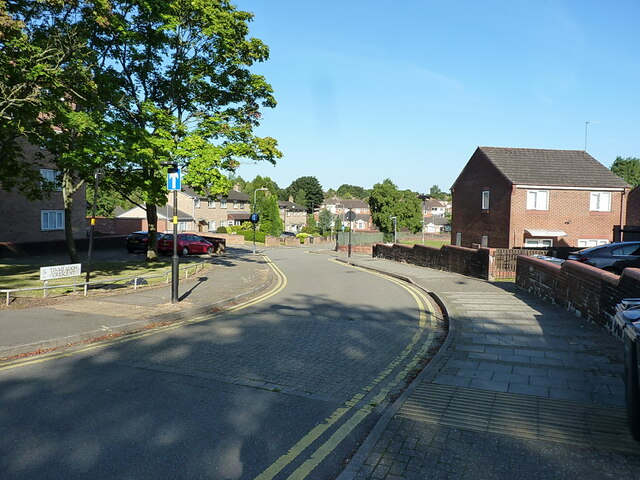
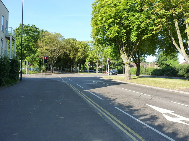
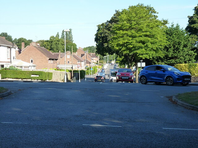
Eachway is a small village located in the county of Worcestershire, England. Situated just a few miles southwest of the town of Redditch, it forms part of the Bromsgrove district. The village is nestled in a picturesque rural setting, surrounded by rolling hills and lush green fields.

Eachway is known for its tranquil and peaceful atmosphere, offering residents and visitors a respite from the hustle and bustle of city life. The village is primarily residential, with a small population of around 500 people. The houses in Eachway are predominantly traditional, reflecting the village's long-standing history.

Despite its small size, Eachway benefits from a close-knit community spirit. The village has a local pub, The Eachway Inn, which serves as a gathering place for locals and visitors alike. The inn offers a cozy atmosphere, traditional pub food, and a selection of beverages.

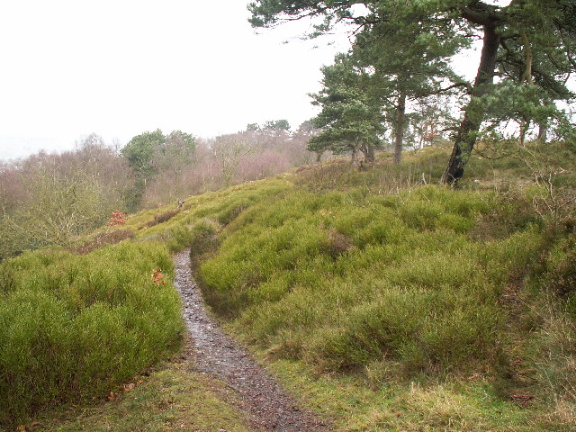
Nature enthusiasts will find plenty to explore in the surrounding area. Eachway is located near several nature reserves and walking trails, providing opportunities for outdoor activities such as hiking and birdwatching.

For amenities and services, residents rely on nearby towns and villages, such as Redditch or Bromsgrove, which offer a wider range of facilities including schools, shops, and healthcare.

In summary, Eachway is a charming village in Worcestershire, offering a peaceful and idyllic setting for those seeking a rural lifestyle. Its close-knit community, traditional architecture, and proximity to nature make it an attractive place to live or visit.

If you have any feedback on the listing, please let us know in the comments section below.
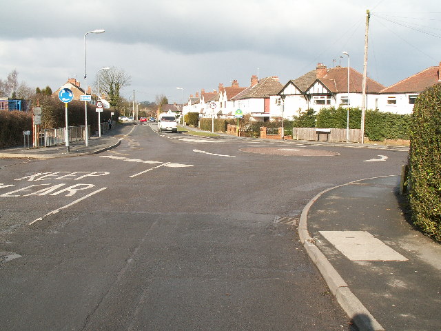
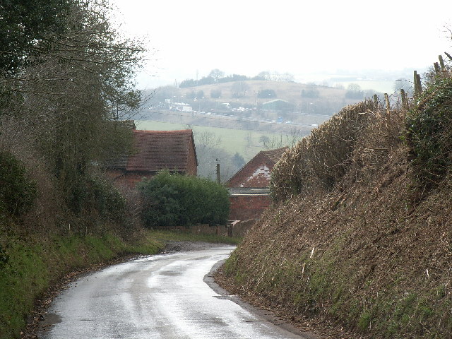
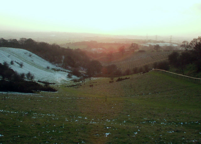
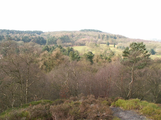
Eachway Images

Images are sourced within 2km of 52.388294/-2.019511 or Grid Reference SO9876. Thanks to Geograph Open Source API. All images are credited.

Art Deco building, 1730 Bristol Road South One of the commercial premises on the south side of the A38, with a distinctly 1920s Art Deco look to it. There is an OS benchmark cut into the brickwork low on the 'tower'
Art Deco building, 1730 Bristol Road South
One of the commercial premises on the south side of the A38, with a distinctly 1920s Art Deco look to it. There is an OS benchmark cut into the brickwork low on the 'tower'
OS benchmark - Longbridge, 1730 Bristol Rd South An OS cutmark on the 'tower' part of <a href="https://www.geograph.org.uk/photo/7423346">SP0077 : Art Deco building, 1730 Bristol Road South</a>, which was last levelled by the OS in 1956 at 180.146m above Ordnance Datum Newlyn.
OS benchmark - Longbridge, 1730 Bristol Rd South
An OS cutmark on the 'tower' part of SP0077 : Art Deco building, 1730 Bristol Road South, which was last levelled by the OS in 1956 at 180.146m above Ordnance Datum Newlyn.
Longbridge Methodist Church Located just off the main A38 Bristol Road South.
Longbridge Methodist Church
Located just off the main A38 Bristol Road South.
Houses west of the former motor works A view down the intriguingly named Tinmeadow Crescent.
Houses west of the former motor works
A view down the intriguingly named Tinmeadow Crescent.
Lowhill Lane junction on the A4120 Lickey Road
Traffic emerging from Edgewood Road Cars coming out onto the Lickey Road from Edgewood Road in Rednal.
Traffic emerging from Edgewood Road
Cars coming out onto the Lickey Road from Edgewood Road in Rednal.
View to Birmingham View to the city of Birmingham from Cofton Hill in the Lickey Hills.
View to Birmingham
View to the city of Birmingham from Cofton Hill in the Lickey Hills.
View from Bilberry Hill towards Beacon Hill Bilberry Hill is in the Lickey Hills Country Park. Together with its neighbours the hill is composed of Lickey Quartzite, one of the oldest rocks in the region. The Lickey Hills include some of the largest areas of bilberry and heather in the county. The hill in the distance is Beacon Hill. The open area in between is a golf course.
View from Bilberry Hill towards Beacon Hill
Bilberry Hill is in the Lickey Hills Country Park. Together with its neighbours the hill is composed of Lickey Quartzite, one of the oldest rocks in the region. The Lickey Hills include some of the largest areas of bilberry and heather in the county. The hill in the distance is Beacon Hill. The open area in between is a golf course.
Rednal Hill Rednal Hill was presented to the City of Birmingham in 1888 by the Birmingham Association for the Preservation of Open Spaces. Together with land donated by the Cadbury family it forms the Lickey Hills Country Park.
Rednal Hill
Rednal Hill was presented to the City of Birmingham in 1888 by the Birmingham Association for the Preservation of Open Spaces. Together with land donated by the Cadbury family it forms the Lickey Hills Country Park.
Toposcope, Beacon Hill The toposcope on Beacon Hill (298m) was constructed in 1923 after Beacon Hill was donated to the City of Birmingham by the Cadbury family. The toposcope was restored in 1988. From this viewpoint on a good day 13 old counties can be seen. Going east from the summit there is no higher land at the same latitude until you reach the Ural Mountains in Russia (I've checked this using Google Earth).
Toposcope, Beacon Hill
The toposcope on Beacon Hill (298m) was constructed in 1923 after Beacon Hill was donated to the City of Birmingham by the Cadbury family. The toposcope was restored in 1988. From this viewpoint on a good day 13 old counties can be seen. Going east from the summit there is no higher land at the same latitude until you reach the Ural Mountains in Russia (I've checked this using Google Earth).
Beacon Hill Looking south-west towards the car park from near the toposcope.
Beacon Hill
Looking south-west towards the car park from near the toposcope.
Road junction , Rubery The junction of School Road, Gannow Road and Gunner Lane in the south west corner of the square, looking north east. Waseley Hills High School and Holywell Junior School are just to the left of the picture.
Road junction , Rubery
The junction of School Road, Gannow Road and Gunner Lane in the south west corner of the square, looking north east. Waseley Hills High School and Holywell Junior School are just to the left of the picture.
Redhill Lane Looking south west towards Redhill Farm. The M5 motorway can be seen climbing up towards junction 4.
Redhill Lane
Looking south west towards Redhill Farm. The M5 motorway can be seen climbing up towards junction 4.
View south west from Windmill Hill, Waseley Hills Country Park Looking down a small valley from the footpath below the summit of the hill, late on a winter afternoon
View south west from Windmill Hill, Waseley Hills Country Park
Looking down a small valley from the footpath below the summit of the hill, late on a winter afternoon
Camera Man Outside Longbridge Motorworks
The parcel office of Austin seen over the rubble
Austin Rover Factory at Longbridge
Will this part of MG Rover be standing much longer?
Show me another place!

Eachway is located at Grid Ref: SO9876 (Lat: 52.388294, Lng: -2.019511)

Administrative County: Worcestershire

District: Bromsgrove

Police Authority: West Mercia

What 3 Words

///caller.toward.human. Near Barnt Green, Worcestershire

Related Wikis

Rubery

Rubery is a village in the Bromsgrove District and a suburb of Birmingham in the counties of Worcestershire and West Midlands, England. It is 9 miles...

St Chad's Church, Rubery

St Chad’s Church, Rubery is a Church of England parish church in Rubery, Worcestershire. == History == The church evolved in 1895 as a mission church from...

Waseley Hills High School and Sixth Form Centre

Waseley Hills High School and Sixth Form Centre is a mixed secondary school and sixth form with academy status in the town of Rubery, on the border of...

Rubery Hill Hospital

Rubery Hill Hospital was a mental health facility in Birmingham, England. The Chapel, which still survives, is a Grade II listed building. == History... ==

Lickey Hills Country Park

Lickey Hills Country Park is a country park in England. It is 10 miles (16 kilometres) south west of Birmingham and 24 miles (39 kilometres) north east...

Lickey Hills

The Lickey Hills (known locally as simply The Lickeys) are a range of hills in Worcestershire, England, 11 miles (18 km) to the south-west of the centre...

Bilberry Hill

Bilberry Hill is one of the Lickey Hills in northern Worcestershire, England, 10.3 miles (16.6 kilometres) south west of Birmingham and 24 miles (39 kilometres...

Colmers School

Colmers School is a coeducational secondary school and sixth form located in the Rednal area of Birmingham, in the West Midlands of England.Previously...

Nearby Amenities

Located within 500m of 52.388294,-2.019511
Turning Circle
Source: Bing
Lat/Long: 52.3902412/-2.0164191
Barrier: bollard
Lat/Long: 52.3860486/-2.0164603
Post Box
Operator: Royal Mail
Operator Wikidata: Q638098
Ref: B45 199
Source: survey
Lat/Long: 52.3901801/-2.0253679
Turning Circle
Source: bing
Lat/Long: 52.3917551/-2.0217619
Shop: convenience
Source: survey
Lat/Long: 52.3886054/-2.0154436
Post Office
Rubery Post Office
Addr City: Birmingham
Addr Housenumber: 126
Addr Postcode: B45 9HY
Addr Street: New Road
Addr Village: Rubery
Brand: Post Office
Brand Wikidata: Q1783168
Opening Hours: Mo-Fr 08:30-17:30; Sa 08:30-15:30
Ref Pol Id: 13608
Source: survey
Website: https://www.postoffice.co.uk/branch-finder/3532011/rubery
Lat/Long: 52.3926464/-2.0207244
Pharmacy
Healthcare: pharmacy
Source: survey
Lat/Long: 52.392472/-2.0210171
Post Box
Post Box Type: pillar
Ref: B45 192
Source: survey
Lat/Long: 52.392701/-2.0207711
Telephone
Booth: K6
Covered: booth
Source: survey
Lat/Long: 52.3926918/-2.0208228
Nightclub
Rubery & Rednal Royal British Legion Club
Addr City: Birmingham
Addr Housenumber: 64
Addr Postcode: B45 9HY
Addr Street: New Road
Source: survey
Website: https://www.ruberybritishlegion.com/
Lat/Long: 52.3917145/-2.0238389
Bus Stop
Whetty Lane / Birch Rd
Bus: yes
Naptan AtcoCode: 43000392001
Naptan Bearing: E
Naptan BusStopType: MKD
Naptan CommonName: Birch Rd
Naptan NaptanCode: nwmtpdgj
Naptan Status: ACT
Naptan StopType: BCT
Naptan Street: WHETTY LANE
Naptan Towards: Longbridge
Naptan Verified: no
Public Transport: platform
Route Ref: 144;202
Source: WMCA
Lat/Long: 52.3913106/-2.0249228
Bus Stop
Post Office
Bus: yes
Naptan AtcoCode: 2000G323039
Naptan Bearing: SW
Naptan CommonName: Post Office
Naptan Indicator: Adj
Naptan Landmark: Post Office
Naptan NaptanCode: wocdwpga
Naptan Street: New Road
Naptan Verified: no
Public Transport: platform
Source: naptan_import
Lat/Long: 52.3924823/-2.0218638
Post Box
Ref: B45 95
Source: GPS Survey
Lat/Long: 52.3894919/-2.0178313
Restaurant
Bano Phool
Addr City: Birmingham
Addr Housenumber: 116-118
Addr Postcode: B45 9HY
Addr Street: New Road
Cuisine: indian
Opening Hours: Mo-Th, Su 17:30-23:30; Fr-Sa 17:30-24:00
Lat/Long: 52.3926126/-2.0208973
Your Move
Addr City: Birmingham
Addr Housenumber: 128
Addr Postcode: B45 9HY
Addr Street: New Road
Brand: Your Move
Brand Wikidata: Q81078416
Office: estate_agent
Lat/Long: 52.3926747/-2.0206288
David Bunn & Co Solicitors
Addr City: Birmingham
Addr Housenumber: 120
Addr Postcode: B45 9HY
Addr Street: New Road
Office: lawyer
Website: http://davidbunnandco.co.uk/
Lat/Long: 52.392633/-2.0208047
Arden
Addr City: Birmingham
Addr Housenumber: 112
Addr Postcode: B45 9HY
Addr Street: New Road
Office: estate_agent
Opening Hours: Mo-Fr 09:00-17:30; Sa 09:00-16:00
Website: https://www.ardenestates.co.uk/
Lat/Long: 52.3925942/-2.0209903
Pharmacy
Knights Rubery Pharmacy
Addr City: Birmingham
Addr Housenumber: 102
Addr Postcode: B45 9HY
Addr Street: New Road
Dispensing: yes
Drive Through: no
Healthcare: pharmacy
Opening Hours: Mo,Tu,Th,Fr 08:45-18:15; We 08:45-18:00; Sa 09:00-13:00
Lat/Long: 52.3923361/-2.0221199
Renaissance Art of Hair
Addr City: Birmingham
Addr Housenumber: 100
Addr Postcode: B45 9HY
Addr Street: New Road
Opening Hours: Tu,Th,Fr 09:00-17:30; We 09:00-19:00; Sa 09:00-16:30
Shop: hairdresser
Website: http://www.renaissance-art-of-hair.co.uk/
Lat/Long: 52.3923155/-2.0222125
Richardz Dance & Fitness
Addr City: Birmingham
Addr Housenumber: 98
Addr Postcode: B45 9HY
Addr Street: New Road
Dance Teaching: yes
Leisure: dance
Website: https://www.richardzdance.com/
Lat/Long: 52.3921554/-2.0222638
Generator Method: photovoltaic
Generator Output Electricity: yes
Generator Source: solar
Generator Type: solar_photovoltaic_panel
Location: roof
Power: generator
Lat/Long: 52.3883956/-2.01579
Generator Method: photovoltaic
Generator Output Electricity: yes
Generator Source: solar
Generator Type: solar_photovoltaic_panel
Location: roof
Power: generator
Lat/Long: 52.3875673/-2.0160744
Generator Method: photovoltaic
Generator Output Electricity: yes
Generator Source: solar
Generator Type: solar_photovoltaic_panel
Location: roof
Power: generator
Lat/Long: 52.3869632/-2.0172948
Fast Food
The Ruby
Addr Housenumber: 115
Addr Postcode: B45 9JR
Addr Street: New Road
Opening Hours: Mo-Sa 17:00-23:30
Phone: +44 121 453 8283
Lat/Long: 52.392627/-2.0208537
Generator Method: photovoltaic
Generator Output Electricity: yes
Generator Source: solar
Generator Type: solar_photovoltaic_panel
Location: roof
Power: generator
Lat/Long: 52.3910195/-2.0190516
Generator Method: photovoltaic
Generator Output Electricity: yes
Generator Source: solar
Generator Type: solar_photovoltaic_panel
Location: roof
Power: generator
Lat/Long: 52.3906873/-2.0204356
Generator Method: photovoltaic
Generator Output Electricity: yes
Generator Source: solar
Generator Type: solar_photovoltaic_panel
Location: roof
Power: generator
Lat/Long: 52.3892607/-2.0223092
Generator Method: photovoltaic
Generator Output Electricity: yes
Generator Source: solar
Generator Type: solar_photovoltaic_panel
Location: roof
Power: generator
Lat/Long: 52.3913461/-2.017618
Generator Method: photovoltaic
Generator Output Electricity: yes
Generator Source: solar
Generator Type: solar_photovoltaic_panel
Location: roof
Power: generator
Lat/Long: 52.3890544/-2.0147453
Generator Method: photovoltaic
Generator Output Electricity: yes
Generator Source: solar
Generator Type: solar_photovoltaic_panel
Location: roof
Power: generator
Lat/Long: 52.3871105/-2.0187566
Generator Method: photovoltaic
Generator Output Electricity: yes
Generator Source: solar
Generator Type: solar_photovoltaic_panel
Location: roof
Power: generator
Lat/Long: 52.3871375/-2.0187056
Generator Method: photovoltaic
Generator Output Electricity: yes
Generator Source: solar
Generator Type: solar_photovoltaic_panel
Location: roof
Power: generator
Lat/Long: 52.3904041/-2.0136336
Generator Method: photovoltaic
Generator Output Electricity: yes
Generator Source: solar
Generator Type: solar_photovoltaic_panel
Location: roof
Power: generator
Lat/Long: 52.3904098/-2.0135464
Generator Method: photovoltaic
Generator Output Electricity: yes
Generator Source: solar
Generator Type: solar_photovoltaic_panel
Location: roof
Power: generator
Lat/Long: 52.3910457/-2.0137167
The data included in this document is from www.openstreetmap.org. The data is made available under ODbL.

Have you been to Eachway?

Leave your review of Eachway below (or comments, questions and feedback).