Whetty Coppice

Wood, Forest in Worcestershire Bromsgrove

England

Whetty Coppice

Art Deco building, 1730 Bristol Road South One of the commercial premises on the south side of the A38, with a distinctly 1920s Art Deco look to it. There is an OS benchmark cut into the brickwork low on the 'tower'
Art Deco building, 1730 Bristol Road South Credit: Richard Law

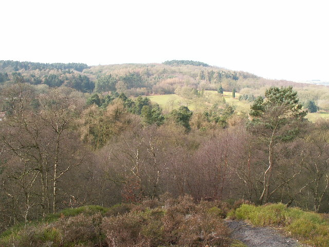
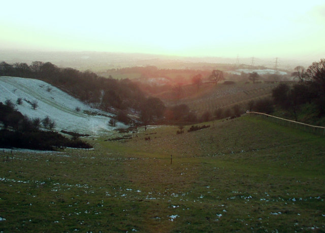
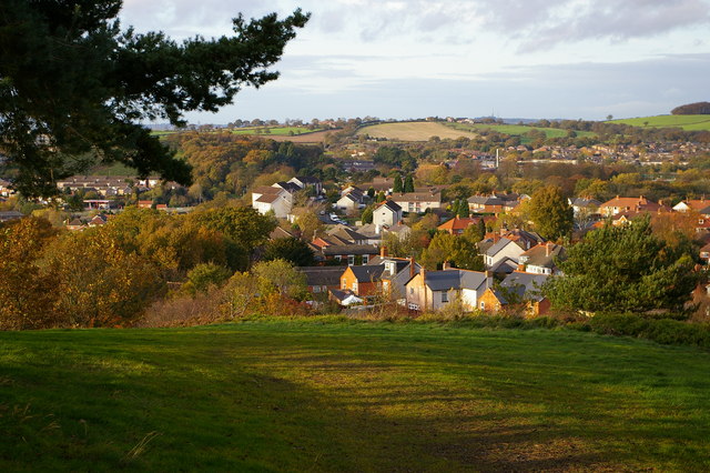
Whetty Coppice is a woodland area located in Worcestershire, England. Situated near the village of Whetty, the coppice covers an area of approximately 50 acres. It is known for its diverse range of tree species and its natural beauty.

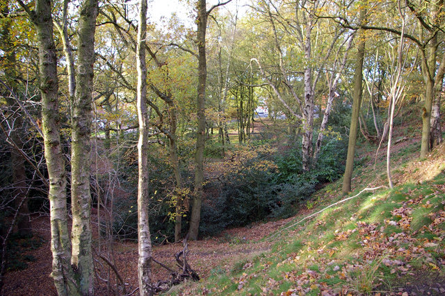
The woodland primarily consists of deciduous trees, including oak, beech, and ash. These trees provide a rich habitat for various wildlife species, such as deer, squirrels, and a wide variety of bird species. In spring, the coppice is adorned with a colorful display of wildflowers, including bluebells and primroses.

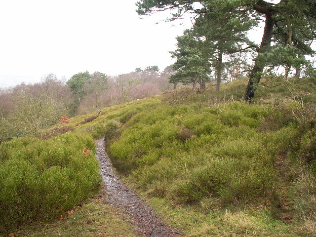
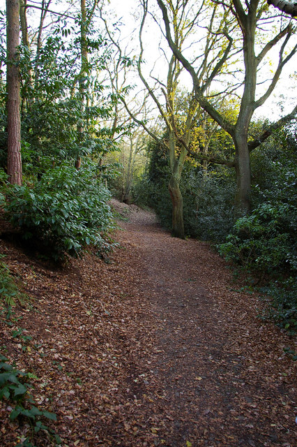
Whetty Coppice is managed by the local council, which ensures that the woodland is well-maintained and accessible to visitors. There are several walking trails that wind through the forest, allowing visitors to explore its natural wonders. The trails are suitable for all ages and fitness levels, making it a popular destination for families and nature enthusiasts alike.

The woodland also offers educational opportunities, with information boards placed along the trails to provide visitors with insights into the local flora and fauna. Additionally, there are picnic areas where visitors can relax and enjoy the serene surroundings.

Whetty Coppice is a peaceful retreat, providing a welcome escape from the hustle and bustle of everyday life. Its tranquil ambiance and stunning scenery make it a perfect place for hiking, birdwatching, or simply immersing oneself in nature.

If you have any feedback on the listing, please let us know in the comments section below.

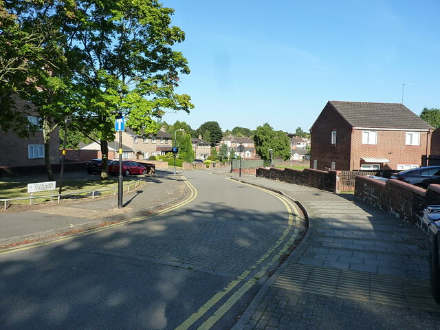
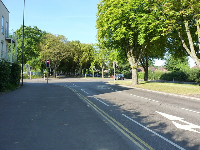
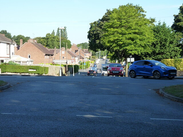
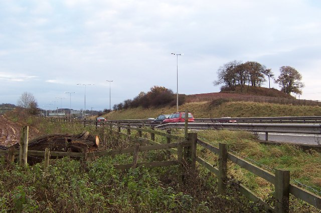
Whetty Coppice Images

Images are sourced within 2km of 52.39068/-2.0237459 or Grid Reference SO9876. Thanks to Geograph Open Source API. All images are credited.

Art Deco building, 1730 Bristol Road South One of the commercial premises on the south side of the A38, with a distinctly 1920s Art Deco look to it. There is an OS benchmark cut into the brickwork low on the 'tower'
Art Deco building, 1730 Bristol Road South
One of the commercial premises on the south side of the A38, with a distinctly 1920s Art Deco look to it. There is an OS benchmark cut into the brickwork low on the 'tower'
OS benchmark - Longbridge, 1730 Bristol Rd South An OS cutmark on the 'tower' part of <a href="https://www.geograph.org.uk/photo/7423346">SP0077 : Art Deco building, 1730 Bristol Road South</a>, which was last levelled by the OS in 1956 at 180.146m above Ordnance Datum Newlyn.
OS benchmark - Longbridge, 1730 Bristol Rd South
An OS cutmark on the 'tower' part of SP0077 : Art Deco building, 1730 Bristol Road South, which was last levelled by the OS in 1956 at 180.146m above Ordnance Datum Newlyn.
Longbridge Methodist Church Located just off the main A38 Bristol Road South.
Longbridge Methodist Church
Located just off the main A38 Bristol Road South.
Houses west of the former motor works A view down the intriguingly named Tinmeadow Crescent.
Houses west of the former motor works
A view down the intriguingly named Tinmeadow Crescent.
Lowhill Lane junction on the A4120 Lickey Road
Traffic emerging from Edgewood Road Cars coming out onto the Lickey Road from Edgewood Road in Rednal.
Traffic emerging from Edgewood Road
Cars coming out onto the Lickey Road from Edgewood Road in Rednal.
The M5 skirts a hillock Seen from the lane that leads to Chadwich Grange.
The M5 skirts a hillock
Seen from the lane that leads to Chadwich Grange.
View from Bilberry Hill towards Beacon Hill Bilberry Hill is in the Lickey Hills Country Park. Together with its neighbours the hill is composed of Lickey Quartzite, one of the oldest rocks in the region. The Lickey Hills include some of the largest areas of bilberry and heather in the county. The hill in the distance is Beacon Hill. The open area in between is a golf course.
View from Bilberry Hill towards Beacon Hill
Bilberry Hill is in the Lickey Hills Country Park. Together with its neighbours the hill is composed of Lickey Quartzite, one of the oldest rocks in the region. The Lickey Hills include some of the largest areas of bilberry and heather in the county. The hill in the distance is Beacon Hill. The open area in between is a golf course.
Rednal Hill Rednal Hill was presented to the City of Birmingham in 1888 by the Birmingham Association for the Preservation of Open Spaces. Together with land donated by the Cadbury family it forms the Lickey Hills Country Park.
Rednal Hill
Rednal Hill was presented to the City of Birmingham in 1888 by the Birmingham Association for the Preservation of Open Spaces. Together with land donated by the Cadbury family it forms the Lickey Hills Country Park.
Toposcope, Beacon Hill The toposcope on Beacon Hill (298m) was constructed in 1923 after Beacon Hill was donated to the City of Birmingham by the Cadbury family. The toposcope was restored in 1988. From this viewpoint on a good day 13 old counties can be seen. Going east from the summit there is no higher land at the same latitude until you reach the Ural Mountains in Russia (I've checked this using Google Earth).
Toposcope, Beacon Hill
The toposcope on Beacon Hill (298m) was constructed in 1923 after Beacon Hill was donated to the City of Birmingham by the Cadbury family. The toposcope was restored in 1988. From this viewpoint on a good day 13 old counties can be seen. Going east from the summit there is no higher land at the same latitude until you reach the Ural Mountains in Russia (I've checked this using Google Earth).
Beacon Hill Looking south-west towards the car park from near the toposcope.
Beacon Hill
Looking south-west towards the car park from near the toposcope.
Road junction , Rubery The junction of School Road, Gannow Road and Gunner Lane in the south west corner of the square, looking north east. Waseley Hills High School and Holywell Junior School are just to the left of the picture.
Road junction , Rubery
The junction of School Road, Gannow Road and Gunner Lane in the south west corner of the square, looking north east. Waseley Hills High School and Holywell Junior School are just to the left of the picture.
Redhill Lane Looking south west towards Redhill Farm. The M5 motorway can be seen climbing up towards junction 4.
Redhill Lane
Looking south west towards Redhill Farm. The M5 motorway can be seen climbing up towards junction 4.
View south west from Windmill Hill, Waseley Hills Country Park Looking down a small valley from the footpath below the summit of the hill, late on a winter afternoon
View south west from Windmill Hill, Waseley Hills Country Park
Looking down a small valley from the footpath below the summit of the hill, late on a winter afternoon
Life in the slow lane Monday morning rush hour on the M5 just past junction 4 heading north
Life in the slow lane
Monday morning rush hour on the M5 just past junction 4 heading north
Rednal Hill, looking towards Rubery Looking out across leafy suburbia
Rednal Hill, looking towards Rubery
Looking out across leafy suburbia
Woodland on north west end of Rednal Hill
Bridleway below south western slope of Rednal Hill
Show me another place!

Whetty Coppice is located at Grid Ref: SO9876 (Lat: 52.39068, Lng: -2.0237459)

Administrative County: Worcestershire

District: Bromsgrove

Police Authority: West Mercia

What 3 Words

///raced.bumpy.lifts. Near Barnt Green, Worcestershire

Related Wikis

Rubery

Rubery is a village in the Bromsgrove District and a suburb of Birmingham in the counties of Worcestershire and West Midlands, England. It is 9 miles...

St Chad's Church, Rubery

St Chad’s Church, Rubery is a Church of England parish church in Rubery, Worcestershire. == History == The church evolved in 1895 as a mission church from...

Waseley Hills High School and Sixth Form Centre

Waseley Hills High School and Sixth Form Centre is a mixed secondary school and sixth form with academy status in the town of Rubery, on the border of...

Rubery Hill Hospital

Rubery Hill Hospital was a mental health facility in Birmingham, England. The Chapel, which still survives, is a Grade II listed building. == History... ==

New Frankley

New Frankley in Birmingham is a civil parish in Birmingham, England. As such, it has its own parish council. == History == It was established in 2000 in...

Rubery railway station

Rubery railway station was a railway station in Rubery, Birmingham, England, on the Great Western Railway and Midland Railway's joint Halesowen Railway...

King Edward VI Balaam Wood Academy

King Edward VI Balaam Wood Academy is a coeducational secondary school located in the New Frankley area of Birmingham, West Midlands, England.The school...

Colmers School

Colmers School is a coeducational secondary school and sixth form located in the Rednal area of Birmingham, in the West Midlands of England.Previously...

Related Videos

Early Morning Forest Walk - Virtual Scenery For Treadmill Workout - Walking Through English Woods

Walking in the woods early on a peaceful summer morning in central England - 45 minute video by Chris PT for home cardio ...

Walking In Rain In The Woods With Umbrella - Virtual Forest Walk Video - 1 Hour 45 Minutes

Virtual rain walk video - peaceful hike through a misty forest in the summer rain on scenic hill trails. Beautiful rainy day hiking ...

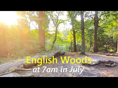
English Forest Walk - Virtual Scenery For Treadmill Workout - Walking Through The Woods

Long hike in the woods at 7am on a peaceful summer morning in central England, UK - 1 hour 30 minute video for home cardio ...

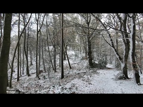
Heavy Snow Falling UK November 2021! Walking Into Snowy Woods Near Birmingham

After Storm Arwen it's still snowing for this virtual morning walk through countryside & forest in central England. With the strong ...

Nearby Amenities

Located within 500m of 52.39068,-2.0237459
Mini Roundabout
Direction: clockwise
Lat/Long: 52.3915766/-2.0300549
Motorway Junction
Lat/Long: 52.3938827/-2.0207067
Turning Circle
Source: Bing
Lat/Long: 52.3902412/-2.0164191
Post Box
Operator: Royal Mail
Operator Wikidata: Q638098
Ref: B45 199
Source: survey
Lat/Long: 52.3901801/-2.0253679
Turning Circle
Source: bing
Lat/Long: 52.3917551/-2.0217619
Library
Rubery Library
Addr City: Birmingham
Addr Housenumber: 7
Addr Postcode: B45 9JS
Addr Street: Library Way
Internet Access: yes
Opening Hours: Mo,Tu,Fr 09:30-17:00; Th 09:30-18:00; Sa 10:00-14:00
Lat/Long: 52.3926713/-2.0227443
Post Office
Rubery Post Office
Addr City: Birmingham
Addr Housenumber: 126
Addr Postcode: B45 9HY
Addr Street: New Road
Addr Village: Rubery
Brand: Post Office
Brand Wikidata: Q1783168
Opening Hours: Mo-Fr 08:30-17:30; Sa 08:30-15:30
Ref Pol Id: 13608
Source: survey
Website: https://www.postoffice.co.uk/branch-finder/3532011/rubery
Lat/Long: 52.3926464/-2.0207244
Pharmacy
Healthcare: pharmacy
Source: survey
Lat/Long: 52.392472/-2.0210171
Fast Food
Crystal
Addr City: Birmingham
Addr Housenumber: 150
Addr Postcode: B45 9JA
Addr Street: New Road
Cuisine: chinese
Drive Through: no
Outdoor Seating: no
Source: survey
Takeaway: yes
Lat/Long: 52.3929178/-2.0198204
Restaurant
Massala
Addr City: Birmingham
Addr Housenumber: 123
Addr Postcode: B45 9JR
Addr Street: New Road
Cuisine: bangladeshi
Lat/Long: 52.3930353/-2.0207229
Fast Food
The Ruby
Source: survey
Lat/Long: 52.3929778/-2.0209491
Fast Food
Sea Queen Fish Bar
Source: survey
Lat/Long: 52.3929375/-2.0210667
Post Box
Post Box Type: pillar
Ref: B45 192
Source: survey
Lat/Long: 52.392701/-2.0207711
Telephone
Booth: K6
Covered: booth
Source: survey
Lat/Long: 52.3926918/-2.0208228
Fast Food
Balti Hut
Source: survey
Lat/Long: 52.3925523/-2.0220256
Nightclub
Rubery & Rednal Royal British Legion Club
Addr City: Birmingham
Addr Housenumber: 64
Addr Postcode: B45 9HY
Addr Street: New Road
Source: survey
Website: https://www.ruberybritishlegion.com/
Lat/Long: 52.3917145/-2.0238389
Rubery Social Club
Addr Postcode: B45 9JW
Club: yes
Source: survey
Website: https://www.ruberysocialclub.co.uk/
Lat/Long: 52.3933339/-2.0198797
Fast Food
Café Licious
Source: survey
Website: http://cafe-licious.com/
Lat/Long: 52.3934684/-2.0193964
Costcutter
Addr City: Birmingham
Addr Housenumber: 149
Addr Postcode: B45 9JW
Addr Street: New Road
Brand: Costcutter
Brand Wikidata: Q5175072
Brand Wikipedia: en:Costcutter
Contact Website: https://store-locator.costcutter.co.uk/costcutter-406abe92ef22
Opening Hours: Mo-Sa 08:30-21:00; Su 10:00-16:00
Shop: supermarket
Source: survey
Lat/Long: 52.3935185/-2.0192178
Bus Stop
Bus: yes
Public Transport: platform
Shelter: yes
Source: survey
Lat/Long: 52.3932474/-2.0189479
Motorway Junction
Lat/Long: 52.3904248/-2.0283631
Post Box
Operator: Royal Mail
Operator Wikidata: Q638098
Ref: B45 368
Lat/Long: 52.3904833/-2.028945
Turning Circle
Lat/Long: 52.3924913/-2.0253628
Post Box
Operator: Royal Mail
Operator Wikidata: Q638098
Ref: B45 249
Lat/Long: 52.3940227/-2.0240739
Bus Stop
School Rd / Waseley Hills School
Bus: yes
Naptan AtcoCode: 43000391902
Naptan Bearing: S
Naptan BusStopType: MKD
Naptan CommonName: Waseley Hills School
Naptan Indicator: adj
Naptan NaptanCode: nwmtpdgd
Naptan Status: ACT
Naptan StopType: BCT
Naptan Street: SCHOOL RD
Naptan Towards: Rubery
Naptan Verified: no
Public Transport: platform
Route Ref: 202
Source: WMCA
Lat/Long: 52.3911182/-2.0300952
Bus Stop
Whetty Lane / Birch Rd
Bus: yes
Naptan AtcoCode: 43000392001
Naptan Bearing: E
Naptan BusStopType: MKD
Naptan CommonName: Birch Rd
Naptan NaptanCode: nwmtpdgj
Naptan Status: ACT
Naptan StopType: BCT
Naptan Street: WHETTY LANE
Naptan Towards: Longbridge
Naptan Verified: no
Public Transport: platform
Route Ref: 144;202
Source: WMCA
Lat/Long: 52.3913106/-2.0249228
Bus Stop
Whetty Lane / Birch Rd
Bus: yes
Naptan AtcoCode: 43000392002
Naptan Bearing: SW
Naptan BusStopType: MKD
Naptan CommonName: Birch Rd
Naptan Indicator: after
Naptan Landmark: Whetty Coppice
Naptan NaptanCode: nwmtpdgm
Naptan Status: ACT
Naptan StopType: BCT
Naptan Street: WHETTY LANE
Naptan Towards: Bromsgrove
Naptan Verified: no
Public Transport: platform
Route Ref: 144;202
Source: WMCA
Lat/Long: 52.390739/-2.0264206
Bus Stop
St. Chads Church
Bus: yes
Naptan AtcoCode: 2000G021801
Naptan Bearing: N
Naptan CommonName: St. Chads Church
Naptan Indicator: opp
Naptan Landmark: St Chads Church
Naptan NaptanCode: wocdmjta
Naptan Street: New Road
Naptan Verified: no
Public Transport: platform
Source: naptan_import
Lat/Long: 52.3932781/-2.0195746
Bus Stop
Old Plough Inn
Bus: yes
Naptan AtcoCode: 2000G323035
Naptan Bearing: NW
Naptan CommonName: Old Plough Inn
Naptan Indicator: Opp
Naptan Landmark: Old Plough Inn
Naptan NaptanCode: wocdwpdm
Naptan Street: Gannow Road
Naptan Verified: no
Public Transport: platform
Source: naptan_import
Lat/Long: 52.390911/-2.0286627
Bus Stop
Post Office
Bus: yes
Naptan AtcoCode: 2000G323039
Naptan Bearing: SW
Naptan CommonName: Post Office
Naptan Indicator: Adj
Naptan Landmark: Post Office
Naptan NaptanCode: wocdwpga
Naptan Street: New Road
Naptan Verified: no
Public Transport: platform
Source: naptan_import
Lat/Long: 52.3924823/-2.0218638
Bus Stop
Post Office
Bus: yes
Naptan AtcoCode: 2000G323040
Naptan Bearing: NE
Naptan CommonName: Post Office
Naptan Indicator: opp
Naptan Landmark: Post Office
Naptan NaptanCode: wocdwpgd
Naptan Street: New Road
Naptan Verified: no
Public Transport: platform
Source: naptan_import
Lat/Long: 52.3923965/-2.0227337
Fixme: continue
Lat/Long: 52.394606/-2.0214282
Post Box
Ref: B45 95
Source: GPS Survey
Lat/Long: 52.3894919/-2.0178313
Turning Circle
Lat/Long: 52.3918655/-2.0279763
Restaurant
Bano Phool
Addr City: Birmingham
Addr Housenumber: 116-118
Addr Postcode: B45 9HY
Addr Street: New Road
Cuisine: indian
Opening Hours: Mo-Th, Su 17:30-23:30; Fr-Sa 17:30-24:00
Lat/Long: 52.3926126/-2.0208973
Doctors
Cornhill Surgery
Addr City: Birmingham
Addr Housenumber: 65
Addr Postcode: B45 9JT
Addr Street: New Road
Healthcare: doctor
Opening Hours: Mo,We-Fr 08:00-18:00; Tu 06:45-18:00
Phone: +44 121 4533591
Website: https://www.cornhillsurgery.com/
Lat/Long: 52.3922704/-2.0234024
Bank
Lloyds Bank
Addr City: Birmingham
Addr Country: GB
Addr Housenumber: 138
Addr Postcode: B45 9JA
Addr Street: New Road
Atm: yes
Brand: Lloyds Bank
Brand Wikidata: Q1152847
Brand Wikipedia: en:Lloyds Bank
Contact Website: https://branches.lloydsbank.com/rubery/138-new-road
Drive Through: no
Opening Hours: Mo,Tu,Th,Fr 09:00-16:30; We 09:30-16:30
Operator: Lloyds Banking Group PLC
Lat/Long: 52.3928385/-2.0201068
Bank
Barclays
Addr City: Birmingham
Addr Housenumber: 156/158
Addr Postcode: B45 9JA
Addr Street: New Road
Atm: yes
Brand: Barclays
Brand Wikidata: Q245343
Brand Wikipedia: en:Barclays
Drive Through: no
Opening Hours: Mo,Tu,Th,Fr 09:30-16:30; We 10:00-16:30
Lat/Long: 52.392974/-2.0196325
Fast Food
Tino's Pizza
Addr City: Birmingham
Addr Housenumber: 170
Addr Postcode: B45 9JA
Addr Street: New Road
Delivery: yes
Drive Through: no
Opening Hours: Mo,We,Th,Sa,Su 16:00-23:45; Tu 16:00-23:50; Fr 16:00-22:30
Outdoor Seating: no
Takeaway: yes
Website: https://lovetinos.co.uk/
Lat/Long: 52.3932674/-2.0177214
School Rd / Waseley Hills School
Naptan AtcoCode: 43000391901
Naptan Bearing: N
Naptan BusStopType: CUS
Naptan CommonName: Waseley Hills School
Naptan NaptanCode: nwmtpdga
Naptan Status: ACT
Naptan StopType: BCT
Naptan Street: SCHOOL RD
Naptan Towards: Frankley
Route Ref: 202
Source: WMCA
Lat/Long: 52.3910666/-2.0303733
Bus Stop
Barrington Rd / Gunner Lane
Bus: yes
Naptan AtcoCode: 43000391801
Naptan Bearing: N
Naptan BusStopType: CUS
Naptan CommonName: Gunner Lane
Naptan NaptanCode: nwmtpdat
Naptan Status: ACT
Naptan StopType: BCT
Naptan Street: BARRINGTON RD
Naptan Towards: Frankley
Public Transport: platform
Route Ref: 202
Source: WMCA
Lat/Long: 52.3921063/-2.0303567
Fire Hydrant
Emergency: fire_hydrant
Fire Hydrant Type: underground
Source: survey
Lat/Long: 52.3898983/-2.0305771
Fast Food
Gerry's
Addr City: Birmingham
Addr Housenumber: 161
Addr Postcode: B45 9JW
Addr Street: New Road
Cuisine: fish_and_chips
Drive Through: no
Lat/Long: 52.3937449/-2.0183738
Williams Optometrists
Addr City: Birmingham
Addr Housenumber: 161
Addr Postcode: B45 9JW
Addr Street: New Road
Healthcare: optometrist
Opening Hours: Mo-Fr 09:00-17:30; Sa 09:00-13:00
Lat/Long: 52.3937209/-2.0184652
MAL Connections
Addr City: Birmingham
Addr Housenumber: 159
Addr Postcode: B45 9JW
Addr Street: New Road
Craft: electronics_repair
Lat/Long: 52.3936956/-2.0185672
William Hill
Addr City: Birmingham
Addr Postcode: B45 9JW
Addr Street: New Road
Brand: William Hill
Brand Wikidata: Q4053147
Brand Wikipedia: en:William Hill (bookmaker)
Shop: bookmaker
Lat/Long: 52.3936784/-2.0186195
WiseMove
Addr City: Birmingham
Addr Housenumber: 155
Addr Postcode: B45 9JW
Addr Street: New Road
Office: estate_agent
Lat/Long: 52.3936178/-2.0188569
PDSA
Addr City: Birmingham
Addr Housenumber: 151
Addr Postcode: B45 9JP
Addr Street: New Road
Brand: PDSA
Brand Wikidata: Q7165541
Brand Wikipedia: en:People's Dispensary for Sick Animals
Shop: charity
Lat/Long: 52.3935698/-2.019022
Footesy's
Shop: hairdresser
Lat/Long: 52.3933672/-2.0195012
Gordon Jones & Co
Addr City: Birmingham
Addr Housenumber: 137
Addr Postcode: B45 9JR
Addr Street: New Road
Office: estate_agent
Website: http://gordonjonessolicitors.co.uk/
Lat/Long: 52.3932082/-2.0201057
Robinson Opticians
Addr City: Birmingham
Addr Housenumber: 135
Addr Postcode: B45 9JR
Addr Street: New Road
Opening Hours: Mo-Sa 09:00-17:00
Shop: optician
Website: https://robinsonopticians.co.uk/
Lat/Long: 52.3931531/-2.0202862
Star Treatment
Addr City: Birmingham
Addr Housenumber: 133
Addr Postcode: B45 9JR
Addr Street: New Road
Opening Hours: Tu-Th 09:30-19:30; Fr 09:30-19:00; Sa 09:30-17:30
Shop: beauty
Website: https://www.startreatmentbeauty.co.uk/
Lat/Long: 52.3931216/-2.0203839
Dark Arts Tattoos
Addr City: Birmingham
Addr Housenumber: 131
Addr Postcode: B45 9JR
Addr Street: New Road
Shop: tattoo
Website: http://www.darkartstattoos.com/
Lat/Long: 52.3930962/-2.020484
Fast Food
American Hut
Addr City: Birmingham
Addr Housenumber: 129
Addr Postcode: B45 9JR
Addr Street: New Road
Cuisine: pizza
Delivery: yes
Drive Through: no
Opening Hours: Tu-Su 15:30-00:00
Takeaway: yes
Website: https://americanhutpizza.com/
Lat/Long: 52.3930809/-2.0205528
Scissor Stitch
Addr City: Birmingham
Addr Housenumber: 127
Addr Postcode: B45 9JR
Addr Street: New Road
Shop: clothes
Website: https://scissorstitch.co.uk/
Lat/Long: 52.3930677/-2.0206098
Fast Food
James Fast Food
Addr City: Birmingham
Addr Housenumber: 160
Addr Postcode: B45 9JA
Addr Street: New Road
Delivery: yes
Drive Through: no
Opening Hours: Mo-Th 14:00-02:00, Fr-Su 15:00-02:30
Outdoor Seating: no
Takeaway: yes
Website: https://jamesfastfood.co.uk/
Lat/Long: 52.3930172/-2.0195016
Police
Rubery Police Station
Addr City: Birmingham
Addr Housenumber: 164
Addr Postcode: B45 9JA
Addr Street: New Road
Lat/Long: 52.3933634/-2.0180563
The Cake Miller
Addr City: Birmingham
Addr Housenumber: 125
Addr Postcode: B45 9JR
Addr Street: New Road
Craft: caterer
Cuisine: cake
Website: https://thecakemiller.co.uk/
Lat/Long: 52.3930502/-2.0206739
Hair Studio
Addr City: Birmingham
Addr Housenumber: 121
Addr Postcode: B45 9JR
Addr Street: New Road
Shop: hairdresser
Lat/Long: 52.3930084/-2.0208269
Dentist
Dentist
Addr City: Birmingham
Addr Housenumber: 119
Addr Postcode: B45 9JR
Addr Street: New Road
Healthcare: dentist
Operator: Rubery Dental Surgery Ltd
Lat/Long: 52.3929957/-2.0208794
Your Move
Addr City: Birmingham
Addr Housenumber: 128
Addr Postcode: B45 9HY
Addr Street: New Road
Brand: Your Move
Brand Wikidata: Q81078416
Office: estate_agent
Lat/Long: 52.3926747/-2.0206288
David Bunn & Co Solicitors
Addr City: Birmingham
Addr Housenumber: 120
Addr Postcode: B45 9HY
Addr Street: New Road
Office: lawyer
Website: http://davidbunnandco.co.uk/
Lat/Long: 52.392633/-2.0208047
Arden
Addr City: Birmingham
Addr Housenumber: 112
Addr Postcode: B45 9HY
Addr Street: New Road
Office: estate_agent
Opening Hours: Mo-Fr 09:00-17:30; Sa 09:00-16:00
Website: https://www.ardenestates.co.uk/
Lat/Long: 52.3925942/-2.0209903
Pharmacy
Knights Rubery Pharmacy
Addr City: Birmingham
Addr Housenumber: 102
Addr Postcode: B45 9HY
Addr Street: New Road
Dispensing: yes
Drive Through: no
Healthcare: pharmacy
Opening Hours: Mo,Tu,Th,Fr 08:45-18:15; We 08:45-18:00; Sa 09:00-13:00
Lat/Long: 52.3923361/-2.0221199
Renaissance Art of Hair
Addr City: Birmingham
Addr Housenumber: 100
Addr Postcode: B45 9HY
Addr Street: New Road
Opening Hours: Tu,Th,Fr 09:00-17:30; We 09:00-19:00; Sa 09:00-16:30
Shop: hairdresser
Website: http://www.renaissance-art-of-hair.co.uk/
Lat/Long: 52.3923155/-2.0222125
Richardz Dance & Fitness
Addr City: Birmingham
Addr Housenumber: 98
Addr Postcode: B45 9HY
Addr Street: New Road
Dance Teaching: yes
Leisure: dance
Website: https://www.richardzdance.com/
Lat/Long: 52.3921554/-2.0222638
Crossing
Crossing: uncontrolled
Source: bing
Lat/Long: 52.3926327/-2.0215353
Fast Food
The Ruby
Addr Housenumber: 115
Addr Postcode: B45 9JR
Addr Street: New Road
Opening Hours: Mo-Sa 17:00-23:30
Phone: +44 121 453 8283
Lat/Long: 52.392627/-2.0208537
Generator Method: photovoltaic
Generator Output Electricity: yes
Generator Source: solar
Generator Type: solar_photovoltaic_panel
Location: roof
Power: generator
Lat/Long: 52.3929625/-2.0263284
Generator Method: photovoltaic
Generator Output Electricity: yes
Generator Source: solar
Generator Type: solar_photovoltaic_panel
Location: roof
Power: generator
Lat/Long: 52.3921367/-2.0269239
Generator Method: photovoltaic
Generator Output Electricity: yes
Generator Source: solar
Generator Type: solar_photovoltaic_panel
Location: roof
Power: generator
Lat/Long: 52.3913003/-2.0296316
Generator Method: photovoltaic
Generator Output Electricity: yes
Generator Source: solar
Generator Type: solar_photovoltaic_panel
Location: roof
Power: generator
Lat/Long: 52.3908452/-2.0306803
Generator Method: photovoltaic
Generator Output Electricity: yes
Generator Source: solar
Generator Type: solar_photovoltaic_panel
Location: roof
Power: generator
Lat/Long: 52.3903091/-2.0292681
Generator Method: photovoltaic
Generator Output Electricity: yes
Generator Source: solar
Generator Type: solar_photovoltaic_panel
Location: roof
Power: generator
Lat/Long: 52.3908248/-2.0282221
Generator Method: photovoltaic
Generator Output Electricity: yes
Generator Source: solar
Generator Type: solar_photovoltaic_panel
Location: roof
Power: generator
Lat/Long: 52.3926367/-2.0252918
Generator Method: photovoltaic
Generator Output Electricity: yes
Generator Source: solar
Generator Type: solar_photovoltaic_panel
Location: roof
Power: generator
Lat/Long: 52.3910195/-2.0190516
Generator Method: photovoltaic
Generator Output Electricity: yes
Generator Source: solar
Generator Type: solar_photovoltaic_panel
Location: roof
Power: generator
Lat/Long: 52.3906873/-2.0204356
Generator Method: photovoltaic
Generator Output Electricity: yes
Generator Source: solar
Generator Type: solar_photovoltaic_panel
Location: roof
Power: generator
Lat/Long: 52.3892607/-2.0223092
Generator Method: photovoltaic
Generator Output Electricity: yes
Generator Source: solar
Generator Type: solar_photovoltaic_panel
Location: roof
Power: generator
Lat/Long: 52.3913461/-2.017618
Generator Method: photovoltaic
Generator Output Electricity: yes
Generator Source: solar
Generator Type: solar_photovoltaic_panel
Location: roof
Power: generator
Lat/Long: 52.3910359/-2.0290616
Camera Mount: pole
Camera Type: dome
Man Made: surveillance
Surveillance Type: camera
Surveillance Zone: town
Lat/Long: 52.3927969/-2.0204015
Barrier: cycle_barrier
Lat/Long: 52.3932277/-2.0189938
Man Made: tower
Tower Type: bell_tower
Lat/Long: 52.3930801/-2.0188727
Motorway Junction
Lat/Long: 52.3908937/-2.0270818
Give Way
Direction: forward
Lat/Long: 52.3942549/-2.0206722
Give Way
Direction: backward
Lat/Long: 52.390511/-2.0269899
Crossing
Crossing: unmarked
Crossing Island: no
Crossing Markings: no
Tactile Paving: yes
Lat/Long: 52.3907009/-2.0283279
Traffic Calming: table
Lat/Long: 52.3901834/-2.0307521
Traffic Calming: hump
Lat/Long: 52.3909985/-2.0302706
Bus Stop
Bus: yes
Public Transport: platform
Lat/Long: 52.3919591/-2.0303252
Traffic Calming: hump
Lat/Long: 52.392254/-2.0302936
The data included in this document is from www.openstreetmap.org. The data is made available under ODbL.

Have you been to Whetty Coppice?

Leave your review of Whetty Coppice below (or comments, questions and feedback).