Lickey Hill

Hill, Mountain in Worcestershire Bromsgrove

England

Lickey Hill

Art Deco building, 1730 Bristol Road South One of the commercial premises on the south side of the A38, with a distinctly 1920s Art Deco look to it. There is an OS benchmark cut into the brickwork low on the 'tower'
Art Deco building, 1730 Bristol Road South Credit: Richard Law

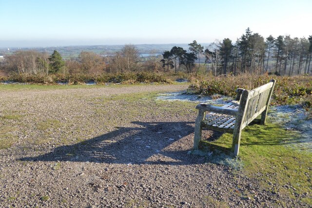
Lickey Hill is a prominent geographical feature located in Worcestershire, England. It is classified as a hill and forms part of the Lickey Hills Country Park. Rising to an elevation of approximately 978 feet (298 meters), it offers stunning panoramic views of the surrounding countryside.

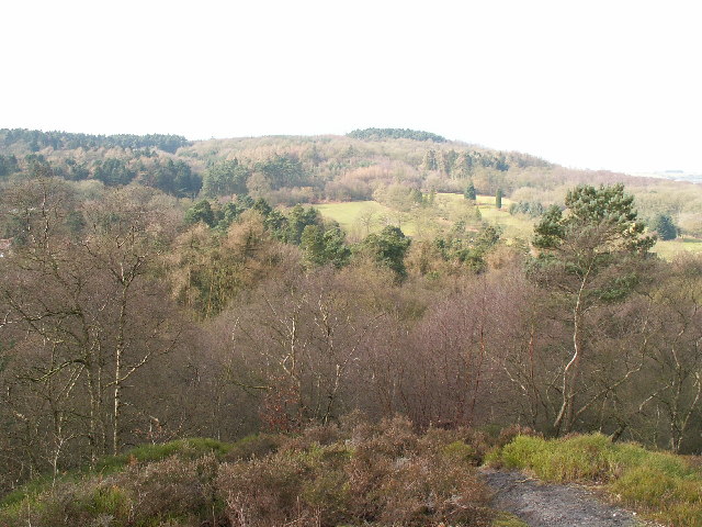
Situated just south of Birmingham, Lickey Hill is easily accessible and attracts a large number of visitors throughout the year. The hill is known for its distinctive shape and lush greenery, making it a popular destination for nature lovers and outdoor enthusiasts.

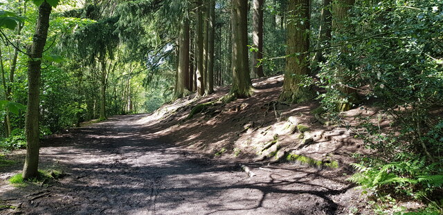
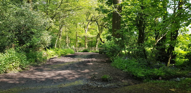
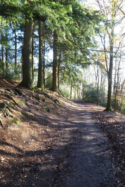
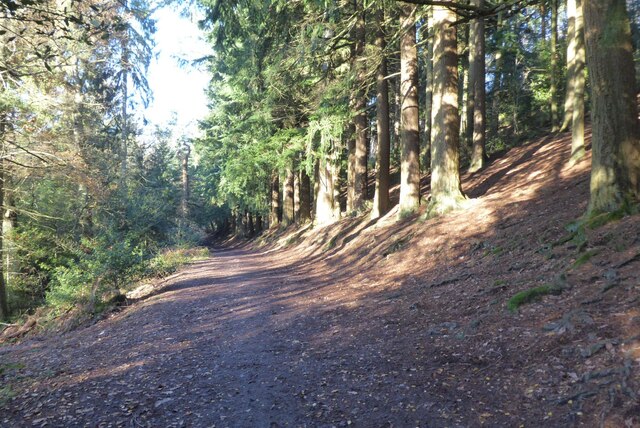
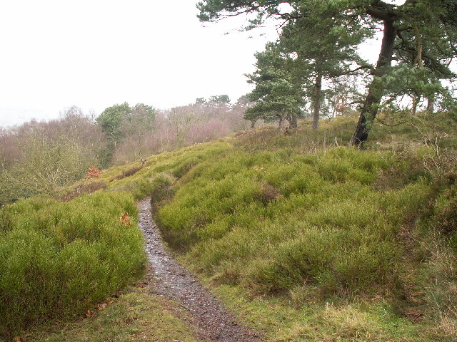
The Lickey Hills Country Park encompasses an area of 524 acres (212 hectares), and Lickey Hill is the highest point within this park. It is covered in a mix of woodland, heathland, and grassland, providing a diverse habitat for a variety of flora and fauna. The hill is home to numerous species of birds, mammals, and insects, making it an ideal location for wildlife spotting and birdwatching.

In addition to its natural beauty, Lickey Hill also boasts a rich history. It has been inhabited since prehistoric times, with archaeological finds indicating human activity dating back thousands of years. There are also remnants of ancient earthworks and hillforts, providing insight into the area's past.

Lickey Hill offers a range of recreational activities for visitors, including walking, hiking, cycling, and picnicking. It has a network of well-maintained trails and paths, ensuring that visitors can easily explore and enjoy the stunning landscapes.

If you have any feedback on the listing, please let us know in the comments section below.
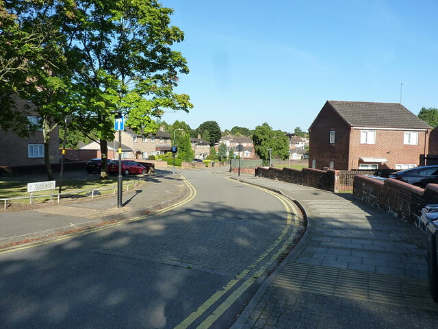
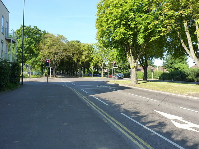
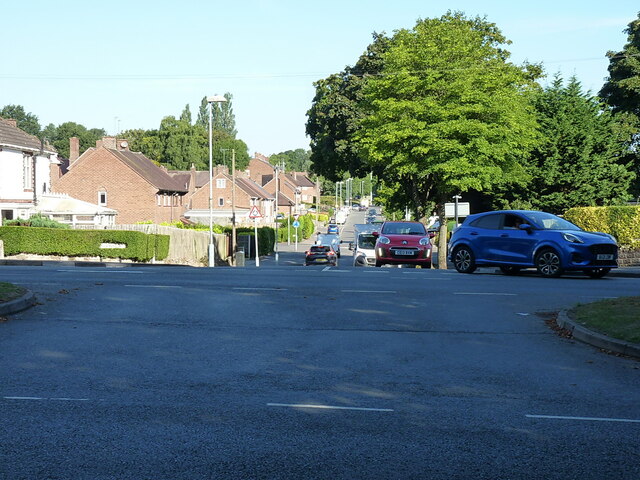
Lickey Hill Images

Images are sourced within 2km of 52.382419/-2.0174387 or Grid Reference SO9876. Thanks to Geograph Open Source API. All images are credited.

Art Deco building, 1730 Bristol Road South One of the commercial premises on the south side of the A38, with a distinctly 1920s Art Deco look to it. There is an OS benchmark cut into the brickwork low on the 'tower'
Art Deco building, 1730 Bristol Road South
One of the commercial premises on the south side of the A38, with a distinctly 1920s Art Deco look to it. There is an OS benchmark cut into the brickwork low on the 'tower'
OS benchmark - Longbridge, 1730 Bristol Rd South An OS cutmark on the 'tower' part of <a href="https://www.geograph.org.uk/photo/7423346">SP0077 : Art Deco building, 1730 Bristol Road South</a>, which was last levelled by the OS in 1956 at 180.146m above Ordnance Datum Newlyn.
OS benchmark - Longbridge, 1730 Bristol Rd South
An OS cutmark on the 'tower' part of SP0077 : Art Deco building, 1730 Bristol Road South, which was last levelled by the OS in 1956 at 180.146m above Ordnance Datum Newlyn.
Houses west of the former motor works A view down the intriguingly named Tinmeadow Crescent.
Houses west of the former motor works
A view down the intriguingly named Tinmeadow Crescent.
Lowhill Lane junction on the A4120 Lickey Road
Traffic emerging from Edgewood Road Cars coming out onto the Lickey Road from Edgewood Road in Rednal.
Traffic emerging from Edgewood Road
Cars coming out onto the Lickey Road from Edgewood Road in Rednal.
Bridleway at Cofton Hill At this point a public footpath intersects the bridleway which contours around Cofton Hill.
Bridleway at Cofton Hill
At this point a public footpath intersects the bridleway which contours around Cofton Hill.
Bridleway at Cofton Hill Here, the bridleway contours around Cofton Hill at the edge of the woods.
Bridleway at Cofton Hill
Here, the bridleway contours around Cofton Hill at the edge of the woods.
Seat on Cofton Hill Seat on Cofton Hill in the Lickey Hills.
Seat on Cofton Hill
Seat on Cofton Hill in the Lickey Hills.
Woodland footpath Woodland footpath on the southern slopes of Cofton Hill in the Lickey Hills.
Woodland footpath
Woodland footpath on the southern slopes of Cofton Hill in the Lickey Hills.
Woodland path Woodland path on southern slopes of the Cofton Hill in the Lickey Hills.
Woodland path
Woodland path on southern slopes of the Cofton Hill in the Lickey Hills.
The North Worcestershire Path The North Worcestershire Path follows this footpath through farmland in the Lickey Hills.
The North Worcestershire Path
The North Worcestershire Path follows this footpath through farmland in the Lickey Hills.
A robin perched on a brier  A robin perched on a brier beside a footpath followed by the North Worcestershire Path.
A robin perched on a brier
A robin perched on a brier beside a footpath followed by the North Worcestershire Path.
View to Birmingham View to the city of Birmingham from Cofton Hill in the Lickey Hills.
View to Birmingham
View to the city of Birmingham from Cofton Hill in the Lickey Hills.
Warren Lane (bridleway), Kendal End This bridleway skirts the southern end of Cofton Hill at Lickey Hills Country Park. The photo was taken from the junction with the B4120, looking south-west.
Warren Lane (bridleway), Kendal End
This bridleway skirts the southern end of Cofton Hill at Lickey Hills Country Park. The photo was taken from the junction with the B4120, looking south-west.
Junction of tracks, Lickey Hills Country Park The track running to the left is the bridleway to Kendal End. The track ahead leads towards Barnt Green. Behind the photographer, this bridleway continues north to the Visitors Centre.
Junction of tracks, Lickey Hills Country Park
The track running to the left is the bridleway to Kendal End. The track ahead leads towards Barnt Green. Behind the photographer, this bridleway continues north to the Visitors Centre.
View from Bilberry Hill towards Beacon Hill Bilberry Hill is in the Lickey Hills Country Park. Together with its neighbours the hill is composed of Lickey Quartzite, one of the oldest rocks in the region. The Lickey Hills include some of the largest areas of bilberry and heather in the county. The hill in the distance is Beacon Hill. The open area in between is a golf course.
View from Bilberry Hill towards Beacon Hill
Bilberry Hill is in the Lickey Hills Country Park. Together with its neighbours the hill is composed of Lickey Quartzite, one of the oldest rocks in the region. The Lickey Hills include some of the largest areas of bilberry and heather in the county. The hill in the distance is Beacon Hill. The open area in between is a golf course.
Rednal Hill Rednal Hill was presented to the City of Birmingham in 1888 by the Birmingham Association for the Preservation of Open Spaces. Together with land donated by the Cadbury family it forms the Lickey Hills Country Park.
Rednal Hill
Rednal Hill was presented to the City of Birmingham in 1888 by the Birmingham Association for the Preservation of Open Spaces. Together with land donated by the Cadbury family it forms the Lickey Hills Country Park.
Toposcope, Beacon Hill The toposcope on Beacon Hill (298m) was constructed in 1923 after Beacon Hill was donated to the City of Birmingham by the Cadbury family. The toposcope was restored in 1988. From this viewpoint on a good day 13 old counties can be seen. Going east from the summit there is no higher land at the same latitude until you reach the Ural Mountains in Russia (I've checked this using Google Earth).
Toposcope, Beacon Hill
The toposcope on Beacon Hill (298m) was constructed in 1923 after Beacon Hill was donated to the City of Birmingham by the Cadbury family. The toposcope was restored in 1988. From this viewpoint on a good day 13 old counties can be seen. Going east from the summit there is no higher land at the same latitude until you reach the Ural Mountains in Russia (I've checked this using Google Earth).
Show me another place!

Lickey Hill is located at Grid Ref: SO9876 (Lat: 52.382419, Lng: -2.0174387)

Administrative County: Worcestershire

District: Bromsgrove

Police Authority: West Mercia

What 3 Words

///senior.kick.spark. Near Barnt Green, Worcestershire

Related Wikis

Rubery

Rubery is a village in the Bromsgrove District and a suburb of Birmingham in the counties of Worcestershire and West Midlands, England. It is 9 miles...

Lickey Hills Country Park

Lickey Hills Country Park is a country park in England. It is 10 miles (16 kilometres) south west of Birmingham and 24 miles (39 kilometres) north east...

Lickey Hills

The Lickey Hills (known locally as simply The Lickeys) are a range of hills in Worcestershire, England, 11 miles (18 km) to the south-west of the centre...

Bilberry Hill

Bilberry Hill is one of the Lickey Hills in northern Worcestershire, England, 10.3 miles (16.6 kilometres) south west of Birmingham and 24 miles (39 kilometres...

Holy Trinity Church, Lickey

Holy Trinity Church, Lickey is a Church of England parish church in Lickey, Worcestershire. == History == The foundation stone was laid on 16 May 1855...

St Chad's Church, Rubery

St Chad’s Church, Rubery is a Church of England parish church in Rubery, Worcestershire. == History == The church evolved in 1895 as a mission church from...

Waseley Hills High School and Sixth Form Centre

Waseley Hills High School and Sixth Form Centre is a mixed secondary school and sixth form with academy status in the town of Rubery, on the border of...

Cofton Hackett

Cofton Hackett is a village and civil parish in the Bromsgrove District of north east Worcestershire, England. It is 10+1⁄4 miles (16.5 kilometres) southwest...

Related Videos

A Walk In The Woods | Virtual Forest Scenery For Treadmill Walking | English Autumn Colours (60 Min)

An hour of walking through beautiful woods and countryside trails at the Lickey Hills Country Park near Birmingham, UK. Relaxing ...

Lickey hills circular walk - exploring Lickey hills country park

Lickey hills circular walk- exploring Lickey hills country park- walking in the Worcestershire countryside. This is the fourth in a ...

Walking In Rain In The Woods With Umbrella - Virtual Forest Walk Video - 1 Hour 45 Minutes

Virtual rain walk video - peaceful hike through a misty forest in the summer rain on scenic hill trails. Beautiful rainy day hiking ...

English Forest Walk - Virtual Scenery For Treadmill Workout - Walking Through The Woods

Long hike in the woods at 7am on a peaceful summer morning in central England, UK - 1 hour 30 minute video for home cardio ...

Nearby Amenities

Located within 500m of 52.382419,-2.0174387
The Toposcope
Source: survey
Tourism: viewpoint
Lat/Long: 52.3821689/-2.0196818
Barrier: bollard
Lat/Long: 52.3860486/-2.0164603
Brand: National Grid
Brand Wikidata: Q1465461
Operator: National Grid Electricity Distribution Plc
Operator Old: Western Power Distribution
Operator Wikidata: Q7988183
Owner: National Grid Electricity Distribution (West Midlands) Plc
Owner Wikidata: Q114397791
Power: substation
Source: survey
Lat/Long: 52.3794194/-2.0194416
Lickey Hill
Ele: 285.829
Inscription: S3147
Man Made: survey_point
Ref: S3147
Lat/Long: 52.3824728/-2.0174727
Post Box
Ref: B45 402
Lat/Long: 52.381379/-2.0228871
Barrier: stile
Material: wood
Source: survey
Step Count: 2
Stile: stepover
Lat/Long: 52.3789139/-2.0213313
Barrier: stile
Lat/Long: 52.3790165/-2.0193677
Barrier: lockable low log
Lat/Long: 52.3790515/-2.0190964
Beacon Hill
Natural: peak
Lat/Long: 52.3824436/-2.0175558
Stock Hill
Natural: peak
Lat/Long: 52.3828556/-2.0236378
Fixme: continue
Lat/Long: 52.3798129/-2.0138666
The data included in this document is from www.openstreetmap.org. The data is made available under ODbL.

Have you been to Lickey Hill?

Leave your review of Lickey Hill below (or comments, questions and feedback).