Dovecotwood

Settlement in Stirlingshire

Scotland

Dovecotwood

Mowing grass Cutting grass for winter fodder, a view over the football park at Queenzieburn.
Mowing grass Credit: Richard Webb

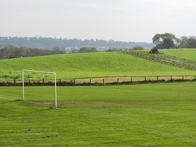
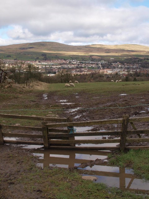
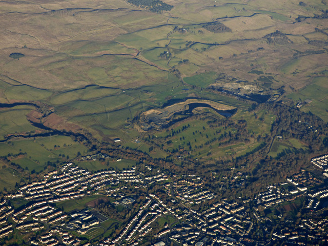
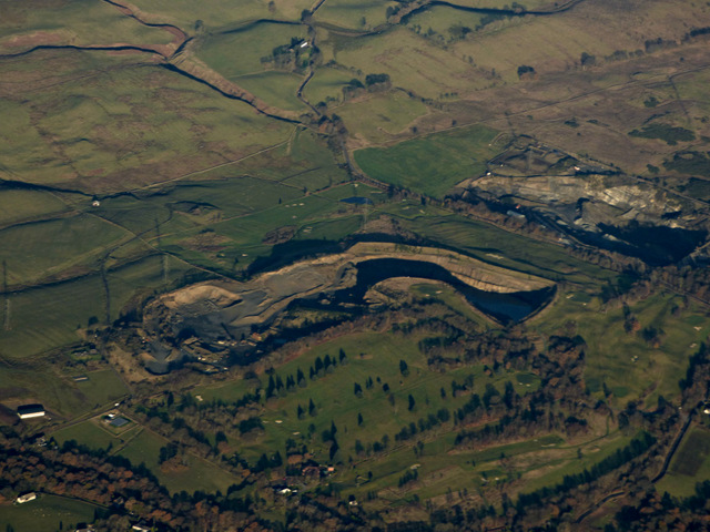
Dovecotwood is a small village located in Stirlingshire, Scotland. Situated in the heart of the country, it is surrounded by picturesque landscapes, including rolling hills and lush green fields. The village is known for its tranquil atmosphere and friendly community.

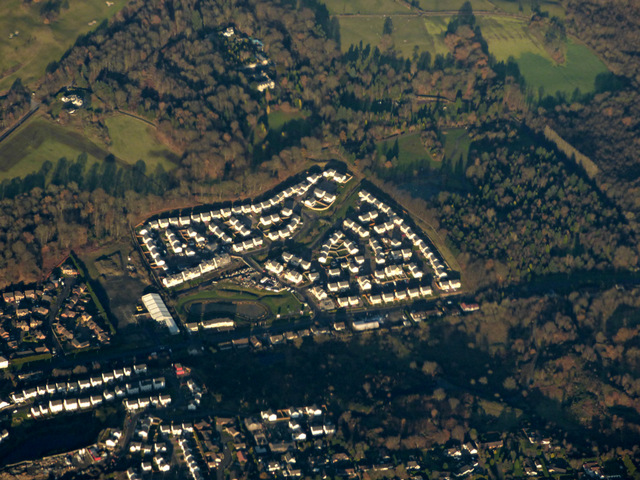
Dovecotwood is home to approximately 500 residents, making it a close-knit and tight community. The village has a mixture of traditional stone cottages and modern houses, giving it a unique charm. The well-maintained streets are lined with trees, adding to its peaceful ambiance.

The village offers a range of amenities to its residents. There is a local primary school that caters to the educational needs of the younger population. Additionally, there are a few small shops, including a grocery store and a post office, providing convenience to the locals.

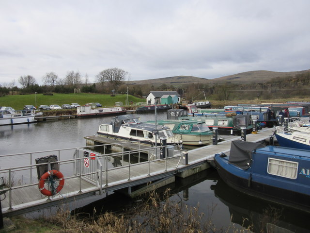
Nature lovers are drawn to Dovecotwood for its beautiful surroundings. The village is located near several hiking trails and nature reserves, allowing residents to explore the great outdoors. The nearby river provides opportunities for fishing and boating as well.

For those who prefer a more urban experience, Dovecotwood is conveniently located near larger towns and cities. Stirling, the nearest city, is just a short drive away and offers a wide range of shopping, dining, and entertainment options.

Overall, Dovecotwood offers a peaceful and idyllic lifestyle, surrounded by natural beauty. With its tight-knit community and convenient location, it is the perfect place for those seeking a balance between rural and urban living.

If you have any feedback on the listing, please let us know in the comments section below.

Dovecotwood Images

Images are sourced within 2km of 55.977595/-4.0688632 or Grid Reference NS7178. Thanks to Geograph Open Source API. All images are credited.

Mowing grass Cutting grass for winter fodder, a view over the football park at Queenzieburn.
Mowing grass
Cutting grass for winter fodder, a view over the football park at Queenzieburn.
The Beacon Still derelict, a former public house.
The Beacon
Still derelict, a former public house.
The Beacon Derelict pub, Queenzieburn.
The Beacon
Derelict pub, Queenzieburn.
Bus stop, Queenzieburn A bus stop on Kilsyth Road.
Bus stop, Queenzieburn
A bus stop on Kilsyth Road.
Fields, Balcastle Steep ground above Balcastle Road.
Fields, Balcastle
Steep ground above Balcastle Road.
Auchinstarry Marina, Kilsyth
Field beside the "Military Way" The picture was taken from the Military Way, as described in <a href="https://www.geograph.org.uk/photo/2781998">NS7176 : The Military Way</a>. The muddy field with the grazing sheep lies immediately north of the track.
Field beside the "Military Way"
The picture was taken from the Military Way, as described in NS7176 : The Military Way. The muddy field with the grazing sheep lies immediately north of the track.
Kilsyth from the air With the Forth & Clyde Canal running the length of the photo on the right.
Kilsyth from the air
With the Forth & Clyde Canal running the length of the photo on the right.
Kilsyth and the Forth & Clyde Canal from the air The disused Rowancraig Quarry is on the right.
Kilsyth and the Forth & Clyde Canal from the air
The disused Rowancraig Quarry is on the right.
Kilsyth from the air Kilsyth Lennox Golf Club and the Beltmoss quarries can also be seen.
Kilsyth from the air
Kilsyth Lennox Golf Club and the Beltmoss quarries can also be seen.
Beltmoss quarries from the air Kilsyth Lennox Golf Club is in the foreground.
Beltmoss quarries from the air
Kilsyth Lennox Golf Club is in the foreground.
Kilsyth from the air Looking over new houses at Cavalry Park Road towards Colzium House.
Kilsyth from the air
Looking over new houses at Cavalry Park Road towards Colzium House.
Houses on Laird's Hill Place, Kilsyth
Entering Kilsyth Heading north east on the A803.
Entering Kilsyth
Heading north east on the A803.
Glasgow Road (A803), Kilsyth Looking north east.
Glasgow Road (A803), Kilsyth
Looking north east.
The Broch Bar, Kilsyth
Bus stop on Balmalloch Road, Kilsyth
Westfield Road, Kilsyth
Show me another place!

Dovecotwood is located at Grid Ref: NS7178 (Lat: 55.977595, Lng: -4.0688632)

Unitary Authority: North Lanarkshire

Police Authority: Lanarkshire

What 3 Words

///bearable.depravity.blaze. Near Kilsyth, North Lanarkshire
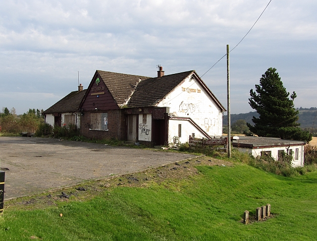
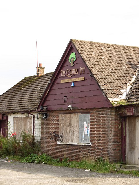
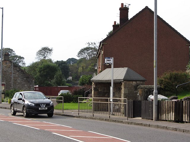
Related Wikis

Kilsyth Victoria Cottage Hospital

Kilsyth Victoria Cottage Hospital is a health facility in Glasgow Road, Kilsyth, North Lanarkshire, Scotland. It is managed by NHS Lanarkshire. == History... ==

Kilsyth Rangers F.C.

Kilsyth Rangers Football Club are a Scottish football club based in the town of Kilsyth, North Lanarkshire. Nicknamed The Wee Gers, they were formed in...

Kilsyth railway station

Kilsyth Old station served the town of Kilsyth in Scotland. It was the original terminus of the Kelvin Valley Railway. == History == The station opened...

Kilsyth

Kilsyth (; Scottish Gaelic: Cill Saidhe) is a town and civil parish in North Lanarkshire, roughly halfway between Glasgow and Stirling in Scotland. The...

Nearby Amenities

Located within 500m of 55.977595,-4.0688632
Note: Name changes at town boundary
Lat/Long: 55.9757847/-4.0746493
Mini Roundabout
Direction: clockwise
Lat/Long: 55.9774532/-4.0678347
Fuel
Duncansfield
Addr Postcode: G65 9AE
Brand: Shell
Brand Wikidata: Q110716465
Operator: Eurogarages
Phone: +44 1236 827277
Ref Navads: NVDS353_10019450
Website: https://find.shell.com/gb/fuel/10019450-eg-duncansfield-service-station
Lat/Long: 55.9773325/-4.0670926
Crossing
Crossing: traffic_signals
Lat/Long: 55.9772457/-4.0686843
Recycling
Recycling Clothes: yes
Source: survey
Lat/Long: 55.9778786/-4.0618066
Balmalloch
Place: suburb
Lat/Long: 55.9793395/-4.0656355
Westfield
Place: suburb
Lat/Long: 55.9775945/-4.0737037
Give Way
Direction: backward
Lat/Long: 55.9775285/-4.0678928
Kilsyth Junction
Historic Railway: junction
Railway: site
Lat/Long: 55.9770019/-4.0661728
Post Box
Source: survey
Lat/Long: 55.976655/-4.0721359
Barrier: bollard
Source: survey
Lat/Long: 55.9791561/-4.07182
Post Box
Source: survey
Lat/Long: 55.979548/-4.0700192
Post Box
Source: survey
Lat/Long: 55.9791554/-4.0626847
Crossing
Crossing: traffic_signals
Crossing Island: no
Tactile Paving: yes
Lat/Long: 55.9778608/-4.0649481
Man Made: tower
Tower Type: communication
Lat/Long: 55.9774925/-4.0613662
Bus Stop
Kilsyth, Glasgow Road opp Ashlea
Bus: yes
Departures Board: timetable
Naptan AtcoCode: 61601410
Naptan NaptanCode: 65236437
Public Transport: platform
Shelter: yes
Lat/Long: 55.9773255/-4.068497
Bus Stop
Kilsyth, Glasgow Road before Victoria Park
Bus: yes
Departures Board: timetable
Naptan AtcoCode: 61601409
Naptan NaptanCode: 65237247
Public Transport: platform
Shelter: no
Lat/Long: 55.9771453/-4.0690426
Kilsyth Old
Historic Railway: station
Railway: site
Wikidata: Q6408220
Wikipedia: en:Kilsyth railway station
Lat/Long: 55.978078/-4.0611897
Bus Stop
Kilsyth, Northfield Road opp Rennie Road
Bus: yes
Departures Board: timetable
Naptan AtcoCode: 61601420
Naptan NaptanCode: 65236468
Public Transport: platform
Shelter: no
Lat/Long: 55.980444/-4.0747016
Bus Stop
Kilsyth, Northfield Road at 29 Northfield Road
Bus: yes
Departures Board: timetable
Naptan AtcoCode: 61601419
Naptan NaptanCode: 65235494
Public Transport: platform
Shelter: yes
Lat/Long: 55.98019/-4.0722227
Bus Stop
Kilsyth Balmalloch Road opp St Andrews Place
Bus: yes
Naptan AtcoCode: 61601783
Naptan NaptanCode: 65238465
Public Transport: platform
Shelter: no
Lat/Long: 55.9809529/-4.0686681
Bus Stop
Kilsyth Balmalloch Road after St Andrews Place
Bus: yes
Departures Board: timetable
Naptan AtcoCode: 61601426
Naptan NaptanCode: 65235763
Public Transport: platform
Shelter: yes
Lat/Long: 55.9810453/-4.0686482
Bus Stop
Kilsyth, Balmalloch Road before Anderson Avenue
Bus: yes
Departures Board: timetable
Naptan AtcoCode: 61601427
Naptan NaptanCode: 65232528
Public Transport: platform
Shelter: yes
Lat/Long: 55.981691/-4.0697402
Bus Stop
Kilsyth, Balmalloch Road before Livingstone Park
Bus: yes
Naptan AtcoCode: 61601784
Naptan NaptanCode: 65238367
Public Transport: platform
Shelter: no
Lat/Long: 55.9817783/-4.0697356
Bus Stop
Kilsyth, Glasgow Road opp Garrell Vale Community Centre
Bench: yes
Bin: no
Bus: yes
Departures Board: timetable
Naptan AtcoCode: 61601407
Naptan NaptanCode: 65234694
Public Transport: platform
Shelter: yes
Lat/Long: 55.978066/-4.0639792
Bus Stop
Kilsyth, Glasgow Road at Garrell Vale Community Centre
Bench: yes
Bus: yes
Departures Board: timetable
Naptan AtcoCode: 61601408
Naptan NaptanCode: 65235682
Public Transport: platform
Shelter: yes
Lat/Long: 55.977754/-4.0653398
Bus Stop
Kilsyth, Balmalloch Road before Corrie Road
Bus: yes
Departures Board: timetable
Naptan AtcoCode: 61601417
Naptan NaptanCode: 65234642
Public Transport: platform
Shelter: yes
Lat/Long: 55.9785324/-4.0688883
Bus Stop
Kilsyth, Balmalloch Road before Westfield Road
Bus: yes
Departures Board: timetable
Naptan AtcoCode: 61601418
Naptan NaptanCode: 65236359
Public Transport: platform
Shelter: no
Lat/Long: 55.9787622/-4.0694125
Bus Stop
Kilsyth, Corrie Brae after Montrose Gardens
Bus: yes
Departures Board: timetable
Naptan AtcoCode: 61601803
Naptan NaptanCode: 65239524
Public Transport: platform
Shelter: no
Lat/Long: 55.9786045/-4.0670526
Bus Stop
Kilsyth, Kelvin Way at 42 Kelvin Way
Bus: yes
Departures Board: timetable
Naptan AtcoCode: 61601804
Naptan NaptanCode: 65239525
Public Transport: platform
Shelter: no
Lat/Long: 55.97926/-4.0626521
Bus Stop
Kilsyth, Kelvin Way before Belmont Street
Bus: yes
Departures Board: no
Naptan AtcoCode: 61601965
Naptan NaptanCode: 65296496
Public Transport: platform
Shelter: no
Lat/Long: 55.9791885/-4.0626198
Give Way
Direction: forward
Lat/Long: 55.9774042/-4.0679436
Give Way
Direction: backward
Lat/Long: 55.9774565/-4.0676659
The data included in this document is from www.openstreetmap.org. The data is made available under ODbL.

Have you been to Dovecotwood?

Leave your review of Dovecotwood below (or comments, questions and feedback).