Dovedale

Settlement in Gloucestershire Cotswold

England

Dovedale

Batsford Arboretum - viewpoint Looking over the boundary fence at one of the corners of the arboretum.
Batsford Arboretum - viewpoint Credit: Chris Allen

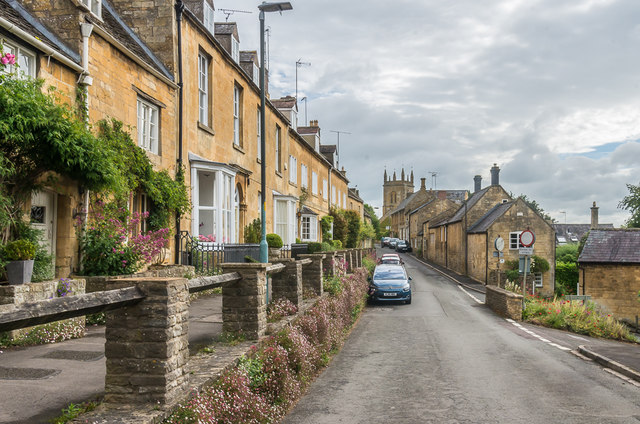
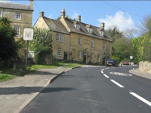
Dovedale is a picturesque village located in the county of Gloucestershire, England. Situated in the Cotswolds, an area renowned for its natural beauty and charming rural landscapes, Dovedale offers visitors a tranquil and idyllic setting to explore.

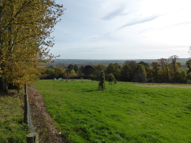
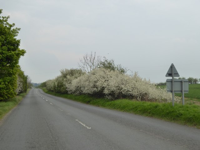
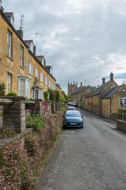
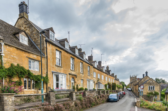
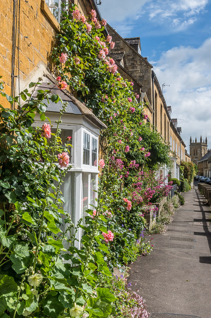
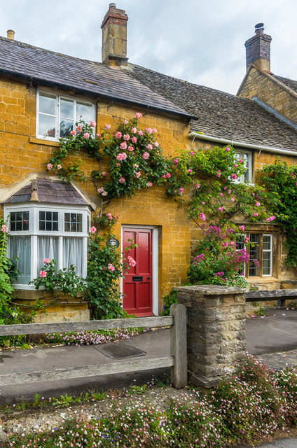
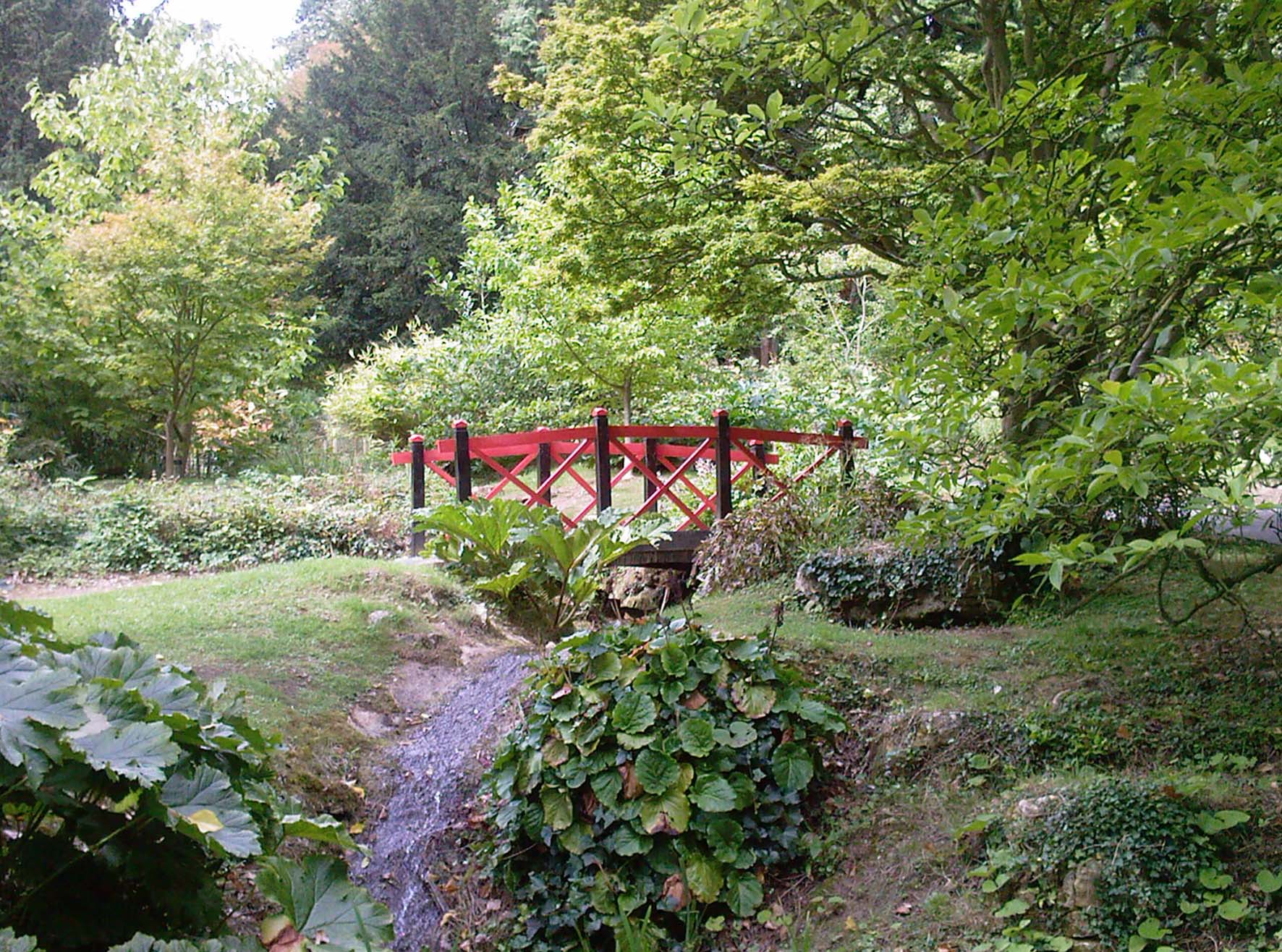
The village is characterized by its traditional stone-built cottages, which exude a quaint and timeless charm. The surrounding countryside is dotted with rolling hills, meandering streams, and lush green fields, creating a postcard-worthy backdrop.

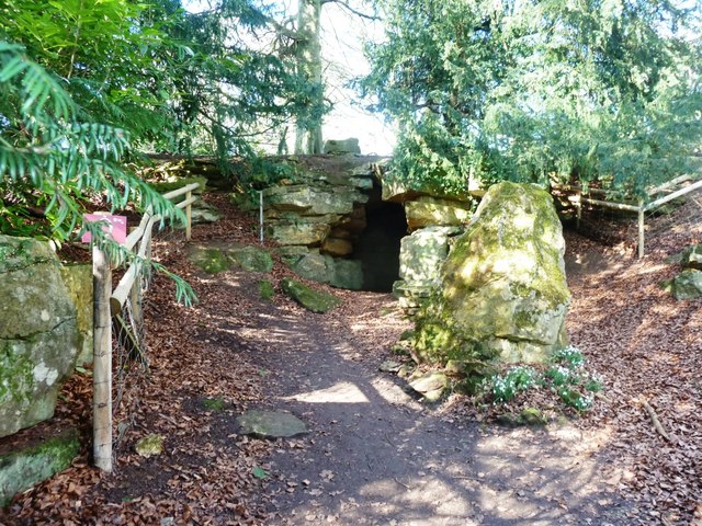
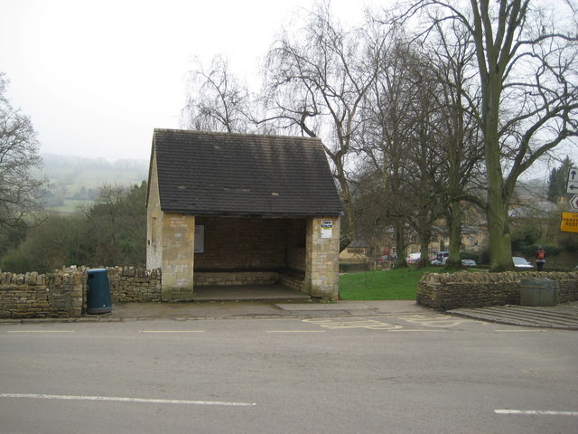
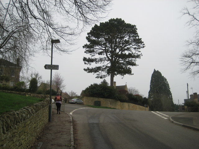
Dovedale is particularly famous for its walking trails, which allow visitors to fully immerse themselves in the beauty of the Cotswolds. The village is conveniently located near the Cotswold Way, a long-distance footpath that stretches for 102 miles through the region. Explorers can enjoy leisurely walks along the trail, taking in panoramic views and discovering the local flora and fauna.

In addition to its natural attractions, Dovedale offers visitors a range of amenities and activities. The village boasts a quaint tearoom, where visitors can relax and enjoy a cup of tea or indulge in traditional English pastries. There are also several pubs in the area, providing an opportunity to experience the warm hospitality and hearty cuisine that the Cotswolds are known for.

For those seeking a peaceful and rural escape, Dovedale in Gloucestershire is a must-visit destination. Its natural beauty, charming architecture, and welcoming atmosphere make it a perfect retreat for nature lovers and those looking to experience the quintessential English countryside.

If you have any feedback on the listing, please let us know in the comments section below.
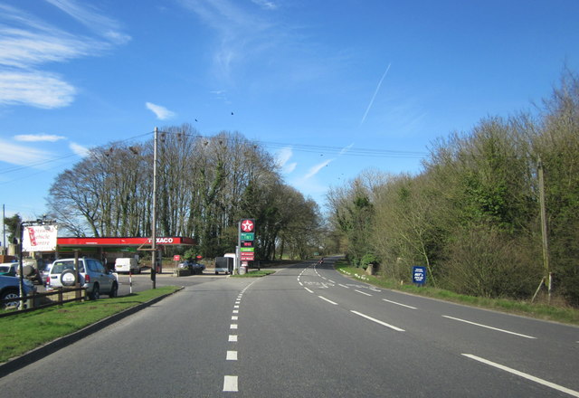
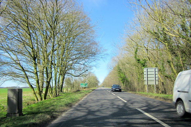
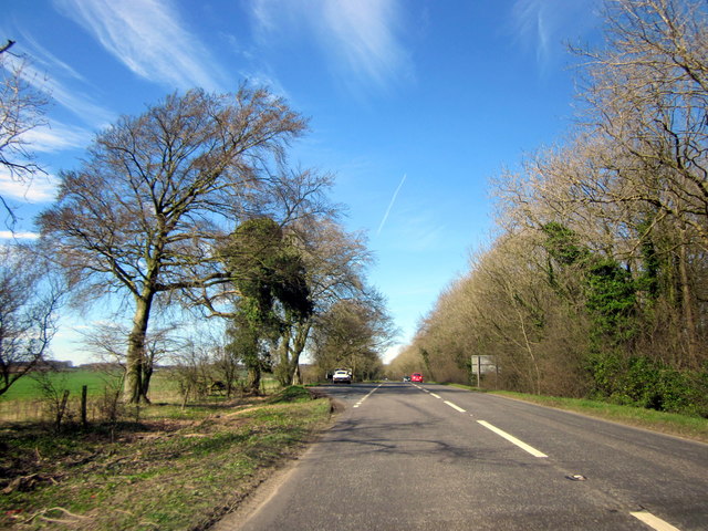
Dovedale Images

Images are sourced within 2km of 52.00421/-1.768331 or Grid Reference SP1634. Thanks to Geograph Open Source API. All images are credited.

Batsford Arboretum - viewpoint Looking over the boundary fence at one of the corners of the arboretum.
Batsford Arboretum - viewpoint
Looking over the boundary fence at one of the corners of the arboretum.
The Hermit's Cave at Batsford Arboretum Located in the western corner of the Arboretum.
The Hermit's Cave at Batsford Arboretum
Located in the western corner of the Arboretum.
Blossom on Five Mile Drive (A424)
B4479 Junction A minor road from Batsford joins the B4479 from Blockley.
B4479 Junction
A minor road from Batsford joins the B4479 from Blockley.
The reason for 'Doing Posh' The dedication plaque for the village bus shelter.
The Coronation of Queen Elizabeth II.
The reason for 'Doing Posh'
The dedication plaque for the village bus shelter. The Coronation of Queen Elizabeth II.
Blockley does posh Whilst the camera does not capture the warmth of the Cotswold stone.
This is one well kept and crafted bus shelter.
It is over 60 years old and commemorates Queen Elizabeth II Coronation.
<a href="https://www.geograph.org.uk/photo/5308627">SP1635 : The reason for 'Doing Posh'</a> has a photo of the plaque.
Blockley does posh
Whilst the camera does not capture the warmth of the Cotswold stone. This is one well kept and crafted bus shelter. It is over 60 years old and commemorates Queen Elizabeth II Coronation. SP1635 : The reason for 'Doing Posh' has a photo of the plaque.
Green in Winter A rather grand conifer in Lower Street.
Green in Winter
A rather grand conifer in Lower Street.
I have a question Are the railings to keep us out or them in?
Quite a number of tombs in this church yard have railings around them.
One would speculate that these are post WWII.
The tomb in front is a bale reflecting the wool trade of the past.
I have a question
Are the railings to keep us out or them in? Quite a number of tombs in this church yard have railings around them. One would speculate that these are post WWII. The tomb in front is a bale reflecting the wool trade of the past.
We are but mortal Not a tribute to a chapter of Hell's Angels. 
But a grim reminder from the stonemason that we are all mortal.
We are but mortal
Not a tribute to a chapter of Hell's Angels. But a grim reminder from the stonemason that we are all mortal.
Troopers Lodge Garage A44
A44 Five Mile Drive Heading Towards Broadway
A44 Five Mile Drive Heading Towards Broadway E-Type Jaguar in Layby
High Street Looking along High Street.  In the left centre of the photo is Bankside, a building of 17th Century origins remodelled in around 1800.  Grade II listed - see <span class="nowrap"><a title="www.historicengland.org.uk/listing/the-list/list-entry/1304362" rel="nofollow ugc noopener" href="http://www.historicengland.org.uk/listing/the-list/list-entry/1304362">Link</a><img style="margin-left:2px;" alt="External link" title="External link - shift click to open in new window" src="https://s1.geograph.org.uk/img/external.png" width="10" height="10"/></span>.
High Street
Looking along High Street. In the left centre of the photo is Bankside, a building of 17th Century origins remodelled in around 1800. Grade II listed - see LinkExternal link.
High Street Looking along High Street.  The house on the left of the photo is Bankside, a building of 17th Century origins remodelled in around 1800.  Grade II listed - see <span class="nowrap"><a title="www.historicengland.org.uk/listing/the-list/list-entry/1304362" rel="nofollow ugc noopener" href="http://www.historicengland.org.uk/listing/the-list/list-entry/1304362">Link</a><img style="margin-left:2px;" alt="External link" title="External link - shift click to open in new window" src="https://s1.geograph.org.uk/img/external.png" width="10" height="10"/></span>.
High Street
Looking along High Street. The house on the left of the photo is Bankside, a building of 17th Century origins remodelled in around 1800. Grade II listed - see LinkExternal link.
High Street Looking along High Street.  The house in the left centre of the photo is Bankside, a building of 17th Century origins remodelled in around 1800.  Grade II listed - see <span class="nowrap"><a title="www.historicengland.org.uk/listing/the-list/list-entry/1304362" rel="nofollow ugc noopener" href="http://www.historicengland.org.uk/listing/the-list/list-entry/1304362">Link</a><img style="margin-left:2px;" alt="External link" title="External link - shift click to open in new window" src="https://s1.geograph.org.uk/img/external.png" width="10" height="10"/></span>.
High Street
Looking along High Street. The house in the left centre of the photo is Bankside, a building of 17th Century origins remodelled in around 1800. Grade II listed - see LinkExternal link.
Hill View Early 19th Century cottage on High Street.  Grade II listed - see <span class="nowrap"><a title="www.historicengland.org.uk/listing/the-list/list-entry/1153336" rel="nofollow ugc noopener" href="http://www.historicengland.org.uk/listing/the-list/list-entry/1153336">Link</a><img style="margin-left:2px;" alt="External link" title="External link - shift click to open in new window" src="https://s1.geograph.org.uk/img/external.png" width="10" height="10"/></span>.
Hill View
Early 19th Century cottage on High Street. Grade II listed - see LinkExternal link.
Crown Inn Hotel/restaurant in High Street dating from around 1700.  Grade II listed - see <span class="nowrap"><a title="www.historicengland.org.uk/listing/the-list/list-entry/1341711" rel="nofollow ugc noopener" href="http://www.historicengland.org.uk/listing/the-list/list-entry/1341711">Link</a><img style="margin-left:2px;" alt="External link" title="External link - shift click to open in new window" src="https://s1.geograph.org.uk/img/external.png" width="10" height="10"/></span>.
Crown Inn
Hotel/restaurant in High Street dating from around 1700. Grade II listed - see LinkExternal link.
Show me another place!

Dovedale is located at Grid Ref: SP1634 (Lat: 52.00421, Lng: -1.768331)

Administrative County: Gloucestershire

District: Cotswold

Police Authority: Gloucestershire

What 3 Words

///equal.satin.triangle. Near Blockley, Gloucestershire

Nearby Locations

Blockley Dovedale

Related Wikis

Blockley

Blockley is a village, civil parish and ecclesiastical parish in the Cotswold district of Gloucestershire, England, about 3 miles (5 km) northwest of Moreton...

Church of St Lawrence, Bourton-on-the-Hill

The Anglican Church of St Lawrence at Bourton-on-the-Hill in the Cotswold District of Gloucestershire, England was built in the 12th century. It is a grade...

Draycott, Gloucestershire

Draycott is a small hamlet in north Gloucestershire between Moreton-in-Marsh and Blockley, within Blockley civil parish. It is not mentioned in Domesday...

Batsford

Batsford is a village and civil parish in the Cotswold district of Gloucestershire, England. The village is about 1½ miles north-west of Moreton-in...

Batsford Arboretum

Batsford Arboretum is a 55-acre (220,000 m2) arboretum and botanical garden near Batsford in Gloucestershire, England, about 1½ miles north-west of Moreton...

Northwick Park, Gloucestershire

Northwick Park is a residential estate and business centre near Blockley in Gloucestershire, England. The estate is built in the grounds of the former...

Bourton-on-the-Hill

Bourton-on-the-Hill is a village and civil parish in the Cotswold district of Gloucestershire, England, and about 2 miles (3 km) west of Moreton-in-Marsh...

Broad Campden

Broad Campden is a small village in Gloucestershire, England, with a church and pub, and notable for its beauty and fine walking trails. == History... ==

Nearby Amenities

Located within 500m of 52.00421,-1.768331
Power: pole
Lat/Long: 52.0049755/-1.771554
Power: pole
Lat/Long: 52.0049384/-1.7694216
Power: pole
Lat/Long: 52.0050089/-1.7739489
Material: wood
Power: pole
Lat/Long: 52.0048044/-1.7611869
Power: pole
Lat/Long: 52.0048472/-1.7639281
Power: pole
Lat/Long: 52.0048975/-1.7670338
Generator Method: photovoltaic
Generator Output Electricity: yes
Generator Source: solar
Generator Type: solar_photovoltaic_panel
Location: roof
Power: generator
Lat/Long: 52.0074673/-1.7650518
Power: pole
Lat/Long: 52.0060028/-1.7744811
Power: pole
Lat/Long: 52.0057213/-1.773085
Power: pole
Lat/Long: 52.0054423/-1.7717506
Power: pole
Lat/Long: 52.005467/-1.7683093
Power: pole
Lat/Long: 52.005453/-1.7704444
Power: pole
Lat/Long: 52.0054514/-1.7695713
Power: pole
Lat/Long: 52.0054836/-1.767109
Warren Cottages Blockley
Power: pole
Transformer: distribution
Voltage Primary: 11000
Lat/Long: 52.0077868/-1.7694063
Dovedale
Power: pole
Transformer: distribution
Voltage Primary: 11000
Lat/Long: 52.0075383/-1.7680813
Power: pole
Lat/Long: 52.0074195/-1.767502
Blockley South
Power: pole
Transformer: distribution
Voltage Primary: 11000
Lat/Long: 52.0076902/-1.766527
Power: pole
Lat/Long: 52.007211/-1.7664613
Power: pole
Lat/Long: 52.0067995/-1.7664076
Power: pole
Lat/Long: 52.0061902/-1.7660643
Power: pole
Lat/Long: 52.0055323/-1.7656935
Hailstone Farm Padmount
Location Transition: yes
Power: pole
Transformer: distribution
Voltage Primary: 11000
Lat/Long: 52.0034733/-1.7637
Location Transition: yes
Power: pole
Lat/Long: 52.0055768/-1.7643102
Power: pole
Lat/Long: 52.0055979/-1.7634042
Power: pole
Lat/Long: 52.0056297/-1.7624138
Power: pole
Lat/Long: 52.0050402/-1.7749894
The data included in this document is from www.openstreetmap.org. The data is made available under ODbL.

Have you been to Dovedale?

Leave your review of Dovedale below (or comments, questions and feedback).