Blockley

Settlement in Gloucestershire Cotswold

England

Blockley

The Hermit's Cave at Batsford Arboretum Located in the western corner of the Arboretum.
The Hermit's Cave at Batsford Arboretum Credit: Clint Mann

Blockley is a picturesque village located in the Cotswolds, a designated Area of Outstanding Natural Beauty, in Gloucestershire, England. Situated about three miles northwest of Moreton-in-Marsh, it is nestled among rolling hills and lush countryside, offering breathtaking views and a tranquil atmosphere.

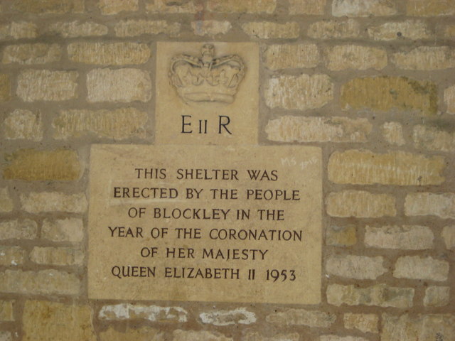
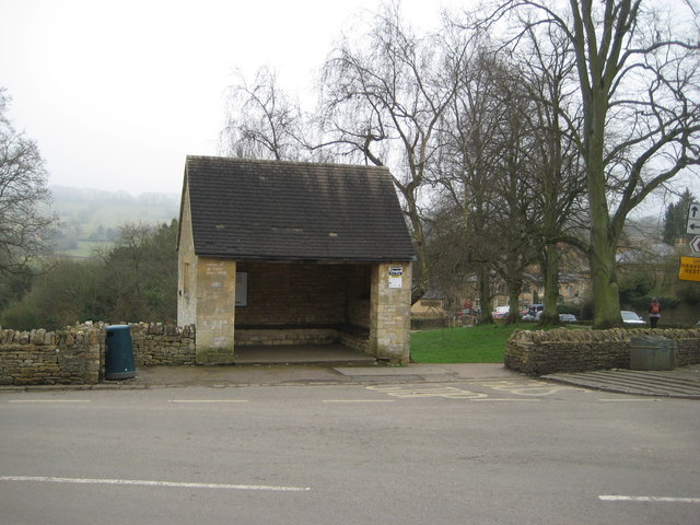
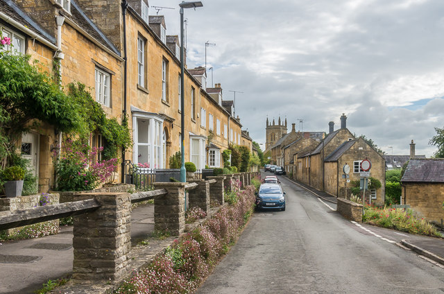
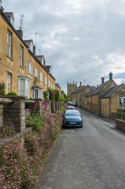
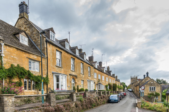
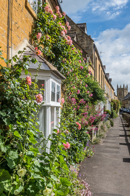
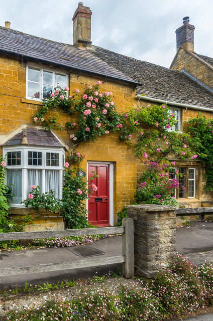
The village is known for its charming honey-colored limestone cottages, many of which date back to the 17th and 18th centuries. The architecture reflects its rich history as a former center for silk production. The narrow streets are lined with beautiful gardens and traditional stone walls, adding to the village's idyllic charm.

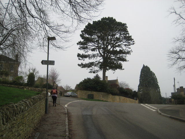
Blockley boasts a strong community spirit, and its residents take pride in maintaining the village's unique character. There are several local amenities available, including a village store, a post office, a café, and a pub. The village also has a primary school and a church, both of which are at the heart of the community.

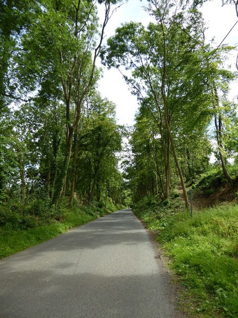
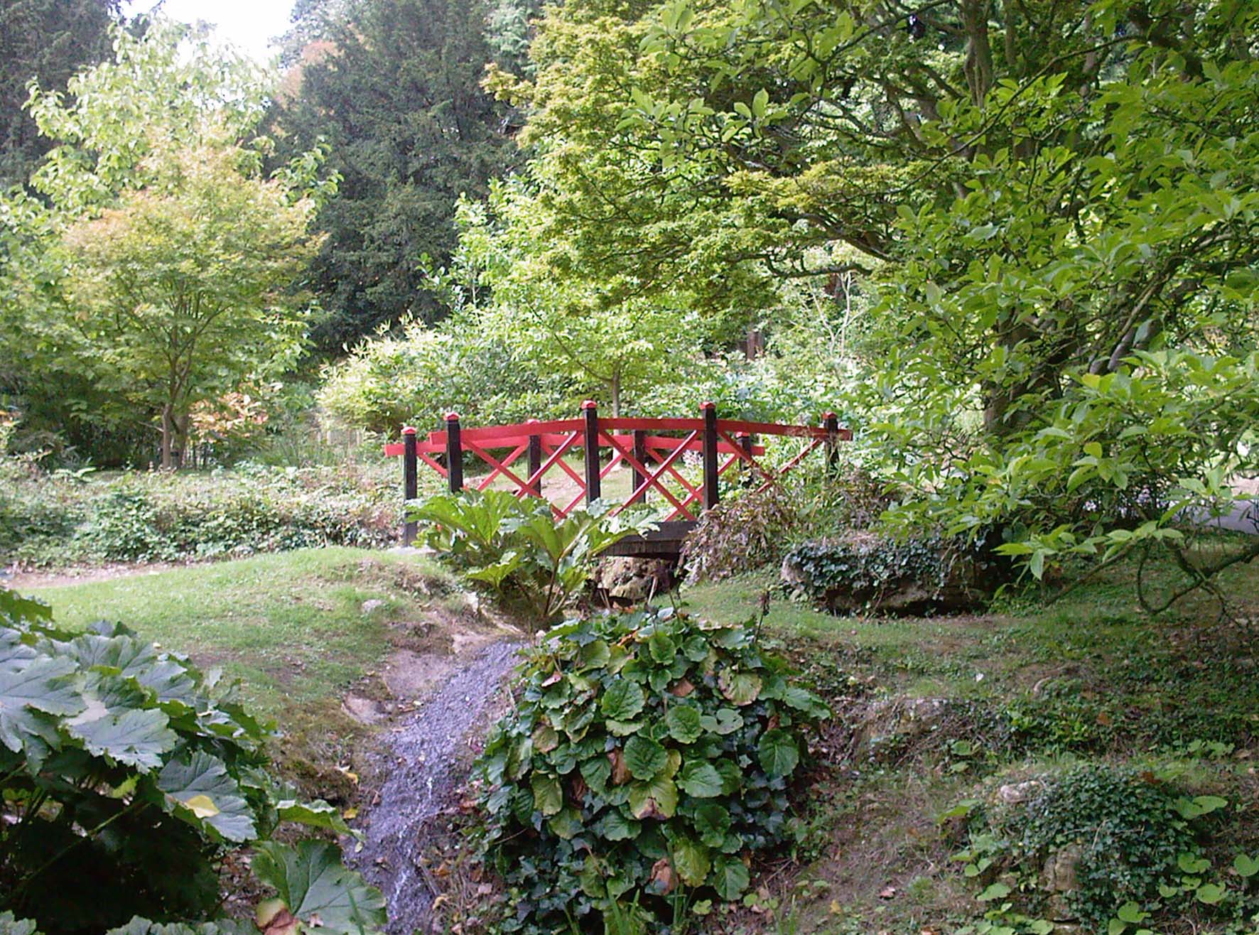
Surrounded by stunning countryside, Blockley offers plenty of opportunities for outdoor activities. There are numerous walking trails and scenic routes, allowing visitors to explore the surrounding Cotswold landscape. The village is also within easy reach of other popular destinations in the area, including Chipping Campden and Stow-on-the-Wold.

With its picturesque setting, historical buildings, and welcoming community, Blockley is a charming destination for those seeking a peaceful retreat in the heart of the Cotswolds.

If you have any feedback on the listing, please let us know in the comments section below.
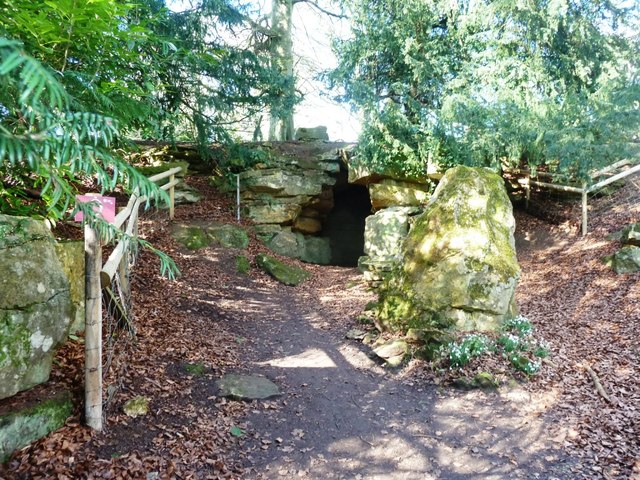
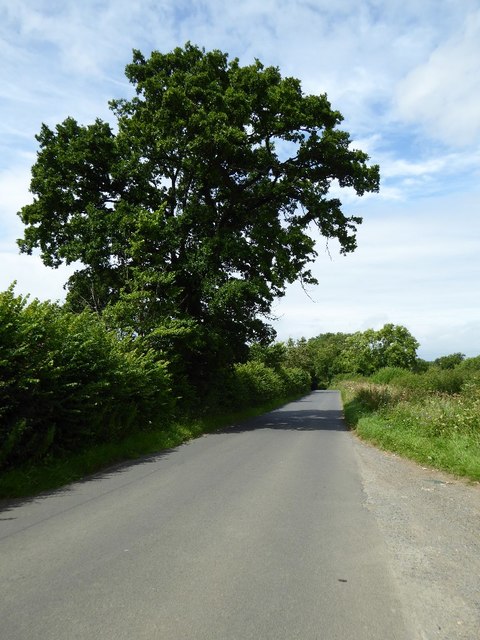
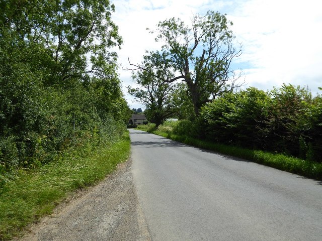
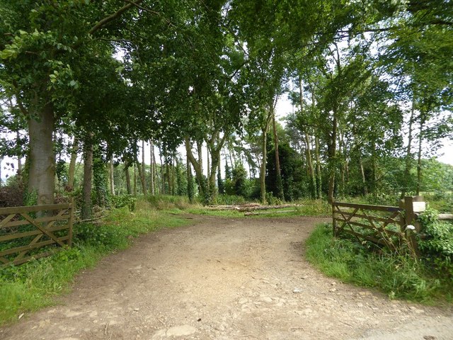
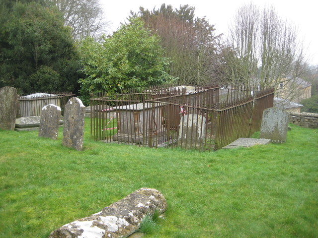
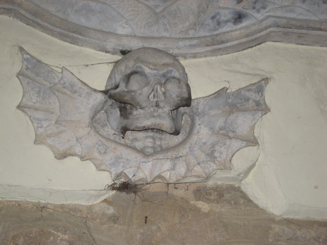
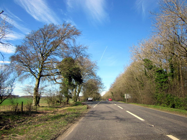
Blockley Images

Images are sourced within 2km of 52.01147/-1.763466 or Grid Reference SP1634. Thanks to Geograph Open Source API. All images are credited.

The Hermit's Cave at Batsford Arboretum Located in the western corner of the Arboretum.
The Hermit's Cave at Batsford Arboretum
Located in the western corner of the Arboretum.
Road to Blockley Greenway Road leads down into Blockley.
Road to Blockley
Greenway Road leads down into Blockley.
Oak tree beside the road An oak tree in the hedgerow beside a country road near Draycott.
Oak tree beside the road
An oak tree in the hedgerow beside a country road near Draycott.
Road approaching Draycott
Woodland belt at Northwick Park Entrance to a woodland belt beside a country road passing Northwick Park, near Blockley.
Woodland belt at Northwick Park
Entrance to a woodland belt beside a country road passing Northwick Park, near Blockley.
Road passing through Beech Plantation Road passing through Beech Plantation in Northwick Park.
Road passing through Beech Plantation
Road passing through Beech Plantation in Northwick Park.
B4479 Junction A minor road from Batsford joins the B4479 from Blockley.
B4479 Junction
A minor road from Batsford joins the B4479 from Blockley.
The reason for 'Doing Posh' The dedication plaque for the village bus shelter.
The Coronation of Queen Elizabeth II.
The reason for 'Doing Posh'
The dedication plaque for the village bus shelter. The Coronation of Queen Elizabeth II.
Blockley does posh Whilst the camera does not capture the warmth of the Cotswold stone.
This is one well kept and crafted bus shelter.
It is over 60 years old and commemorates Queen Elizabeth II Coronation.
<a href="https://www.geograph.org.uk/photo/5308627">SP1635 : The reason for 'Doing Posh'</a> has a photo of the plaque.
Blockley does posh
Whilst the camera does not capture the warmth of the Cotswold stone. This is one well kept and crafted bus shelter. It is over 60 years old and commemorates Queen Elizabeth II Coronation. SP1635 : The reason for 'Doing Posh' has a photo of the plaque.
Green in Winter A rather grand conifer in Lower Street.
Green in Winter
A rather grand conifer in Lower Street.
I have a question Are the railings to keep us out or them in?
Quite a number of tombs in this church yard have railings around them.
One would speculate that these are post WWII.
The tomb in front is a bale reflecting the wool trade of the past.
I have a question
Are the railings to keep us out or them in? Quite a number of tombs in this church yard have railings around them. One would speculate that these are post WWII. The tomb in front is a bale reflecting the wool trade of the past.
We are but mortal Not a tribute to a chapter of Hell's Angels. 
But a grim reminder from the stonemason that we are all mortal.
We are but mortal
Not a tribute to a chapter of Hell's Angels. But a grim reminder from the stonemason that we are all mortal.
A44 Five Mile Drive Heading Towards Broadway E-Type Jaguar in Layby
High Street Looking along High Street.  In the left centre of the photo is Bankside, a building of 17th Century origins remodelled in around 1800.  Grade II listed - see <span class="nowrap"><a title="www.historicengland.org.uk/listing/the-list/list-entry/1304362" rel="nofollow ugc noopener" href="http://www.historicengland.org.uk/listing/the-list/list-entry/1304362">Link</a><img style="margin-left:2px;" alt="External link" title="External link - shift click to open in new window" src="https://s1.geograph.org.uk/img/external.png" width="10" height="10"/></span>.
High Street
Looking along High Street. In the left centre of the photo is Bankside, a building of 17th Century origins remodelled in around 1800. Grade II listed - see LinkExternal link.
High Street Looking along High Street.  The house on the left of the photo is Bankside, a building of 17th Century origins remodelled in around 1800.  Grade II listed - see <span class="nowrap"><a title="www.historicengland.org.uk/listing/the-list/list-entry/1304362" rel="nofollow ugc noopener" href="http://www.historicengland.org.uk/listing/the-list/list-entry/1304362">Link</a><img style="margin-left:2px;" alt="External link" title="External link - shift click to open in new window" src="https://s1.geograph.org.uk/img/external.png" width="10" height="10"/></span>.
High Street
Looking along High Street. The house on the left of the photo is Bankside, a building of 17th Century origins remodelled in around 1800. Grade II listed - see LinkExternal link.
High Street Looking along High Street.  The house in the left centre of the photo is Bankside, a building of 17th Century origins remodelled in around 1800.  Grade II listed - see <span class="nowrap"><a title="www.historicengland.org.uk/listing/the-list/list-entry/1304362" rel="nofollow ugc noopener" href="http://www.historicengland.org.uk/listing/the-list/list-entry/1304362">Link</a><img style="margin-left:2px;" alt="External link" title="External link - shift click to open in new window" src="https://s1.geograph.org.uk/img/external.png" width="10" height="10"/></span>.
High Street
Looking along High Street. The house in the left centre of the photo is Bankside, a building of 17th Century origins remodelled in around 1800. Grade II listed - see LinkExternal link.
Hill View Early 19th Century cottage on High Street.  Grade II listed - see <span class="nowrap"><a title="www.historicengland.org.uk/listing/the-list/list-entry/1153336" rel="nofollow ugc noopener" href="http://www.historicengland.org.uk/listing/the-list/list-entry/1153336">Link</a><img style="margin-left:2px;" alt="External link" title="External link - shift click to open in new window" src="https://s1.geograph.org.uk/img/external.png" width="10" height="10"/></span>.
Hill View
Early 19th Century cottage on High Street. Grade II listed - see LinkExternal link.
Show me another place!

Blockley is located at Grid Ref: SP1634 (Lat: 52.01147, Lng: -1.763466)

Administrative County: Gloucestershire

District: Cotswold

Police Authority: Gloucestershire

What 3 Words

///exporters.defrost.nimbly. Near Blockley, Gloucestershire

Nearby Locations

Blockley Dovedale

Related Wikis

Blockley

Blockley is a village, civil parish and ecclesiastical parish in the Cotswold district of Gloucestershire, England, about 3 miles (5 km) northwest of Moreton...

Draycott, Gloucestershire

Draycott is a small hamlet in north Gloucestershire between Moreton-in-Marsh and Blockley, within Blockley civil parish. It is not mentioned in Domesday...

Northwick Park, Gloucestershire

Northwick Park is a residential estate and business centre near Blockley in Gloucestershire, England. The estate is built in the grounds of the former...

Broad Campden

Broad Campden is a small village in Gloucestershire, England, with a church and pub, and notable for its beauty and fine walking trails. == History... ==

Batsford

Batsford is a village and civil parish in the Cotswold district of Gloucestershire, England. The village is about 1½ miles north-west of Moreton-in...

Batsford Arboretum

Batsford Arboretum is a 55-acre (220,000 m2) arboretum and botanical garden near Batsford in Gloucestershire, England, about 1½ miles north-west of Moreton...

Church of St Lawrence, Bourton-on-the-Hill

The Anglican Church of St Lawrence at Bourton-on-the-Hill in the Cotswold District of Gloucestershire, England was built in the 12th century. It is a grade...

Wellacre Quarry

Wellacre Quarry (grid reference SP180370) is a 12.3 hectare geological Site of Special Scientific Interest in Gloucestershire, notified in 1974. It is...

Nearby Amenities

Located within 500m of 52.01147,-1.763466
Blockley
Created By: Potlatch 0.10f
Place: village
Lat/Long: 52.0134309/-1.7623307
Bus Stop
War Memorial
Bus: yes
Naptan AtcoCode: 1600GL507
Naptan Bearing: W
Naptan CommonName: War Memorial
Naptan NaptanCode: glogdwad
Naptan ShortCommonName: Top Shelter
Naptan Street: Church Rd
Public Transport: platform
Shelter: yes
Source: naptan_import;survey
Lat/Long: 52.0137068/-1.7622309
Bus Stop
War Memorial
Bus: yes
Naptan AtcoCode: 1600GL508
Naptan Bearing: E
Naptan CommonName: War Memorial
Naptan Indicator: Opp
Naptan NaptanCode: glogdwag
Naptan Street: Church Rd
Naptan Verified: no
Public Transport: platform
Source: naptan_import
Lat/Long: 52.0138056/-1.7621575
Bus Stop
Village Green
Bus: yes
Naptan AtcoCode: 1600GL511
Naptan Bearing: N
Naptan CommonName: Village Green
Naptan NaptanCode: glogdwdp
Naptan Street: Lower St
Naptan Verified: no
Public Transport: platform
Source: naptan_import
Lat/Long: 52.013402/-1.7602997
Bus Stop
Village Green
Bus: yes
Naptan AtcoCode: 1600GL512
Naptan Bearing: S
Naptan CommonName: Village Green
Naptan Indicator: Opp
Naptan NaptanCode: glogdwga
Naptan Street: Lower St
Naptan Verified: no
Public Transport: platform
Source: naptan_import
Lat/Long: 52.0134149/-1.7601634
Bus Stop
St George's Hall
Bus: yes
Naptan AtcoCode: 1600GL513
Naptan Bearing: N
Naptan CommonName: St George's Hall
Naptan NaptanCode: glogdtwp
Naptan Street: Park Road
Naptan Verified: no
Public Transport: platform
Source: naptan_import
Lat/Long: 52.0153167/-1.7624701
Bus Stop
St George's Hall
Bus: yes
Naptan AtcoCode: 1600GL514
Naptan Bearing: S
Naptan CommonName: St George's Hall
Naptan Indicator: Opp
Naptan NaptanCode: glogdtwt
Naptan Street: Park Road
Naptan Verified: no
Public Transport: platform
Source: naptan_import
Lat/Long: 52.0154423/-1.7623529
Bus Stop
Snugborough Mill Turn
Bus: yes
Naptan AtcoCode: 1600GLC573
Naptan Bearing: NE
Naptan CommonName: Snugborough Mill Turn
Naptan Indicator: Opp
Naptan NaptanCode: glogdwgd
Naptan Street: Station Rd
Naptan Verified: no
Public Transport: platform
Source: naptan_import
Lat/Long: 52.0147243/-1.758539
Bus Stop
Snugborough Mill Turn
Bus: yes
Naptan AtcoCode: 1600GLC574
Naptan Bearing: SW
Naptan CommonName: Snugborough Mill Turn
Naptan NaptanCode: glogdwgj
Naptan Street: Station Rd
Naptan Verified: no
Public Transport: platform
Source: naptan_import
Lat/Long: 52.0146971/-1.7584371
Barrier: stile
Foot: yes
Lat/Long: 52.0142637/-1.7649676
Barrier: stile
Source: survey
Lat/Long: 52.0095274/-1.7589541
War Memorial
Historic: memorial
Memorial: war_memorial
Source: survey
Lat/Long: 52.0137412/-1.7618964
Grit Bin
Source: survey
Lat/Long: 52.011424/-1.7635712
Information: guidepost
Source: survey
Tourism: information
Lat/Long: 52.0121095/-1.7648342
Bench
Source: survey
Lat/Long: 52.0122635/-1.7646053
Grit Bin
Source: survey
Lat/Long: 52.0139887/-1.764896
Information: guidepost
Source: survey
Tourism: information
Lat/Long: 52.0139918/-1.7648173
Toilets
Source: survey
Lat/Long: 52.0129302/-1.7621092
Post Office
Blockley Post Office
Addr City: Moreton-in-Marsh
Addr Country: GB
Addr Housename: Blockley Village Shop and Cafe
Addr Postcode: GL56 9BB
Addr Street: Bell Lane
Addr Village: Blockley
Fixme: Find location in shop
Opening Hours: Mo,We,Fr 09:30-14:30
Ref Pol Id: 96628
Lat/Long: 52.0126587/-1.7622237
Generator Method: photovoltaic
Generator Output Electricity: yes
Generator Source: solar
Generator Type: solar_photovoltaic_panel
Location: roof
Power: generator
Lat/Long: 52.0074673/-1.7650518
Telephone
Booth: K6
Covered: booth
Listed Status: Grade II
Operator: BT
Phone: +44 1386 788211
Lat/Long: 52.0127674/-1.7622571
Post Box
Post Box Design: type_k
Post Box Type: pillar
Royal Cypher: EIIR
Royal Cypher Wikidata: Q33102113
Lat/Long: 52.0128957/-1.7622071
Give Way
Direction: forward
Lat/Long: 52.0121521/-1.7625715
Blockley
Power: transformer
Transformer: distribution
Voltage Primary: 11000
Lat/Long: 52.0132085/-1.7601286
Location Transition: yes
Power: pole
Lat/Long: 52.0128057/-1.7586105
Power: pole
Lat/Long: 52.0132614/-1.757551
Power: pole
Lat/Long: 52.0121454/-1.7568871
Power: pole
Lat/Long: 52.0114297/-1.7571741
Pasture Lane
Power: pole
Transformer: distribution
Voltage Primary: 11000
Lat/Long: 52.0112646/-1.7590235
Power: pole
Lat/Long: 52.0110186/-1.7581572
Power: pole
Lat/Long: 52.0107792/-1.757331
Power: pole
Lat/Long: 52.0101329/-1.7574584
Power: pole
Lat/Long: 52.0094015/-1.7576154
Blockley School
Power: pole
Transformer: distribution
Voltage Primary: 11000
Lat/Long: 52.0106472/-1.7628564
Power: pole
Lat/Long: 52.0104218/-1.7627397
Power: pole
Lat/Long: 52.009967/-1.7625707
Power: pole
Lat/Long: 52.009943/-1.7615072
Power: pole
Lat/Long: 52.0096228/-1.7606194
Power: pole
Lat/Long: 52.0090565/-1.7590114
Blockley South
Power: pole
Transformer: distribution
Voltage Primary: 11000
Lat/Long: 52.0076902/-1.766527
Village Hall Blockley
Power: pole
Transformer: distribution
Voltage Primary: 11000
Lat/Long: 52.015376/-1.7630509
Power: pole
Lat/Long: 52.01535/-1.7634264
Park Hall
Power: pole
Transformer: distribution
Voltage Primary: 11000
Lat/Long: 52.0144206/-1.763479
Location Transition: yes
Power: pole
Lat/Long: 52.0143546/-1.7644262
Power: pole
Lat/Long: 52.0151107/-1.7647118
Power: pole
Lat/Long: 52.0149662/-1.765489
Power: pole
Lat/Long: 52.0148094/-1.766299
Power: pole
Lat/Long: 52.0145676/-1.7675851
Power: pole
Lat/Long: 52.0143381/-1.7688303
The data included in this document is from www.openstreetmap.org. The data is made available under ODbL.

Have you been to Blockley?

Leave your review of Blockley below (or comments, questions and feedback).