Green Wood

Wood, Forest in Derbyshire North East Derbyshire

England

Green Wood

Harperhill Farm Not in a great state of repair and not in current use.
Harperhill Farm Credit: Bill Boaden

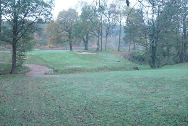
Green Wood is a picturesque forest located in the county of Derbyshire, England. Spanning over an extensive area, it is a popular destination for nature enthusiasts and outdoor adventurers alike. The forest is characterized by its lush greenery, diverse flora, and tranquil atmosphere, making it an ideal escape from the hustle and bustle of city life.

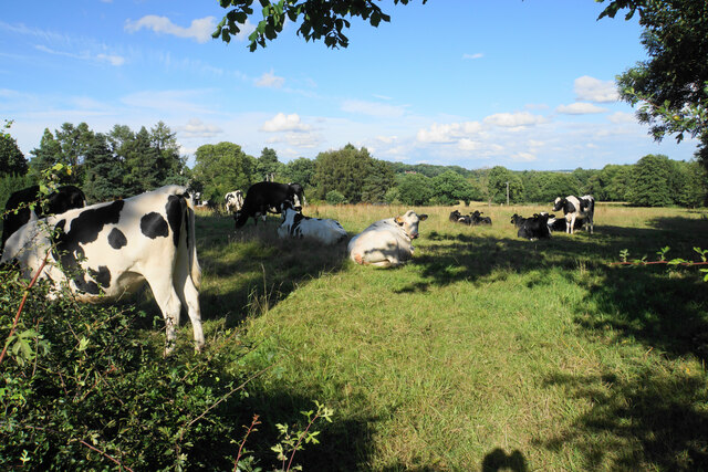
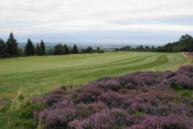
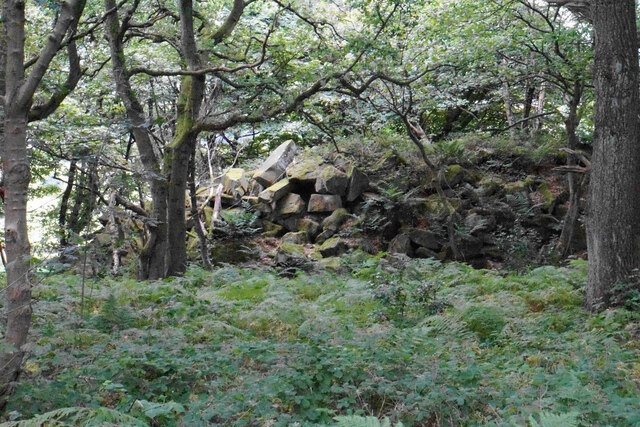
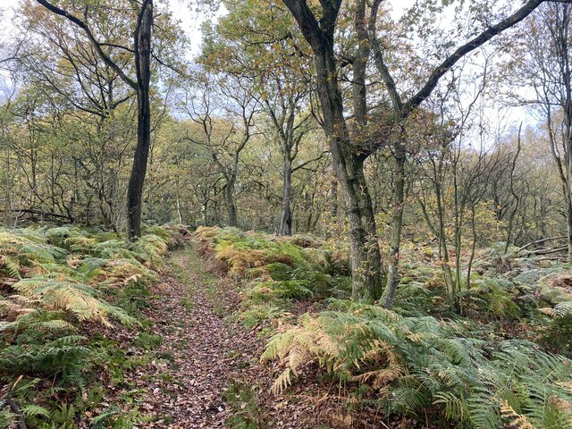
Covering a mix of deciduous and coniferous trees, Green Wood offers a rich tapestry of colors throughout the year. In spring, vibrant wildflowers carpet the forest floor, while in autumn, the foliage transforms into a stunning display of oranges, yellows, and reds. The variety of tree species, including oak, beech, and pine, provides a habitat for a wide range of wildlife, such as deer, foxes, and numerous bird species.

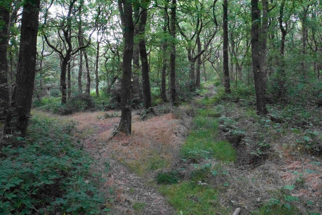
A network of well-maintained trails and paths winds its way through Green Wood, allowing visitors to explore the forest at their own pace. These paths cater to different levels of difficulty, from leisurely strolls to more challenging hikes, ensuring there is something for everyone. Along the way, visitors can appreciate the tranquil ponds, babbling brooks, and hidden glades that add to the enchanting ambiance of the forest.

Green Wood is also home to a visitor center, providing information on the local flora and fauna, as well as offering guided tours and educational programs for both adults and children. Additionally, there are picnic areas and designated camping spots, allowing visitors to immerse themselves in the natural beauty of the forest for an extended period.

Overall, Green Wood in Derbyshire is a captivating destination for nature lovers, offering a sanctuary of peace and serenity amidst the stunning beauty of the British countryside.

If you have any feedback on the listing, please let us know in the comments section below.
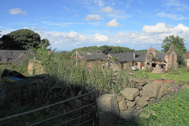
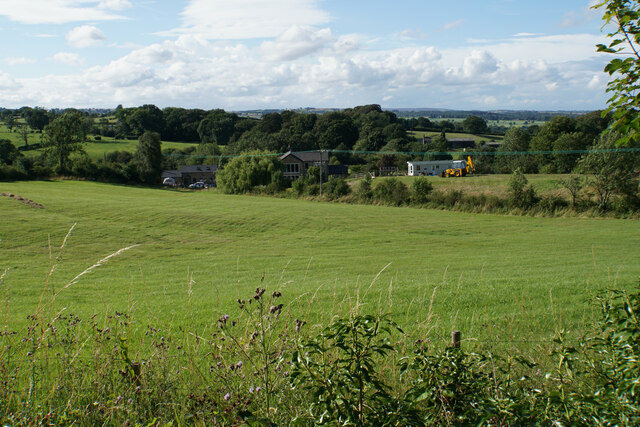
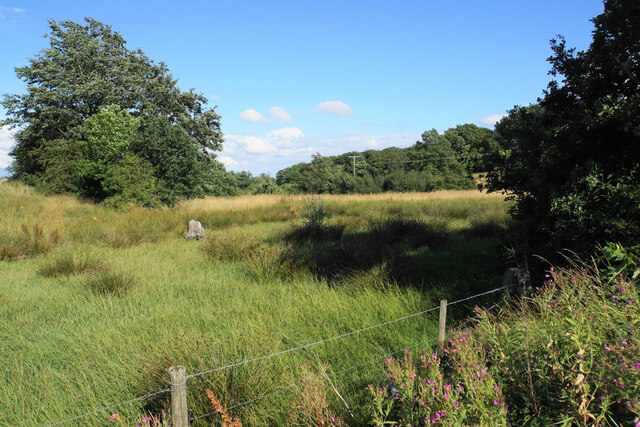
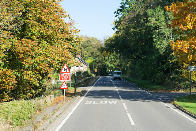
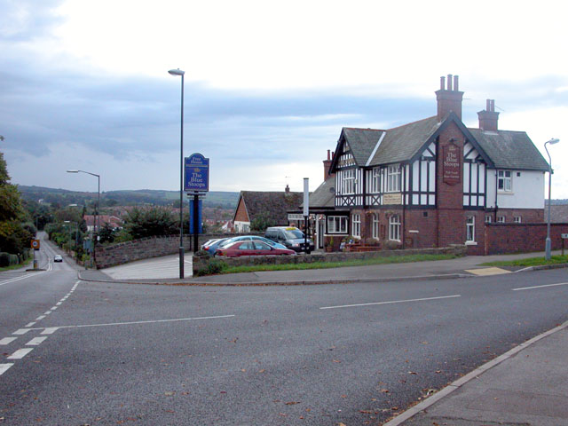
Green Wood Images

Images are sourced within 2km of 53.205333/-1.4635285 or Grid Reference SK3567. Thanks to Geograph Open Source API. All images are credited.

Harperhill Farm Not in a great state of repair and not in current use.
Harperhill Farm
Not in a great state of repair and not in current use.
Farmland below Stoneycroft Lane The farmland is on the gently rising land to the west of Chesterfield.
Farmland below Stoneycroft Lane
The farmland is on the gently rising land to the west of Chesterfield.
Rough grazing land off Stoneycroft Lane The land is sloping up to Harper Hill.
Rough grazing land off Stoneycroft Lane
The land is sloping up to Harper Hill.
Cattle by Matlock Road On the outskirts of the Chesterfield conurbation.
Cattle by Matlock Road
On the outskirts of the Chesterfield conurbation.
Roadworks on Matlock Road The A632 is down to single-lane traffic.
Roadworks on Matlock Road
The A632 is down to single-lane traffic.
St John's Church, Walton Not easily seen from Matlock Road. The main entrance is on the other side, off Walton Back Lane.
St John's Church, Walton
Not easily seen from Matlock Road. The main entrance is on the other side, off Walton Back Lane.
Matlock Road heading towards Chesterfield Passing through the suburb of Walton, most of which is to the left. A footpath which predates most of the housing crosses at this point.
Matlock Road heading towards Chesterfield
Passing through the suburb of Walton, most of which is to the left. A footpath which predates most of the housing crosses at this point.
Blue Stoops A challenging view taken directly into the sun. The pub is the only one on Matlock Road in Chesterfield, seen here from across Foljambe Avenue.
Blue Stoops
A challenging view taken directly into the sun. The pub is the only one on Matlock Road in Chesterfield, seen here from across Foljambe Avenue.
The end of Matlock Road The A632 take a left turn here, though there are not many signs to tell you. The entrance to Chesterfield Golf Club is on the right.
The end of Matlock Road
The A632 take a left turn here, though there are not many signs to tell you. The entrance to Chesterfield Golf Club is on the right.
Fairway at Stanedge Golf Club One of the fairways crossed by a footpath. Chesterfield is seen on the plain in the distance.
Fairway at Stanedge Golf Club
One of the fairways crossed by a footpath. Chesterfield is seen on the plain in the distance.
Path through Stone Edge Plantation A pleasant and sufficiently airy route through this broad-leaved plantation on former quarry land.
Path through Stone Edge Plantation
A pleasant and sufficiently airy route through this broad-leaved plantation on former quarry land.
Pile of rocks in Stone Edge Plantation A reminder of former quarrying activity.
Pile of rocks in Stone Edge Plantation
A reminder of former quarrying activity.
Farm paraphernalia above Carr House Farm Looking down from Bole Hill.
Farm paraphernalia above Carr House Farm
Looking down from Bole Hill.
Path through Stone Edge plantation Showing some autumn colour.
Path through Stone Edge plantation
Showing some autumn colour.
Footpath crossing Birdholme Brook The path is passing through the Chesterfield Golf Club course. It is viewed in fading light on a misty autumn afternoon.
Footpath crossing Birdholme Brook
The path is passing through the Chesterfield Golf Club course. It is viewed in fading light on a misty autumn afternoon.
Matlock Road (A632) The A632 is an important (though non-primary) A-road which runs for 22½ miles between Matlock, in Derbyshire, and Cuckney, in Nottinghamshire, via Chesterfield and Bolsover.
Matlock Road (A632)
The A632 is an important (though non-primary) A-road which runs for 22½ miles between Matlock, in Derbyshire, and Cuckney, in Nottinghamshire, via Chesterfield and Bolsover.
Matlock Road, Slatepit Dale The A632 is an important (though non-primary) A-road which runs for 22½ miles between Matlock, in Derbyshire, and Cuckney, in Nottinghamshire, via Chesterfield and Bolsover.
Matlock Road, Slatepit Dale
The A632 is an important (though non-primary) A-road which runs for 22½ miles between Matlock, in Derbyshire, and Cuckney, in Nottinghamshire, via Chesterfield and Bolsover.
A632 Matlock Road The A632 is an important (though non-primary) A-road which runs for 22½ miles between Matlock, in Derbyshire, and Cuckney, in Nottinghamshire, via Chesterfield and Bolsover.
A632 Matlock Road
The A632 is an important (though non-primary) A-road which runs for 22½ miles between Matlock, in Derbyshire, and Cuckney, in Nottinghamshire, via Chesterfield and Bolsover.
Show me another place!

Green Wood is located at Grid Ref: SK3567 (Lat: 53.205333, Lng: -1.4635285)

Administrative County: Derbyshire

District: North East Derbyshire

Police Authority: Derbyshire

What 3 Words

///openly.widest.habit. Near Walton, Derbyshire

Related Wikis

Walton, Chesterfield

Walton is a suburb of Chesterfield, in the Chesterfield district, in the county of Derbyshire, England. Walton extends into the neighbouring North East...

Holymoorside

Holymoorside is a village in the civil parish of Holymoorside and Walton, in the North East Derbyshire district, in the county of Derbyshire, England,...

Walton Hall, Chesterfield

Walton Hall is a late 18th-century country house, now a farmhouse, situated at Foljambe Avenue, Walton, Chesterfield. It is a Grade II listed building...

Wingerworth

Wingerworth is a large village and parish in North East Derbyshire, England. Its population, according to the 2011 census, was 6,533. Wingerworth is 3...

Somersall Hall

Somersall Hall is a small country house near Brampton, Chesterfield, Derbyshire. It is a Grade II listed building.The Clarke family owned the estate in...

All Saints' Church, Wingerworth

All Saints’ Church, Wingerworth is a Grade I listed parish church in the Church of England in Wingerworth, Derbyshire. == History == The church dates from...
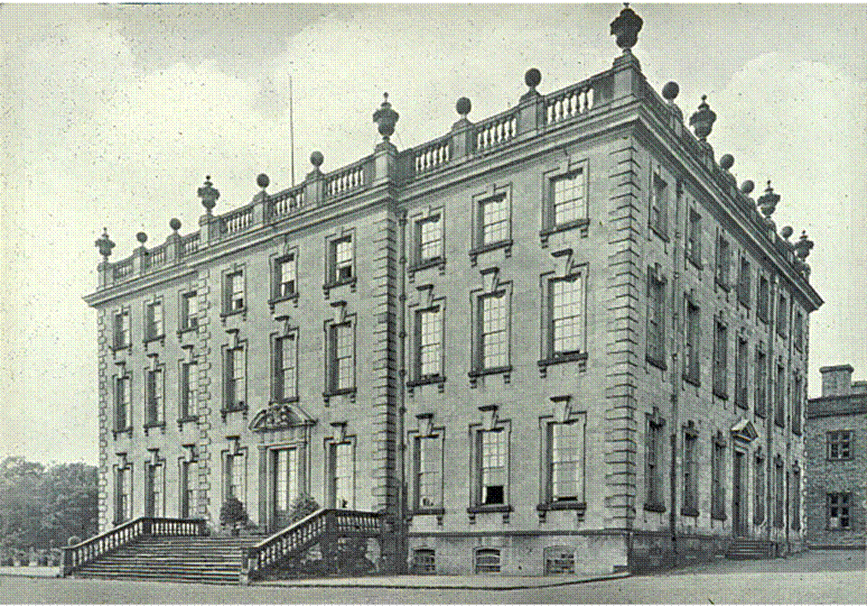
Wingerworth Hall

Wingerworth Hall, demolished 1927, was the ancestral home of the Hunloke family in the village of Wingerworth, Derbyshire, England. It was built on an...

North East Derbyshire

North East Derbyshire is a local government district in Derbyshire, England. The council is based in the large village of Wingerworth. The district also...

Nearby Amenities

Located within 500m of 53.205333,-1.4635285
Barrier: stile
Stile: squeezer
Lat/Long: 53.2024901/-1.4642629
Barrier: stile
Steps: 1
Stile: stepover
Lat/Long: 53.2028347/-1.4641878
Barrier: stile
Stile: squeezer
Lat/Long: 53.2039167/-1.4639773
Parking
Ele: 148.4080811
Lat/Long: 53.2022224/-1.4633501
Communication Mobile Phone: yes
Description: Mobile Phone Mast disguised as a tree
Man Made: tower
Mimics: tree
Tower Type: communication
Lat/Long: 53.2086355/-1.4591959
Barrier: stile
Steps: 2
Stile: wall
Lat/Long: 53.2066001/-1.4582583
Barrier: stile
Steps: 2
Stile: stepover
Lat/Long: 53.2068474/-1.4577018
Barrier: stile
Steps: 2
Stile: stepover
Lat/Long: 53.2074249/-1.4577177
Barrier: stile
Steps: 2
Stile: stepover
Lat/Long: 53.2080553/-1.4581906
Parking
Access: unknown
Description: Private-looking parking area opposite farm
Ele: 193.1091309
Lat/Long: 53.2068839/-1.4674538
Ele: 188.7832031
Lat/Long: 53.2074971/-1.4671991
Ele: 187.5814209
Lat/Long: 53.2063129/-1.4649653
Barrier: stile
Steps: 2
Stile: stepover
Lat/Long: 53.2067751/-1.4660903
Barrier: stile
Steps: 2
Stile: stepover
Lat/Long: 53.205733/-1.4628168
Barrier: stile
Material: wood
Steps: 1
Stile: stepover
Lat/Long: 53.2072536/-1.4670515
Barrier: stile
Ele: 177.0072021
Material: wood
Steps: 2
Stile: stepover
Lat/Long: 53.2087207/-1.4679424
Ele: 152
Lat/Long: 53.2040416/-1.4679971
Ele: 150
Lat/Long: 53.2044259/-1.4669773
Barrier: stile
Material: stone
Steps: 2
Stile: stepover
Lat/Long: 53.206983/-1.4672433
Barrier: stile
Steps: 2
Stile: stepover
Lat/Long: 53.2053116/-1.4622768
Barrier: stile
Steps: 2
Stile: stepover
Lat/Long: 53.2060833/-1.4642215
Barrier: stile
Steps: 4
Stile: wall
Lat/Long: 53.2028508/-1.4694579
Barrier: stile
Lat/Long: 53.2049969/-1.4613775
Barrier: stile
Steps: 1
Stile: stepover
Lat/Long: 53.2065292/-1.4583291
Barrier: stile
Lat/Long: 53.2060702/-1.4589985
Barrier: stile
Steps: 2
Stile: stepover
Lat/Long: 53.2049706/-1.461478
Barrier: stile
Source: survey
Steps: 1
Stile: stepover
Lat/Long: 53.2042387/-1.4638592
Barrier: stile
Source: survey
Lat/Long: 53.2041899/-1.4631088
Barrier: stile
Source: survey
Steps: 1
Stile: stepover
Lat/Long: 53.2030914/-1.4610981
Ele: 163
Lat/Long: 53.2071267/-1.4569375
Information: route_marker
Tourism: information
Lat/Long: 53.2031381/-1.4610056
Information: route_marker
Tourism: information
Lat/Long: 53.2041576/-1.4630928
Barrier: stile
Material: stone
Source: survey;gps
Stile: squeezer
Lat/Long: 53.2072529/-1.4670506
The data included in this document is from www.openstreetmap.org. The data is made available under ODbL.

Have you been to Green Wood?

Leave your review of Green Wood below (or comments, questions and feedback).