Scotland Wood

Wood, Forest in Yorkshire

England

Scotland Wood

The Fairway - Alwoodley Lane
The Fairway - Alwoodley Lane Credit: Betty Longbottom

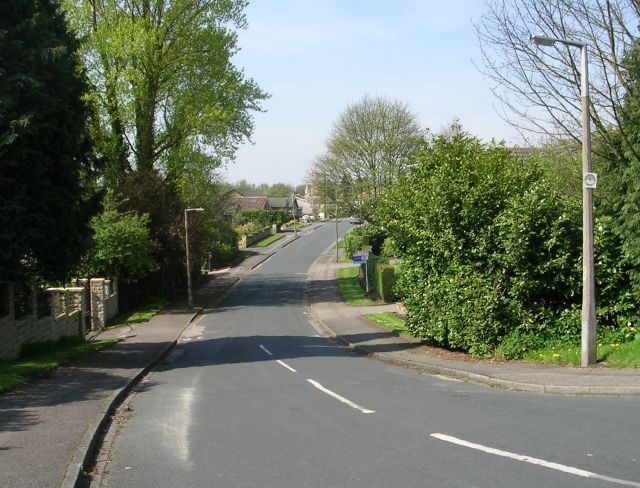
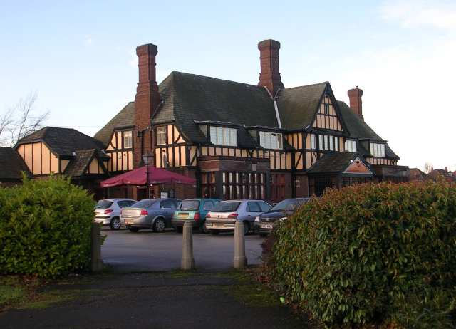
Scotland Wood is a small suburban area situated in the city of Leeds, West Yorkshire, England. It is located approximately 5 miles northwest of Leeds city center and is a part of the larger district of Bramley. The area gets its name from the dense woodland that surrounds it, creating a peaceful and picturesque environment.

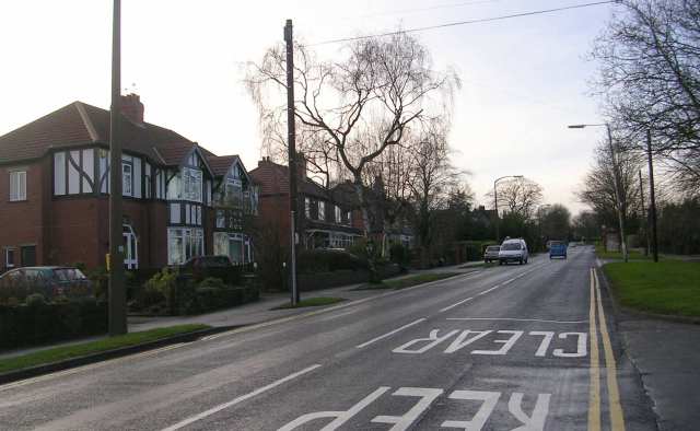
Scotland Wood is primarily a residential area, characterized by a mix of housing types including detached and semi-detached houses, as well as some apartment buildings. The properties in the area are mainly family homes, attracting a diverse population.

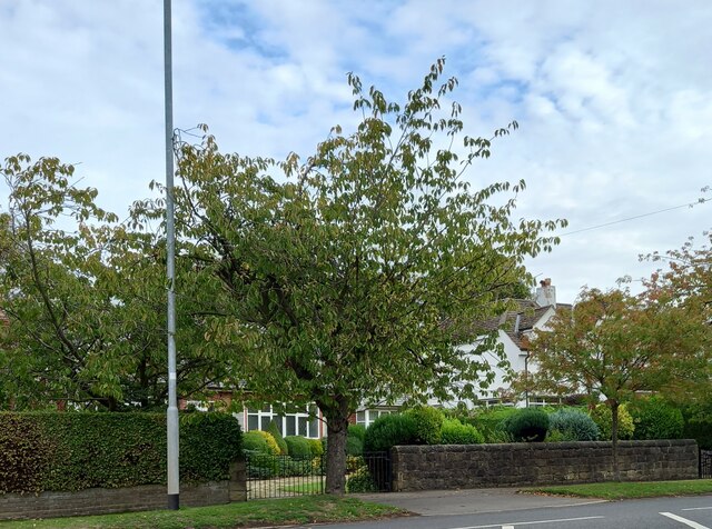
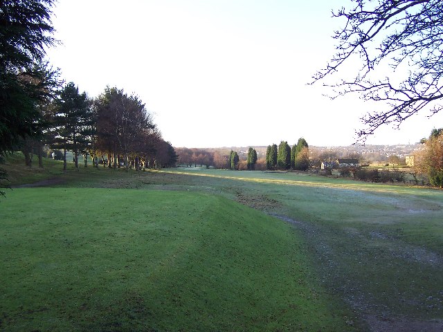
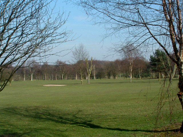
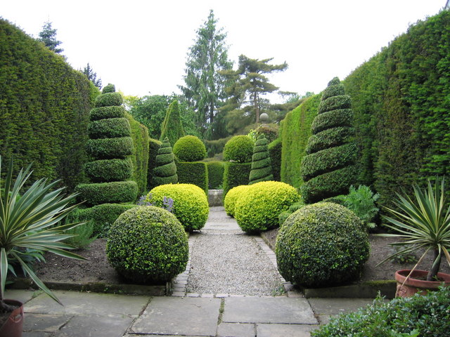
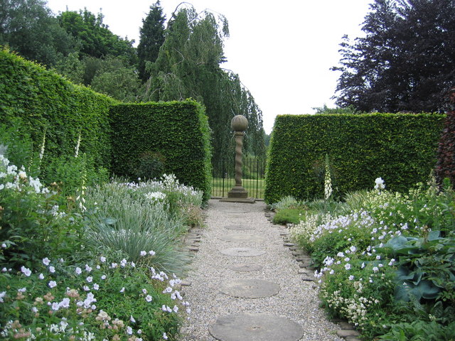
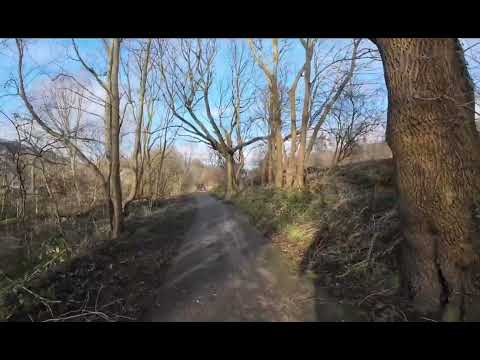
One of the highlights of Scotland Wood is its proximity to beautiful natural surroundings. The area is surrounded by lush green spaces, including Scotland Wood itself, which offers peaceful walks and opportunities for outdoor activities. Nearby attractions include Bramley Fall Park and Calverley Woods, providing residents with ample opportunities to enjoy nature and engage in recreational pursuits.

In terms of amenities, Scotland Wood benefits from its close proximity to Bramley, which offers a range of local shops, supermarkets, and other essential services. The area is also well connected to Leeds city center and other nearby towns through regular bus services.

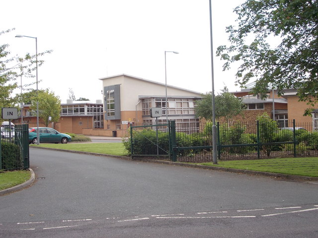
Scotland Wood is home to several schools and educational institutions, making it an attractive location for families. The area also has good transport links, with easy access to major road networks such as the A647 and A657, allowing residents to commute easily to surrounding areas.

Overall, Scotland Wood offers a tranquil living environment within close reach of the amenities and attractions of Leeds city center, making it an appealing place to reside for both families and professionals.

If you have any feedback on the listing, please let us know in the comments section below.

Scotland Wood Images

Images are sourced within 2km of 53.849192/-1.5645191 or Grid Reference SE2839. Thanks to Geograph Open Source API. All images are credited.
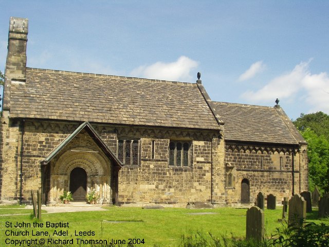
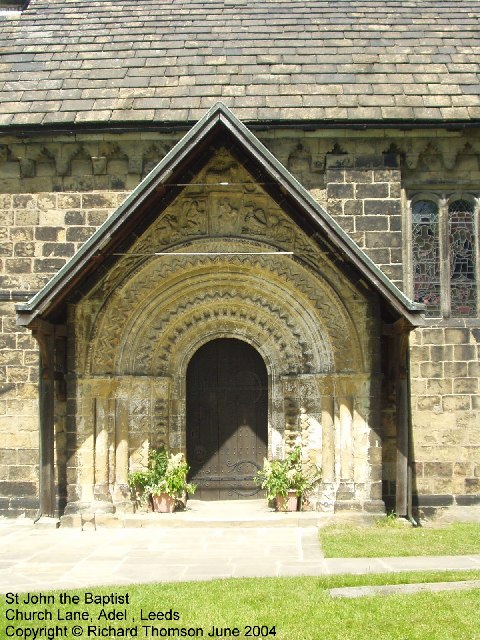
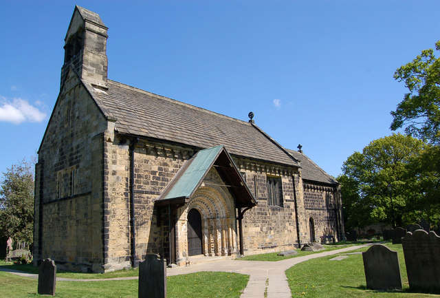
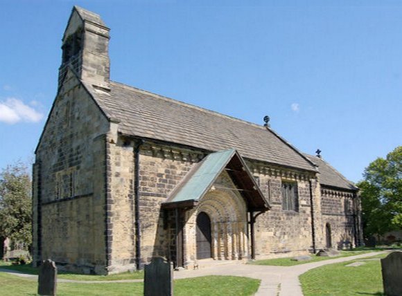
The Fairway - Alwoodley Lane
Alwoodley, Alwoodley Lane The benchmark is cut into the roadside wall on the north side of the road, and is immediately to the left of the entrance to number 177.
Alwoodley, Alwoodley Lane
The benchmark is cut into the roadside wall on the north side of the road, and is immediately to the left of the entrance to number 177.
Alwoodley, Alwoodley Lane There is a benchmark cut into the roadside wall on the north side of the road, and is immediately to the left of the wrought iron gate at the entrance to number 177.
Alwoodley, Alwoodley Lane
There is a benchmark cut into the roadside wall on the north side of the road, and is immediately to the left of the wrought iron gate at the entrance to number 177.
Frosty morning on Headingley Golf Course Not actually in Headingley - but situated between Adel, Alwoodley and Eccup Lane
Frosty morning on Headingley Golf Course
Not actually in Headingley - but situated between Adel, Alwoodley and Eccup Lane
St John The Baptist Church, Church Lane, Adel, Leeds This is one of the oldest churches in the Leeds area, dating back to Norman times (11th-12th century). Unusually for such an old church, it was not developed, enlarged or extended in Victorian times.
St John The Baptist Church, Church Lane, Adel, Leeds
This is one of the oldest churches in the Leeds area, dating back to Norman times (11th-12th century). Unusually for such an old church, it was not developed, enlarged or extended in Victorian times.
St John the Baptist Church, Church Lane, Adel, Leeds This church has a lovely Norman doorway.
St John the Baptist Church, Church Lane, Adel, Leeds
This church has a lovely Norman doorway.
Road repairs, Long Causeway, Adel, Leeds At the north end of Long Causeway, by its junction with Stairfoot Lane and Back Church Lane
Road repairs, Long Causeway, Adel, Leeds
At the north end of Long Causeway, by its junction with Stairfoot Lane and Back Church Lane
Stairfoot Lane, Alwoodley, Leeds Looking west towards Adel, near the junction of King Lane.
Stairfoot Lane, Alwoodley, Leeds
Looking west towards Adel, near the junction of King Lane.
Alwoodley Park. Looking SW down The Avenue, near the junction with The Drive and The Fairway.
Alwoodley Park.
Looking SW down The Avenue, near the junction with The Drive and The Fairway.
Sand Moor Golf Club Escaping from the suburbs of Leeds you pass the manicured fairways (and manicured trees) of Sand Moor
Sand Moor Golf Club
Escaping from the suburbs of Leeds you pass the manicured fairways (and manicured trees) of Sand Moor
Adel Crag This famous rock outcrop in Adel Woods is a magnet for boys of all ages.
Adel Crag
This famous rock outcrop in Adel Woods is a magnet for boys of all ages.
Adel, St John the Baptist Norman Door Ring (1963) The original Norman bronze piece shown was stolen in 2002 and was replaced in replica. The handle is in the form of a monster’s head, probably a lion, with a mouth swallowing a man. 

Acknowledgements.

1. Nikolaus Pevsner. The Buildings of England. Yorkshire: The West Riding. 1959.

2. Leeds / Susan Wrathmell with John Minnis / and contributions by Janet Douglas ... [et al.] 2005.

3. Leodis - a photographic archive of Leeds. <span class="nowrap"><a title="http://www.leodis.net" rel="nofollow ugc noopener" href="http://www.leodis.net">Link</a><img style="margin-left:2px;" alt="External link" title="External link - shift click to open in new window" src="https://s1.geograph.org.uk/img/external.png" width="10" height="10"/></span>
Adel, St John the Baptist Norman Door Ring (1963)
The original Norman bronze piece shown was stolen in 2002 and was replaced in replica. The handle is in the form of a monster’s head, probably a lion, with a mouth swallowing a man. Acknowledgements. 1. Nikolaus Pevsner. The Buildings of England. Yorkshire: The West Riding. 1959. 2. Leeds / Susan Wrathmell with John Minnis / and contributions by Janet Douglas ... [et al.] 2005. 3. Leodis - a photographic archive of Leeds. LinkExternal link
Adel Church St John the Baptist Church, Adel. Built 1170 on a prehistoric trade route between the East and West Ridings.
Pevsner wrote that this is the most complete Norman church in Yorkshire.  Apart from its celebrated Norman archway now protected by the porch structure shown here, an unusual feature of this church are the corbels.These are decorated in a similar grotesque style to that of the gargoyles at Ripon Cathedral which it seems they must pre-date.
Adel Church
St John the Baptist Church, Adel. Built 1170 on a prehistoric trade route between the East and West Ridings. Pevsner wrote that this is the most complete Norman church in Yorkshire. Apart from its celebrated Norman archway now protected by the porch structure shown here, an unusual feature of this church are the corbels.These are decorated in a similar grotesque style to that of the gargoyles at Ripon Cathedral which it seems they must pre-date.
Signpost to Adel Crag This signpost, at the side of the Dales way through Adel Woods, indicates the way to the famous Adel Crag.  See <a href="https://www.geograph.org.uk/photo/280853">SE2840 : Adel Crag</a>.
Signpost to Adel Crag
This signpost, at the side of the Dales way through Adel Woods, indicates the way to the famous Adel Crag. See SE2840 : Adel Crag.
The Lawnswood Arms - Otley Road
Herb Garden, York Gate Garden Owned by the charity Perennial,this is one of 14 areas within the garden.
Herb Garden, York Gate Garden
Owned by the charity Perennial,this is one of 14 areas within the garden.
White and Silver Garden, York Gate Garden York Gate Garden is owned by the charity Perennial and is open to the public in Spring and Summer.
White and Silver Garden, York Gate Garden
York Gate Garden is owned by the charity Perennial and is open to the public in Spring and Summer.
Show me another place!

Scotland Wood is located at Grid Ref: SE2839 (Lat: 53.849192, Lng: -1.5645191)

Division: West Riding

Unitary Authority: Leeds

Police Authority: West Yorkshire

What 3 Words

///blunt.payer.spike. Near Chapel Allerton, West Yorkshire

Related Wikis

Related Videos

Awesome walking trails through Meanwood valley

Part of the Meanwood valley trail in Leeds-west Yorkshire.uk.this is a way marked footpath covering 7 miles in total from ...

#woodland #walking #adventure #ww2 #nature What's that in the woods? Adel Wood, North Leeds

A walk through the lovely Adel Wood to the pre WW2 bunker and the Devil's Rock. Free car parking is available on King Lane and ...

Nearby Amenities

Located within 500m of 53.849192,-1.5645191
Bus Stop
Black Moor Road Scotland Wood Road
Bench: yes
Bin: yes
Bus: yes
Lit: yes
Local Ref: 45010591
Naptan AtcoCode: 450010591
Naptan Bearing: SE
Naptan CommonName: Black Moor Road Scotland Wood Road
Naptan Crossing: Scotland Wood Road
Naptan Indicator: Stop 45010591
Naptan PlusbusZoneRef: LEEDS
Naptan ShortCommonName: Scotland Wood Road
Naptan Street: Black Moor Road
Naptan Verified: no
Public Transport: platform
Ref: 45010591
Shelter: yes
Source: naptan_import
Tactile Paving: no
Lat/Long: 53.8463874/-1.5610462
Bus Stop
Cranmer Bank
Bench: yes
Bin: yes
Bus: yes
Local Ref: 45010592
Naptan AtcoCode: 450010592
Naptan Bearing: NW
Naptan CommonName: Cranmer Bank Tynwald Hill
Naptan Crossing: Tynwald Hill
Naptan Indicator: Stop 45010592
Naptan Landmark: Cranmer Bank PH
Naptan PlusbusZoneRef: LEEDS
Naptan ShortCommonName: Tynwald Hill
Naptan Street: Cranmer Bank
Naptan Verified: no
Public Transport: platform
Ref: 45010592
Shelter: yes
Source: naptan_import
Lat/Long: 53.8475147/-1.5577196
Bus Stop
Cranmer Bank
Bench: no
Bus: yes
Local Ref: 45012617
Naptan AtcoCode: 450012617
Naptan Bearing: SE
Naptan CommonName: Cranmer Bank Tynwald Hill
Naptan Crossing: Tynwald Hill
Naptan Indicator: Stop 45012617
Naptan Landmark: Cranmer Bank PH
Naptan PlusbusZoneRef: LEEDS
Naptan ShortCommonName: Tynwald Hill
Naptan Street: Cranmer Bank
Naptan Verified: no
Public Transport: platform
Ref: 45012617
Shelter: no
Source: naptan_import
Lat/Long: 53.847516/-1.5575383
Bus Stop
Black Moor Road Scotland Wood Road
Bench: no
Bus: yes
Local Ref: 45012665
Naptan AtcoCode: 450012665
Naptan Bearing: NW
Naptan CommonName: Black Moor Road Scotland Wood Road
Naptan Crossing: Scotland Wood Road
Naptan Indicator: Stop 45012665
Naptan PlusbusZoneRef: LEEDS
Naptan ShortCommonName: Scotland Wood Road
Naptan Street: Black Moor Road
Naptan Verified: no
Public Transport: platform
Ref: 45012665
Shelter: no
Source: naptan_import
Lat/Long: 53.8465323/-1.5613639
Turning Circle
Lat/Long: 53.8519975/-1.560837
Turning Circle
Lat/Long: 53.8516288/-1.5589181
Turning Circle
Lat/Long: 53.8511892/-1.5623338
Turning Circle
Lat/Long: 53.8531236/-1.5632824
Turning Circle
Lat/Long: 53.8508267/-1.5616085
Turning Circle
Lat/Long: 53.850183/-1.5599533
Parking
Parking: surface
Lat/Long: 53.8448772/-1.5638618
Parking
Parking: surface
Lat/Long: 53.8455214/-1.5631984
Atm
Fee: no
Operator: Post Office
Source: memory
Lat/Long: 53.8475809/-1.5580053
Turning Circle
Lat/Long: 53.8491048/-1.5602056
Post Box
Operator: Royal Mail
Post Box Type: pillar
Ref: LS17 936
Lat/Long: 53.8476455/-1.5579747
Fast Food
Pizza Marino & Mega Balti
Addr City: Leeds
Addr Housenumber: 63a
Addr Postcode: LS17 5JD
Addr Street: Cranmer Bank
Addr Suburb: Moortown
Fhrs Id: 319691
Lat/Long: 53.8477181/-1.5582107
Cafe
Cranmer Bank Community Cafe
Addr City: Leeds
Addr Housenumber: 53-55
Addr Postcode: LS17 5JD
Addr Street: Cranmer Bank
Addr Suburb: Moortown
Fhrs Id: 1089476
Old Name: Nosh @ Northcall Cafe
Lat/Long: 53.8473813/-1.557811
Bicycle Parking
Bicycle Parking: stands
Capacity: 4
Covered: no
Lat/Long: 53.8474699/-1.5576796
The Wine Shop
Addr City: Leeds
Addr Housenumber: 63
Addr Postcode: LS17 5JD
Addr Street: Cranmer Bank
Addr Suburb: Moortown
Fhrs Id: 1583932
Shop: alcohol
Lat/Long: 53.8476534/-1.5581383
Post Office
Ali News
Shop: convenience
Lat/Long: 53.8472784/-1.5576742
Bench
Lat/Long: 53.8474161/-1.5576689
Post Box
Collection Times: Mo-Fr 09:00, Sa 07:00
Operator: Royal Mail
Post Box Type: pillar
Ref: LS17 898
Royal Cypher: GVIR
Royal Cypher Wikidata: Q33102169
Lat/Long: 53.8486771/-1.5611355
Waste Basket
Ref UK Leedscc Bin: 823
Lat/Long: 53.847564/-1.557769
Waste Basket
Ref UK Leedscc Bin: 825
Lat/Long: 53.847518/-1.557925
Waste Basket
Ref UK Leedscc Bin: 826
Lat/Long: 53.847691/-1.558117
Waste Basket
Ref UK Leedscc Bin: 257
Lat/Long: 53.8464016/-1.5610934
Turning Circle
Lat/Long: 53.8455292/-1.5605549
Bus Stop
Deanswood Hill
Bench: no
Bin: no
Bus: yes
Lit: no
Naptan AtcoCode: 450027894
Naptan NaptanCode: 45027894
Public Transport: platform
Ref: 45027894
Shelter: no
Tactile Paving: no
Lat/Long: 53.8478222/-1.5599979
Bus Stop
Deanswood Hill
Bench: no
Bin: no
Bus: yes
Public Transport: platform
Ref: 45027313
Shelter: no
Lat/Long: 53.8478066/-1.5591893
The data included in this document is from www.openstreetmap.org. The data is made available under ODbL.

Have you been to Scotland Wood?

Leave your review of Scotland Wood below (or comments, questions and feedback).