Denny Bottom
Settlement in Kent Tunbridge Wells
England
Denny Bottom
Denny Bottom is a small rural settlement located in the county of Kent, in the southeastern part of England. Situated near the village of Seal, it is nestled in the picturesque landscape of the North Downs, renowned for its beautiful rolling hills and stunning countryside views.
This quaint hamlet primarily consists of a cluster of residential properties, including a mix of traditional cottages and modern houses. The area is known for its peaceful and idyllic atmosphere, making it a desirable place to live for those seeking a tranquil lifestyle away from the bustling city.
Denny Bottom benefits from its close proximity to a number of amenities and attractions. The nearby village of Seal offers various local shops, pubs, and a primary school, providing essential services for the residents of Denny Bottom. Additionally, the larger town of Sevenoaks is just a short drive away, offering a wider range of facilities, including supermarkets, restaurants, and leisure centers.
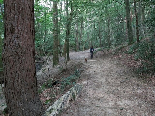
For nature enthusiasts, Denny Bottom offers easy access to the stunning North Downs Way, a popular long-distance footpath that stretches across the North Downs. The area is also surrounded by an abundance of beautiful woodland and countryside, providing ample opportunities for outdoor activities such as hiking, cycling, and horse riding.
Overall, Denny Bottom is a charming and peaceful rural settlement, perfect for those seeking a serene lifestyle immersed in the natural beauty of the Kentish countryside.
If you have any feedback on the listing, please let us know in the comments section below.
Denny Bottom Images
Images are sourced within 2km of 51.135894/0.242559 or Grid Reference TQ5639. Thanks to Geograph Open Source API. All images are credited.


Denny Bottom is located at Grid Ref: TQ5639 (Lat: 51.135894, Lng: 0.242559)
Administrative County: Kent
District: Tunbridge Wells
Police Authority: Kent
What 3 Words
///infects.clipboard.shorthand. Near Rusthall, Kent
Nearby Locations
Related Wikis
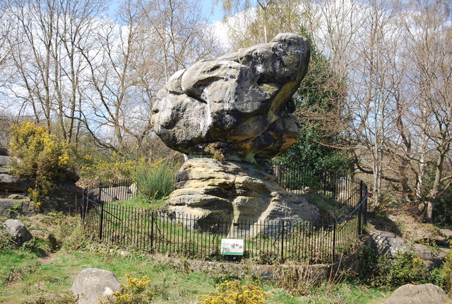
Rusthall Common
Rusthall Common is a 2.7-hectare (6.7-acre) geological Site of Special Scientific Interest in Rusthall, a suburb of Tunbridge Wells in Kent. It is a Geological...
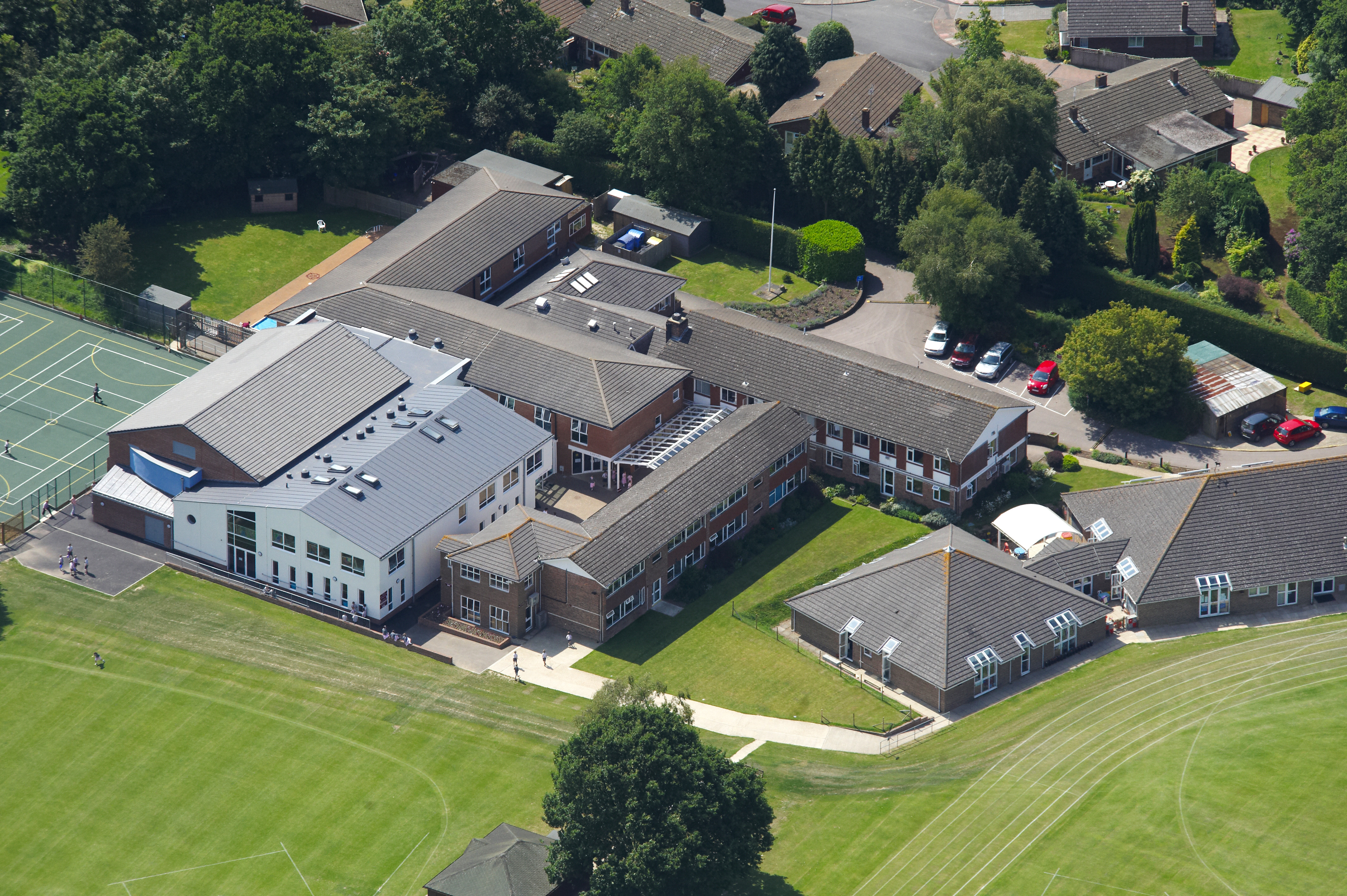
Rose Hill School
Rose Hill School is a co-educational preparatory school in Royal Tunbridge Wells, Kent, England. It is a member of the Independent Association of Preparatory...

Rusthall
Rusthall is a village located approximately 2 miles to the west of the spa town of Tunbridge Wells in Kent. The village grew up around a large property...

St Paul's Church, Rusthall
St Paul's Church is a Church of England parish church in Rusthall, Kent, England. It is a Grade II listed building. == History == St Paul's Church was...

Bennett Memorial Diocesan School
Bennett Memorial Diocesan School is an all ability co-educational academy in Royal Tunbridge Wells, Kent, England, which caters for students from age 11...
Linden Park Cricket Club
Linden Park Cricket Club (LPCC) is a cricket club based at Higher Cricket Ground, Fir Tree Road, Royal Tunbridge Wells, Kent, England.The club has a senior...

Higher Common Ground
Higher Common Ground is a cricket ground on Tunbridge Wells Common in the town of Royal Tunbridge Wells in Kent. It was used as a ground by Kent County...
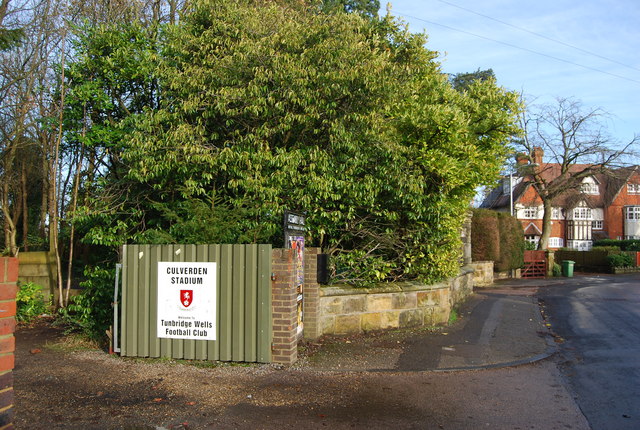
Culverden Stadium
Culverden Stadium is an association football stadium in Royal Tunbridge Wells, Kent, England. It is the home ground of Tunbridge Wells F.C. It has a capacity...
Nearby Amenities
Located within 500m of 51.135894,0.242559Have you been to Denny Bottom?
Leave your review of Denny Bottom below (or comments, questions and feedback).