Denny

Settlement in Stirlingshire

Scotland

Denny

Road approaching Blaefaulds Looking south-eastward.
Road approaching Blaefaulds Credit: Peter Wood

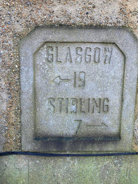
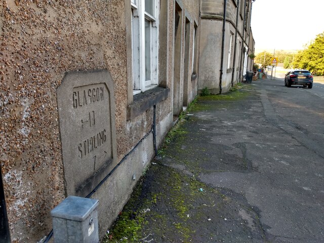
Denny is a small town located in Stirlingshire, Scotland. Situated on the banks of the River Carron, it lies approximately 7 miles west of Falkirk and 6 miles north of Cumbernauld. With a population of around 8,000, Denny is a close-knit community with a rich history.

Historically, Denny was known for its iron and steel industries, which thrived in the 19th and early 20th centuries. The town played a crucial role in Scotland's industrial revolution, and remnants of this heritage can still be seen today. The iconic Denny Ship Model Experiment Tank, built in 1882, is a notable landmark that serves as a reminder of the town's shipbuilding legacy.

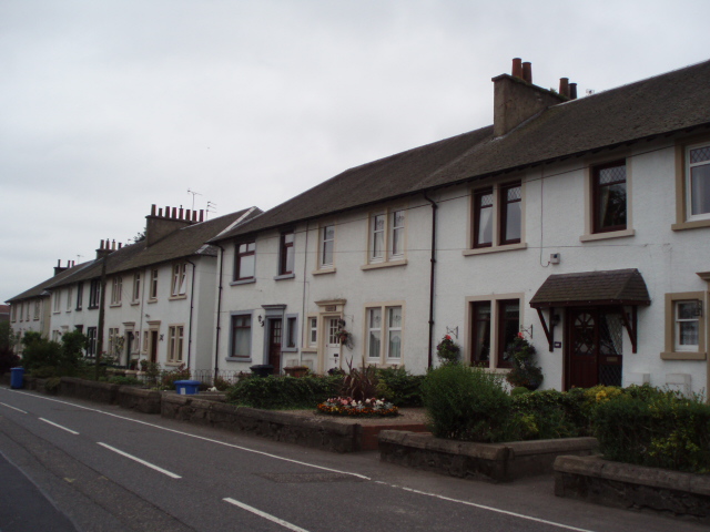
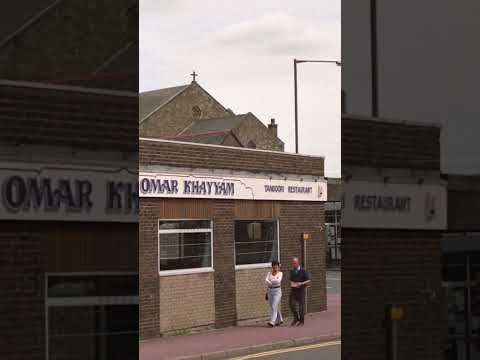
Today, Denny has become a residential area with a mix of housing styles, ranging from traditional stone-built houses to modern developments. The town offers various amenities, including shops, cafes, and pubs, catering to the needs of its residents.

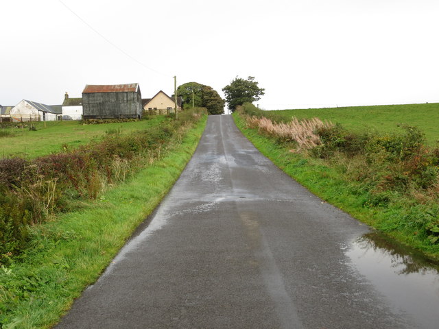
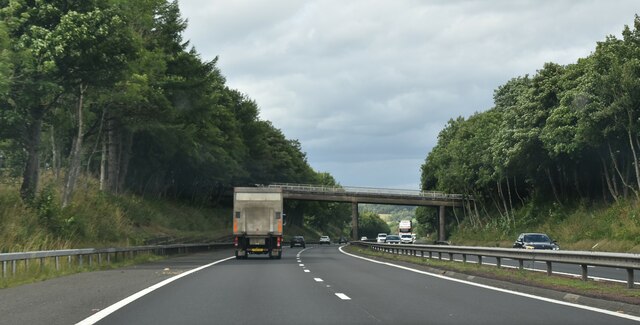
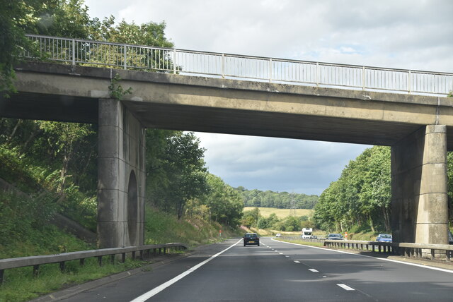
Nature enthusiasts can explore the nearby Denny and Dunipace Glens, which provide picturesque walking trails and opportunities to observe local wildlife. Additionally, the town is well-connected, with good transportation links to nearby cities and towns, making it an attractive place to live for those seeking a balance between a peaceful community and access to urban amenities.

Overall, Denny, Stirlingshire offers a charming blend of history, natural beauty, and a close community spirit, making it an appealing place to call home in central Scotland.

If you have any feedback on the listing, please let us know in the comments section below.

Denny Images

Images are sourced within 2km of 56.022888/-3.907543 or Grid Reference NS8182. Thanks to Geograph Open Source API. All images are credited.

Road approaching Blaefaulds Looking south-eastward.
Road approaching Blaefaulds
Looking south-eastward.
Little Denny Reservoir The Little Denny Burn flows through the hollow in the foreground.
Little Denny Reservoir
The Little Denny Burn flows through the hollow in the foreground.
Minor road at Barnego The signpost on the left points to the path which leads through the Carron Glen woods, and eventually to Fankerton on the opposite side of the River Carron (crossed via a wooden footbridge).
Minor road at Barnego
The signpost on the left points to the path which leads through the Carron Glen woods, and eventually to Fankerton on the opposite side of the River Carron (crossed via a wooden footbridge).
M80, northbound The M80 joins Glasgow to Stirling. It runs 25 miles from Glasgow to Bannockburn.
<span class="nowrap"><a title="https://www.sabre-roads.org.uk/wiki/index.php?title=M80" rel="nofollow ugc noopener" href="https://www.sabre-roads.org.uk/wiki/index.php?title=M80">Link</a><img style="margin-left:2px;" alt="External link" title="External link - shift click to open in new window" src="https://s1.geograph.org.uk/img/external.png" width="10" height="10"/></span>
M80, northbound
The M80 joins Glasgow to Stirling. It runs 25 miles from Glasgow to Bannockburn. LinkExternal link
M80 approaching River Carron The M80 joins Glasgow to Stirling. It runs 25 miles from Glasgow to Bannockburn.
<span class="nowrap"><a title="https://www.sabre-roads.org.uk/wiki/index.php?title=M80" rel="nofollow ugc noopener" href="https://www.sabre-roads.org.uk/wiki/index.php?title=M80">Link</a><img style="margin-left:2px;" alt="External link" title="External link - shift click to open in new window" src="https://s1.geograph.org.uk/img/external.png" width="10" height="10"/></span>
M80 approaching River Carron
The M80 joins Glasgow to Stirling. It runs 25 miles from Glasgow to Bannockburn. LinkExternal link
Barnego Bridge, M80 The M80 joins Glasgow to Stirling. It runs 25 miles from Glasgow to Bannockburn.
<span class="nowrap"><a title="https://www.sabre-roads.org.uk/wiki/index.php?title=M80" rel="nofollow ugc noopener" href="https://www.sabre-roads.org.uk/wiki/index.php?title=M80">Link</a><img style="margin-left:2px;" alt="External link" title="External link - shift click to open in new window" src="https://s1.geograph.org.uk/img/external.png" width="10" height="10"/></span>
Barnego Bridge, M80
The M80 joins Glasgow to Stirling. It runs 25 miles from Glasgow to Bannockburn. LinkExternal link
M80, northbound The M80 joins Glasgow to Stirling. It runs 25 miles from Glasgow to Bannockburn.
<span class="nowrap"><a title="https://www.sabre-roads.org.uk/wiki/index.php?title=M80" rel="nofollow ugc noopener" href="https://www.sabre-roads.org.uk/wiki/index.php?title=M80">Link</a><img style="margin-left:2px;" alt="External link" title="External link - shift click to open in new window" src="https://s1.geograph.org.uk/img/external.png" width="10" height="10"/></span>
M80, northbound
The M80 joins Glasgow to Stirling. It runs 25 miles from Glasgow to Bannockburn. LinkExternal link
M80 crossing River Carron The M80 joins Glasgow to Stirling. It runs 25 miles from Glasgow to Bannockburn.
<span class="nowrap"><a title="https://www.sabre-roads.org.uk/wiki/index.php?title=M80" rel="nofollow ugc noopener" href="https://www.sabre-roads.org.uk/wiki/index.php?title=M80">Link</a><img style="margin-left:2px;" alt="External link" title="External link - shift click to open in new window" src="https://s1.geograph.org.uk/img/external.png" width="10" height="10"/></span>
M80 crossing River Carron
The M80 joins Glasgow to Stirling. It runs 25 miles from Glasgow to Bannockburn. LinkExternal link
M80, northbound The M80 joins Glasgow to Stirling. It runs 25 miles from Glasgow to Bannockburn.
<span class="nowrap"><a title="https://www.sabre-roads.org.uk/wiki/index.php?title=M80" rel="nofollow ugc noopener" href="https://www.sabre-roads.org.uk/wiki/index.php?title=M80">Link</a><img style="margin-left:2px;" alt="External link" title="External link - shift click to open in new window" src="https://s1.geograph.org.uk/img/external.png" width="10" height="10"/></span>
M80, northbound
The M80 joins Glasgow to Stirling. It runs 25 miles from Glasgow to Bannockburn. LinkExternal link
Old Milestone, Stirling St, Denny Set in the wall of a private house on the South side of the road.

Inscription: Glasgow / ⇦19 / Stirling / 7⇨

Milestone Society National ID: FK_GWST19
Old Milestone, Stirling St, Denny
Set in the wall of a private house on the South side of the road. Inscription: Glasgow / ⇦19 / Stirling / 7⇨ Milestone Society National ID: FK_GWST19
Building site at Dunipace New development of house building at Rosebank
Building site at Dunipace
New development of house building at Rosebank
Old milemarker A view looking west along Stirling Street before it turns to the north to cross Denny Bridge over the River Carron.  The milemarker plaque is in the wall of 111 Stirling Street.
Old milemarker
A view looking west along Stirling Street before it turns to the north to cross Denny Bridge over the River Carron. The milemarker plaque is in the wall of 111 Stirling Street.
Old milemarker A close up of the milemarker at 111 Stirling Street.   It is made of concrete.   The inscription with Glasgow to the left and Stirling to the right suggests that it may once have been on the western parapet of Denny Bridge.   Certainly, to follow the arrow to Glasgow from its current position would be a long way round.
Old milemarker
A close up of the milemarker at 111 Stirling Street. It is made of concrete. The inscription with Glasgow to the left and Stirling to the right suggests that it may once have been on the western parapet of Denny Bridge. Certainly, to follow the arrow to Glasgow from its current position would be a long way round.
Westfield Park, Home of Dunipace FC Scottish Cup First Round, Dunipace 1 Broxburn Athletic 1 (after extra time), Dunipace won 4-2 on penalties, estimated attendance 300
As a traditionalist I don't like the use of penalty shootouts to decide cup ties for any reasons that aren't pragmatic. For whatever reason, that is obviously pragmatic for the SFA in some way this year, but unclear to outside observers, all Scottish Cup ties - with the exception of the previous preliminary round - are to be decided on the day through extra time and penalties if required. The drama created by the penalty shootouts of great European and international tournaments can never be replicated in such small-scale settings as this. Plus replays bring in extra revenue, the big league teams are not yet involved, and even if they were, Scotland is not in this year's weirdly timetabled winter World Cup either. Bring back the old days of the occasional third replays I say!
Dunipace are based in Denny, a small town a couple of miles West of Falkirk. An area of Denny, not too far away but on the opposite side of the River Carron from here, is still shown on today's maps as being the actual Dunipace, so presumably the team - established as long ago as the 1880s - has not been based here from the start.
Dunipace are in the seventh tier of Scotland's football pyramid, and had won 12-0 in the preliminary round - their (currently)  bearded striker David Grant, who was playing in this game, scored a remarkable 9 goals in that match, which probably would have got more attention were it not for the fact that someone apparently scored thirteen in the most famous historic cup tie of all time well over a hundred years ago - Arbroath 36 Bon Accord 0. It must be quite high up there though in the record lists and I am surprised that the story didn't do the rounds more in the media.
Dunipace scored first with a very good classic cross-to-header goal, but after that it was mostly all Broxburn who, despite being in the next league higher up, and spending a great deal of the time in or close to the Dunipace penalty area, lacked the ability to fire a decent shot on goal (apart from the equaliser obviously!) This lack of killer instinct was evident again in the penalty shootout; the two that got in only just did so.
The long green and black shed on the far side of the pitch is where the dressing rooms are, and the only stand is tiny and oddly-positioned compared to other small clubs' lone stands - it is  to the right of the goal in the distance and only has enough room for about 50 spectators. Dunipace are in the black and white, and the ball is just to the right of the floodlight at the left of the picture (I think!)
On top of the usual pies, burgers and hotdogs were also available at the kiosk - always nice to have a few more options I think. But why a Bovril was more expensive than a tea or coffee is beyond my simple mind.
Westfield Park, Home of Dunipace FC
Scottish Cup First Round, Dunipace 1 Broxburn Athletic 1 (after extra time), Dunipace won 4-2 on penalties, estimated attendance 300 As a traditionalist I don't like the use of penalty shootouts to decide cup ties for any reasons that aren't pragmatic. For whatever reason, that is obviously pragmatic for the SFA in some way this year, but unclear to outside observers, all Scottish Cup ties - with the exception of the previous preliminary round - are to be decided on the day through extra time and penalties if required. The drama created by the penalty shootouts of great European and international tournaments can never be replicated in such small-scale settings as this. Plus replays bring in extra revenue, the big league teams are not yet involved, and even if they were, Scotland is not in this year's weirdly timetabled winter World Cup either. Bring back the old days of the occasional third replays I say! Dunipace are based in Denny, a small town a couple of miles West of Falkirk. An area of Denny, not too far away but on the opposite side of the River Carron from here, is still shown on today's maps as being the actual Dunipace, so presumably the team - established as long ago as the 1880s - has not been based here from the start. Dunipace are in the seventh tier of Scotland's football pyramid, and had won 12-0 in the preliminary round - their (currently) bearded striker David Grant, who was playing in this game, scored a remarkable 9 goals in that match, which probably would have got more attention were it not for the fact that someone apparently scored thirteen in the most famous historic cup tie of all time well over a hundred years ago - Arbroath 36 Bon Accord 0. It must be quite high up there though in the record lists and I am surprised that the story didn't do the rounds more in the media. Dunipace scored first with a very good classic cross-to-header goal, but after that it was mostly all Broxburn who, despite being in the next league higher up, and spending a great deal of the time in or close to the Dunipace penalty area, lacked the ability to fire a decent shot on goal (apart from the equaliser obviously!) This lack of killer instinct was evident again in the penalty shootout; the two that got in only just did so. The long green and black shed on the far side of the pitch is where the dressing rooms are, and the only stand is tiny and oddly-positioned compared to other small clubs' lone stands - it is to the right of the goal in the distance and only has enough room for about 50 spectators. Dunipace are in the black and white, and the ball is just to the right of the floodlight at the left of the picture (I think!) On top of the usual pies, burgers and hotdogs were also available at the kiosk - always nice to have a few more options I think. But why a Bovril was more expensive than a tea or coffee is beyond my simple mind.
Plot for sale, Stirling Street, Denny
New building, Stirling Street Replacing <a href="https://www.geograph.org.uk/photo/3749001">NS8182 : Stirling Street, Denny</a> in Denny.
New building, Stirling Street
Replacing NS8182 : Stirling Street, Denny in Denny.
Show me another place!

Denny is located at Grid Ref: NS8182 (Lat: 56.022888, Lng: -3.907543)

Unitary Authority: Falkirk

Police Authority: Forth Valley

What 3 Words

///irritated.consults.forge. Near Denny, Falkirk

Nearby Locations

Denny

Related Wikis

Denny railway station

Denny railway station served the town of Denny, Falkirk, Scotland from 1858 to 1930 on the Scottish Central Railway. == History == The station opened on...
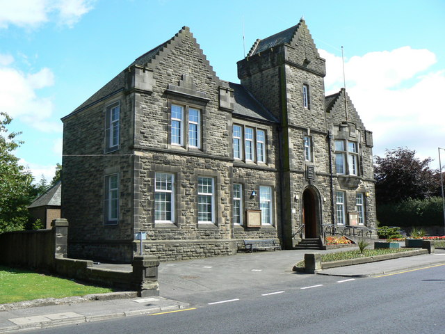
Denny Town House

Denny Town House is a municipal building in Glasgow Road, Denny, Falkirk, Scotland. The structure is used by Falkirk Council for the provision of local...

Denny, Falkirk

Denny (Scottish Gaelic: an Daingneach) is a town in the Falkirk council area of Scotland. Historically in Stirlingshire, it is situated 7 miles (11 kilometres...

Denny High School

Denny High School in Scotland is a non-denominational public secondary school. The school was opened in 1959, and moved to a new building in February 2009...

Dunipace

Dunipace (Scottish Gaelic: Dùn a' Bhàis) is a village in the west of the Falkirk council area of Scotland. The village is 6.3 miles (10.1 km) south of...

Herbertshire Castle

Herbertshire Castle was a castle built in the Barony of Herbertshire in the early fifteenth century, located near Dunipace, Falkirk, central Scotland....

Stoneywood, Falkirk

Stoneywood is a small village which lies in the Falkirk council area of Scotland. The village is located 0.1 miles (0.2 km) west of Denny and 7.3 miles...

Head of Muir

Head of Muir is a village located in the Falkirk council area, Central Scotland, between Denny and Dennyloanhead. Its local primary school is Head of Muir...

Related Videos

More UFO Sightings Than Anywhere On Earth. And We Camp There. In Winter. Welcome To Bonnybridge...

Bonnybridge. The unassuming little town in central-belt Scotland with an incredible claim to fame - it has the highest concentration ...
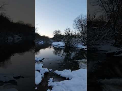
Nearby Amenities

Located within 500m of 56.022888,-3.907543
Denny
Name En: Denny
Name Gd: Deanaidh
Place: town
Source: npe
Wikidata: Q3778259
Wikipedia: en:Denny, Falkirk
Lat/Long: 56.0237411/-3.9081978
Mini Roundabout
Lat/Long: 56.0246681/-3.9132316
Traffic Signals
Lat/Long: 56.0228626/-3.9075247
Noexit: yes
Lat/Long: 56.0234563/-3.9099925
Noexit: yes
Lat/Long: 56.0202286/-3.9112526
Vending Machine
Lat/Long: 56.0240413/-3.9081977
Fast Food
Golden Chip
Addr City: Denny
Addr Street: Stirling Street
Cuisine: fish_and_chips
Description: Fish and Chips to take away
Lat/Long: 56.0247124/-3.9096397
The Co-operative Food
Addr City: Denny
Addr Street: Stirling Street
Brand: The Co-operative Food
Brand Wikidata: Q3277439
Brand Wikipedia: en:Co-op Food
Operator: The Co-operative Group
Operator Wikidata: Q117202
Shop: supermarket
Website: https://www.coop.co.uk/store-finder/FK6-6DJ/56-64-stirling-street
Lat/Long: 56.0241369/-3.9082042
Library
Denny Library
Addr City: Denny
Addr Postcode: FK6 6FA
Addr Street: Davies Row
Digital Access: printer;photocopier;computer
Digital Access Membership: yes
Internet Access: wlan
Opening Hours: Mo,Fr 10:00-17:00; Tu,Th 10:00-20:00; We 10:00-16:00; Sa 10:00-15:00
Phone: +44 1324 504242
Website: http://www.falkirkcommunitytrust.org/venues/denny-library/
Wheelchair: yes
Lat/Long: 56.023698/-3.908562
Advice Service
West Advice and Support Hub
Addr City: Denny
Addr Housename: Carronbank House
Addr Postcode: FK6 6GA
Addr Street: Carronbank Crescent
Description: The cash desk will be closed for payments between 11:30am - 12:30pm and closes at 4:30pm. However, those wishing to make payments by card can do so online via our self serve facility during these times.
Email: westhub@falkirk.gov.uk
Government: services
Office: government
Phone: +44 1324 506070
Service Times: Mo-Fr 09:00-17:00
Website: https://www.falkirk.gov.uk/places/oss-ash/west-support-hub.aspx
Lat/Long: 56.0251337/-3.9083486
Social Facility
Denny & Dunipace Citizens Advice Bureau
Addr City: Denny
Addr Housenumber: 24
Addr Postcode: FK6 6DD
Addr Street: Duke Street
Description: Contact 01324 823118 for telephone service only Mon-Fri 9am - 8pm and Sat 10am - 2pm Except public holidays
Phone: +44 1324 823118
Service Times: Mo-Th 10:00-14:00; Tu,Fr 10:00-12:00
Social Facility: citizens_advice
Website: https://www.cas.org.uk/bureaux/denny-and-dunipace-citizens-advice-bureau
Lat/Long: 56.023182/-3.9096048
Bus Stop
Bus: yes
Naptan AtcoCode: 66903000030
Naptan NaptanCode: 32525937
Public Transport: platform
Lat/Long: 56.0231317/-3.9085131
Bus Stop
Bus: yes
Naptan AtcoCode: 66903140019
Naptan NaptanCode: 32525435
Public Transport: platform
Lat/Long: 56.0241506/-3.908526
Ladbrokes
Brand: Ladbrokes
Brand Wikidata: Q1799875
Brand Wikipedia: en:Ladbrokes Coral
Shop: bookmaker
Lat/Long: 56.0229404/-3.9073549
Bus Stop
Bus: yes
Naptan AtcoCode: 66903000024
Naptan NaptanCode: 32525749
Public Transport: platform
Lat/Long: 56.022336/-3.9075269
Bus Stop
Bus: yes
Naptan AtcoCode: 66903000025
Naptan NaptanCode: 32525786
Public Transport: platform
Lat/Long: 56.0220082/-3.9072673
Noexit: yes
Lat/Long: 56.0234646/-3.9099052
Pub
The Donner Inn
Addr City: Denny
Addr Housenumber: 78
Addr Postcode: FK6 6DJ
Addr Street: Stirling Street
Lat/Long: 56.02442/-3.9084308
Pub
First Down
Addr City: Denny
Addr Housenumber: 162
Addr Postcode: FK6 6JQ
Addr Street: Stirling Street
Lat/Long: 56.0252253/-3.913698
Pub
Wheatsheaf Bar
Addr City: Denny
Addr Housenumber: 3
Addr Postcode: FK6 6DX
Addr Street: Broad Street
Lat/Long: 56.0229004/-3.9071597
Generator Method: photovoltaic
Generator Output Electricity: yes
Generator Source: solar
Generator Type: solar_photovoltaic_panel
Power: generator
Lat/Long: 56.0240725/-3.9054159
Generator Method: photovoltaic
Generator Output Electricity: yes
Generator Source: solar
Generator Type: solar_photovoltaic_panel
Power: generator
Lat/Long: 56.0238875/-3.9057769
Generator Method: photovoltaic
Generator Output Electricity: yes
Generator Source: solar
Generator Type: solar_photovoltaic_panel
Power: generator
Lat/Long: 56.0238994/-3.905715
Generator Method: photovoltaic
Generator Output Electricity: yes
Generator Source: solar
Generator Type: solar_photovoltaic_panel
Power: generator
Lat/Long: 56.0236522/-3.9057522
Generator Method: photovoltaic
Generator Output Electricity: yes
Generator Source: solar
Generator Type: solar_photovoltaic_panel
Power: generator
Lat/Long: 56.0236581/-3.9057097
Generator Method: photovoltaic
Generator Output Electricity: yes
Generator Source: solar
Generator Type: solar_photovoltaic_panel
Power: generator
Lat/Long: 56.0238885/-3.9053841
Generator Method: photovoltaic
Generator Output Electricity: yes
Generator Source: solar
Generator Type: solar_photovoltaic_panel
Power: generator
Lat/Long: 56.0238905/-3.9053186
Generator Method: photovoltaic
Generator Output Electricity: yes
Generator Source: solar
Generator Type: solar_photovoltaic_panel
Power: generator
Lat/Long: 56.0239686/-3.9054124
Generator Method: photovoltaic
Generator Output Electricity: yes
Generator Source: solar
Generator Type: solar_photovoltaic_panel
Power: generator
Lat/Long: 56.0240191/-3.9054142
Generator Method: photovoltaic
Generator Output Electricity: yes
Generator Source: solar
Generator Type: solar_photovoltaic_panel
Power: generator
Lat/Long: 56.0240833/-3.9053451
Generator Method: photovoltaic
Generator Output Electricity: yes
Generator Source: solar
Generator Type: solar_photovoltaic_panel
Power: generator
Lat/Long: 56.0240289/-3.9053275
Generator Method: photovoltaic
Generator Output Electricity: yes
Generator Source: solar
Generator Type: solar_photovoltaic_panel
Power: generator
Lat/Long: 56.0239676/-3.905331
Generator Method: photovoltaic
Generator Output Electricity: yes
Generator Source: solar
Generator Type: solar_photovoltaic_panel
Power: generator
Lat/Long: 56.0242455/-3.9049912
Generator Method: photovoltaic
Generator Output Electricity: yes
Generator Source: solar
Generator Type: solar_photovoltaic_panel
Power: generator
Lat/Long: 56.0242465/-3.9049169
Generator Method: photovoltaic
Generator Output Electricity: yes
Generator Source: solar
Generator Type: solar_photovoltaic_panel
Power: generator
Lat/Long: 56.023664/-3.9049718
Generator Method: photovoltaic
Generator Output Electricity: yes
Generator Source: solar
Generator Type: solar_photovoltaic_panel
Power: generator
Lat/Long: 56.023668/-3.9049275
Generator Method: photovoltaic
Generator Output Electricity: yes
Generator Source: solar
Generator Type: solar_photovoltaic_panel
Power: generator
Lat/Long: 56.02524/-3.906635
Denny
Wikidata: Q79802629
Wikipedia: en:Denny railway station
Lat/Long: 56.0210999/-3.9059885
Crossing
Crossing: traffic_signals
Lat/Long: 56.0228528/-3.9073588
Crossing
Crossing: traffic_signals
Lat/Long: 56.0227046/-3.9075039
Crossing
Crossing: traffic_signals
Lat/Long: 56.0232523/-3.907785
Fuel
Gulf
Brand: Gulf
Brand Wikidata: Q5617505
Brand Wikipedia: en:Gulf Oil LP
Lat/Long: 56.0205387/-3.9075013
Generator Method: photovoltaic
Generator Output Electricity: yes
Generator Source: solar
Generator Type: solar_photovoltaic_panel
Power: generator
Lat/Long: 56.0198848/-3.9021029
Fast Food
Greggs
Brand: Greggs
Brand Wikidata: Q3403981
Contact Website: https://www.greggs.co.uk/shop-finder?shop-code=3851
Cuisine: sandwich;bakery
Takeaway: yes
Lat/Long: 56.0238418/-3.9084253
Pharmacy
Boots
Brand: Boots
Brand Wikidata: Q6123139
Dispensing: yes
Healthcare: pharmacy
Website: https://www.boots.com/stores/1967-denny-stirling-street-fk6-6el
Lat/Long: 56.0237577/-3.9083806
Pharmacy
Lloyds Pharmacy
Brand: Lloyds Pharmacy
Brand Wikidata: Q6662870
Dispensing: yes
Healthcare: pharmacy
Lat/Long: 56.0234923/-3.9082237
Communication Mobile Phone: yes
Man Made: mast
Tower Type: communication
Lat/Long: 56.0190982/-3.9051178
Barrier: bollard
Lat/Long: 56.0238462/-3.90729
Barrier: bollard
Lat/Long: 56.0238873/-3.9070035
Bicycle Parking
Bicycle Parking: stands
Covered: no
Lat/Long: 56.021095/-3.9054829
The data included in this document is from www.openstreetmap.org. The data is made available under ODbL.

Have you been to Denny?

Leave your review of Denny below (or comments, questions and feedback).