Denny End
Settlement in Cambridgeshire South Cambridgeshire
England
Denny End

Denny End is a small rural village located in the county of Cambridgeshire, England. Situated approximately 9 miles northwest of the city of Cambridge, it is surrounded by picturesque countryside and farmland. The village is part of the South Cambridgeshire district and falls under the administrative authority of the local government.
With a population of around 300 residents, Denny End is a close-knit community known for its peaceful and tranquil atmosphere. The village primarily consists of residential properties, including a mix of modern houses and traditional cottages. The architecture in Denny End is reflective of the rural charm and character of the area.
Despite its small size, the village offers a range of amenities for its residents. It is home to a local pub, providing a gathering place for locals and visitors alike. Additionally, Denny End has a community hall that hosts various events throughout the year, fostering a sense of community spirit.
The surrounding countryside provides ample opportunities for outdoor activities and exploration. Denny End benefits from its proximity to the River Cam, offering scenic riverside walks and boating opportunities. The village is also well-connected to nearby towns and cities, with good transport links ensuring easy access to amenities and employment opportunities.
Overall, Denny End is a charming and idyllic village, offering a peaceful rural lifestyle while remaining conveniently connected to larger urban centers.
If you have any feedback on the listing, please let us know in the comments section below.
Denny End Images
Images are sourced within 2km of 52.270991/0.184501 or Grid Reference TL4965. Thanks to Geograph Open Source API. All images are credited.


Denny End is located at Grid Ref: TL4965 (Lat: 52.270991, Lng: 0.184501)
Administrative County: Cambridgeshire
District: South Cambridgeshire
Police Authority: Cambridgeshire
What 3 Words
///critic.weekends.operating. Near Waterbeach, Cambridgeshire
Nearby Locations
Related Wikis
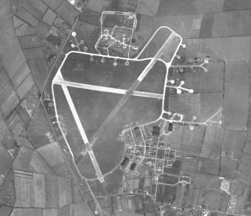
RAF Waterbeach
Royal Air Force Waterbeach or more simply RAF Waterbeach is a former Royal Air Force station located in Waterbeach, Cambridgeshire which is about 5.5 miles...

Waterbeach Barracks
Waterbeach Barracks was a military installation in Waterbeach, Cambridgeshire. The site was an RAF Station, RAF Waterbeach and then used by the Royal Engineers...

Waterbeach
Waterbeach is an expanding village 6 miles (9.7 km) north of Cambridge on the edge of The Fens, in the South Cambridgeshire district of Cambridgeshire...

Church of St John the Evangelist, Waterbeach
The Anglican Church of St John the Evangelist (also known as St John's Church) is the parish church of the village of Waterbeach in Cambridgeshire, England...
Nearby Amenities
Located within 500m of 52.270991,0.184501Have you been to Denny End?
Leave your review of Denny End below (or comments, questions and feedback).