Rusthall

Civil Parish in Kent Tunbridge Wells

England

Rusthall

Woodland Path through the Trees A path through the dense beech woodland of Sproud's Wood, south of Speldhurst in Kent.
Woodland Path through the Trees Credit: John P Reeves

Rusthall is a civil parish located in the county of Kent, in southeastern England. Situated on the outskirts of the town of Tunbridge Wells, Rusthall is a small, picturesque village nestled within the High Weald Area of Outstanding Natural Beauty.

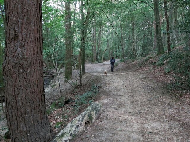
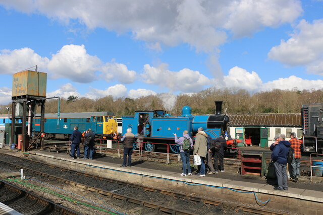
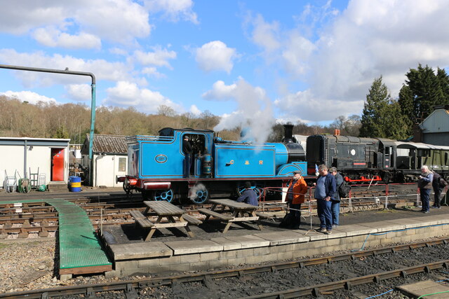
The village is renowned for its stunning natural surroundings, with numerous woodland areas and open green spaces. One of the highlights is Rusthall Common, a large open space with heathland, ponds, and a diverse range of flora and fauna. The common is popular among locals and visitors for walks, picnics, and recreational activities.

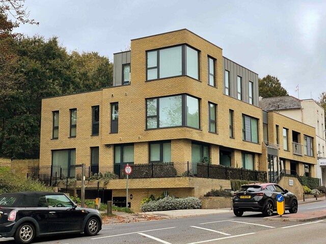
Rusthall has a rich history, and evidence of human habitation in the area dates back to the Stone Age. The village itself grew around the Rusthall Manor, a historic building that still stands today. The architecture of the village reflects its long history, with a mix of traditional cottages, Victorian houses, and more modern developments. The village center features a range of amenities, including local shops, cafes, and pubs.

The community in Rusthall is vibrant and close-knit, with various events and activities taking place throughout the year. The village holds an annual summer fair, which attracts both residents and visitors. Additionally, there are several community groups and organizations that cater to different interests and age groups.

Overall, Rusthall offers a peaceful and idyllic setting, combined with easy access to the amenities and services of nearby Tunbridge Wells. Its natural beauty, rich history, and strong community spirit make it a desirable place to live and visit in the heart of Kent.

If you have any feedback on the listing, please let us know in the comments section below.

Rusthall Images

Images are sourced within 2km of 51.136835/0.235228 or Grid Reference TQ5639. Thanks to Geograph Open Source API. All images are credited.

Woodland Path through the Trees A path through the dense beech woodland of Sproud's Wood, south of Speldhurst in Kent.
Woodland Path through the Trees
A path through the dense beech woodland of Sproud's Wood, south of Speldhurst in Kent.
Footbridge over a Stream A wooden footpath over a stream in Shadwell Wood, south of Speldhurst in Kent on part of the Tunbridge Wells Circular Long Distance Footpath.
Footbridge over a Stream
A wooden footpath over a stream in Shadwell Wood, south of Speldhurst in Kent on part of the Tunbridge Wells Circular Long Distance Footpath.
Former Congregational Church Jabez Scholes may have been the original architect of this large Classical-style chapel, erected for £3,700 in 1845–48. The Tuscan portico at the front cost a further £1,400 in 1866. Acquired by Pentecostalists in 1977, it was sold three years later and turned into shops.At present occupied by Cotswold.
Grade II* listed. <span class="nowrap"><a title="http://www.britishlistedbuildings.co.uk/en-168097-lecture-hall-mount-pleasant-congregation" rel="nofollow ugc noopener" href="http://www.britishlistedbuildings.co.uk/en-168097-lecture-hall-mount-pleasant-congregation">Link</a><img style="margin-left:2px;" alt="External link" title="External link - shift click to open in new window" src="https://s1.geograph.org.uk/img/external.png" width="10" height="10"/></span>
Former Congregational Church
Jabez Scholes may have been the original architect of this large Classical-style chapel, erected for £3,700 in 1845–48. The Tuscan portico at the front cost a further £1,400 in 1866. Acquired by Pentecostalists in 1977, it was sold three years later and turned into shops.At present occupied by Cotswold. Grade II* listed. LinkExternal link
The Pantiles The Pantiles is the most famous street in Tunbridge Wells. It was originally a grove of trees until the Chalybeate spring was discovered in 1606. It rapidly developed into the hub of the new spa town. The street has over 40 listed buildings on it.
The Pantiles and Tunbridge Wells itself, owe their beginnings to the discovery of the Chalybeate Spring in the early 17th century and the popularity of the spa water amongst the gentry and royalty of Georgian England. As Tunbridge Wells grew in popularity as a spa resort, so did the area surrounding the Spring - eventually leading to the building of the colonnaded walkway in the 18th century, later known as The Pantiles. 
In its heyday in Georgian times, the 'Walks' as they were then known, were the place to see and be seen for visitors to Tunbridge Wells. A strict protocol was adhered to - gentry on the 'Upper Walks', the colonnade, and everyone else on the 'Lower Walks'. Richard Beau Nash, a dandy of the day made it his business to ensure that this protocol was adhered to by acting as a kind of Master of Ceremonies during 'the season' in Tunbridge Wells and in the town's rival, Bath. Things are much more relaxed nowadays and the Pantiles is now a very attractive and stylish part of Royal Tunbridge Wells.
Much of the colonnade has been renewed since its beginnings in the 17th century but most of the surrounding buildings date from the 18th and 19th centuries.
The tiled surface is Grade II listed. <span class="nowrap"><a title="https://historicengland.org.uk/listing/the-list/list-entry/1084405" rel="nofollow ugc noopener" href="https://historicengland.org.uk/listing/the-list/list-entry/1084405">Link</a><img style="margin-left:2px;" alt="External link" title="External link - shift click to open in new window" src="https://s1.geograph.org.uk/img/external.png" width="10" height="10"/></span>
The Pantiles
The Pantiles is the most famous street in Tunbridge Wells. It was originally a grove of trees until the Chalybeate spring was discovered in 1606. It rapidly developed into the hub of the new spa town. The street has over 40 listed buildings on it. The Pantiles and Tunbridge Wells itself, owe their beginnings to the discovery of the Chalybeate Spring in the early 17th century and the popularity of the spa water amongst the gentry and royalty of Georgian England. As Tunbridge Wells grew in popularity as a spa resort, so did the area surrounding the Spring - eventually leading to the building of the colonnaded walkway in the 18th century, later known as The Pantiles. In its heyday in Georgian times, the 'Walks' as they were then known, were the place to see and be seen for visitors to Tunbridge Wells. A strict protocol was adhered to - gentry on the 'Upper Walks', the colonnade, and everyone else on the 'Lower Walks'. Richard Beau Nash, a dandy of the day made it his business to ensure that this protocol was adhered to by acting as a kind of Master of Ceremonies during 'the season' in Tunbridge Wells and in the town's rival, Bath. Things are much more relaxed nowadays and the Pantiles is now a very attractive and stylish part of Royal Tunbridge Wells. Much of the colonnade has been renewed since its beginnings in the 17th century but most of the surrounding buildings date from the 18th and 19th centuries. The tiled surface is Grade II listed. LinkExternal link
Bath House The Pantiles is the most famous street in Tunbridge Wells. It was originally a grove of trees until the Chalybeate spring was discovered in 1606. It rapidly developed into the hub of the new spa town. The street has over 40 listed buildings on it.
The Pantiles and Tunbridge Wells itself, owe their beginnings to the discovery of the Chalybeate Spring in the early 17th century and the popularity of the spa water amongst the gentry and royalty of Georgian England. As Tunbridge Wells grew in popularity as a spa resort, so did the area surrounding the Spring - eventually leading to the building of the colonnaded walkway in the 18th century, later known as The Pantiles. 
In its heyday in Georgian times, the 'Walks' as they were then known, were the place to see and be seen for visitors to Tunbridge Wells. A strict protocol was adhered to - gentry on the 'Upper Walks', the colonnade, and everyone else on the 'Lower Walks'. Richard Beau Nash, a dandy of the day made it his business to ensure that this protocol was adhered to by acting as a kind of Master of Ceremonies during 'the season' in Tunbridge Wells and in the town's rival, Bath. Things are much more relaxed nowadays and the Pantiles is now a very attractive and stylish part of Royal Tunbridge Wells.
Much of the colonnade has been renewed since its beginnings in the 17th century but most of the surrounding buildings date from the 18th and 19th centuries.
The tiled surface is Grade II listed. <span class="nowrap"><a title="https://historicengland.org.uk/listing/the-list/list-entry/1084405" rel="nofollow ugc noopener" href="https://historicengland.org.uk/listing/the-list/list-entry/1084405">Link</a><img style="margin-left:2px;" alt="External link" title="External link - shift click to open in new window" src="https://s1.geograph.org.uk/img/external.png" width="10" height="10"/></span>
Bath House
The Pantiles is the most famous street in Tunbridge Wells. It was originally a grove of trees until the Chalybeate spring was discovered in 1606. It rapidly developed into the hub of the new spa town. The street has over 40 listed buildings on it. The Pantiles and Tunbridge Wells itself, owe their beginnings to the discovery of the Chalybeate Spring in the early 17th century and the popularity of the spa water amongst the gentry and royalty of Georgian England. As Tunbridge Wells grew in popularity as a spa resort, so did the area surrounding the Spring - eventually leading to the building of the colonnaded walkway in the 18th century, later known as The Pantiles. In its heyday in Georgian times, the 'Walks' as they were then known, were the place to see and be seen for visitors to Tunbridge Wells. A strict protocol was adhered to - gentry on the 'Upper Walks', the colonnade, and everyone else on the 'Lower Walks'. Richard Beau Nash, a dandy of the day made it his business to ensure that this protocol was adhered to by acting as a kind of Master of Ceremonies during 'the season' in Tunbridge Wells and in the town's rival, Bath. Things are much more relaxed nowadays and the Pantiles is now a very attractive and stylish part of Royal Tunbridge Wells. Much of the colonnade has been renewed since its beginnings in the 17th century but most of the surrounding buildings date from the 18th and 19th centuries. The tiled surface is Grade II listed. LinkExternal link
The Forum The Forum is an independent music venue in Royal Tunbridge Wells with a standing capacity of 250. The Forum opened in 1993.
The building was built in 1939 as rest rooms for visitors to The Common.
Wikipedia: <span class="nowrap"><a title="https://en.wikipedia.org/wiki/Tunbridge_Wells_Forum" rel="nofollow ugc noopener" href="https://en.wikipedia.org/wiki/Tunbridge_Wells_Forum">Link</a><img style="margin-left:2px;" alt="External link" title="External link - shift click to open in new window" src="https://s1.geograph.org.uk/img/external.png" width="10" height="10"/></span>
The Forum
The Forum is an independent music venue in Royal Tunbridge Wells with a standing capacity of 250. The Forum opened in 1993. The building was built in 1939 as rest rooms for visitors to The Common. Wikipedia: LinkExternal link
Trinity Arts Centre Originally Trinity Church, built by Decimus Burton as part of the Georgian New town of Tunbridge Wells. The church was de-commissioned in 1975. The Arts centre opened in 1983 and since then has grown in size.
Grade II* listed. <span class="nowrap"><a title="http://www.britishlistedbuildings.co.uk/en-167949-trinity-arts-centre-formerly-holy-trinit" rel="nofollow ugc noopener" href="http://www.britishlistedbuildings.co.uk/en-167949-trinity-arts-centre-formerly-holy-trinit">Link</a><img style="margin-left:2px;" alt="External link" title="External link - shift click to open in new window" src="https://s1.geograph.org.uk/img/external.png" width="10" height="10"/></span> 
Website <span class="nowrap"><a title="http://www.trinitytheatre.net/" rel="nofollow ugc noopener" href="http://www.trinitytheatre.net/">Link</a><img style="margin-left:2px;" alt="External link" title="External link - shift click to open in new window" src="https://s1.geograph.org.uk/img/external.png" width="10" height="10"/></span>
Trinity Arts Centre
Originally Trinity Church, built by Decimus Burton as part of the Georgian New town of Tunbridge Wells. The church was de-commissioned in 1975. The Arts centre opened in 1983 and since then has grown in size. Grade II* listed. LinkExternal link Website LinkExternal link
Grosvenor Rd
Grosvenor Rd
Albion House
Albion House
Tunbridge Wells Baptist Church
Caledonian Railway Class 439 No 419 at Tunbridge Wells West Station This photo shows No 419 on its first day at the special 'Scottish Steam Up' event at The Spa Valley Railway. This photo was taken at Tunbridge Wells West Station, Kent. No 419 was built by the Caledonian Railway at St Rollox Works, Glasgow in 1907.
Caledonian Railway Class 439 No 419 at Tunbridge Wells West Station
This photo shows No 419 on its first day at the special 'Scottish Steam Up' event at The Spa Valley Railway. This photo was taken at Tunbridge Wells West Station, Kent. No 419 was built by the Caledonian Railway at St Rollox Works, Glasgow in 1907.
Caledonian Railway Class 439 No 419 at the Spa Valley Railway Caledonian Railway Class 439 No 419 is the lighter blue coloured locomotive in the distance and it is the flagship of the Scottish Railway Preservation Society. It was designed for branch work, fast suburban and banking duties. The train nearer the camera is No 828 which is visiting the Spa Valley Railway until October 2022.
Caledonian Railway Class 439 No 419 at the Spa Valley Railway
Caledonian Railway Class 439 No 419 is the lighter blue coloured locomotive in the distance and it is the flagship of the Scottish Railway Preservation Society. It was designed for branch work, fast suburban and banking duties. The train nearer the camera is No 828 which is visiting the Spa Valley Railway until October 2022.
Class 439 No 419, Tunbridge Wells West Station, Kent This photo shows No 419 standing in the station at Tunbridge Wells West on the occasion of the opening day of its first visit to the Spa Valley Railway. In 1948, the locomotive passed into the ownership of British Railways and became No 55189. The locomotive remained with BR until its withdrawal in December 1962, along with 200 other steam engines in Scotland.
Class 439 No 419, Tunbridge Wells West Station, Kent
This photo shows No 419 standing in the station at Tunbridge Wells West on the occasion of the opening day of its first visit to the Spa Valley Railway. In 1948, the locomotive passed into the ownership of British Railways and became No 55189. The locomotive remained with BR until its withdrawal in December 1962, along with 200 other steam engines in Scotland.
Class 439 No. 419 at Tunbridge Wells West  Station, Kent This photo shows the last surviving locomotive from the Caledonian Railway 439 class of which 92 were built between 1895 and 1925. This locomotive dates from 1907 when it was built at the St Rollox Works in Glasgow. As the last of its kind and the flagship of the Scottish Railway Preservation Society, it was a most welcome and greatly anticipated visitor to the 'Scottish Steam Up' event on the Spa Valley Railway. The iconic locomotive is seen here on the opening day of this historic occasion.
Class 439 No. 419 at Tunbridge Wells West Station, Kent
This photo shows the last surviving locomotive from the Caledonian Railway 439 class of which 92 were built between 1895 and 1925. This locomotive dates from 1907 when it was built at the St Rollox Works in Glasgow. As the last of its kind and the flagship of the Scottish Railway Preservation Society, it was a most welcome and greatly anticipated visitor to the 'Scottish Steam Up' event on the Spa Valley Railway. The iconic locomotive is seen here on the opening day of this historic occasion.
Tables Laid round the Bandstand All set for supper outside on the terrace with jazz in the bandstand. 
Several other pictures here show that the Pantiles Bandstand is still regularly used for its original purpose, in this case a Jazz & Gin festival.
Tables Laid round the Bandstand
All set for supper outside on the terrace with jazz in the bandstand. Several other pictures here show that the Pantiles Bandstand is still regularly used for its original purpose, in this case a Jazz & Gin festival.
The Tunbridge Wells Hotel
Show me another place!

Rusthall is located at Grid Ref: TQ5639 (Lat: 51.136835, Lng: 0.235228)

Administrative County: Kent

District: Tunbridge Wells

Police Authority: Kent

What 3 Words

///grinning.mysteries.purist. Near Rusthall, Kent

Related Wikis

Rusthall

Rusthall is a village located approximately 2 miles to the west of the spa town of Tunbridge Wells in Kent. The village grew up around a large property...
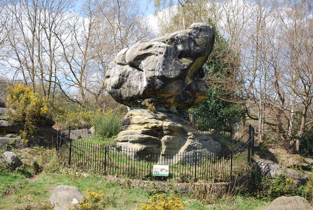
Rusthall Common

Rusthall Common is a 2.7-hectare (6.7-acre) geological Site of Special Scientific Interest in Rusthall, a suburb of Tunbridge Wells in Kent. It is a Geological...

St Paul's Church, Rusthall

St Paul's Church is a Church of England parish church in Rusthall, Kent, England. It is a Grade II listed building. == History == St Paul's Church was...

Rusthall F.C.

Rusthall FC is an English football club located in Rusthall, near Royal Tunbridge Wells, in Kent. The club plays in the Southern Counties East League Premier...
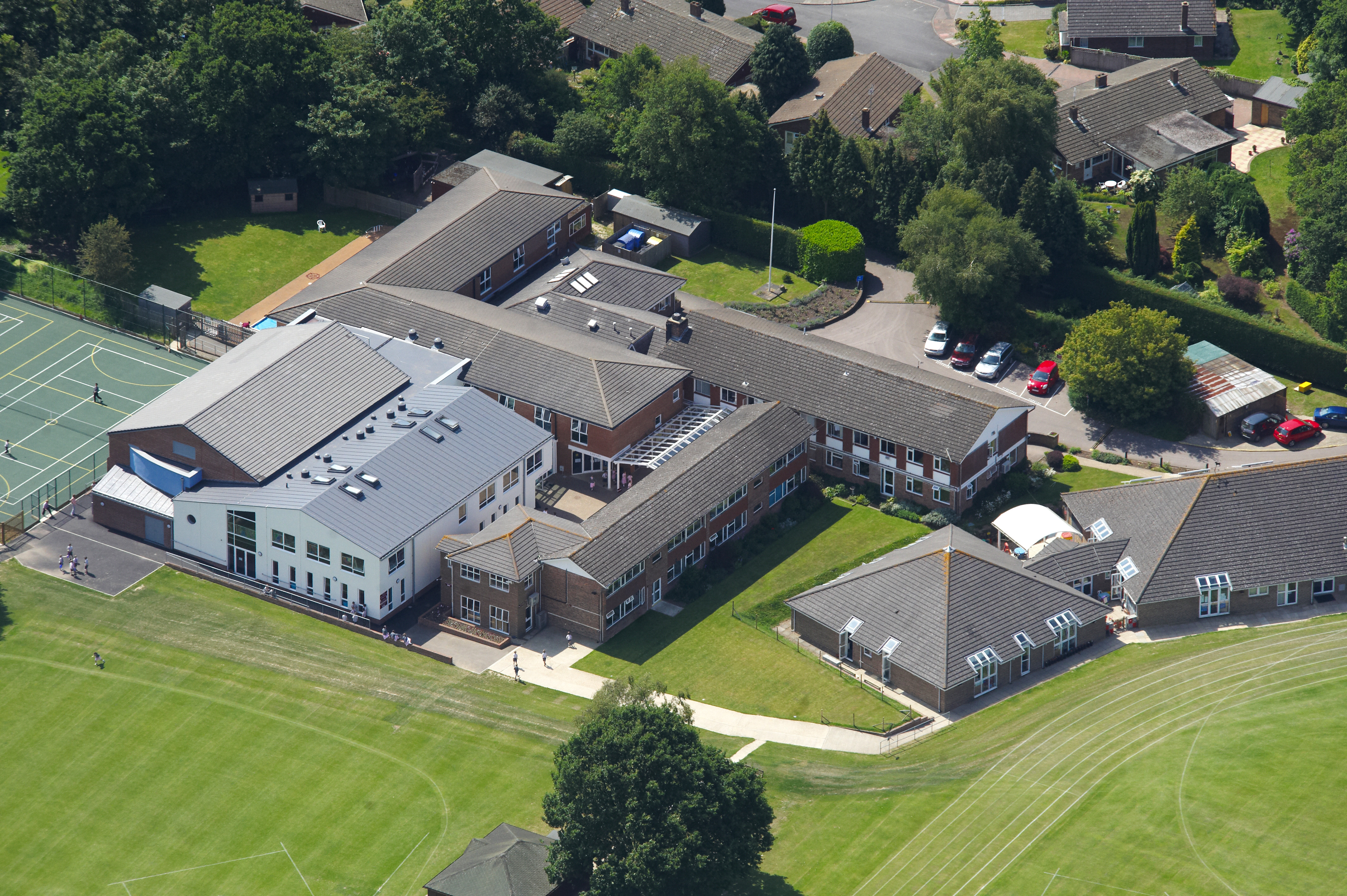
Rose Hill School

Rose Hill School is a co-educational preparatory school in Royal Tunbridge Wells, Kent, England. It is a member of the Independent Association of Preparatory...

Bennett Memorial Diocesan School

Bennett Memorial Diocesan School is an all ability co-educational academy in Royal Tunbridge Wells, Kent, England, which caters for students from age 11...
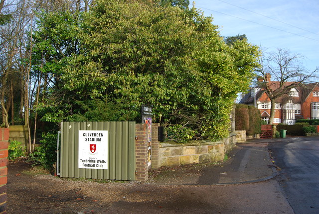
Culverden Stadium

Culverden Stadium is an association football stadium in Royal Tunbridge Wells, Kent, England. It is the home ground of Tunbridge Wells F.C. It has a capacity...

Tunbridge Wells F.C.

Tunbridge Wells Football Club is a football club based in Royal Tunbridge Wells, Kent, England. They are currently members of the Southern Counties East...

Nearby Amenities

Located within 500m of 51.136835,0.235228
Pub
Toad Rock Retreat
Lat/Long: 51.1346175/0.2398078
Bus Stop
Rusthall High Street
Naptan AtcoCode: 2400A007890A
Naptan Bearing: SE
Naptan CommonName: Rusthall High Street
Naptan Indicator: SE-bound
Naptan Landmark: Common View
Naptan NaptanCode: kntajpgt
Naptan PlusbusZoneRef: TUNWELL
Naptan Street: Rusthall High St
Naptan Verified: no
Source: naptan_import
Lat/Long: 51.1351314/0.2309396
Post Box
Operator: Royal Mail
Post Box Type: lamp
Ref: TN4 102D
Royal Cypher: EIIR
Royal Cypher Wikidata: Q33102113
Lat/Long: 51.1386847/0.2305452
Pub
White Hart
Lat/Long: 51.1354009/0.2326885
Turning Circle
Lat/Long: 51.1362351/0.2376908
Rusthall
Is In: Kent
Place: village
Lat/Long: 51.1361512/0.2294342
Place Of Worship
Rusthall Evangelical Church
Religion: christian
Lat/Long: 51.1390174/0.2297125
Post Box
Operator: Royal Mail
Post Box Type: pillar
Ref: TN4 31D
Royal Cypher: VR
Royal Cypher Wikidata: Q33102356
Lat/Long: 51.1344355/0.2355019
Post Office
Rusthall Post Office
Addr Country: GB
Addr Postcode: TN4 8RW
Brand: Post Office
Brand Wikidata: Q1783168
Contact Website: https://www.postoffice.co.uk/branch-finder/0869481/rusthall
Ref Pol Id: 945
Lat/Long: 51.1354058/0.2297991
Post Box
Collection Times: Mo-Fr 17:15; Sa 12:15
Post Box Apertures: 2
Post Box Type: pillar
Ref: TN4 1131;TN4 1132
Royal Cypher: EIIR
Royal Cypher Wikidata: Q33102113
Lat/Long: 51.1353821/0.229671
Crossing
Crossing: zebra
Crossing Island: no
Kerb: flush
Tactile Paving: yes
Lat/Long: 51.1358033/0.2283658
Addr City: Tunbridge Wells
Addr Housenumber: 63
Addr Street: Lower Green Road
Lat/Long: 51.1389722/0.2315442
Addr City: Tunbridge Wells
Addr Housenumber: 67
Addr Street: Lower Green Road
Lat/Long: 51.1391996/0.2312665
Addr City: Tunbridge Wells
Addr Housenumber: 63a
Addr Street: Lower Green Road
Lat/Long: 51.1389874/0.231484
Bus Stop
Rusthall High Street
Lat/Long: 51.135165/0.2304944
Bus Stop
Rusthall Grange
Lat/Long: 51.1344747/0.2366598
Bus Stop
Rusthall Grange
Lat/Long: 51.1344109/0.2369688
Parking
Capacity: 4
Fee: no
Parking: lane
Lat/Long: 51.1330118/0.2333835
Quarrintons
Addr City: Rusthall
Addr Housenumber: 38
Addr Postcode: TN4 8RY
Addr Street: Rusthall High Street
Fhrs Id: 24136
Shop: butcher
Source Addr: FHRS Open Data
Lat/Long: 51.1356364/0.2289916
Veterinary
Rusthall Veterinary Surgery
Phone: +44 1892 511715
Lat/Long: 51.1385168/0.2307778
Post Box
Operator: Royal Mail
Post Box Type: lamp
Ref: TN4 314D
Royal Cypher: EIIR
Royal Cypher Wikidata: Q33102113
Lat/Long: 51.1371083/0.2388474
Community Centre
Sunnyside Community Hall
Lat/Long: 51.1346649/0.2338867
Restaurant
The Wok
Lat/Long: 51.1353293/0.2291961
Bench
Backrest: yes
Lat/Long: 51.1337756/0.2403125
Board Type: geology
Information: board
Tourism: information
Lat/Long: 51.1338482/0.2399763
Waste Basket
Lat/Long: 51.1334537/0.2351774
Generator Method: photovoltaic
Generator Output Electricity: yes
Generator Source: solar
Generator Type: solar_photovoltaic_panel
Location: roof
Power: generator
Lat/Long: 51.1412259/0.2345404
Generator Method: photovoltaic
Generator Output Electricity: yes
Generator Source: solar
Generator Type: solar_photovoltaic_panel
Location: roof
Power: generator
Lat/Long: 51.1361132/0.2308094
Generator Method: photovoltaic
Generator Output Electricity: yes
Generator Source: solar
Generator Type: solar_photovoltaic_panel
Location: roof
Power: generator
Lat/Long: 51.136268/0.2314773
Generator Method: photovoltaic
Generator Output Electricity: yes
Generator Source: solar
Generator Type: solar_photovoltaic_panel
Location: roof
Power: generator
Lat/Long: 51.1379005/0.2335118
Generator Method: photovoltaic
Generator Output Electricity: yes
Generator Source: solar
Generator Type: solar_photovoltaic_panel
Location: roof
Power: generator
Lat/Long: 51.137988/0.232746
Generator Method: photovoltaic
Generator Output Electricity: yes
Generator Source: solar
Generator Type: solar_photovoltaic_panel
Location: roof
Power: generator
Lat/Long: 51.1379544/0.2327943
Generator Method: photovoltaic
Generator Output Electricity: yes
Generator Source: solar
Generator Type: solar_photovoltaic_panel
Location: roof
Power: generator
Lat/Long: 51.1379762/0.2328801
Generator Method: photovoltaic
Generator Output Electricity: yes
Generator Source: solar
Generator Type: solar_photovoltaic_panel
Location: roof
Power: generator
Lat/Long: 51.1376312/0.2301335
Generator Method: photovoltaic
Generator Output Electricity: yes
Generator Source: solar
Generator Type: solar_photovoltaic_panel
Location: roof
Power: generator
Lat/Long: 51.1384003/0.2288192
Generator Method: photovoltaic
Generator Output Electricity: yes
Generator Source: solar
Generator Type: solar_photovoltaic_panel
Location: roof
Power: generator
Lat/Long: 51.1389709/0.2291599
Generator Method: photovoltaic
Generator Output Electricity: yes
Generator Source: solar
Generator Type: solar_photovoltaic_panel
Location: roof
Power: generator
Lat/Long: 51.1389456/0.2290741
Generator Method: photovoltaic
Generator Output Electricity: yes
Generator Source: solar
Generator Type: solar_photovoltaic_panel
Location: roof
Power: generator
Lat/Long: 51.1396928/0.2321532
Generator Method: photovoltaic
Generator Output Electricity: yes
Generator Source: solar
Generator Type: solar_photovoltaic_panel
Location: roof
Power: generator
Lat/Long: 51.1396777/0.2322149
Generator Method: photovoltaic
Generator Output Electricity: yes
Generator Source: solar
Generator Type: solar_photovoltaic_panel
Location: roof
Power: generator
Lat/Long: 51.1388934/0.2331001
Generator Method: photovoltaic
Generator Output Electricity: yes
Generator Source: solar
Generator Type: solar_photovoltaic_panel
Location: roof
Power: generator
Lat/Long: 51.138498/0.2344063
Generator Method: photovoltaic
Generator Output Electricity: yes
Generator Source: solar
Generator Type: solar_photovoltaic_panel
Location: roof
Power: generator
Lat/Long: 51.138503/0.2344626
Generator Method: photovoltaic
Generator Output Electricity: yes
Generator Source: solar
Generator Type: solar_photovoltaic_panel
Location: roof
Power: generator
Lat/Long: 51.1386225/0.2357528
Generator Method: photovoltaic
Generator Output Electricity: yes
Generator Source: solar
Generator Type: solar_photovoltaic_panel
Location: roof
Power: generator
Lat/Long: 51.1362344/0.234755
Generator Method: photovoltaic
Generator Output Electricity: yes
Generator Source: solar
Generator Type: solar_photovoltaic_panel
Location: roof
Power: generator
Lat/Long: 51.1363118/0.2351385
Generator Method: photovoltaic
Generator Output Electricity: yes
Generator Source: solar
Generator Type: solar_photovoltaic_panel
Location: roof
Power: generator
Lat/Long: 51.1374024/0.2360076
Generator Method: photovoltaic
Generator Output Electricity: yes
Generator Source: solar
Generator Type: solar_photovoltaic_panel
Location: roof
Power: generator
Lat/Long: 51.1374074/0.2360827
Generator Method: photovoltaic
Generator Output Electricity: yes
Generator Source: solar
Generator Type: solar_photovoltaic_panel
Location: roof
Power: generator
Lat/Long: 51.136332/0.2360143
Generator Method: photovoltaic
Generator Output Electricity: yes
Generator Source: solar
Generator Type: solar_photovoltaic_panel
Location: roof
Power: generator
Lat/Long: 51.1364641/0.2359432
Generator Method: photovoltaic
Generator Output Electricity: yes
Generator Source: solar
Generator Type: solar_photovoltaic_panel
Location: roof
Power: generator
Lat/Long: 51.1364153/0.2359754
Generator Method: photovoltaic
Generator Output Electricity: yes
Generator Source: solar
Generator Type: solar_photovoltaic_panel
Location: roof
Power: generator
Lat/Long: 51.1363665/0.2359955
Generator Method: photovoltaic
Generator Output Electricity: yes
Generator Source: solar
Generator Type: solar_photovoltaic_panel
Location: roof
Power: generator
Lat/Long: 51.1369715/0.23527
Generator Method: photovoltaic
Generator Output Electricity: yes
Generator Source: solar
Generator Type: solar_photovoltaic_panel
Location: roof
Power: generator
Lat/Long: 51.1360425/0.2339892
Generator Method: photovoltaic
Generator Output Electricity: yes
Generator Source: solar
Generator Type: solar_photovoltaic_panel
Location: roof
Power: generator
Lat/Long: 51.136056/0.2340616
Generator Method: photovoltaic
Generator Output Electricity: yes
Generator Source: solar
Generator Type: solar_photovoltaic_panel
Location: roof
Power: generator
Lat/Long: 51.1360677/0.234122
Generator Method: photovoltaic
Generator Output Electricity: yes
Generator Source: solar
Generator Type: solar_photovoltaic_panel
Location: roof
Power: generator
Lat/Long: 51.1360829/0.2342212
Generator Method: photovoltaic
Generator Output Electricity: yes
Generator Source: solar
Generator Type: solar_photovoltaic_panel
Location: roof
Power: generator
Lat/Long: 51.1360947/0.234291
Generator Method: photovoltaic
Generator Output Electricity: yes
Generator Source: solar
Generator Type: solar_photovoltaic_panel
Location: roof
Power: generator
Lat/Long: 51.1361098/0.2343526
Generator Method: photovoltaic
Generator Output Electricity: yes
Generator Source: solar
Generator Type: solar_photovoltaic_panel
Location: roof
Power: generator
Lat/Long: 51.1361216/0.2344626
Generator Method: photovoltaic
Generator Output Electricity: yes
Generator Source: solar
Generator Type: solar_photovoltaic_panel
Location: roof
Power: generator
Lat/Long: 51.1361418/0.2345136
Generator Method: photovoltaic
Generator Output Electricity: yes
Generator Source: solar
Generator Type: solar_photovoltaic_panel
Location: roof
Power: generator
Lat/Long: 51.1361519/0.2345806
Generator Method: photovoltaic
Generator Output Electricity: yes
Generator Source: solar
Generator Type: solar_photovoltaic_panel
Location: roof
Power: generator
Lat/Long: 51.1361822/0.234645
Generator Method: photovoltaic
Generator Output Electricity: yes
Generator Source: solar
Generator Type: solar_photovoltaic_panel
Location: roof
Power: generator
Lat/Long: 51.1362966/0.2354631
Generator Method: photovoltaic
Generator Output Electricity: yes
Generator Source: solar
Generator Type: solar_photovoltaic_panel
Location: roof
Power: generator
Lat/Long: 51.1363118/0.2355221
Generator Method: photovoltaic
Generator Output Electricity: yes
Generator Source: solar
Generator Type: solar_photovoltaic_panel
Location: roof
Power: generator
Lat/Long: 51.1363151/0.2355784
Generator Method: photovoltaic
Generator Output Electricity: yes
Generator Source: solar
Generator Type: solar_photovoltaic_panel
Location: roof
Power: generator
Lat/Long: 51.136337/0.2356938
Generator Method: photovoltaic
Generator Output Electricity: yes
Generator Source: solar
Generator Type: solar_photovoltaic_panel
Location: roof
Power: generator
Lat/Long: 51.1363471/0.2357554
Generator Method: photovoltaic
Generator Output Electricity: yes
Generator Source: solar
Generator Type: solar_photovoltaic_panel
Location: roof
Power: generator
Lat/Long: 51.1352565/0.235852
Generator Method: photovoltaic
Generator Output Electricity: yes
Generator Source: solar
Generator Type: solar_photovoltaic_panel
Location: roof
Power: generator
Lat/Long: 51.1352178/0.2397922
Generator Method: photovoltaic
Generator Output Electricity: yes
Generator Source: solar
Generator Type: solar_photovoltaic_panel
Location: roof
Power: generator
Lat/Long: 51.1374259/0.2377939
The data included in this document is from www.openstreetmap.org. The data is made available under ODbL.

Have you been to Rusthall?

Leave your review of Rusthall below (or comments, questions and feedback).