Still Green

Wood, Forest in Kent Tunbridge Wells

England

Still Green

Woodland Path through the Trees A path through the dense beech woodland of Sproud's Wood, south of Speldhurst in Kent.
Woodland Path through the Trees Credit: John P Reeves

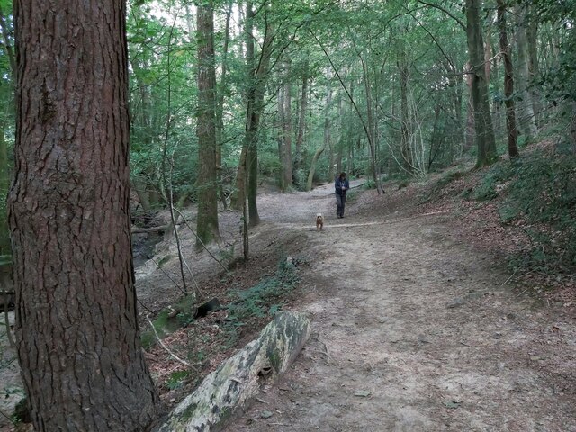
Still Green, Kent is a picturesque woodland located in the county of Kent, England. Spread over an area of approximately 100 acres, this enchanting forest is a popular destination for nature enthusiasts and outdoor adventurers alike.

The woodland is predominantly made up of a diverse range of native tree species, including oak, beech, and birch. These towering trees create a dense canopy, providing a cool and shaded environment even on hot summer days. The forest floor is adorned with a vibrant carpet of wildflowers, ferns, and mosses, enhancing the natural beauty of the area.

Still Green offers a multitude of walking trails that wind through the forest, allowing visitors to immerse themselves in the tranquility and serenity of nature. These trails cater to different levels of fitness and difficulty, ensuring that there is something for everyone. Along the way, hikers may encounter various wildlife species, such as deer, squirrels, and a variety of birdlife.

The woodland is well-maintained, with designated picnic areas and benches scattered throughout, offering visitors the chance to take a break and enjoy a packed lunch amidst the peaceful surroundings. Additionally, there are informative signposts providing details about the flora and fauna found within the forest, adding an educational element to the experience.

Still Green, Kent is a true haven for nature lovers, providing a serene escape from the bustle of everyday life. Whether it's a leisurely stroll, a family outing, or a wildlife-spotting adventure, this woodland offers a delightful and rejuvenating experience for all who visit.

If you have any feedback on the listing, please let us know in the comments section below.

Still Green Images

Images are sourced within 2km of 51.137036/0.24155716 or Grid Reference TQ5639. Thanks to Geograph Open Source API. All images are credited.

Woodland Path through the Trees A path through the dense beech woodland of Sproud's Wood, south of Speldhurst in Kent.
Woodland Path through the Trees
A path through the dense beech woodland of Sproud's Wood, south of Speldhurst in Kent.
Footbridge over a Stream A wooden footpath over a stream in Shadwell Wood, south of Speldhurst in Kent on part of the Tunbridge Wells Circular Long Distance Footpath.
Footbridge over a Stream
A wooden footpath over a stream in Shadwell Wood, south of Speldhurst in Kent on part of the Tunbridge Wells Circular Long Distance Footpath.
Crossroads, Upper Grosvenor Rd
The Black Horse
The Black Horse
Camden Rd The shops in Camden Road are a diverse and specialist mix of traders, proud of their heritage and the unique atmosphere that the road brings to Tunbridge Wells. Enjoy a refreshing change from the regular chain stores - you will have an interesting shopping experience! 
Visitors to Camden Road can find a wide range of specialist goods from over 130 shops, just a few of which include: designer furniture and upholsterers, lighting, hairdressers and barbers, photography studios, picture framers, sewing machines and fabrics, pet shop, shoe repairs, wedding specialists, clothing and a shoe shop. There are many restaurants, cafes, pubs and bars offering everything from cocktails, Italian coffees, cakes, milkshakes and specialist chocolates to Greek, Italian, Chinese and Indian restaurants and fish and chips. Source: <span class="nowrap"><a title="http://www.camdenroad.co.uk/?page=about" rel="nofollow ugc noopener" href="http://www.camdenroad.co.uk/?page=about">Link</a><img style="margin-left:2px;" alt="External link" title="External link - shift click to open in new window" src="https://s1.geograph.org.uk/img/external.png" width="10" height="10"/></span>
Camden Rd
The shops in Camden Road are a diverse and specialist mix of traders, proud of their heritage and the unique atmosphere that the road brings to Tunbridge Wells. Enjoy a refreshing change from the regular chain stores - you will have an interesting shopping experience! Visitors to Camden Road can find a wide range of specialist goods from over 130 shops, just a few of which include: designer furniture and upholsterers, lighting, hairdressers and barbers, photography studios, picture framers, sewing machines and fabrics, pet shop, shoe repairs, wedding specialists, clothing and a shoe shop. There are many restaurants, cafes, pubs and bars offering everything from cocktails, Italian coffees, cakes, milkshakes and specialist chocolates to Greek, Italian, Chinese and Indian restaurants and fish and chips. Source: LinkExternal link
Box junction, Camden Rd A box junction is a traffic control measure designed to prevent gridlock at busy road junctions. The surface of the junction is marked with a criss-cross grid of diagonal painted lines and vehicles may not enter the area so marked unless their exit from the junction is clear; drivers may enter the box and wait when they want to turn right and are stopped from doing so only by oncoming traffic or by other vehicles waiting to turn right. <span class="nowrap"><a title="http://en.wikipedia.org/wiki/Box_junction" rel="nofollow ugc noopener" href="http://en.wikipedia.org/wiki/Box_junction">Link</a><img style="margin-left:2px;" alt="External link" title="External link - shift click to open in new window" src="https://s1.geograph.org.uk/img/external.png" width="10" height="10"/></span>
Box junction, Camden Rd
A box junction is a traffic control measure designed to prevent gridlock at busy road junctions. The surface of the junction is marked with a criss-cross grid of diagonal painted lines and vehicles may not enter the area so marked unless their exit from the junction is clear; drivers may enter the box and wait when they want to turn right and are stopped from doing so only by oncoming traffic or by other vehicles waiting to turn right. LinkExternal link
End of Camden Rd
End of Camden Rd
TN1, Monson Rd Monson Road is a short curved shopping street in Tunbridge Wells. One side of the road is taken up by a row of Victorian houses with a first floor balcony and ground floor shops, which are Grade II listed. <span class="nowrap"><a title="http://www.britishlistedbuildings.co.uk/en-168065-8-36-royal-tunbridge-wells" rel="nofollow ugc noopener" href="http://www.britishlistedbuildings.co.uk/en-168065-8-36-royal-tunbridge-wells">Link</a><img style="margin-left:2px;" alt="External link" title="External link - shift click to open in new window" src="https://s1.geograph.org.uk/img/external.png" width="10" height="10"/></span> 
Tunbridge Wells Adult Education Centre is also on this road.
TN1, Monson Rd
Monson Road is a short curved shopping street in Tunbridge Wells. One side of the road is taken up by a row of Victorian houses with a first floor balcony and ground floor shops, which are Grade II listed. LinkExternal link Tunbridge Wells Adult Education Centre is also on this road.
Former Congregational Church Jabez Scholes may have been the original architect of this large Classical-style chapel, erected for £3,700 in 1845–48. The Tuscan portico at the front cost a further £1,400 in 1866. Acquired by Pentecostalists in 1977, it was sold three years later and turned into shops.At present occupied by Cotswold.
Grade II* listed. <span class="nowrap"><a title="http://www.britishlistedbuildings.co.uk/en-168097-lecture-hall-mount-pleasant-congregation" rel="nofollow ugc noopener" href="http://www.britishlistedbuildings.co.uk/en-168097-lecture-hall-mount-pleasant-congregation">Link</a><img style="margin-left:2px;" alt="External link" title="External link - shift click to open in new window" src="https://s1.geograph.org.uk/img/external.png" width="10" height="10"/></span>
Former Congregational Church
Jabez Scholes may have been the original architect of this large Classical-style chapel, erected for £3,700 in 1845–48. The Tuscan portico at the front cost a further £1,400 in 1866. Acquired by Pentecostalists in 1977, it was sold three years later and turned into shops.At present occupied by Cotswold. Grade II* listed. LinkExternal link
Tunbridge Wells War Memorial The memorial is in the form of a low wall surrounding a central memorial with the figure of a soldier holding a rifle mounted on a plinth. The names of the dead from World War 1, 764 names, are set in plaques around the wall. The memorial was unveiled and dedicated February 1923; the sculptor was  Stanley Babb.
Grade II listed. <span class="nowrap"><a title="http://www.britishlistedbuildings.co.uk/en-1401309-tunbridge-wells-war-memorial-non-civil-" rel="nofollow ugc noopener" href="http://www.britishlistedbuildings.co.uk/en-1401309-tunbridge-wells-war-memorial-non-civil-">Link</a><img style="margin-left:2px;" alt="External link" title="External link - shift click to open in new window" src="https://s1.geograph.org.uk/img/external.png" width="10" height="10"/></span> 
More information at <span class="nowrap"><a title="http://www.roll-of-honour.com/Kent/TunbridgeWells.html" rel="nofollow ugc noopener" href="http://www.roll-of-honour.com/Kent/TunbridgeWells.html">Link</a><img style="margin-left:2px;" alt="External link" title="External link - shift click to open in new window" src="https://s1.geograph.org.uk/img/external.png" width="10" height="10"/></span>
Tunbridge Wells War Memorial
The memorial is in the form of a low wall surrounding a central memorial with the figure of a soldier holding a rifle mounted on a plinth. The names of the dead from World War 1, 764 names, are set in plaques around the wall. The memorial was unveiled and dedicated February 1923; the sculptor was Stanley Babb. Grade II listed. LinkExternal link More information at LinkExternal link
Vacant Site The three-screen cinema at the corner of Mount Pleasant Road and Church Road closed in October 2000, after a new multiplex opened on the edge of town. The building was built around 1934.  Previously the site was Belvedere House. 

Along with the adjoining shop buildings on Mount Pleasant Road and Church Road, the site had numerous planning applications and owners since it was disused in 2000, and the old buildings were finally demolished and cleared in 2014.

A new planning application for the site was submitted in July 2017. It includes retail and restaurant use, cinema, and 99 flats (Application ref 17/02262/FULL ).
Vacant Site
The three-screen cinema at the corner of Mount Pleasant Road and Church Road closed in October 2000, after a new multiplex opened on the edge of town. The building was built around 1934. Previously the site was Belvedere House. Along with the adjoining shop buildings on Mount Pleasant Road and Church Road, the site had numerous planning applications and owners since it was disused in 2000, and the old buildings were finally demolished and cleared in 2014. A new planning application for the site was submitted in July 2017. It includes retail and restaurant use, cinema, and 99 flats (Application ref 17/02262/FULL ).
Mount Pleasant Rd
Mount Pleasant Rd
Tunbridge Wells Station Tunbridge Wells Station was opened by the South Eastern Railway (SER) on 25th November 1846. It is on "the Hastings line" ( <a title="https://www.geograph.org.uk/snippet/2428" href="https://www.geograph.org.uk/snippet/2428">Link</a> ). The station is a cut station with access in both directions by tunnels, the Grove Tunnel from the south and the Wells Tunnel from the north.
The station has a regular service to both London Charing Cross and Hastings as well as shuttles to Tonbridge and some to London Bridge via Redhill.
A Grade II listed building. <span class="nowrap"><a title="http://www.britishlistedbuildings.co.uk/en-168166-tunbridge-wells-central-railway-station-" rel="nofollow ugc noopener" href="http://www.britishlistedbuildings.co.uk/en-168166-tunbridge-wells-central-railway-station-">Link</a><img style="margin-left:2px;" alt="External link" title="External link - shift click to open in new window" src="https://s1.geograph.org.uk/img/external.png" width="10" height="10"/></span>
Tunbridge Wells Station
Tunbridge Wells Station was opened by the South Eastern Railway (SER) on 25th November 1846. It is on "the Hastings line" ( Link ). The station is a cut station with access in both directions by tunnels, the Grove Tunnel from the south and the Wells Tunnel from the north. The station has a regular service to both London Charing Cross and Hastings as well as shuttles to Tonbridge and some to London Bridge via Redhill. A Grade II listed building. LinkExternal link
The Bedford
The Bedford
High St
High St
The White Bear
The White Bear
Zizzi, High St
Zizzi, High St
Show me another place!

Still Green is located at Grid Ref: TQ5639 (Lat: 51.137036, Lng: 0.24155716)

Administrative County: Kent

District: Tunbridge Wells

Police Authority: Kent

What 3 Words

///sapping.ankle.required. Near Rusthall, Kent

Related Wikis

Rose Hill School

Rose Hill School is a co-educational preparatory school in Royal Tunbridge Wells, Kent, England. It is a member of the Independent Association of Preparatory...
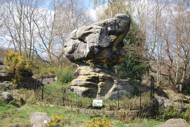
Rusthall Common

Rusthall Common is a 2.7-hectare (6.7-acre) geological Site of Special Scientific Interest in Rusthall, a suburb of Tunbridge Wells in Kent. It is a Geological...

Rusthall

Rusthall is a village located approximately 2 miles to the west of the spa town of Tunbridge Wells in Kent. The village grew up around a large property...

St Paul's Church, Rusthall

St Paul's Church is a Church of England parish church in Rusthall, Kent, England. It is a Grade II listed building. == History == St Paul's Church was...

Bennett Memorial Diocesan School

Bennett Memorial Diocesan School is an all ability co-educational academy in Royal Tunbridge Wells, Kent, England, which caters for students from age 11...
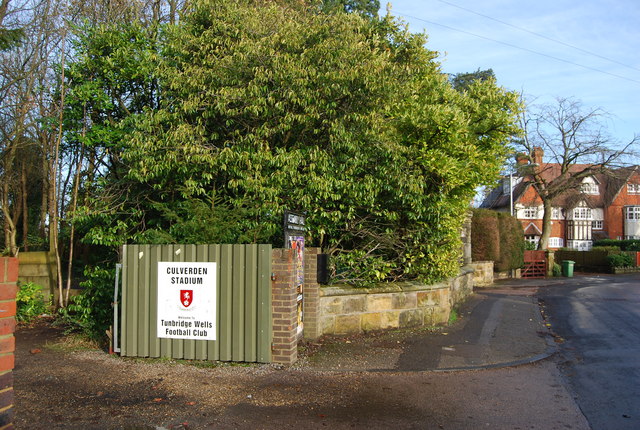
Culverden Stadium

Culverden Stadium is an association football stadium in Royal Tunbridge Wells, Kent, England. It is the home ground of Tunbridge Wells F.C. It has a capacity...

Tunbridge Wells F.C.

Tunbridge Wells Football Club is a football club based in Royal Tunbridge Wells, Kent, England. They are currently members of the Southern Counties East...

Linden Park Cricket Club

Linden Park Cricket Club (LPCC) is a cricket club based at Higher Cricket Ground, Fir Tree Road, Royal Tunbridge Wells, Kent, England.The club has a senior...

Nearby Amenities

Located within 500m of 51.137036,0.24155716
Booth: K6
Removed Amenity: telephone
Lat/Long: 51.1383181/0.24606
Pub
Toad Rock Retreat
Lat/Long: 51.1346175/0.2398078
Bus Stop
Court Road
Naptan AtcoCode: 2400100168
Naptan Bearing: N
Naptan CommonName: Court Road
Naptan Indicator: opp
Naptan Landmark: Court Road
Naptan NaptanCode: kntgwdpt
Naptan PlusbusZoneRef: TUNWELL
Naptan Street: Bishop's Down Park Road
Naptan Verified: no
Source: naptan_import
Lat/Long: 51.1373642/0.2485196
Bus Stop
Rydal Drive
Flag: no
Naptan AtcoCode: 2400A072130A
Naptan Bearing: E
Naptan BusStopType: CUS
Naptan CommonName: Rydal Drive
Naptan Indicator: adj
Naptan Landmark: Rydal Drive
Naptan NaptanCode: kntgdtdm
Naptan PlusbusZoneRef: TUNWELL
Naptan Street: Coniston Avenue
Naptan Verified: no
Public Transport: platform
Source: naptan_import
Lat/Long: 51.1381989/0.2458159
Bus Stop
Rydal Drive
Flag: no
Naptan AtcoCode: 2400A072140A
Naptan Bearing: W
Naptan BusStopType: CUS
Naptan CommonName: Rydal Drive
Naptan Indicator: opp
Naptan Landmark: Rydal Drive
Naptan NaptanCode: kntgdtdp
Naptan PlusbusZoneRef: TUNWELL
Naptan Street: Coniston Avenue
Naptan Verified: no
Public Transport: platform
Source: naptan_import
Lat/Long: 51.1378893/0.2460734
Turning Circle
Lat/Long: 51.1362351/0.2376908
Traffic Calming: cushion
Lat/Long: 51.1368525/0.2486683
Bus Stop
Rusthall Grange
Lat/Long: 51.1344747/0.2366598
Bus Stop
Rusthall Grange
Lat/Long: 51.1344109/0.2369688
Post Box
Operator: Royal Mail
Post Box Type: pillar
Ref: TN4 212D
Royal Cypher: GR
Royal Cypher Wikidata: Q33102273
Lat/Long: 51.1341452/0.2419085
Post Box
Operator: Royal Mail
Post Box Type: lamp
Ref: TN4 314D
Royal Cypher: EIIR
Royal Cypher Wikidata: Q33102113
Lat/Long: 51.1371083/0.2388474
Bench
Backrest: yes
Lat/Long: 51.1337756/0.2403125
Board Type: geology
Information: board
Tourism: information
Lat/Long: 51.1338482/0.2399763
Barrier: swing_gate
Lat/Long: 51.1367361/0.2443788
Grit Bin
Lat/Long: 51.1382841/0.2460946
Generator Method: photovoltaic
Generator Output Electricity: yes
Generator Source: solar
Generator Type: solar_photovoltaic_panel
Location: roof
Power: generator
Lat/Long: 51.1391593/0.2423161
Generator Method: photovoltaic
Generator Output Electricity: yes
Generator Source: solar
Generator Type: solar_photovoltaic_panel
Location: roof
Power: generator
Lat/Long: 51.1386225/0.2357528
Generator Method: photovoltaic
Generator Output Electricity: yes
Generator Source: solar
Generator Type: solar_photovoltaic_panel
Location: roof
Power: generator
Lat/Long: 51.1362344/0.234755
Generator Method: photovoltaic
Generator Output Electricity: yes
Generator Source: solar
Generator Type: solar_photovoltaic_panel
Location: roof
Power: generator
Lat/Long: 51.1363118/0.2351385
Generator Method: photovoltaic
Generator Output Electricity: yes
Generator Source: solar
Generator Type: solar_photovoltaic_panel
Location: roof
Power: generator
Lat/Long: 51.1374024/0.2360076
Generator Method: photovoltaic
Generator Output Electricity: yes
Generator Source: solar
Generator Type: solar_photovoltaic_panel
Location: roof
Power: generator
Lat/Long: 51.1374074/0.2360827
Generator Method: photovoltaic
Generator Output Electricity: yes
Generator Source: solar
Generator Type: solar_photovoltaic_panel
Location: roof
Power: generator
Lat/Long: 51.136332/0.2360143
Generator Method: photovoltaic
Generator Output Electricity: yes
Generator Source: solar
Generator Type: solar_photovoltaic_panel
Location: roof
Power: generator
Lat/Long: 51.1364641/0.2359432
Generator Method: photovoltaic
Generator Output Electricity: yes
Generator Source: solar
Generator Type: solar_photovoltaic_panel
Location: roof
Power: generator
Lat/Long: 51.1364153/0.2359754
Generator Method: photovoltaic
Generator Output Electricity: yes
Generator Source: solar
Generator Type: solar_photovoltaic_panel
Location: roof
Power: generator
Lat/Long: 51.1363665/0.2359955
Generator Method: photovoltaic
Generator Output Electricity: yes
Generator Source: solar
Generator Type: solar_photovoltaic_panel
Location: roof
Power: generator
Lat/Long: 51.1369715/0.23527
Generator Method: photovoltaic
Generator Output Electricity: yes
Generator Source: solar
Generator Type: solar_photovoltaic_panel
Location: roof
Power: generator
Lat/Long: 51.1361519/0.2345806
Generator Method: photovoltaic
Generator Output Electricity: yes
Generator Source: solar
Generator Type: solar_photovoltaic_panel
Location: roof
Power: generator
Lat/Long: 51.1361822/0.234645
Generator Method: photovoltaic
Generator Output Electricity: yes
Generator Source: solar
Generator Type: solar_photovoltaic_panel
Location: roof
Power: generator
Lat/Long: 51.1362966/0.2354631
Generator Method: photovoltaic
Generator Output Electricity: yes
Generator Source: solar
Generator Type: solar_photovoltaic_panel
Location: roof
Power: generator
Lat/Long: 51.1363118/0.2355221
Generator Method: photovoltaic
Generator Output Electricity: yes
Generator Source: solar
Generator Type: solar_photovoltaic_panel
Location: roof
Power: generator
Lat/Long: 51.1363151/0.2355784
Generator Method: photovoltaic
Generator Output Electricity: yes
Generator Source: solar
Generator Type: solar_photovoltaic_panel
Location: roof
Power: generator
Lat/Long: 51.136337/0.2356938
Generator Method: photovoltaic
Generator Output Electricity: yes
Generator Source: solar
Generator Type: solar_photovoltaic_panel
Location: roof
Power: generator
Lat/Long: 51.1363471/0.2357554
Generator Method: photovoltaic
Generator Output Electricity: yes
Generator Source: solar
Generator Type: solar_photovoltaic_panel
Location: roof
Power: generator
Lat/Long: 51.1352565/0.235852
Generator Method: photovoltaic
Generator Output Electricity: yes
Generator Source: solar
Generator Type: solar_photovoltaic_panel
Location: roof
Power: generator
Lat/Long: 51.1352178/0.2397922
Generator Method: photovoltaic
Generator Output Electricity: yes
Generator Source: solar
Generator Type: solar_photovoltaic_panel
Location: roof
Power: generator
Lat/Long: 51.1374259/0.2377939
Generator Method: photovoltaic
Generator Output Electricity: yes
Generator Source: solar
Generator Type: solar_photovoltaic_panel
Location: roof
Power: generator
Lat/Long: 51.1343351/0.2419996
Generator Method: photovoltaic
Generator Output Electricity: yes
Generator Source: solar
Generator Type: solar_photovoltaic_panel
Location: roof
Power: generator
Lat/Long: 51.1343611/0.2421458
The data included in this document is from www.openstreetmap.org. The data is made available under ODbL.

Have you been to Still Green?

Leave your review of Still Green below (or comments, questions and feedback).