Stanton Moor Plantation

Wood, Forest in Derbyshire Derbyshire Dales

England

Stanton Moor Plantation

Path down from Stanton Moor
Path down from Stanton Moor Credit: David Lally

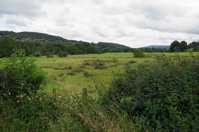
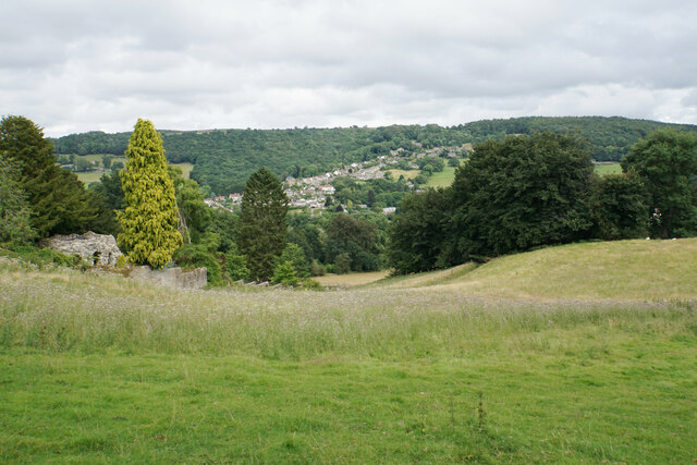
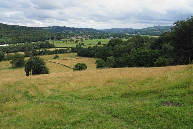
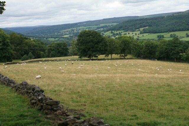
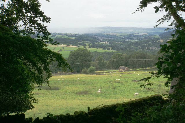
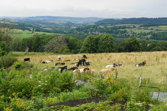
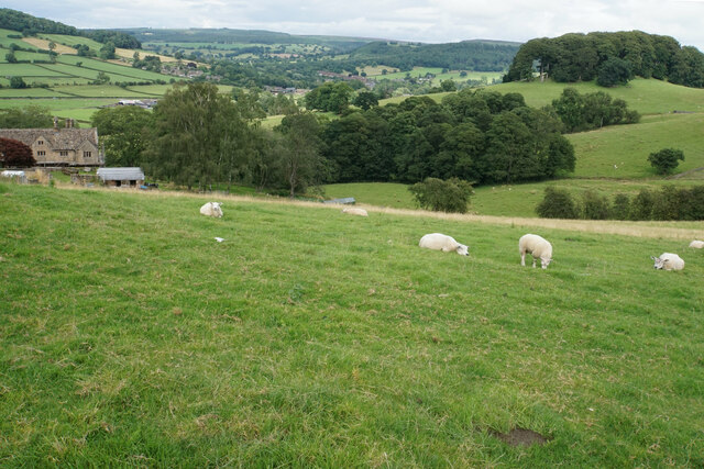
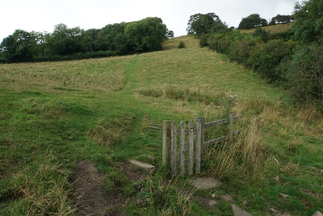
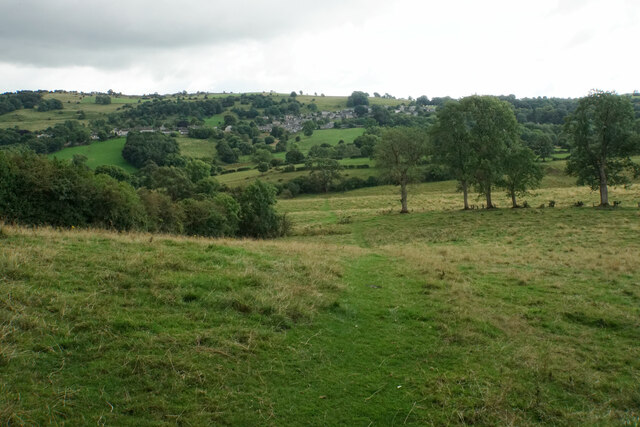
Stanton Moor Plantation is a picturesque woodland located in the county of Derbyshire, England. It covers an area of approximately 70 hectares and is situated on Stanton Moor, a high plateau in the Peak District National Park. The plantation is known for its diverse range of trees and beautiful landscape, making it a popular destination for nature enthusiasts and hikers.

The woodland consists predominantly of broadleaf trees, including oak, birch, beech, and ash, providing a rich habitat for various wildlife species. The undergrowth is characterized by ferns, mosses, and wildflowers, creating a vibrant and enchanting atmosphere. The plantation is also home to several species of birds, such as woodpeckers, thrushes, and owls, adding to the natural charm of the area.

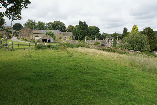
Stanton Moor Plantation has historical significance, as it was once part of the extensive Dukes of Rutland estate. The woodland has remnants of ancient stone circles, including the Nine Ladies Stone Circle, which is a well-preserved Bronze Age monument. These ancient features attract archaeologists and history enthusiasts who are interested in exploring the site's cultural heritage.

Visitors to Stanton Moor Plantation can enjoy a network of footpaths and trails that meander through the woodland, providing opportunities for peaceful walks and breathtaking views of the surrounding countryside. The plantation offers a tranquil and serene setting, making it an ideal spot for picnics, photography, and simply immersing oneself in nature.

If you have any feedback on the listing, please let us know in the comments section below.

Stanton Moor Plantation Images

Images are sourced within 2km of 53.165431/-1.6315378 or Grid Reference SK2463. Thanks to Geograph Open Source API. All images are credited.

Path down from Stanton Moor
Leaning oak Wind-blown on Stanton Moor.
Leaning oak
Wind-blown on Stanton Moor.
Valley bottom of the River Derwent Part of the flood plain of the Derwent near Rowsley, a little below its confluence with the Wye.
Valley bottom of the River Derwent
Part of the flood plain of the Derwent near Rowsley, a little below its confluence with the Wye.
Hillside below Stanton Woodhouse The western side of the Derwent valley. The village of Northwood is seen on the other side.
Hillside below Stanton Woodhouse
The western side of the Derwent valley. The village of Northwood is seen on the other side.
Stanton Woodhouse A manor house and farm in the Haddon estate.
Stanton Woodhouse
A manor house and farm in the Haddon estate.
Hillside above the Derwent valley A hillside near Stanton Woodhouse. The next visible community is Darley Dale.
Hillside above the Derwent valley
A hillside near Stanton Woodhouse. The next visible community is Darley Dale.
Sheep above Stanton Woodhouse Looking up the Derwent valley.
Sheep above Stanton Woodhouse
Looking up the Derwent valley.
Cottages in Stanton in Peak A long thin village climbing the hillside. A shower is passing a couple of miles to the north.
Cottages in Stanton in Peak
A long thin village climbing the hillside. A shower is passing a couple of miles to the north.
Field near Stanton in Peak A view from the top of the village, which is off to the left.
Field near Stanton in Peak
A view from the top of the village, which is off to the left.
Cottages in Stanton in Peak Near the bottom of the long thin village.
Cottages in Stanton in Peak
Near the bottom of the long thin village.
Field at Stanton in Peak Right at the bottom of the village.
Field at Stanton in Peak
Right at the bottom of the village.
Stanton in Peak From the bottom of the village looking up. The spire of Holy Trinity Church is seen but the village continues quite a long way past that.
Stanton in Peak
From the bottom of the village looking up. The spire of Holy Trinity Church is seen but the village continues quite a long way past that.
Stanton in Peak The village pub, the Flying Childers, is straight ahead, and the spire of Holy Trinity Church is behind.
Stanton in Peak
The village pub, the Flying Childers, is straight ahead, and the spire of Holy Trinity Church is behind.
Allotments and cattle at Stanton in Peak Looking down on the valley of the River Wye where Haddon Hall can be seen.
Allotments and cattle at Stanton in Peak
Looking down on the valley of the River Wye where Haddon Hall can be seen.
Sheep above Congreave Looking towards Rowsley down the Wye valley.
Sheep above Congreave
Looking towards Rowsley down the Wye valley.
Path to Birchover It is necessary to climb up Birchover Edge.
Path to Birchover
It is necessary to climb up Birchover Edge.
Path to Winster The village of Winster is seen on the hill ahead.
Path to Winster
The village of Winster is seen on the hill ahead.
Fields near Birchover The village is seen in the background from this point on Birchover Edge.
Fields near Birchover
The village is seen in the background from this point on Birchover Edge.
Show me another place!

Stanton Moor Plantation is located at Grid Ref: SK2463 (Lat: 53.165431, Lng: -1.6315378)

Administrative County: Derbyshire

District: Derbyshire Dales

Police Authority: Derbyshire

What 3 Words

///revealing.actual.recent. Near Youlgreave, Derbyshire

Related Wikis

Stanton Moor

Stanton Moor is a small upland area in the Derbyshire Peak District of central northern England, lying between Matlock and Bakewell near the villages of...

Nine Ladies

The Nine Ladies is a stone circle located on Stanton Moor in Derbyshire in the English East Midlands. The Nine Ladies is part of a tradition of stone circle...
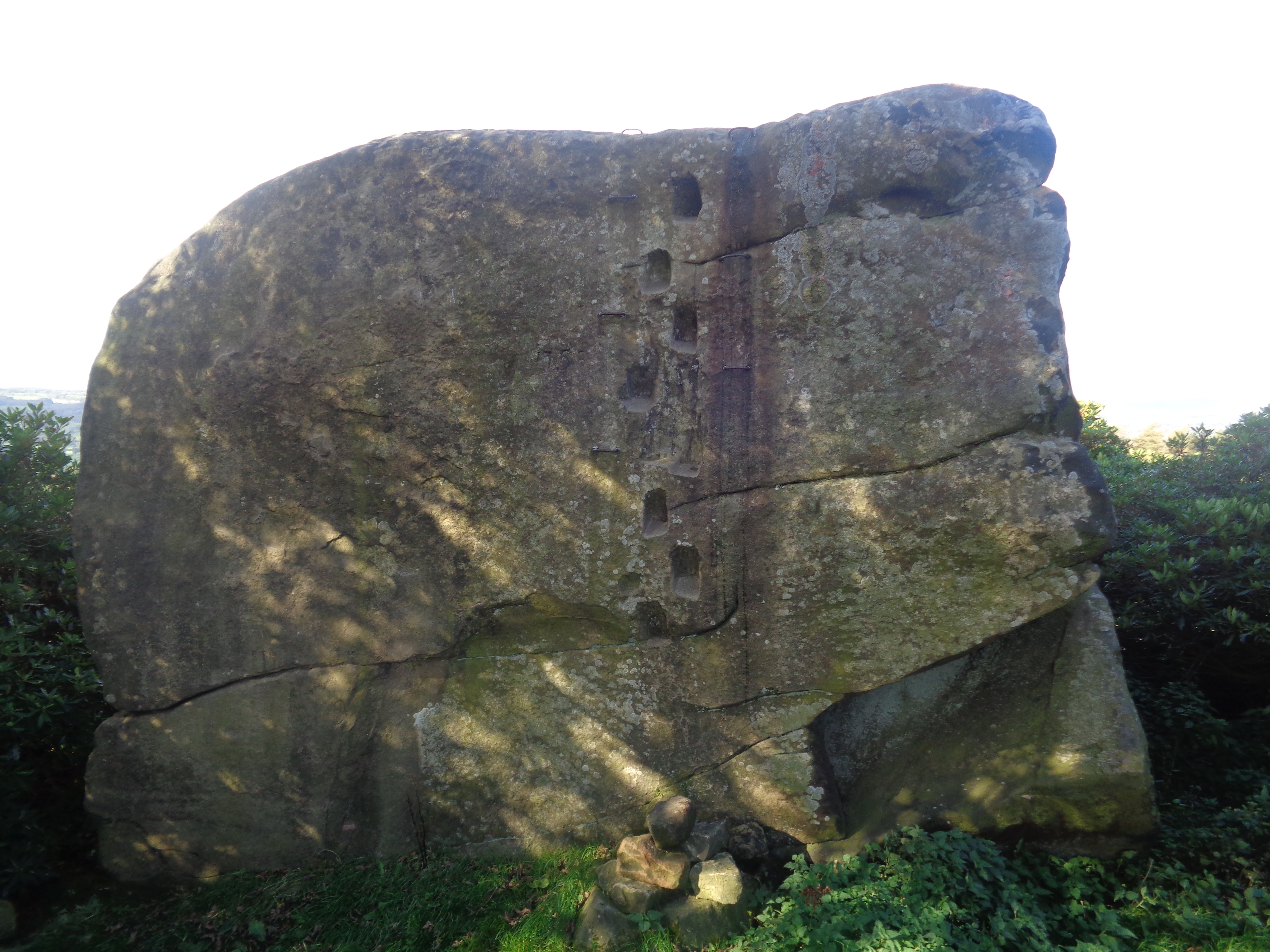
Andle Stone

The Andle Stone is a large gritstone boulder on Stanton Moor in Derbyshire. The stone block is 6m long, 4m high and lies within a low, circular, dry stone...

Doll Tor

Doll Tor is a stone circle located just to the west of Stanton Moor, near the village of Birchover, Derbyshire in the English East Midlands. Doll Tor is...

Stanton Hall, Stanton in Peak

Stanton Hall is a privately owned country house at Stanton in Peak in the Derbyshire Peak District, the home of the Davie-Thornhill family. It is a Grade...

Holy Trinity Church, Stanton-in-Peak

Holy Trinity Church, Stanton-in-Peak is a Grade II listed parish church in the Church of England in Stanton in Peak, Derbyshire. == History == The church...

Stanton in Peak

Stanton in Peak (also written as Stanton-in-Peak) is a village in the Derbyshire Dales district of Derbyshire, It is about seven miles north-west of Matlock...

St Michael's Church, Birchover

St Michael's Church, Birchover, also known as Rowtor Chapel, is a Grade II listed parish church in the Church of England in Birchover, Derbyshire. Located...

Nearby Amenities

Located within 500m of 53.165431,-1.6315378
Board Title: The Nine Ladies Stone Circle
Board Type: history
Information: board
Tourism: information
Lat/Long: 53.1678899/-1.6284043
Natural: stone
Lat/Long: 53.1679673/-1.6288827
T2 Bronze age cairn
Historic: archaeological_site
Lat/Long: 53.1616794/-1.6323868
Inscribed stones 1854
Historic: archaeological_site
Lat/Long: 53.1677368/-1.6262299
Natural: stone
Lat/Long: 53.1680178/-1.6288599
Natural: stone
Lat/Long: 53.1680099/-1.6287352
T55 large cairn
Historic: archaeological_site
Lat/Long: 53.1647351/-1.6302126
Board Type: history
Information: board
Tourism: information
Lat/Long: 53.1611467/-1.630167
Cat Stone (EIN 1831)
Historic: archaeological_site
Lat/Long: 53.1657778/-1.6243056
Natural: stone
Lat/Long: 53.1679503/-1.6288656
Natural: stone
Lat/Long: 53.1679329/-1.6287805
T43 Ring cairn
Historic: archaeological_site
Lat/Long: 53.1626699/-1.6319205
Duchess of Sutherland Stone (HS 1830)
Historic: archaeological_site
Lat/Long: 53.1626181/-1.6265434
Natural: stone
Lat/Long: 53.1680243/-1.6287621
Natural: stone
Lat/Long: 53.1679614/-1.6287263
Barrier: stile
Material: wood
Source: survey;bing;gps
Stile: stepover
Lat/Long: 53.1611307/-1.6301779
Barrier: stile
Material: wood
Source: survey;bing;gps
Stile: stepover
Lat/Long: 53.167081/-1.6255869
Watering Place
Lat/Long: 53.1678054/-1.6253928
Barrier: stile
Source: survey;gps
Stile: stepover
Lat/Long: 53.1683902/-1.6272554
Stanton Moor
Ele: 323
Natural: peak
Lat/Long: 53.1627977/-1.6350449
Barrier: stile
Material: wood
Source: survey;gps
Stile: stepover
Lat/Long: 53.1664623/-1.6346952
Natural: rock
Lat/Long: 53.1660447/-1.6338529
The Kings Stone
Historic: archaeological_site
Natural: stone
Lat/Long: 53.1678295/-1.6293347
Natural: stone
Lat/Long: 53.1680292/-1.6288136
Natural: stone
Lat/Long: 53.1679947/-1.6288808
Barrier: stile
Material: wood
Source: survey;gps
Stile: stepover
Lat/Long: 53.168913/-1.6299465
Man Made: survey_point
Tpuk Ref: S4151
Lat/Long: 53.1627679/-1.6350091
Direction: 112
Tourism: viewpoint
Lat/Long: 53.1620969/-1.6267341
The data included in this document is from www.openstreetmap.org. The data is made available under ODbL.

Have you been to Stanton Moor Plantation?

Leave your review of Stanton Moor Plantation below (or comments, questions and feedback).