Coast Wood

Wood, Forest in Derbyshire Derbyshire Dales

England

Coast Wood

Path down from Stanton Moor
Path down from Stanton Moor Credit: David Lally

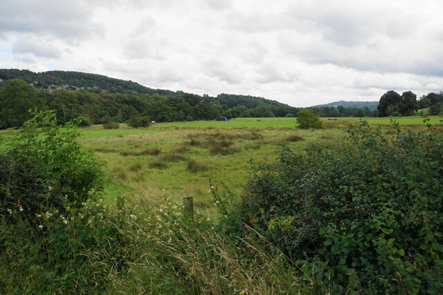
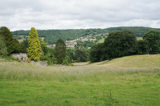
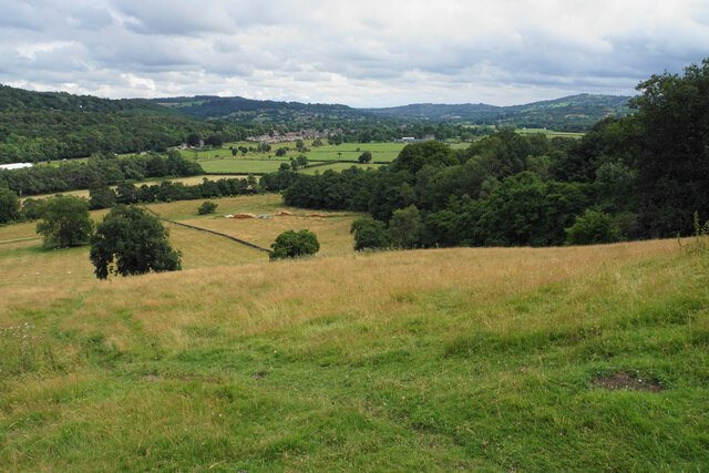
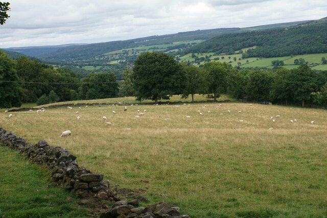
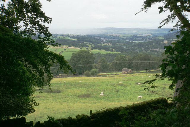
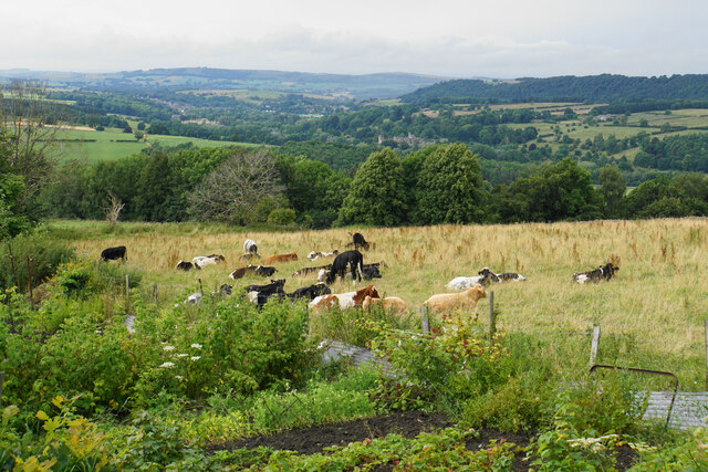
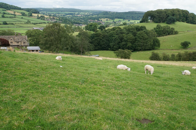
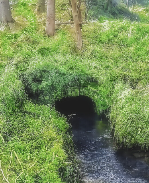
Coast Wood, situated in Derbyshire, is a picturesque forest that spans across a vast area of land. Known for its natural beauty and diverse wildlife, it has become a popular destination for nature enthusiasts and outdoor lovers.

The wood boasts a variety of tree species, including oak, birch, beech, and pine, which create a stunning canopy of colors throughout the seasons. The forest floor is covered in a lush carpet of ferns, wildflowers, and moss, providing a perfect habitat for a wide range of animal species.

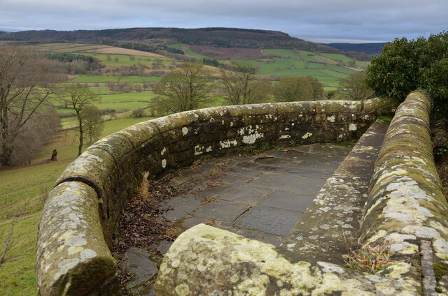
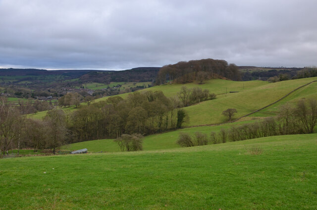
Visitors to Coast Wood can explore its many walking trails, which wind through the dense foliage and offer breathtaking views of the surrounding landscape. The forest is also home to a network of cycling paths, allowing cyclists to enjoy the serene atmosphere while enjoying a leisurely ride.

Nature lovers will be delighted to encounter an array of wildlife in Coast Wood. The forest is home to various bird species, including woodpeckers, owls, and songbirds, making it a haven for birdwatchers. Additionally, deer, foxes, rabbits, and squirrels can often be spotted, adding to the charm of the woodland experience.

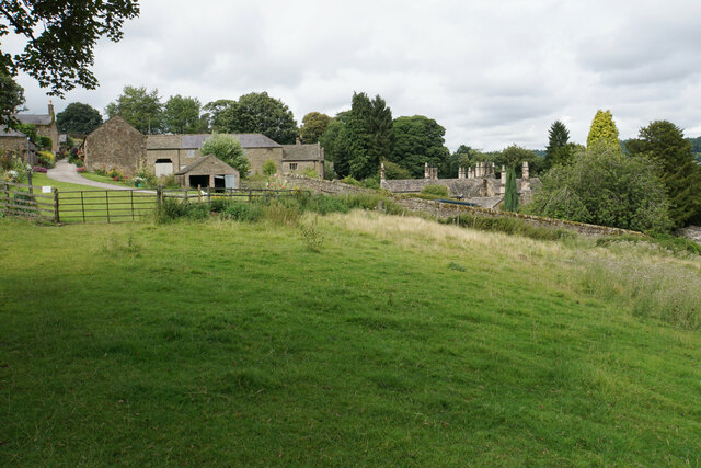
Coast Wood is not only a place of natural beauty but also a significant historical site. The forest has a rich history dating back centuries, with remnants of ancient settlements and burial grounds scattered throughout. Archaeologists and history enthusiasts frequently visit the wood to explore and uncover its fascinating past.

Overall, Coast Wood in Derbyshire offers visitors a tranquil escape into nature, with its stunning landscapes, abundant wildlife, and historical significance making it a must-visit destination for individuals seeking a peaceful retreat.

If you have any feedback on the listing, please let us know in the comments section below.

Coast Wood Images

Images are sourced within 2km of 53.172535/-1.6355013 or Grid Reference SK2463. Thanks to Geograph Open Source API. All images are credited.

Path down from Stanton Moor
Leaning oak Wind-blown on Stanton Moor.
Leaning oak
Wind-blown on Stanton Moor.
Valley bottom of the River Derwent Part of the flood plain of the Derwent near Rowsley, a little below its confluence with the Wye.
Valley bottom of the River Derwent
Part of the flood plain of the Derwent near Rowsley, a little below its confluence with the Wye.
Hillside below Stanton Woodhouse The western side of the Derwent valley. The village of Northwood is seen on the other side.
Hillside below Stanton Woodhouse
The western side of the Derwent valley. The village of Northwood is seen on the other side.
Stanton Woodhouse A manor house and farm in the Haddon estate.
Stanton Woodhouse
A manor house and farm in the Haddon estate.
Hillside above the Derwent valley A hillside near Stanton Woodhouse. The next visible community is Darley Dale.
Hillside above the Derwent valley
A hillside near Stanton Woodhouse. The next visible community is Darley Dale.
Sheep above Stanton Woodhouse Looking up the Derwent valley.
Sheep above Stanton Woodhouse
Looking up the Derwent valley.
Cottages in Stanton in Peak A long thin village climbing the hillside. A shower is passing a couple of miles to the north.
Cottages in Stanton in Peak
A long thin village climbing the hillside. A shower is passing a couple of miles to the north.
Field near Stanton in Peak A view from the top of the village, which is off to the left.
Field near Stanton in Peak
A view from the top of the village, which is off to the left.
Cottages in Stanton in Peak Near the bottom of the long thin village.
Cottages in Stanton in Peak
Near the bottom of the long thin village.
Field at Stanton in Peak Right at the bottom of the village.
Field at Stanton in Peak
Right at the bottom of the village.
Stanton in Peak From the bottom of the village looking up. The spire of Holy Trinity Church is seen but the village continues quite a long way past that.
Stanton in Peak
From the bottom of the village looking up. The spire of Holy Trinity Church is seen but the village continues quite a long way past that.
Stanton in Peak The village pub, the Flying Childers, is straight ahead, and the spire of Holy Trinity Church is behind.
Stanton in Peak
The village pub, the Flying Childers, is straight ahead, and the spire of Holy Trinity Church is behind.
Allotments and cattle at Stanton in Peak Looking down on the valley of the River Wye where Haddon Hall can be seen.
Allotments and cattle at Stanton in Peak
Looking down on the valley of the River Wye where Haddon Hall can be seen.
Sheep above Congreave Looking towards Rowsley down the Wye valley.
Sheep above Congreave
Looking towards Rowsley down the Wye valley.
Portal of Hillcarr Sough, Darley Dale Set back from the River Derwent, into which its water flows, is the portal or tail of Hillcarr Sough, one of the most important mine drainage levels within the Derbyshire lead mining area. The total length, including its many branches, is approximately 4.5 miles. Begun in 1766 it took twenty one years to reach the mines and cost about £32,000, which was a huge sum in those days. Because of the great depth beneath Stanton Moor, there were few air shafts sunk during its construction which caused ventilation problems. Ultimately it was hugely successful, allowing mining at depth in the mines around Alport and Youlgreave. Exploration in the late 70s, in chest deep water, revealed beautiful gritstone arching which was carried for some distance from the portal but shortly after this ends, there has been a roof fall over which the water now roars. A rusty link on the portal's keystone was once visible and used to tie boats up during and after construction.
Portal of Hillcarr Sough, Darley Dale
Set back from the River Derwent, into which its water flows, is the portal or tail of Hillcarr Sough, one of the most important mine drainage levels within the Derbyshire lead mining area. The total length, including its many branches, is approximately 4.5 miles. Begun in 1766 it took twenty one years to reach the mines and cost about £32,000, which was a huge sum in those days. Because of the great depth beneath Stanton Moor, there were few air shafts sunk during its construction which caused ventilation problems. Ultimately it was hugely successful, allowing mining at depth in the mines around Alport and Youlgreave. Exploration in the late 70s, in chest deep water, revealed beautiful gritstone arching which was carried for some distance from the portal but shortly after this ends, there has been a roof fall over which the water now roars. A rusty link on the portal's keystone was once visible and used to tie boats up during and after construction.
Viewpoint by Pilhough Lane, near Stanton, Derbyshire A viewing point over the lower valley of the River Wye in the Derbyshire Peak District.
Viewpoint by Pilhough Lane, near Stanton, Derbyshire
A viewing point over the lower valley of the River Wye in the Derbyshire Peak District.
Pastures at Congreave, near Rowsley, Derbyshire
Show me another place!

Coast Wood is located at Grid Ref: SK2463 (Lat: 53.172535, Lng: -1.6355013)

Administrative County: Derbyshire

District: Derbyshire Dales

Police Authority: Derbyshire

What 3 Words

///desktops.hats.hovered. Near Youlgreave, Derbyshire

Related Wikis

Stanton Hall, Stanton in Peak

Stanton Hall is a privately owned country house at Stanton in Peak in the Derbyshire Peak District, the home of the Davie-Thornhill family. It is a Grade...

Holy Trinity Church, Stanton-in-Peak

Holy Trinity Church, Stanton-in-Peak is a Grade II listed parish church in the Church of England in Stanton in Peak, Derbyshire. == History == The church...

Stanton in Peak

Stanton in Peak (also written as Stanton-in-Peak) is a village in the Derbyshire Dales district of Derbyshire, It is about seven miles north-west of Matlock...

Nine Ladies

The Nine Ladies is a stone circle located on Stanton Moor in Derbyshire in the English East Midlands. The Nine Ladies is part of a tradition of stone circle...

Stanton Moor

Stanton Moor is a small upland area in the Derbyshire Peak District of central northern England, lying between Matlock and Bakewell near the villages of...
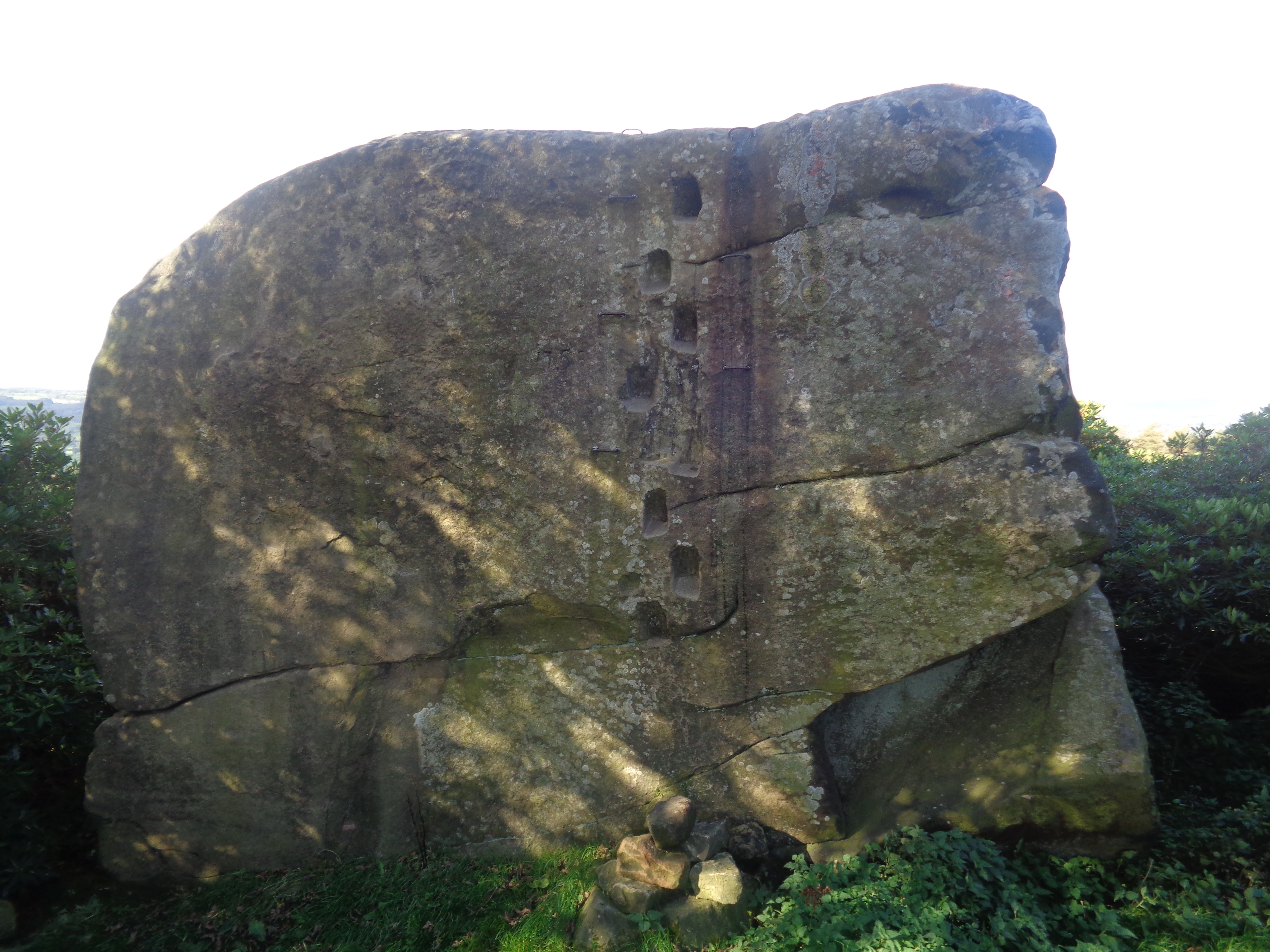
Andle Stone

The Andle Stone is a large gritstone boulder on Stanton Moor in Derbyshire. The stone block is 6m long, 4m high and lies within a low, circular, dry stone...

Doll Tor

Doll Tor is a stone circle located just to the west of Stanton Moor, near the village of Birchover, Derbyshire in the English East Midlands. Doll Tor is...

Harthill Hall

Harthill Hall was formerly the Manor House of a great 13th century Estate, and the hall is now a Grade II listed building within the civil parish of Harthill...

Related Videos

We're having a baby (and the future of this channel)

In this video Hay & Kyle announce why they have been absent from YouTube for a few months with the biggest reason being that ...

A GLIMPSE INSIDE MY FAVOURITE MEDIEVAL HOUSE - Haddon Hall At Christmas

Join me this week as I return to my favourite medieval house in England, Haddon Hall, to see the Christmas decorations. Always a ...

A GLIMPSE INSIDE TWO ROMANTIC ENGLISH ROSE GARDENS - Haddon Hall and David Austin

Join me this week as I return to my favourite house in England, Haddon Hall, to see the roses in bloom. Then I pay a visit to the ...

Nearby Amenities

Located within 500m of 53.172535,-1.6355013
Stanton-in-Peak
Is In: Derbyshire, England, UK
Place: village
Wikidata: Q280623
Wikipedia: en:Stanton in Peak
Lat/Long: 53.1749317/-1.6400286
Board Title: Stanton Moor - thousands of years of human activity
Board Type: history
Information: board
Tourism: information
Lat/Long: 53.1705273/-1.6295129
Post Box
Operator: Royal Mail
Ref: DE4 996
Lat/Long: 53.1740247/-1.6397815
Post Box
Operator: Royal Mail
Post Box Type: lamp
Ref: DE4 980
Royal Cypher: EIIR
Royal Cypher Wikidata: Q33102113
Lat/Long: 53.1754449/-1.6410091
Stanton Moor
Man Made: tower
Lat/Long: 53.170253/-1.6337646
Entrance: yes
Lat/Long: 53.1755247/-1.638988
Parking
Lat/Long: 53.1739027/-1.6323452
Defibrillator
Access: yes
Defibrillator Location: The Green, Stanton-in-Peak
Emergency: defibrillator
Indoor: no
Lat/Long: 53.174889/-1.6396579
Noexit: yes
Lat/Long: 53.1764074/-1.6318694
Bench
Source: bing
Lat/Long: 53.1752908/-1.6408642
Waste Basket
Lat/Long: 53.1752506/-1.640832
Bench
Source: bing
Lat/Long: 53.175261/-1.6408467
Historic: memorial
Memorial: war_memorial
Lat/Long: 53.1752743/-1.6408635
Bench: yes
Bus: yes
Public Transport: stop_position
Shelter: yes
Lat/Long: 53.1754483/-1.6410344
The data included in this document is from www.openstreetmap.org. The data is made available under ODbL.

Have you been to Coast Wood?

Leave your review of Coast Wood below (or comments, questions and feedback).