Stanton

Civil Parish in Derbyshire Derbyshire Dales

England

Stanton

Path down from Stanton Moor
Path down from Stanton Moor Credit: David Lally

Stanton is a civil parish located in the county of Derbyshire, England. It is situated approximately 10 miles south of the city of Derby and lies within the East Midlands region. The parish covers an area of around 6 square miles and is home to a population of around 1,000 residents.

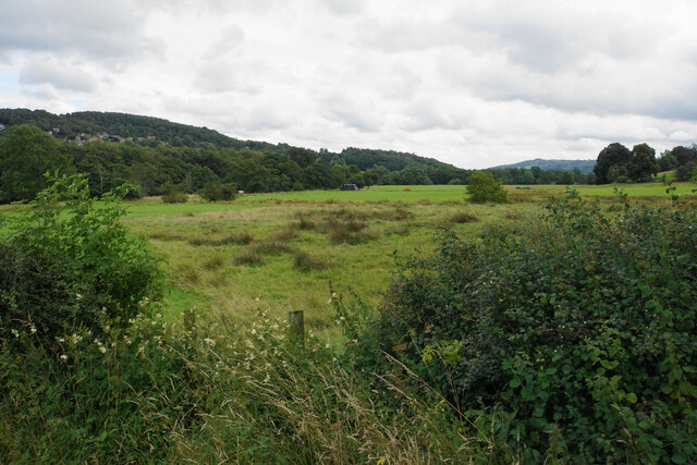
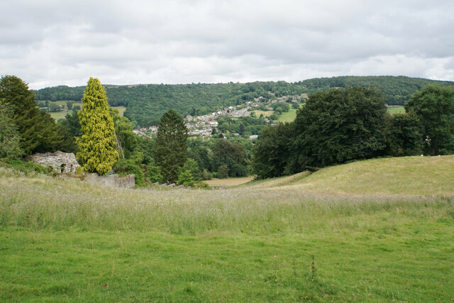
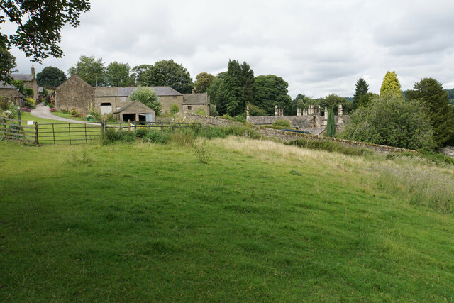
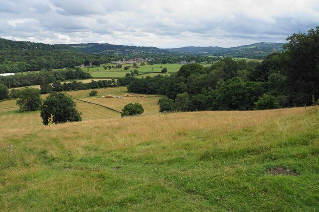
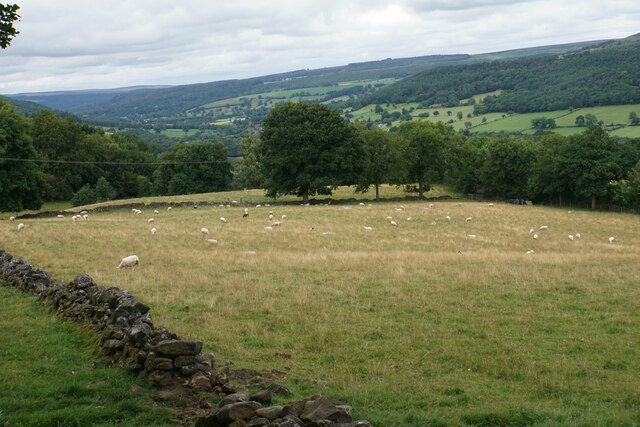
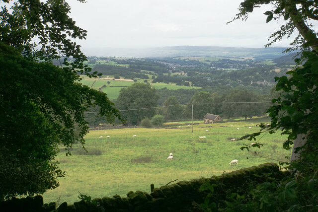
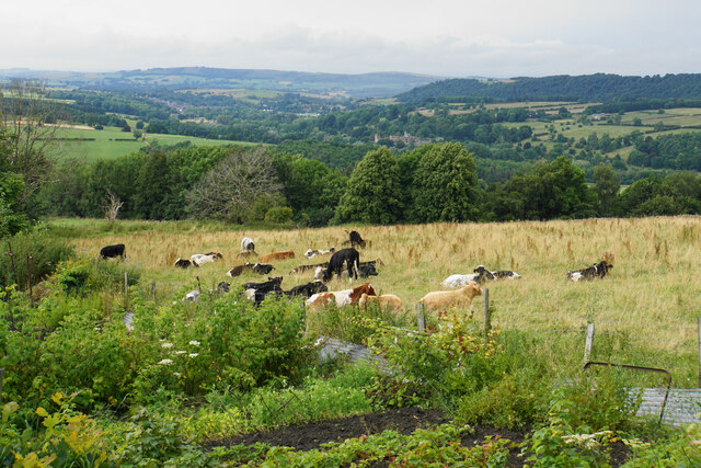
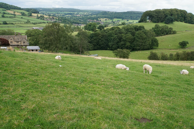
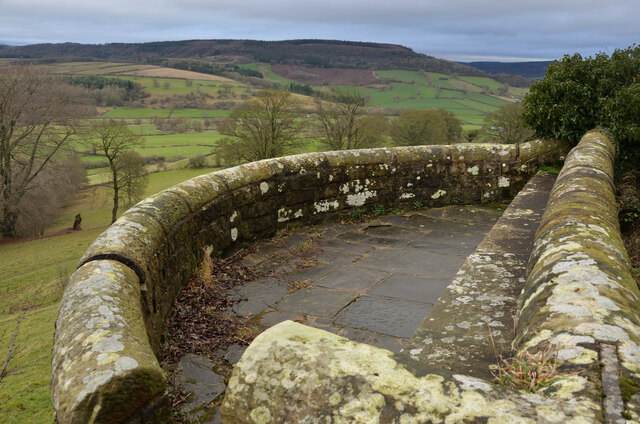
Stanton is characterized by its picturesque rural setting, surrounded by rolling hills and agricultural fields. The village itself is quaint and charming, with a mix of traditional stone cottages and more modern homes. The parish is also known for its historic buildings, including the Grade II listed Stanton Hall, a grand country house dating back to the 18th century.

The village has a strong sense of community, with a range of amenities and facilities to serve its residents. These include a village hall, a primary school, a church, and a pub. Stanton also benefits from its proximity to larger towns and cities, with easy access to shopping, healthcare, and leisure facilities.

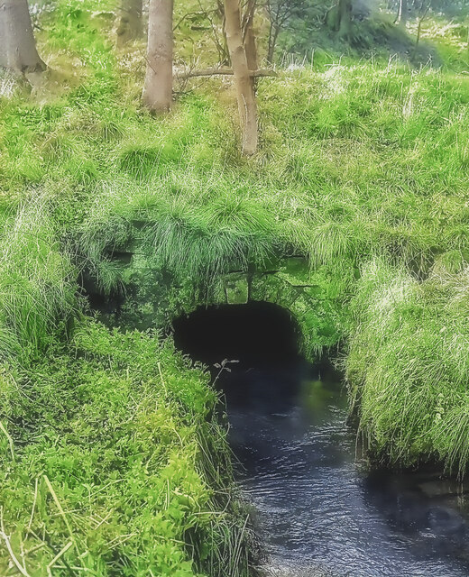
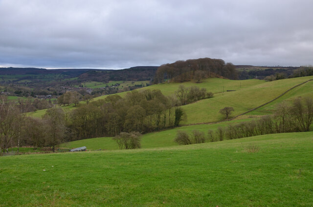
The surrounding countryside offers plenty of opportunities for outdoor activities, including walking, cycling, and horse riding. Stanton is also within close proximity to the Peak District National Park, a popular destination for nature lovers and outdoor enthusiasts.

Overall, Stanton offers a peaceful and idyllic setting for residents who value the tranquility of rural living while still being within reach of urban amenities.

If you have any feedback on the listing, please let us know in the comments section below.

Stanton Images

Images are sourced within 2km of 53.172026/-1.635655 or Grid Reference SK2463. Thanks to Geograph Open Source API. All images are credited.

Path down from Stanton Moor
Leaning oak Wind-blown on Stanton Moor.
Leaning oak
Wind-blown on Stanton Moor.
Valley bottom of the River Derwent Part of the flood plain of the Derwent near Rowsley, a little below its confluence with the Wye.
Valley bottom of the River Derwent
Part of the flood plain of the Derwent near Rowsley, a little below its confluence with the Wye.
Hillside below Stanton Woodhouse The western side of the Derwent valley. The village of Northwood is seen on the other side.
Hillside below Stanton Woodhouse
The western side of the Derwent valley. The village of Northwood is seen on the other side.
Stanton Woodhouse A manor house and farm in the Haddon estate.
Stanton Woodhouse
A manor house and farm in the Haddon estate.
Hillside above the Derwent valley A hillside near Stanton Woodhouse. The next visible community is Darley Dale.
Hillside above the Derwent valley
A hillside near Stanton Woodhouse. The next visible community is Darley Dale.
Sheep above Stanton Woodhouse Looking up the Derwent valley.
Sheep above Stanton Woodhouse
Looking up the Derwent valley.
Cottages in Stanton in Peak A long thin village climbing the hillside. A shower is passing a couple of miles to the north.
Cottages in Stanton in Peak
A long thin village climbing the hillside. A shower is passing a couple of miles to the north.
Field near Stanton in Peak A view from the top of the village, which is off to the left.
Field near Stanton in Peak
A view from the top of the village, which is off to the left.
Cottages in Stanton in Peak Near the bottom of the long thin village.
Cottages in Stanton in Peak
Near the bottom of the long thin village.
Field at Stanton in Peak Right at the bottom of the village.
Field at Stanton in Peak
Right at the bottom of the village.
Stanton in Peak From the bottom of the village looking up. The spire of Holy Trinity Church is seen but the village continues quite a long way past that.
Stanton in Peak
From the bottom of the village looking up. The spire of Holy Trinity Church is seen but the village continues quite a long way past that.
Stanton in Peak The village pub, the Flying Childers, is straight ahead, and the spire of Holy Trinity Church is behind.
Stanton in Peak
The village pub, the Flying Childers, is straight ahead, and the spire of Holy Trinity Church is behind.
Allotments and cattle at Stanton in Peak Looking down on the valley of the River Wye where Haddon Hall can be seen.
Allotments and cattle at Stanton in Peak
Looking down on the valley of the River Wye where Haddon Hall can be seen.
Sheep above Congreave Looking towards Rowsley down the Wye valley.
Sheep above Congreave
Looking towards Rowsley down the Wye valley.
Portal of Hillcarr Sough, Darley Dale Set back from the River Derwent, into which its water flows, is the portal or tail of Hillcarr Sough, one of the most important mine drainage levels within the Derbyshire lead mining area. The total length, including its many branches, is approximately 4.5 miles. Begun in 1766 it took twenty one years to reach the mines and cost about £32,000, which was a huge sum in those days. Because of the great depth beneath Stanton Moor, there were few air shafts sunk during its construction which caused ventilation problems. Ultimately it was hugely successful, allowing mining at depth in the mines around Alport and Youlgreave. Exploration in the late 70s, in chest deep water, revealed beautiful gritstone arching which was carried for some distance from the portal but shortly after this ends, there has been a roof fall over which the water now roars. A rusty link on the portal's keystone was once visible and used to tie boats up during and after construction.
Portal of Hillcarr Sough, Darley Dale
Set back from the River Derwent, into which its water flows, is the portal or tail of Hillcarr Sough, one of the most important mine drainage levels within the Derbyshire lead mining area. The total length, including its many branches, is approximately 4.5 miles. Begun in 1766 it took twenty one years to reach the mines and cost about £32,000, which was a huge sum in those days. Because of the great depth beneath Stanton Moor, there were few air shafts sunk during its construction which caused ventilation problems. Ultimately it was hugely successful, allowing mining at depth in the mines around Alport and Youlgreave. Exploration in the late 70s, in chest deep water, revealed beautiful gritstone arching which was carried for some distance from the portal but shortly after this ends, there has been a roof fall over which the water now roars. A rusty link on the portal's keystone was once visible and used to tie boats up during and after construction.
Viewpoint by Pilhough Lane, near Stanton, Derbyshire A viewing point over the lower valley of the River Wye in the Derbyshire Peak District.
Viewpoint by Pilhough Lane, near Stanton, Derbyshire
A viewing point over the lower valley of the River Wye in the Derbyshire Peak District.
Pastures at Congreave, near Rowsley, Derbyshire
Show me another place!

Stanton is located at Grid Ref: SK2463 (Lat: 53.172026, Lng: -1.635655)

Administrative County: Derbyshire

District: Derbyshire Dales

Police Authority: Derbyshire

What 3 Words

///hobby.warned.polished. Near Youlgreave, Derbyshire

Related Wikis

Stanton Hall, Stanton in Peak

Stanton Hall is a privately owned country house at Stanton in Peak in the Derbyshire Peak District, the home of the Davie-Thornhill family. It is a Grade...

Holy Trinity Church, Stanton-in-Peak

Holy Trinity Church, Stanton-in-Peak is a Grade II listed parish church in the Church of England in Stanton in Peak, Derbyshire. == History == The church...

Stanton in Peak

Stanton in Peak (also written as Stanton-in-Peak) is a village in the Derbyshire Dales district of Derbyshire, It is about seven miles north-west of Matlock...

Nine Ladies

The Nine Ladies is a stone circle located on Stanton Moor in Derbyshire in the English East Midlands. The Nine Ladies is part of a tradition of stone circle...

Stanton Moor

Stanton Moor is a small upland area in the Derbyshire Peak District of central northern England, lying between Matlock and Bakewell near the villages of...
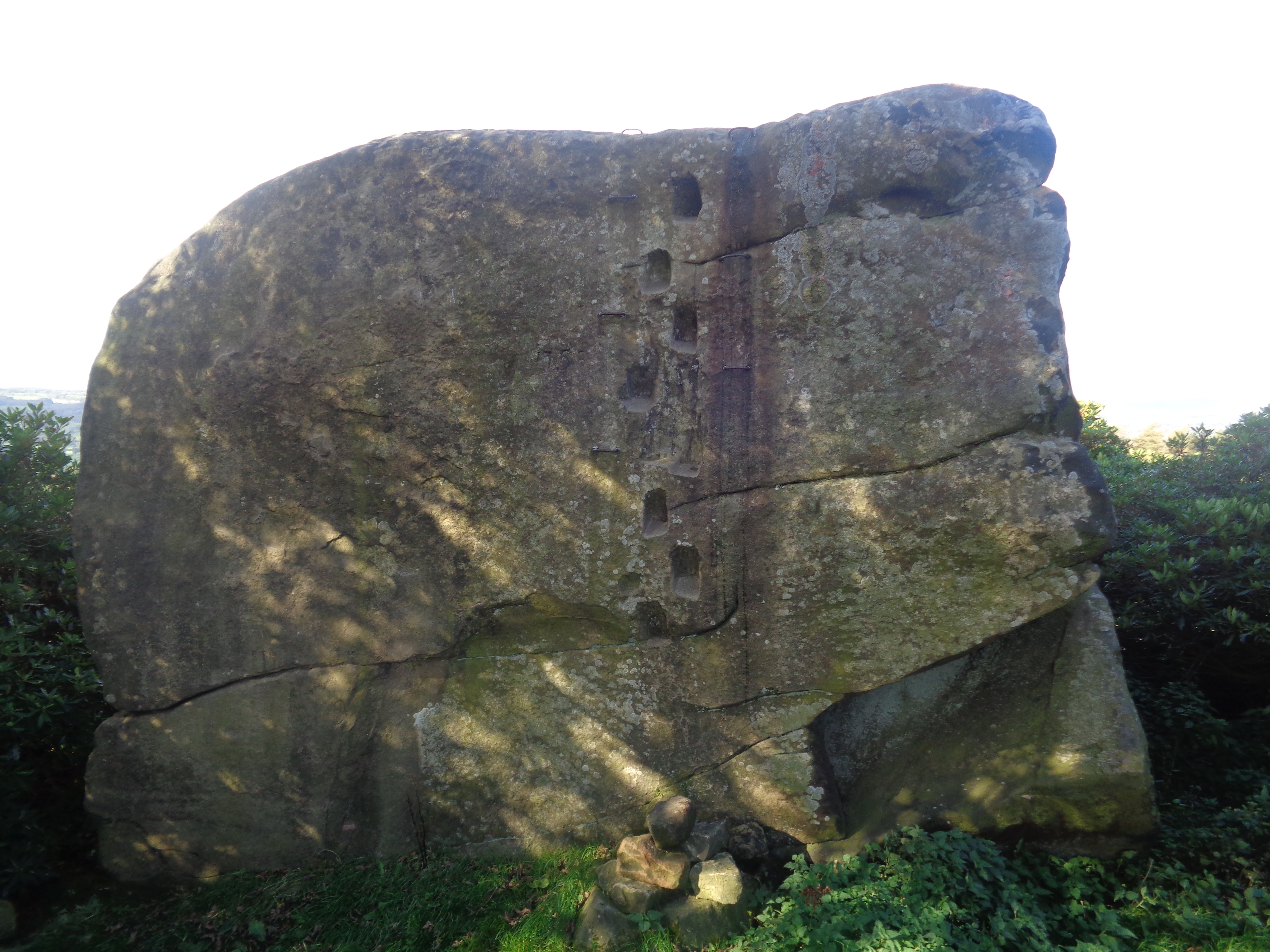
Andle Stone

The Andle Stone is a large gritstone boulder on Stanton Moor in Derbyshire. The stone block is 6m long, 4m high and lies within a low, circular, dry stone...

Doll Tor

Doll Tor is a stone circle located just to the west of Stanton Moor, near the village of Birchover, Derbyshire in the English East Midlands. Doll Tor is...

Harthill Hall

Harthill Hall was formerly the Manor House of a great 13th century Estate, and the hall is now a Grade II listed building within the civil parish of Harthill...

Nearby Amenities

Located within 500m of 53.172026,-1.635655
Stanton-in-Peak
Is In: Derbyshire, England, UK
Place: village
Wikidata: Q280623
Wikipedia: en:Stanton in Peak
Lat/Long: 53.1749317/-1.6400286
Board Title: Stanton Moor - thousands of years of human activity
Board Type: history
Information: board
Tourism: information
Lat/Long: 53.1705273/-1.6295129
Post Box
Operator: Royal Mail
Ref: DE4 996
Lat/Long: 53.1740247/-1.6397815
Stanton Moor
Man Made: tower
Lat/Long: 53.170253/-1.6337646
Entrance: yes
Lat/Long: 53.1755247/-1.638988
Parking
Lat/Long: 53.1739027/-1.6323452
Defibrillator
Access: yes
Defibrillator Location: The Green, Stanton-in-Peak
Emergency: defibrillator
Indoor: no
Lat/Long: 53.174889/-1.6396579
Waste Basket
Lat/Long: 53.1752506/-1.640832
Bench
Source: bing
Lat/Long: 53.175261/-1.6408467
The data included in this document is from www.openstreetmap.org. The data is made available under ODbL.

Have you been to Stanton?

Leave your review of Stanton below (or comments, questions and feedback).