Darnick

Settlement in Roxburghshire

Scotland

Darnick

Footbridge across the River Tweed
Footbridge across the River Tweed Credit: Les Hull

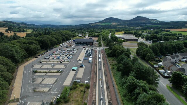
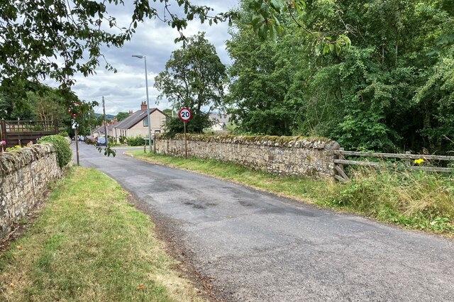
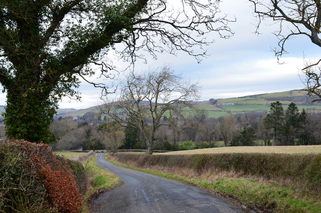
Darnick is a small village located in the county of Roxburghshire, in the Scottish Borders region of Scotland. Situated just south of the town of Melrose, it is nestled in a picturesque countryside setting, surrounded by rolling hills and beautiful landscapes.

The village of Darnick has a rich history dating back many centuries. It is believed to have been settled since prehistoric times, and evidence of Roman occupation has also been found in the area. The village's name is derived from the Old English word "dorn," meaning thorn tree, and "wic," meaning farm or settlement.

Today, Darnick is a peaceful and close-knit community with a population of around 400 residents. It offers a tranquil and idyllic environment, making it an attractive place for those seeking a quieter lifestyle. The village is known for its charming stone-built houses, many of which date back to the 18th and 19th centuries, adding to its historical character.

Despite its small size, Darnick boasts a number of amenities for its residents and visitors. These include a village hall, a primary school, and a local pub. The village is also well-connected, with regular bus services to nearby towns and cities.

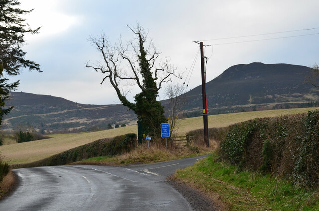
In terms of attractions, Darnick is ideally situated for exploring the surrounding areas, including the nearby town of Melrose with its stunning Melrose Abbey, and the Eildon Hills, which offer breathtaking views and scenic walks. Outdoor enthusiasts can also enjoy activities such as fishing and golfing, as there are several golf courses and fishing spots in the vicinity.

Overall, Darnick is a charming village that offers a peaceful and scenic retreat for both residents and visitors, with its rich history, beautiful landscapes, and close proximity to other attractions in the region.

If you have any feedback on the listing, please let us know in the comments section below.
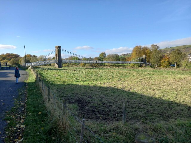
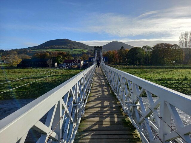
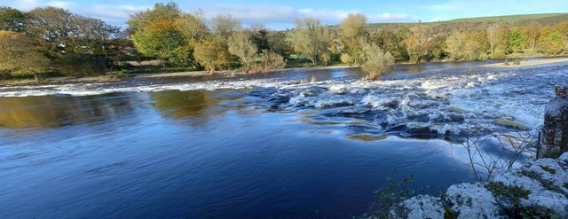
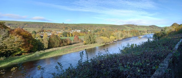
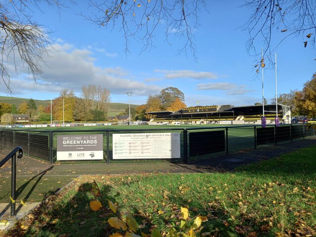
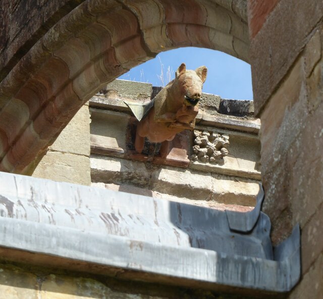
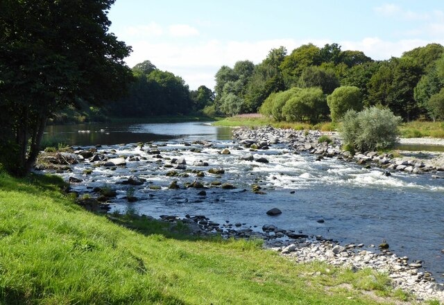
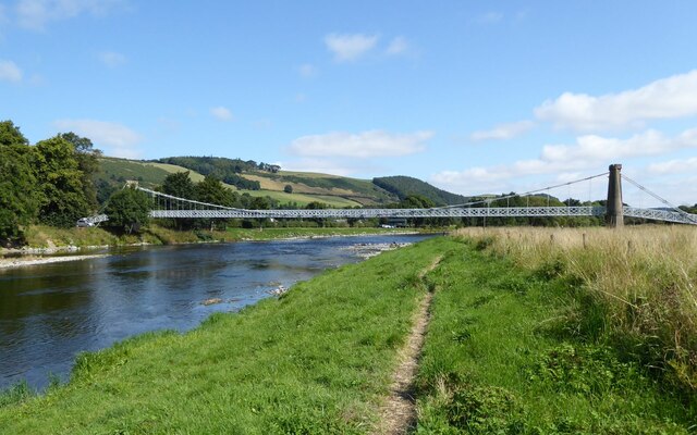
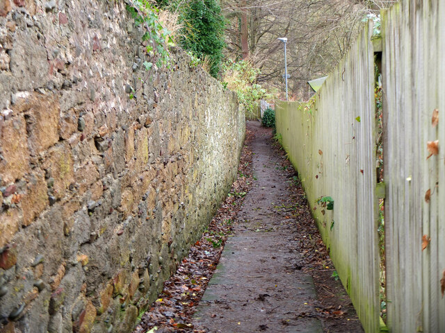
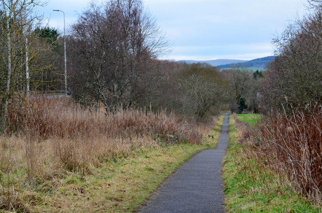
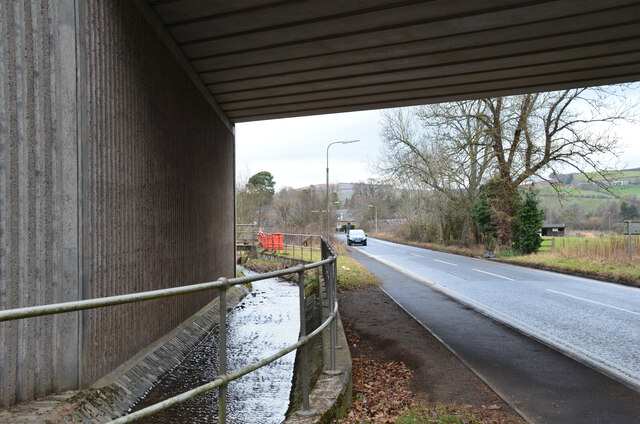
Darnick Images

Images are sourced within 2km of 55.598776/-2.7434155 or Grid Reference NT5334. Thanks to Geograph Open Source API. All images are credited.

Footbridge across the River Tweed
Footbridge across the River Tweed Eildon Hill in the background
Footbridge across the River Tweed
Eildon Hill in the background
River Tweed at Melrose Site of a weir which I think might have  been damaged.
River Tweed at Melrose
Site of a weir which I think might have been damaged.
View of River Tweed Village of Gattonside and distant hills.
View of River Tweed
Village of Gattonside and distant hills.
Melrose Rugby Union Ground
Melrose Abbey Pig playing a bagpipe, as a gargoyle, viewed under a flying buttress.
Melrose Abbey
Pig playing a bagpipe, as a gargoyle, viewed under a flying buttress.
Derelict weir on River Tweed A lade, just to the left of the image, carried water to the abbey some 500 m to the east.
Derelict weir on River Tweed
A lade, just to the left of the image, carried water to the abbey some 500 m to the east.
Melrose, Gattonside Suspension Footbridge Tolls had to be paid to cross the new bridge over the River Tweed, which joined the communities of Melrose and Gattonside. Constructed in 1826, it is a footbridge with iron-link suspension chains, iron rods as vertical suspenders and a wooden deck.
Melrose, Gattonside Suspension Footbridge
Tolls had to be paid to cross the new bridge over the River Tweed, which joined the communities of Melrose and Gattonside. Constructed in 1826, it is a footbridge with iron-link suspension chains, iron rods as vertical suspenders and a wooden deck.
Tweedbank station An aerial view over Tweedbank station looking towards Melrose.

Forms part of Railway Routes Blogpost <span class="nowrap"><a title="https://tinyurl.com/e94tw557" rel="nofollow ugc noopener" href="https://tinyurl.com/e94tw557">Link</a><img style="margin-left:2px;" alt="External link" title="External link - shift click to open in new window" src="https://s1.geograph.org.uk/img/external.png" width="10" height="10"/></span>
Tweedbank station
An aerial view over Tweedbank station looking towards Melrose. Forms part of Railway Routes Blogpost LinkExternal link
Tweedbank station Aerial view of Tweedbank station which forms part of "Railway Routes" BlogPost <span class="nowrap"><a title="https://tinyurl.com/e94tw557" rel="nofollow ugc noopener" href="https://tinyurl.com/e94tw557">Link</a><img style="margin-left:2px;" alt="External link" title="External link - shift click to open in new window" src="https://s1.geograph.org.uk/img/external.png" width="10" height="10"/></span>
Tweedbank station
Aerial view of Tweedbank station which forms part of "Railway Routes" BlogPost LinkExternal link
Broomilees Road. Infilled Railway cutting At this point was an over bridge on the Waverley Line, now infilled.


<span class="nowrap"><a title="https://tinyurl.com/e94tw557" rel="nofollow ugc noopener" href="https://tinyurl.com/e94tw557">Link</a><img style="margin-left:2px;" alt="External link" title="External link - shift click to open in new window" src="https://s1.geograph.org.uk/img/external.png" width="10" height="10"/></span>
Broomilees Road. Infilled Railway cutting
At this point was an over bridge on the Waverley Line, now infilled. LinkExternal link
Hoof fungus (Fomes fomentarius) This grey bracket fungus was growing on a fallen beech tree in Broomyknowe Plantation.
Hoof fungus (Fomes fomentarius)
This grey bracket fungus was growing on a fallen beech tree in Broomyknowe Plantation.
A gateway to a beech wood Most of the trees in Broomyknowe Plantation are beech.
A gateway to a beech wood
Most of the trees in Broomyknowe Plantation are beech.
A narrow path in Melrose The path connects High Road with Priorswalk.
A narrow path in Melrose
The path connects High Road with Priorswalk.
Cyclepath alongside Melrose By-Pass A path by the A6091 east of the Borders General Hospital.
Cyclepath alongside Melrose By-Pass
A path by the A6091 east of the Borders General Hospital.
Underpass near Borders General Hospital The underpass carries the Dingleton road and the Huntly Burn below the A6091 Melrose By-Pass.
Underpass near Borders General Hospital
The underpass carries the Dingleton road and the Huntly Burn below the A6091 Melrose By-Pass.
Road junction near Borders General Hospital Junction for a minor road, single track with passing places, with the road between Darnick and Dingleton. Eildon Mid Hill is to the right.
Road junction near Borders General Hospital
Junction for a minor road, single track with passing places, with the road between Darnick and Dingleton. Eildon Mid Hill is to the right.
Minor road near Dingleton A single-track road through farmland and plantations west of Dingleton.
Minor road near Dingleton
A single-track road through farmland and plantations west of Dingleton.
Show me another place!

Darnick is located at Grid Ref: NT5334 (Lat: 55.598776, Lng: -2.7434155)

Unitary Authority: The Scottish Borders

Police Authority: The Lothians and Scottish Borders

What 3 Words

///stereos.publisher.lines. Near Melrose, Scottish Borders

Related Wikis

Borders General Hospital

Borders General Hospital (BGH) is a district general hospital on the outskirts of Melrose, Scotland. It is managed by NHS Borders. == History == The hospital...

Darnick

Darnick is a village near Melrose in the Scottish Borders area of Scotland, in the former Roxburghshire. The name was first recorded in 1124, and has changed...

Melrose, Scottish Borders

Melrose (Scottish Gaelic: Maolros, "bald moor") is a town and civil parish in the Scottish Borders, historically in Roxburghshire. It lies within the Eildon...

St. Mary's School, Melrose

St. Mary's School is a private, co-educational, day and boarding prep school in Melrose, Scotland. As of 2015 there are 190 pupils; 97 boys and 93 girls...

Nearby Amenities

Located within 500m of 55.598776,-2.7434155
Crossing
Crossing: unmarked
Kerb: flush
Tactile Paving: no
Lat/Long: 55.5973271/-2.7395255
Noexit: yes
Lat/Long: 55.6021257/-2.740195
Bus Stop
Borders General Hospital
Bench: yes
Bus: yes
Departures Board: timetable
Lit: no
Local Ref: at
Naptan AtcoCode: 6900625
Naptan Bearing: N
Naptan CommonName: Borders General Hospital
Naptan Indicator: at
Naptan Landmark: Hospital
Naptan NaptanCode: 72723736
Naptan Street: Access Road
Naptan Verified: yes
Operator: Scottish Borders Council
Public Transport: platform
Ref: 6900625
Shelter: yes
Source: local knowledge;survey;NaPTAN
Lat/Long: 55.5959903/-2.7414723
Bus Stop
Darnick Vale
Bench: yes
Bus: yes
Departures Board: timetable
Lit: no
Local Ref: opp
Naptan AtcoCode: 6900991
Naptan Bearing: W
Naptan CommonName: Darnick Vale
Naptan Indicator: opp
Naptan Landmark: Chiefswood Road
Naptan NaptanCode: 72725842
Naptan Street: High Cross Avenue
Naptan Verified: yes
Public Transport: platform
Ref: 6900991
Shelter: yes
Source: local knowledge;survey;NaPTAN
Lat/Long: 55.5986128/-2.7400915
Bus Stop
Darnick Vale
Bench: no
Bus: yes
Departures Board: no
Lit: no
Local Ref: at
Naptan AtcoCode: 6900992
Naptan Bearing: E
Naptan CommonName: Darnick Vale
Naptan Indicator: at
Naptan Landmark: Chiefswood Road
Naptan NaptanCode: 72725839
Naptan Street: High Cross Avenue
Naptan Verified: yes
Public Transport: platform
Ref: 6900992
Shelter: no
Source: local knowledge;survey;NaPTAN
Lat/Long: 55.5987109/-2.7397803
Bus Stop
Smiths Road
Bench: yes
Bus: yes
Departures Board: no
Lit: yes
Local Ref: at
Naptan AtcoCode: 6900993
Naptan Bearing: N
Naptan CommonName: Smiths Road
Naptan Indicator: at
Naptan NaptanCode: 72725843
Naptan Street: Abbotsford Road
Operator: Scottish Borders Council
Public Transport: platform
Ref: 6900993
Shelter: no
Source: local knowledge;survey;NaPTAN
Lat/Long: 55.5995534/-2.7445891
Bus Stop
Tower Road
Bench: no
Bus: yes
Departures Board: yes
Lit: yes
Local Ref: at
Naptan AtcoCode: 6900994
Naptan Bearing: S
Naptan CommonName: Tower Road
Naptan Indicator: at
Naptan Landmark: Tower Road
Naptan NaptanCode: 72726542
Naptan Street: Abbotsford Road
Naptan Verified: no
Operator: Scottish Borders Council
Public Transport: platform
Ref: 6900994
Shelter: no
Source: local knowledge;survey;NaPTAN
Lat/Long: 55.6003257/-2.7443585
Bus Stop
Darnlee
Bench: yes
Bus: yes
Departures Board: timetable
Lit: yes
Local Ref: opp
Naptan AtcoCode: 6900995
Naptan Bearing: S
Naptan CommonName: Darnlee
Naptan Indicator: opp
Naptan Landmark: Waverley Castle Hotel
Naptan NaptanCode: 72725837
Operator: Scottish Borders Council
Public Transport: platform
Ref: 6900995
Shelter: yes
Source: local knowledge;survey;NaPTAN
Lat/Long: 55.6022753/-2.7446284
Bus Stop
Darnlee
Bench: no
Bus: yes
Departures Board: timetable
Lit: yes
Local Ref: adj
Naptan AtcoCode: 6900996
Naptan Bearing: N
Naptan CommonName: Darnlee
Naptan Indicator: adj
Naptan NaptanCode: 72725838
Naptan Street: Abbotsford Road
Operator: Scottish Borders Council
Public Transport: platform
Ref: 6900996
Shelter: yes
Source: local knowledge;survey;NaPTAN
Lat/Long: 55.6026329/-2.7450284
Darnick
Name Gd: Drochaid Eadaraig
Place: village
Population: 397
Wikidata: Q15059215
Wikipedia: en:Darnick
Lat/Long: 55.6002886/-2.7442942
Give Way
Direction: forward
Lat/Long: 55.5982849/-2.7446718
Noexit: yes
Lat/Long: 55.5951133/-2.7445841
Bus: yes
Public Transport: stop_position
Lat/Long: 55.5986459/-2.7399351
Crossing
Crossing: marked
Lat/Long: 55.5954797/-2.7440495
Post Box
Ref: TD6 63
Lat/Long: 55.6002904/-2.7448944
Crossing
Crossing: zebra
Lat/Long: 55.5969198/-2.7425937
Traffic Signals
Traffic Signals: signal
Traffic Signals Direction: forward
Lat/Long: 55.5983901/-2.7449732
Give Way
Direction: forward
Lat/Long: 55.6006158/-2.7449464
Crossing
Lat/Long: 55.5958633/-2.7418386
Crossing
Lat/Long: 55.5963571/-2.7413769
Generator Method: photovoltaic
Generator Output Electricity: yes
Generator Solar Modules: 16
Generator Source: solar
Generator Type: solar_photovoltaic_panel
Power: generator
Lat/Long: 55.599173/-2.7423052
Generator Method: photovoltaic
Generator Output Electricity: yes
Generator Source: solar
Generator Type: solar_photovoltaic_panel
Power: generator
Lat/Long: 55.5996351/-2.7416796
Generator Method: photovoltaic
Generator Output Electricity: yes
Generator Solar Modules: 12
Generator Source: solar
Generator Type: solar_photovoltaic_panel
Power: generator
Lat/Long: 55.6014452/-2.7404481
Noexit: yes
Lat/Long: 55.6014735/-2.7408971
Noexit: yes
Lat/Long: 55.6016546/-2.7415743
Generator Method: photovoltaic
Generator Output Electricity: yes
Generator Solar Modules: 12
Generator Source: solar
Generator Type: solar_photovoltaic_panel
Power: generator
Lat/Long: 55.6022001/-2.7406959
Give Way
Direction: forward
Lat/Long: 55.6023403/-2.7398001
Give Way
Direction: forward
Lat/Long: 55.5988466/-2.7433842
Give Way
Direction: backward
Lat/Long: 55.5987045/-2.7408938
Give Way
Direction: backward
Lat/Long: 55.5994293/-2.7410285
Give Way
Direction: forward
Lat/Long: 55.6002544/-2.7442674
Give Way
Direction: backward
Lat/Long: 55.5994043/-2.7444788
Give Way
Direction: backward
Lat/Long: 55.5993623/-2.7447047
Generator Method: photovoltaic
Generator Output Electricity: yes
Generator Solar Modules: 12
Generator Source: solar
Generator Type: solar_photovoltaic_panel
Power: generator
Lat/Long: 55.6014492/-2.7418023
Noexit: yes
Lat/Long: 55.6011333/-2.7422798
Noexit: yes
Lat/Long: 55.6011826/-2.7420612
Cafe
Melrose Cricket Club Cafe
Survey Date: 2021-11-22
Lat/Long: 55.5960469/-2.7462737
Waste Basket
Colour: black
Material: plastic
Survey Date: 2021-11-22
Waste: trash
Lat/Long: 55.5960394/-2.7463964
Crossing
Crossing: marked
Lat/Long: 55.5959468/-2.7439923
Crossing
Crossing: marked
Lat/Long: 55.5959235/-2.744153
Crossing
Lat/Long: 55.5961567/-2.7431398
Give Way
Direction: forward
Lat/Long: 55.596154/-2.7429133
Give Way
Direction: forward
Lat/Long: 55.5963622/-2.7436892
Give Way
Direction: backward
Lat/Long: 55.5962745/-2.7437066
Waste Basket
Survey Date: 2021-11-22
Lat/Long: 55.5953361/-2.7461058
Bench
Survey Date: 2021-11-22
Lat/Long: 55.5952119/-2.7458126
Bicycle Parking
Survey Date: 2021-11-22
Lat/Long: 55.595938/-2.7432457
Bench
Survey Date: 2021-11-22
Lat/Long: 55.5972122/-2.7383758
Bench
Survey Date: 2021-11-22
Lat/Long: 55.597086/-2.7369856
Traffic Signals
Traffic Signals: signal
Traffic Signals Direction: backward
Lat/Long: 55.5983529/-2.7448389
Traffic Signals
Traffic Signals: signal
Traffic Signals Direction: forward
Lat/Long: 55.5983246/-2.7446238
Traffic Signals
Traffic Signals: signal
Traffic Signals Direction: forward
Lat/Long: 55.5986205/-2.7451799
The data included in this document is from www.openstreetmap.org. The data is made available under ODbL.

Have you been to Darnick?

Leave your review of Darnick below (or comments, questions and feedback).