Highcross

Settlement in Roxburghshire

Scotland

Highcross

Footbridge across the River Tweed
Footbridge across the River Tweed Credit: Les Hull

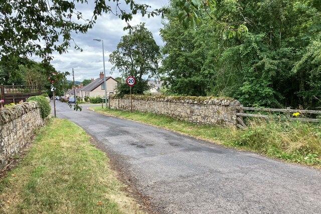
Highcross is a small village located in Roxburghshire, Scotland. Situated in the Scottish Borders region, it is surrounded by picturesque countryside and offers a peaceful and idyllic setting for its residents. The village lies approximately 5 miles southeast of the town of Jedburgh.

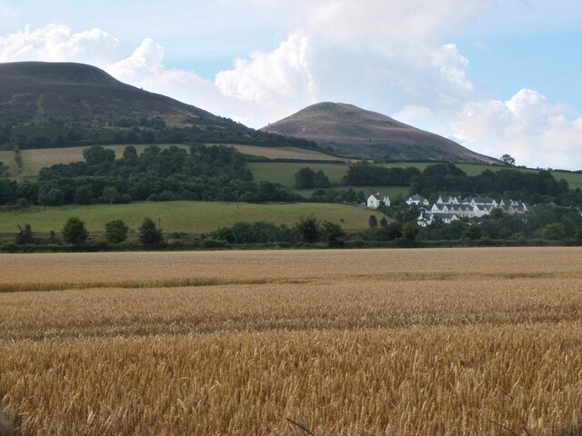
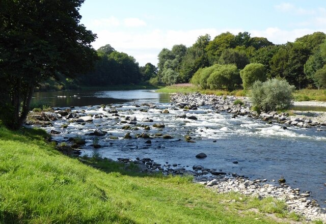
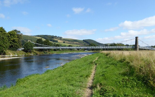
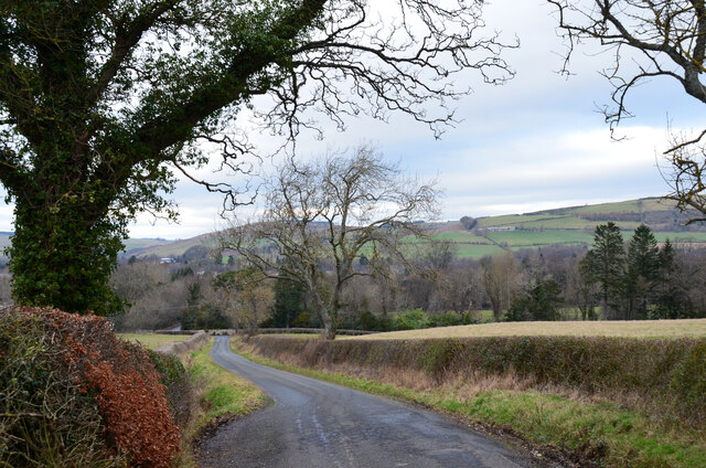
Highcross is renowned for its natural beauty, with rolling hills, lush green fields, and stunning views of the surrounding landscape. The village is home to a close-knit community of friendly and welcoming residents, who take great pride in their village and its heritage.

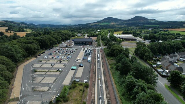
The village itself boasts a range of amenities to cater to the needs of its residents. These include a local pub, a village hall, and a primary school. Highcross also benefits from excellent transport links, with regular bus services connecting the village to nearby towns and cities.

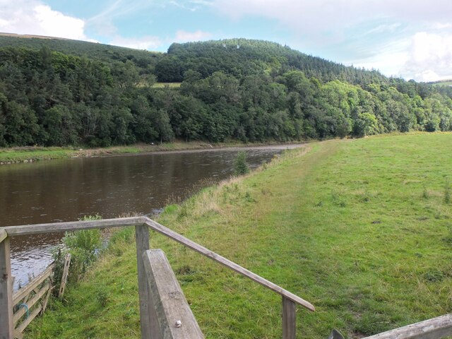
For outdoor enthusiasts, Highcross offers a wealth of opportunities for outdoor activities. The surrounding countryside provides ample space for walking, hiking, and cycling, with numerous trails and paths to explore. The nearby Jed Water river is a popular spot for fishing, and there are also several golf courses within a short drive of the village.

Overall, Highcross offers a peaceful and scenic location for those seeking a rural lifestyle in the stunning Scottish Borders. With its strong sense of community, beautiful surroundings, and range of amenities and outdoor pursuits, Highcross is a highly desirable place to live.

If you have any feedback on the listing, please let us know in the comments section below.
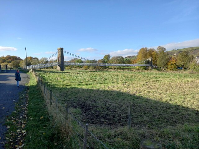
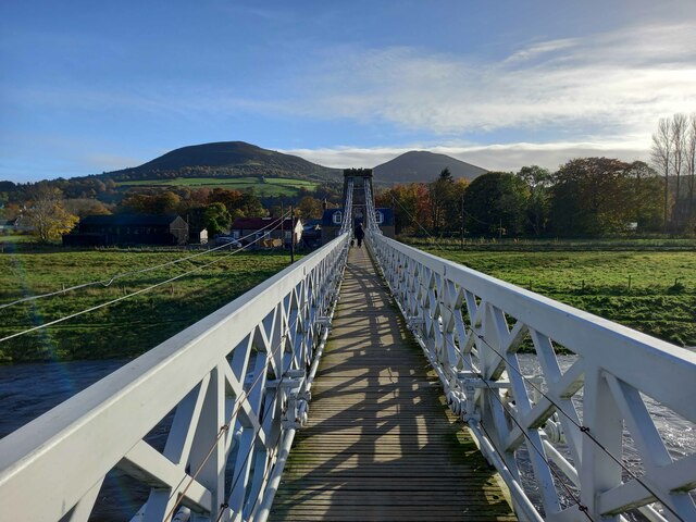
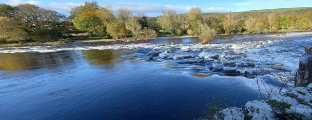
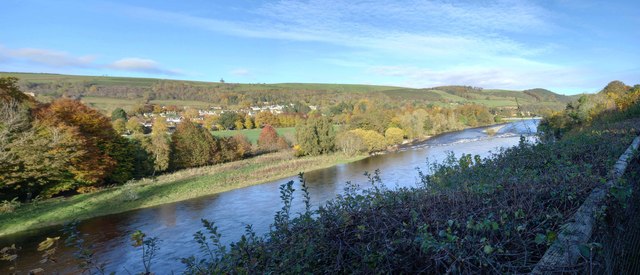
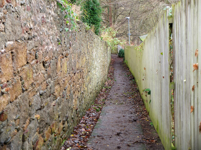
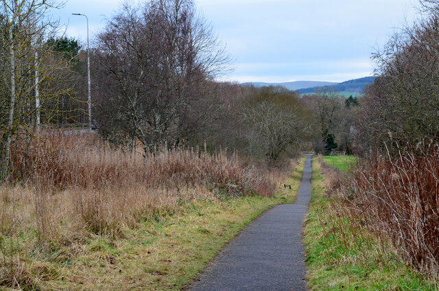
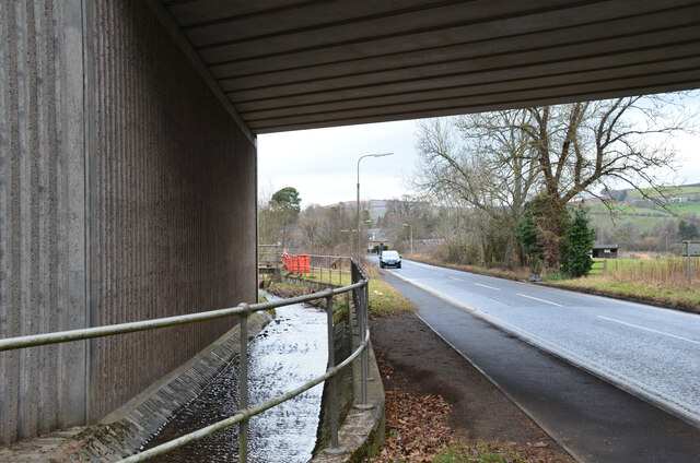
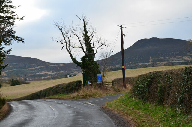
Highcross Images

Images are sourced within 2km of 55.598846/-2.7348788 or Grid Reference NT5334. Thanks to Geograph Open Source API. All images are credited.

Footbridge across the River Tweed
Footbridge across the River Tweed Eildon Hill in the background
Footbridge across the River Tweed
Eildon Hill in the background
River Tweed at Melrose Site of a weir which I think might have  been damaged.
River Tweed at Melrose
Site of a weir which I think might have been damaged.
View of River Tweed Village of Gattonside and distant hills.
View of River Tweed
Village of Gattonside and distant hills.
Melrose Rugby Union Ground
Barley field below the Eildon Hills, Melrose A field on The Annay beside the Tweed with Eildon Hill North (L) and Mid Hill (R). The houses are on the eastern fringe of Melrose.
Barley field below the Eildon Hills, Melrose
A field on The Annay beside the Tweed with Eildon Hill North (L) and Mid Hill (R). The houses are on the eastern fringe of Melrose.
The Tweed east of Melrose The Tweed seen from an elevated stile on the riverside path to Newstead.
The Tweed east of Melrose
The Tweed seen from an elevated stile on the riverside path to Newstead.
Melrose Abbey Pig playing a bagpipe, as a gargoyle, viewed under a flying buttress.
Melrose Abbey
Pig playing a bagpipe, as a gargoyle, viewed under a flying buttress.
Derelict weir on River Tweed A lade, just to the left of the image, carried water to the abbey some 500 m to the east.
Derelict weir on River Tweed
A lade, just to the left of the image, carried water to the abbey some 500 m to the east.
Melrose, Gattonside Suspension Footbridge Tolls had to be paid to cross the new bridge over the River Tweed, which joined the communities of Melrose and Gattonside. Constructed in 1826, it is a footbridge with iron-link suspension chains, iron rods as vertical suspenders and a wooden deck.
Melrose, Gattonside Suspension Footbridge
Tolls had to be paid to cross the new bridge over the River Tweed, which joined the communities of Melrose and Gattonside. Constructed in 1826, it is a footbridge with iron-link suspension chains, iron rods as vertical suspenders and a wooden deck.
Tweedbank station An aerial view over Tweedbank station looking towards Melrose.

Forms part of Railway Routes Blogpost <span class="nowrap"><a title="https://tinyurl.com/e94tw557" rel="nofollow ugc noopener" href="https://tinyurl.com/e94tw557">Link</a><img style="margin-left:2px;" alt="External link" title="External link - shift click to open in new window" src="https://s1.geograph.org.uk/img/external.png" width="10" height="10"/></span>
Tweedbank station
An aerial view over Tweedbank station looking towards Melrose. Forms part of Railway Routes Blogpost LinkExternal link
Tweedbank station Aerial view of Tweedbank station which forms part of "Railway Routes" BlogPost <span class="nowrap"><a title="https://tinyurl.com/e94tw557" rel="nofollow ugc noopener" href="https://tinyurl.com/e94tw557">Link</a><img style="margin-left:2px;" alt="External link" title="External link - shift click to open in new window" src="https://s1.geograph.org.uk/img/external.png" width="10" height="10"/></span>
Tweedbank station
Aerial view of Tweedbank station which forms part of "Railway Routes" BlogPost LinkExternal link
Broomilees Road. Infilled Railway cutting At this point was an over bridge on the Waverley Line, now infilled.


<span class="nowrap"><a title="https://tinyurl.com/e94tw557" rel="nofollow ugc noopener" href="https://tinyurl.com/e94tw557">Link</a><img style="margin-left:2px;" alt="External link" title="External link - shift click to open in new window" src="https://s1.geograph.org.uk/img/external.png" width="10" height="10"/></span>
Broomilees Road. Infilled Railway cutting
At this point was an over bridge on the Waverley Line, now infilled. LinkExternal link
A narrow path in Melrose The path connects High Road with Priorswalk.
A narrow path in Melrose
The path connects High Road with Priorswalk.
Cyclepath alongside Melrose By-Pass A path by the A6091 east of the Borders General Hospital.
Cyclepath alongside Melrose By-Pass
A path by the A6091 east of the Borders General Hospital.
Underpass near Borders General Hospital The underpass carries the Dingleton road and the Huntly Burn below the A6091 Melrose By-Pass.
Underpass near Borders General Hospital
The underpass carries the Dingleton road and the Huntly Burn below the A6091 Melrose By-Pass.
Road junction near Borders General Hospital Junction for a minor road, single track with passing places, with the road between Darnick and Dingleton. Eildon Mid Hill is to the right.
Road junction near Borders General Hospital
Junction for a minor road, single track with passing places, with the road between Darnick and Dingleton. Eildon Mid Hill is to the right.
Minor road near Dingleton A single-track road through farmland and plantations west of Dingleton.
Minor road near Dingleton
A single-track road through farmland and plantations west of Dingleton.
Show me another place!

Highcross is located at Grid Ref: NT5334 (Lat: 55.598846, Lng: -2.7348788)

Unitary Authority: The Scottish Borders

Police Authority: The Lothians and Scottish Borders

What 3 Words

///suddenly.nutty.motored. Near Melrose, Scottish Borders

Related Wikis

Melrose, Scottish Borders

Melrose (Scottish Gaelic: Maolros, "bald moor") is a town and civil parish in the Scottish Borders, historically in Roxburghshire. It lies within the Eildon...

St. Mary's School, Melrose

St. Mary's School is a private, co-educational, day and boarding prep school in Melrose, Scotland. As of 2015 there are 190 pupils; 97 boys and 93 girls...

Borders General Hospital

Borders General Hospital (BGH) is a district general hospital on the outskirts of Melrose, Scotland. It is managed by NHS Borders. == History == The hospital...
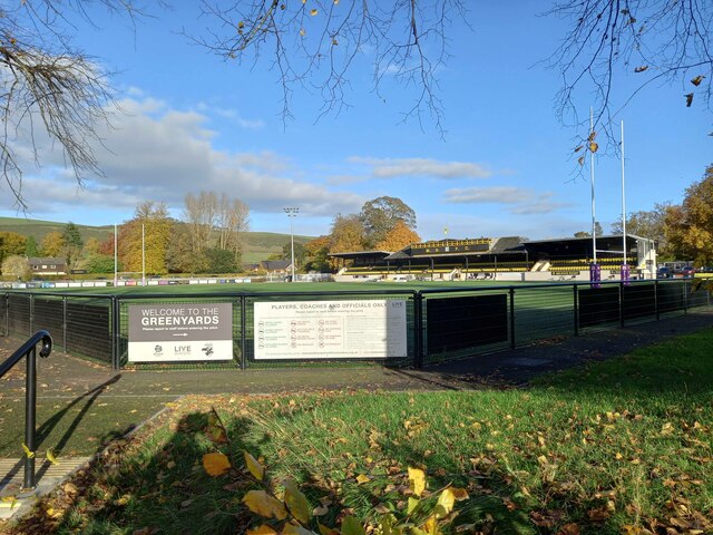
Greenyards

The Greenyards is a sports ground in Melrose, Scottish Borders. It has been the home of Melrose RFC for rugby union matches and the annual Melrose Sevens...

Nearby Amenities

Located within 500m of 55.598846,-2.7348788
Kerb: raised
Lat/Long: 55.5966268/-2.7299621
Crossing
Crossing: unmarked
Kerb: flush
Tactile Paving: no
Lat/Long: 55.5973271/-2.7395255
Noexit: yes
Lat/Long: 55.6021257/-2.740195
Bus Stop
Weirhill Place
Bench: no
Bus: yes
Departures Board: no
Lit: no
Local Ref: at
Naptan AtcoCode: 6900985
Naptan Bearing: E
Naptan CommonName: Weirhill Place
Naptan Indicator: at
Naptan Landmark: Weirhill Place
Naptan NaptanCode: 72725383
Naptan Street: Weirhill
Naptan Verified: yes
Public Transport: platform
Ref: 6900985
Shelter: no
Source: local knowledge;survey;NaPTAN
Lat/Long: 55.5997458/-2.7275
Bus Stop
Weirhill Place
Bench: no
Bin: yes
Bus: yes
Lit: no
Local Ref: opp
Naptan AtcoCode: 6900986
Naptan Bearing: W
Naptan CommonName: Weirhill Place
Naptan Indicator: opp
Naptan Landmark: Weirhill Place
Naptan NaptanCode: 72725382
Naptan Street: High Cross Avenue
Naptan Verified: yes
Public Transport: platform
Ref: 6900986
Shelter: no
Source: local knowledge;survey;NaPTAN
Tactile Paving: no
Lat/Long: 55.5996357/-2.728001
Bus Stop
Holy Trinity Church
Bench: no
Bus: yes
Departures Board: no
Lit: yes
Local Ref: o/s
Naptan AtcoCode: 6900987
Naptan Bearing: E
Naptan CommonName: Holy Trinity Church
Naptan Indicator: o/s
Naptan Landmark: Holy Trinity Church
Naptan NaptanCode: 72725436
Naptan Street: High Cross Avenue
Naptan Verified: yes
Public Transport: platform
Ref: 6900987
Shelter: no
Source: local knowledge;survey;NaPTAN
Lat/Long: 55.5993373/-2.731222
Bus Stop
Holy Trinity Church
Bench: no
Bus: yes
Departures Board: no
Lit: no
Local Ref: opp
Naptan AtcoCode: 6900988
Naptan Bearing: W
Naptan CommonName: Holy Trinity Church
Naptan Indicator: opp
Naptan Landmark: Holy Trinity Church
Naptan NaptanCode: 72725376
Naptan Street: High Cross Avenue
Naptan Verified: yes
Public Transport: platform
Ref: 6900988
Shelter: no
Source: local knowledge;survey;NaPTAN
Lat/Long: 55.5991712/-2.7317432
Bus Stop
Ormiston Terrace
Bench: no
Bus: yes
Departures Board: no
Lit: yes
Local Ref: at
Naptan AtcoCode: 6900989
Naptan Bearing: W
Naptan CommonName: Ormiston Terrace
Naptan Indicator: at
Naptan Landmark: Ormiston Terrace
Naptan NaptanCode: 72725425
Naptan Street: High Cross Avenue
Naptan Verified: yes
Public Transport: platform
Ref: 6900989
Shelter: no
Source: local knowledge;survey;NaPTAN
Lat/Long: 55.5988797/-2.7342652
Bus Stop
Ormiston Terrace
Bench: no
Bus: yes
Departures Board: no
Lit: no
Local Ref: opp
Naptan AtcoCode: 6900990
Naptan Bearing: E
Naptan CommonName: Ormiston Terrace
Naptan Indicator: opp
Naptan Landmark: Ormiston Terrace
Naptan NaptanCode: 72725429
Naptan Street: High Cross Avenue
Naptan Verified: yes
Public Transport: platform
Ref: 6900990
Shelter: no
Source: local knowledge;survey;NaPTAN
Lat/Long: 55.5989213/-2.734674
Bus Stop
Darnick Vale
Bench: yes
Bus: yes
Departures Board: timetable
Lit: no
Local Ref: opp
Naptan AtcoCode: 6900991
Naptan Bearing: W
Naptan CommonName: Darnick Vale
Naptan Indicator: opp
Naptan Landmark: Chiefswood Road
Naptan NaptanCode: 72725842
Naptan Street: High Cross Avenue
Naptan Verified: yes
Public Transport: platform
Ref: 6900991
Shelter: yes
Source: local knowledge;survey;NaPTAN
Lat/Long: 55.5986128/-2.7400915
Bus Stop
Darnick Vale
Bench: no
Bus: yes
Departures Board: no
Lit: no
Local Ref: at
Naptan AtcoCode: 6900992
Naptan Bearing: E
Naptan CommonName: Darnick Vale
Naptan Indicator: at
Naptan Landmark: Chiefswood Road
Naptan NaptanCode: 72725839
Naptan Street: High Cross Avenue
Naptan Verified: yes
Public Transport: platform
Ref: 6900992
Shelter: no
Source: local knowledge;survey;NaPTAN
Lat/Long: 55.5987109/-2.7397803
Post Box
Collection Times: Mo-Fr 09:00, Sa 19:00
Post Box Type: wall
Postal Code: TD6
Ref: TD6 62D
Royal Cypher: EVIIR
Royal Cypher Wikidata: Q33102324
Source: survey
Lat/Long: 55.5993233/-2.7315561
Barrier: kissing_gate
Lat/Long: 55.6017805/-2.732298
Bus: yes
Public Transport: stop_position
Lat/Long: 55.5986459/-2.7399351
Noexit: yes
Lat/Long: 55.597073/-2.7283245
Crossing
Lat/Long: 55.5963571/-2.7413769
Generator Method: photovoltaic
Generator Output Electricity: yes
Generator Solar Modules: 16
Generator Source: solar
Generator Type: solar_photovoltaic_panel
Power: generator
Lat/Long: 55.599173/-2.7423052
Generator Method: photovoltaic
Generator Output Electricity: yes
Generator Source: solar
Generator Type: solar_photovoltaic_panel
Power: generator
Lat/Long: 55.5996351/-2.7416796
Generator Method: photovoltaic
Generator Output Electricity: yes
Generator Solar Modules: 12
Generator Source: solar
Generator Type: solar_photovoltaic_panel
Power: generator
Lat/Long: 55.6014452/-2.7404481
Noexit: yes
Lat/Long: 55.6014735/-2.7408971
Generator Method: photovoltaic
Generator Output Electricity: yes
Generator Source: solar
Generator Type: solar_photovoltaic_panel
Power: generator
Lat/Long: 55.5970675/-2.7330449
Generator Method: photovoltaic
Generator Output Electricity: yes
Generator Source: solar
Generator Type: solar_photovoltaic_panel
Power: generator
Lat/Long: 55.5971145/-2.7328585
Generator Method: photovoltaic
Generator Output Electricity: yes
Generator Source: solar
Generator Type: solar_photovoltaic_panel
Power: generator
Lat/Long: 55.5970895/-2.7298826
Generator Method: photovoltaic
Generator Output Electricity: yes
Generator Source: solar
Generator Type: solar_photovoltaic_panel
Power: generator
Lat/Long: 55.6007931/-2.7308361
Generator Method: photovoltaic
Generator Output Electricity: yes
Generator Source: solar
Generator Type: solar_photovoltaic_panel
Power: generator
Lat/Long: 55.6011075/-2.7307235
Give Way
Direction: forward
Lat/Long: 55.6023403/-2.7398001
Give Way
Direction: backward
Lat/Long: 55.5987045/-2.7408938
Give Way
Direction: backward
Lat/Long: 55.5994293/-2.7410285
Give Way
Direction: backward
Lat/Long: 55.5949806/-2.7380126
Power: pole
Lat/Long: 55.5948658/-2.7378514
Bench
Survey Date: 2021-11-22
Lat/Long: 55.5972122/-2.7383758
Bench
Survey Date: 2021-11-22
Lat/Long: 55.597086/-2.7369856
Waste Basket
Survey Date: 2021-11-22
Lat/Long: 55.5968404/-2.7296649
Bench
Survey Date: 2021-11-22
Lat/Long: 55.5968993/-2.732989
The data included in this document is from www.openstreetmap.org. The data is made available under ODbL.

Have you been to Highcross?

Leave your review of Highcross below (or comments, questions and feedback).