Darleyford

Settlement in Cornwall

England

Darleyford

Wind & rain at the Cheeswring, Minions, Cornwall Cold, Wind & rain in mid September, 2017.
Wind & rain at the Cheeswring, Minions, Cornwall Credit: david coombes

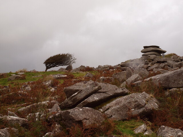
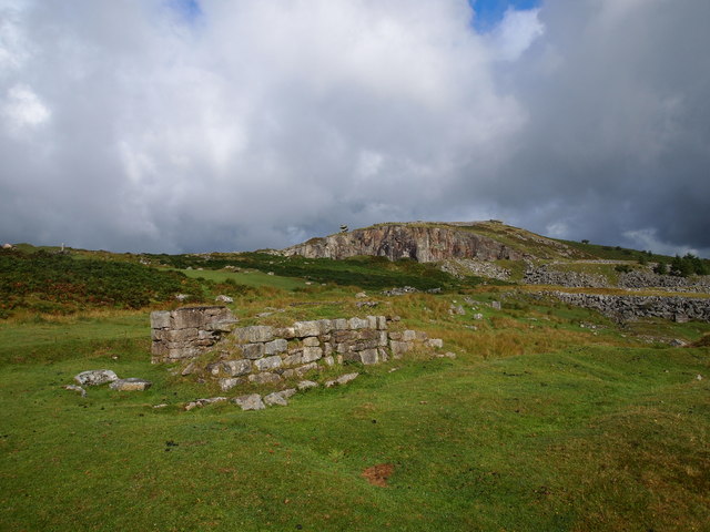
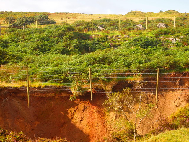
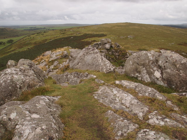
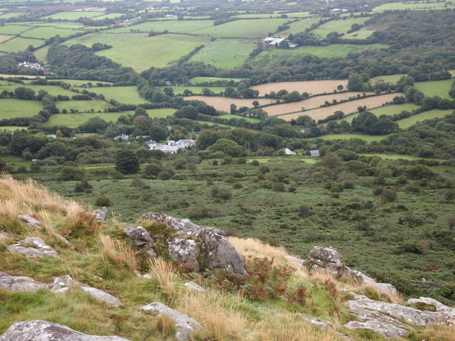
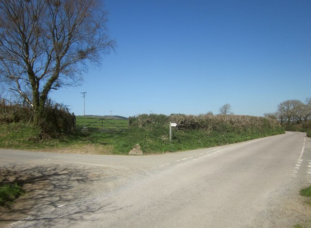
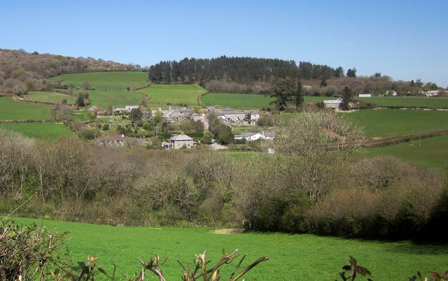
Darleyford is a small village located in the county of Cornwall, in southwestern England. Situated in a picturesque countryside setting, Darleyford is surrounded by rolling hills, lush green fields, and enchanting woodlands. The village is nestled within the Dartmoor National Park, which provides breathtaking views and abundant outdoor recreational opportunities for visitors and locals alike.

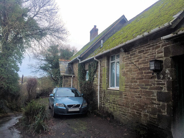
Historically, Darleyford has been a farming community, with agriculture playing a significant role in the local economy. The village is known for its traditional stone cottages, which add to the charm and character of the area. The nearby River Darleyford meanders through the village, offering peaceful riverside walks and fishing spots.

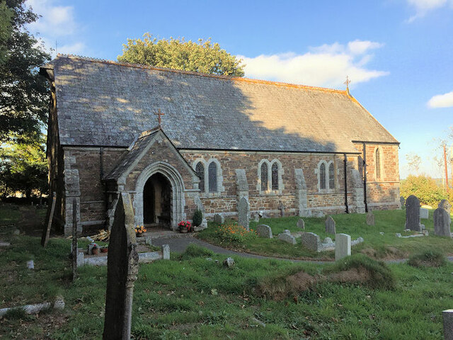
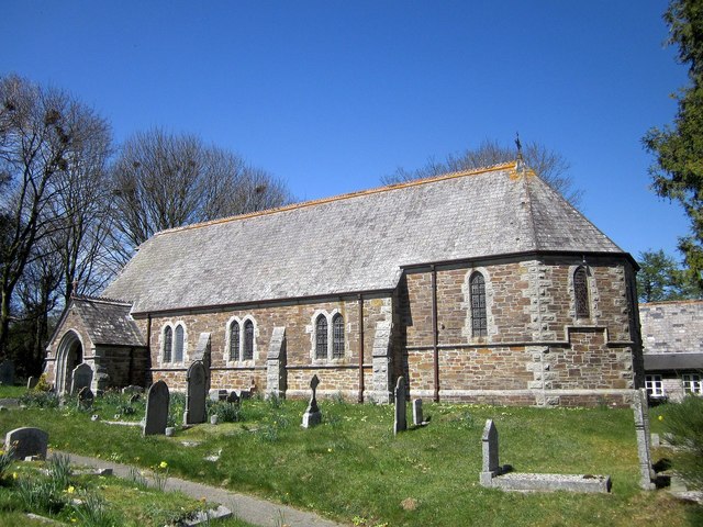
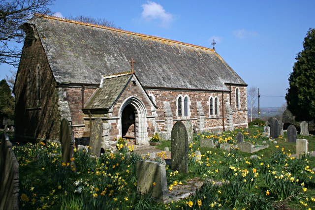
Despite its small size, Darleyford boasts a close-knit community that takes pride in preserving its rich heritage. The village has a quaint church, St. Mary's, which dates back to the 12th century and is a popular attraction for history enthusiasts. The church's architecture and stained glass windows are particularly noteworthy.

For those seeking outdoor adventures, Darleyford is a gateway to the Dartmoor National Park, renowned for its stunning landscapes and diverse wildlife. Visitors can explore miles of walking trails, go horseback riding, or simply relax and soak in the natural beauty of the area.

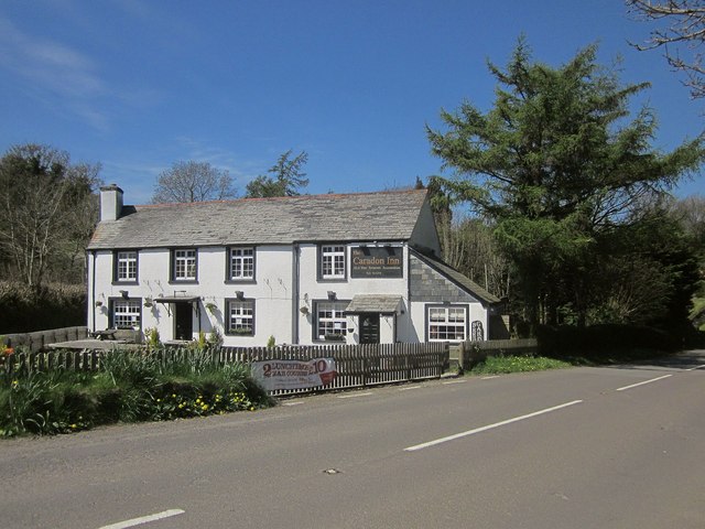
In terms of amenities, Darleyford has a few local shops and a cozy pub where residents and visitors can enjoy a pint and sample traditional Cornish cuisine. The village also holds seasonal events and fairs, providing opportunities for community gatherings and socializing.

Overall, Darleyford offers a peaceful and idyllic retreat for those looking to immerse themselves in the beauty of the Cornish countryside, with its rich history and ample outdoor recreational activities.

If you have any feedback on the listing, please let us know in the comments section below.
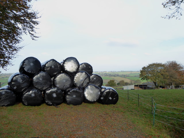
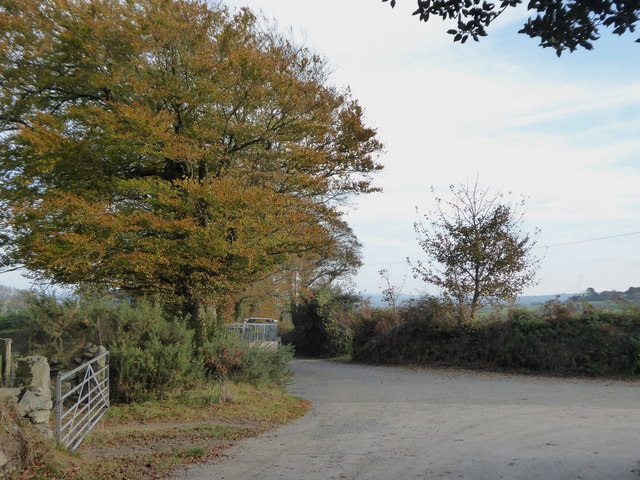
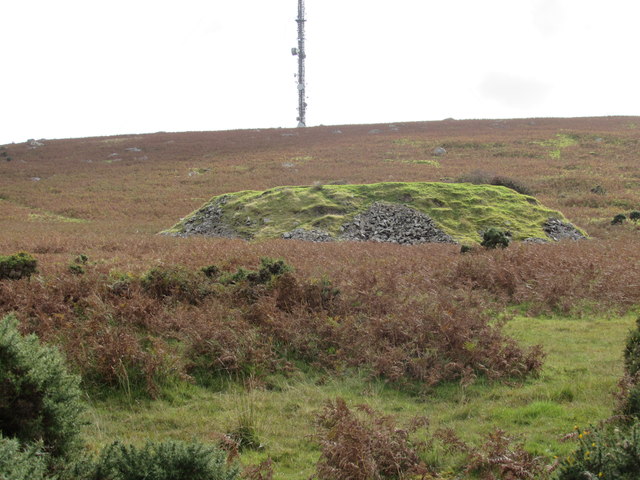
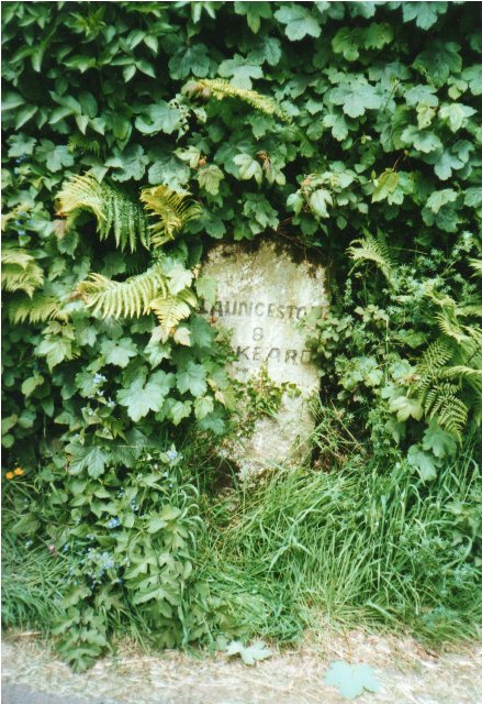
Darleyford Images

Images are sourced within 2km of 50.532009/-4.436132 or Grid Reference SX2773. Thanks to Geograph Open Source API. All images are credited.

Wind & rain at the Cheeswring, Minions, Cornwall Cold, Wind & rain in mid September, 2017.
Wind & rain at the Cheeswring, Minions, Cornwall
Cold, Wind & rain in mid September, 2017.
Former Wesleyan Methodist Chapel
St Paul's Church, Upton Cross
Former Wesleyan Methodist Chapel
Surface Remains of Mine, Below Stowe's Hill
Collapsed Shaft Near Minions
Sharp Tor
Sharp Tor
Henwood From Sharp Tor
Treovis Cross A crossroads on the B3254 that is more or less on a grid line. The right turn here is shown in <a href="https://www.geograph.org.uk/photo/4446942">SX2873 : Lane to Treovis</a>.
Treovis Cross
A crossroads on the B3254 that is more or less on a grid line. The right turn here is shown in SX2873 : Lane to Treovis.
Darley Farm From the same place on the B3254 as <a href="https://www.geograph.org.uk/photo/4447026">SX2772 : B3254 approaching Darleyford</a> looking across the valley of a tributary of the Lynher, and a grid line. Amid the farming hamlet is the listed farmhouse <span class="nowrap"><a title="http://www.historicengland.org.uk/listing/the-list/list-entry/1329173" rel="nofollow ugc noopener" href="http://www.historicengland.org.uk/listing/the-list/list-entry/1329173">Link</a><img style="margin-left:2px;" alt="External link" title="External link - shift click to open in new window" src="https://s1.geograph.org.uk/img/external.png" width="10" height="10"/></span> . Behind is Darley Wood.
Darley Farm
From the same place on the B3254 as SX2772 : B3254 approaching Darleyford looking across the valley of a tributary of the Lynher, and a grid line. Amid the farming hamlet is the listed farmhouse LinkExternal link . Behind is Darley Wood.
The Caradon Inn Another photo (see <a href="https://www.geograph.org.uk/photo/376937">SX2772 : The Caradon Inn</a>) of the pub beside the B3254. It is on the fringe of the designated area of the Cornwall and West Devon Mining Landscape.
The Caradon Inn
Another photo (see SX2772 : The Caradon Inn) of the pub beside the B3254. It is on the fringe of the designated area of the Cornwall and West Devon Mining Landscape.
St Paul's Church, Upton Cross A further image of the C19 church shown in <a href="https://www.geograph.org.uk/photo/376917">SX2872 : Upton Cross Church</a> and <a href="https://www.geograph.org.uk/photo/4447580">SX2872 : St Paul's Church, Upton Cross</a>, from the churchyard. A bit of a rookery in the background.
St Paul's Church, Upton Cross
A further image of the C19 church shown in SX2872 : Upton Cross Church and SX2872 : St Paul's Church, Upton Cross, from the churchyard. A bit of a rookery in the background.
Silage bales at Kingbeare
The lane leading from Kingbeare to Botternell
Salisbury Engine House and Chimney of the Marke Valley Mine The Marke Valley Mine, including at various times Wheal Jenkin and West Rosedown Mine. There are four main shafts including Fawcett Shaft (located in Leymill Wood), Engine Shaft (with a 36-inch pumping engine installed over it), Child's Shaft (with an 18-inch winding engine installed) and Salisbury Shaft (Its engine house housing a 70-inch pumping engine in 1855, later moved to Bellingham's Shaft). After a slow start at Marke Valley, production increased steadily. Its total recorded output being in the region of 130,000 tons of relatively low grade copper ore at 4%. Just west of Salisbury Shaft lay West Rosedown Mine - itself part of Wheal Jenkin from the 1830's when they were worked as Cornwall Great United. In 1845 the mine was in the ownership of Caradon Great Consols.

Marke Valley Mine was quite significant in the Caradon area and the decision was taken to run the nearby Mineral railway to it by means of a branch line. This was completed in 1877. As the copper production declined, the mine switched production to tin.
Salisbury Engine House and Chimney of the Marke Valley Mine
The Marke Valley Mine, including at various times Wheal Jenkin and West Rosedown Mine. There are four main shafts including Fawcett Shaft (located in Leymill Wood), Engine Shaft (with a 36-inch pumping engine installed over it), Child's Shaft (with an 18-inch winding engine installed) and Salisbury Shaft (Its engine house housing a 70-inch pumping engine in 1855, later moved to Bellingham's Shaft). After a slow start at Marke Valley, production increased steadily. Its total recorded output being in the region of 130,000 tons of relatively low grade copper ore at 4%. Just west of Salisbury Shaft lay West Rosedown Mine - itself part of Wheal Jenkin from the 1830's when they were worked as Cornwall Great United. In 1845 the mine was in the ownership of Caradon Great Consols. Marke Valley Mine was quite significant in the Caradon area and the decision was taken to run the nearby Mineral railway to it by means of a branch line. This was completed in 1877. As the copper production declined, the mine switched production to tin.
Old Whim Shaft on Caradon Hill Most likely begun in the hunt for tin pre 1840; when the mineral of choice in this area changed to copper. It was later absorbed into the Wheal Jenkin's Mine, before coming under the Marke Valley Mining Company ground in the 1870's.
Old Whim Shaft on Caradon Hill
Most likely begun in the hunt for tin pre 1840; when the mineral of choice in this area changed to copper. It was later absorbed into the Wheal Jenkin's Mine, before coming under the Marke Valley Mining Company ground in the 1870's.
Old Milestone by the B3254 at Botternell Carved stone post by the B3254, in parish of NORTH HILL (NORTH CORNWALL District), opposite Botternell farmhouse, against Cornish hedge, on West side of road. Liskeard iii stone, erected by the Local Highways Board in the 19th century. 

Inscription reads:-
LAUNCESTON
8 
LISKEARD
7iii (7¾)  

Grade II Listed. List Entry Number: 1249563
<span class="nowrap"><a title="https://historicengland.org.uk/listing/the-list/list-entry/1249563" rel="nofollow ugc noopener" href="https://historicengland.org.uk/listing/the-list/list-entry/1249563">Link</a><img style="margin-left:2px;" alt="External link" title="External link - shift click to open in new window" src="https://s1.geograph.org.uk/img/external.png" width="10" height="10"/></span>

Milestone Society National ID: CW_LALK08.
Old Milestone by the B3254 at Botternell
Carved stone post by the B3254, in parish of NORTH HILL (NORTH CORNWALL District), opposite Botternell farmhouse, against Cornish hedge, on West side of road. Liskeard iii stone, erected by the Local Highways Board in the 19th century. Inscription reads:- LAUNCESTON 8 LISKEARD 7iii (7¾) Grade II Listed. List Entry Number: 1249563 LinkExternal link Milestone Society National ID: CW_LALK08.
Old Milestone by the B3254, north of Upton Cross Carved stone post by the B3254, in parish of LINKINHORNE (CARADON District), Upton, on crossroads in front of Cornish hedge, on East side of road. Gravestone, erected by the Local Highways Board in the 19th century. 

Inscription reads:-
LISKEARD
6 

Grade II Listed. List Entry Number: 1140529
<span class="nowrap"><a title="https://historicengland.org.uk/listing/the-list/list-entry/1140529" rel="nofollow ugc noopener" href="https://historicengland.org.uk/listing/the-list/list-entry/1140529">Link</a><img style="margin-left:2px;" alt="External link" title="External link - shift click to open in new window" src="https://s1.geograph.org.uk/img/external.png" width="10" height="10"/></span>

Milestone Society National ID: CW_LKLA06.
Old Milestone by the B3254, north of Upton Cross
Carved stone post by the B3254, in parish of LINKINHORNE (CARADON District), Upton, on crossroads in front of Cornish hedge, on East side of road. Gravestone, erected by the Local Highways Board in the 19th century. Inscription reads:- LISKEARD 6 Grade II Listed. List Entry Number: 1140529 LinkExternal link Milestone Society National ID: CW_LKLA06.
Show me another place!

Darleyford is located at Grid Ref: SX2773 (Lat: 50.532009, Lng: -4.436132)

Unitary Authority: Cornwall

Police Authority: Devon and Cornwall

What 3 Words

///massing.shave.fatherly. Near North Hill, Cornwall

Related Wikis

Darleyford

Darleyford (Cornish: Rys Dowr Legh, meaning ford of the rock slab river) is a hamlet in the parish of Linkinhorne in Cornwall, UK.The Darley Oak is a notable...

Darley Oak

The Darley Oak is a Pedunculate oak tree (Quercus robur) which grows near Darleyford in the parish of Linkinhorne on the edge of Bodmin Moor, Cornwall...

North Darley

North Darley (Cornish: Dowr Legh, meaning rock slab river) is a hamlet in Cornwall, England. It is two miles south of North Hill on the B3254 road from...

Henwood, Cornwall

Henwood is a hamlet in the civil parish of Linkinhorne in east Cornwall, England. Henwood is on the edge of Bodmin Moor and situated between Stowe's Hill...

Upton Cross

Upton Cross and Upton are hamlets a quarter of a mile apart in east Cornwall, England, United Kingdom. Upton is situated at grid reference SX 279 724 north...

Phoenix United Mine

Phoenix United Mine is a disused 19th century copper and tin mine in Cornwall, England, UK. Heavy metals left over in the soil from the mining operations...

Netherton, Cornwall

Netherton is a hamlet in the parish of Linkinhorne, Cornwall, England. == References ==

Sharptor

Sharptor is a hamlet west of Henwood in the civil parish of Linkinhorne in east Cornwall, England, United Kingdom. It is named after Sharp Tor on Bodmin...

Nearby Amenities

Located within 500m of 50.532009,-4.436132
Bus Stop
Meadowside
Bus: yes
Naptan AtcoCode: 0800COY38521
Naptan Bearing: E
Naptan CommonName: Meadowside
Naptan NaptanCode: cordtjpw
Naptan Street: B3254
Naptan Verified: no
Public Transport: platform
Source: naptan_import
Lat/Long: 50.5321551/-4.4363576
Barrier: stile
Bicycle: no
Foot: yes
Material: wood
Stile: stepover
Lat/Long: 50.5361117/-4.4375008
Generator Method: photovoltaic
Generator Output Electricity: yes
Generator Source: solar
Generator Type: solar_photovoltaic_panel
Location: roof
Power: generator
Lat/Long: 50.5337174/-4.4337724
The data included in this document is from www.openstreetmap.org. The data is made available under ODbL.

Have you been to Darleyford?

Leave your review of Darleyford below (or comments, questions and feedback).