Inn Down

Downs, Moorland in Cornwall

England

Inn Down

Former Wesleyan Methodist Chapel
Former Wesleyan Methodist Chapel Credit: Paul Barnett

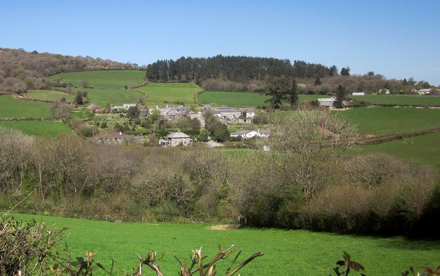
Inn Down is a picturesque village located in Cornwall, England. It is situated amidst the stunning surroundings of Downs and Moorland. The village is known for its tranquility and natural beauty, making it a popular destination for nature enthusiasts and those seeking a peaceful retreat.

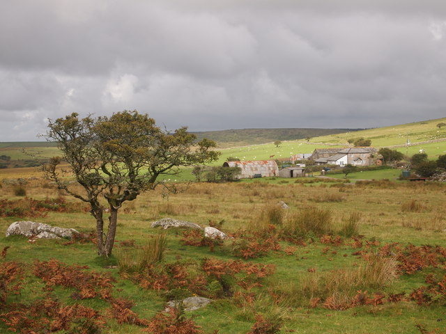
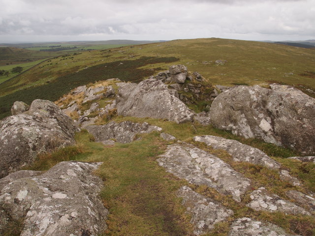
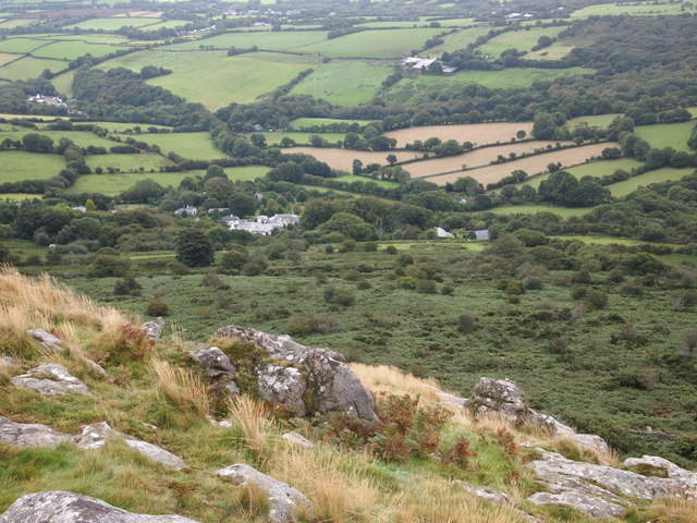
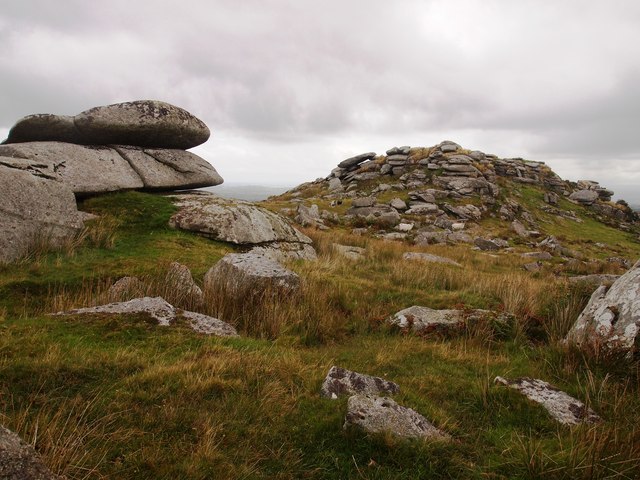
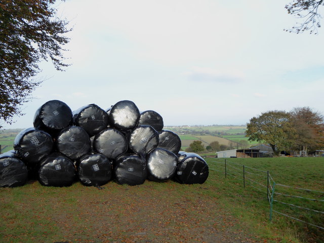
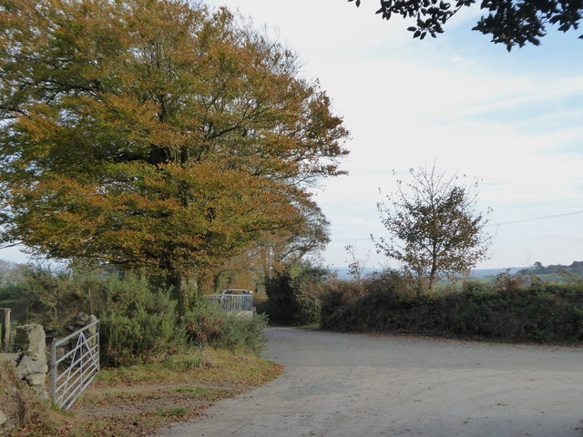
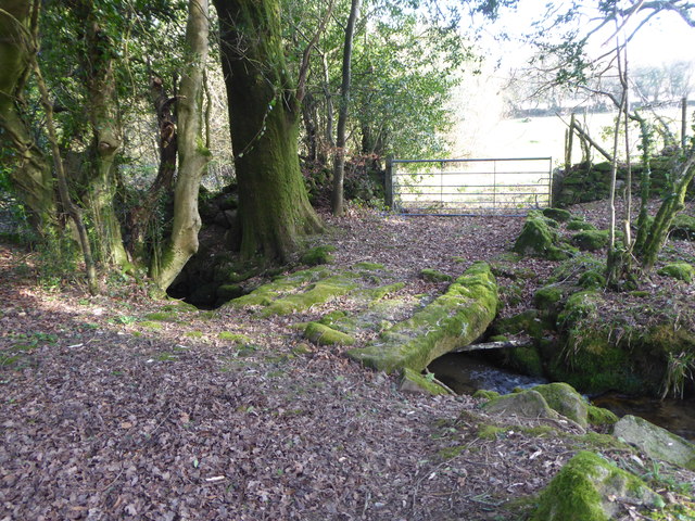
The landscape of Inn Down is characterized by its rolling hills, lush green meadows, and vast stretches of moorland. The area boasts an abundance of native wildlife, including rare bird species and grazing animals such as sheep and ponies. The expansive moorland offers breathtaking views and is a haven for hikers and photographers.

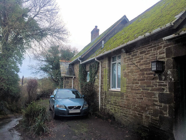
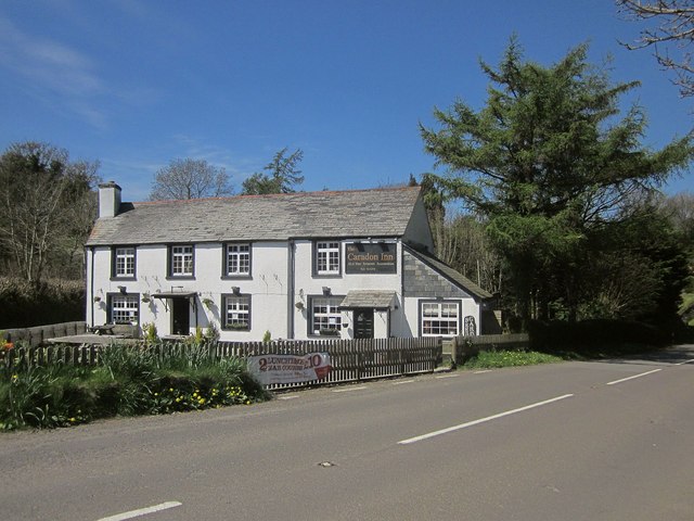
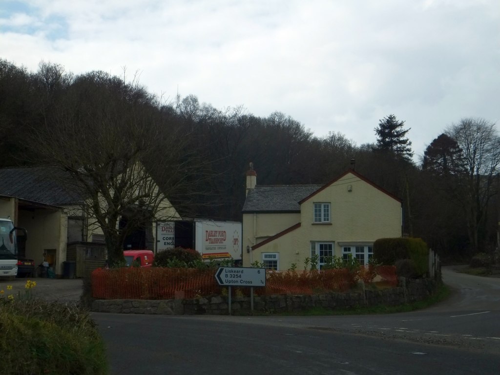
The village itself is small and charming, with traditional stone cottages and a quaint village pub serving delicious local cuisine. It has a close-knit community that prides itself on preserving the area's natural heritage and promoting sustainable tourism.

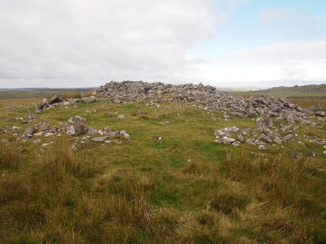
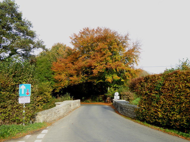
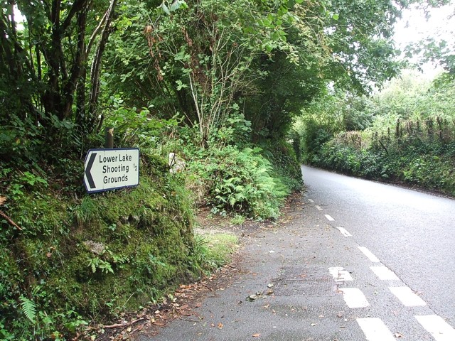
Visitors to Inn Down can enjoy a range of activities, including walking and hiking trails that lead to various points of interest, such as ancient archaeological sites and historic landmarks. The area is also known for its excellent fishing spots, with several rivers and streams teeming with salmon and trout.

For those seeking a cultural experience, nearby towns offer art galleries, museums, and quaint shops selling local handicrafts. The stunning coastline is within easy reach, providing opportunities for beach walks, water sports, and exploring hidden coves.

Inn Down, Cornwall, is a captivating destination that offers a unique blend of natural beauty, outdoor activities, and a warm community spirit. It is a place where visitors can immerse themselves in the serene surroundings and create lasting memories.

If you have any feedback on the listing, please let us know in the comments section below.
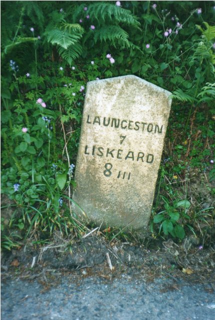
Inn Down Images

Images are sourced within 2km of 50.539965/-4.4410569 or Grid Reference SX2773. Thanks to Geograph Open Source API. All images are credited.

Former Wesleyan Methodist Chapel
Wardbrook Farm
Wardbrook Farm
Cairns, Langstone Downs
Sharp Tor
Sharp Tor
Henwood From Sharp Tor
Bearah Tor
Bearah Tor
Treovis Cross A crossroads on the B3254 that is more or less on a grid line. The right turn here is shown in <a href="https://www.geograph.org.uk/photo/4446942">SX2873 : Lane to Treovis</a>.
Treovis Cross
A crossroads on the B3254 that is more or less on a grid line. The right turn here is shown in SX2873 : Lane to Treovis.
Darley Farm From the same place on the B3254 as <a href="https://www.geograph.org.uk/photo/4447026">SX2772 : B3254 approaching Darleyford</a> looking across the valley of a tributary of the Lynher, and a grid line. Amid the farming hamlet is the listed farmhouse <span class="nowrap"><a title="http://www.historicengland.org.uk/listing/the-list/list-entry/1329173" rel="nofollow ugc noopener" href="http://www.historicengland.org.uk/listing/the-list/list-entry/1329173">Link</a><img style="margin-left:2px;" alt="External link" title="External link - shift click to open in new window" src="https://s1.geograph.org.uk/img/external.png" width="10" height="10"/></span> . Behind is Darley Wood.
Darley Farm
From the same place on the B3254 as SX2772 : B3254 approaching Darleyford looking across the valley of a tributary of the Lynher, and a grid line. Amid the farming hamlet is the listed farmhouse LinkExternal link . Behind is Darley Wood.
The Caradon Inn Another photo (see <a href="https://www.geograph.org.uk/photo/376937">SX2772 : The Caradon Inn</a>) of the pub beside the B3254. It is on the fringe of the designated area of the Cornwall and West Devon Mining Landscape.
The Caradon Inn
Another photo (see SX2772 : The Caradon Inn) of the pub beside the B3254. It is on the fringe of the designated area of the Cornwall and West Devon Mining Landscape.
Silage bales at Kingbeare
The lane leading from Kingbeare to Botternell
Beriow Bridge over the River Lynher A Scheduled Monument and also Grade II* Listed. Dating from circa mid C16, repaired in 1640 (datestone) and widened on the upper side in 1890.
Beriow Bridge over the River Lynher
A Scheduled Monument and also Grade II* Listed. Dating from circa mid C16, repaired in 1640 (datestone) and widened on the upper side in 1890.
Old Milestone by the B3254, north of Berriowbridge Carved stone post by the B3254, in parish of NORTH HILL (NORTH CORNWALL District), 160m North of East Berriow, in Cornish hedge on steep narrow descent, on East side of road. Liskeard iii stone, erected by the Local Highways Board in the 19th century. 

Inscription reads:-
LAUNCESTON
7
LISKEARD
8iii 

Grade II Listed. List Entry Number: 1249711
<span class="nowrap"><a title="https://historicengland.org.uk/listing/the-list/list-entry/1249711" rel="nofollow ugc noopener" href="https://historicengland.org.uk/listing/the-list/list-entry/1249711">Link</a><img style="margin-left:2px;" alt="External link" title="External link - shift click to open in new window" src="https://s1.geograph.org.uk/img/external.png" width="10" height="10"/></span>

Milestone Society National ID: CW_LALK07.
Old Milestone by the B3254, north of Berriowbridge
Carved stone post by the B3254, in parish of NORTH HILL (NORTH CORNWALL District), 160m North of East Berriow, in Cornish hedge on steep narrow descent, on East side of road. Liskeard iii stone, erected by the Local Highways Board in the 19th century. Inscription reads:- LAUNCESTON 7 LISKEARD 8iii Grade II Listed. List Entry Number: 1249711 LinkExternal link Milestone Society National ID: CW_LALK07.
Old Milestone by the B3254 at Botternell Carved stone post by the B3254, in parish of NORTH HILL (NORTH CORNWALL District), opposite Botternell farmhouse, against Cornish hedge, on West side of road. Liskeard iii stone, erected by the Local Highways Board in the 19th century. 

Inscription reads:-
LAUNCESTON
8 
LISKEARD
7iii (7¾)  

Grade II Listed. List Entry Number: 1249563
<span class="nowrap"><a title="https://historicengland.org.uk/listing/the-list/list-entry/1249563" rel="nofollow ugc noopener" href="https://historicengland.org.uk/listing/the-list/list-entry/1249563">Link</a><img style="margin-left:2px;" alt="External link" title="External link - shift click to open in new window" src="https://s1.geograph.org.uk/img/external.png" width="10" height="10"/></span>

Milestone Society National ID: CW_LALK08.
Old Milestone by the B3254 at Botternell
Carved stone post by the B3254, in parish of NORTH HILL (NORTH CORNWALL District), opposite Botternell farmhouse, against Cornish hedge, on West side of road. Liskeard iii stone, erected by the Local Highways Board in the 19th century. Inscription reads:- LAUNCESTON 8 LISKEARD 7iii (7¾) Grade II Listed. List Entry Number: 1249563 LinkExternal link Milestone Society National ID: CW_LALK08.
Old Milestone by the B3254, north of Upton Cross Carved stone post by the B3254, in parish of LINKINHORNE (CARADON District), Upton, on crossroads in front of Cornish hedge, on East side of road. Gravestone, erected by the Local Highways Board in the 19th century. 

Inscription reads:-
LISKEARD
6 

Grade II Listed. List Entry Number: 1140529
<span class="nowrap"><a title="https://historicengland.org.uk/listing/the-list/list-entry/1140529" rel="nofollow ugc noopener" href="https://historicengland.org.uk/listing/the-list/list-entry/1140529">Link</a><img style="margin-left:2px;" alt="External link" title="External link - shift click to open in new window" src="https://s1.geograph.org.uk/img/external.png" width="10" height="10"/></span>

Milestone Society National ID: CW_LKLA06.
Old Milestone by the B3254, north of Upton Cross
Carved stone post by the B3254, in parish of LINKINHORNE (CARADON District), Upton, on crossroads in front of Cornish hedge, on East side of road. Gravestone, erected by the Local Highways Board in the 19th century. Inscription reads:- LISKEARD 6 Grade II Listed. List Entry Number: 1140529 LinkExternal link Milestone Society National ID: CW_LKLA06.
Old Milestone by the B3254 at North Darley Carved stone post by the B3254, in parish of LINKINHORNE (CARADON District), North Darley, against wall beside entrance to Darley House, on West side of road. Gravestone, erected by the Local Highways Board in the 19th century. 

Inscription reads:-
LISKEARD
7 
Carved benchmark on lower face.

Grade II Listed. List Entry Number: 1311190
<span class="nowrap"><a title="https://historicengland.org.uk/listing/the-list/list-entry/1311190" rel="nofollow ugc noopener" href="https://historicengland.org.uk/listing/the-list/list-entry/1311190">Link</a><img style="margin-left:2px;" alt="External link" title="External link - shift click to open in new window" src="https://s1.geograph.org.uk/img/external.png" width="10" height="10"/></span>

Milestone Society National ID: CW_LKLA07.
Old Milestone by the B3254 at North Darley
Carved stone post by the B3254, in parish of LINKINHORNE (CARADON District), North Darley, against wall beside entrance to Darley House, on West side of road. Gravestone, erected by the Local Highways Board in the 19th century. Inscription reads:- LISKEARD 7 Carved benchmark on lower face. Grade II Listed. List Entry Number: 1311190 LinkExternal link Milestone Society National ID: CW_LKLA07.
Stone bridge over the stream near Blackcoombe Farm
Old Milestone by Berrio Bridge House, North Hill Carved stone post in parish of North Hill (North Cornwall District), Berrio Bridge House B & B, at end of boundary wall. Ornamental, on South side of road. C&L railway marker, erected by a railway company in the 19th century. 

Inscription reads:-
2
M

Cornwall & Scilly HER.
HER Number: MCO58216 <span class="nowrap"><a title="https://www.heritagegateway.org.uk/Gateway/Results_Single.aspx?uid=MCO58216&resourceID=1020" rel="nofollow ugc noopener" href="https://www.heritagegateway.org.uk/Gateway/Results_Single.aspx?uid=MCO58216&resourceID=1020">Link</a><img style="margin-left:2px;" alt="External link" title="External link - shift click to open in new window" src="https://s1.geograph.org.uk/img/external.png" width="10" height="10"/></span> 

Milestone Society National ID: CW_M2
Old Milestone by Berrio Bridge House, North Hill
Carved stone post in parish of North Hill (North Cornwall District), Berrio Bridge House B & B, at end of boundary wall. Ornamental, on South side of road. C&L railway marker, erected by a railway company in the 19th century. Inscription reads:- 2 M Cornwall & Scilly HER. HER Number: MCO58216 LinkExternal link Milestone Society National ID: CW_M2
Show me another place!

Inn Down is located at Grid Ref: SX2773 (Lat: 50.539965, Lng: -4.4410569)

Unitary Authority: Cornwall

Police Authority: Devon and Cornwall

What 3 Words

///atoms.fruitcake.blush. Near North Hill, Cornwall

Related Wikis

Henwood, Cornwall

Henwood is a hamlet in the civil parish of Linkinhorne in east Cornwall, England. Henwood is on the edge of Bodmin Moor and situated between Stowe's Hill...

Kingbeare

Kingbeare is a hamlet in the parish of North Hill, Cornwall, England. == References ==

Darley Oak

The Darley Oak is a Pedunculate oak tree (Quercus robur) which grows near Darleyford in the parish of Linkinhorne on the edge of Bodmin Moor, Cornwall...

North Darley

North Darley (Cornish: Dowr Legh, meaning rock slab river) is a hamlet in Cornwall, England. It is two miles south of North Hill on the B3254 road from...

Botternell

Botternell is a hamlet in the parish of North Hill, east Cornwall in the United Kingdom. The name means "Dornel's dwelling". Boturnell, also in Cornwall...

Darleyford

Darleyford (Cornish: Rys Dowr Legh, meaning ford of the rock slab river) is a hamlet in the parish of Linkinhorne in Cornwall, UK.The Darley Oak is a notable...

Middlewood, Cornwall

Middlewood is a small village in the parish of North Hill, Cornwall, England, UK. Middlewood is in the valley of the River Lynher and on the B3254 road...

Sharptor

Sharptor is a hamlet west of Henwood in the civil parish of Linkinhorne in east Cornwall, England, United Kingdom. It is named after Sharp Tor on Bodmin...

Nearby Amenities

Located within 500m of 50.539965,-4.4410569
Notter Tor
Natural: peak
Lat/Long: 50.5380515/-4.4400226
Barrier: stile
Bicycle: no
Foot: yes
Material: wood
Stile: stepover
Lat/Long: 50.5361117/-4.4375008
Ford: yes
Lat/Long: 50.5409519/-4.445466
Ford: yes
Lat/Long: 50.5419733/-4.4446993
The data included in this document is from www.openstreetmap.org. The data is made available under ODbL.

Have you been to Inn Down?

Leave your review of Inn Down below (or comments, questions and feedback).