Wilkins's Coomb

Wood, Forest in Hampshire New Forest

England

Wilkins's Coomb

Marl Lane
Marl Lane Credit: David Martin

Wilkins's Coomb is a picturesque wood located in Hampshire, England. Situated in the heart of the New Forest, it offers visitors a unique and tranquil experience. The wood is named after a local botanist, William Wilkins, who discovered and documented various plant species in the area during the 19th century.

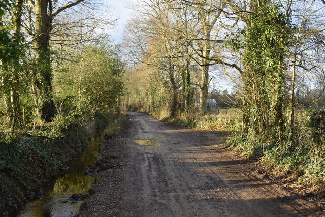
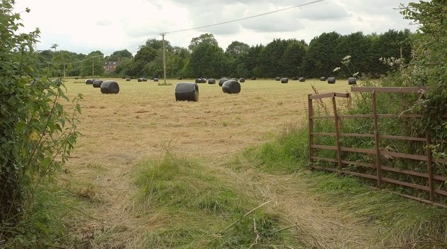
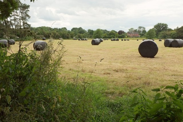
Covering an area of approximately 200 acres, Wilkins's Coomb is characterized by its dense, ancient woodland. The wood is primarily composed of deciduous trees such as oak, beech, and birch, creating a diverse and vibrant ecosystem. The forest floor is adorned with a rich carpet of ferns, mosses, and wildflowers, providing a haven for numerous species of wildlife.

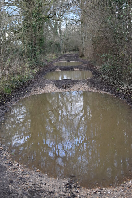
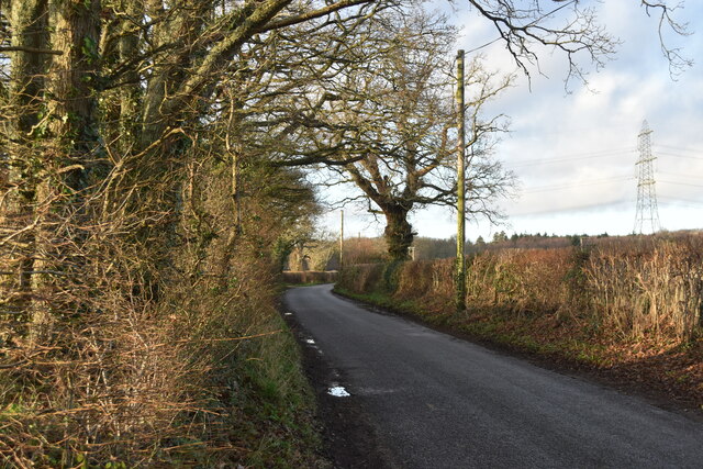
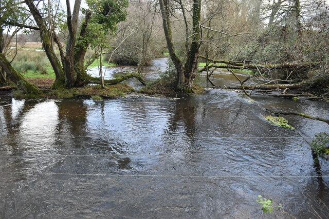
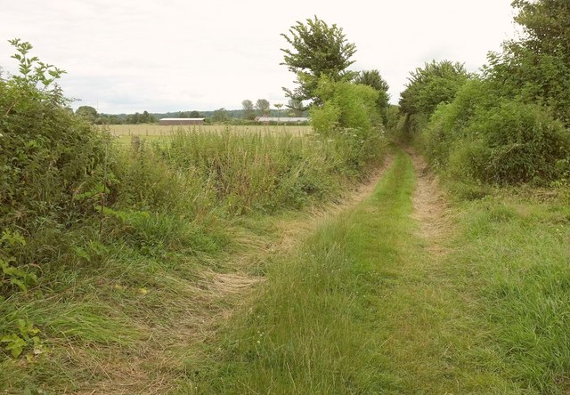
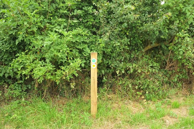
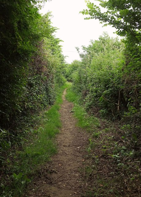
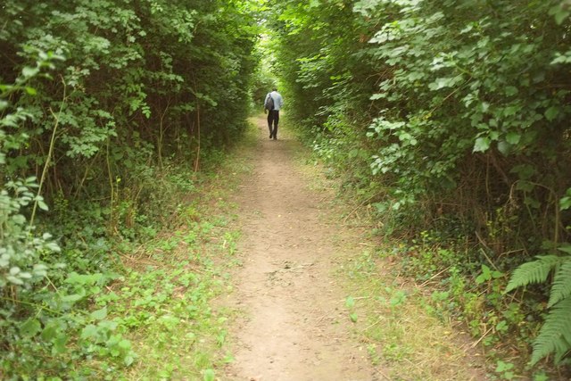
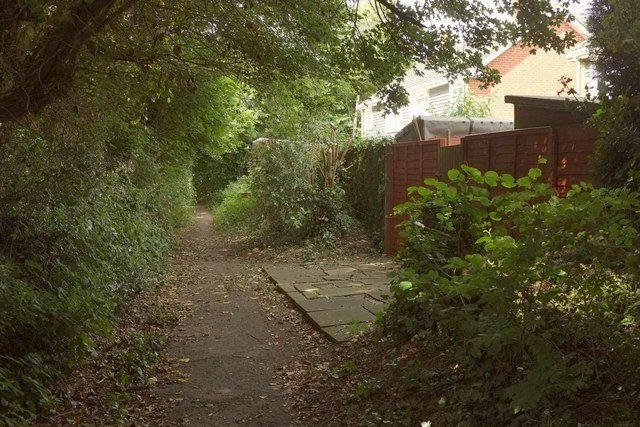
The wood is crisscrossed by a network of well-maintained footpaths, allowing visitors to explore its beauty at their own pace. These paths lead to several scenic spots, including a small stream that runs through the heart of the wood. The sound of running water adds to the peaceful ambiance, making it a perfect spot for relaxation and contemplation.

Wilkins's Coomb is also home to a variety of wildlife, including deer, foxes, and a wide range of bird species. Birdwatchers can catch a glimpse of woodpeckers, owls, and even the rare nightjar.

The wood is open to the public year-round, and visitors are encouraged to respect the natural environment by not disturbing the flora and fauna. Wilkins's Coomb is a true gem within the New Forest, offering visitors a chance to immerse themselves in the beauty of nature and experience the tranquility of this ancient woodland.

If you have any feedback on the listing, please let us know in the comments section below.

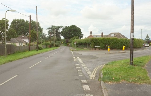
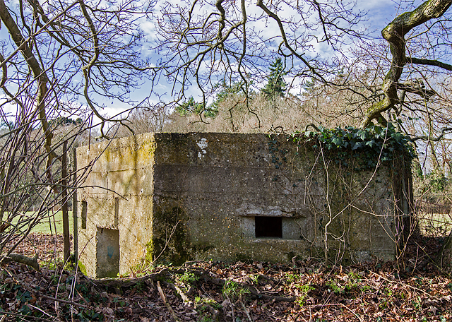
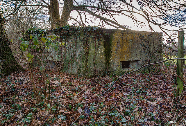
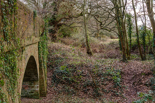
Wilkins's Coomb Images

Images are sourced within 2km of 50.939997/-1.8175461 or Grid Reference SU1215. Thanks to Geograph Open Source API. All images are credited.

Marl Lane
Marl Lane
Puddleslosh Lane I had to walk round this way to find out if the track lived up to its name - and it does!
Puddleslosh Lane
I had to walk round this way to find out if the track lived up to its name - and it does!
Whitsbury Road
Whitsbury Road
Modern housing development on the edge of Fordingbridge
Sweatfords Water flowing under Puddleslosh Lane A fine set of rather wet placenames!
Sweatfords Water flowing under Puddleslosh Lane
A fine set of rather wet placenames!
Plastic bales by the Avon Valley path From where the Path makes a right-angled bend involving Fordingbridge footpaths 83 and 84. The same field appears in <a href="https://www.geograph.org.uk/photo/5196926">SU1415 : Plastic bales by the Avon Valley path</a>. The house you can see is on Whitsbury Road.
Plastic bales by the Avon Valley path
From where the Path makes a right-angled bend involving Fordingbridge footpaths 83 and 84. The same field appears in SU1415 : Plastic bales by the Avon Valley path. The house you can see is on Whitsbury Road.
Avon Valley Path near Upper Burgate From the same junction as <a href="https://www.geograph.org.uk/photo/5196854">SU1415 : Plastic bales by the Avon Valley path</a>. This is Fordingbridge footpath 83 heading towards the A338 at Upper Burgate. Ahead you can see the rear of units at the Fairgate Centre. Goodness, it's gone very gloomy.
Avon Valley Path near Upper Burgate
From the same junction as SU1415 : Plastic bales by the Avon Valley path. This is Fordingbridge footpath 83 heading towards the A338 at Upper Burgate. Ahead you can see the rear of units at the Fairgate Centre. Goodness, it's gone very gloomy.
Waymark post, Avon Valley Path At the junction where <a href="https://www.geograph.org.uk/photo/5196854">SU1415 : Plastic bales by the Avon Valley path</a> and <a href="https://www.geograph.org.uk/photo/5196879">SU1415 : Avon Valley Path near Upper Burgate</a> were taken. The upper green arrow signals the route of the Avon Valley Path and displays the bridge symbol shown in <a href="https://www.geograph.org.uk/photo/403962">SU1327 : Sign for the Avon Valley Path</a>; the left arrow indicates the path to Tinkers Cross.
Waymark post, Avon Valley Path
At the junction where SU1415 : Plastic bales by the Avon Valley path and SU1415 : Avon Valley Path near Upper Burgate were taken. The upper green arrow signals the route of the Avon Valley Path and displays the bridge symbol shown in SU1327 : Sign for the Avon Valley Path; the left arrow indicates the path to Tinkers Cross.
Avon Valley Path north of Fordingbridge The gloom of the afternoon is intensified by the tall hedges and the narrowness of Fordingbridge footpath 84.
Avon Valley Path north of Fordingbridge
The gloom of the afternoon is intensified by the tall hedges and the narrowness of Fordingbridge footpath 84.
Avon Valley Path to Fordingbridge From the same spot as <a href="https://www.geograph.org.uk/photo/5196901">SU1415 : Avon Valley Path north of Fordingbridge</a>, looking in the opposite direction along Fordingbridge footpath 84.
Avon Valley Path to Fordingbridge
From the same spot as SU1415 : Avon Valley Path north of Fordingbridge, looking in the opposite direction along Fordingbridge footpath 84.
Plastic bales by the Avon Valley path The southern part of the field also shown in <a href="https://www.geograph.org.uk/photo/5196854">SU1415 : Plastic bales by the Avon Valley path</a>, with the same house on Whitsbury Road visible.
Plastic bales by the Avon Valley path
The southern part of the field also shown in SU1415 : Plastic bales by the Avon Valley path, with the same house on Whitsbury Road visible.
Avon Valley Path leaving Fordingbridge The path follows Fordingbridge footpath 84 through the town's northern suburbs, here passing houses on Penny's Close.
Avon Valley Path leaving Fordingbridge
The path follows Fordingbridge footpath 84 through the town's northern suburbs, here passing houses on Penny's Close.
Waverley Road, Fordingbridge A side turning seen from the Avon Valley Path as it follows Penny's Lane.
Waverley Road, Fordingbridge
A side turning seen from the Avon Valley Path as it follows Penny's Lane.
Road junction, Fordingbridge The Avon Valley Path forks right here off Whitsbury Road and along Penny's Lane.
Road junction, Fordingbridge
The Avon Valley Path forks right here off Whitsbury Road and along Penny's Lane.
WWII Hampshire - Ringwood Stop Line, Avon Valley - Fordingbridge anti-tank island (15) -
Marl Lane pillbox type FW3/22: DoB ID: S0012673

A pillbox in very good condition that once overlooked open ground to the west, and the track of the now disused railway. It's a concrete faced type 22 constructed using horizontal wooden planking, and having an embrasure in each wall including a slanted rifle port by the entrance doorway.

<a href="https://www.geograph.org.uk/photo/5255891">SU1414 : WWII Hampshire - Ringwood Stop Line, Avon Valley - Fordingbridge anti-tank island (16)</a>
WWII Hampshire - Ringwood Stop Line, Avon Valley - Fordingbridge anti-tank island (15)
- Marl Lane pillbox type FW3/22: DoB ID: S0012673 A pillbox in very good condition that once overlooked open ground to the west, and the track of the now disused railway. It's a concrete faced type 22 constructed using horizontal wooden planking, and having an embrasure in each wall including a slanted rifle port by the entrance doorway. SU1414 : WWII Hampshire - Ringwood Stop Line, Avon Valley - Fordingbridge anti-tank island (16)
WWII Hampshire - Ringwood Stop Line, Avon Valley - Fordingbridge anti-tank island (16) -
Marl Lane pillbox type FW3/22: DoB ID: S0012673

Buried almost to embrasure level in some places.

<a href="https://www.geograph.org.uk/photo/5255893">SU1414 : WWII Hampshire - Ringwood Stop Line, Avon Valley - Fordingbridge anti-tank island (17)</a>
WWII Hampshire - Ringwood Stop Line, Avon Valley - Fordingbridge anti-tank island (16)
- Marl Lane pillbox type FW3/22: DoB ID: S0012673 Buried almost to embrasure level in some places. SU1414 : WWII Hampshire - Ringwood Stop Line, Avon Valley - Fordingbridge anti-tank island (17)
WWII Hampshire - Ringwood Stop Line, Avon Valley - Fordingbridge anti-tank island (17) -
Marl Lane pillbox type FW3/22: DoB ID: S0012673

Interior view showing the Y-plan ricochet/blast wall and the deep-set embrasures.

<a href="https://www.geograph.org.uk/photo/5255898">SU1414 : WWII Hampshire - Ringwood Stop Line, Avon Valley - Fordingbridge anti-tank island (18)</a>
WWII Hampshire - Ringwood Stop Line, Avon Valley - Fordingbridge anti-tank island (17)
- Marl Lane pillbox type FW3/22: DoB ID: S0012673 Interior view showing the Y-plan ricochet/blast wall and the deep-set embrasures. SU1414 : WWII Hampshire - Ringwood Stop Line, Avon Valley - Fordingbridge anti-tank island (18)
WWII Hampshire - Ringwood Stop Line, Avon Valley - Fordingbridge anti-tank island (18) -
Marl Lane pillbox type FW3/22: DoB ID: S0012673

A distant view of the pillbox from the old railway bridge, showing its location 100 yds S of the former Salisbury & Dorset Junction Railway.

<a href="https://www.geograph.org.uk/photo/5255903">SU1414 : WWII Hampshire - Ringwood Stop Line, Avon Valley - Fordingbridge anti-tank island (19)</a>
WWII Hampshire - Ringwood Stop Line, Avon Valley - Fordingbridge anti-tank island (18)
- Marl Lane pillbox type FW3/22: DoB ID: S0012673 A distant view of the pillbox from the old railway bridge, showing its location 100 yds S of the former Salisbury & Dorset Junction Railway. SU1414 : WWII Hampshire - Ringwood Stop Line, Avon Valley - Fordingbridge anti-tank island (19)
Show me another place!

Wilkins's Coomb is located at Grid Ref: SU1215 (Lat: 50.939997, Lng: -1.8175461)

Administrative County: Hampshire

District: New Forest

Police Authority: Hampshire

What 3 Words

///letter.threaten.stylists. Near Fordingbridge, Hampshire

Related Wikis

Sandleheath

Sandleheath is a village and civil parish about 1.8 miles (2.9 km) west of Fordingbridge in the New Forest District of Hampshire, England. It has a...

Fordingbridge railway station

Fordingbridge was a railway station serving Fordingbridge, a small town in Hampshire. It was one of many casualties of the mass closure of British railway...

Rockbourne Roman Villa

Rockbourne Roman Villa is a Roman courtyard villa excavated and put on public display in the village of Rockbourne in the English county of Hampshire....

The Burgate School and Sixth Form

The Burgate School and Sixth Form (opened in 1957) is an 11–18 academy school. The school is situated in Fordingbridge, Hampshire, and at the current time...

Fordingbridge Hospital

Fordingbridge Hospital is a small community hospital in Fordingbridge, Hampshire, England. The hospital closed to admissions in September 2023. == History... ==

Burgate, Hampshire

Burgate (divided into Upper Burgate and Lower Burgate) is a hamlet situated on the western edge of the New Forest National Park in Hampshire, England....

Fordingbridge Town Hall

Fordingbridge Town Hall is a municipal building in the High Street in Fordingbridge, Hampshire, England. The structure, which is the meeting place of Fordingbridge...

Fordingbridge

Fordingbridge is a town and broader civil parish with a population of 6,000 on the River Avon in the New Forest District of Hampshire, England, near the...

Nearby Amenities

Located within 500m of 50.939997,-1.8175461
Power: tower
Source: Bing
Lat/Long: 50.9408548/-1.8163163
Power: tower
Source: Bing
Lat/Long: 50.9390538/-1.819689
Power: tower
Source: bing
Lat/Long: 50.9424857/-1.8132992
Barrier: kissing_gate
Lat/Long: 50.9384361/-1.8228639
Power: pole
Lat/Long: 50.9425919/-1.8123338
Power: pole
Lat/Long: 50.9438696/-1.8151045
Power: pole
Lat/Long: 50.9442498/-1.8165314
Power: pole
Lat/Long: 50.9364194/-1.8143749
Power: pole
Lat/Long: 50.9373998/-1.8144393
Power: pole
Lat/Long: 50.9396444/-1.8112984
Power: pole
Source: bing
Lat/Long: 50.938195/-1.8133289
Power: pole
Source: bing
Lat/Long: 50.9389992/-1.8122013
Power: pole
Source: bing
Transformer: distribution
Lat/Long: 50.943781/-1.8158342
Power: pole
Source: bing
Lat/Long: 50.9441172/-1.8167746
Power: pole
Source: bing
Lat/Long: 50.9390011/-1.8239688
Power: pole
Source: bing
Lat/Long: 50.9386273/-1.823426
Power: pole
Source: bing
Lat/Long: 50.937524/-1.8234321
Power: pole
Source: bing
Lat/Long: 50.9400061/-1.8237945
Power: pole
Source: bing
Lat/Long: 50.9407335/-1.8240606
Power: pole
Source: bing
Lat/Long: 50.9411546/-1.8242333
The data included in this document is from www.openstreetmap.org. The data is made available under ODbL.

Have you been to Wilkins's Coomb?

Leave your review of Wilkins's Coomb below (or comments, questions and feedback).