Jonathan's Coppice

Wood, Forest in Warwickshire Stratford-on-Avon

England

Jonathan's Coppice

Stratford-upon-Avon Canal towards bridge #24
Stratford-upon-Avon Canal towards bridge #24 Credit: Ian S

Jonathan's Coppice is a picturesque woodland located in Warwickshire, England. Covering an area of approximately 50 acres, it is a thriving example of a coppiced woodland, characterized by its diverse range of tree species and abundant wildlife.

The woodland is predominantly composed of native tree species such as oak, ash, birch, and beech, which have been carefully managed through the traditional practice of coppicing. This involves cutting the trees at ground level to encourage new growth, resulting in a dense and multi-layered woodland structure. The coppicing process not only provides a sustainable source of timber but also creates a varied habitat for wildlife.

Visitors to Jonathan's Coppice can explore a network of well-maintained footpaths that meander through the woodland, allowing them to immerse themselves in the natural beauty of the area. A variety of flora can be observed throughout the seasons, including bluebells, wild garlic, and wood anemones, which create a vibrant carpet of color in the spring.

The woodland is also home to a rich diversity of wildlife, providing a sanctuary for various bird species, mammals, and insects. Birdwatchers may spot species such as woodpeckers, nuthatches, and tawny owls, while lucky visitors might catch a glimpse of a shy roe deer or red fox.

Jonathan's Coppice offers a tranquil and educational experience for nature enthusiasts, providing a valuable insight into the importance of sustainable woodland management and the benefits it brings to both the environment and the local community.

If you have any feedback on the listing, please let us know in the comments section below.

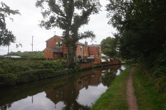
Jonathan's Coppice Images

Images are sourced within 2km of 52.346904/-1.8118186 or Grid Reference SP1272. Thanks to Geograph Open Source API. All images are credited.

Stratford-upon-Avon Canal towards bridge #24
Stratford-upon-Avon Canal at Saddlerswell Lane Bridge,  bridge #24
Stratford-upon-Avon Canal at Saddlerswell Lane Bridge, bridge #24
Stratford-upon-Avon Canal towards bridge #23
Stratford-upon-Avon Canal at Ashford Lane Bridge,  bridge #23
Stratford-upon-Avon Canal at Ashford Lane Bridge, bridge #23
Stratford-upon-Avon Canal at Ashford Lane Bridge,  bridge #23
Stratford-upon-Avon Canal at Ashford Lane Bridge, bridge #23
Stratford-upon-Avon Canal towards bridge #22
Stratford-upon-Avon Canal at Rotherhams Oak Bridge, bridge #22
Stratford-upon-Avon Canal towards bridge #21
Stratford-upon-Avon Canal at Tinkers Lane Bridge, bridge #21
Stratford-upon-Avon Canal towards bridge #20A
Stratford-upon-Avon Canal at M42 Bridge, bridge #20A
Stratford-upon-Avon Canal towards bridge #20
Stratford-upon-Avon Canal at Dyers Lane Bridge, bridge #20
Canal boat Lavinia Mary, Stratford-upon-Avon Canal
Show me another place!

Jonathan's Coppice is located at Grid Ref: SP1272 (Lat: 52.346904, Lng: -1.8118186)

Administrative County: Warwickshire

District: Stratford-on-Avon

Police Authority: Warwickshire

What 3 Words

///hours.famed.until. Near Hockley Heath, West Midlands

Related Wikis

Umberslade Hall

Umberslade Hall is a 17th-century mansion converted into residential apartments situated in Nuthurst near Tanworth-in-Arden, Warwickshire. It is a Grade...
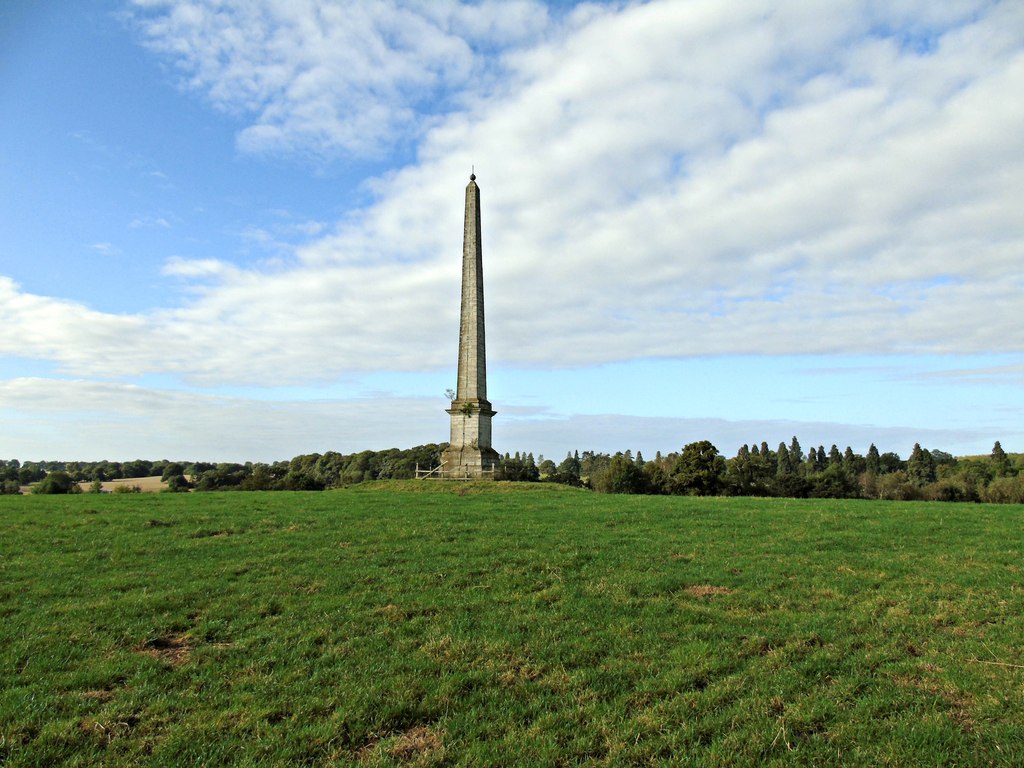
Umberslade Obelisk

The Umberslade Obelisk is a Grade II listed monument in Warwickshire, England constructed by order of Thomas Archer, 1st Baron Archer, on his estate of...

Umberslade Baptist Church

Umberslade Baptist Church is a redundant Baptist church southwest of the village of Hockley Heath, Solihull, West Midlands, England (grid reference SP147721...

RAF Hockley Heath

RAF Hockley Heath is a former Royal Air Force station located 4 miles (6.4 km) south of Solihull, Warwickshire, England, 7.7 miles (12.4 km) north-east...

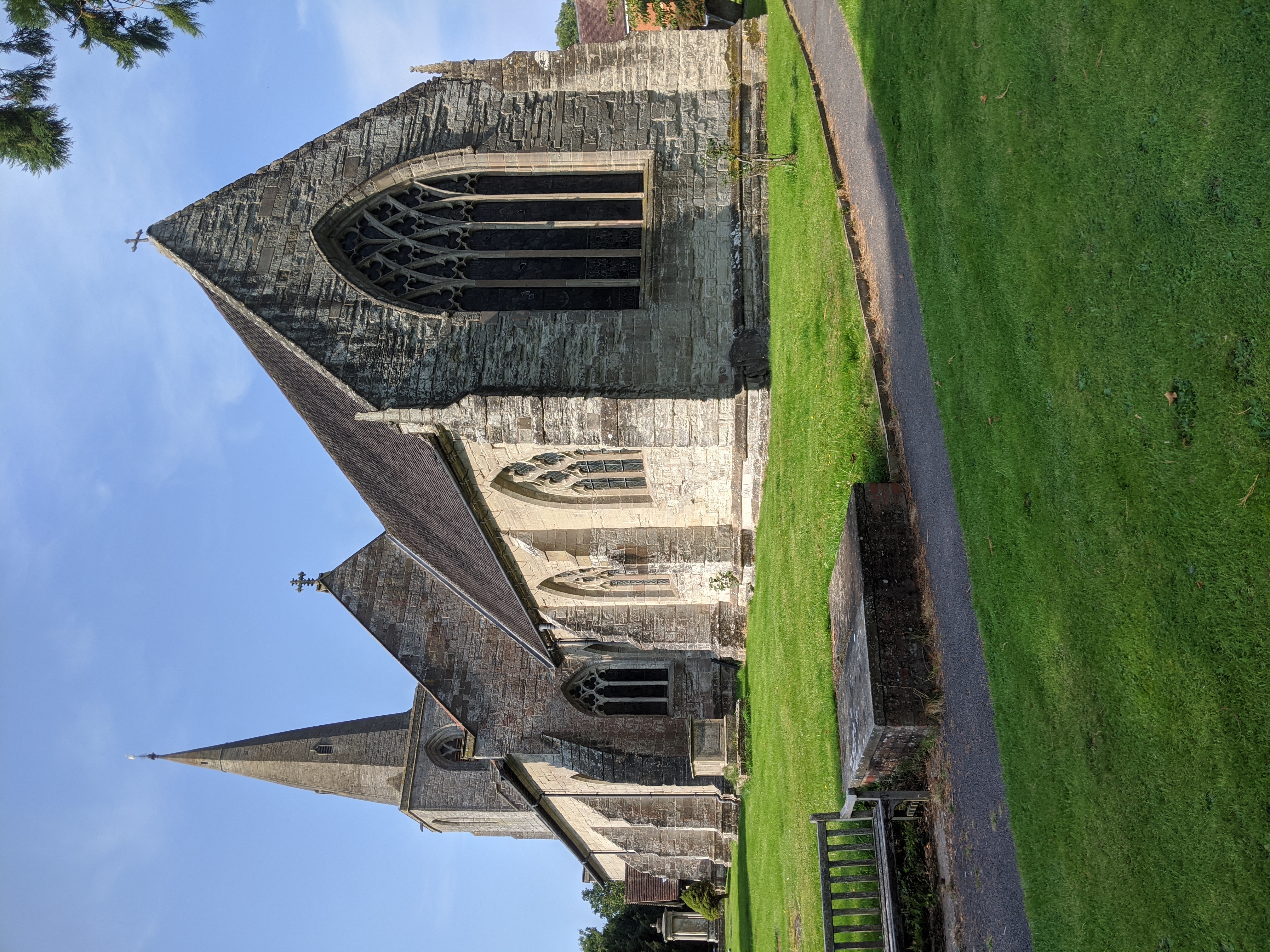
Church of St Mary Magdalene, Tanworth-in-Arden

The Church of St Mary Magdalene is an Anglican church in the village of Tanworth-in-Arden, in Warwickshire, England, and in the Diocese of Birmingham....

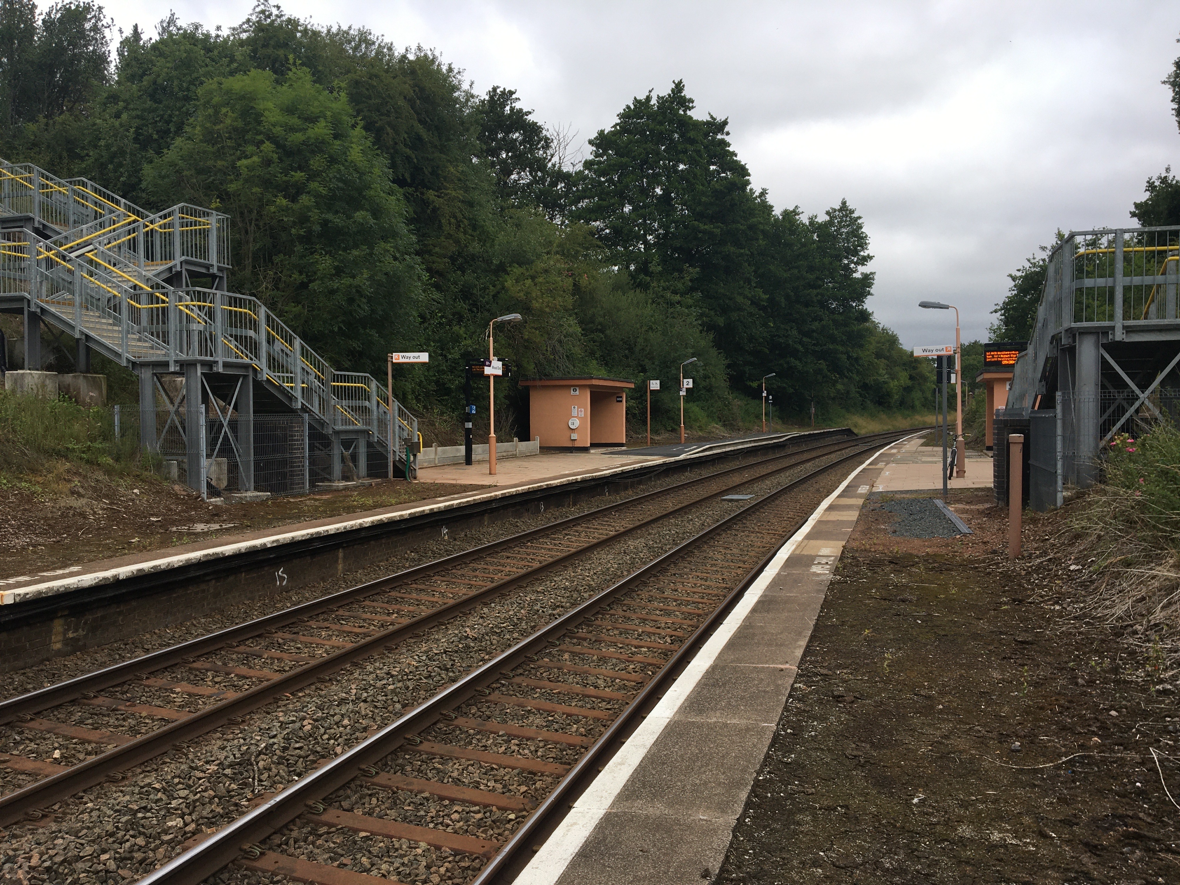
Wood End railway station

Wood End is a railway station on the North Warwickshire Line serving the village of Wood End in Warwickshire, England. Situated on the Stratford-upon-Avon...

Tanworth-in-Arden

Tanworth-in-Arden (; often abbreviated to Tanworth) is a village and civil parish in the county of Warwickshire, England. It is 12.5 miles (20 km) south...

Wood End, Stratford-on-Avon

Wood End is a village in Warwickshire, England. It is about 1 mile north of Tanworth-in-Arden (where the population can be found), and has a railway station...

Nearby Amenities

Located within 500m of 52.346904,-1.8118186
Phone
Check Date: 2022-03-25
Emergency: phone
Source: survey
Lat/Long: 52.3472412/-1.813348
Phone
Check Date: 2022-03-22
Emergency: phone
Source: survey
Lat/Long: 52.3479568/-1.8140371
Man Made: pipeline_marker
Operator: Esso
Ref: Km 22.35
Source: survey
Substance: oil
Lat/Long: 52.3450779/-1.8088374
Man Made: pipeline_marker
Operator: Esso
Ref: Km 22.36
Source: survey
Substance: oil
Lat/Long: 52.3451114/-1.8086332
Man Made: tower
Source: visual survey; bing
Tower Type: communication
Lat/Long: 52.347027/-1.8106275
ShortDescription: M42/6289A M42 northBound
Bcc Ref: 30084635
Operator: National Highways
Operator Wikidata: Q5760006
Ref: M42/6289A
Traffic Sign: variable_message
Traffic Sign Location: overhead
Variable Message Information: traffic
Lat/Long: 52.3476449/-1.8152353
ShortDescription: M40/9705K M40 northBound
Bcc Ref: 30084600
Operator: National Highways
Operator Wikidata: Q5760006
Ref: M40/9705K
Traffic Sign: variable_message
Traffic Sign Location: roadside
Variable Message Information: traffic
Lat/Long: 52.3476087/-1.8115911
ShortDescription: M42/6294B M42 southBound
Bcc Ref: 30084642
Operator: National Highways
Operator Wikidata: Q5760006
Ref: M42/6294B
Source: bcc
Traffic Sign: variable_message
Traffic Sign Location: roadside
Variable Message Information: traffic
Lat/Long: 52.3485608/-1.8108492
Power: pole
Source: bing
Lat/Long: 52.3442048/-1.8068808
Power: pole
Source: bing
Lat/Long: 52.3434314/-1.8083614
Power: pole
Source: bing
Lat/Long: 52.3431446/-1.8092224
Power: pole
Ref: 720152
Source: wpd_opendata
Transformer: distribution
Lat/Long: 52.3426121/-1.8105447
Power: pole
Source: bing
Lat/Long: 52.342535/-1.8119931
Power: pole
Source: bing
Lat/Long: 52.3431676/-1.8149167
Power: pole
Source: bing
Lat/Long: 52.343696/-1.8161292
Power: pole
Source: bing
Lat/Long: 52.3442917/-1.8171456
Material: wood
Power: pole
Source: bing
Lat/Long: 52.344975/-1.8177706
Material: wood
Power: pole
Source: bing
Lat/Long: 52.345972/-1.8189336
Material: wood
Power: pole
Source: bing
Lat/Long: 52.3467003/-1.8189374
Material: wood
Power: pole
Source: bing
Lat/Long: 52.3477588/-1.8185806
Material: wood
Power: pole
Source: bing
Lat/Long: 52.3481242/-1.8171886
Power: pole
Source: bing
Lat/Long: 52.3486321/-1.8156168
Power: tower
Source: bing
Tower Type: communication
Lat/Long: 52.3493956/-1.8118952
Power: pole
Source: bing
Lat/Long: 52.3496807/-1.8121849
Material: wood
Power: pole
Ref: 720394
Source: wpd_opendata
Transformer: distribution
Lat/Long: 52.3496479/-1.8112528
Power: pole
Source: bing
Lat/Long: 52.3496381/-1.8134281
Power: pole
Ref: 720395
Source: wpd_opendata
Transformer: distribution
Lat/Long: 52.3489221/-1.8144339
Power: pole
Source: bing
Lat/Long: 52.3496201/-1.8147129
Power: pole
Source: bing
Lat/Long: 52.3503279/-1.8150589
The data included in this document is from www.openstreetmap.org. The data is made available under ODbL.

Have you been to Jonathan's Coppice?

Leave your review of Jonathan's Coppice below (or comments, questions and feedback).