Massa Flatts Wood

Wood, Forest in Yorkshire Craven

England

Massa Flatts Wood

A65 Skipton bypass leading west from junction with the A6131
A65 Skipton bypass leading west from junction with the A6131 Credit: peter robinson

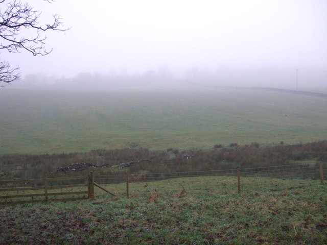
Massa Flatts Wood, located in Yorkshire, is a picturesque woodland area that offers a serene escape from the bustling city life. Covering an area of approximately 50 acres, this enchanting forest is home to a diverse range of flora and fauna.

The wood boasts a rich history, dating back several centuries. It was originally part of the medieval deer park belonging to the nearby castle, and remnants of the park's boundary can still be seen today. The wood was later converted into a commercial plantation, primarily for the production of timber.

Visitors to Massa Flatts Wood can expect to find a variety of tree species, including oak, birch, and beech, creating a lush canopy that provides a tranquil atmosphere. The forest floor is adorned with a vibrant carpet of bluebells and wildflowers during the spring season, adding to the beauty of the surroundings.

The wood is a haven for wildlife enthusiasts, as it is home to numerous bird species, such as woodpeckers, owls, and various songbirds. The presence of mammals, including foxes, badgers, and squirrels, further enhances the woodland experience.

Massa Flatts Wood offers well-maintained walking trails, allowing visitors to explore its natural beauty at their own pace. Picnic areas are scattered throughout the wood, providing an excellent opportunity to relax and enjoy the peaceful surroundings.

Managed by the local conservation authority, Massa Flatts Wood is a cherished natural treasure, providing a tranquil retreat for nature lovers and a valuable habitat for the local ecosystem.

If you have any feedback on the listing, please let us know in the comments section below.

Massa Flatts Wood Images

Images are sourced within 2km of 53.965515/-2.0285895 or Grid Reference SD9852. Thanks to Geograph Open Source API. All images are credited.

A65 Skipton bypass leading west from junction with the A6131
Abandoned well head on the outskirts of Skipton Old well head in field on north east edge of Skipton.
Abandoned well head on the outskirts of Skipton
Old well head in field on north east edge of Skipton.
Skipton:Old well I was intrigued by this small stone structure by the side of the track of the former Haw Bank Tramway.  On further investigation, it proved to be a well, presumably disused many years ago.
Skipton:Old well
I was intrigued by this small stone structure by the side of the track of the former Haw Bank Tramway. On further investigation, it proved to be a well, presumably disused many years ago.
Footpath towards Spring Gardens, Skipton
Moorview Way - viewed from Hurrs Road
The Grove - Aldersley Avenue
The Oval - Aldersley Avenue
Field entrance off Cross Bank
Grazing beside the former Yorkshire Dales Railway
Hillside grazing, Elsey Off Otley Road.
Hillside grazing, Elsey
Off Otley Road.
Grazing east of Skipton Looking north through the gloom from Otley Road.
Grazing east of Skipton
Looking north through the gloom from Otley Road.
Looking west along the eastbound carriageway of the A65
Building in field south of the A65
Estates on the east side of Skipton Viewed from the path down Jenny Gill.
Estates on the east side of Skipton
Viewed from the path down Jenny Gill.
The road to Embsay The path in the grass leads away from the OS Berntsen
The road to Embsay
The path in the grass leads away from the OS Berntsen
The other Castle, Skipton This pub is on the corner of High Street and Mill Bridge at the northern end of the town. The pub is adjacent to Holy Trinity church, the walls of which can be seen right of shot.
The other Castle, Skipton
This pub is on the corner of High Street and Mill Bridge at the northern end of the town. The pub is adjacent to Holy Trinity church, the walls of which can be seen right of shot.
Blue umbrellas, Skipton Seen outside The Castle pub at the northern end of town. Looking down Mill Bridge from outside Holy Trinity Church.
Blue umbrellas, Skipton
Seen outside The Castle pub at the northern end of town. Looking down Mill Bridge from outside Holy Trinity Church.
Show me another place!

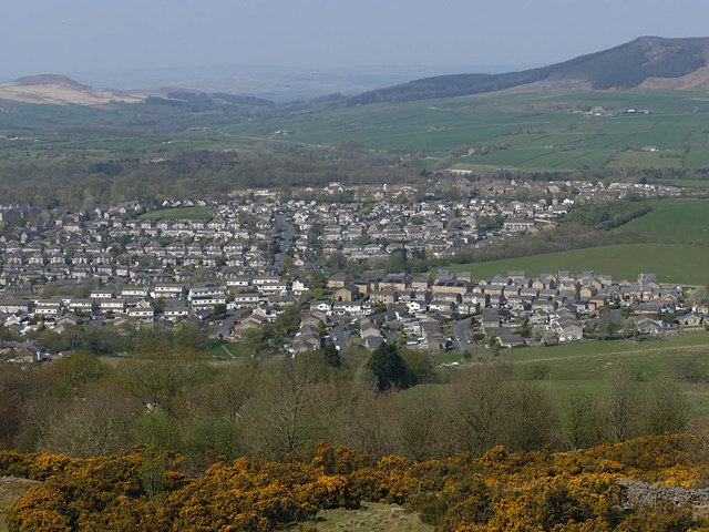
Massa Flatts Wood is located at Grid Ref: SD9852 (Lat: 53.965515, Lng: -2.0285895)

Division: West Riding

Administrative County: North Yorkshire

District: Craven

Police Authority: North Yorkshire

What 3 Words

///compiled.hairstyle.stay. Near Skipton, North Yorkshire

Related Wikis

Skipton Girls' High School

Skipton Girls' High School, founded in 1886 by the Petyt Trust, is an all-girls selective grammar school situated in Skipton, North Yorkshire, England...

Raikeswood Hospital

Raikeswood Hospital was a health facility in Gargrave Road, Skipton, North Yorkshire, England. It has been converted for residential use and remains a...

Aireville Park

Aireville Park is a park in Skipton, North Yorkshire, England. == History == Aireville Park was created in the 1830s by Henry Allcock as part of the Aireville...

Ermysted's Grammar School

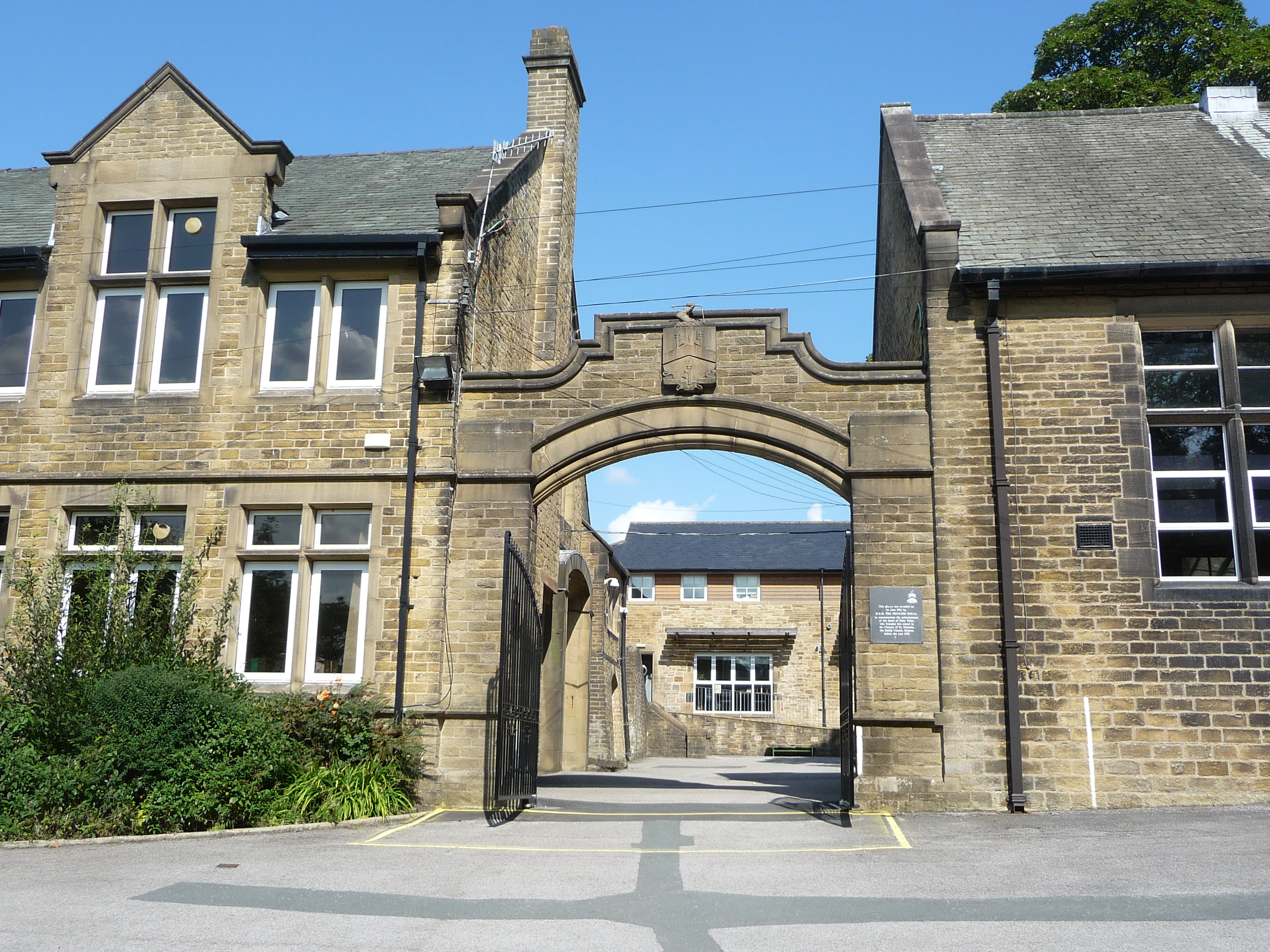
Ermysted's Grammar School is an 11-18 boys' voluntary aided grammar school in Skipton, North Yorkshire, England.It was founded by Peter Toller in the 15th...

The Skipton Academy

The Skipton Academy (formerly Aireville School) is a small rural 11–16 coeducational secondary school located in Skipton, North Yorkshire, England.Previously...

St Stephen's Church, Skipton

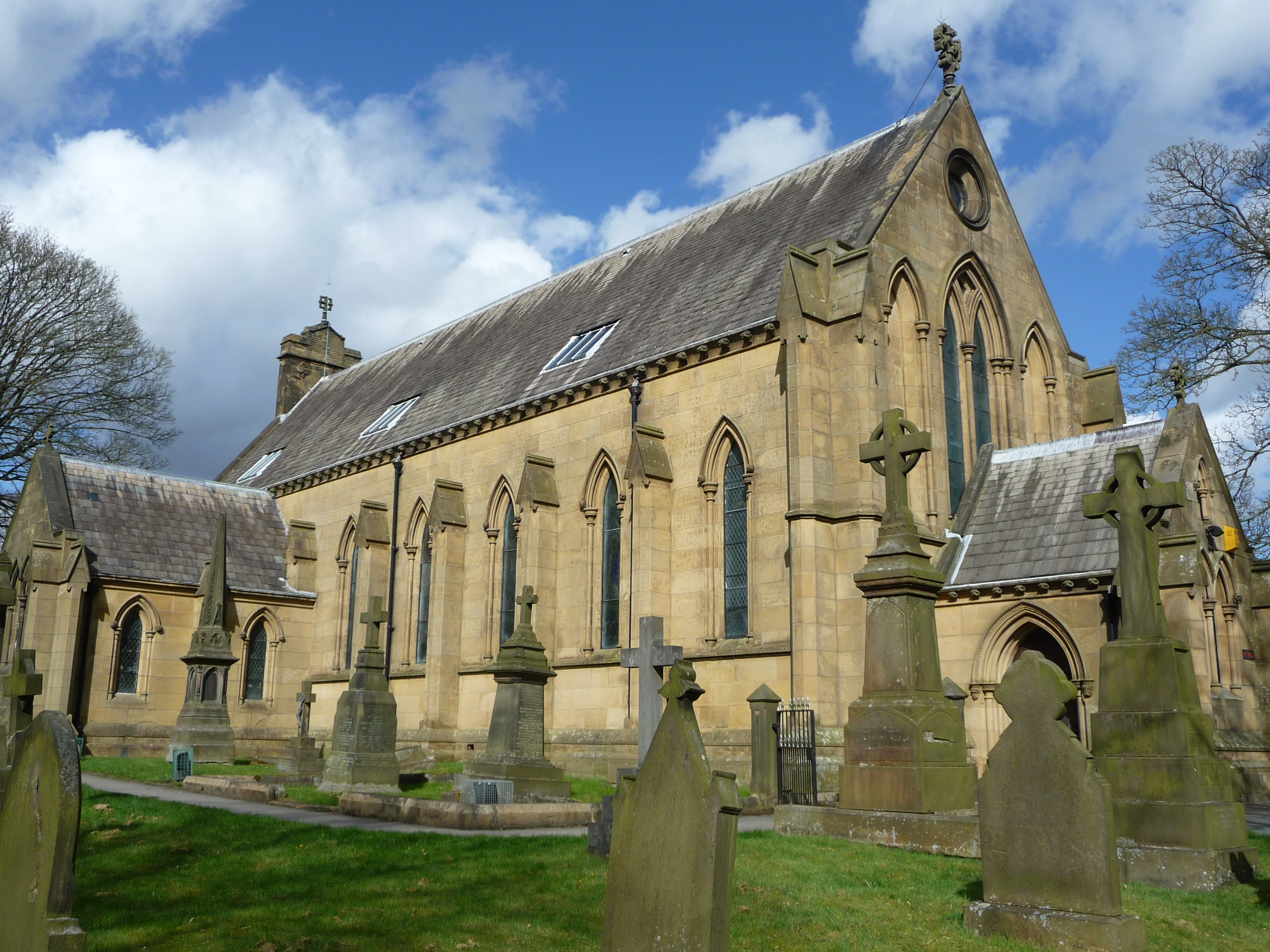
St Stephen's Church is a Roman Catholic Parish church in Skipton, North Yorkshire, England. It is situated next to Ermysted's Grammar School close to the...

Craven College

Craven College is a further education college based in Skipton, North Yorkshire, England. Craven offers a variety of further and higher education courses...

Skipton railway station

Skipton railway station is a Grade II listed station which serves the town of Skipton in North Yorkshire, England on the Airedale Line, which gives Skipton...

Nearby Amenities

Located within 500m of 53.965515,-2.0285895
Leisure: playground
Lat/Long: 53.9680959/-2.0287098
Turning Circle
Source: EsriWorldImageryClarity
Lat/Long: 53.9657486/-2.030437
Turning Circle
Source: EsriWorldImageryClarity
Lat/Long: 53.9639823/-2.0318411
Mini Roundabout
Direction: clockwise
Source: survey
Lat/Long: 53.963097/-2.0302671
Post Box
Ref: BD23 98
Source: survey
Lat/Long: 53.9662028/-2.0248632
Post Box
Ref: BD23 156
Source: survey
Lat/Long: 53.9638646/-2.0305901
Post Box
Collection Times: Mo-Fr 09:00; Sa 07:00
Ref: BD23 15
Source: survey
Lat/Long: 53.9630082/-2.0257152
Grassington Road
Bus: yes
Public Transport: stop_position
Lat/Long: 53.9664125/-2.0229871
Sod Hill
Bus: yes
Public Transport: stop_position
Lat/Long: 53.968803/-2.0241617
Bench
Backrest: yes
Lat/Long: 53.9617862/-2.0315208
Bench
Backrest: yes
Lat/Long: 53.9617686/-2.0314538
Bench
Backrest: yes
Lat/Long: 53.9619077/-2.028219
Bench
Backrest: yes
Lat/Long: 53.9622738/-2.0316543
Bench
Backrest: yes
Lat/Long: 53.9615564/-2.0274248
Bench
Lat/Long: 53.9613267/-2.0266261
Waste Basket
Lat/Long: 53.9617783/-2.0314863
Waste Basket
Lat/Long: 53.962775/-2.0338153
Waste Basket
Lat/Long: 53.9618414/-2.0306595
Waste Basket
Lat/Long: 53.9629615/-2.0304624
Bench
Lat/Long: 53.9627961/-2.0306911
Bench
Backrest: yes
Lat/Long: 53.9620359/-2.0323313
Bench
Backrest: yes
Lat/Long: 53.9620131/-2.0322768
Waste Basket
Lat/Long: 53.9620262/-2.032305
Waste Basket
Lat/Long: 53.9622875/-2.0307668
Information: board
Source: survey
Tourism: information
Lat/Long: 53.9679665/-2.0277116
Generator Method: photovoltaic
Generator Output Electricity: yes
Generator Source: solar
Generator Type: solar_photovoltaic_panel
Location: roof
Power: generator
Lat/Long: 53.9630433/-2.027681
Generator Method: photovoltaic
Generator Output Electricity: yes
Generator Source: solar
Generator Type: solar_photovoltaic_panel
Location: roof
Power: generator
Lat/Long: 53.9637549/-2.0297008
Generator Method: photovoltaic
Generator Output Electricity: yes
Generator Source: solar
Generator Type: solar_photovoltaic_panel
Location: roof
Power: generator
Lat/Long: 53.9639569/-2.031353
Generator Method: photovoltaic
Generator Output Electricity: yes
Generator Source: solar
Generator Type: solar_photovoltaic_panel
Location: roof
Power: generator
Lat/Long: 53.9640579/-2.0309292
Generator Method: photovoltaic
Generator Output Electricity: yes
Generator Source: solar
Generator Type: solar_photovoltaic_panel
Location: roof
Power: generator
Lat/Long: 53.9642914/-2.0325144
Generator Method: photovoltaic
Generator Output Electricity: yes
Generator Source: solar
Generator Type: solar_photovoltaic_panel
Location: roof
Power: generator
Lat/Long: 53.967021/-2.0270829
Generator Method: photovoltaic
Generator Output Electricity: yes
Generator Source: solar
Generator Type: solar_photovoltaic_panel
Location: roof
Power: generator
Lat/Long: 53.9678897/-2.024744
Generator Method: photovoltaic
Generator Output Electricity: yes
Generator Source: solar
Generator Type: solar_photovoltaic_panel
Location: roof
Power: generator
Lat/Long: 53.9673042/-2.0260275
Generator Method: photovoltaic
Generator Output Electricity: yes
Generator Source: solar
Generator Type: solar_photovoltaic_panel
Location: roof
Power: generator
Lat/Long: 53.9657265/-2.0243739
Generator Method: photovoltaic
Generator Output Electricity: yes
Generator Source: solar
Generator Type: solar_photovoltaic_panel
Location: roof
Power: generator
Lat/Long: 53.9653611/-2.0231964
Generator Method: photovoltaic
Generator Output Electricity: yes
Generator Source: solar
Generator Type: solar_photovoltaic_panel
Location: roof
Power: generator
Lat/Long: 53.9635198/-2.0227364
Generator Method: photovoltaic
Generator Output Electricity: yes
Generator Source: solar
Generator Type: solar_photovoltaic_panel
Location: roof
Power: generator
Lat/Long: 53.9686358/-2.0279251
Generator Method: photovoltaic
Generator Output Electricity: yes
Generator Source: solar
Generator Type: solar_photovoltaic_panel
Location: roof
Power: generator
Lat/Long: 53.9695202/-2.0253301
Generator Method: photovoltaic
Generator Output Electricity: yes
Generator Source: solar
Generator Type: solar_photovoltaic_panel
Location: roof
Power: generator
Lat/Long: 53.96939/-2.0251356
Generator Method: photovoltaic
Generator Output Electricity: yes
Generator Source: solar
Generator Type: solar_photovoltaic_panel
Location: roof
Power: generator
Lat/Long: 53.9660145/-2.0246756
Generator Method: photovoltaic
Generator Output Electricity: yes
Generator Source: solar
Generator Type: solar_photovoltaic_panel
Location: roof
Power: generator
Lat/Long: 53.9668698/-2.0265416
Generator Method: photovoltaic
Generator Output Electricity: yes
Generator Source: solar
Generator Type: solar_photovoltaic_panel
Location: roof
Power: generator
Lat/Long: 53.9668367/-2.0266355
Bus Stop
Raikeswood
Public Transport: platform
Lat/Long: 53.9626157/-2.0244375
Bus Stop
Raikeswood
Public Transport: platform
Lat/Long: 53.962824/-2.0252877
Bus Stop
Woodlands Drive
Naptan AtcoCode: 3200YNF10191
Naptan NaptanCode: 32010191
Public Transport: platform
Lat/Long: 53.963284/-2.0279807
Bus Stop
Woodlands Drive
Public Transport: platform
Lat/Long: 53.9632138/-2.0286848
Bus Stop
Craven College
Naptan AtcoCode: 3200YNA01875
Naptan NaptanCode: 32001875
Public Transport: platform
Lat/Long: 53.9641037/-2.0356277
Bus Stop
Craven College
Naptan AtcoCode: 3200YNA01876
Naptan NaptanCode: 32001876
Public Transport: platform
Lat/Long: 53.9641116/-2.0355029
Skipton Park Run Starting Point
Lat/Long: 53.9614114/-2.0301019
Bus Stop
Grassington Road
Bus: yes
Naptan AtcoCode: 3200YNA01783
Naptan NaptanCode: 32001783
Public Transport: platform
Lat/Long: 53.9663888/-2.0230311
Bus Stop
Grassington Road
Bus: yes
Naptan AtcoCode: 3200YNA01784
Naptan NaptanCode: 32001784
Public Transport: platform
Lat/Long: 53.9664152/-2.0229573
Grassington Road
Bus: yes
Public Transport: stop_position
Lat/Long: 53.9664079/-2.0229825
Bus Stop
Sod Hill
Bus: yes
Naptan AtcoCode: 3200YNA01782
Naptan NaptanCode: 32001782
Public Transport: platform
Lat/Long: 53.9687961/-2.0242299
Bus Stop
Sod Hill
Bus: yes
Naptan AtcoCode: 3200YNA01781
Naptan NaptanCode: 32001781
Public Transport: platform
Lat/Long: 53.9687882/-2.0241025
Sod Hill
Bus: yes
Public Transport: stop_position
Lat/Long: 53.9687892/-2.0241534
Raikes
Place: suburb
Lat/Long: 53.9672574/-2.0254061
Rockwood
Place: suburb
Lat/Long: 53.9652324/-2.0319352
Crossing
Lat/Long: 53.9635081/-2.0304703
Crossing
Crossing: unmarked
Crossing Markings: no
Lat/Long: 53.963219/-2.0302918
The data included in this document is from www.openstreetmap.org. The data is made available under ODbL.

Have you been to Massa Flatts Wood?

Leave your review of Massa Flatts Wood below (or comments, questions and feedback).