French's Coppice

Wood, Forest in Dorset

England

French's Coppice

Deans Drove
Deans Drove Credit: Alex McGregor

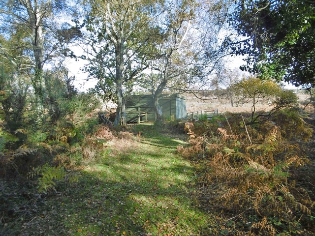
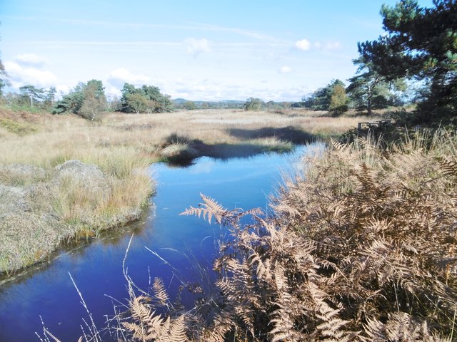
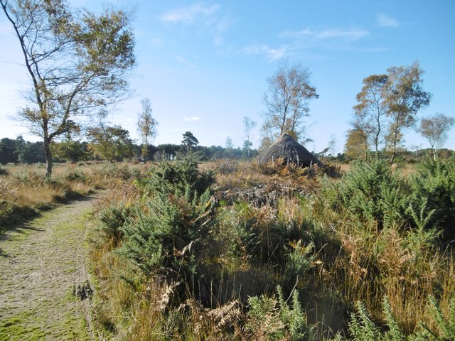
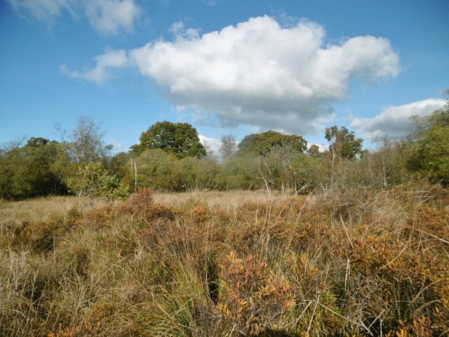
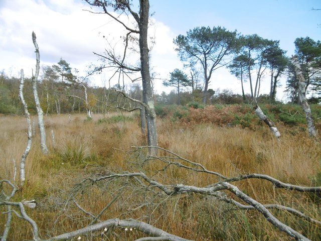
French's Coppice is a picturesque woodland located in Dorset, England. Covering an area of approximately 50 acres, it is known for its rich biodiversity and stunning natural beauty. The coppice is situated in the heart of the county, surrounded by rolling hills and meandering streams, creating a tranquil and serene environment.

The woodland is predominantly composed of broadleaf trees such as oak, ash, and beech, which provide a lush canopy overhead. The forest floor is carpeted with an array of wildflowers, including bluebells and primroses, adding bursts of color to the landscape during springtime.

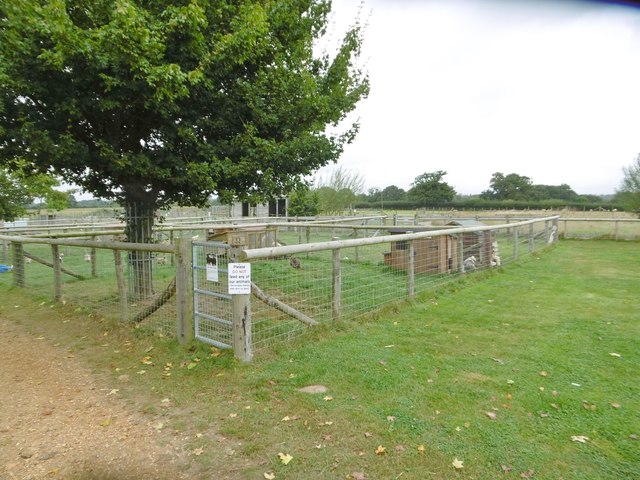
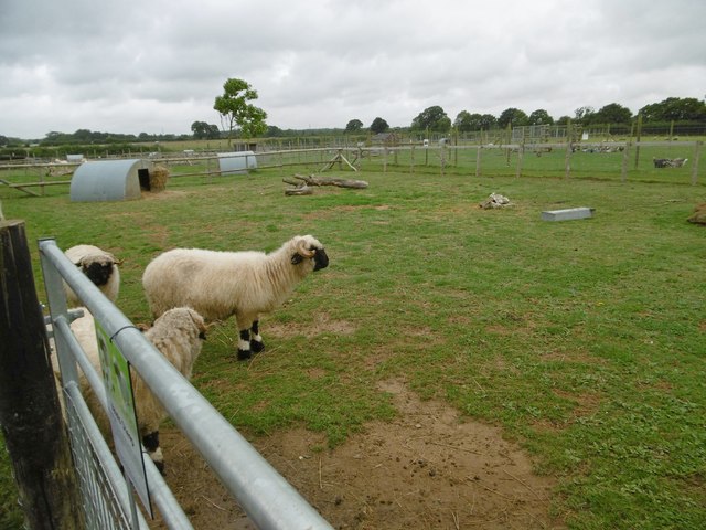
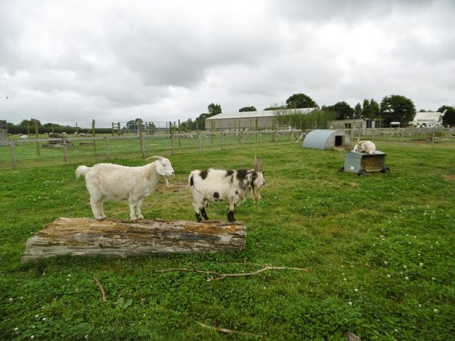
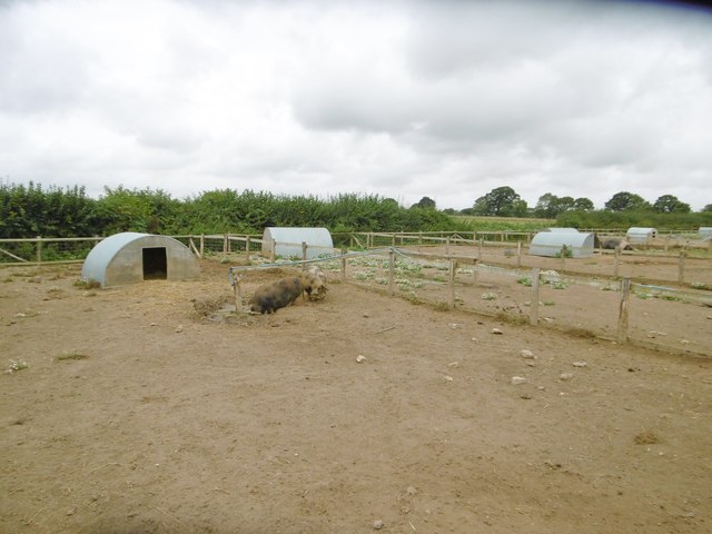
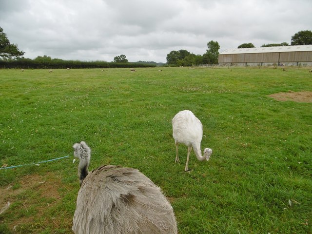
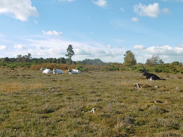
French's Coppice is home to a diverse range of wildlife, making it a haven for nature enthusiasts. Visitors may be lucky enough to spot deer, foxes, badgers, and an abundance of bird species, including woodpeckers, owls, and various songbirds. The woodland's secluded location offers a peaceful retreat for these creatures, ensuring their protection and preservation.

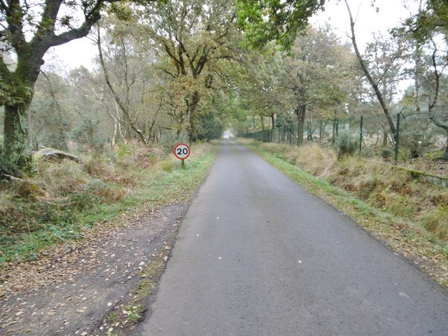
The coppice has several well-maintained walking trails, allowing visitors to explore and immerse themselves in its natural splendor. The paths wind through the trees, offering glimpses of the surrounding countryside and providing opportunities for birdwatching and photography. Additionally, there are picnic areas and benches scattered throughout the woodland, providing visitors with places to rest and appreciate the tranquility of the area.

French's Coppice is a true gem of Dorset, offering a unique and enchanting experience for nature lovers and those seeking a peaceful escape from the hustle and bustle of everyday life.

If you have any feedback on the listing, please let us know in the comments section below.

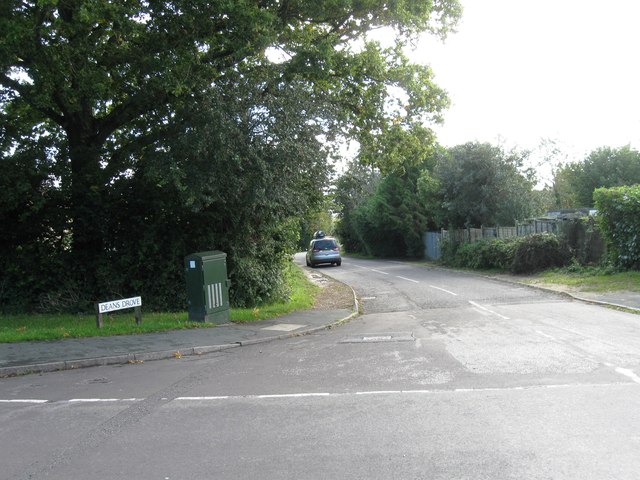
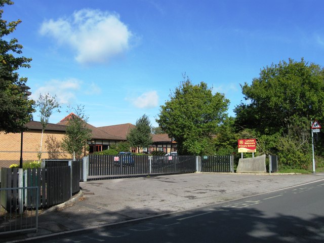
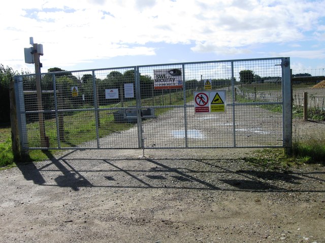
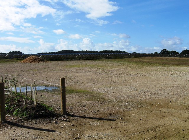
French's Coppice Images

Images are sourced within 2km of 50.73576/-2.0769925 or Grid Reference SY9492. Thanks to Geograph Open Source API. All images are credited.

Deans Drove
Deans Drove
Entrance to Lytchett Matravers Primary School
Entrance to Solar Farm
Solar Farm
Solar Farm
Organford, poultry enclosure At Farmer Palmers Farm Park: <span class="nowrap"><a title="http://farmerpalmers.co.uk/" rel="nofollow ugc noopener" href="http://farmerpalmers.co.uk/">Link</a><img style="margin-left:2px;" alt="External link" title="External link - shift click to open in new window" src="https://s1.geograph.org.uk/img/external.png" width="10" height="10"/></span>
Organford, poultry enclosure
At Farmer Palmers Farm Park: LinkExternal link
Organford, sheep Valais sheep at Farmer Palmers Park Farm: <span class="nowrap"><a title="http://farmerpalmers.co.uk/" rel="nofollow ugc noopener" href="http://farmerpalmers.co.uk/">Link</a><img style="margin-left:2px;" alt="External link" title="External link - shift click to open in new window" src="https://s1.geograph.org.uk/img/external.png" width="10" height="10"/></span>
Organford, sheep
Valais sheep at Farmer Palmers Park Farm: LinkExternal link
Organford, goats Angora goats at Farmer Palmers Farm Park: <span class="nowrap"><a title="http://farmerpalmers.co.uk/" rel="nofollow ugc noopener" href="http://farmerpalmers.co.uk/">Link</a><img style="margin-left:2px;" alt="External link" title="External link - shift click to open in new window" src="https://s1.geograph.org.uk/img/external.png" width="10" height="10"/></span>
Organford, goats
Angora goats at Farmer Palmers Farm Park: LinkExternal link
Organford, pigs Kune Kune pigs at Farmer Palmers Farm Park: <span class="nowrap"><a title="http://farmerpalmers.co.uk/" rel="nofollow ugc noopener" href="http://farmerpalmers.co.uk/">Link</a><img style="margin-left:2px;" alt="External link" title="External link - shift click to open in new window" src="https://s1.geograph.org.uk/img/external.png" width="10" height="10"/></span>
Organford, pigs
Kune Kune pigs at Farmer Palmers Farm Park: LinkExternal link
Organford, rheas In the sheep enclosure at Farmer Palmers Farm Park: <span class="nowrap"><a title="http://farmerpalmers.co.uk/" rel="nofollow ugc noopener" href="http://farmerpalmers.co.uk/">Link</a><img style="margin-left:2px;" alt="External link" title="External link - shift click to open in new window" src="https://s1.geograph.org.uk/img/external.png" width="10" height="10"/></span>
Organford, rheas
In the sheep enclosure at Farmer Palmers Farm Park: LinkExternal link
Holton Lee, access road From Sandford Road (A351) to Holton Lee; left and right heathland, parts of nature reserves, though the right hand side is not open to the public because of potential dangers.
Holton Lee, access road
From Sandford Road (A351) to Holton Lee; left and right heathland, parts of nature reserves, though the right hand side is not open to the public because of potential dangers.
East Holton, scrub On the Holton & Sandford Heaths SSSI. Heather has gone over; gorse and bracken remain. <span class="nowrap"><a title="https://designatedsites.naturalengland.org.uk/UnitDetail.aspx?UnitId=1018670&SiteCode=S2000234&SiteName=&countyCode=12&responsiblePerson=MATTHEW%20LOW" rel="nofollow ugc noopener" href="https://designatedsites.naturalengland.org.uk/UnitDetail.aspx?UnitId=1018670&SiteCode=S2000234&SiteName=&countyCode=12&responsiblePerson=MATTHEW%20LOW">Link</a><img style="margin-left:2px;" alt="External link" title="External link - shift click to open in new window" src="https://s1.geograph.org.uk/img/external.png" width="10" height="10"/></span> Part of the Holton Lee Estate: <span class="nowrap"><a title="http://www.holtonlee.org/" rel="nofollow ugc noopener" href="http://www.holtonlee.org/">Link</a><img style="margin-left:2px;" alt="External link" title="External link - shift click to open in new window" src="https://s1.geograph.org.uk/img/external.png" width="10" height="10"/></span>
East Holton, scrub
On the Holton & Sandford Heaths SSSI. Heather has gone over; gorse and bracken remain. LinkExternal link Part of the Holton Lee Estate: LinkExternal link
East Holton, bird hide One of two overlooking reed beds and Lytchett Bay, on the Holton Lee Estate: <span class="nowrap"><a title="http://www.holtonlee.org/" rel="nofollow ugc noopener" href="http://www.holtonlee.org/">Link</a><img style="margin-left:2px;" alt="External link" title="External link - shift click to open in new window" src="https://s1.geograph.org.uk/img/external.png" width="10" height="10"/></span>
East Holton, bird hide
One of two overlooking reed beds and Lytchett Bay, on the Holton Lee Estate: LinkExternal link
East Holton, Horseshoe Pond The southern end of the pond, on the Holton Lee Estate <span class="nowrap"><a title="http://www.holtonlee.org/" rel="nofollow ugc noopener" href="http://www.holtonlee.org/">Link</a><img style="margin-left:2px;" alt="External link" title="External link - shift click to open in new window" src="https://s1.geograph.org.uk/img/external.png" width="10" height="10"/></span> and the Holton & Sandford Heaths SSSI: <span class="nowrap"><a title="https://designatedsites.naturalengland.org.uk/UnitDetail.aspx?UnitId=1018670&SiteCode=S2000234&SiteName=&countyCode=12&responsiblePerson=MATTHEW%20LOW" rel="nofollow ugc noopener" href="https://designatedsites.naturalengland.org.uk/UnitDetail.aspx?UnitId=1018670&SiteCode=S2000234&SiteName=&countyCode=12&responsiblePerson=MATTHEW%20LOW">Link</a><img style="margin-left:2px;" alt="External link" title="External link - shift click to open in new window" src="https://s1.geograph.org.uk/img/external.png" width="10" height="10"/></span>
East Holton, Horseshoe Pond
The southern end of the pond, on the Holton Lee Estate LinkExternal link and the Holton & Sandford Heaths SSSI: LinkExternal link
East Holton, Iron Age hut Reconstructed from hazel thatch and daub by the BTCV, on the Holton Lee Estate <span class="nowrap"><a title="http://www.holtonlee.org/" rel="nofollow ugc noopener" href="http://www.holtonlee.org/">Link</a><img style="margin-left:2px;" alt="External link" title="External link - shift click to open in new window" src="https://s1.geograph.org.uk/img/external.png" width="10" height="10"/></span> and Holton & Sandford Heaths SSSI <span class="nowrap"><a title="https://designatedsites.naturalengland.org.uk/UnitDetail.aspx?UnitId=1018670&SiteCode=S2000234&SiteName=&countyCode=12&responsiblePerson=MATTHEW%20LOW" rel="nofollow ugc noopener" href="https://designatedsites.naturalengland.org.uk/UnitDetail.aspx?UnitId=1018670&SiteCode=S2000234&SiteName=&countyCode=12&responsiblePerson=MATTHEW%20LOW">Link</a><img style="margin-left:2px;" alt="External link" title="External link - shift click to open in new window" src="https://s1.geograph.org.uk/img/external.png" width="10" height="10"/></span>
East Holton, Iron Age hut
Reconstructed from hazel thatch and daub by the BTCV, on the Holton Lee Estate LinkExternal link and Holton & Sandford Heaths SSSI LinkExternal link
East Holton, cattle grazing Used to help control scrub on the Holton & Sandford Heaths SSSI: <span class="nowrap"><a title="https://designatedsites.naturalengland.org.uk/UnitDetail.aspx?UnitId=1018670&SiteCode=S2000234&SiteName=&countyCode=12&responsiblePerson=MATTHEW%20LOW" rel="nofollow ugc noopener" href="https://designatedsites.naturalengland.org.uk/UnitDetail.aspx?UnitId=1018670&SiteCode=S2000234&SiteName=&countyCode=12&responsiblePerson=MATTHEW%20LOW">Link</a><img style="margin-left:2px;" alt="External link" title="External link - shift click to open in new window" src="https://s1.geograph.org.uk/img/external.png" width="10" height="10"/></span> and Holton Lee Estate: <span class="nowrap"><a title="http://www.holtonlee.org/" rel="nofollow ugc noopener" href="http://www.holtonlee.org/">Link</a><img style="margin-left:2px;" alt="External link" title="External link - shift click to open in new window" src="https://s1.geograph.org.uk/img/external.png" width="10" height="10"/></span>
East Holton, cattle grazing
Used to help control scrub on the Holton & Sandford Heaths SSSI: LinkExternal link and Holton Lee Estate: LinkExternal link
Holton Heath, guard post At the northwestern boundary of the former Royal Navy Cordite Factory.
Holton Heath, guard post
At the northwestern boundary of the former Royal Navy Cordite Factory.
East Holton, wetland A deceptive landscape; tussocks hide patches of bog. Leaf scorching on the shrubs might be caused by attempts to deradicate an invasive shrub, Gaultheria.
East Holton, wetland
A deceptive landscape; tussocks hide patches of bog. Leaf scorching on the shrubs might be caused by attempts to deradicate an invasive shrub, Gaultheria.
East Holton, heathland A sombre landscape of grass, gorse and pine, on the Holton & Sandford Heaths SSSI: <span class="nowrap"><a title="https://designatedsites.naturalengland.org.uk/UnitDetail.aspx?UnitId=1018670&SiteCode=S2000234&SiteName=&countyCode=12&responsiblePerson=MATTHEW%20LOW" rel="nofollow ugc noopener" href="https://designatedsites.naturalengland.org.uk/UnitDetail.aspx?UnitId=1018670&SiteCode=S2000234&SiteName=&countyCode=12&responsiblePerson=MATTHEW%20LOW">Link</a><img style="margin-left:2px;" alt="External link" title="External link - shift click to open in new window" src="https://s1.geograph.org.uk/img/external.png" width="10" height="10"/></span> and Holton Lee Estate: <span class="nowrap"><a title="http://www.holtonlee.org/" rel="nofollow ugc noopener" href="http://www.holtonlee.org/">Link</a><img style="margin-left:2px;" alt="External link" title="External link - shift click to open in new window" src="https://s1.geograph.org.uk/img/external.png" width="10" height="10"/></span>
East Holton, heathland
A sombre landscape of grass, gorse and pine, on the Holton & Sandford Heaths SSSI: LinkExternal link and Holton Lee Estate: LinkExternal link
Show me another place!

French's Coppice is located at Grid Ref: SY9492 (Lat: 50.73576, Lng: -2.0769925)

Unitary Authority: Dorset

Police Authority: Dorset

What 3 Words

///cling.stuck.forest. Near Lytchett Matravers, Dorset

Related Wikis

Organford

Organford is a hamlet in the county of Dorset, England. It is located just south of the A35 between Lytchett Minster and Slepe. == References ==

Lytchett Minster

Lytchett Minster is a village in Dorset, England. It lies around 4 miles (6.4 km) north-west of Poole town centre. The village forms part of the civil...

Lytchett Minster School

Lytchett Minster School is a comprehensive school, with about 1,400 students aged 11 to 18, and 100 teachers, in Lytchett Minster, just outside Upton,...

Slepe

Slepe is a hamlet in the county of Dorset, England. It is located on the A35 east of Organford. == References ==

Holton Heath

Holton Heath is an area of the parish of Wareham St. Martin, Dorset, England. The area includes a trading estate, on the site of the former Royal Navy...

River Sherford

The River Sherford, also frequently called the Sherford River, is one of the four main rivers flowing into Poole Harbour in the county of Dorset, England...

Royal Naval Cordite Factory, Holton Heath

The Royal Naval Cordite Factory, Holton Heath (RNCF) was set up at Holton Heath, Dorset, England, in World War I to manufacture cordite for the Royal Navy...

Lytchett Matravers

Lytchett Matravers is a large village and civil parish in Dorset, England. The 2011 census recorded the parish as having 1,439 households and a population...

Nearby Amenities

Located within 500m of 50.73576,-2.0769925
Power: tower
Ref: JJ25
Source: bing
Lat/Long: 50.731834/-2.0758654
Power: tower
Source: bing
Lat/Long: 50.733961/-2.0772096
Power: tower
Source: bing
Lat/Long: 50.7362992/-2.0786661
Power: tower
Source: bing
Lat/Long: 50.7386998/-2.0802355
Material: wood
Power: pole
Source: bing
Lat/Long: 50.737425/-2.0704634
Material: wood
Power: pole
Source: bing
Lat/Long: 50.7377084/-2.0718526
Material: wood
Power: pole
Source: survey
Lat/Long: 50.7382007/-2.0745888
Material: wood
Power: pole
Source: survey
Switch: mechanical
Lat/Long: 50.7386047/-2.0766717
Material: wood
Power: pole
Source: bing
Lat/Long: 50.7394359/-2.0782141
Power: switch
Source: survey
Lat/Long: 50.7318745/-2.0757318
Power: switch
Source: survey
Lat/Long: 50.7319192/-2.0757766
Marker: sign
Note: Polution Control Point 1
Lat/Long: 50.7336619/-2.0737662
Power: pole
Source: bing
Transformer: distribution
Lat/Long: 50.739452/-2.074741
Power: pole
Source: bing
Lat/Long: 50.7388384/-2.0746712
Power: pole
Source: bing
Lat/Long: 50.7379566/-2.0732296
The data included in this document is from www.openstreetmap.org. The data is made available under ODbL.

Have you been to French's Coppice?

Leave your review of French's Coppice below (or comments, questions and feedback).