Birkbeck Wood

Wood, Forest in Yorkshire Richmondshire

England

Birkbeck Wood

Old limekiln at Middle Bank
Old limekiln at Middle Bank Credit: Chris Holifield

Birkbeck Wood is a picturesque woodland located in the county of Yorkshire, England. Situated near the village of Birkbeck, this forested area covers an approximate area of 100 acres, offering a tranquil escape for nature enthusiasts and visitors alike.

The wood is predominantly composed of native tree species, including oak, beech, and birch, which create a diverse and vibrant ecosystem. The abundance of wildlife within Birkbeck Wood makes it a popular spot for birdwatching, as well as a habitat for various mammals, such as deer, foxes, and rabbits.

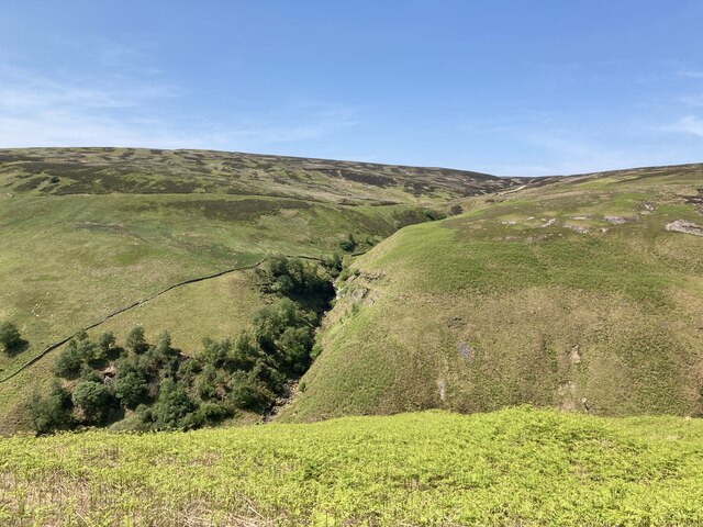
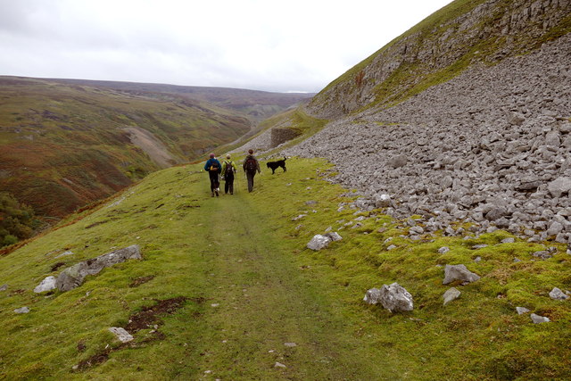
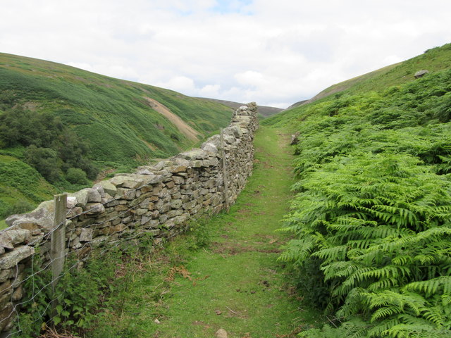
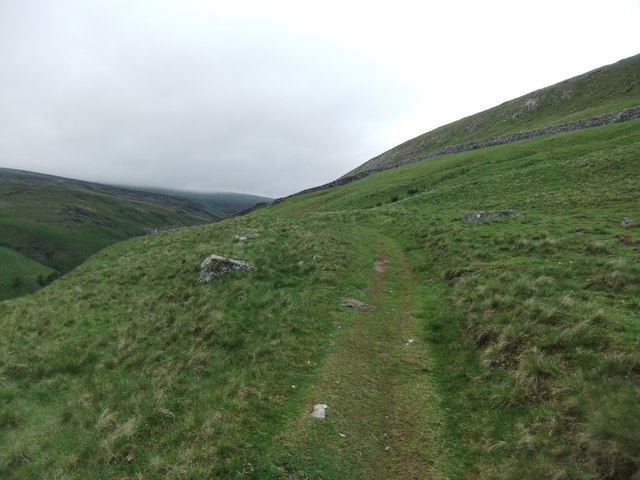
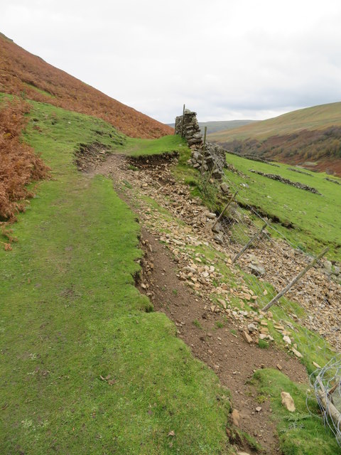
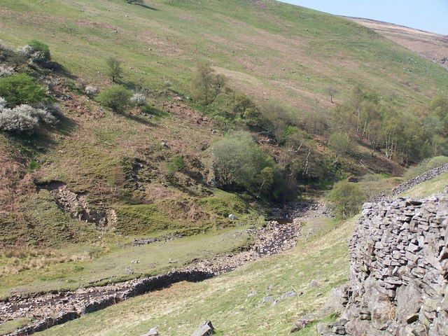
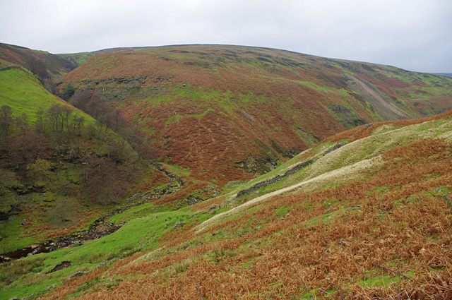
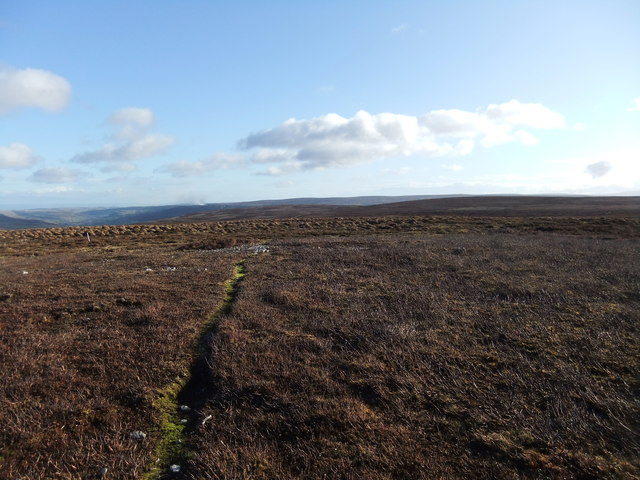
The woodland features several well-maintained walking trails, allowing visitors to explore its natural beauty at their own pace. These paths wind through the trees, providing glimpses of scenic vistas and opportunities for peaceful contemplation. The dappled sunlight filtering through the dense canopy adds to the enchanting atmosphere of the wood.

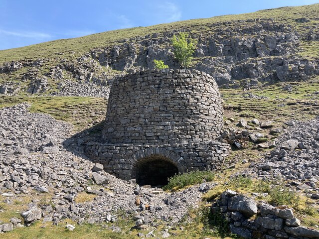
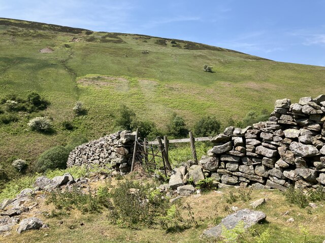
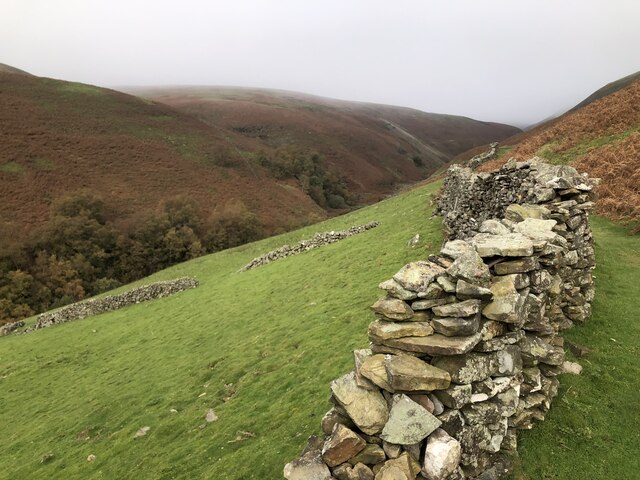
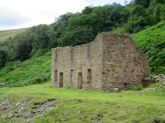
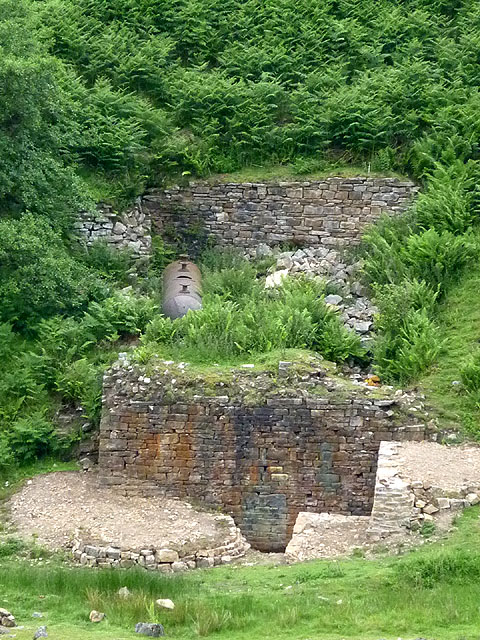
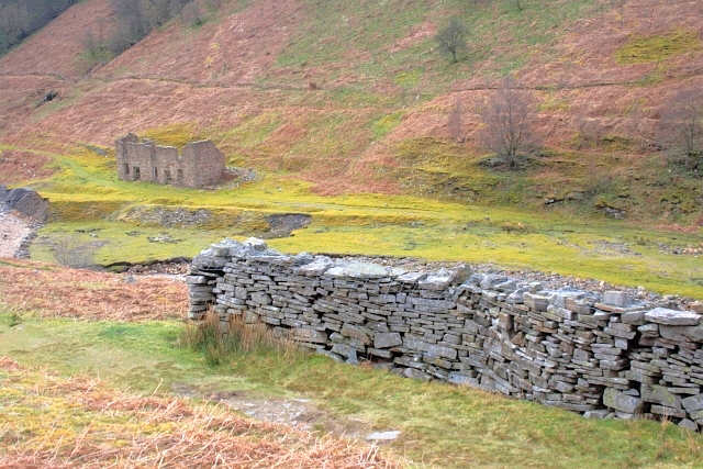
Birkbeck Wood is also known for its rich history. It has played a significant role in the local community for centuries, with evidence of human activity dating back to the prehistoric era. The wood was once used for timber production and as a hunting ground for the aristocracy. Today, remnants of old walls and structures can still be seen, serving as a reminder of its past.

In addition to its natural and historical significance, Birkbeck Wood offers various recreational activities. It is a popular spot for picnics, with designated areas providing a perfect setting for families and friends to enjoy a meal amidst nature. The wood also allows for camping, creating opportunities for overnight stays and a chance to experience the magic of the forest after dark.

Overall, Birkbeck Wood is a captivating destination that seamlessly combines natural beauty, historical charm, and recreational opportunities, making it a must-visit location in Yorkshire.

If you have any feedback on the listing, please let us know in the comments section below.

Birkbeck Wood Images

Images are sourced within 2km of 54.385722/-2.0836845 or Grid Reference SD9498. Thanks to Geograph Open Source API. All images are credited.

Old limekiln at Middle Bank
Botcher Gill
Botcher Gill
Drystone wall at Middle Bank
Formerly enclosed pasture at Middle Bank
Gunnerside Gill Downstream of the major buildings, evidence of lead mining is less obvious, though there are still waste tips and the number of footpaths and bridleways is very much down to the widespread industrial activity in this area up until the end of the nineteenth century. Nowadays it's more the haunt of walkers and mountain bikers using the area for leisure pursuits as many of the scars on the landscape become hidden by vegetation.
Gunnerside Gill
Downstream of the major buildings, evidence of lead mining is less obvious, though there are still waste tips and the number of footpaths and bridleways is very much down to the widespread industrial activity in this area up until the end of the nineteenth century. Nowadays it's more the haunt of walkers and mountain bikers using the area for leisure pursuits as many of the scars on the landscape become hidden by vegetation.
Gunnerside Gill track below Winterings Scar This bridleway from Blades into Gunnerside Gill is excellent going for a mountain bike, as well as on foot, but if one is doing a round trip over Melbecks Moor by bike, the track that ascends behind the lime kiln (technically only a public footpath) is a far safer option than the bridleway in the steep and rocky Bunton Hush that would be the legal way of doing it.
Gunnerside Gill track below Winterings Scar
This bridleway from Blades into Gunnerside Gill is excellent going for a mountain bike, as well as on foot, but if one is doing a round trip over Melbecks Moor by bike, the track that ascends behind the lime kiln (technically only a public footpath) is a far safer option than the bridleway in the steep and rocky Bunton Hush that would be the legal way of doing it.
Wall, footpath and bracken Above Gunnerside Beck
Wall, footpath and bracken
Above Gunnerside Beck
Ruined mine building Adjacent to Gunnerside Beck.
Ruined mine building
Adjacent to Gunnerside Beck.
Path on Winterings Pasture
Groove of Ash Pot Gutter Ash Pot Gutter is a minor stream feeding water into Mill Gill, itself a tributary of the River Swale. The pale twigs are stems of dead heather, probably burnt by the owning estate as part of their management of the grouse moor; new growth is coming through.
Groove of Ash Pot Gutter
Ash Pot Gutter is a minor stream feeding water into Mill Gill, itself a tributary of the River Swale. The pale twigs are stems of dead heather, probably burnt by the owning estate as part of their management of the grouse moor; new growth is coming through.
Path erosion at Middle Bank At this point a minor landslip has taken out the wall and part of the path above it. Over the last five years this has developed from a minor gap of no more than a couple of metres to one that is now nearer 15m in length. The farmer has plugged the gap with mesh fencing, whilst the walked path is gradually moving uphill. Just one of several path problems in and around Gunnerside Gill.
Path erosion at Middle Bank
At this point a minor landslip has taken out the wall and part of the path above it. Over the last five years this has developed from a minor gap of no more than a couple of metres to one that is now nearer 15m in length. The farmer has plugged the gap with mesh fencing, whilst the walked path is gradually moving uphill. Just one of several path problems in and around Gunnerside Gill.
Ash Pot Gutter draining east from the Melbecks Moor track This track is obviously still of importance to someone long after the demise of lead mining on the moor which was the original raison d'être for most of the rights of way up here, since Ash Pot Gutter crosses it by a recent-looking and substantial concrete ford. There's maybe a quarter square kilometre of catchment at this point where a number of small sikes have coalesced to form a single stream which has only one tributary, on its right bank, all the way down to its confluence with Old Gang Beck a little over a kilometre from this point.
Ash Pot Gutter draining east from the Melbecks Moor track
This track is obviously still of importance to someone long after the demise of lead mining on the moor which was the original raison d'être for most of the rights of way up here, since Ash Pot Gutter crosses it by a recent-looking and substantial concrete ford. There's maybe a quarter square kilometre of catchment at this point where a number of small sikes have coalesced to form a single stream which has only one tributary, on its right bank, all the way down to its confluence with Old Gang Beck a little over a kilometre from this point.
Gunnerside Beck
Gunnerside Beck
Restoration at the Sir Francis Mine The masonry at the air tank near the Sir Francis Mine remains seems to have been recently consolidated. This appears to be an ongoing project at Gunnerside Gill.
Restoration at the Sir Francis Mine
The masonry at the air tank near the Sir Francis Mine remains seems to have been recently consolidated. This appears to be an ongoing project at Gunnerside Gill.
Wall on Black Brae
Wall on Black Brae
Gunnerside Gill View from the east side of the gill, just south of the Barbara Level. 
Across the gill, Botcher Gill is on the left and the spoil from Dolly Lead Level can be seen on the right.
Gunnerside Gill
View from the east side of the gill, just south of the Barbara Level. Across the gill, Botcher Gill is on the left and the spoil from Dolly Lead Level can be seen on the right.
Near the 578m spot height on Melbecks Moor An unmarked hill
Near the 578m spot height on Melbecks Moor
An unmarked hill
Dry Stone Wall Corner With Sir Francis Mine in the distance (<a href="https://www.geograph.org.uk/gridref/SD9499">SD9499</a>).
Dry Stone Wall Corner
With Sir Francis Mine in the distance (SD9499).
Show me another place!

Birkbeck Wood is located at Grid Ref: SD9498 (Lat: 54.385722, Lng: -2.0836845)

Division: North Riding

Administrative County: North Yorkshire

District: Richmondshire

Police Authority: North Yorkshire

What 3 Words

///shrimp.swatting.type. Near Bowes, Co. Durham

Related Wikis

Gunnerside

Gunnerside is a village in North Yorkshire, England. It is situated in Swaledale, on the B6270 road, 3 miles (5 km) east of Muker and 6 miles (10 km) west...

Satron

Satron is a hamlet in Swaledale, North Yorkshire, England. It lies 0.6 miles (1 km) south west of Gunnerside on the opposite bank of the River Swale. It...

Melbecks

Melbecks is a civil parish in North Yorkshire, England. It is located in upper Swaledale and covers the settlements of Gunnerside, Low Row, Feetham and...

Ivelet

Ivelet is a hamlet in the Yorkshire Dales, North Yorkshire, England about a mile west of Gunnerside in Swaledale. Ivelet Bridge crosses the River Swale...

Gunnerside Gill

Gunnerside Gill (or Ghyll) is a small valley in the Yorkshire Dales, England, which branches off Swaledale into moorland to the north of Gunnerside. The...

Crackpot, North Yorkshire

Crackpot is a village in Swaledale, North Yorkshire, England. Its name derives from the Old English kraka (crow) and the Viking word pot (usually a pit...

Low Row

Low Row is a village in Swaledale, in the Yorkshire Dales, North Yorkshire, England. It lies about 3 miles west of Reeth and is between Healaugh and Gunnerside...

Muker

Muker is a village and civil parish at the western end of Swaledale in North Yorkshire, England, within the Yorkshire Dales. The parish includes the hamlets...

Nearby Amenities

Located within 500m of 54.385722,-2.0836845
Barrier: stile
Foot: yes
Lat/Long: 54.3837629/-2.0781224
Ford: yes
Lat/Long: 54.383596/-2.0778766
The data included in this document is from www.openstreetmap.org. The data is made available under ODbL.

Have you been to Birkbeck Wood?

Leave your review of Birkbeck Wood below (or comments, questions and feedback).